Saltar al contenido principal
icon-intereses-cultura

Recreational Area Burguillos

Submitted by brandcode_deweloper on
Id
6615992
Descripción
Descripción larga

Mount Burguillos is one of the most significant elevations of the border area between Sierra Morena and the countryside.

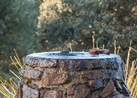
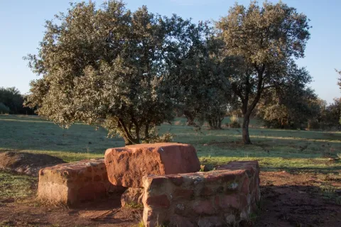
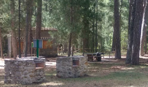
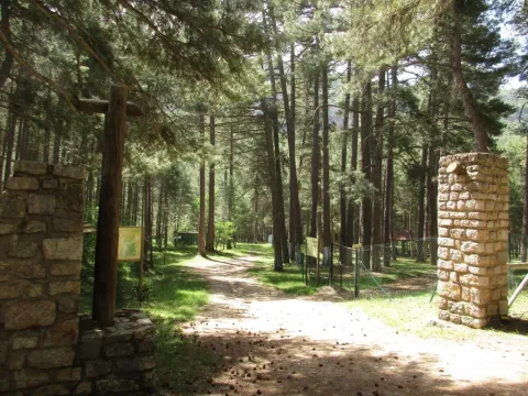
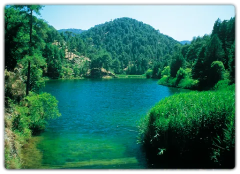
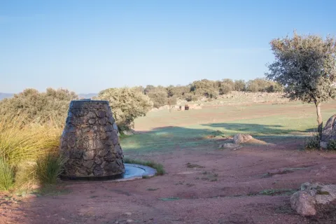
The recreational area of Burguillos is equipped with tables, banks and barbecues, as well as sources, an artificial lagoon, parking area, a bar-restaurant and a Nature Hall.

The area is frequented by people who want to share a field meal with their friends or family, take a walk in the middle of nature or simply contemplate the rich biodiversity that Burguillos has.

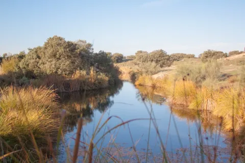
The area of the Dehesa de Burguillos, also known as the Villa, is home to a Mediterranean forest of oak trees, alcornoques and complaints, a bucolic livestock area and a beautiful closed area through which the Rumblar River passes after leaving the dam. In addition, the land is splattered with spectacular rounded blocks of granite called "bowling" and of cavalry stones, as well as carrocal features of this area of Sierra Morena.

From the recreational area there are numerous hiking routes, all signposted and of medium-low difficulty, being able to intertwine with each other, highlighting one that goes into the mountain under adhesado to the Rumblar River and another that runs through the so-called Cerro de las Trinches, where trenches used in the Civil War are located.

Breve descripción

The Burguillos recreational area is located 5 kilometres north of the town of Bailén, within the area known as the Dehesa de Burguillos, a city-owned public mountain.

Ubicación
Latitud
38.138960
Longitud
-3.811280
Distrito
Municipio
Ubicación en el mapa
POINT (-3.81128 38.13896)
Tipos de punto de interés
Imágenes carrusel
imagen
Imagen
natural28_223.jpg
Imagen principal
Desactivado
imagen
Imagen
natural28.jpg
Imagen principal
Desactivado
imagen
Imagen
natural28_224.jpg
Imagen principal
Desactivado
Imágenes cabecera
imagen
Imagen
natural28_227.jpg
Imagen principal
Activado
Microsite al que pertenece
Loading map
Preparing points of interest and routes...

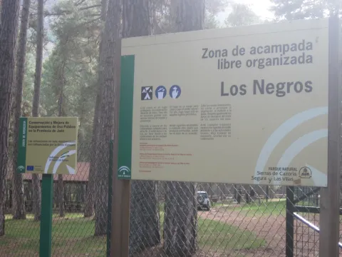
Los Negros Camping Area

Submitted by brandcode_deweloper on
Id
5928053
Descripción
Breve descripción

This ZALO is located in the valley of Rio Madera, a few kilometres after its birth, next to the road in the Canyon of Poyo Torres and very close to the river line. It is located in an area where the larix pine forest predominates, with a sotoforest of ferns, which denotes the moist nature of the environment.

Ubicación
Latitud
38.317340
Longitud
-2.575560
Distrito
Municipio
Ubicación en el mapa
POINT (-2.57556 38.31734)
Tipos de punto de interés
Imágenes carrusel
imagen
Imagen
Los%20Negros%203.jpg
Imagen principal
Desactivado
imagen
Imagen
Los%20Negros.jpg
Imagen principal
Desactivado
Imágenes cabecera
imagen
Imagen
3%20%281%29.jpg
Imagen principal
Activado
Loading map
Preparing points of interest and routes...

San Lorenzo Arch

Submitted by brandcode_deweloper on
Id
12675639
Descripción
Descripción larga
We can highlight some curiosities: -   It was the place where the body of the monarch Ferdinand IV, king of Castile, who died in Jaén, was laid to rest.  -   Juan de Olid (secretary of Constable Iranzo) and his wife Randelez are buried inside. -   Maximilian of Austria was baptized in 1555, who, if recognized, would be the half-brother of Philip the Fair. It can be visited by prior reservation with one of the authorized companies and guides: Association of Official Guides: 606 68 23 03 Claritas Tourism: 678 77 50 43 Lizard Tours: 953 71 52 15 For more information, contact the Municipal Tourism Office: 953 19 04 55
Breve descripción
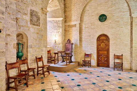
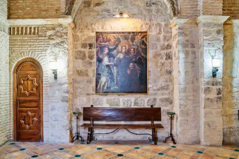
Building that was part of the extinct Iglesia de San Lorenzo (erected between the 13th and 14th centuries). After the demolition of said temple in 1825, the arch was preserved, housing inside a room on the upper floor (which at the time would be the Sacristy) and a small chapel on the ground floor. It has been listed as a National Monument since 1877 and its interior contains Moorish tiles and coffered ceilings. It is currently owned by the Jaén City Council and is used as the headquarters of the Jaén association “Amigos de San Antón”. The San Lorenzo arch also stands out for the enormous historical legacy it holds, having been veiled by the monarch Ferdinand IV, king of Castile, who died in Jaén and which Eslava Galán himself attests to in The Templars and the Table of Solomon. (…) The same tradition assures that they watched over the monarch's body, or even buried it, in the Arco de San Lorenzo de Jaén. (…) The Templars and Solomon's Table. Chapter 21. Another historical milestone that the Arco de San Lorenzo treasures is that Juan de Olid, secretary of Constable Iranzo, lies here. Historical and also literary milestone, because Juan de Olid is the hero that Juan Eslava Galán uses to go “En busca del unicornio”. The author also mentions this fact in The Templars and the Table of Solomon (…) Juan de Olid and his wife were buried in the parish of San Lorenzo, belonging to the hospital founded by Don Luis (…) The Templars and Solomon's Table. Chapter 22.
Ubicación
Código Postal
23002
Latitud
37.766541
Longitud
-3.792381
Dirección
C/ Almendros Aguilar, 27
Distrito
Municipio
Ubicación en el mapa
POINT (-3.792381 37.766541)
Tipos de punto de interés
Imágenes carrusel
imagen
Imagen
arco-de-san-lorenzo-j-a-partal-1-1-jpg
Imagen principal
Desactivado
imagen
Imagen
arco-de-san-lorenzo-j-a-partal-3-jpg
Imagen principal
Desactivado
Imágenes cabecera
imagen
Imagen
arco-de-san-lorenzo-1-jpg
Imagen principal
Activado
Loading map
Preparing points of interest and routes...

Arch of la Plaza

Submitted by brandcode_deweloper on
Id
4485954
Descripción
Descripción larga

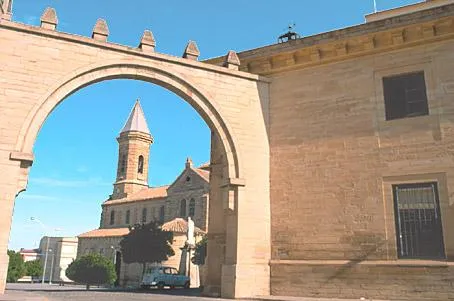
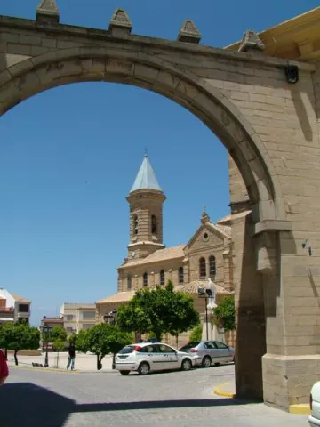
The religious, administrative and social centre is the Plaza de Andalucía, of generous proportions and houses with arqueras and balconades, to which it is accessed through a replacement arch of another of Gothic origin. This arch, which was the gateway to the medieval fortress of the old walled enclosure, was rebuilt in 1952 over the ancient medieval arch.

Telecomunicaciones
Sitio web
www.porcuna.es
Ubicación
Código Postal
23790
Latitud
37.870160
Longitud
-4.184900
Distrito
Municipio
Ubicación en el mapa
POINT (-4.1849 37.87016)
Tipos de punto de interés
Imágenes carrusel
imagen
Imagen
Arco%20de%20la%20Plaza%20Porcuna%20%281%29.jpg
Imagen principal
Desactivado
Imágenes cabecera
imagen
Imagen
Arco%20de%20la%20Plaza%20Porcuna.jpg
Imagen principal
Activado
Loading map
Preparing points of interest and routes...

Arch of la Encarnación

Submitted by brandcode_deweloper on
Id
4659054
Descripción
Breve descripción

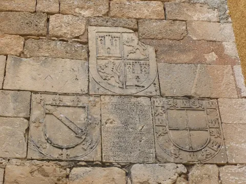
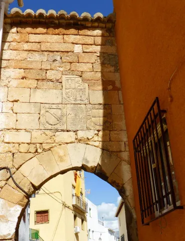
On the Arc of the Incarnation of Pegalajar, a pointed arch that was the main entrance door to the castle of Pegalajar, is a commemorative stone surrounded by heraldic shields. The stone is recorded in relief with a textual gothic letter, in some parts damaged. The writing box of the stone is distributed in relief lines where the photographs are attached. It uses some abbreviations and the concealment of some letters at the end or in the middle of the word. Words are usually separated by scores. Head the tombstone the word "Jheits ", framed in two crosses, religious invocation usual at the beginning of all public writings, followed by the date, the reference to the king reigning and then the ordinator of it and the type of work commemorative. The transcription of the stone is as follows:

Telecomunicaciones
Sitio web
www.ayto-pegalajar.org
Correo electrónico
pegalajar@promojaen.es
Ubicación
Código Postal
23110
Latitud
37.738970
Longitud
-3.649050
Distrito
Municipio
Ubicación en el mapa
POINT (-3.64905 37.73897)
Tipos de punto de interés
Imágenes carrusel
imagen
Imagen
arco%20de%20la%20encarnaci%C3%B3n%202.jpg
Imagen principal
Desactivado
imagen
Imagen
arco%20de%20la%20encarnaci%C3%B3n.jpg
Imagen principal
Desactivado
Imágenes cabecera
imagen
Imagen
10486986676_87a2769dfe_b.jpg
Imagen principal
Activado
Microsite al que pertenece
Loading map
Preparing points of interest and routes...

Arch of Jano

Submitted by brandcode_deweloper on
Id
13575693
Descripción
Descripción larga

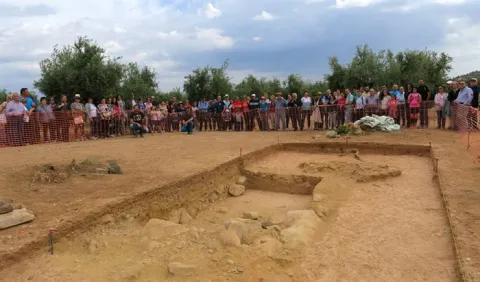
The work for its location, carried out by the University Institute of Research in Iberian Archaeology of the University of Jaén with the support of the City of Mengíbar, began in 2018. In relation to its characteristics, it is proposed that the foundation found allows to interpret a large arc of 14.80 meters long, almost 5 meters wide and a single central vanity of 5.15 meters, where the Via Augusta was running.

The relevance of this finding served to be declared, with great haste (2019), as Good of Cultural Interest.

Breve descripción

Located in the vicinity of the city of Mengibar, a stone's throw from the Guadalquivir and next to the so-called "Way of the Romans," is the Arc de Jano or "Ianus Augustus," the door to the Betics while Rome was "owner of the known world." This is a first order territorial marker located next to the Roman road of the Via Augusta, the point from which the distances were measured and marked by militaries. It was also the limit place between the provinces of the Senatorial Betica and the Imperial Tarraconense.

Telecomunicaciones
Sitio web
https://aytomengibar.com/municipio/descubre-mengibar/
Teléfono de contacto
677 222 285
Correo electrónico
turismo@aytomengibar.com
Ubicación
Código Postal
23620
Latitud
37.998137
Longitud
-3.809457
Dirección
Carretera JV-2304. Camino de los Romanos
Distrito
Municipio
Ubicación en el mapa
POINT (-3.809457 37.998137)
Tipos de punto de interés
Imágenes cabecera
imagen
Imagen
a78a62de3d2fcbeb931803c84b06232b0e661efa-jpg
Imagen principal
Activado
Loading map
Preparing points of interest and routes...
Interés

Aptiense de la Formación Arroyo de los Anchos

Submitted by brandcode_deweloper on
Id
661117
Descripción
Descripción larga

The first of the corals, located between meters 66 and 69 of the stratigraphic series, can be found at its base some levels with small requirements. On this level there are limestones with abundant orbitolins and milliolids; on the roof of some banks we can find drying cracks and rhizocretions. The second level of corals is between meters 109 and 116. On both levels they are massive corals, usually located in a position of life. On the second level of corals there are sand and sand that have above the first levels of rudists. The best florings of these organisms are from the 142 meter to the roof of the stratigraphic section.

Source: Inventory of Georresources of Andalusia. Environmental Council. Junta de Andalusia.

Breve descripción

The Aptiense de la Formación Arroyo de los Anchos is mainly made up of carbonates with an abundant fossiliferous content. There are also intercalations of margas, sandstone and sand. The total power is 93 m. Especially striking are the banks with corals and the levels of rudists.

Ubicación
Latitud
37.772886
Longitud
-3.788329
Ubicación en el mapa
POINT (-3.788329 37.772886)
Tipos de punto de interés
Imágenes carrusel
imagen
Imagen
Aptiense%20de%20la%20Formaci%C3%B3n%20Arroyo%20de%20los%20Anchos.png
Imagen principal
Desactivado
Imágenes cabecera
imagen
Imagen
146354-aldea-de-los-anchos.jpg
Imagen principal
Activado
Loading map
Preparing points of interest and routes...

Former San Felipe Neri Seminary (current UNIA headquarters)

Submitted by brandcode_deweloper on
Id
5965089
Descripción
Breve descripción

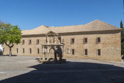
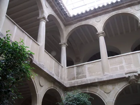
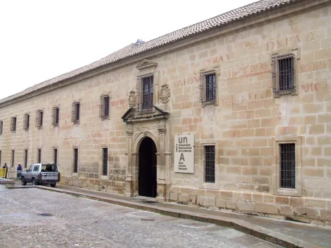
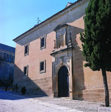
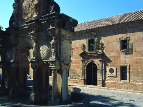
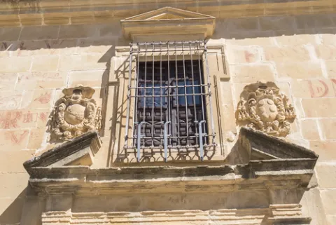
Founded as a seminary in 1660 by the bishop of Jaén, Fernando Andrade de Castro. The works were carried out by Eufrassio López de Rojas, author of the façade of the Cathedral of Jaén. It ceased to be used for the purpose of 1969. From the outside stands the façade that looks at the square of Santa Maria with two high floors where critical and festive cheers decorate its stones. The interior features a courtyard with narrow Tuscan columns and double arqueria. Today it houses the Antonio Machado headquarters of the International University of Andalusia.

Telecomunicaciones
Sitio web
www.baeza.es
Teléfono de contacto
953 742 775
Ubicación
Código Postal
23440
Latitud
37.990432
Longitud
-3.468978
Dirección
Plaza Santa María, s/n
Municipio
Ubicación en el mapa
POINT (-3.468978 37.990432)
Tipos de punto de interés
Imágenes carrusel
imagen
Imagen
shutterstock_670115896.jpg
Imagen principal
Desactivado
imagen
Imagen
seminario-felipe.jpg
Imagen principal
Desactivado
imagen
Imagen
Baeza_-_Seminario_de_San_Felipe_Neri_1.jpg
Imagen principal
Desactivado
imagen
Imagen
Mon016.jpg
Imagen principal
Desactivado
imagen
Imagen
Mon547.jpg
Imagen principal
Desactivado
Imágenes cabecera
imagen
Imagen
shutterstock_670115821.jpg
Imagen principal
Activado
Horario
Monday to Friday: 09: 00 - 14: 00. Saturday, Sunday and holidays closed.
Loading map
Preparing points of interest and routes...

Former Pósito - Ciudad y Museum of Raphael Interpretation Centre

Submitted by brandcode_deweloper on
Id
2343550
Descripción
Descripción larga

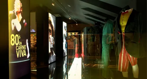
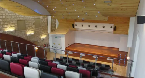
Today turned into a cultural and tourist space, this Interpretation Center of the city, welcomes in its interior the brightest pages of local history, the evolution of its urbanism and all its Art and Culture where the Toreo and the Flamenco in Linares have a prominent place. This building, in turn, houses the Museum of Raphael, a English universal singer, the Tourist Information Office, souvenir shop, a Linear Documentation Centre, temporary exhibition room and the Municipal Auditorium, able to host congresses and events of all kinds.

Based on a conceptual recreation of the Santa Margarita Thing, which was erected as one of the largest rings in the world in 1866, the visitor will be immersed in a 360-degree enveloping projection. Six exhibition spaces are offered that explain the importance of the city in the history of the party and its main representatives; such as Palomo Linares, Paco Bautista, Curro Díaz, José Fuentes, Curro Vázquez and so up to 20 great matadores.

In addition, taking advantage of Linares' world fame for being the city where the right-hand Cordobe Manuel Rodríguez Sánchez 'Manolete' lost his life in a tragic evening of bulls, the City Council promotes the tourist product "Linares, after the legend of Manolete," which allows groups to know wineries, museums, scenarios of special relevance, such as the Santa Margarita Coso and the Los Marqueses Hospital, or the Flemish peñas of the city.

Breve descripción

The building of the Old Posite, was built in the second half of the 18th century as a grain warehouse, by then the Villa de Linares, transformed years later into prison, in 1975 became a special education school.

Telecomunicaciones
Sitio web
www.elpositolinares.es
Teléfono de contacto
953 100 183
Correo electrónico
turismo@aytolinares.es
Ubicación
Código Postal
23700
Latitud
38.092871
Longitud
-3.634982
Dirección
Iglesia, 5
Distrito
Municipio
Ubicación en el mapa
POINT (-3.634982 38.092871)
Imágenes carrusel
imagen
Imagen
MuseoLinares.jpg
Imagen principal
Desactivado
imagen
Imagen
raphael27.jpg
Imagen principal
Desactivado
imagen
Imagen
espacios_expos.jpg
Imagen principal
Desactivado
imagen
Imagen
espacios_auditorio.jpg
Imagen principal
Desactivado
Imágenes cabecera
imagen
Imagen
0_3726_1.jpg
Imagen principal
Activado
Horario
Winter: Wednesday to Sunday 10: 00 - 14: 00 and 17: 00 - 19: 00. Summer: Wednesday to Sunday 10: 00 - 14: 00 and 18: 00 - 20: 00.
Loading map
Preparing points of interest and routes...
Marcas de calidad

Former Hospital of San Miguel

Submitted by brandcode_deweloper on
Id
1487115
Descripción
Descripción larga

The first fact of the existence of the Hospital of San Miguel is given by Jimena Jurado "Historia o Anales del Municipio Albense Urgavonense" 1643, arguing that already in 1488 a total of six hospitals are quoted in Arjona (Santa María, San Miguel, San Juan, Santiago, San Bartolomé, Santa Olaya).

Another data showing the antiquity of these Hospitals was found in 1542, when the Supreme Pontiff issued his Bula to make an inventory of the number of hospitals in Spain, calling for the elimination of those who by their poverty did not meet basic needs. In response to the Bula, the lobby next to the officers of the village's cofradies meet and decide to reduce all hospitals to one, leaving only the Hospital of San Miguel, which was better located and more capable.

As far as the location is concerned, there is no doubt that it occupied the left side of what is now Hospital Street and the old La Plaza Street (now Cervantes). The most obvious evidence of its location is found in a drawing from 1628, published by Don Juan González in "Historia de la Ciudad de Arjona" 1905.

At the end of the 17th century the family of the perpetual regior of the villa Corrales Javalera serves it as endowments, highlighting the breadth of its rooms, highlighting an oratory above all. From this date on, the historical reviews that refer to the above-mentioned hospital are remarkable, highlighting that of Don Pascual Madoz, who, in his "Geographical, Statistical and Historical Dictionary of Spain" 1845 writes "Arjona...... has a Hospital entitled San Miguel, with public prayer, founded in 1665 by Don Bernabé Corrales Javalera...... The hospital is in charge of an administrator and has a surgeon and nurse to assist the suffering humanity of both sexes that is admitted to it."

The progress of the centuries, the new laws inherited from the French tradition, public hygiene and urban police, close the location of the hospital. These ordinances put in place the mechanisms for the new location of the Hospital, June 1863 in a Act of the Council "the governor is asked to allow the House of the King and to temporarily enable the hospital..." This house located in the square of Santa María belongs to Don José Pérez de Herrasti, which gives way for a modest price, thus increasing the works to transfer the Hospital to that place, leaving the works completed in 1868, as demonstrated by the letter that the Architect d. José María Cuenca (architect of the province), emits the mayor of the town.

Since then and after having undergone several remodelations such as that in 1924, in which part of it was sank, it has served as a reference in the cure of the sick, specializing in primary care, until in the 1990s when a new hospital complex in Arjona is built. The site that occupied this hospital, suffered a series of remodeling at the end of the 20th century, passing through the center of Youth Information, until today becoming the Museum of Arts and Costumbres Juan Eslava Galán and the Archaeological Museum City of Arjona, next to the old people's residence "Fundación Corrales Javalera," which follows the legacy used by the Bernabé Corrales Javalera in the second Mitad of the 17th century.

Breve descripción

Today's missing building, which was erected at the site that today occupies the town council. The date of its construction is not known, but through the study of different sources it is brought closer to the 13th century, framed in the context of the Christian reconquest under the baton of Fernando III the Holy. In 1244 Arjona is conquered and as such began to form Cofradias under the title of a saint, to whom the aid goes to the most disadvantaged.

Telecomunicaciones
Sitio web
www.visitarjona.com/cultura/otros-monumentos/antiguo-hospital-de-san-miguel
Teléfono de contacto
953 523 325 / 953 523 641
Ubicación
Código Postal
23760
Latitud
37.935170
Longitud
-4.054660
Dirección
C/ Cervantes, 9
Distrito
Municipio
Ubicación en el mapa
POINT (-4.05466 37.93517)
Tipos de punto de interés
Imágenes carrusel
imagen
Imagen
Antiguo%20Hospital%20de%20San%20Miguel.jpg
Imagen principal
Desactivado
Imágenes cabecera
imagen
Imagen
arjona-hospital01.jpg
Imagen principal
Activado
Loading map
Preparing points of interest and routes...