Saltar al contenido principal
icon-intereses-cultura

Recreational Zone La Cañada

Submitted by brandcode_deweloper on
Id
4691127
Descripción
Breve descripción

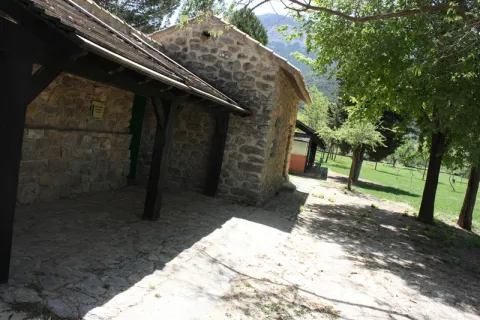
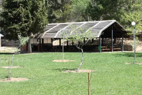
It is a perfectly equipped road that has an interesting look, a water source and an information panel on landscape interpretation.

Telecomunicaciones
Sitio web
www.pinademontalgrao.es/content/complejo-la-canada
Teléfono de contacto
953 781 500
Correo electrónico
ayuntamiento@larva.es
Ubicación
Código Postal
23591
Latitud
37.758500
Longitud
-3.200520
Dirección
C/ Conde Torrerando, 22
Distrito
Municipio
Ubicación en el mapa
POINT (-3.20052 37.7585)
Tipos de punto de interés
Imágenes carrusel
imagen
Image
Area%20Recreativa%20La%20Ca%C3%B1ada.jpg
Imagen principal
Desactivado
Imágenes cabecera
imagen
Image
9085_0nw5ulj32ahczt4o.jpg
Imagen principal
Activado
Horario
24 h.
Microsite al que pertenece
Loading map
Preparing points of interest and routes...

Mágina Peaks and Miramundos Zone

Submitted by brandcode_deweloper on
Id
5846349
Descripción
Breve descripción

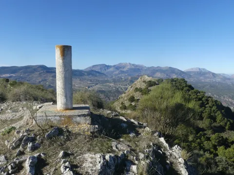
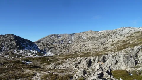
In this summit crest is the roof of the province: the Pico Magina, with 2,167 meters of height, which is the third highest altitude of Andalusia, after the massizos of Sierra Nevada and the Sierra de Baza. The vegetation and conditions are typical of the high Mediterranean mountain.

Ubicación
Latitud
37.730270
Longitud
-3.445830
Distrito
Ubicación en el mapa
POINT (-3.44583 37.73027)
Tipos de punto de interés
Imágenes carrusel
imagen
Image
17%20Magina.JPG
Imagen principal
Desactivado
imagen
Image
naturaleza_14268337_20191208114422%20%281%29.jpg
Imagen principal
Desactivado
imagen
Image
9788440Master%20%282%29.jpg
Imagen principal
Desactivado
Imágenes cabecera
imagen
Image
P1240066%20%282%29.jpg
Imagen principal
Activado
Microsite al que pertenece
Loading map
Preparing points of interest and routes...

Hondacabras Camping Area

Submitted by brandcode_deweloper on
Id
2980330
Descripción
Descripción larga

The landscape surrounding this equipment, located on the rest of a pecuary road, is typically olive-growing and invites hiking. The facilities, with a capacity for a hundred people, have areas for tents, roofed dining, kitchen, toilets and showers.

Breve descripción

It is accessed from the JA-1107 road that goes from Torres to Albanchez de Magina; after walking about two km, in the middle of a curve, to the right, it connects a lane that, with a total length of one kilometre, leads us directly to this camping area of the Sierra Magina Natural Park called Hondacabras.

Telecomunicaciones
Sitio web
www.juntadeandalucia.es
Teléfono de contacto
953 363 011
Correo electrónico
informacion@juntadeandalucia.es
Ubicación
Código Postal
23540
Latitud
37.768770
Longitud
-3.495980
Dirección
Carretera JA-3107
Distrito
Municipio
Ubicación en el mapa
POINT (-3.49598 37.76877)
Tipos de punto de interés
Imágenes carrusel
imagen
Image
acampada%20Hondacabras.jpg
Imagen principal
Desactivado
imagen
Image
acampada%20Hondacabras%202.jpg
Imagen principal
Desactivado
imagen
Image
acampada%20Hondacabras%203.jpg
Imagen principal
Desactivado
Imágenes cabecera
imagen
Image
acampada%20Hondacabras%204.jpg
Imagen principal
Activado
Microsite al que pertenece
Loading map
Preparing points of interest and routes...

Santa Potenciana Hermitage Archaeological Site

Submitted by brandcode_deweloper on
Id
4524002
Descripción
Breve descripción

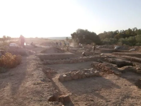
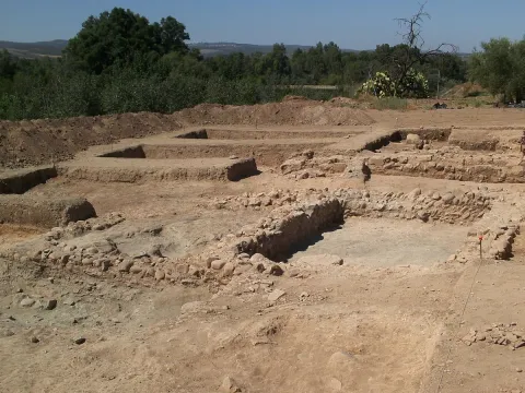
The excavations of the Archaeological site Hermitage Santa Potenica de Villanueva de la Reina have been presenting new findings, withnew materials and structures that confirm this area as a historic crossing of cultures between large cities. An archaeological site that has, in five years, achieved great results andtake the municipality of Villanueva de la Reina to specialized and prestigious forums.

Telecomunicaciones
Sitio web
www.redjaen.es/francis/?m=c&o=93197
Teléfono de contacto
953 537 110
Ubicación
Código Postal
23730
Latitud
38.027860
Longitud
-3.912560
Distrito
Ubicación en el mapa
POINT (-3.91256 38.02786)
Tipos de punto de interés
Imágenes carrusel
imagen
Image
Yacimiento%20Ermita%20Santa%20Potenciana.jpg
Imagen principal
Desactivado
Imágenes cabecera
imagen
Image
Yacimiento_de_la_Ermita_de_Santa_Potenciana.jpg
Imagen principal
Activado
Microsite al que pertenece
Loading map
Preparing points of interest and routes...

Archaeological Site of Peñalosa

Submitted by brandcode_deweloper on
Id
10887417
Descripción
Descripción larga

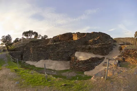
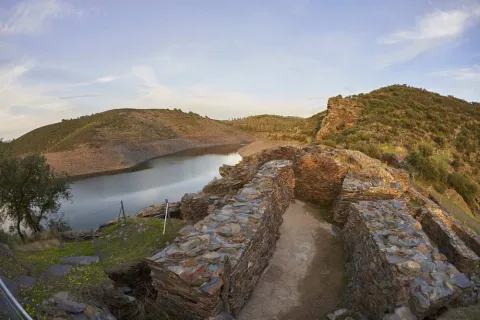
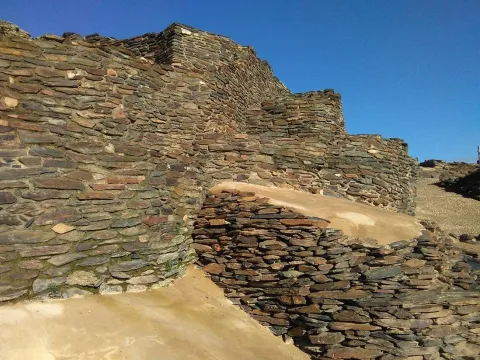
Located in the municipality of Baños de la Encina, the argaric village of Peñalosa has been a reference in the research of the Bronze of Alto Guadalquivir. It sits on a slate slate in the form of a tongue, with two large slopes of strong slopes limiting to the north with the Rumblar River and to the south with the Salsipuas stream. The waters of the Rumbar reservoir now bathe the structures of this argaric village.

The town belongs to the Argar Culture, which was developed during the Bronze Age by the provinces of Almería, Murcia, Granada and part of those of Jaén and Alicante, and was inhabited about 400 years, from the mid-19th century a. C. until the mid-15th century a. C.

The site is a fortified village with houses built with slate on the hill and along its slopes on terraces, as steps, connected with each other by narrow streets and corridors, no significant architectural differences between the different terraces are seen. Within the village there are several different areas: on the top of the hill a fortified area with three houses connected to each other by the aforementioned corridors; generating a structured and organized area. On the north side, three natural and artificial terraces are alternated, interconnected with corridors, and in which houses are distributed. The village also has a large tank in the lower part that would collect the water from the rain and powerful defensive bastions that delimited the village. A characteristic feature of this culture was the interiors within the houses themselves, accompanying the deceased with joules corresponding to the social range they had within the village.

The main economic activity of the population was copper mining, especially the Azurite and Malakita, exploiting the mining wealth of the valley. The entire mining process has been documented: mining, reduction, casting and manufacturing of tools and ingots. Other economic activities such as looms and cereal processing, especially barley, have also been documented.

Socially, there are differences between the burials between those on the middle and upper terraces and those on the bottom; in addition, most burials on the upper terrace are located in exclusively funerary spaces, which has led to the hypothesis that it was a very hierarchical community, with a militarized elite (upper terrace) to which the mass of peasants - free warriors (middle terrace) would be subordinate and on whose base there would be a population layer in a servile state attached to the elite (lower terrace).

Breve descripción

In Peñalosa we can find the best-studied town of the Bronze Age of the Peninsular South, belonging to the Argar Culture and example of the socio-economic reality of this society.

Telecomunicaciones
Sitio web
www.bdelaencinaturismo.com/banos-de-la-encina/
Teléfono de contacto
953 613 338 / 626 818 446
Correo electrónico
info@laencinaturismo.com
Ubicación
Código Postal
23711
Latitud
38.170813
Longitud
-3.796032
Distrito
Ubicación en el mapa
POINT (-3.796032 38.170813)
Tipos de punto de interés
Imágenes carrusel
imagen
Image
Pe%C3%B1alosa%202.jpg
Imagen principal
Desactivado
imagen
Image
Pe%C3%B1alosa%203.jpg
Imagen principal
Desactivado
imagen
Image
Pe%C3%B1alosa%204.jpg
Imagen principal
Desactivado
imagen
Image
Pe%C3%B1alosa%205.jpg
Imagen principal
Desactivado
Imágenes cabecera
imagen
Image
Pe%C3%B1alosa1.jpg
Imagen principal
Activado
Microsite al que pertenece
Loading map
Preparing points of interest and routes...

Archaeological Site Terrazas del Guadalimar

Submitted by brandcode_deweloper on
Id
7971552
Descripción
Descripción larga

The human occupation of the environment of what is today Beas de Segura is very old. The first human testimonies of the Sierra de Segura appear in this site, in the area of Puente Moccho, a name that is designated to an extensive outdoor habitat next to the terraces of the Guadalimar River. There are materials from the Lower and Middle Paleolithic of the dawn of the last glaciation (between 100,000-10,000 BC).

This place was the passage of important mammals, it had abundant fishing resources and abundant raw material for the manufacture of carved stone tools, highlighting rolling edges and pebbles worked in quartdate.

The remains of the Lachelian political industry of this place were discovered in 1913 by Cabré and the Abad Breuil and part of them are found in the Provincial Museum of Jaén, in the Archaeology Section, room 1: Prehistory.

Breve descripción

It is the oldest archaeological site in the province of Jaén, so the oldest pieces that are preserved in the provincial archaeological museum are those from this site.

Telecomunicaciones
Sitio web
www.beasdesegura.es
Correo electrónico
aytobeas@yahoo.es
Ubicación
Código Postal
23280
Latitud
38.253863
Longitud
-2.889467
Dirección
Paseo de la Constitución, 1
Distrito
Municipio
Ubicación en el mapa
POINT (-2.889467 38.253863)
Tipos de punto de interés
Imágenes carrusel
imagen
Image
Yacimiento%20Arqueol%C3%B3gico%20Terrazas%20del%20Guadalimar2.jpg
Imagen principal
Desactivado
Imágenes cabecera
imagen
Image
YACIMIENTO%20ARQUEOL%C3%93GICO%20TERRAZAS%20DEL%20GUADALIMAR%20PUENTE%20MOCHO.jpg
Imagen principal
Activado
Loading map
Preparing points of interest and routes...

Archaeological Site of the Vega Baja

Submitted by brandcode_deweloper on
Id
13575393
Descripción
Breve descripción

This site, located north of Mengibar, is an exceptional testimony of historical continuity, ranging from the Final Neolithic to the altomedieval period. Although not currently visible, their vestiges show intense human and economic activity over the centuries.

Telecomunicaciones
Sitio web
https://mengibarturismo.com/
Teléfono de contacto
677 222 285
Correo electrónico
turismo@aytomengibar.com
Ubicación
Latitud
37.968050
Longitud
-3.808780
Distrito
Municipio
Ubicación en el mapa
POINT (-3.80878 37.96805)
Tipos de punto de interés
Loading map
Preparing points of interest and routes...
Interés

Archaeological Site of the Iliturgi romana (Cerro Maquiz)

Submitted by brandcode_deweloper on
Id
13576957
Descripción
Descripción larga

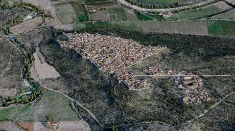
In this city, surrounded by a powerful wall, large public buildings were created, of which large remains of bases and capitals are preserved, and public inscriptions that were part of great sculptures.

In addition, it was equipped with an aqueduct that supplied large aljibes that are still visible today on the plateau of Maquiz. In the southern part of the city was built a large enlisted square of more than 1000 square meters (40x30m), possibly the forum of the city, from which we know in detail a small temple located on one of the corners of this square.

The beneficial acts of its most prominent citizens are reflected in several epigraphic documents, and reveal the existence of large playful buildings as a possible circus.

The identification of Cerro Machiz with the old Iliturgi is argued, among a large set of archaeological data, with the presence of several headings located in Cerro Machiz that refer to this name. Among them the most famous comes from an honorary heading dedicated by the "popvlus ilitvurgitanus" to Tiberio Sememonio Graccho.

Breve descripción

Around the change of era, the city of Iliturgi experienced a process of monumentalization, becoming one of the largest cities of Alto Guadalquivir. Qualified by Plinio at this time as Forum Iulium, one of the region's main markets thanks to its strategic position for land and river trade.

Telecomunicaciones
Sitio web
https://aytomengibar.com/municipio/descubre-mengibar/
Teléfono de contacto
677 222 285
Correo electrónico
turismo@aytomengibar.com
Ubicación
Código Postal
23620
Latitud
37.971404
Longitud
-3.774360
Dirección
Carretera A-600. Camino de los Chorrillos
Distrito
Municipio
Ubicación en el mapa
POINT (-3.77436 37.971404)
Tipos de punto de interés
Imágenes carrusel
imagen
Image
yacimiento-arqueologico-de-la-iliturgi-romana-1-jpg
Imagen principal
Desactivado
Imágenes cabecera
imagen
Image
yacimiento-arqueologico-de-la-iliturgi-romana-jpg
Imagen principal
Activado
Loading map
Preparing points of interest and routes...
Interés

Roman Villa of Bruñel

Submitted by brandcode_deweloper on
Id
919543
Descripción
Descripción larga

Most of these buildings are based as a second residence during the High Empire, although with the crisis of the third century and the insecurity of the cities many great aristocrats withdraw to their villages. As the residence becomes, the luxury and refinement of which the rich mosaics and the beginning of the walls of the different rooms are preserved as a testimony. Next to the Palaciega area there were other units with stables, with forges, alfares and, ultimately, everything necessary to be self-sufficient away from the city. Over time, the cities lost their importance, had to wafer to avoid dangers and the cultural spotlights that had gone out.

If we know nothing about the inhabitants of these luxurious rooms, we know less about those people who left the city to take refuge in these villas. They helped defend property in exchange for being able to cultivate a piece of land with which to get what is necessary to feed. Here is the origin of what would be the vasalage in the Middle Ages. Nor do we know how the craftsmen made these great mosaics, nor their living conditions, would they know that they represented the images they reproduced with the tesels? and the last inhabitants at the end of the fourth century?

Breve descripción

The villa of Bruñel represents the typical model of Roman villa that begins to extend during the Lower Empire.

Ubicación
Latitud
37.842982
Longitud
-3.066921
Municipio
Ubicación en el mapa
POINT (-3.066921 37.842982)
Tipos de punto de interés
Imágenes carrusel
imagen
Image
Mon167.jpg
Imagen principal
Desactivado
imagen
Image
quesada.jpg
Imagen principal
Desactivado
Imágenes cabecera
imagen
Image
DQxszNiU8AAV39W.jpg
Imagen principal
Activado
Loading map
Preparing points of interest and routes...
Marcas de calidad

Roman Villa of Bruñel

Submitted by brandcode_deweloper on
Id
10884676
Descripción
Descripción larga

The name Bruñel comes from the Latin word Balneum (bathroom), with the evolution of the mozarina degenerated in the word Bruñel (spa).

Despite the obvious Roman present, there is a record of an Iberian necropolis dating from the 4th century BC and the presence of material and constructive remains.

The villa of Bruñel would be framed in the Roman road that connected Catulo with the current Guadix and, according to the Roman constituency, was attached to the Roman province of the Carthaginense, with capital in Cartago Nova, present Cartagena. The Roman occupation of the village of Bruñel is referred to three phases throughout the II and IV centuries d. C. and according to its evolution, it can be distinguished the socio-economic changes that the Spanish population suffered.

A first phase corresponding to the 2nd century d. C. and is formed by an irregular cruciform building to which contrasts are associated, a tank and an arc of circular structure. The material used is the rich opus camenticium or Roman cement; in addition to stucco with large bermellon mirrors, dark blue or green, separated by dark bands and columns.

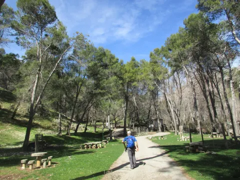
The second phase of the villa corresponds to the 3rd century d. C., being a well preserved villa with pretensions. It highlights the presence of an imposing Atrium with impluvium and a peristil around which most rooms and rooms are articulated. It highlights the decoration with the presence of mosaics with generally geometrical compositions, with swastika bands or braids of different ends or combinations of the previous ones with medallions with human figures; as well as the presence of stucco decorated in most rooms. It highlights the mosaic with the figure of Tetis that is currently located in the Museum of Jaén.

The third phase of the villa adheres to the 4th century d. C., a century of socio-economic changes that are reflected in the villa, demolishing part of the previous phase and replacing it with another building without pretensions, more focused on agricultural activity. These are two buildings, one of them rectangular with apses marked on its minor sides and another building with a large courtyard around which different rooms and rooms are connected with the peristil through two corridors. This latter building would be a courthouse, being the different rooms without paving warehouses or blocks. While the rectangular building, remains of the village of the 3rd century d. C., would be preserved as an urban villa, that is, the area reserved as the home of the owners.

The end of the villa occurred as a result of a great fire, evidenced by the carbonized remains found, although it is discussed whether it happened in the V century d. C. or VIII d. C.

Breve descripción

The Roman villa of Bruñel is a clear exponent of the passage of the Romans through Jaén, being an example of the typical Roman villa under imperial and being formed the archaeological site by an Iberian necropolis from the 4th century a. C. and a Roman occupation that extends from the 2nd century d. C. to the 4th century d.

Telecomunicaciones
Sitio web
www.ayuntamientoquesada.es/
Teléfono de contacto
953 714 011 / 638 395 912
Correo electrónico
oficinadeturismodequesada@gmail.com
Ubicación
Código Postal
23488
Latitud
37.843510
Longitud
-3.067440
Dirección
Carretera de Cazorla a Quesada, km. 6
Municipio
Ubicación en el mapa
POINT (-3.06744 37.84351)
Tipos de punto de interés
Imágenes carrusel
imagen
Image
Bru%C3%B1el%20defi2.jpg
Imagen principal
Desactivado
imagen
Image
bru%C3%B1el%20defi%203.jpg
Imagen principal
Desactivado
Imágenes cabecera
imagen
Image
Bru%C3%B1el%20defi1.jpg
Imagen principal
Activado
Horario
Quesada Tourist Office: Wednesday to Saturday 10: 00 - 14: 00 and 17: 00 - 20: 00. Interpretation Center: Wednesday to Saturday 10: 00 - 14: 00 and 16: 00 - 19: 00, Sundays or holidays 10: 00 - 14: 30 (afternoon closed). Free entry.
Loading map
Preparing points of interest and routes...