Saltar al contenido principal
icon-intereses-cultura

Valley of the Segura

Submitted by brandcode_deweloper on
Id
914042
Descripción
Descripción larga

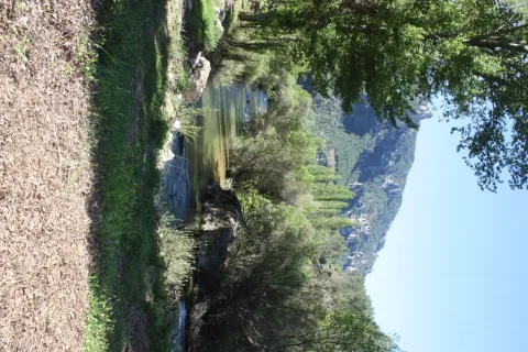
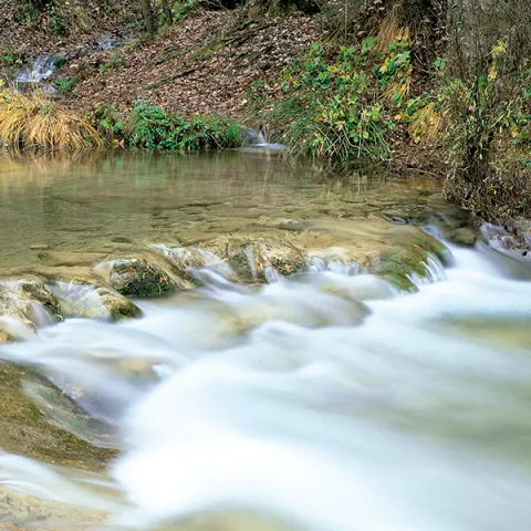
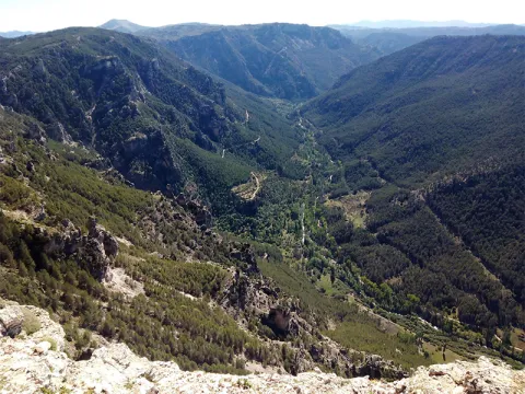
The inhabited cores around the valley were able to take advantage of the river's passage by creating small channels and waterfalls. You will see great walnuts and some orchards by the villages, irrigated with a pure crystalline water. At this point, the river still has the presence of the common trout, a species that only lives in especially clean waters.

After Las Anchuricas the valley goes to Las Juntas de Miller, where the Segura receives its second tributary, the Zumeta River. Together they cross the provincial limit that is located there, entering the province of Albacete. In this place a hydroelectric power plant was erected in the 1950s to take advantage of the flow of these two rivers.

The valley offers pleasant visits around it that will allow you to get to know the Sierra de Segura in depth. Among others, we recommend:

  • Visit the village of La Toba, a place where water is the great protagonist. If the cold water does not impress you, you can go up to the birth of La Toba, which is found in a curious cave well known in the region.
  • Rest next to the reservoir of Las Anchuricas. The water and the high mountains have created this peaceful place, of which you will surely have to leave.
  • Walk around some of the nearby villages such as La Fuente del Esparto, La Peguera del Madroño or Las Gorgollitas. The latter offers an exciting view of the valley.
  • Seating water in the impressive fountain of The Four Caños, between the Anchuricas reservoir and Miller's Boards.
Breve descripción

In the village of Huberga Utrera, the Segura River receives its first tributary, the Madera River. From this point on the Segura, with an already important flow, goes through its valley through bridges - one of them built by the Romans - and visiting villages that were born on its bank and thanks to it survived. The road goes parallel to the river, and on its sides there are impressive calares with magnificent views of the Sierra. As you pass the village of La Toba, the river falls into the charming reservoir of Las Anchuricas.

Ubicación
Latitud
38.298857
Longitud
-2.651877
Distrito
Ubicación en el mapa
POINT (-2.651877 38.298857)
Tipos de punto de interés
Imágenes carrusel
imagen
Image
valle.jpg
Imagen principal
Desactivado
Imágenes cabecera
imagen
Image
valle-del-segura.png
Imagen principal
Activado
Loading map
Preparing points of interest and routes...

Valley of the Segura

Submitted by brandcode_deweloper on
Id
2980198
Descripción
Descripción larga

The road goes parallel to the river and, on its sides, there are impressive calares with magnificent views of the saw. As you pass the village of La Toba, the river remains in the charming reservoir of Las Anchuricas, one of the most beautiful of the Sierras de Cazorla Natural Park, Segura and Las Villas, The valley offers pleasant visits around you that will allow us to know more about the Sierra de Segura, such as the village of La Toba, a place where water is the great protagonist, or the nearby populations of La Fuente del Esparto, La Peguera del Madroño or Las Gorgollitas.

On the JF-7038 road, from The Utrera Strike to Miller's Boards.

Breve descripción

In the village of Huberga Utrera, the Segura River receives its first tributary, the Madera River. From this point on, the Segura, with an already important flow, advances through its valley through bridges and visiting villages that were born on its bank and that survived thanks to it.

Ubicación
Código Postal
23298
Latitud
38.118420
Longitud
-2.670480
Dirección
Carretera A-317
Distrito
Municipio
Ubicación en el mapa
POINT (-2.67048 38.11842)
Imágenes carrusel
imagen
Image
R%C3%ADo%20Segura%20%28La%20Toba%29.jpg
Imagen principal
Desactivado
Imágenes cabecera
imagen
Image
9.jpg
Imagen principal
Activado
Loading map
Preparing points of interest and routes...

Town Planning of Aldeaquemada

Submitted by brandcode_deweloper on
Id
5869042
Descripción
Descripción larga

We can also find other architectural monuments in Aldeaquemada, which come from the time of the colonization of Charles III, highlighting:

• Church of the Purple Conception (18th century). A colonial-type church with a single ship. A vertical trend in relation to the rest of the buildings. Its facade is made of brick and is articulated in two bodies. In the first one, in rectangular form, the only differentiated elements are a narrow cover with a half-point arch and above, two lunetes that keep the line of horizontality. In the second body, a slight swordsman with a bell tower is triangulated, culminating in a small front. There are two houses on both sides of the church, corresponding to the old house of the priest and the post commander.

• The Comandante's House has also come to serve as a city hall for many years and even... The poultry house where bulls and bravas were locked up during the holidays of San Miguel! It is now the Retired Home, renovated and opened in April.

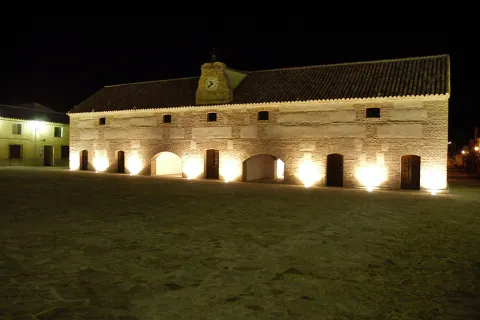
• Diezm and Labrador site (18th century). Building of the time of colonization and present in all the foundations of Charles III. It was dedicated to housing the cereals harvested by the farmers and as a warehouse in times of famine. Current town hall of the town, it is built in brick, of rectangular floor, of two floors and roof to two waters where it has a discreet structure of grabbard brick that houses the city's watch. New atypical uses: some of their rooms have performed the role of dungeon, home of the retired, butcher's shop, teleclub and, of course, municipal warehouse.

Breve descripción

Aldeaquemada was born as a crossroads of roads, faithful to that function is the layout of its streets: rectangular urbanism, with long rectilinear axes. Aldeaquemada, is certainly the "Perla urbanística de Sierra Morena," for its urban innovations of structuring the streets on cross-sectional axes that divide it into squares and for the conservation of its original layout, hence it can be considered the entire urban town of the town as one more monument. The streets are perfectly aligned with the cardinal points, and the church with the altar
East.

Telecomunicaciones
Sitio web
www.aldeaquemada.com
Teléfono de contacto
680 104 199
Correo electrónico
turismo.aldeaquemada@gmail.com
Ubicación
Código Postal
23215
Latitud
38.412120
Longitud
-3.373310
Distrito
Municipio
Ubicación en el mapa
POINT (-3.37331 38.41212)
Tipos de punto de interés
Imágenes carrusel
imagen
Image
Aldeaquemada.png
Imagen principal
Desactivado
imagen
Image
Urbanismo_Aldeaquemada.jpg
Imagen principal
Desactivado
Imágenes cabecera
imagen
Image
Aldeaquemada%202.jpg
Imagen principal
Activado
Loading map
Preparing points of interest and routes...

Shaded Hillside of Cabeza Gorda

Submitted by brandcode_deweloper on
Id
660013
Descripción
Descripción larga

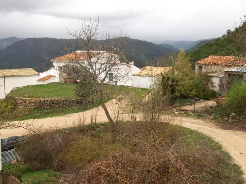
Traditional constructions have only been modified, although the most rewarding is the view that you can enjoy from the village that really constitutes a natural balcony open to an overwhelming landscape in which stands out on the whole Calar del Cobo with the Puntal of the Mass.

If you like them, you can't stop visiting the Umbria, as it's a very good area for the collection of these mushrooms. In addition, a delicious unmarked road leads to the nearby village of Cabeza Gorda, located on the opposite side of a mountain, which is naturally called Morro de Cabeza Gorda.

Breve descripción

Despite being called the Umbria de Cabeza Gorda we are in front of a village located on a solana, with vegetation typical of the Mediterranean forest. You can see an isolated house around an explanade belonging to the ancient era, next to which there are some cherry trees and a fountain that welcome us.

Ubicación
Latitud
38.183050
Longitud
-2.626130
Distrito
Ubicación en el mapa
POINT (-2.62613 38.18305)
Tipos de punto de interés
Imágenes carrusel
imagen
Image
1137903Master.jpg
Imagen principal
Desactivado
imagen
Image
unnamed%20%281%29.png
Imagen principal
Desactivado
Imágenes cabecera
imagen
Image
8.jpg
Imagen principal
Activado
Loading map
Preparing points of interest and routes...
Marcas de calidad

Toya and Hornos Princely Tombs

Submitted by brandcode_deweloper on
Id
308552
Descripción
Descripción larga

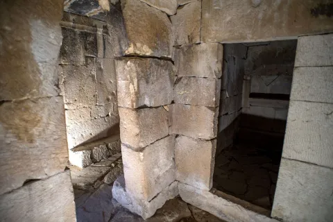
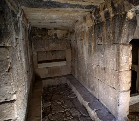
The camera has rectangular floor with three ships. The greater than the sides, and these to the right and left, have an antecedent that is accessed by false arches with simulated capitel in their jambas. In the interior of the receptacles we can observe banks and poyetes to deposit the cineries and the joules. The side and central ships have niches on the walls to receive offerings. The construction of about four meters in length by almost three meters wide is made with large armchairs adjusted to the time of its assembly and covered by a structure of large slabs. The whole construction is of a monumental character, cyclopean by the size of some armchairs and dintels. In terms of its content, we must refer to the recovered, and among all this we highlight the Greek ceramics of red figures, especially the crateras and the metal elements among which the remains of a car stand out. His chronology includes it within the Iberian culture of the end of the S. V and the beginning of the IV before Christ. The aim of this stop is to show how a main funeral chamber is and its meaning in the context of the Iberian aristocratic society. The Centre of the Principesque Tombs of Peal allows you to know the theme of the life of the ultratumba and the funeral rites.

Breve descripción

In the well-known Cerro de la Horca, very close to the village of Toya and the famous castle-archaeological site of its same name, is the great tomb known as the funeral chamber of Toya.

Telecomunicaciones
Sitio web
www.viajealtiempodelosiberos.com
Teléfono de contacto
953 730 075
Correo electrónico
info@viajealtiempodelosiberos.com
Ubicación
Código Postal
23460
Latitud
37.911830
Longitud
-3.127110
Dirección
Carretera Peal de Becerro a Toya
Municipio
Ubicación en el mapa
POINT (-3.12711 37.91183)
Tipos de punto de interés
Imágenes carrusel
imagen
Image
peal-becerro-tumbas%20%283%29.jpg
Imagen principal
Desactivado
imagen
Image
img-porcuna.jpg
Imagen principal
Desactivado
Imágenes cabecera
imagen
Image
peal-becerro-tumbas-ok.jpg
Imagen principal
Activado
Horario
Make visits.
Loading map
Preparing points of interest and routes...

Travertines of the Río Borosa

Submitted by brandcode_deweloper on
Id
877964
Descripción
Descripción larga

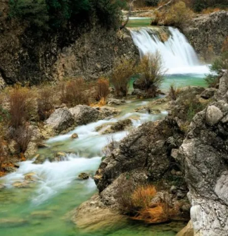
The upper part of the Borosa River, has a scalated profile for the development of pozas and waterfalls in which travertine terraces are formed with spectacular botroidal calcite morphologies that were precipitated during the most humid and warm periods of the Quaternary.

Although travertine appear throughout the river, the highest concentration is located in the sector between the organ jump and the electric power plant. Its formation is due to the precipitation of calcite caused by the tear-up of the river waters produced by the turbulent regime of the water leaps in the areas with the greatest slope. This precipitation occurs in areas of dense vegetation receding elements of plants and producing subvertical sheets known as cascade facies.

Breve descripción

Travertinos del Río Borosa

Ubicación
Nombre
Río Borosa
Latitud
38.298857
Longitud
-2.651877
Distrito
Ubicación en el mapa
POINT (-2.651877 38.298857)
Tipos de punto de interés
Imágenes carrusel
imagen
Image
5%20%284%29.jpg
Imagen principal
Desactivado
Imágenes cabecera
imagen
Image
borosa.png
Imagen principal
Activado
Horario
Tuesday to Friday: 10: 00 - 14: 00. Tuesday to Saturday: 18: 00 - 20: 00. Saturdays and Sundays: 10: 00 - 13: 30.
Loading map
Preparing points of interest and routes...

Travertines of La Toba

Submitted by brandcode_deweloper on
Id
877847
Descripción
Descripción larga

It is a travertine of hectometric dimensions, located on the southern side of the valley of the Segura River, in a sector very close between the Puntal of the Vultures (1680 m) and the Calar del Pino (1567 m). The travertine, attached to the steep carbonate side of the Cretaceous, has a higher flat morphology, on which the picturesque village of La Toba is located.

In the vertical walls of the travertine there are several karmic resurrections with spectacular water jumps and great beauty carbonate morphologies. Stratigraphically, the uprisings are at the base of the upper Cretaceous dolomies, which constitute the aquifer, on the waterproof levels that belong to the lower Cretaceous.

Source: Inventory of Georresources of Andalusia. Environmental Council. Junta de Andalusia.

Breve descripción

Travertinos de La Toba

Ubicación
Latitud
37.912893
Longitud
-3.003887
Municipio
Ubicación en el mapa
POINT (-3.003887 37.912893)
Tipos de punto de interés
Imágenes carrusel
imagen
Image
5%20%281%29.jpg
Imagen principal
Desactivado
imagen
Image
6%20%281%29.jpg
Imagen principal
Desactivado
Imágenes cabecera
imagen
Image
la-toba.png
Imagen principal
Activado
Loading map
Preparing points of interest and routes...

Dark Towers

Submitted by brandcode_deweloper on
Id
4892712
Descripción
Breve descripción

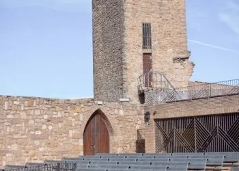
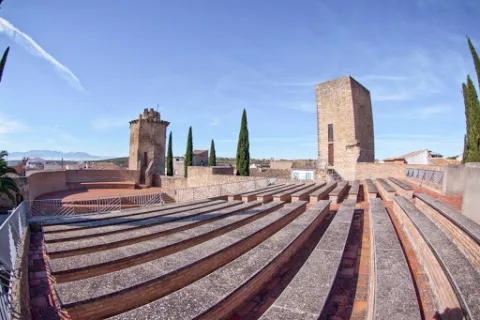
They're themost representative element of the urban complex of Torreperogil. They were part of the old castle - a fortress built in the 13th century, between 1230 and 1240 and which gave rise to the villa that was built after the battle of the Navas de Tolosa. At the end of the 19th century there were four towers, but at present only two are preserved. One of them is a square floor, it is accessed inside by an intellized door. It has a single floor covered by a pointed vault and it has aspillers in its paraments. The other, known as the ochavada tower, has an octagonal plant, is built of thick armchair and crowned with powerful shoes for the support of the matacans. To access its interior, it has a narrow warhead door and is given light by small saetera windows. They have been rehabilitated in recent yearsof the 20th centuryhowMunicipal Auditorium. The Ochavado Torreon and the Square TorreonThey are declared a Historical Monument.(BOE 26 / 06 / 1985).

Telecomunicaciones
Sitio web
www.torreperogil.es
Teléfono de contacto
953 776 000
Correo electrónico
info@torreperogil.es
Ubicación
Código Postal
23320
Latitud
38.034620
Longitud
-3.287700
Dirección
C/ las Torres, 19D
Distrito
Municipio
Ubicación en el mapa
POINT (-3.2877 38.03462)
Tipos de punto de interés
Imágenes carrusel
imagen
Image
torres%20oscuras.jpg
Imagen principal
Desactivado
Imágenes cabecera
imagen
Image
torres%20%281%29.jpg
Imagen principal
Activado
Microsite al que pertenece
Loading map
Preparing points of interest and routes...

Santa Catalina Towers

Submitted by brandcode_deweloper on
Id
4672189
Descripción
Descripción larga

According to some authors, the torres- atalaya of the area of Orcera and Segura of the Sierra must be reconsidered and dated again as coming from the time of Carthaginese domination of the peninsula, between the years 237 and 202 before Christ, for being quoted in Tito Livio asTowers of Anibal, being in one of them where one of the Scipion brothers died in the warrior refriegas of 211 BC This hypothesis must be taken into account and confronted by the specialists of ancient history of Spain, but in no case can it be held seriously that they are only medieval, Islamic, Almohade or Christian. Its origin, although in medieval times they were the subject of partial restorations or reconstructions, possibly from the third century BC, between the years cited and in the occasion of the wars between Rome and Cartago for the possession of the peninsula.

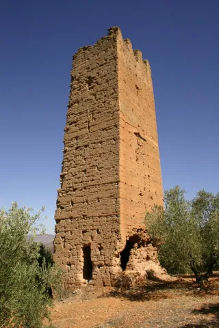
This tower is a twin of the tower of Santa Catalina II, it seems to be a Muslim work of the late 12th or early 13th century and its function would be to monitor the intricate landscape of hills surrounding them.

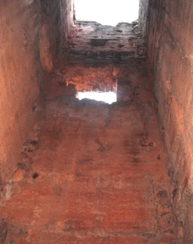
Its quadrangular plant measures about 5.30 by 4.20 meters from sides, its height of about 14 meters, the thickness of its walls on the ground is 1.19 meters, and the access gap is about 7 meters high. Its interior is organized in 4 plants separated by beams that supported the zócalos resulting from the progressive narrowing of the walls.

Breve descripción

The Tower of Santa Catalina I is located in the municipal term of Orcera, province of Jaén, and is part of the defensive set of three towers that exist between Segura de la Sierra and Orcera, and are named after Santa Catalina.

Telecomunicaciones
Teléfono de contacto
953 480 154
Correo electrónico
ayuntamiento@orcera.es
Ubicación
Código Postal
23370
Latitud
38.313210
Longitud
-2.673180
Distrito
Municipio
Ubicación en el mapa
POINT (-2.67318 38.31321)
Tipos de punto de interés
Imágenes carrusel
imagen
Image
santa%20catalina.jpg
Imagen principal
Desactivado
Imágenes cabecera
imagen
Image
10264136784_cd928a76e8_b.jpg
Imagen principal
Activado
Loading map
Preparing points of interest and routes...

Customs Towers

Submitted by brandcode_deweloper on
Id
4383877
Descripción
Breve descripción

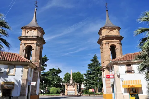
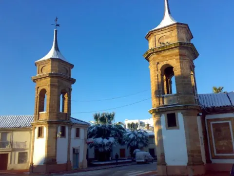
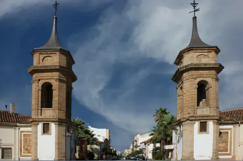
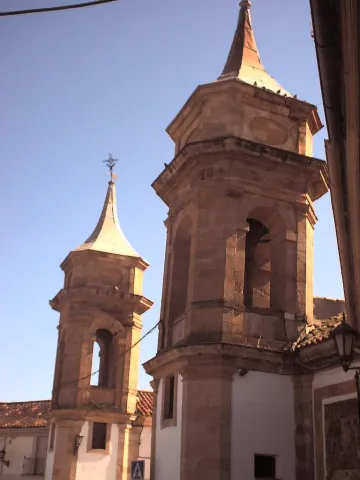
The towers of the Customs (18th century) were built to flank the passage to the Customs Square, where taxes and tolls were charged. These neoclassical-style constructions are one of the most well-known and representative monuments of La Carolina. They intended to bring a sign architecture to the capital of the New People and a revolution to the urban planning of the time. In 1792 they were moved to keep the north entrance of the city. In the original plane of the population, a tower was planned to be erected for each vertex of the city.

Telecomunicaciones
Sitio web
www.lacarolina.innovasur.es
Teléfono de contacto
953 660 034
Correo electrónico
info@lacarolina.es
Ubicación
Código Postal
23200
Latitud
38.276040
Longitud
-3.611560
Dirección
C/ de Madrid
Distrito
Municipio
Ubicación en el mapa
POINT (-3.61156 38.27604)
Tipos de punto de interés
Imágenes carrusel
imagen
Image
1200px-La_Carolina_-_010_%2830102808753%29.jpg
Imagen principal
Desactivado
imagen
Image
00502096.jpg
Imagen principal
Desactivado
imagen
Image
5104433718_40f0c329fc_b.jpg
Imagen principal
Desactivado
Imágenes cabecera
imagen
Image
Aduana_0104_03.jpg
Imagen principal
Activado
Microsite al que pertenece
Loading map
Preparing points of interest and routes...