Saltar al contenido principal
icon-intereses-cultura

Keep / Tower Medieval de Villarrodrigo

Submitted by brandcode_deweloper on
Id
3964217
Descripción
Descripción larga

In the back there is a single safetiere set at high height to illuminate the snail staircase that gives access to a terrace. The only inner stay is covered with a shell vault.

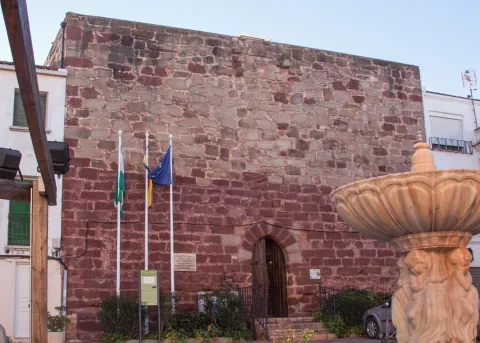
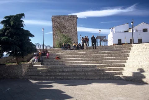
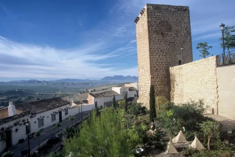
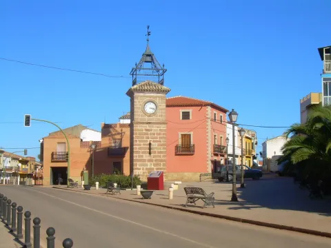
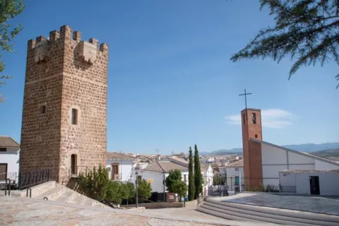
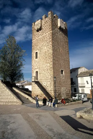
Despite the fact that in the 1960s its upper part was decoupled to the level of the surrounding houses, some of which have been joined by two of its sides, it arouses a great interest not only for its own architectural typology but also for the medieval urban scenography it reproduces in the center of the municipality.

Breve descripción

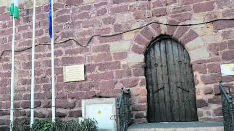
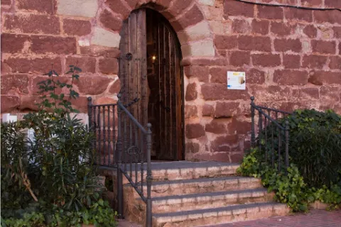
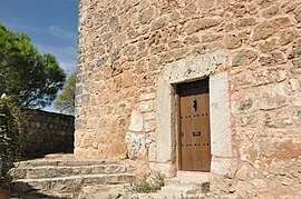
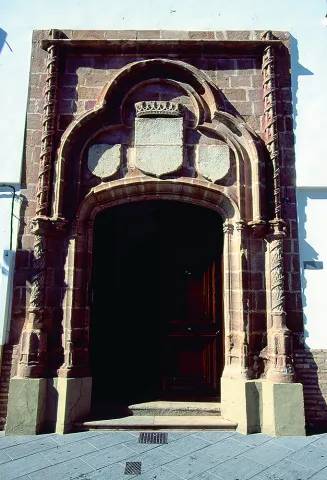
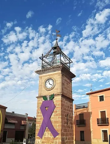
The Torreon de Villarrodrigo is of a square floor and is made of good masonry covered by large irregular armchairs. Its main façade, of 13.60 meters, has an arch door made up of striking carved candles, an entrance that is somewhat elevated with respect to the level of the square.

Telecomunicaciones
Sitio web
www.villarrodrigo.es/el-municipio/patrimonio-historico.html
Correo electrónico
villarrodrigo@promojaen.es
Ubicación
Código Postal
23393
Latitud
38.032400
Longitud
-3.287500
Dirección
C/ la Torre, 5
Distrito
Municipio
Ubicación en el mapa
POINT (-3.2875 38.0324)
Tipos de punto de interés
Imágenes carrusel
imagen
Image
image_content_13099033_20171223114005.jpg
Imagen principal
Desactivado
imagen
Image
unnamed.jpg
Imagen principal
Desactivado
Imágenes cabecera
imagen
Image
fortaleza32.jpg
Imagen principal
Activado
Microsite al que pertenece
Loading map
Preparing points of interest and routes...

Keep / Tower Árabe

Submitted by brandcode_deweloper on
Id
4909134
Descripción
Descripción larga

On the surface of the plateau there are traces of ancient fortification, possibly a Roman fortress or ibera linked to Oretania.

In the middle of the S. IX, an Arab fortification was built in Sorihuela to defend the left margin of Guadalquivir and as the advance of the Guadalimar River.

In 1235 Fernando III conquered Sorihuela, a small Arab house, giving it as a service to the infant Mr Sancho, Bishop of Toledo, as part of the advance of Cazorla and border to the Muslims. Sorihuela was soon revalued for its proximity to the Montizón road that was communicating Sierra Morena with Castile.

The tower of Tribute was ordered to be built by the Toledo archbishops at the end of the 13th century, taking advantage of the primitive structure of the small medieval castle. This tower guaranteed that the advance would receive the rent of the marzadga that all the inhabitants were to pay to the Archbishopric for their belonging to the Lordship of Toledo as well as the tribute of the plumbing paid by those who intended to free themselves from the service of weapons.

Even at the end of the 16th century he was occupied by a guardian dependent on the warden of Iznatoraf.

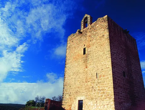
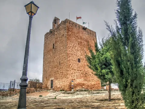
The tower of tribute is square of regular masonry placed with yarn and chains on the corners of silery, ready to rope and sawn. The plant has 9.4 meters of side and 13.7 to the almond parapet.

Breve descripción

Sorihuela de Guadalimar is located to the north of the Guadalquivir and Guadalimar rivers, at the foot of the Loma de Chiclana in the Sierra de las Cuatro Villas. In its vicinity the old way of Montizón, which was a common communication route with Castile through Sierra Morena, was taking place. The castle of Sorihuela was located on a rocky promontory above the town. The only vestige that is preserved is the tower of tribute, raised in the 13th century.

Telecomunicaciones
Sitio web
www.aytosorihueladelguadalimar.es
Teléfono de contacto
953 430 004
Ubicación
Código Postal
23270
Latitud
38.240920
Longitud
-3.053800
Dirección
C/ Eras, 9
Distrito
Municipio
Ubicación en el mapa
POINT (-3.0538 38.24092)
Tipos de punto de interés
Imágenes carrusel
imagen
Image
Mon511.jpg
Imagen principal
Desactivado
imagen
Image
270px-Castillo_de_Sorihuela_-_entrada_a_la_torre.jpg
Imagen principal
Desactivado
Imágenes cabecera
imagen
Image
sorihuela_del_guadalimar_1%20%281%29.jpg
Imagen principal
Activado
Loading map
Preparing points of interest and routes...

Torreón

Submitted by brandcode_deweloper on
Id
4650480
Descripción
Breve descripción
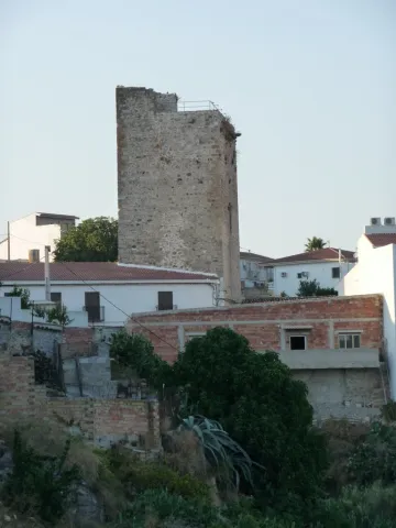
The tower, as it survives today, is built of regular masonry, with ashlar stretcher-and-header corner stones, and has had homes attached to it in modern times. It must have been the keep of a small but strong castle that carried out relatively important military functions throughout the 13th and 14th centuries: it acted as a stronghold of Calatrava power in the Martos countryside and played a leading role in bloody battles, such as the one popular tradition attributes to the conflict between the King of Castile and the King of Granada in 1431. It originally had two floors, of which only the lower one survives, with a narrow entrance featuring a semicircular arch made up of large voussoirs, which contrast with the reduced size of the opening itself, kept small for security reasons. This doorway, a window, and the remains of another arch are the few significant elements that can still be seen today. It was declared a Site of Cultural Interest in 1985.
Telecomunicaciones
Sitio web
www.higueradecalatrava.es/el-municipio/patrimonio-historico.html
Teléfono de contacto
953 529107
Ubicación
Código Postal
23611
Latitud
37.79899
Longitud
-4.15984
Dirección
C/ Torre, 26
Distrito
Ubicación en el mapa
POINT (-4.15984 37.79899)
Tipos de punto de interés
Imágenes carrusel
imagen
Image
torreon%20%20higuera%20calatrava.jpg
Imagen principal
Desactivado
Imágenes cabecera
imagen
Image
Torre_higuera.jpg
Imagen principal
Activado
Loading map
Preparing points of interest and routes...

Mocha Tower

Submitted by brandcode_deweloper on
Id
4540320
Descripción
Descripción larga

Its construction was to be carried out between the 13th and 14th centuries and over time it was joined by houses of little entity that distorted its image. In 1987 the Cultural delegation of the Junta de Andalucía, in view of its state of advanced deterioration, carried out a restoration for the emergency procedure led by the architect Luis Carlos Gutiérrez Calatrava, which was modelic in terms of its rigor and treatment: consolidation of vaults and construction of roof for the evacuation of water, repair of external and interior locks, replacement of parts and outdoor carpentry and conditioning of the exterior and areas of access.

It was declared Good of Cultural Interest in 1985

Breve descripción

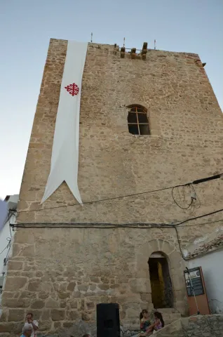
The Mocha tower, the other preserved in the medieval castle, is less elegant than the Clock. It is about seven meters from the side, it is made of masonry in one of its parts, it has its corners reinforced with rope and sawn, and it is topped with squiners - beams whose ends stand out to the outside.

Telecomunicaciones
Sitio web
www.pealdebecerro.es
Teléfono de contacto
953 730 075
Correo electrónico
ayuntamiento@pealdebecerro.es
Ubicación
Código Postal
23460
Latitud
37.911650
Longitud
-3.127570
Distrito
Municipio
Ubicación en el mapa
POINT (-3.12757 37.91165)
Tipos de punto de interés
Imágenes carrusel
imagen
Image
torre-mocha-peal-de-becerro-jpg
Imagen principal
Desactivado
Imágenes cabecera
imagen
Image
torre-mocha-y-paisaje-peal-de-becerro-jpg
Imagen principal
Activado
Loading map
Preparing points of interest and routes...

Tower of the Risquillo

Submitted by brandcode_deweloper on
Id
5387308
Descripción
Breve descripción

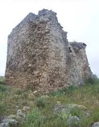
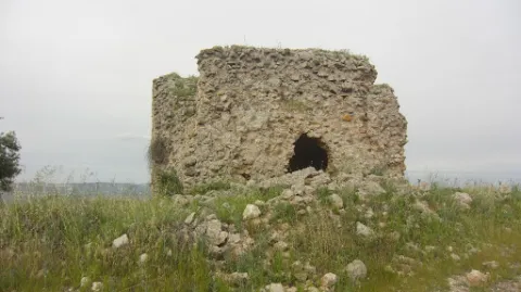
They are remains ofa bajomieval tower(tower of the homage of the old castle), probably from the 13th century thatconserves 4 m highand is located on a small hill a few meters fromCortijo Risquillo.

Ubicación
Código Postal
23100
Latitud
37.929300
Longitud
-3.560670
Distrito
Municipio
Ubicación en el mapa
POINT (-3.56067 37.9293)
Tipos de punto de interés
Imágenes carrusel
imagen
Image
t.%20risquillo.jpg
Imagen principal
Desactivado
Imágenes cabecera
imagen
Image
torre.jpg
Imagen principal
Activado
Microsite al que pertenece
Loading map
Preparing points of interest and routes...

Clock Tower and Plaza de Santa María

Submitted by brandcode_deweloper on
Id
6231552
Descripción
Breve descripción

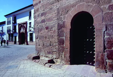
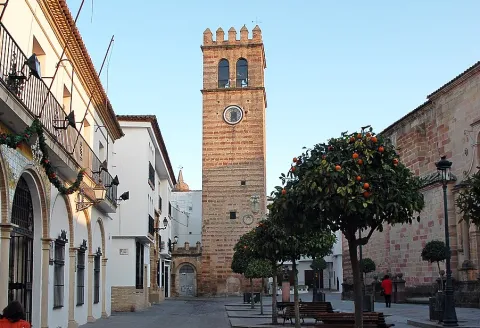
It was the main square of the city during the 16th and 17th centuries, and the heart of the city from the low Middle Ages. It is thought that there was a mosque in the Muslim era that was converted to Christian worship, following the taking of the city by Fernando III. In this case, the Sahara or courtyard of Abluciones would generate the current Plaza de Santa María and its minaret the Torre del Clock. Already in the 15th century it was considered the first public space of the city and evidence of this is the fact that the Cabildo decided to build his house in it.

Telecomunicaciones
Sitio web
www.turismodeandujar.com/
Teléfono de contacto
953 504 959
Correo electrónico
turismodeandujar@andujar.es
Ubicación
Código Postal
23740
Latitud
38.037480
Longitud
-4.055490
Distrito
Municipio
Ubicación en el mapa
POINT (-4.05549 38.03748)
Tipos de punto de interés
Imágenes carrusel
imagen
Image
Mon500.jpg
Imagen principal
Desactivado
imagen
Image
Mon499.jpg
Imagen principal
Desactivado
imagen
Image
Mon498.jpg
Imagen principal
Desactivado
Microsite al que pertenece
Loading map
Preparing points of interest and routes...

19th-century Clock Tower

Submitted by brandcode_deweloper on
Id
1735371
Descripción
Descripción larga

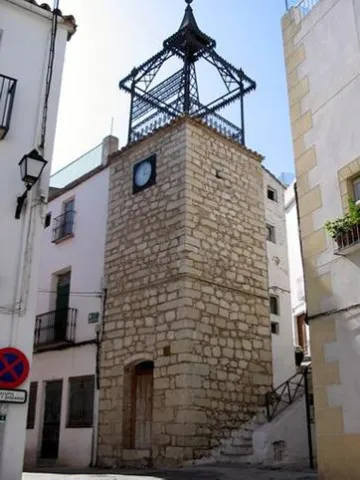
It's a square-floor turret. The construction in 1883 of this bell tower, in which new techniques of work with cast iron were used and a new public watch was installed, was a symbol of modernity that reflected the influence of the industrial revolution that was taking place at the national level.

At the end of the 19th century, Albanchez lives a period of expansion thanks to the agriculture of the olive tree, doubling the population.

The iron inscription of the watch reads:

"Coised with municipal funds being mayor Don Sebastian Ogayar León Year 1883".

Breve descripción

Square floor turret built with masonry. It is topped by a bell tower of cast iron structure built in 1883.

Telecomunicaciones
Sitio web
www.albanchezdemagina.es/el-municipio/patrimonio-historico.html
Teléfono de contacto
953 347 009
Correo electrónico
ayuntamiento@albanchezdemagina.es
Ubicación
Código Postal
23538
Latitud
37.791732
Longitud
-3.463718
Dirección
C/ Abogado Mesías, 8
Distrito
Ubicación en el mapa
POINT (-3.463718 37.791732)
Tipos de punto de interés
Imágenes carrusel
imagen
Image
t.%20del%20reloj%20XIX%202.jpg
Imagen principal
Desactivado
Imágenes cabecera
imagen
Image
main_image_43951.jpeg
Imagen principal
Activado
Horario
24 h.
Microsite al que pertenece
Loading map
Preparing points of interest and routes...
Interés

Tower of the Reloj de Arquillos

Submitted by brandcode_deweloper on
Id
12389296
Descripción
Descripción larga

The tower is square and starts from a zocalo. The whole factory is a bartender. Of its two bodies, the first has twice its height and in it is opened a half-point arch with pillows. On this door a flask window opens that gives light to its interior and is repeated on the other three sides. A triple molding separates the first from the second body, in which the clock appears, a small square window and docile pilasters at the ends. On the ledge there is an artisan iron structure, added in 1884 to house the bell and the veleta. In the 18th century the hours were marked by the bells of the churches. To raise a municipal tower with the sole function of indicating the hours was unusual at the time and symbolizes the confrontation between the civil and ecclesiastical powers that stars the reign of Charles III.

Breve descripción

Located on Avenida de Adalucía, this building dates back to the late 18th century, with an architectural sample of its colonial past in the time of Charles III.

Telecomunicaciones
Teléfono de contacto
953 633 000
Ubicación
Código Postal
23230
Latitud
38.182413
Longitud
-3.430364
Dirección
Plaza Carlos III
Distrito
Municipio
Ubicación en el mapa
POINT (-3.430364 38.182413)
Tipos de punto de interés
Imágenes carrusel
imagen
Image
torre-del-reloj-1-jpg
Imagen principal
Desactivado
imagen
Image
torre-del-reloj-3-jpg
Imagen principal
Desactivado
Imágenes cabecera
imagen
Image
torre-del-reloj-2-jpg
Imagen principal
Activado
Microsite al que pertenece
Loading map
Preparing points of interest and routes...
Interés

Clock Tower

Submitted by brandcode_deweloper on
Id
1914290
Descripción
Descripción larga

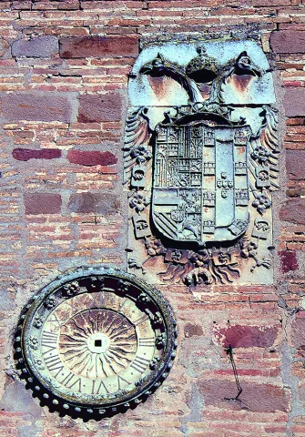
Under the shield is a beautiful watch, carved in stone and of elegant bill, which probably gave name to the new construction. It is a clock that at the present time has no function, because of it only its cultivated sphere persists. Clock that would be replaced, surely in the 19th century, by the one we see below the looking body.

Everything seems to indicate, according to the capitular records of the 17th century, that the Clock Tower was an element attached to the royal prison with which it was communicated. On September 12, 1653, he reported that a prisoner had fled through the tower because of the watchmaker's neglect, which is why he would be punished and replaced. Surveillance tower from where the streets and people of Andújar are seen and from where the work rate of their neighbours was marked. At the present time, the Clock Tower is certainly one of the most representative elements of the monumental city of Andújar and part of the morphology of the square of Santa Maria.

On the west front and at half height we find the imperial shield of Charles V and a watch carved in stone. In the first ornamental element, a bicephalous eagle carries the imperial crown and the gold Toison borders the shield. In the right canton the lineage of the Trastámara and the Habsburg and in the sinister of the House of Avís, which correspond to Charles V and his wife Isabel of Portugal, respectively. His presence is due to the coincidence of the execution of the work with the reign of Charles V, for it was customary at the time to leave witness to the reigning monarch in the new constructions. An imperial shield that reminds the Andujareans of their fidelity to the monarch in the years of the war of the Communities, as part of the Junta de las Ramblas. It was not in that same view his mayor, Francisco de Vergara, who "had sympathy for the Communists, and knew the city of the management he brought with them, was so outraged, that in the middle of Cabildo he took away the rod of justice." From the loyalty and obedience of the city the emperor was very pleased and proof of this was the letter he sent on July 20, 1520, from the city of Ipres, in which he thanked the city's attitude towards his person at those difficult times.

The only documentary source that exists today on this construction is on its west front and says: "The great knight Francisco / Alarcón twenty-four of Granada and his major mayor Sancho Díaz / Baeza, who is the king of this city, is now the only one who has been the author of this city. Mayordomo Alonso Yáñez."

At its base is the Municipal Tourism Office, from where you can access the Panoramic Mirador.

Breve descripción

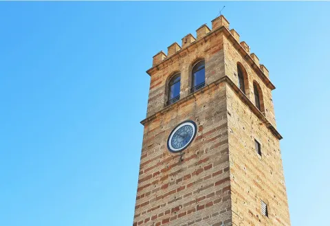
Almond tower, built with stone and brick rows, with a lookout on its top, framed between cornlines and with half-point windows on all its fronts.

Telecomunicaciones
Sitio web
https://www.turismodeandujar.com/torre-del-reloj
Correo electrónico
ayuntamiento@arquillos.es
Ubicación
Código Postal
23780
Latitud
38.182350
Longitud
-3.430360
Dirección
Plaza de Santa María
Distrito
Municipio
Ubicación en el mapa
POINT (-3.43036 38.18235)
Tipos de punto de interés
Imágenes carrusel
imagen
Image
Anotaci%C3%B3n%202020-04-16%20081008.jpg
Imagen principal
Desactivado
imagen
Image
Anotaci%C3%B3n%202020-04-16%20081027.jpg
Imagen principal
Desactivado
Imágenes cabecera
imagen
Image
Anotaci%C3%B3n%202020-04-16%20081048.jpg
Imagen principal
Activado
Horario
Winter (16 sept - 14 Jun): Monday to Friday 09: 00 - 14: 15 and 16: 30 - 19: 15, Saturday 09: 00 - 14: 30. Summer (15 Jun - 15 Sept): Monday to Friday 07: 30 - 14: 30, Saturday 09: 00 - 13: 30.
Microsite al que pertenece
Loading map
Preparing points of interest and routes...

Clock Tower

Submitted by brandcode_deweloper on
Id
4540260
Descripción
Descripción larga

The Clock tower, built in the late 14th century, is about 12 meters high. It sits on a stone socket, it is quadrangular, its silvery is not entirely regular, it is distributed internally on four levels, it conserves the almenate and also, on two of its faces, balconies with the function of matacan; on another, matacan ménsulas; while on the north-west one has been placed a named watch, where the matacan and its ménilas were first located.

In 1985 it was declared Good of Cultural Interest.

Breve descripción

As we approach the mound on which the people are based, in the heart of the urban core, two towers that were part of a medieval fortress that was attached to Quesada and, past the equator of the 14th century, in 1361, was looted and burned in a raison of Arab troops from the kingdom of Granada.

Telecomunicaciones
Sitio web
www.pealdebecerro.es
Teléfono de contacto
953 730 075
Correo electrónico
ayuntamiento@pealdebecerro.es
Ubicación
Código Postal
23460
Latitud
37.912220
Longitud
-3.127110
Dirección
C/ de Josefa Sta. María, 2
Municipio
Ubicación en el mapa
POINT (-3.12711 37.91222)
Tipos de punto de interés
Imágenes carrusel
imagen
Image
torre%20del%20reloj%202.jpg
Imagen principal
Desactivado
Imágenes cabecera
imagen
Image
torre-del-reloj-peal-de-becerro-jpg
Imagen principal
Activado
Loading map
Preparing points of interest and routes...