Saltar al contenido principal
icon-intereses-cultura

Gall Oak and Oak Forests

Submitted by brandcode_deweloper on
Id
881625
Descripción
Descripción larga

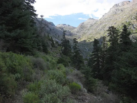
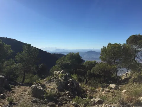
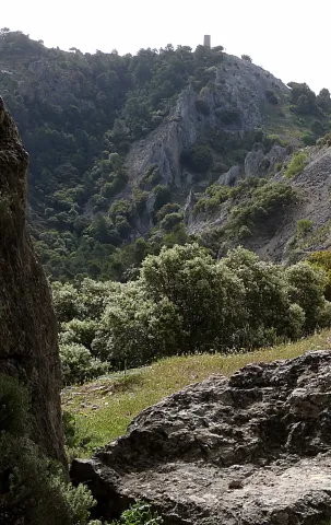
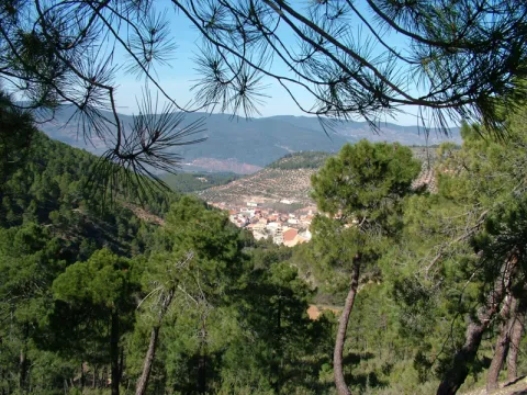
The Barrio del Guadalentín is one of the best complaints forests in the park. Among the complaints, on the other side of the ravine, the Poyos de la Carilong rise majestic. The whole set, whimsical, river and rocky fleshly make this walk a true enjoyment of our nature.

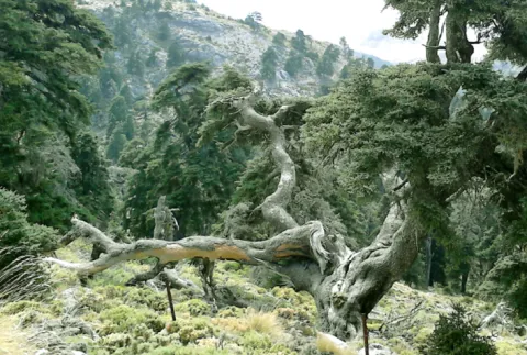
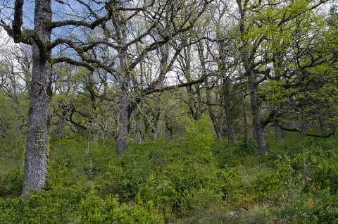
In other times, one of the most widespread forest formations in the mountains was the deniigal, embedded in deep soils, with abundant organic matter and quality. In this forest the dominant tree is the whine (Quercus faginea). In the colonization of the saw the human being occupied these rich and fertile soils for use, cutting the forest and taking advantage of its offal as fuel and material for construction. Later on it was the naval industry that was supplied with the wood of the Robledals or Robledals. In our days, the robledal, as it is named in the saw, survives in areas that are short-lived, in bright slopes and in the bottom of valleys like rodents or bosquets.

The complaints (Quercus faginea) are accompanied by some salgarean pine (Pinus nigra salzmannii) and some oaks (Quercus ilex ballota). In the forest, we find trees such as cereals (Prunus mahaleb) and pespejones (Sorbus torinlis), and shrubs such as majuelos (Crataegus monogina), skirmishes (Rosa spp.), laureolas (Daphne laureola), thorns (Berberis vulgaris australis). And by covering the ground, we find a herbaceous entourage among which we highlight grasses such as Brachypodium sylvaticum, Brachypodium phoenocoids, Festuca arundinacea, Dactylis glomerata, and Piptaterum meliaceum. Other species that we find in the complaint are the gold button (Geum sylvaticum), violets (Viola odorata), primaveras (Primula vulgaris), consueldas (Prunella grandiflora, P. laciniata, P. vulgaris), filippines (Filipendula vulgaris), eléboros (Helleborus foetidus), narcissos (Narcissus triandrus pallidulus) and wild jacintos (Scilla paui).

LOCATION

To access, we follow the road from Vadillo Castril to the San Pedro Navy. At the height of Los Collados it becomes a ground track, but with good firm. As we overcome the San Pedro Navy, we will be waiting for the second detour to our right. It is a closed track to the traffic of vehicles that is located a few meters from the old forest house of Fuente Steel, which is currently abandoned, but is kept standing and seen from the track. As we pass through it, about 200 meters away we find the detour, where we park and walk along the track. We will soon begin to enter a splendid forest of complaints.

Breve descripción

Environ del Barranco del Guadalentín

Ubicación
Latitud
37.702695
Longitud
-2.935057
Municipio
Ubicación en el mapa
POINT (-2.935057 37.702695)
Tipos de punto de interés
Imágenes carrusel
imagen
Image
837034Master%20%281%29.jpg
Imagen principal
Desactivado
imagen
Image
los-quejigales%20%281%29.png
Imagen principal
Desactivado
imagen
Image
Natu224.jpg
Imagen principal
Desactivado
Imágenes cabecera
imagen
Image
1200px-Robledal_de_Arabarko.jpg
Imagen principal
Activado
Loading map
Preparing points of interest and routes...

Gall Oak Forest of the Collado de los Jardines

Submitted by brandcode_deweloper on
Id
4554494
Descripción
Descripción larga

With regard to the faunistic species that inhabit the environment, mention the wolf, the lince, the otter, the imperial eagle, the royal eagle or the azor.

Location: To the north-east of the town, in the heart of the Natural Park of Despeñacolos.

Distance: 16 km.

Medium: Tourism vehicle.

Access route: Departing from the village by the highway of Andalusia in the sense of Madrid and taking, to the right and after going about 6 km, the road J-6.110 towards Aldeaquemada.

Breve descripción

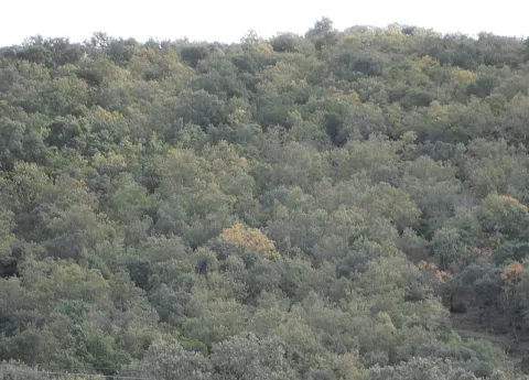
This enclave, which belongs to the Natural Park of Despeñacolos, stands out for its biodiversity; thus, among the plant species present, there are complaints, alcornoques, maples and other typical of the humid Mediterranean forest.

Ubicación
Código Postal
23213
Latitud
38.390302
Longitud
-3.494124
Dirección
Carretera Aldeaquemada, km. 6,6
Distrito
Municipio
Ubicación en el mapa
POINT (-3.494124 38.390302)
Tipos de punto de interés
Imágenes carrusel
imagen
Image
quejical.png
Imagen principal
Desactivado
Loading map
Preparing points of interest and routes...

Pass of Tíscar

Submitted by brandcode_deweloper on
Id
913726
Descripción
Descripción larga

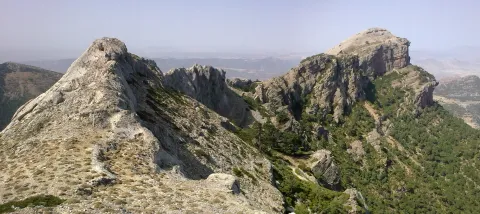
From the watchtower we will be able to contemplate a panoramic that will help us to know the environment better. Looking south a large ravine, which is named after the port, communicates the hill with the stepparian Valle del Guadiana Menor. The ravine is narrowed at the end in a rocky portico, which served for the Arabs to build the fortin of the Castle of Peña Negra. Once the Muslims were expelled, the new occupants raised the Tícar Sanctuary over the walls of the fortress. Looking to the west, the Peña de las Carboneras, one of the summits of the smallest and colecte orographic unit of the mountain massif, stands at the front: the Quesada saw, which houses numerous rock paintings of the Levine art, considered by UNESCO as the World Heritage Site.

To the north our view is lost in the olive sea of the Jiennense countryside, which as waves in a time, is aggressive in the slopes of the Cazorla saw, whose alignment is clear to the right of the olive tree. As we look east, our view inevitably stops at the Rayal Picon (1,834 m of altitude), the first important elevation of the Sierra de Cazorla from the south and impressive limestone mole that has a vertical cut on its north face. The name Rayal was synonymous with the border in the Middle Ages and the torreon in which we are located reminds us that this space was a border with the Nazareth Kingdom of Granada for almost three centuries.

We suggest...

  • It is recommended to carry binoculars and to track with them the limestone crestons that are seen, above all, in the northern half of the area, because it is quite easy to observe the montane goat. It is also a good point to see rapacious birds in flight.
  • Right in the same port is the Fuente de las Carboneras, a good place to refresh us. If the pipe was dry, the usual circumstance in the summer, following the lane that leaves from the same source, we arrive at the Forest House of Las Carboneras and, after the building, we will find another spring.

The Port of Tiscar is the highest point on the road A-6206, the winding mountain road that unites Quesada with the two southernmost villages of the Natural Park: Pozo Alcón and Hinojares. To get to this beautiful hill, if we leave from Quesada, at the exit we will continue straight, avoiding to the right the detour to Huesa (there is an indicator to the Port of Tíscar), until the rise, about 8.5 km later, where we find a signal indicating the location and altitude. From Hinojares (18 km) and Pozo Alcón (23 km) you have to take the A-6206 inverse to the previous one, always direction to Quesada at all the crosses.

Breve descripción

The Port of Tíscar is not only the mountain barrier to be saved to go to the Sanctuary of Our Lady of Tíscar, the historical patron of the advance of Cazorla and now of Quesada, and one of the most emblematic religious symbols of these mountains. It is an agribusiness area, with spectacular views, where it is easy to see the mountain goat, a corner full of history and nature. Leaving the vehicle in the parking areas in the same port, taking a small walk we arrive to a medieval watchtower, the Atalaya del Infante Don Enrique (14th century), an excellent lookout, with views to which for nothing in the world we must give up if we are there.

Ubicación
Latitud
37.865164
Longitud
-3.068421
Municipio
Ubicación en el mapa
POINT (-3.068421 37.865164)
Tipos de punto de interés
Imágenes carrusel
imagen
Image
tiscar.jpg
Imagen principal
Desactivado
imagen
Image
CazPuertoDeTiscar1.jpg
Imagen principal
Desactivado
Imágenes cabecera
imagen
Image
22072009_006_stitch.jpg
Imagen principal
Activado
Loading map
Preparing points of interest and routes...

Bridge Viejo sobre el Cañamares

Submitted by brandcode_deweloper on
Id
8088389
Descripción
Descripción larga

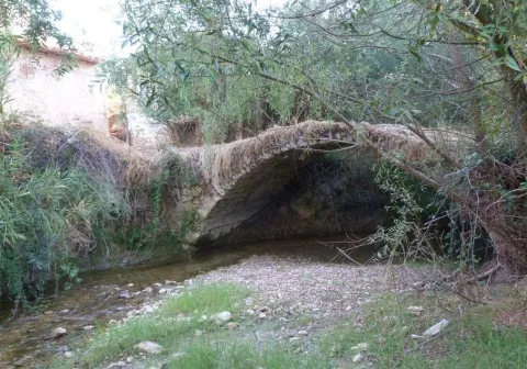
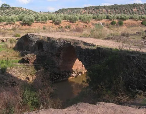
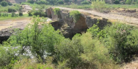
It is a one-eye bridge made up of a half-point arch, quite robust and with pillars and paraments that make a curve to the Cañamares River. The shillery is well worked and is quite regular in size.

Breve descripción

It has traditionally been given as a certain chronology for this construction the first centuries of the Christian era coinciding with the Roman presence on our lands, and the proximity of the Almansas, where there was an important settlement at the time.

Telecomunicaciones
Sitio web
http://www.chilluevar.es/
Teléfono de contacto
953 717 300 / 953 717 225
Ubicación
Código Postal
23477
Latitud
38.001450
Longitud
-3.030960
Dirección
Av. Andalucía, 6
Municipio
Ubicación en el mapa
POINT (-3.03096 38.00145)
Tipos de punto de interés
Imágenes cabecera
imagen
Image
Puente%20Viejo%20sobre%20el%20Ca%C3%B1amares2.jpg
Imagen principal
Activado
Loading map
Preparing points of interest and routes...

Bridge Romano

Submitted by brandcode_deweloper on
Id
4706810
Descripción
Breve descripción

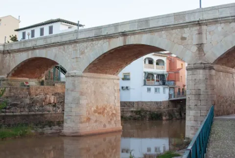
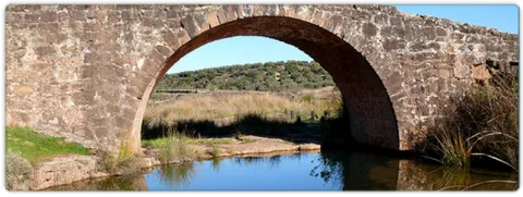
In Puente de Génave we find the Old Bridge or Roman Bridge, on the river Guadalimar, of stone, reduced arch and one eye, in which the masonry is alternated with the silery. They highlight the environment and configuration of the village, being a forming element of the settlement of the village around the river and an essential step to know the riverside and its implementation in the territory.

Telecomunicaciones
Sitio web
www.puentedegenave.es/el-municipio/patrimonio-historico.html
Correo electrónico
pgenave@puentedegenave.es
Ubicación
Código Postal
23350
Latitud
38.355380
Longitud
-2.803190
Distrito
Municipio
Ubicación en el mapa
POINT (-2.80319 38.35538)
Tipos de punto de interés
Imágenes carrusel
imagen
Image
Mon501.jpg
Imagen principal
Desactivado
Imágenes cabecera
imagen
Image
puente-romano.jpg
Imagen principal
Activado
Loading map
Preparing points of interest and routes...

Bridge Renaissance

Submitted by brandcode_deweloper on
Id
4276894
Descripción
Breve descripción

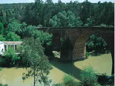
It is one of the most important historical and artistic milestones of Marmolejo, along with the Parish Church of Our Lady of Peace and the spa of medicinal waters that spring up next to the same channel of the Guadalquivir River. Precisely bridge and spa linked their existence since the discovery of the therapeutic utility of the waters of these springs at the end of the 18th century (whose first news appears in theTreaty on the main medicinal sources of AndalusiaJohn of God Help, 1794) and the first facilities began to be built. But before thousands of swimmers turned this quiet place into bustling, there was already an architectural element in the environment: the San Bartolomé Bridge, possibly called for opening the day of the onomastics of this Holy, on August 24.

Telecomunicaciones
Sitio web
www.villademarmolejo.es/urbanismo-y-monumentos/monumentos/puente-de-san-bartolome/
Ubicación
Código Postal
23770
Latitud
38.054040
Longitud
-4.193410
Distrito
Municipio
Ubicación en el mapa
POINT (-4.19341 38.05404)
Tipos de punto de interés
Imágenes carrusel
imagen
Image
puente%20renacentista-1.png
Imagen principal
Desactivado
Imágenes cabecera
imagen
Image
puente%20renacentista_marmolejo-1.png
Imagen principal
Activado
Microsite al que pertenece
Loading map
Preparing points of interest and routes...

Bridge Musulmán

Submitted by brandcode_deweloper on
Id
5709600
Descripción
Breve descripción

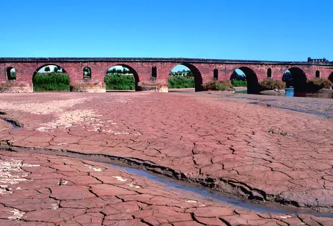
Built in Muslim times, it served as a prey in the event of danger, as it was covered with a door, the waters would remain and rise from level by flooding everything and leaving the bridge impracticable. Some medieval elements still remain semi-hidden, but most of the present part of it is modern: it is a long-term escarzan arch in a half-barrel vault that forms its only eye.

Telecomunicaciones
Sitio web
www.lapuertadesegura.es/el-municipio/patrimonio-historico.html
Correo electrónico
lapuerta@promojaen.es
Ubicación
Código Postal
23360
Latitud
38.349640
Longitud
-2.736660
Dirección
C/ de Pablo Iglesias, 37
Distrito
Ubicación en el mapa
POINT (-2.73666 38.34964)
Tipos de punto de interés
Imágenes carrusel
imagen
Image
tierras-de-jaen-042-2-jpg
Imagen principal
Desactivado
Imágenes cabecera
imagen
Image
puerta-de-segura-sobre-el-guadalimar-1-jpg
Imagen principal
Activado
Loading map
Preparing points of interest and routes...

Mocho Bridge

Submitted by brandcode_deweloper on
Id
919194
Descripción
Descripción larga
Puente Mocho constitutes an example of Roman architecture. The Romans carried out large civil constructions to guarantee communications within the different provinces that made up their domains and the mobility of the troops stationed in the different territories. In fact, in many cases it was the legionaries themselves who built some of the constructions that are preserved today, especially in the period known as the Pax Romana, in which there were no succession problems between the emperors and there was effective border control.
Breve descripción
Puente Mocho constitutes an example of Roman architecture. The Romans carried out large civil constructions to guarantee communications within the different provinces that made up their domains and the mobility of the troops stationed in the different territories. In fact, in many cases it was the legionaries themselves who built some of the constructions that are preserved today, especially in the period known as the Pax Romana, in which there were no succession problems between the emperors and there was effective border control.
Ubicación
Latitud
38.252679
Longitud
-2.890872
Distrito
Municipio
Ubicación en el mapa
POINT (-2.890872 38.252679)
Tipos de punto de interés
Imágenes carrusel
imagen
Image
Puente-Mocho-768x600.jpg
Imagen principal
Desactivado
imagen
Image
638_img.png
Imagen principal
Desactivado
Imágenes cabecera
imagen
Image
02-grand-01.jpg
Imagen principal
Activado
Loading map
Preparing points of interest and routes...

Bridge honda

Submitted by brandcode_deweloper on
Id
5631322
Descripción
Descripción larga

Location: east of the city centre, in the pedanía of Puente Honda.

Distance: 4 km.

Medium: by vehicle tourism.

Access: local road to Puente Honda.

Breve descripción

It is a recreational area in thepedanía de Puente Honda. 4 km. from the town of Benatae, and it is worth observing from this atalayo the Natural Park of the Sierra de Cazorla, Segura and Las Villas.

Telecomunicaciones
Sitio web
www.benatae@promojaen.es
Teléfono de contacto
953 480 378
Ubicación
Código Postal
23390
Latitud
38.352720
Longitud
-2.652320
Distrito
Municipio
Ubicación en el mapa
POINT (-2.65232 38.35272)
Imágenes carrusel
imagen
Image
benatae%20%281%29.jpg
Imagen principal
Desactivado
Imágenes cabecera
imagen
Image
c4d3ccf2_y.jpg
Imagen principal
Activado
Loading map
Preparing points of interest and routes...

Bridge of the Obispo Romano

Submitted by brandcode_deweloper on
Id
4380493
Descripción
Descripción larga

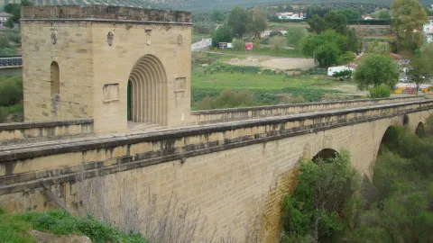
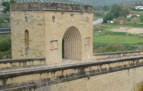
The tower has in its interior a chapel, which has access from the road of the bridge, through a door with arquivoltas, located on both sides of the same stone paths with inscriptions allusive to the bishop of Jaén, Mr Alonso Suárez of the Fuente del Sauce, who financed it. On the door, three shields reproduce the weapons of the prelate. On the three remaining sides of the tower, there are open and half-point windows, also topped by shields.

Breve descripción

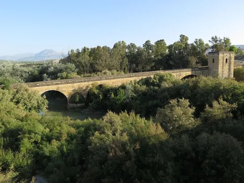
The Bishop's bridge, one of the first of the Hispanic Renaissance, consists of 4 unequal canyon vaults, of sandstone silery, accompanied by yarn of also unequal height. The trail is tilted, and has a quadrangular tower at its highest end. The batteries that hold the arches, they have Tajamars, and it is overcome with a factory pretil.

Telecomunicaciones
Sitio web
www.baezafotografiaehistoria.blogspot.com/2016/01/puente-del-obispo.html
Ubicación
Código Postal
23529
Latitud
37.954120
Longitud
-3.540120
Dirección
Av. Jaén
Municipio
Ubicación en el mapa
POINT (-3.54012 37.95412)
Tipos de punto de interés
Imágenes carrusel
imagen
Image
Puente_del_Obispo01.jpg
Imagen principal
Desactivado
imagen
Image
Puente_del_Obispo.jpg
Imagen principal
Desactivado
Imágenes cabecera
imagen
Image
Puente_del_Obispo.jpg
Imagen principal
Activado
Loading map
Preparing points of interest and routes...