Saltar al contenido principal
icon-intereses-cultura

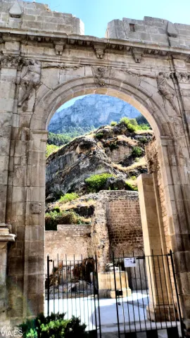
Ruins of the Church of Santa María

Submitted by brandcode_deweloper on
Id
912868
Descripción
Descripción larga

It cost him the effort, but in the end, and despite Toledo's resistance, in 1534 he obtained the title, but his descendants could not keep it, as he was reintegrated to his former owners after a sound lawsuit in 1634. Cobos would soon complete his dream of becoming a great lord with the purchase of the jiennese villas of Sabiote, Canena, Torres and Velliza (Valladolid); his wife, Maria de Mendoza, rounded this great state with the acquisition of Jimena, whose purchase process was already initiated by her husband.

In all these enclaves, more in his hometown and in that of his wife (Ubeda and Valladolid, respectively), Francisco de los Cobos planned great building programs of marked artistic and propaganda significance. This double intention is perfectly reflected in the project of the church of Santa Maria, which was in all probability carried out by his trusted man, the deán Ortega, who in turn would entrust the works and direction in Andrés de Vandelvira, the master of the house's quarry, especially from the works in El Salvador de Ubeda.

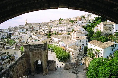
The new church would rise on the way of the River Cerezuelo, but for this it was necessary to abovednot only the space dedicated to the church, but also the rest of the same located in front of it. Thus the temple closes and presides over the square, which also had the City Hall building (now hidden) and a beautiful pilar-abrevadero, which Chueca Goitia attributes to the hand of Andrés de Vandelvira, although the date 1606 carved in its large central billboard indicates otherwise. We must not forget that the advance to Toledo was returned the traces of Cobos and his descendants, the Marquis of Camarasa, had to be erased in all those goods where they were present.

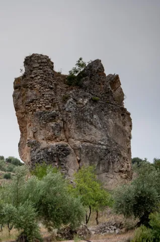
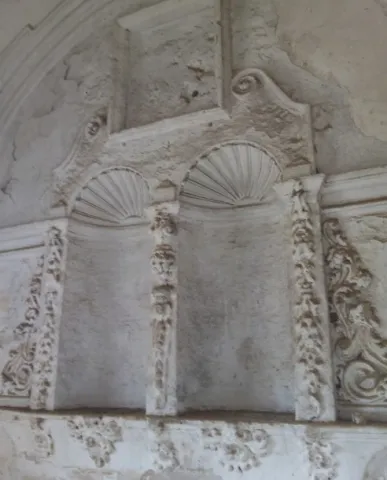
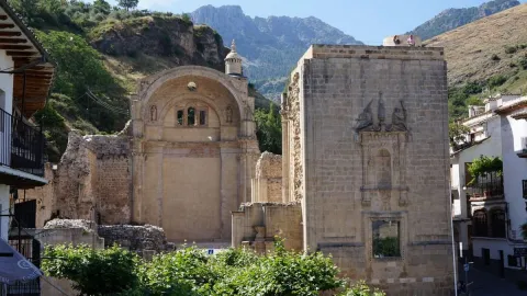
This temple, located in a unique natural setting, suffered a catastrophic raid at the end of the 17th century, taking with it almost all its movable property. The fire by the Napoleonic troops in the War of Independence left the factory ruined, remaining standing the header, part of the perimeter walls, one of the two foot towers, with various remains, and a cover on the side of the Epistle. The destruction and the limited documentation found so far about its constructive process makes it difficult to set the stages and the teachers responsible for its factory. In any case, the difference in style between the header and the rest seems clear. Andrés de Vandelvira is present in the head and chapel of San Isicio, leaving out of his language the part of the feet and the side cover, which, according to José María Crespo, was able to run to a large extent by Alonso Barba.

The canyon vault of the presbyterium, the serlian vanity of the tester, the angular pillars that would form the cruise, with half Corinthian columns and fantastic heads, and the snail staircase topped into a cylindrical body are certainly elements used by Vandelvira around the 1540's. The vault of the chapel of San Isicio, for its part, is closely related to the one located under the tower-bell tower of El Salvador de Ubeda. The plant, made up of a ship and cruise to cover (at least in the initial project) with boned vaults, would approach the type of La Guardia, a conventual church in which Vandelvira also left the best of its art in the major chapel and cruise.

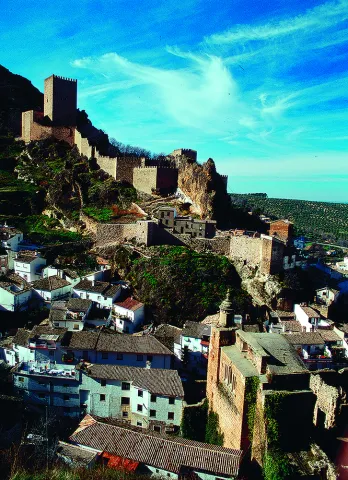
The ruins of Santa María, currently in the process of restoration in accordance with the project of the architect Mr Pedro Salmerón, still show today the proud architecture with which it was conceived by one of the most influential men of the 16th century in Spain, Don Francisco de los Cobos, who was also lucky to have at his service Andrés de Vandelvira, one of the most outstanding singers of the Spanish Renaissance.

Breve descripción

Monument of the Historical-Artistic Set. Declared 13 / 07 / 1972. The advance of Cazorla remained under the jurisdiction of the Archbishop of Toledo from the 13th to the 16th century. The large territory provided important benefits and the position of Advantado gave prestige to the one who held them. Both reasons must have weighed enough for Don Francisco de los Cobos, the prepowerful secretary of the Emperor Charles V, to come up with all the means at his disposal to obtain the rule and charge of such wide-ranging dominion for himself and his descendants.
Telecomunicaciones
Sitio web
www.cazorla.es/turismo/ruinas-de-santa-maria/
Teléfono de contacto
953 710 102
Ubicación
Código Postal
23470
Latitud
37.908550
Longitud
-2.999930
Dirección
C/ Hoz, 6
Municipio
Ubicación en el mapa
POINT (-2.99993 37.90855)
Tipos de punto de interés
Imágenes carrusel
imagen
Image
2%20%282%29.jpg
Imagen principal
Desactivado
imagen
Image
3%20%282%29.jpg
Imagen principal
Desactivado
imagen
Image
Mon165.jpg
Imagen principal
Desactivado
imagen
Image
Mon244.jpg
Imagen principal
Desactivado
Imágenes cabecera
imagen
Image
iglesia-santa-maria-de-cazorla-830x623.jpg
Imagen principal
Activado
Microsite al que pertenece
Loading map
Preparing points of interest and routes...

Castillejo Ruins

Submitted by brandcode_deweloper on
Id
4405889
Descripción
Breve descripción

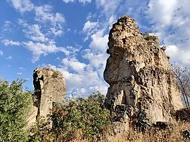
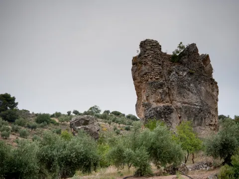
The Castlejo de Cárchel is of Muslim origin and in the surrounding areas there have been many fragments of Spanish-Muslim ceramic glazed and unglazed, and among all the archaeological remains found in the area, stands the head of a clay figure, found in 1997 by the child José M. Ruiz. It is possibly a survival of Iberian exvotes in Muslim times.

Telecomunicaciones
Sitio web
www.carcheles.es/el-municipio/patrimonio-historico.html
Teléfono de contacto
953 302 291 / 953 302 003
Correo electrónico
Webmaster@carcheles.es
Ubicación
Código Postal
23192
Latitud
37.634510
Longitud
-3.640960
Distrito
Municipio
Ubicación en el mapa
POINT (-3.64096 37.63451)
Tipos de punto de interés
Imágenes carrusel
imagen
Image
270px-Castillo_de_C%C3%A1rchel_24J_14.jpg
Imagen principal
Desactivado
imagen
Image
castillejo.jpg
Imagen principal
Desactivado
Imágenes cabecera
imagen
Image
castillejlo.jpg
Imagen principal
Activado
Microsite al que pertenece
Loading map
Preparing points of interest and routes...

Pillories and Jurisdiction Columns

Submitted by brandcode_deweloper on
Id
13581021
Descripción
Descripción larga

The title, granted by Philip II, allowed him to have full jurisdiction, made symbolized by the presence of rolls and picotas. While the former reflect the new administrative and legal status, picotta is the place where the prisoners were punished.

The rolls marked the jurisdictional limit and were commemorative monuments of the award of the title of Villa. The picotas were stone columns, more or less ornamented, where punishments and public scarings were applied. At present, the three conserved in the municipality are crouched and topped by crosses.

Breve descripción

Located in the historical set of Mengibar, the rolls and the picotas are evidence of their formation as a people with its own jurisdiction. The origin of the rolls is on the date of 1574, when the city of Jaén was emancipated and the title of Villa was acquired.

Telecomunicaciones
Sitio web
https://mengibarturismo.com/
Teléfono de contacto
677 222 285
Correo electrónico
turismo@aytomengibar.com
Ubicación
Código Postal
23620
Latitud
37.968050
Longitud
-3.808780
Dirección
C/ Santos Galindo, 1
Distrito
Municipio
Ubicación en el mapa
POINT (-3.80878 37.96805)
Imágenes cabecera
imagen
Image
cruz-del-rollo-jpg
Imagen principal
Activado
Loading map
Preparing points of interest and routes...

Jandulilla River

Submitted by brandcode_deweloper on
Id
8114425
Descripción
Descripción larga

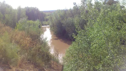
Former Xandulilla. Influent on the left bank of the Guadalquivir River. Collect the waters from the northeastern face of the Sierra Magina massif. The associated valley is given the same name. Unwind in the Guadalquivir River, in the area of Ubeda the old one. The Arab geographer Al-Zuhrí, mentions him by the name of Wadi-l-Ard, or Rio de la Tierra.

He named the former population of Xandulilla, of which there are many archaeological remains of great importance spread throughout the area. In the 17th century it was known as "Villa de Felix" with its own jurisdiction. It is a river with a normally low and variable flow rate and without regulatory structures. It is born under the Port of the Gallardos, also known in its first stretch as Rio Huelma, its main tributaries, both on the left are the Gualijar River and the Garganton River that are born in the main massif of Magina and after a very short journey they result in the Jandulilla, apart from numerous intermittent rags and ramps.

Breve descripción

The Jandulilla River is a short river in the south of Spain, tributary to the left bank of the Guadalquivir River that runs through the province of Jaén and collects the waters of the northeastern face of the Sierra Magina massif. The associated valley is given the same name. Unwind in the Guadalquivir River, in the area of Ubeda la Vieja.

Telecomunicaciones
Teléfono de contacto
953 390 210
Ubicación
Código Postal
23560
Latitud
37.650300
Longitud
-3.459550
Distrito
Municipio
Ubicación en el mapa
POINT (-3.45955 37.6503)
Imágenes carrusel
imagen
Image
r%C3%ADo%20Jandulilla%202%20%281%29.jpg
Imagen principal
Desactivado
Imágenes cabecera
imagen
Image
r%C3%ADo%20Jandulilla.jpg
Imagen principal
Activado
Microsite al que pertenece
Loading map
Preparing points of interest and routes...

Río Guadalimar

Submitted by brandcode_deweloper on
Id
4528704
Descripción
Descripción larga
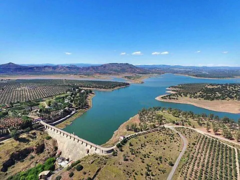
It crosses the Sierra de Cazorla, Segura y las Villas, collecting the waters of numerous smaller streams and rivers: its course receives water from the Onsares, Guadalmena, Guadalén, Cortillas, Frío, Carrizas, Morles and Trujala rivers. The river and its main tributaries have a gentle slope and a rather limited flow, but among its streams are spots of spectacular beauty. Its waters slow down at the Giribaile reservoir, the second most important reservoir in the province, where barbel, carp, largemouth bass and pike can be fished. It marks the boundary of the Torreblascopedro district along its entire north-eastern side, giving rise to a typical riparian ecosystem and creating a fertile plain characterised by cotton and wheat farming. It is accessible via the JV-3003/4 and must be crossed via its bridge to reach Linares from our municipality.
Breve descripción
The Guadalimar river rises at the foot of the Almenara hill, at an altitude of 1,200 m, in the Sierra de Alcaraz, in Albacete, and flows towards the Natural Park of the Sierras de Cazorla, Segura y las Villas, joining the Guadalquivir river within the municipal district of Torreblascopedro. It takes its name from the colour of its waters, as "Guadalimar" derives from wad al-Ihmar, "red river".
Ubicación
Municipio
Imágenes carrusel
imagen
Image
guadalimar.jpg
Imagen principal
Desactivado
Imágenes cabecera
imagen
Image
4%20%281%29.jpg
Imagen principal
Activado

Guadalén River

Submitted by brandcode_deweloper on
Id
6552251
Descripción
Descripción larga

It receives from the right to the rivers Onsares, Guadalmena and Guadalén. On the left to the rivers Cotillas, Arroyo Frio, Carrizas, Morles, Trujala and the creek of Peñolite. On its way through the Sierra de Segura.

In Roman times it was called the Tago, Tagus or Tugio River, just as its birth was the Sierra de Tugia. Its Arabic name "wad al-ihmar" means "red river," which is curiously as it is called in the area, by the red color of its waters.

Breve descripción

The Guadalimar River is a river in the south of Spain, a tributary of the Guadalquivir River that is born at the foot of the Sarga peak (1770 m.), in the Alcaraz Sierra, in the province of Albacete, resulting from the confluence of several streams in the surroundings of Villaverde de Guadalimar. It provides its waters to the Guadalquivir in the municipality of Jabalfifth (Jaén province).

Ubicación
Latitud
38.180950
Longitud
-3.427055
Distrito
Municipio
Ubicación en el mapa
POINT (-3.427055 38.18095)
Imágenes carrusel
imagen
Image
7e0b619bb599cba0f135d1f24a105a0f.jpg
Imagen principal
Desactivado
imagen
Image
00945f1.jpg
Imagen principal
Desactivado
Imágenes cabecera
imagen
Image
5678744Master.jpg
Imagen principal
Activado
Microsite al que pertenece
Loading map
Preparing points of interest and routes...

River Aguamulas

Submitted by brandcode_deweloper on
Id
913807
Descripción
Descripción larga

The forest track, 9 km long, is very pleasant to travel and has no loss, as it is only to follow right, and is also marked as GR-7. It always runs by the river, with very little level, except in a section where it is separated by forming several elevation curves.

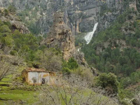
It is not necessary to travel throughout to enjoy these places, but if you arrive at the end you will find a lookout with unforgettable views of the Reco del Aguamulas. It is the rocky amphitheatre where this river is born, on whose base there are abandoned meadows and gardens.

You will also see the cords - already ruin - of La Fresneilla. In them lived the last inhabitant of these valleys, called Máximo Fernández Cruz, nicknamed "the Cojo de la Fresnedilla." This serrano character fought for thirty years not to leave the land he was born, from which were expelled the close to a hundred neighbors of the Aguamulas environment who suffered expropriation when the National Cote of Hunting was created in 1960. In 1982, Maximo paid for his resistance with the prison.

We suggest...

  • Be attentive to see some example of the dark green Valverde lizard, endemic to the Park and discovered in 1958 very close to here.
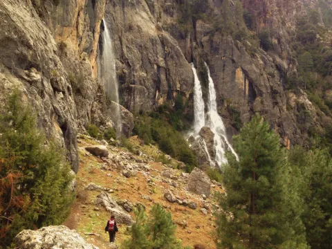
  • Continue beyond the lookout and take a walk in the La Fresnedilla area. If the water abounds, you will see the waterfalls of the birth of the Aguamulas.

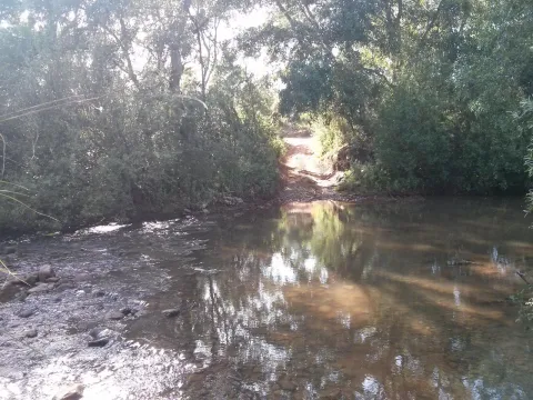
In the campsite Llanos de Arance (road A-319) you have to take the forest track that crosses the Guadalquivir. At 3 km, after wading the Aguamulas, the crossing is taken to the right and followed 1 km to the barrier in the forest house of Los Bonal, where you can leave the car.

Breve descripción

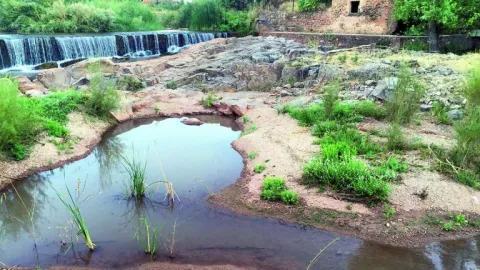
The Aguamulas is a small tributary of the Guadalquivir that runs one of the most beautiful valleys of the park, forming numerous rapids and pozas. It is enjoyed walking through a nice forest track between pine trees, in the shadow of which is developed a thick Mediterranean vegetation with oaks, madroños, lentils and cornicabra. At the bottom are the impressive walls of the Banderillas, whose summit is about 2,000 m high.

Ubicación
Nombre
Casa forestal Los Bonales
Latitud
38.044880
Longitud
-2.794950
Ubicación en el mapa
POINT (-2.79495 38.04488)
Tipos de punto de interés
Imágenes carrusel
imagen
Image
nacimiento-aguasmulas.jpg
Imagen principal
Desactivado
imagen
Image
aguasmulas.jpg
Imagen principal
Desactivado
Imágenes cabecera
imagen
Image
natu001%20%281%29.png
Imagen principal
Activado
Loading map
Preparing points of interest and routes...

Remains of the Ancient ermita de San Ildefonso

Submitted by brandcode_deweloper on
Id
4747699
Descripción
Breve descripción

With an external appearance similar to that of other rural cortijos, it now retains remains of what was an ancient hermitage, called the hermitage of San Ildefonso.

As in most rural areas of Jaén, these ancient cortijos of the 18th and 19th centuries are owned by large families and have over the years served as a residence for farm workers and olive collectors.

Ubicación
Nombre
Cortijo de San Ildefonso
Latitud
38.342440
Longitud
-3.103540
Distrito
Municipio
Ubicación en el mapa
POINT (-3.10354 38.34244)
Tipos de punto de interés
Imágenes carrusel
imagen
Image
ermita%20de%20San%20Ildefonso%20en%20montizon2.jpg
Imagen principal
Desactivado
imagen
Image
ermita%20de%20San%20Ildefonso%20en%20montizon.jpg
Imagen principal
Desactivado
Imágenes cabecera
imagen
Image
18.jpg
Imagen principal
Activado
Microsite al que pertenece
Loading map
Preparing points of interest and routes...

Santiago Square Air Raid Shelter

Submitted by brandcode_deweloper on
Id
12676773
Descripción
Descripción larga
The shelter can also be seen through a virtual tour: http://www.bimnd.es/wp-content/uploads/Panorama/Refugio.html For more information, contact the Municipal Tourism Office: 953 19 04 55. It can be visited by prior reservation with one of the authorized companies and guides: -   Association of official guides: 606 68 23 03 -   Claritas Tourism: 678 77 50 43 -   Lagarto Tours: 953 71 52 15
Breve descripción
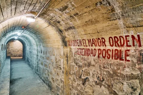
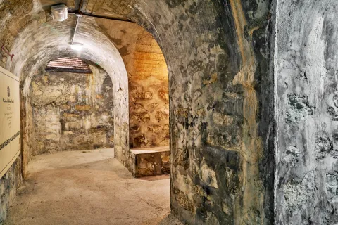
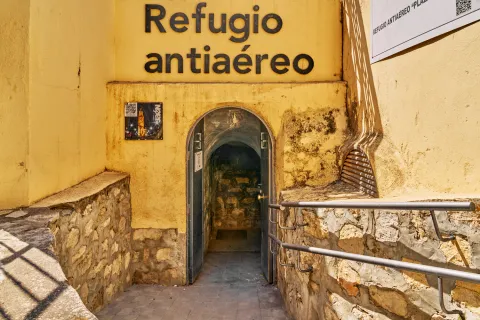
It is one of the many air raid shelters that were built in the city after the bombing suffered by the civilian population on April 1, 1937. After the attack, which caused 159 fatalities and extensive material damage, measures were taken to prevent and minimize future aerial bombardments: sound warnings, night dimming by turning off lights, and the construction of several public underground shelters scattered throughout the city. Shelters that, at the end of the war, were abandoned and even forgotten, with significant physical deterioration. Located in Plaza de Santiago, it was built using the old crypts of Iglesia de Santiago and had a capacity to accommodate up to 1,040 people in its different corridors. This refuge has been recovered as a space for interpretation of the Civil War, as well as a place of historical memory of Andalusia and reflection for peace. In its hallways you can see various photographs of the bombing, the tragic consequences it brought, as well as other testimonies such as covers of the Southern Front or various poems by Miguel Hernández.
Ubicación
Código Postal
23004
Latitud
37.768114
Longitud
-3.792983
Dirección
Plaza de Santiago, s/n
Distrito
Municipio
Ubicación en el mapa
POINT (-3.792983 37.768114)
Imágenes carrusel
imagen
Image
refugio-antiaereo-plaza-santiago-j-a-partal-3-jpg
Imagen principal
Desactivado
imagen
Image
refugio-antiaereo-plaza-santiago-j-a-partal-2-jpg
Imagen principal
Desactivado
Imágenes cabecera
imagen
Image
refugio-antiaereo-plaza-santiago-j-a-partal-1-jpg
Imagen principal
Activado
Loading map
Preparing points of interest and routes...
Interés

Almazaras Oleo Turísticas Regional Network

Submitted by brandcode_deweloper on
Id
777503
Descripción
Descripción larga

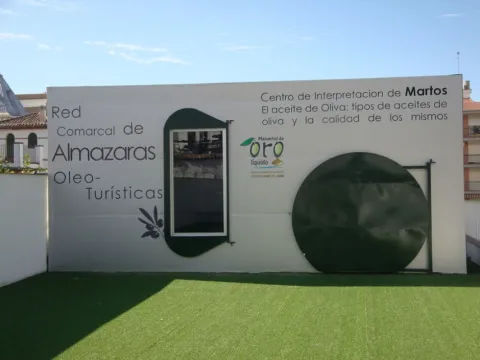
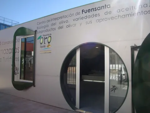
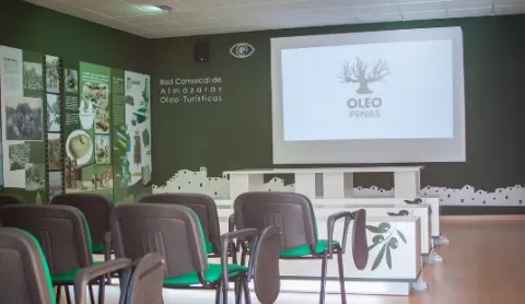
The Network is made up of nine Interpretation Centres in Almazaras Oileteras in the Sierra Sur de Jaén for the promotion of olive cultivation. Each Centre has a different theme on various aspects related to olive oil, such as olive oil production systems and evolution throughout history, olive oil qualities and uses, olive oil cultivation systems, olive oil analysis and olive oil marketing system, olive biology, olive varieties, olive by-products, olive oil and its uses, olive heritage, traditions, olive oil types and olive oil quality and history.

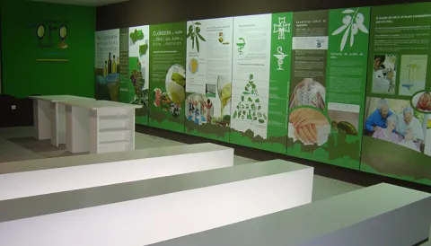
The Interpreting Centres have a space of about 85 square meters arranged for interpretation, teaching and tourism use, equipped with latest technology such as touch screen, and multitactile, to enjoy games and multimedia application, interpretative panels or 3D projection canyon.

It is intended to take advantage of olive oil and olive oil, very abundant resources in the region, such as tourism resources, to value the idle resources (facilities, machinery, documentation etc.) of the almazaras, for as long as they are not in the full process of collecting and producing oil, to promote knowledge about the different uses of the olive and olive oil, to promote knowledge of the culture, traditions and related customs, and to diversify the comarcal tourist offer by taking advantage of the resources available such as the almazaras, olive and olive oil.

Oilticulture will be promoted and disseminated in a didactic, dynamic and attractive way for a wide range of audiences, from thematic staff, professionals from the olive sector, people from school or training ages, to tourists or local audiences. Visitors will be able to connect intellectually and emotionally, through the Network's interpretative script, to the fascinating world of cultural and ethnographic heritage that olive oil and olive oil form around them.

The Comarcal Network of Almazaras Ole- touristic can be visited through the tourist route that connects the nine Interpretation Centres with the main tourist attractions of the municipalities of the Sierra Sur de Jaén: Alcalá la Real, Alcaudete, Castillo de Locubín, Friiles, Fuensana, Jamilena, Martos, Torredelcampo, Valdepeñas de Jaén and Los Villares can be traveled under the enigmas of liquid gold and the sea of olive trees that shape the orography of this territory. On the other hand, the visit to the Centres will be completed with an internal route through the facilities of the milling plants that make up the Network, adapted to the resources, and particular characteristics of each of them and of the visiting public.

The project is funded by the European Agricultural Fund for Rural Development (EAFRD) at 40% in the framework of the Global Action Plan, of the Council for Agriculture, Fisheries and the Environment, and by 60% from the Sustainable Tourism Initiative - Lands of Romance and Legend, of the Council for Tourism and Trade.

Breve descripción

TheComarcal Network of Almazaras Ole- touristis a project promoted by the Association for Rural Development of the South Sierra de Jaén (ADSUR). It is a commitment to economic diversification by taking advantage of the tourist potential that the mills offer as a factor of sustainable development and as an element of territorial identity.

Telecomunicaciones
Sitio web
http://www.redalmazarassierrasurjaen.es/
Correo electrónico
adsur@adsur.es
Ubicación
Latitud
37.770588
Longitud
-3.899727
Distrito
Municipio
Ubicación en el mapa
POINT (-3.899727 37.770588)
Tipos de punto de interés
Imágenes carrusel
imagen
Image
torredelcampoDSC04828.jpg
Imagen principal
Desactivado
imagen
Image
9962afd4d7801adbe96e49a2f2eab69f_8_XL.jpg
Imagen principal
Desactivado
imagen
Image
9962afd4d7801adbe96e49a2f2eab69f_6_XL.jpg
Imagen principal
Desactivado
imagen
Image
museo3.jpg
Imagen principal
Desactivado
Imágenes cabecera
imagen
Image
thb_g_1.jpeg
Imagen principal
Activado
Microsite al que pertenece
Loading map
Preparing points of interest and routes...