Saltar al contenido principal
icon-intereses-cultura

Granary (actual ayuntamiento)

Submitted by brandcode_deweloper on
Id
913332
Descripción
Descripción larga

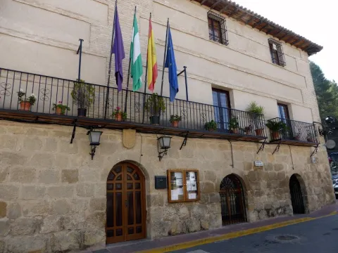
In 1572, the cantero Pedro Venetian and the mason Luís de Vilches committed themselves to building the posio, in accordance with the conditions and traces dictated by Andrés de Vandelvira. The building, of a rectangular floor, defines the confluence of the streets Corredera and San Antón with the square of the Constitution. It rises in the planned enranche in the 16th century, outside the medieval compound, essentially formed by the castle and the Renaissance church raised at the foot of it, in which, although perhaps not directly, Andrés de Vandelvira was able to intervene.

The ground floor, with a stone factory seen, is most likely the best preserved part, as the high ones (originally compartmentalized in trickery and built in brick and masonry) were later adapted for other local administrative functions. The singularity of this building is in the division drawn by Vandelvira on the ground floor, made up of five small rectangular ships covered with parallel half-barrel vaults, popularly called the "positillos," built in silery, which communicate directly with the outside based on half-point voids, being the largest central than the other ones.

Typically Vandelvira acuña a model, developed in such a way in the Pósito de Baeza, in which the knowledge of the stereotomy or cutting of the stone requires a great perfection due to the need for the isolation of wetlands to preserve the genre stored in the best conditions. Several heraldic shields are preserved in the building and, as a reminder of the recovery of the advance of Cazorla (in which the villa of La Iruela was included) by the Archbishopric of Toledo, in the early 17th century was placed by the command of Archbishop Don Bernardo de Rojas and Sandoval in the capitular room an allusive inscription to perpetuate this important event. A lot of effort and money cost Toledo's mitre to be made again with her old territory, which was taken from her in 1545 by Don Francisco de los Cobos, Secretary of the Emperor Charles V.

Breve descripción

Monument of the Historical-Artistic Set. Incoation 01 / 04 / 85. The professional activity of Andrés de Vandelvira revolved not only around religious or private architecture, but was also hired by the Councils to intervene in various municipal works: sources, bridges, foundings or grain stores, municipalities, etc. In the villa of La Iruela, the Pósito, the current headquarters of the City Council, has arrived today, from which the contract has been retained, published by V. M. Ruiz Fuentes.
Ubicación
Código Postal
23476
Latitud
37.920510
Longitud
-2.993990
Dirección
Plaza del Ayuntamiento
Municipio
Ubicación en el mapa
POINT (-2.99399 37.92051)
Tipos de punto de interés
Imágenes cabecera
imagen
Image
p%C3%B3sito%20-%20ayuntamiento.jpg
Imagen principal
Activado
Loading map
Preparing points of interest and routes...

River Folds of Borosa

Submitted by brandcode_deweloper on
Id
877125
Descripción
Descripción larga

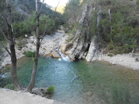
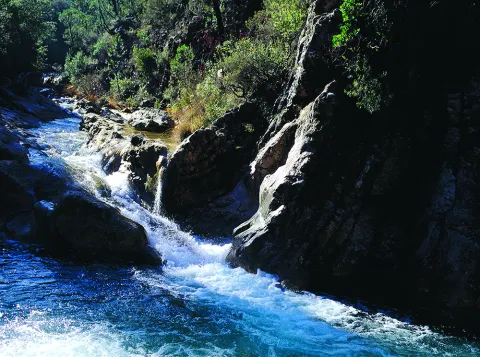
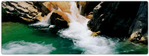
The route of the Borosa River, between the Piscifactory and the Cerrada de Elias, allows to observe a varied set of folds. The structure of the Sierra del Pozo, in which the Borosa River is located, is characterized by the presence of folds and NNE-SSW direction failures. The general geological structure of this Sierra is controlled by two large synchlinals: the birth of the Guadalquivir River and the Cabañas River.

In the four initial kilometers of the itinerary that part of the Piscifactory, folds associated with those of a regional character are observed, the size of which ranges from 1 meter to several tens of meters. These are developed in Cretaceous materials of Urgonian facies and their orientation determines the course of neighboring streams, with the concordant relief of the Arroyo de las Trout valley controlled by a spectacular sinchinal. As an example of anti-linear, the best fold is found in the Los Caracolillo Bridge.

Source: Inventory of Georresources of Andalusia. Environmental Council. Junta de Andalusia.

Breve descripción

Plizas del Río Borosa

Ubicación
Latitud
38.298857
Longitud
-2.651877
Distrito
Ubicación en el mapa
POINT (-2.651877 38.298857)
Tipos de punto de interés
Imágenes carrusel
imagen
Image
1%20%285%29.jpg
Imagen principal
Desactivado
imagen
Image
2%20%284%29.jpg
Imagen principal
Desactivado
imagen
Image
Natu249.jpg
Imagen principal
Desactivado
Imágenes cabecera
imagen
Image
558_img.png
Imagen principal
Activado
Loading map
Preparing points of interest and routes...

Small Square of the Armas

Submitted by brandcode_deweloper on
Id
6550232
Descripción
Descripción larga

Located between La Mella and Jabalcuz, Mount Almodóvar is famous for its crest, visible almost from any point in the city of Jaén. With 992 meters in height, this hill does not stand out for its altitude, but it does stand out for hosting very close places for the Jiennans, such as the Fuente de la Peña or the Plazoleta de las Armas. The Plazoleta de las Armas is a small plain surrounded by almonds, majolets and pines that offers beautiful views of the city. Place of play, walk and "bulls" of several generations of jiennenses, this square - which is accessed from the district of the Gloriet - remains a special place worth visiting.

Breve descripción

From almost any point in the city of Jaén are visible the spectacular crest of Cerro Almodóvar. Located between La Mella and Jabalcuz, the Almodóvar is 992 meters high and houses places much loved by the Jiennenses, such as the Fuente de la Peña or the protagonist of this report. The Plazoleta de las Armas is a small plain surrounded by almonds, pines and majolets where several generations of jiennenses have grown between games. Located just above the Glorieta district, it is worth taking a walk through and looking at the wonderful views it offers.

Ubicación
Latitud
37.757478
Longitud
-3.800935
Distrito
Municipio
Ubicación en el mapa
POINT (-3.800935 37.757478)
Tipos de punto de interés
Imágenes cabecera
imagen
Image
_G8Y2454.jpg
Imagen principal
Activado
Microsite al que pertenece
Loading map
Preparing points of interest and routes...

Square Vázquez de Molina

Submitted by brandcode_deweloper on
Id
5737218
Descripción
Descripción larga

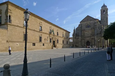
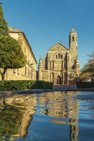
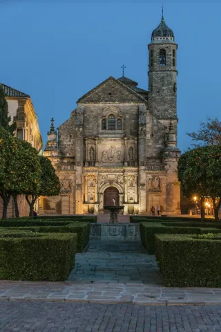
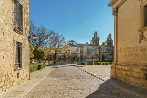
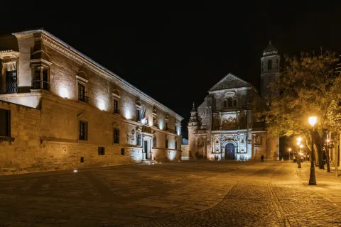
The square is configured as the union of several spaces that give it a trapezoidal set, it is an arrogant and self-affirmative place whose perspectives, coals and prints are located on the corners of as many streets as they reach it. The reference idea, however, is established by the Sacred Chapel of El Salvador del Mundo, the largest civil mausoleum built in Spain. It was formerly known as Llano de Santa María and Paseo de Santa María in the 19th century. It is the ideal place to start a tourist itinerary through the monumental city of Ubeda.

Breve descripción

The Vázquez de Molina Square is one of the best examples of Renaissance urbanism in Spain. This has been one of the reasons for this square, along with part of the monumental set of Baeza, to be declared on July 3, 2003 a World Heritage Site by Unesco.

Telecomunicaciones
Sitio web
https://www.turismodeubeda.com/index.php/es/
Teléfono de contacto
953 750 440
Ubicación
Código Postal
23400
Latitud
38.007610
Longitud
-3.368330
Dirección
Plaza de Vázquez de Molina
Municipio
Ubicación en el mapa
POINT (-3.36833 38.00761)
Tipos de punto de interés
Imágenes carrusel
imagen
Image
6321782897_688e825fcd_b.jpg
Imagen principal
Desactivado
imagen
Image
vazquez-de-molina38-jpg
Imagen principal
Desactivado
imagen
Image
plaza-vazquez-de-molina16-jpg
Imagen principal
Desactivado
imagen
Image
plaza-vazquez-de-molina46-jpg
Imagen principal
Desactivado
imagen
Image
plaza-vazquez-de-molina60-jpg
Imagen principal
Desactivado
imagen
Image
plaza-vazquez-de-molina3-3-jpg
Imagen principal
Desactivado
Imágenes cabecera
imagen
Image
plaza-vazquez-de-molina207-2-jpg
Imagen principal
Activado
Microsite al que pertenece
Loading map
Preparing points of interest and routes...

Square Nicolás Kerche

Submitted by brandcode_deweloper on
Id
4485314
Descripción
Descripción larga

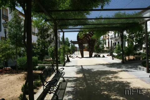
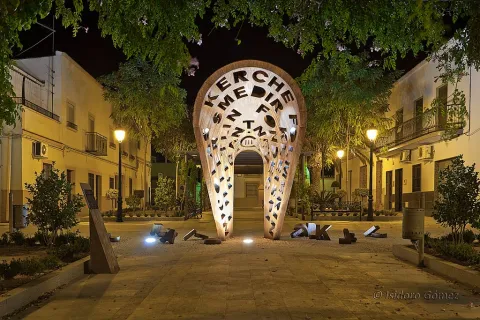
The sculpture of the center is dedicated to the settlers arrived in 1767 and symbolizes the rebirth of the dreams that the first settlers had to achieve a better future on this land.

Dedicated to the first Guarromanense, that is, the first son of settlers born in Guarroman. Nicolás was born on October 26, 1767 and today the nearest Sunday to this date is the Festival of the Colonos, in which a bell has eight times, one for each generation of Guarromanos. It was remodeled in 2010.

Breve descripción

This square, located on the main street of Guarroman, bears this name in honor of the first born in our village.

Ubicación
Código Postal
23210
Latitud
38.183310
Longitud
-3.687220
Dirección
Av. de Andalucía, 49
Distrito
Municipio
Ubicación en el mapa
POINT (-3.68722 38.18331)
Tipos de punto de interés
Imágenes carrusel
imagen
Image
Plaza%20Nicol%C3%A1s%20Kerche.jpg
Imagen principal
Desactivado
Imágenes cabecera
imagen
Image
Plaza%20Nicol%C3%A1s%20Kerche%202.jpg
Imagen principal
Activado
Loading map
Preparing points of interest and routes...

Bullring Segura de la Sierra

Submitted by brandcode_deweloper on
Id
1563917
Descripción
Descripción larga

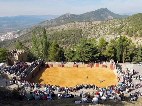
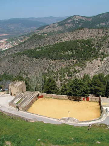
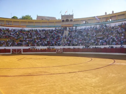
It is characterized by its quadrangular plant and because it has neither protective walls nor stands. The public is located on the slopes of the mountain for free and free, and can meet more than a thousand people. There continue to be taurine celebrations between 6 and 8 October, coinciding with the holidays in honor of the Virgin of the Rosary.

Breve descripción

The peculiar bullring of Segura de la Sierra is one of the oldest in Spain. It is located on the foot of the castle of the town, in what were the courtyard of arms and chivalry, attached to a tower next to the remains of wall that are preserved in what was one of the entrance doors to the town.

Telecomunicaciones
Sitio web
www.seguradelasierra.es/patrimonio/plaza-de-toros.html
Correo electrónico
administracion@seguradelasierra.es
Ubicación
Código Postal
23379
Latitud
38.300237
Longitud
-2.650082
Dirección
C/ Castillo, s/n
Distrito
Ubicación en el mapa
POINT (-2.650082 38.300237)
Tipos de punto de interés
Imágenes carrusel
imagen
Image
plaza-de-toros-Segura-de-la-Sierra.jpg
Imagen principal
Desactivado
Imágenes cabecera
imagen
Image
PlazaSegura.jpg
Imagen principal
Activado
Microsite al que pertenece
Loading map
Preparing points of interest and routes...

Bullring of Villanueva del Arzobispo

Submitted by brandcode_deweloper on
Id
1563946
Descripción
Descripción larga

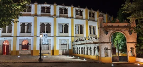
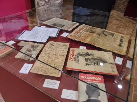
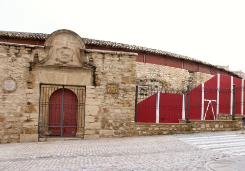
It was designed by the architect Mr Angel Arbex, Commander of Engineers. It was opened on 10 September 1928 by the rejonador Antonio Cañero and the matadores Manuel Jiménez Chicuelo, "El Algabeño" and Vicente Barrera before eight bulls of the cattle-making of Veragua.

This monument marks the architectural explosion of the 1920s in Villanueva del Archbishop, since to it would be added the House of the Arches, the Old Casino of the Commercial Circle, etc.

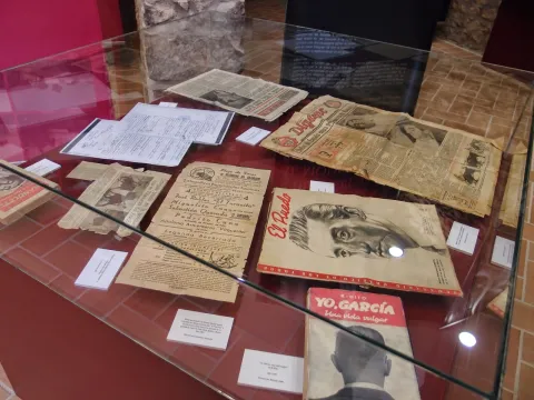
The 3rd Category Square has a capacity for 6,000 spectators. It is one of the most important Taurino things in the province of Jaén and through which the first figures of the Toreo have passed, from Manolete to the brothers Rivera Ordóñez, the Cordobés, Fandi... witnessing great taurine evenings and other cultural events of the villa.

Breve descripción

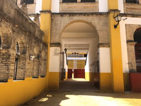
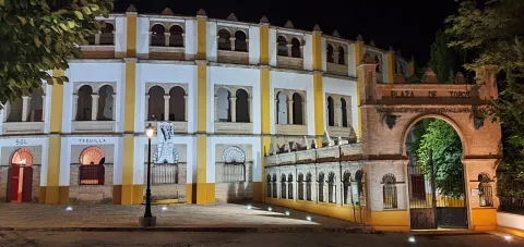
The Archbishop's Plaza de Toros de Villanueva is Neomudéjar style, with use of brick and horseshoe arches.

Telecomunicaciones
Sitio web
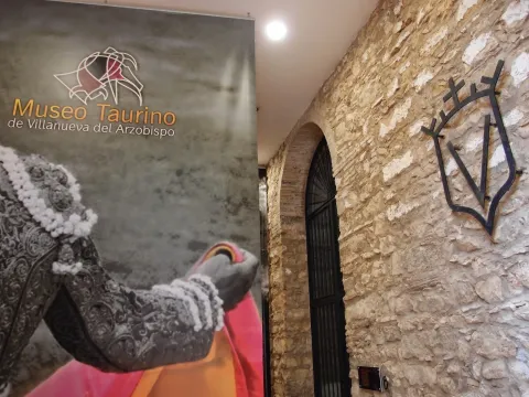
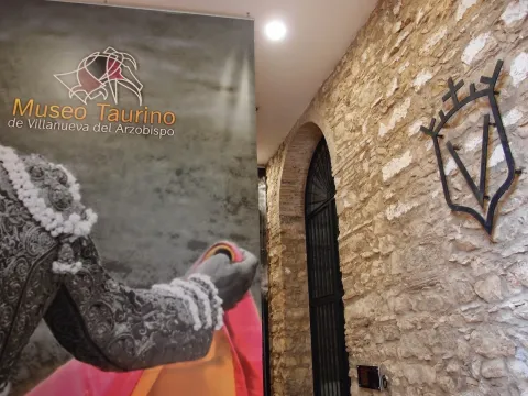
www.villanuevadelarzobispo.es/museo-taurino/
Teléfono de contacto
639 955 416
Correo electrónico
lamoralejaserviciosturisticos@gmail.com / turismo@villanuevadelarzobispo.es
Ubicación
Código Postal
23330
Latitud
38.162722
Longitud
-3.007320
Dirección
C/ Fuensanta, s/n
Ubicación en el mapa
POINT (-3.00732 38.162722)
Tipos de punto de interés
Imágenes carrusel
imagen
Image
16047678658039ca5c677-a731-4e34-ad3c-7fd9740e17b42254242240483307573.jpg
Imagen principal
Desactivado
imagen
Image
1604767365180126482876139755464677.jpeg
Imagen principal
Desactivado
imagen
Image
1604767869996A0436615-D3EB-4647-9691-2C55843102FB6154242950581307528.jpeg
Imagen principal
Desactivado
imagen
Image
160476787171270170C86-6429-4532-9AFE-4C6AAC4E610F7267178523688453260.jpeg
Imagen principal
Desactivado
imagen
Image
1604767359041112508596545032774690.jpeg
Imagen principal
Desactivado
Imágenes cabecera
imagen
Image
PlazaVillanueva.jpg
Imagen principal
Activado
Loading map
Preparing points of interest and routes...

Bullring of Úbeda

Submitted by brandcode_deweloper on
Id
10871902
Descripción
Descripción larga

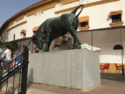
It was built on the grounds occupied by the Garden of the Convent of San Nicasio, reusing the materials of this and another ancient convent, which was that of San Antonio. It opened in 1857, being one of the first five built in our country. Traditionally, in Ubeda, the races were held in squares and streets, until the 19th century, when the bullfighting squares began to be built throughout Spain, adopting a certain similarity for their circular and progressive plant, with the Roman amphitheaters. This work is an exponent of the decimononic architecture in the city, with the incorporation of the use of cast iron, typical of this century, in the corrido balconage and rails with interesting outings of sticks and balconds. The square consists of two floors and a capacity of 5,000 spectators. There are two covers, that of the Great Gate, intellized and topped with a shield in which a taurino lance is represented, and that of the interior, which is from the 16th century, perhaps from the convent of San Nicasio. The first figures of the bullfighting have passed through this square. Here took the alternative one of the best bullfighters in the entire history of the country, "Lagartijo," on September 29, 1864. There are currently runs at the San Miguel Fair, between September 29 and October 4, as well as other musical and artistic events throughout the year.

Breve descripción

Known as the Coso of San Nicasio, it is a historic building included in the General Catalogue of Andalusian Historical Heritage. The bullring square on Sagasta Street is incorporated into the apple in front of the Santiago Hospital, so its circular form is not seen outside.

Telecomunicaciones
Sitio web
https://www.turismodeubeda.com/index.php/es/
Teléfono de contacto
953 750 440
Correo electrónico
alcaldia@ayuntamientodeubeda.com
Ubicación
Código Postal
23400
Latitud
38.010844
Longitud
-3.376250
Dirección
C/ Sagasta, 10
Municipio
Ubicación en el mapa
POINT (-3.37625 38.010844)
Tipos de punto de interés
Imágenes carrusel
imagen
Image
16047678658039ca5c677-a731-4e34-ad3c-7fd9740e17b42254242240483307573.jpg
Imagen principal
Desactivado
imagen
Image
1604767365180126482876139755464677.jpeg
Imagen principal
Desactivado
imagen
Image
1604767869996A0436615-D3EB-4647-9691-2C55843102FB6154242950581307528.jpeg
Imagen principal
Desactivado
imagen
Image
160476787171270170C86-6429-4532-9AFE-4C6AAC4E610F7267178523688453260.jpeg
Imagen principal
Desactivado
imagen
Image
1604767359041112508596545032774690.jpeg
Imagen principal
Desactivado
Imágenes cabecera
imagen
Image
Plaza%20de%20Toros%20%C3%9Abeda.jpg
Imagen principal
Activado
Microsite al que pertenece
Loading map
Preparing points of interest and routes...

Bullring of Santa Margarita

Submitted by brandcode_deweloper on
Id
6066942
Descripción
Descripción larga

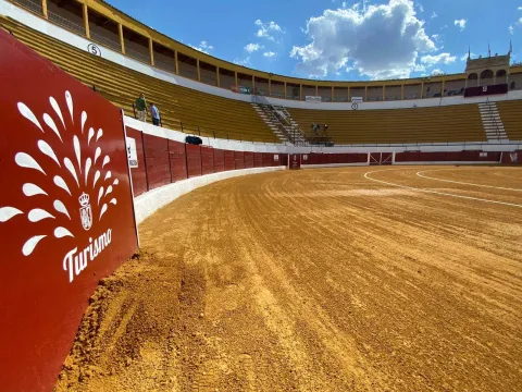
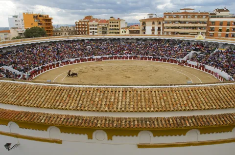
The square has a capacity of 9,000 spectators. Circular with an alley of 1.30 meters high, it consists of three floors: lying, standing and gallery, to which they lead four stairs, one at each access door to the enclosure. Among its dependencies is cavalry, corrals, ten chickers, concierge, administration, bullfighting room, lockers, nursing and desolate.

Full of history and legend, in which memorable afternoons have been lived, the best priests and rejoners have tried luck in their course. But the one that remains recorded in the collective memory of the hobby and for which the Linares coso is worldwide known, was for the mortal capture of Manuel Rodríguez Sánchez "Manolete" on August 29, 1947, for the myura called Isero. Next to the ring door there is a ceramic and marble plate commemorative of that tragic afternoon of the Royal Fair and Fiestas of San Agustín.

Breve descripción

The square of Linares, known as Santa Margarita, built in stone, brick, iron and wood, was built in the last third of the 19th century, specifically between the years 1865 and 1867, when it was inaugurated. This thing has one of the largest rings in the world and consists of three floors. He has witnessed the emergence of numerous Linaran matators and historical epic afternoons. This square is also offered as a space for concerts and unique events in the city center.

Telecomunicaciones
Sitio web
www.turismolinares.es/planifica-tu-visita/itinerarios/linares-taurina/
Teléfono de contacto
953 690 849
Correo electrónico
turismo@aytolinares.es
Ubicación
Código Postal
23700
Latitud
38.097860
Longitud
-3.631525
Dirección
C/ Argüelles, s/n
Distrito
Municipio
Ubicación en el mapa
POINT (-3.631525 38.09786)
Tipos de punto de interés
Imágenes carrusel
imagen
Image
2.jpg
Imagen principal
Desactivado
imagen
Image
1.jpg
Imagen principal
Desactivado
imagen
Image
santa-margarita.jpg
Imagen principal
Desactivado
imagen
Image
3.jpg
Imagen principal
Desactivado
Imágenes cabecera
imagen
Image
Coso%20Santa%20Margarita%20de%20Linares.jpg
Imagen principal
Activado
Microsite al que pertenece
Loading map
Preparing points of interest and routes...

Bullring of Jaén

Submitted by brandcode_deweloper on
Id
10871582
Descripción
Descripción larga

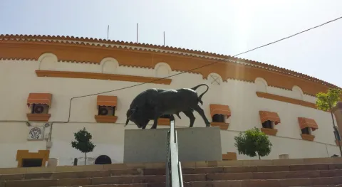
The first run was held on 18 October 1960 with the unfinished work and was in charge of the bullfighters "Pedrés," Gregorio Sánchez and Victor Quesada. The official inauguration of the coso took place two years later with a sign formed by the swords Diego Puerta, Paco Camino and Palmeño. On October 18, 2010, coinciding with the celebration of the San Lucas Fair, it commemorated the 50th anniversary of the first walk in the square, with a cumshot by José Carlos Venegas, Enrique Ponce and El Juli. It has a capacity for more than 10,000 spectators and a restoration area in the lower area of the square.

Breve descripción

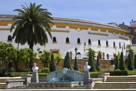
The current square also called Alameda thing, is the work of the architect Antonio María Sánchez and stands on the old square opened on August 15, 1847, which disappeared in the mid-20th century.

Telecomunicaciones
Sitio web
https://www.tauroemocion.es/index.php/plazas/jaen
Teléfono de contacto
953 241 100
Correo electrónico
administracion@tauroemocion.com
Ubicación
Código Postal
23002
Latitud
37.767602
Longitud
-3.783212
Dirección
Alameda de Adolfo Suárez, 2
Distrito
Municipio
Ubicación en el mapa
POINT (-3.783212 37.767602)
Tipos de punto de interés
Imágenes cabecera
imagen
Image
FNz8c6hXsA4oQ4t.jpg
Imagen principal
Activado
Microsite al que pertenece
Loading map
Preparing points of interest and routes...