Saltar al contenido principal
icon-intereses-cultura

Parque Municipal de Fuerte del Rey

Submitted by brandcode_deweloper on
Id
8113746
Descripción
Descripción larga
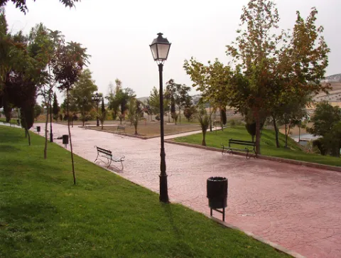
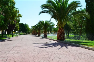
The great appeal of this park lies in its views and the large number of benches for resting, along with its function as an eco-park, allowing visitors to exercise on its outdoor gym equipment, although access to these is over uneven ground. The park has a children's play area that is not accessible, as it has a step of around 12 cm.
Breve descripción
A park located in the highest part of Fuerte del Rey, from where almost the entire town can be seen. At the main entrance there is a slight side incline that makes access more difficult.
Telecomunicaciones
Teléfono de contacto
953 37 60 11 / 953 37 61 17
Correo electrónico
ayuntamiento@fuertedelrey.es
Ubicación
Código Postal
23180
Latitud
37.87573
Longitud
-3.88143
Dirección
C/ Antonio Machado, nº 20
Distrito
Municipio
Ubicación en el mapa
POINT (-3.88143 37.87573)
Tipos de punto de interés
Imágenes carrusel
imagen
Image
Parque%20Municipal%20Fuerte%20del%20Rey2.jpg
Imagen principal
Desactivado
Imágenes cabecera
imagen
Image
Parque%20Municipal%20Fuerte%20del%20Rey.jpg
Imagen principal
Activado
Loading map
Preparing points of interest and routes...
Parque de las Eras

Submitted by brandcode_deweloper on
Id
8113062
Descripción
Breve descripción
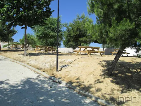
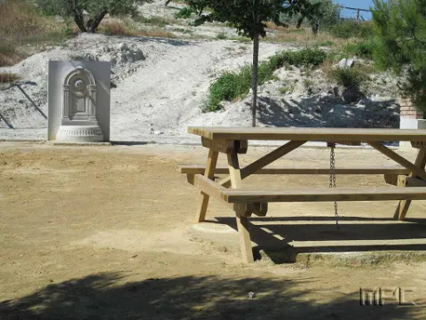
Located in the upper part of the town. It has wooden benches, a fountain and large shaded areas for relaxing and enjoying a wonderful day outdoors.
Telecomunicaciones
Teléfono de contacto
953 37 60 11 / 953 37 61 17
Correo electrónico
ayuntamiento@fuertedelrey.es
Ubicación
Código Postal
23180
Latitud
37.87327
Longitud
-3.88616
Dirección
C/ las Eras.  Fuerte del Rey
Distrito
Municipio
Ubicación en el mapa
POINT (-3.88616 37.87327)
Imágenes carrusel
imagen
Image
Parque%20de%20las%20Eras%2C2.jpg
Imagen principal
Desactivado
Imágenes cabecera
imagen
Image
Parque%20de%20las%20Eras%2C.jpg
Imagen principal
Activado
Loading map
Preparing points of interest and routes...
Iglesia Parroquial de la Natividad de Nuestra Señora

Submitted by brandcode_deweloper on
Id
4517663
Descripción
Descripción larga
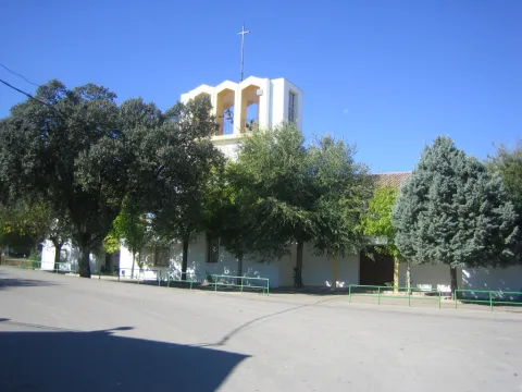
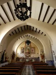
This is the most notable building in Fuerte del Rey. Its construction was completed in 1796. It has a single floor with whitewashed pointed arches. The choir is set on a raised level facing the altar. The façade is built in ashlar stone, reinforced with strong buttresses. The most interesting feature is the bell gable at the foot of the church. It is arranged in three sections separated by moulding, with a window in the second section framed by ashlar surrounds. The final section, the bell gable proper, is not built in stone, and features two stylised bell openings covered with semicircular arches. It ends in a pediment shaped like a truncated pyramid, decorated at its base with graceful scrollwork.
Telecomunicaciones
Sitio web
www.fuertedelrey.es/el-municipio/patrimonio-historico.html
Teléfono de contacto
953 37 60 11
Ubicación
Código Postal
23180
Latitud
37.87433
Longitud
-3.88463
Dirección
Plaza de la Constitución, 3, Fuerte del Rey
Distrito
Municipio
Ubicación en el mapa
POINT (-3.88463 37.87433)
Tipos de punto de interés
Imágenes carrusel
imagen
Image
Iglesia%20Parroquial%20de%20la%20Natividad%203.jpg
Imagen principal
Desactivado
Imágenes cabecera
imagen
Image
iglfuerte.jpg
Imagen principal
Activado
Loading map
Preparing points of interest and routes...
Vieja fábrica de harina

Submitted by brandcode_deweloper on
Id
4517777
Descripción
Descripción larga
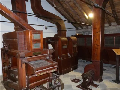
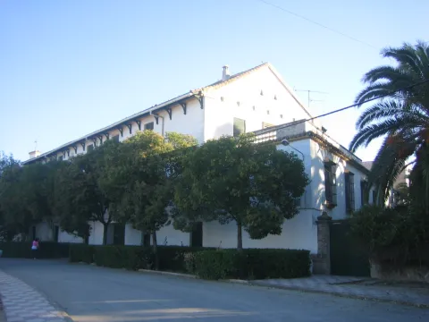
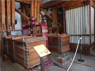
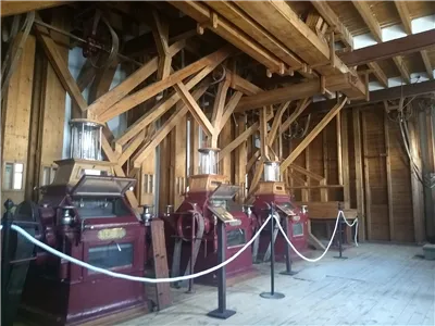
Dating from the first half of the 20th century, it is one of the oldest flour mills in the province. It was a key facility for the municipality's economy during the post-war years. In 2004, it was listed in the General Catalogue of Andalusian Historical Heritage as a site of ethnological interest.
Telecomunicaciones
Sitio web
www.fuertedelrey.es
Teléfono de contacto
953 37 60 11 - 953 37 61 17
Ubicación
Código Postal
23180
Latitud
37.87464
Longitud
-3.88427
Dirección
Av. de Jaén, 68
Distrito
Municipio
Ubicación en el mapa
POINT (-3.88427 37.87464)
Imágenes carrusel
imagen
Image
thb_g_P1300402.jpg
Imagen principal
Desactivado
imagen
Image
Fabrica%20Harinas%20Nuestra%20Se%C3%B1ora%20del%20Rosario%20Fuerte%20del%20Rey%20%28Ja%C3%A9n%29%20fachada.jpg
Imagen principal
Desactivado
imagen
Image
thb_g_IMG_20190827_103314228.jpg
Imagen principal
Desactivado
imagen
Image
thb_g_P1300413.jpg
Imagen principal
Desactivado
imagen
Image
thb_g_P1300420.jpg
Imagen principal
Desactivado
Imágenes cabecera
imagen
Image
thb_g_P1300371.jpg
Imagen principal
Activado
Loading map
Preparing points of interest and routes...
Iglesia Santa Catalina

Submitted by brandcode_deweloper on
Id
4523752
Descripción
Descripción larga
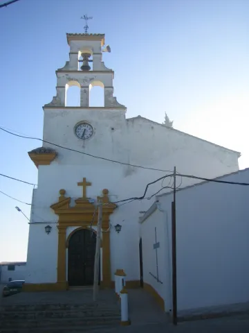
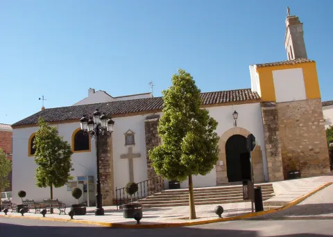
The small parish church, built on the site of the old Oratory of Santa Catalina and reached by a gentle flight of steps, was inaugurated in 1954. Its narrow, tall whitewashed façade features a simple lintelled doorway framing a semicircular-arched entrance with a broken pediment holding a cross, topped by a bell gable with three bell openings arranged in the shape of a truncated pyramid.
Telecomunicaciones
Sitio web
www.applicajaen.com/?load=applica&guia&punto=670_iglesia-santa-catalina-espeluy
Teléfono de contacto
953 537 161
Ubicación
Código Postal
23628
Latitud
38.03272
Longitud
-3.86193
Dirección
Plaza Constitucion, 2A
Distrito
Municipio
Ubicación en el mapa
POINT (-3.86193 38.03272)
Tipos de punto de interés
Imágenes carrusel
imagen
Image
Iglesia%20Santa%20Catalina.JPG
Imagen principal
Desactivado
imagen
Image
Iglesia%20Santa%20Catalina2.JPG
Imagen principal
Desactivado
Imágenes cabecera
imagen
Image
santacatalina.jpg
Imagen principal
Activado
Loading map
Preparing points of interest and routes...
Iglesia Inmaculada Concepción

Submitted by brandcode_deweloper on
Id
4524144
Descripción
Descripción larga
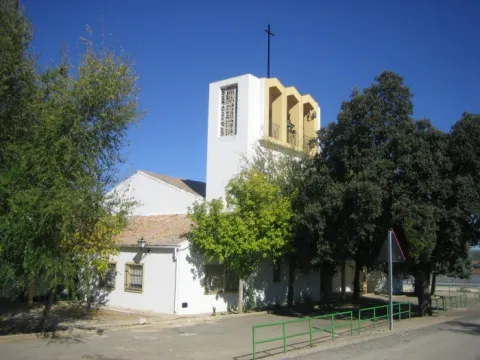
Located in the Barriada Santa Ana, it was built in 1968. It houses images of San Miguel, San José and the Immaculate Conception.
Telecomunicaciones
Sitio web
www.espeluy.es/el-municipio/patrimonio-historico.html
Teléfono de contacto
953 537 161
Ubicación
Código Postal
23628
Latitud
38.03274
Longitud
-3.86195
Dirección
C/ Constitución, 1
Distrito
Municipio
Ubicación en el mapa
POINT (-3.86195 38.03274)
Tipos de punto de interés
Imágenes carrusel
imagen
Image
Iglesia%20Inmaculada%20Concepci%C3%B3n_Espeluy.jpg
Imagen principal
Desactivado
Imágenes cabecera
imagen
Image
inmaculadac.jpg
Imagen principal
Activado
Loading map
Preparing points of interest and routes...

Castillo de Espelúy

Submitted by brandcode_deweloper on
Id
4522991
Descripción
Descripción larga
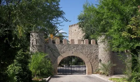
The castle played an important role at one of the key strategic points controlling the Guadalquivir and Guadalimar rivers. Its origins probably date back to the Caliphate period, although it was destroyed by Ferdinand III in the first third of the 13th century. Once under Christian rule, the castle was rebuilt between the end of that century and the beginning of the next. Its most authentic feature is its magnificent keep, square in plan, which houses two superimposed rooms inside, covered by barrel vaults. It was declared a Site of Cultural Interest in 1985.
Telecomunicaciones
Sitio web
www.espeluy.es/el-municipio/patrimonio-historico.html
Teléfono de contacto
953 537 161
Correo electrónico
espeluy@promojaen.es
Ubicación
Código Postal
23628
Latitud
38.03362
Longitud
-3.86188
Dirección
23628 Espelúy
Distrito
Municipio
Ubicación en el mapa
POINT (-3.86188 38.03362)
Tipos de punto de interés
Imágenes carrusel
imagen
Image
Castillo%20de%20Espel%C3%BAy%202.jpg
Imagen principal
Desactivado
Imágenes cabecera
imagen
Image
castillo_de_espeluy_03_cde.jpg
Imagen principal
Activado
Loading map
Preparing points of interest and routes...
Hacienda del Pilar

Submitted by brandcode_deweloper on
Id
4523531
Descripción
Descripción larga
The Hacienda del Pilar, which takes its name from the image of the Virgin under this title placed on its façade, was built from 1904 onwards as a working farm estate and later remodelled into a private noble residence for receiving dignitaries. Owned by José del Prado y Palacio, former Minister of Public Instruction and Marquis of Rincón de San Ildefonso, it hosted Alfonso XIII during his visit to Jaén in 1916. It was approached through carefully tended English-style gardens with a monumental fountain at their centre and another, in Seville style, to one side. The façade, with two columned galleries — one of them glazed — featured wooden columns and finely worked ironwork, all in a markedly eclectic style. Inside, this eclecticism continued with an element of special interest: a Renaissance courtyard belonging to a palace in Andújar, demolished in the second decade of the century and acquired and transferred to El Pilar by its owner. Nine slender columns, eight arches with cushioned coffering, spandrels, medallions and noble coats of arms were removed from their original building and brought here, along with a fountain with a wide basin, four shells and two bowls, decorated with caryatids. The building also had spacious rooms, a small theatre and a hall with fine furnishings.
Breve descripción
Closed and very difficult to visit. Built from 1904 onwards as a working farm estate and later remodelled into a private noble residence for receiving dignitaries. Its owner was the Marquis of Rincón de San Ildefonso, Don José del Prado y Palacio, Minister of Public Instruction under King Alfonso XIII and one of the great landowners of the area. It is approached through English-style gardens with fountains. It incorporates a Renaissance courtyard taken from a demolished palace in Andújar — that of the Marquis of Puente de la Virgen, formerly located in Andújar's Plaza de España, today Plaza de la Constitución. The building included a small theatre and a hall furnished with walnut furniture.
Telecomunicaciones
Sitio web
www.espeluy.es/el-municipio/patrimonio-historico.html
Correo electrónico
espeluy@promojaen.es
Ubicación
Código Postal
23628
Latitud
38.03192
Longitud
-3.86257
Distrito
Municipio
Ubicación en el mapa
POINT (-3.86257 38.03192)
Imágenes carrusel
imagen
Image
hacienda%20del%20pilar.jpg
Imagen principal
Desactivado
Imágenes cabecera
imagen
Image
hacienda_El_pilar%20%281%29.jpg
Imagen principal
Activado
Loading map
Preparing points of interest and routes...
Fountain of the Seven Spouts. Albanchez de Mágina

Submitted by brandcode_deweloper on
Id
1735433
Descripción larga

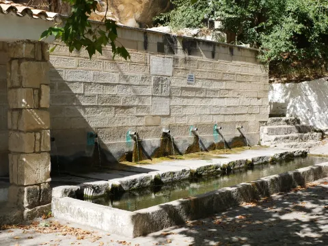
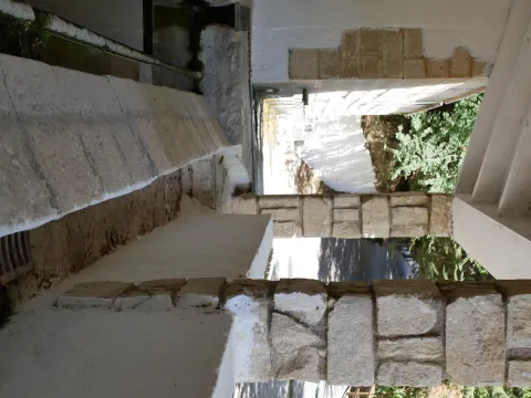
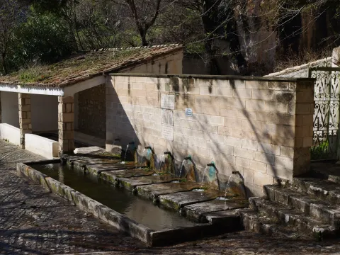
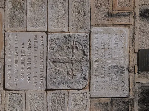
The Fuente de los Siete Caños is a water spring located about 500 metres south of the town of Albanchez de Mágina. This is a clear example of rural architecture, one that combined aesthetics with functionality to pleasing effect. In this case, little explanation is needed, as it is plain to see how the water was put to use for the trough, the washing place, and the irrigation of nearby market gardens and olive groves.

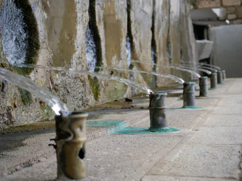
The fountain's construction features a finely finished stone ashlar front. It has seven water spouts, in bronze pipes, which give it a pleasing appearance. It carries a fairly abundant flow, which has never dried up, although in times of drought it tends to reduce somewhat.

The water flow collects in a trough of modest depth, which until recently was used to quench the thirst of the "beasts" that worked the land. Each spout carries a variable flow, with the last one carrying the greatest. Attached to it is a public washing place, featuring two rows for washing clothes and an iron fitting. The water from the washing place flows from the trough through a small stone channel, fitted with a grille to protect anyone passing over it.
The rest area also has street furniture for sitting and enjoying impressive views of the Albanchez river, El Torcal and Bedmar.

This spot also lies along the Route to the Caldera del Tío Lobo, so if you enjoy hiking, don't hesitate to walk it. And once you've completed it, stop, rest and enjoy the surroundings.


Breve descripción

Fountain with seven water spouts, which give it its name. It has a stone-fronted trough and a public washing place, an example of traditional rural architecture linked to the use of water for drinking and for irrigating market gardens, dating back to the 16th century.

Latitud
37.788118
Longitud
-3.466169
Distrito
Ubicación en el mapa
POINT (-3.466169 37.788118)
imagen
Image
p1080490-jpg
Imagen principal
Activado
imagen
Image
p1080488-jpg
Imagen principal
Desactivado
imagen
Image
p1080494-jpg
Imagen principal
Desactivado
imagen
Image
p1022493-jpg
Imagen principal
Desactivado
imagen
Image
dji_20250522110724_0010_d-jpg
Imagen principal
Desactivado
imagen
Image
p1023710-jpg
Imagen principal
Desactivado
imagen
Image
p1070609-jpg
Imagen principal
Desactivado

Friends

icon-intereses-amigos

Nature

icon-intereses-naturaleza

Solo travel

icon-intereses-viajar-solo

Culture

icon-intereses-cultura

Adventure

icon-intereses-aventura

Sport

icon-intereses-deporte

Municipality

icon-intereses-municipio

Low-cost tourism

icon-intereses-turismo-low-cost

Eco-friendly

icon-intereses-eco-friendly
Fuente de los Siete Caños. Albanchez de Mágina
Desactivado

Open 24 hours.

Coordenadas / Huso 30S

30S x=458954 y=4182409

Tramo de asfalto o cemento
 
Tramo de pista o camino forestal
 
Tramo de vía pecuaria
 
Tramo de senda
 

Route of the Castles and Battles

Submitted by brandcode_deweloper on
Id
1477084
Descripción larga

Arjona is included in the Route of the Castles and Battles, an itinerary running through the province of Jaén and part of the provinces of Ciudad Real and Granada. Arjona once had one of the most complex fortification systems in Al-Ándalus, with a triple line of defensive walls which, combined with Arjona's own strategic position, made it an impregnable stronghold. The origin of its wall system is set within the protohistory of the Iberian Peninsula, having been used by the successive cultures that passed through it, all of which left their mark on its structure. Today, part of this vast defensive system survives, along with an Almohad-period cistern located at the heart of the Alcazaba. The Archaeology Room of the Arjona Museum holds remains of weapons used in the Islamic medieval period, notably including arrowheads of a type matching those used at the Battle of Las Navas de Tolosa; also of note, inside the Sanctuary of the Sacred Relics, is a collection of drawings and plans based on the manuscripts of the 17th-century historian Martín Ximena Jurado, showing what Arjona's defensive system looked like at that time.

The visit ticket includes a guide and admission to all monuments, museums and churches, except the Sanctuary of the Sacred Relics; admission to the Sanctuary costs €1, payable at its entrance.

Latitud
37.936503
Longitud
-4.055315
Distrito
Municipio
Ubicación en el mapa
POINT (-4.055315 37.936503)
imagen
Image
vistas.JPG
Imagen principal
Activado

Nature

icon-intereses-naturaleza

Friends

icon-intereses-amigos

Adventure

icon-intereses-aventura

Culture

icon-intereses-cultura

Sport

icon-intereses-deporte

Eco-friendly

icon-intereses-eco-friendly

For couples

icon-intereses-en-pareja

Family

icon-intereses-familia

Gastronomy

icon-intereses-gastronomia

Municipality

icon-intereses-municipio

Low-cost tourism

icon-intereses-turismo-low-cost

Solo travel

icon-intereses-viajar-solo

Ruta de los castillos y batallas

All year round

Desactivado
Coordenadas / Huso 30S

30S x=407265 y=4199295

Tramo de asfalto o cemento
 
Tramo de pista o camino forestal
 
Tramo de vía pecuaria
 
Tramo de senda