Saltar al contenido principal
icon-intereses-cultura

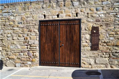
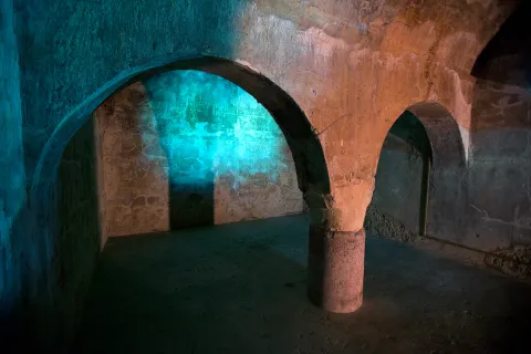
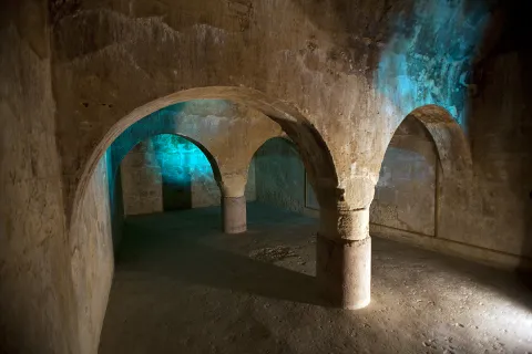
Almohad Cistern del castillo de Arjona

Submitted by brandcode_deweloper on
Id
5689533
Descripción
Descripción larga

El conjunto fortificado de Arjona, de época medieval, conformaba un complejo e inexpugnable sistema defensivo, formado por tres recintos amurallados: un primer anillo de murallas jalonado por 24 torres que protegía la ciudad, una Alcazaba y el Alcázar. Contaría además con otros elementos defensivos como un foso, que se ha documentado al sur de la fortaleza y un antemuro que crearía una liza o zona de tránsito. 

En las murallas de Arjona se abrirían siete puertas flanqueadas por parejas de torres, excepto la Puerta Nueva que, en realidad, era un portillo. La mayor parte de estos elementos defensivos fueron construidos con mampostería irregular, que puede considerarse sillarejo, unida con argamasa de cal y arena.

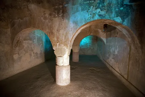
La actual Plaza de Santa María se convirtió durante la Edad Media en la Alcazaba, emplazada en el lugar más elevado de la zona. Un recinto amurallado en el que se levantaban las áreas palatinas que acogían a las clases dirigentes y del estamento militar. Ocupando un extremo de la misma se encontraba el Alcázar, centro político de la ciudad. La Iglesia de Santa María, que preside la mencionada plaza, se identifica con la primitiva mezquita aljama, que se edificaría frente a los palacios islámicos. Junto a ella, se conserva hoy día un gran aljibe medieval, posiblemente almohade, de planta rectangular y cubierto con 3 bóvedas de cañón apoyadas en arcos de medio punto, que descansan sobre columnas romanas, algunas con inscripciones.

En la actualidad permanecen en pie algunos vestigios de sus defensas dispersos entre el caserío, torres y lienzos embutidos en las traseras de las casas, sirviendo de medianeras a viviendas emplazadas en las calles del Reloj, Belén, Sol, etc.  Además, existen fragmentos del antemuro de la Alcazaba en el Paseo de los Mártires, actuando como muro de contención del mismo. También se conservan testimonios de lienzos embutidos en las medianerías que separan el Hospital de San Miguel y la calle Alcázar. 

La ciudad de Arjona ocupa la cumbre y vertientes superiores de un cerro amesetado, desde el que se domina un amplio territorio y las vías de comunicación entre el valle del Guadalquivir y la Campiña. Por su valor estratégico, ha estado ocupada desde la Prehistoria hasta nuestros días. 
En el espacio que hoy ocupa la plaza de santa María se ubicó un asentamiento de las Edades del Cobre y del Bronce. Su ocupación continuará durante el periodo Ibérico, con el establecimiento de un oppidum de medianas proporciones protegido por un sólido recinto amurallado reforzado con bastiones y torres, que rebasaría el espacio de la actual plaza.

Con la llegada de los romanos, el asentamiento se convierte en el municipium de Urgavo, uno de los municipios de mayor importancia a nivel político desde época Augustea y de los primeros que alcanzaron la plenitud de ciudadanía romana. Arjona continuará en poder de Roma hasta el 412 d.n.e., posteriormente, durante el periodo visigodo, el área de ocupación se reduciría a la zona más elevada del cerro.

Tras la conquista musulmana, el linaje de Banu Bayla se asentó en la actual Arjona, que será conocida como Qal´at Aryuna. En estos momentos se reforzaron las murallas y se construye la alcazaba, ocupando lo que fue el oppidum ibérico. Arjona se convirtió en la cabecera de uno de los principales distritos administrativos (Iqlim) en los que fue estructurada la Kura de Yayyan, del que dependerían los asentamientos rurales existentes en su zona de influencia. A finales del siglo IX, el emir Abd Allah mandó fortificar Arjona y Andújar, con el fin de concentrar en estas localidades a la población campesina de su entorno. 

La ciudad de Arjona se consolidaría, al igual que otras poblaciones del Valle del Guadalquivir, entre los siglos XI y XIII, como consecuencia de la inestable situación política en al-Andalus tras la desintegración del Califato Omeya, y por la presión de los ejércitos cristianos. En este periodo se produjo el mayor desarrollo de la ciudad, que se tradujo en un reforzamiento de sus defensas y en la configuración de su entramado urbanístico medieval. En 1232 Muhammad ibn Yusuf ibn Nasr ibn al-Ahmar (Alhamar), originario de Arjona, se proclama sultán en Jaén y seis años después fundará un nuevo reino con capital en Granada.

En 1244, Nuño González sitia Arjona y las autoridades musulmanas pactan la rendición, entregando la ciudad sin resistencia. Pasó a formar parte de las tierras de realengo, constituyéndose como uno de los grandes concejos de Villa y Tierra en los que se estructuraba el reino de Jaén. En el año 1248 le fue concedido el título de Villa por el rey Sancho. En compensación por el apoyo prestado, la ciudad pasó a formar parte del señorío del Condestable de Castilla, Ruy López Dávalos, integrándose posteriormente en las posesiones de D. Álvaro de Luna, quien finalmente la permutaría a la Orden de Calatrava por otras posesiones, que la convirtió en cabeza de Encomienda de la Orden.

La desaparición de la frontera castellano-nazarí dejó obsoletas buena parte de las estructuras que conformaban la cerca murada de Arjona.

LEYENDAS

La yegua del vencedor. Al-lushi poseía una yegua excelente, que llegó a ser tan conocida entre los cristianos de las comarcas vecinas, que el rey castellano, quiso comprarla a cualquier precio. Pero su dueño estaba tan prendado de ella que se la negó. Durante tres noches escuchó una voz en sueños que le decía: “Ve a Arjona y lleva contigo la yegua; pregunta por uno al que llaman Mohammed-ben-Yusuf y en cuanto lo encuentres, véndesela, porque con ella ha de conquistar Jaén y otras ciudades y ha de ser esta conquista muy beneficiosa para las generaciones venideras”. Le contaron que debía tratarse de Alhamar, por lo que partió para Arjona. En la mezquita del castillo le reveló su sueño y acordaron un precio por el animal.  

Un año después, Alhamar tomó el título real en su ciudad natal, Arjona, se apoderó de la ciudad de Jaén y más delante de Córdoba, Sevilla Granada, Málaga, Almería y otras muchas, siendo el fundador de la dinastía y el reino nazarí. 

Breve descripción

The fortified set of Arjona, of medieval times, was a large complex composed of a alcazaba, a alcazar and a large walled exterior enclosure jalonado of towers. Although only structures of the fortress have been preserved, the presence of vestiges of its defenses, towers and canvases, scattered between the house, as well as the almohade, with columns of Roman times, which can be visited by the church. On the 22nd of the Sun Street, the rehabilitation of part of the wall canvas, and of an annexed tower, has made it possible to create a small space for interpretation of the walls of Arjona.
In the Plaza de Santa María, the highest area of the town, the settlements have taken place from Prehistory to today. It was originally a town of the Etudes of Copper and Bronze and then an Iberian oppidum that ended up becoming the Roman Urgavo municipality. After a sharp decline in the population in the Visigodic era, the Muslim occupation brought with it a great development of the city, now called Qal'at Aryuna, head of one of the main administrative districts of the Cora de Jaén. Once conquered by the Christian armies it was made the head of one of the great councils of Villa and Land of the kingdom of Jaén and head of the Order of Calatrava.
Telecomunicaciones
Sitio web
www.arjona.es
Teléfono de contacto
953 523 325
Correo electrónico
ayuntamiento@arjona.es
Ubicación
Código Postal
23760
Latitud
37.937050
Longitud
-4.061320
Distrito
Municipio
Ubicación en el mapa
POINT (-4.06132 37.93705)
Tipos de punto de interés
Imágenes carrusel
imagen
Image
Aljibe%20de%20Arjona.jpg
Imagen principal
Desactivado
imagen
Image
desarrollo-tenflowers_arjona_img_3194-copia%20%281%29.jpg
Imagen principal
Desactivado
imagen
Image
Aljibe%20Almohade.jpg
Imagen principal
Desactivado
Imágenes cabecera
imagen
Image
desarrollo-tenflowers_arjona_img_3190-copia.jpg
Imagen principal
Activado
Horario
Previous date.
Microsite al que pertenece
Loading map
Preparing points of interest and routes...

Un Mar de Canciones

Submitted by brandcode_deweloper on
Id
11879527
Descripción
Breve descripción

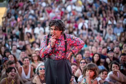
A combination of music, magic, comedy and literature define this festival, which remains a celebration of Spanish singer-songwriter music, where the spoken word is usually the true star.

Ubicación
Código Postal
23320
Latitud
38.035664
Longitud
-3.289111
Municipio
Ubicación en el mapa
POINT (-3.289111 38.035664)
Imágenes
imagen
Image
Un%20mar%20de%20Canciones.jpg
Imagen principal
Activado
Fecha Inicio
10 Jul 2026 00:00
Fecha Fin
10 Jul 2026 00:00
Evento anual (=Periodicidad)
Activado
Tipo de evento
Loading map
Preparing points of interest and routes...
Interés

Imagina Funk

Submitted by brandcode_deweloper on
Id
11879746
Descripción
Breve descripción

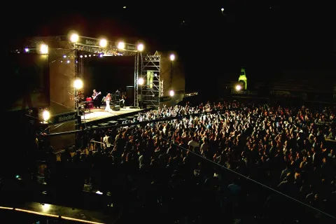
This festival is considered one of the most important events of its kind in Europe, being the only one on the continent held in festival format. Black music has found its great meeting point in Pozo Alcón, right in the heart of the Cazorla, Segura y Las Villas Natural Park.

Ubicación
Código Postal
23485
Latitud
37.704661
Longitud
-2.934062
Dirección
Pozo Alcón
Municipio
Ubicación en el mapa
POINT (-2.934062 37.704661)
Imágenes
imagen
Image
imagina%20funk.jpg
Imagen principal
Activado
Fecha Inicio
31 Jul 2026 00:00
Fecha Fin
01 Aug 2026 00:00
Evento anual (=Periodicidad)
Activado
Tipo de evento
Loading map
Preparing points of interest and routes...
Interés

Blues Cazorla Festival

Submitted by brandcode_deweloper on
Id
989902
Descripción
Breve descripción

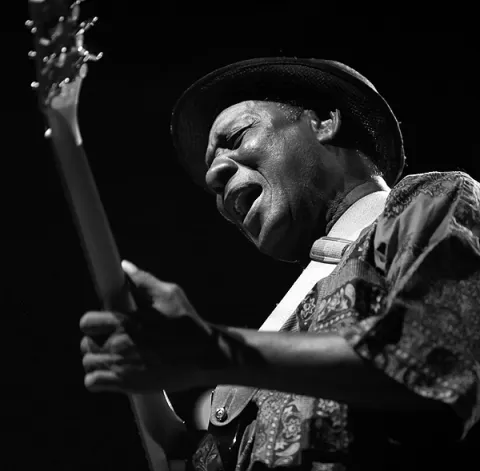
The Cazorla International Blues Festival is a must for lovers of this North American musical genre. At the Municipal Auditorium, groups from various countries offer more than 18 hours of the best national and international blues in this picturesque town which, declared a Historic-Artistic Site in 1972, is one of Spain's leading inland tourist destinations.


Ubicación
Código Postal
23470
Latitud
37.913575
Longitud
-3.011814
Municipio
Ubicación en el mapa
POINT (-3.011814 37.913575)
Imágenes
imagen
Image
Festival_Blues_Cazorla.jpg
Imagen principal
Activado
Fecha Inicio
09 Jul 2026 00:00
Fecha Fin
12 Jul 2026 00:00
Evento anual (=Periodicidad)
Activado
Tipo de evento
Loading map
Preparing points of interest and routes...
Interés

Etnosur

Submitted by brandcode_deweloper on
Id
11879624
Descripción
Descripción larga

The 2026 edition arrives with an early line-up announcement confirming its global outlook: the legendary Cuban orchestra Los Van Van, the Dhoad Gypsies of Rajasthan from India, the Galician group Fillas de Cassandra, the Tanzanian Zawose Queens, the Afro-Cuban project Afrosideral and Argentina's Luqui Salvadori are all part of a programme bringing together acts from nine countries. An eclectic mix that keeps the festival true to its essence as a melting pot of cultures and sounds.

Breve descripción

The Ethnic Gatherings in the Sierra del Sur (Etnosur) were created with the aim of bringing together and blending distant cultures with nearby ones through music. It features a huge range of activities: workshops, circus performances, forums, film screenings and literary gatherings all shape a free, multidisciplinary festival.

Ubicación
Código Postal
23680
Latitud
37.464177
Longitud
-3.925342
Distrito
Municipio
Ubicación en el mapa
POINT (-3.925342 37.464177)
Imágenes
imagen
Image
Etnosur%20%281%29.jpg
Imagen principal
Activado
Enlace reserva
https://etnosur.com/
Fecha Inicio
16 Jul 2026 00:00
Fecha Fin
19 Jul 2026 00:00
Microsite al que pertenece
Evento anual (=Periodicidad)
Activado
Tipo de evento
Loading map
Preparing points of interest and routes...
Interés
Evento cancelado
Desactivado

Blues Cazorla

Submitted by brandcode_deweloper on
Id
11879490
Descripción
Breve descripción

Considered the Best International Blues Festival by the Blues Foundation of Memphis, Blues Cazorla is an international benchmark for fans and musicians of this genre and an unmissable event held in one of the most picturesque towns of the Cazorla, Segura y Las Villas Natural Park: Cazorla.

Ubicación
Código Postal
23470
Latitud
37.912450
Longitud
-3.003922
Municipio
Ubicación en el mapa
POINT (-3.003922 37.91245)
Imágenes
imagen
Image
BLUES%20DE%20CAZORLA.jpg
Imagen principal
Activado
Fecha Inicio
02 Jul 2026 00:00
Fecha Fin
04 Jul 2026 00:00
Evento anual (=Periodicidad)
Activado
Tipo de evento
Loading map
Preparing points of interest and routes...
Interés

30th BluesCazorla

Submitted by brandcode_deweloper on
Id
13961406
Descripción
Descripción larga

From 2 to 4 July, the cobbled streets of Cazorla will become the world epicentre of the blues. Picture this: the sun setting over the Sierra de Cazorla as the chords of Erix Johnson (confirmed for the grand closing on Saturday 4th) ring out in the Plaza de Toros, or letting yourself be carried away by the purest rhythms at the acoustic concerts in the magical Plaza de Santa María.

Breve descripción
BluesCazorla 2026 is not just a festival — it's a must for lovers of soulful music, and this year it returns stronger than ever to celebrate its 30th anniversary.
Ubicación
Latitud
37.912893
Longitud
-3.003887
Municipio
Ubicación en el mapa
POINT (-3.003887 37.912893)
Imágenes
imagen
Image
bluescazorla-2-jpg
Imagen principal
Activado
Enlace reserva
https://www.cazorla.es/bluescazorla06/
Fecha Inicio
02 Jul 2026 00:00
Fecha Fin
04 Jul 2026 00:00
Loading map
Preparing points of interest and routes...
Interés
Evento cancelado
Desactivado

La Iruela

Submitted by brandcode_deweloper on
Id
918750
Descripción
Descripción larga

Next to the castle you will find the ruins of the Church of Sto. Silos Sunday. The legend tells that it was built on the place where the Arabs held captive Christians in prison and there was Santo Domingo doing his job. In the building there are traces of the disciples of Vandelvira. It's a must-see for any lover of history.

The Iruela was part of Cazorla until 1370, when Archbishop D. Gome Manrique gave it independence, power and shield. His political and territorial position has allowed him to preserve an important heritage: the Conistory House - a proud building in the Mudejar style of Toledan - and the Church of the Immaculate Conception are part of this legacy.

The population has a core worth visiting. The streets are steep and narrow, with crouched houses and flowers on the balconies. In the center there is a beautiful fountain from which several roads arise to surround the village. From here you can go up to Temple Street on a beautiful stone road accompanied by fig trees and cypresses.

We suggest:

  • About five minutes from La Iruela you will find Burunchel. Come to know the Hermitage of San Julián and the temple of the Holy Spirit among other attractions of this pedany.
  • On August 27, during the summer parties of the village you will see a curious pyrotechnic show, in which the castle is also the protagonist.
Breve descripción

The road that goes up to the saw from Cazorla borders this small, but amazing population. Its best known profile is due to the castle, a legendary fortress that became owned by the Templars and dominates the Guadalquivir Valley. The need to defend itself has given rise to this fortification which, because of its most abrupt aspect, is inexortable. But the Iruela is more attractive.

Ubicación
Latitud
37.920351
Longitud
-2.994140
Municipio
Ubicación en el mapa
POINT (-2.99414 37.920351)
Tipos de punto de interés
Imágenes carrusel
imagen
Image
iruela.jpeg
Imagen principal
Desactivado
Imágenes cabecera
imagen
Image
La-Iruela-Jaen-nuevo-municipio-turistico-de-Andalucia-foto-de-Junta.jpg
Imagen principal
Activado
Loading map
Preparing points of interest and routes...
Marcas de calidad

Archivo Histórico Provincial de Jaén

Submitted by brandcode_deweloper on
Id
PUN-0012
Perfil de redes sociales
Descripción
Descripción larga
In 1952, already at the expense of the Institute of Giennese Studies, the notarial protocols of the Jaén and Andújar district were transferred to some premises. A group of fellows, with no specific knowledge or direction, tried to formalize this first delivery. Following the appointment of Don Melchor Lamana Navascués, an official of the Optional Corps of Archives and Libraries, as director of the Provincial Historical Archive of Jaén (hereinafter AHPJ), the scientific organization of these funds is carried out in a place given by the City Council on Julio Ángel Street. As a result of the new situation, the centenary protocols were received from the districts of Alcalá la Real, Huelma and La Carolina, as well as the books of the Mortgage Contaduries of Andújar, La Carolina and Jaén. The delegation of the Ministry of Finance transferred its historical fund: Intencia, Unique Contribución, which includes the Marqués de la Ensenada, Colonization of Sierra Morena and Provincial Administration of Income. The AHPJ moved in 1973 to the so-called "House of Culture," where it shared a building with the State Public Library. Once again, it was able to receive funds from the Commission of Supply and Transport, Notarial districts of Cazorla, Linares, Martos and Villacarillo, Books of Accounts of Mortgages of Linares, Court of Jaén District, Delegation of Statistics, and as always of Finance. In 1977, the Decree of Legal Creation of the AHPJ was published. The precariousness of space forced most funds to be placed on the ground, hence they were not accessible. This, together with the collapse in the growth of the State Library, leads the Ministry of Culture to seek new and definitive building for the AHPJ. The efforts culminated in the cession of the use of the Royal Convent of Santa Catalina Martir, of the order of Santo Domingo, property of the Ella. Provincial Council. From the whole of convent and church, declared Good of Cultural Interest and located in the old town of the city, the building corresponding to the convent was rehabilitated, by the architect Don Luis Berges Roldán. The project was completed for two purposes, to recover an emblematic building of the city and to provide Jaén with a file of 7,089 square meters, of which 2,515 are for deposits that enable it for more than 12,000 linear meters of open shelf. The transfer and its immediate implementation took place in July 1989, although it was officially reopened on 30 November 1989. Since then, AHPJ has tripled its funds, with effective coordination with agencies throughout the public administration. It is managed by the Autonomous Community of Andalusia, although the ownership of the Archive and its funds belong to the State.
Breve descripción
The Decree of 8 March 1931 created, at the regulatory level and in a general manner, all the Provincial Historical Archives. In Jaén, the efforts to implement the creation were initiated by the official of the Optional Corps, Don Antonio Alcalá Venceslada, without the desired results being produced; justified negative reports of the then Inspector General, Don Miguel Gómez del Campillo, aborted the first attempts.
Telecomunicaciones
Sitio web
https://www.juntadeandalucia.es/organismos/turismoculturaydeporte/areas/cultura/archivos/archivos-consejeria/archivo-historico-provincial-jaen.html
Teléfono de contacto
953 313 570 / 953 313 571
Correo electrónico
informacion.ahp.ja.ccul@juntadeandalucia.es
Ubicación
Código Postal
23003
Dirección
C/ Santo , 12
Distrito
Municipio
Tipos de punto de interés
Imágenes cabecera
imagen
Image
Real_Convento_de_Santo_Domingo
Imagen principal
Desactivado
Microsite al que pertenece

Paraninfo Antigua Universidad de Baeza

Submitted by brandcode_deweloper on
Id
PUN-0007
Perfil de redes sociales
Descripción
Breve descripción
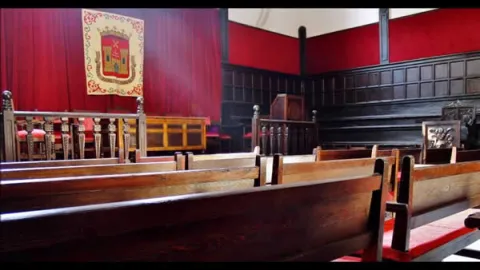
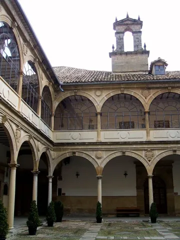
The building of the second half of the 16th century, is structured around a large courtyard with double half-point arches on the dogrous columns and ancestors at the top and in the mirrors and shields. Around are distributed the dependencies, with stone garrison in the lower cloister; among others are the staircase and, above all, the paraninfo, the square floor space, with the gradual and high wooden ceiling, of pairs, knuckles and straps, with a horizontal cloth carved from cassettes and hexagon.
Telecomunicaciones
Sitio web
www.juntadeandalucia.es/cultura/agendaculturaldeandalucia/evento/antigua-universidad-de-baeza
Teléfono de contacto
953 779 522
Correo electrónico
23000817.edu@juntadeandalucia.es
Ubicación
Código Postal
23440
Dirección
San Juan de Ávila, Baeza
Municipio
Tipos de punto de interés
Imágenes carrusel
imagen
Image
Baeza.-Paraninfo-de-la-Antigua-Universidad.jpg
Imagen principal
Desactivado
Imágenes cabecera
imagen
Image
Baeza_-_Antigua_Universidad_08.JPG
Imagen principal
Activado
Microsite al que pertenece