Saltar al contenido principal
icon-intereses-cultura

La Cerradilla

Submitted by brandcode_deweloper on
Id
8094084
Descripción
Descripción larga

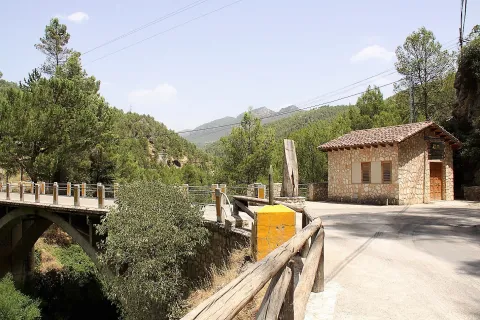
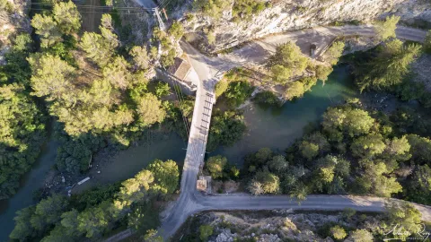
Location: To the north-east of the city centre, very close to it and at the limits of the Natural Park of Cazorla, Segura and Las Villas.

Distance: 3 km.

Medium: On foot.

Access route: By a road that leaves directly from the city centre towards Los Rinnes.

Breve descripción

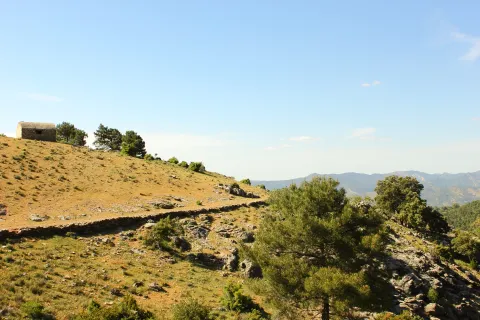
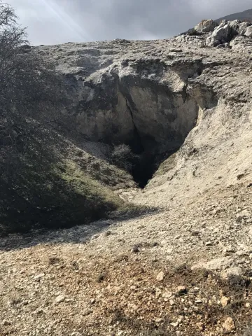
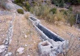
To the north-east of the city centre, very close to it and at the limits of the Natural Park of Cazorla, Segura and Las Villas, beautiful natural enclave that stands out for the presence of a natural water source, as well as the remains of an Arab castle.

Telecomunicaciones
Sitio web
www.huesa.es/el-municipio/patrimonio-natural.html
Correo electrónico
huesa@promojaen.es
Ubicación
Código Postal
23487
Latitud
37.764200
Longitud
-3.077910
Municipio
Ubicación en el mapa
POINT (-3.07791 37.7642)
Tipos de punto de interés
Imágenes carrusel
imagen
Image
Rinc%C3%B3n%20Alto%20.%20La%20Cerradilla.%20%281%29.jpg
Imagen principal
Desactivado
Loading map
Preparing points of interest and routes...
The Big House

Submitted by brandcode_deweloper on
Id
4571299
Descripción
Descripción larga

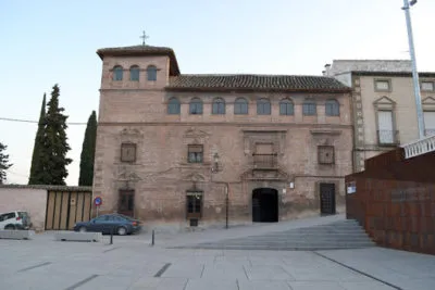
It is actually a wide rectangle, divided into three floors in height and with an airful turret-view on the east side - or left side. Very common typology in Granada, especially in the neighborhoods of San Jerónimo, San Matías and la Magdalena. Although, unlike here, it does not present a porticated and blasphemed courtyard in its centralizer, which leads us to think that it would not in its origin be a foundation of a family - more or less aristocratic - for its particular residence, so we suspect it would have another purpose.

The same similarity with the granadine is also given from a constructive point of view. Thus, if brick is used for the wall walls, for the structural elements, jambas, dintels and frontons, the quarry is used - in this case the asperon so abundant in the place - and the latter are the elements that define it from the stylistic point of view.

As a result, we are facing an interesting example of a typical house of the full baroque - the second half of the XVII-, where there is still a very strong presence of the elements of Mudejar tradition, the façade being very well resolved, because of its interior only highlights the dome on the pechines that originally topped the staircase.

On the first floor, whose cover of the apainelated arch does not appear by focusing the set, its beautiful intellized windows, crowned by beautiful curved and broken fronts, stand out. In the second, the most noble, the rhythms are changed, as they are small intellized windows with the same type of front, except that located on the door which is a large balcony framed by a beautiful alfice, also being in both bodies of a high quality the grate. Finally, a large, flying cornice separates them from the last with a proliferation of semicircular windows.

A number of hypotheses have been set aside on the promoters of its construction. At some times we thought it might be the great plateau that the first Marquis de la Rambla ordered to raise in the town, from which we even have several works payments. However, by some documents it seems to be deduced that it was built by the albaceas and employers of the foundation created by Mother Martha of Jesus - the so-called Almagro House - from the place - to also use it as a table to house travellers and carriages, which with their income would help to cover the expenses of the Hospital of Mercy.

Breve descripción

The so-called Casa Grande is located flanking the southern side of the Plaza de Bajo - a popular name -, wide public space, which works and performs functions that a larger square of any Spanish village.

Telecomunicaciones
Sitio web
www.cabradelsantocristo.org/monumentos/la-casa-grande/
Teléfono de contacto
953 397 002
Correo electrónico
info@aytocabradelsantocristo.com
Ubicación
Latitud
37.704510
Longitud
-3.285770
Distrito
Ubicación en el mapa
POINT (-3.28577 37.70451)
Tipos de punto de interés
Imágenes carrusel
imagen
Image
casa-grande-cabradelsantocristo-400x267.jpg
Imagen principal
Desactivado
Imágenes cabecera
imagen
Image
11.jpg
Imagen principal
Activado
Microsite al que pertenece
Loading map
Preparing points of interest and routes...
The Priest's House

Submitted by brandcode_deweloper on
Id
6547993
Descripción
Breve descripción

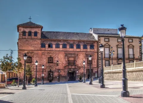
Located on the side of the church, the house of the priest is currently in the process of restoration after a time of abandonment.

Telecomunicaciones
Sitio web
www.aldeaquemada.com
Teléfono de contacto
680 104 199
Correo electrónico
turismo.aldeaquemada@gmail.com
Ubicación
Código Postal
23215
Latitud
38.412170
Longitud
-3.371710
Dirección
C/ Miguel Hernández, 4
Distrito
Municipio
Ubicación en el mapa
POINT (-3.37171 38.41217)
Tipos de punto de interés
Imágenes carrusel
imagen
Image
1.jpg
Imagen principal
Desactivado
Imágenes cabecera
imagen
Image
3.jpg
Imagen principal
Activado
Loading map
Preparing points of interest and routes...
The Civil Commander's House

Submitted by brandcode_deweloper on
Id
6549854
Descripción
Breve descripción

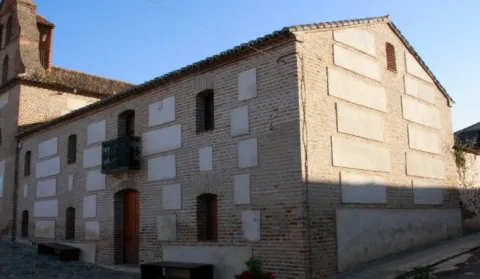
In the church, this house has had several functions, some of which are the City Council and currently the home of the retired. For many years it was used as a poultry of braves during the holidays.

Telecomunicaciones
Sitio web
www.aldeaquemada.com
Teléfono de contacto
680 104 199
Correo electrónico
turismo.aldeaquemada@gmail.com
Ubicación
Código Postal
23215
Latitud
38.411930
Longitud
-3.371660
Dirección
C/ Miguel Hernández, 4
Distrito
Municipio
Ubicación en el mapa
POINT (-3.37166 38.41193)
Tipos de punto de interés
Imágenes carrusel
imagen
Image
1001176.jpg
Imagen principal
Desactivado
Imágenes cabecera
imagen
Image
Aldeaquemada%20-%20Iglesia%20%281%29.jpg
Imagen principal
Activado
Loading map
Preparing points of interest and routes...
The Carrillera House

Submitted by brandcode_deweloper on
Id
4444747
Descripción
Descripción larga

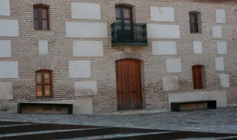
It is the oldest and largest house in the town, sent to build in the year 1,760. It was used as a house of the Carrillera and the posio, where food was stored to distribute to the people in the years of scarcity and drought.

It was also believed that the inquisition was established there because his shield was on the facade, but after successive studies the researchers concluded that the Court of the Inquisition was in another house and that only one member of it lived there. This house, other ancient people and the Church, are united by underground tunnels that come out of its wells and lead to the outskirts of the village.

Breve descripción

It is the oldest and largest house in the town, sent to build in the year 1,760. Known as Casa de la Carrillera or Casa Grande of the 17th century. It was used as a home of the Carrillera and the posio, where food was stored to distribute to the village in the years of scarcity and drought.

Telecomunicaciones
Sitio web
www.cazalilla.es/el-municipio/patrimonio-historico.html
Teléfono de contacto
953 537 131
Correo electrónico
castalla@cazalilla.es
Ubicación
Código Postal
23628
Latitud
37.984340
Longitud
-3.881640
Dirección
C/ Donantes de Sangre, 12
Distrito
Municipio
Ubicación en el mapa
POINT (-3.88164 37.98434)
Tipos de punto de interés
Imágenes cabecera
imagen
Image
casa-carrilera.jpg
Imagen principal
Activado
Loading map
Preparing points of interest and routes...
The Chaplaincy

Submitted by brandcode_deweloper on
Id
659644
Descripción
Descripción larga

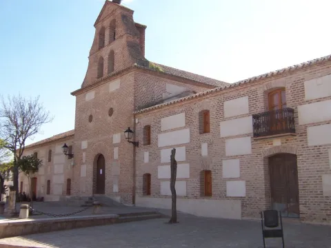
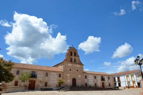
A small hermitage, which at the time made the school, brings to our head memories of past times. Its position allows it to have a privileged view over the nearby mountains, which you can know more in depth if you do the circular path of the Yelmo Chico, the PR-A 150 that part of the Capellania.

Breve descripción

Jars, rosemary and pines accompany the road leading to the Capellania. Small gardens between the pine trees and some olive trees lead to the area where the village is located. It has an immense central meadow with several roads that lead to the different houses.

Ubicación
Latitud
37.913575
Longitud
-3.011814
Municipio
Ubicación en el mapa
POINT (-3.011814 37.913575)
Tipos de punto de interés
Imágenes carrusel
imagen
Image
6%20%281%29.jpg
Imagen principal
Desactivado
imagen
Image
b4b8d505ab9cd1db1bf562f9e4900a0b40f1d770.jpeg
Imagen principal
Desactivado
Imágenes cabecera
imagen
Image
Cazorla_%2814277828194%29.jpg
Imagen principal
Activado
Loading map
Preparing points of interest and routes...
Marcas de calidad

La Ballestera y Montalvo

Submitted by brandcode_deweloper on
Id
659617
Descripción
Descripción larga

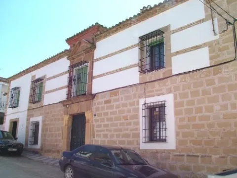
The crossbow is made up of two cores of houses separated by an old laundry room that awaits the arrival of people in laundry clothes. During the winter it has only four neighbors. It surprises the cleaning of the village and the freshness of the water that runs next to it. If you close your eyes you can discover that the silence is broken only by the rooster singing, the cat's maullido or the water running.

Next to the Ballestera we find Montalvo with a completely different landscape. It dominates an elevation that is accessed by a road that zigzaguea to the village and offers us impressive views over the valley. You can see narrow streets, narrow walls, houses recovered from ruin, all surrounded by privileged views of the valley.

Breve descripción

A very narrow road surrounded by trees leads us to the Ballestera. You will pass through a bread oven and an old haystack, witnesses from another time, from the self-sufficient past of this village. The gardens are intermingled with the pines and some olive trees, the result of the need to get oil before.

Ubicación
Latitud
38.148202
Longitud
-2.693707
Ubicación en el mapa
POINT (-2.693707 38.148202)
Tipos de punto de interés
Imágenes carrusel
imagen
Image
596_img.png
Imagen principal
Desactivado
imagen
Image
IMG_7633.JPG
Imagen principal
Desactivado
Imágenes cabecera
imagen
Image
ballesteraMontalvo%20%281%29.jpg
Imagen principal
Activado
Loading map
Preparing points of interest and routes...
Marcas de calidad

The Stone Wall

Submitted by brandcode_deweloper on
Id
4971000
Descripción
Breve descripción

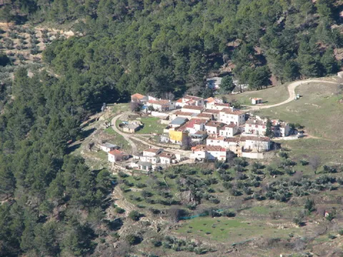
This is an old mud quarry next to the city centre. It has an artificial water lagoon very interesting for its ecological function.

Ubicación
Código Postal
23750
Latitud
37.973500
Longitud
-4.106650
Distrito
Municipio
Ubicación en el mapa
POINT (-4.10665 37.9735)
Tipos de punto de interés
Imágenes carrusel
imagen
Image
albarrada.png
Imagen principal
Desactivado
Imágenes cabecera
imagen
Image
Olivar.jpg
Imagen principal
Activado
Microsite al que pertenece
Loading map
Preparing points of interest and routes...
Karst of Pinar Negro

Submitted by brandcode_deweloper on
Id
876621
Descripción
Descripción larga

In the eastern part of the Sierra de Segura there is a spectacular karmic landscape, characterized by the presence of an exokarst of exceptional beauty with an immense field of dolins and uvalas, splashed with sims, of different scale. This karmic relief is controlled litologically and structurally, and conditioned by a high mountain climate, with level periods that accentuate the dissolution in karmic cavities. In this area, a carbonated altiplanicie that includes from the fields of Hernán Perea to those of the Black Pinar, stands out a series of simas, within dolinas and uvalas, among which stand out the one of the Campo del Espino, the one of the Hunzón, the one of the Cortijo, and mainly the very one of the Black Pinar.

The morphology of these cavities, with frequent balance chimneys, uses and some subhorizontal galleries, with clear structural control, reflects the importance of dissolution in the geomorphological evolution of them, with few examples of tectonic simas such. The most important of its development is that of the Black Pinar which is the sink of a large dolina of 105 x 130 m. In the area around the mouth a small channel runs through which a water course temporarily circulates that penetrates the cavity as a ponor. It has a large mouth (8 x 2 m.) that communicates with a large initial well of 10 x 16 m that descends to 104 m., where a second well of 40 m is started; reaching the bottom of the main track of the sima. Fifteen meters above the second well is the side track of smaller dimensions, but it reaches more depth, reaching more than 100 m.

Source: Inventory of Georresources of Andalusia. Environmental Council. Junta de Andalusia.

Breve descripción

Karst of Black Pinar

Ubicación
Latitud
38.298857
Longitud
-2.651877
Distrito
Ubicación en el mapa
POINT (-2.651877 38.298857)
Tipos de punto de interés
Imágenes carrusel
imagen
Image
10379407Master.jpg
Imagen principal
Desactivado
Imágenes cabecera
imagen
Image
800px-Campos_de_Hern%C3%A1n_Perea_24J_01.jpg
Imagen principal
Activado
Loading map
Preparing points of interest and routes...

Confluence of Miller

Submitted by brandcode_deweloper on
Id
913153
Descripción
Descripción larga

Here was born in the 1950s a village with the same name: Miller's Boards. This core was created to house the personnel employed in the construction of Miller's hydraulic power plant. To supply water to this plant the reservoirs of the Anchuricas (Segura River) and the Old River (Zumeta River) were built. The water jumps are 185 and 195 meters high respectively.

A magnificent view of Las Juntas is from the place known as the Loma del Paerón. To get to this point we recommend you make the route "Loma del Paerón" which is identified as PR-A 108. From here a natural lookout is opened before you to contemplate the valleys of the Zumeta and Segura rivers, and the union of both.

In front of the Loma are the Cañás de la Muela, where there is a large colony of leonado vulture, as well as the Iberian village of the Peñón de los Almendros, the village of Góntar... You're in a magical area worth discovering.

We suggest...

  • If you get to Miller's Boards after you have made a good route, where you have known villages like Miller, the Coke's Calar or the Eguijones' Cave, you certainly need to get a good dip (only in summer, of course...).
  • To know and remember the history of the following pineers who, until the 1950s of the 20th century, carried wood through the rivers, helped with hooks and shooting beasts.
  • There is a great book for hiking in the area: Valleys of the Segura River and Zumeta. It describes with precision and deep knowledge a series of routes that you will certainly love.

It is reached through the road JF-7038 from the town of Santiago de la Espada after 22 km. From Segura de la Sierra we can also reach the road in the direction of Rio Madera - La Toba - Miller's Boards. This way the distance is 54 km. and a time of about 1 hour.

Breve descripción

With this suggestive name we know the union of two important rivers of the Sierra de Segura: the Zumeta and the Segura. Together they say goodbye to Jaén - this peaceful and beautiful parachute - to enter the province of Albacete. From the bridge it is easy to imagine the ancient "pineros" preparing the logs that arrived from the two rivers and that would take them, after a fabulous journey, to the Mediterranean, with no tool other than a double-pointed hazelnut stick hook.

Ubicación
Latitud
38.298857
Longitud
-2.651877
Distrito
Ubicación en el mapa
POINT (-2.651877 38.298857)
Tipos de punto de interés
Imágenes carrusel
imagen
Image
19250548_143367852884610_5379292057515744177_o.jpg
Imagen principal
Desactivado
imagen
Image
17%20Las%20Juntas%20de%20Miller.jpg
Imagen principal
Desactivado
imagen
Image
6%20Juntas%20de%20Miller.JPG
Imagen principal
Desactivado
Imágenes cabecera
imagen
Image
43310356724_616217becc_b.jpg
Imagen principal
Activado
Loading map
Preparing points of interest and routes...