Saltar al contenido principal

Ascensiones a la Peña de Jaén and Tajos de la Mella

Submitted by brandcode_deweloper on
Id
2611103
Descripción larga

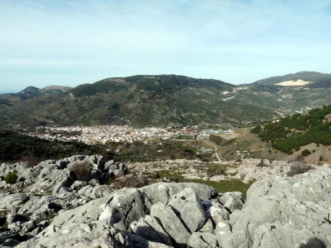
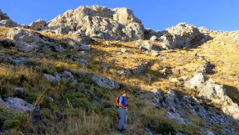
If we decide to ascend to the Peña de Jaén, to our left, we will take a path of goats that leads us to the ridge on the southern slope and that is quickly lost between the steep and sharp limestone skulls that make up the entire high area of this mountain. We will have to continue through this rocky terrain, trying to get close to the crest line and looking for the most appropriate steps, so the ascension is quite difficult. After 30 minutes we will be in one of the "peinets," as the mountaineers call these summits, on impressive cuts that fall lead to the North. Few cities count in their surroundings
immediate with a look as majestic as the one that offers us this emblematic rock.

The descent we can do on the opposite side by letting us fall down to the hill that forms the two combs and catch a sidewalk that descends at first with quite a slope between the slices, on a seemingly inaccessible terrain, and then turns left, bordering the mountain below the cliffs. It will lead us to the roof of the abrevadero.

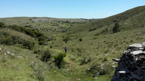
If we decide to ascend to the Tajos de la Mella and "crest them" we will have to take from the same hill a sidewalk that goes up to the right and that, through a small climb, allows us to place ourselves in the ridge line. The path is broken down and will have to continue, as in the case of the Peña de Jaén, very carefully, above the rocks, trying not to distance us from the ridge, but paying attention to the cliff, as we walk above slices of up to 70 and 80 meters. It is worth it, however, for the views that we will enjoy all the way. We will continue to the highest part (1245 m) and once the mountain has finished to come down on the West side to find an accessible step. We will go out near a stone shelter and from there we will take the road that descends us to the city.

From the roof we can also go through the lower sides, following some of the animal paths that go up parallel to them. This option presents less difficulty and may be interesting for those who go for climbing routes. Throughout more than 1 km of rock walls we will find a lot of them. It is a true paradise for climbers just a few minutes from the city.

Breve descripción

To ascend to the Peña de Jaén, without a doubt the most spectacular peak of these saws, it is best to do so on the northern side.
Latitud
37.7796
Longitud
-3.7849
Distrito
Municipio
Ubicación en el mapa
POINT (-3.7849 37.7796)
imagen
Image
9281686.jpg
Imagen principal
Activado
imagen
Image
Ascensiones%20a%20la%20Pe%C3%B1a%20de%20Ja%C3%A9n%20y%20Tajos%20de%20la%20Mella.jpg
Imagen principal
Desactivado

Nature

icon-intereses-naturaleza

Friends

icon-intereses-amigos

Adventure

icon-intereses-aventura

Culture

icon-intereses-cultura

Sport

icon-intereses-deporte

Eco-friendly

icon-intereses-eco-friendly

For couples

icon-intereses-en-pareja

Family

icon-intereses-familia

Gastronomy

icon-intereses-gastronomia

Municipality

icon-intereses-municipio

Low-cost tourism

icon-intereses-turismo-low-cost

Solo travel

icon-intereses-viajar-solo
Ascensiones a la Peña de Jaén y Tajos de la Mella
Desactivado

Approximate distance: 5.5 Km
Difficulty: Low to the hill and medium-high along the ridge.
Estimated time: 2 hours
Tramo de asfalto o cemento
 
Tramo de pista o camino forestal
 
Tramo de vía pecuaria
 
Tramo de senda
 

Cerro Media Luna

Submitted by brandcode_deweloper on
Id
2599231
Descripción larga

The first steps pass through the rail of Fries, but must be left immediately, at the first crossing: on the left hand side another lane goes back the lone ravine of the Arroyo del Vadillo. The rise, though long, 1 hour 25 minutes of march, does not offer difficulties for the walkers. The proud rocky scarves of the Solana del Morón will accompany during the first repulses.

A number of curves reach a farmer's cortijo. The road passes immediately to the right bank of the ravine, usually without water. The landscape changes. On the slopes, now of less sharp profile, small-sized chaperones grow and some I complain looking for the freshness of the umbria. After another tight zigzag, this longer time, the Navalayegua Collado is crowned at 1,500 meters high. At this point you have to leave the main lane, and go through an ancient era to take the road around the hill and die a little later.

A narrow path that goes up parallel to the wire is born next to the barren. This is the most uncomfortable part of the excursion, as thorny bushes sometimes make progress difficult. As you gain height, the tree vegetation disappears. On the top of the hill, the route is turning to the right, with the naked summit of the Cerro de la Media Luna, which is crowned in about 20 minutes. The return takes place on the same path as the one-way.

Breve descripción

The starting point of the excursion is in the upper part of Valdepeñas, near the football field. At the explanade next to the fountain, you can leave the car. The tour will take almost three hours

Latitud
37.6003
Longitud
-3.8301
Distrito
Ubicación en el mapa
POINT (-3.8301 37.6003)
imagen
Image
Vista_del_valle_del_Hilo_de_la_Vida.jpg
Imagen principal
Activado
imagen
Image
turismoActivo3.jpg
Imagen principal
Desactivado

Nature

icon-intereses-naturaleza

Friends

icon-intereses-amigos

Adventure

icon-intereses-aventura

Culture

icon-intereses-cultura

Sport

icon-intereses-deporte

Eco-friendly

icon-intereses-eco-friendly

For couples

icon-intereses-en-pareja

Family

icon-intereses-familia

Gastronomy

icon-intereses-gastronomia

Municipality

icon-intereses-municipio

Low-cost tourism

icon-intereses-turismo-low-cost

Solo travel

icon-intereses-viajar-solo
Cerro Media Luna
Desactivado
Tramo de asfalto o cemento
 
Tramo de pista o camino forestal
 
Tramo de vía pecuaria
 
Tramo de senda
 

Colada de Valdepeñas

Submitted by brandcode_deweloper on
Id
2599201
Descripción larga

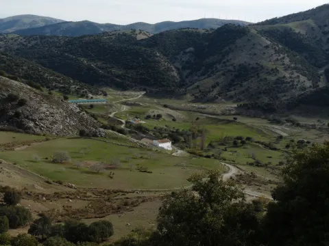
Once an altozane is reached, the panorama opens and an era serves as an unconventional lookout. Shortly after and already practically horizontal, the lane draws a recess next to the abrevadero of a semi-noise cortijo.

After the ruins, the pecuary road is diverted by a less obvious road that goes back a small uncamped ravine. When you reach the highest area you have to turn back, now to the left and on the path that borders the olive tree. A short time later, he will be in a lane that will go to a crossing.

The road on the left is fork right away. The left branch will be where it returns and the other one goes down in the direction of the Cortijo de Nogueruelas. After passing through the buildings, it goes back up to a hill where another cortijo is located.

At this point you must cross the access gate to a cherry plantation, and leave two lanes to the left. Shortly before the olive tree starts a path that goes up to the hill, just at the foot of Cerro La Martina and the breakers where the route ends.

To return, it descends on the same path to the first cortijo, for this time to take the lane on the right that runs on half a hillside.

Breve descripción

The excursion leaves Charilla, a village of Alcalá la Real, and lasts about 2 and a half hours. In the Plaza Real you take the Calle de la Fuente that leads to the outskirts of the village, where it becomes a lane of land. After about 5 minutes of march another lane appears to the left. From this point on, the route is always close to the route of a pecuary road, the old Colada de Valdepeñas.

Latitud
37.5939
Longitud
-3.8125
Distrito
Municipio
Ubicación en el mapa
POINT (-3.8125 37.5939)
imagen
Image
4915776Master.jpg
Imagen principal
Activado
imagen
Image
Colada%20de%20Valdepe%C3%B1as.jpg
Imagen principal
Desactivado

Nature

icon-intereses-naturaleza

Friends

icon-intereses-amigos

Adventure

icon-intereses-aventura

Culture

icon-intereses-cultura

Sport

icon-intereses-deporte

Eco-friendly

icon-intereses-eco-friendly

For couples

icon-intereses-en-pareja

Family

icon-intereses-familia

Gastronomy

icon-intereses-gastronomia

Municipality

icon-intereses-municipio

Low-cost tourism

icon-intereses-turismo-low-cost

Solo travel

icon-intereses-viajar-solo
Colada de Valdepeñas
Desactivado

Source of Tercero

Submitted by brandcode_deweloper on
Id
2599120
Descripción larga

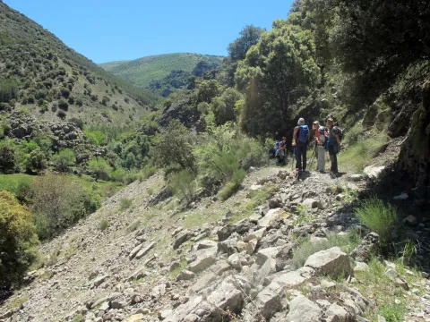
Not far from the road and just in front of the cortijo, it starts on the right a signposted path parallel to the stream, which later must be watered shortly before the wire. Once on the other side, the explanade is crossed in search of a path that penetrates the beautiful throat of the Arroyo de la Fresnedilla.

The ravine gradually narrows and forces several times to change the shore. At the confluence with another stream and after walking about 25 minutes, the ravine opens. At this point you have to move to the right margin to link with a dirt lane. The road now accompanies the rising river bed, on some occasions on the right bank and on others, on the opposite. Unavoidably, you have to go through the channel several times, and if it has a lot of water, you will even have to go down on more than one occasion.

Finally, the lane disappears. The route continues to jump from one bank to another in search of the most comfortable steps to a dam and waterfall, after an hour and ten minutes.

It is taken on the right bank, the sidewalk of the acequia that used to carry the water from the chorreta to the old light factory, in the Barranco de Valdearazo. Place where the route ends.

Breve descripción

To get to the place of departure of the excursion you have to take, at the exit of Fries, the asphalt lane that leads to the cortijos of Los Rosales and Cerezo Gordo. After leaving to the right the zigzagueante lane of Noalejo, reach the Portillo Pinatero and from there descends directly to the Cortijo de La Fresnedilla where the car is left.

Latitud
37.9004
Longitud
-2.9901
Distrito
Municipio
Ubicación en el mapa
POINT (-2.9901 37.9004)
imagen
Image
tercero.jpg
Imagen principal
Activado
imagen
Image
turismoActivo10.jpg
Imagen principal
Desactivado

Nature

icon-intereses-naturaleza

Friends

icon-intereses-amigos

Adventure

icon-intereses-aventura

Culture

icon-intereses-cultura

Sport

icon-intereses-deporte

Eco-friendly

icon-intereses-eco-friendly

For couples

icon-intereses-en-pareja

Family

icon-intereses-familia

Gastronomy

icon-intereses-gastronomia

Municipality

icon-intereses-municipio

Low-cost tourism

icon-intereses-turismo-low-cost

Solo travel

icon-intereses-viajar-solo
Nacimiento del Tercero
Desactivado

Puerto de la Nava

Submitted by brandcode_deweloper on
Id
2597181
Descripción larga

On the same roof, two lanes are born, the one on the left side ends in a few meters in the New Cortijo. Right behind a waterfront begins the path of the Port of the Navy. The first section of the climb runs under the vertical flannel of the saw of La Pandera, through a rugged forest of sparrows and Mediterranean bushes.

Later on, the trees give way to a pallet and thorny vegetation. The height gained already allows you to enjoy splendid panoramic views over the Quebrajano Embalse and the surrounding mountains. Then the path is transformed into a beautiful steep sidewalk that is twisted by the abrupt and rough hillside. It straps three sticks of wires that limit pastures and municipalities. Finally, the sidewalk reaches an altozane where it ends abruptly after 50 minutes of march.

The aggressiveness of the land is lost in this herbous raid presided by a corpulent oak; it is the ideal point to delight with the panoramic views, now much more dilated.

To complete the route it is possible to approach the same Port of La Nava in about 20 minutes. First, it is necessary to descend to the bottom of a garden, where an abrevadero is located. Then it rises through a forest of pine trees intermingled with some other year old oak, until it finds the highest point of a calvero.

Breve descripción

From Valdepeñas you follow the road towards Jaén. After the gas station and a bridge, a paved lane is set off to the right, which goes up to the port of the Coberteras, the starting point of the excursion.

Latitud
38.0201
Longitud
-2.7103
Distrito
Municipio
Ubicación en el mapa
POINT (-2.7103 38.0201)
imagen
Image
DSC00553.JPG
Imagen principal
Activado
imagen
Image
Puerto%20de%20la%20Nava.jpg
Imagen principal
Desactivado

Nature

icon-intereses-naturaleza

Friends

icon-intereses-amigos

Adventure

icon-intereses-aventura

Culture

icon-intereses-cultura

Sport

icon-intereses-deporte

Eco-friendly

icon-intereses-eco-friendly

For couples

icon-intereses-en-pareja

Family

icon-intereses-familia

Gastronomy

icon-intereses-gastronomia

Municipality

icon-intereses-municipio

Low-cost tourism

icon-intereses-turismo-low-cost

Solo travel

icon-intereses-viajar-solo
Puerto de la Nava
Desactivado
Tramo de asfalto o cemento
 
Tramo de pista o camino forestal
 
Tramo de vía pecuaria
 
Tramo de senda
 

Mingo

Submitted by brandcode_deweloper on
Id
1909247
Descripción larga

How to get there. -7 km from Jaén capital. Access is a little complicated. Take the road that leads to Puente de la Sierra; after passing a small urbanization of shawls, 50 meters from the kilometric milestone take the asphalt deviation that comes to the right. Continue without diverting to a point where it is fork in two, then take the right track and reach a chain that prevents us from passing. From here we have to continue to an old cortijo where the road is over. Taking as reference the walls of the Mingo (another area) in front of us, continue to the right on a low marked road that leads us to the Canjorro.

Right at the entrance of this popular school, it comes down first by the olive grove and then through a vaguada, until it comes, about 10 minutes later, following a little marked path, to the river, right in front of one of the most spectacular walls. We cross the river and to the left we take a smooth upward path that leads five minutes to the Inkilino sector. To reach other sectors you have to continue along this path to a wire, and to the right, in the direction of the larger sectors.

Breve descripción

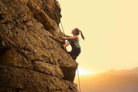
The area is of high quality landscape. It is a classic wall par excellence in which the sports sector known as the Inkilino has recently been equipped. It has a long approach, good possibilities and for the moment few routes. In this area there are alternating paths of sports climbing and classical climbing. Some routes require an explosive escalation, especially in the extrusions. The anchorages we found are reliable. The average height is 15 meters. The maximum height is 25 meters.

Latitud
37.764682
Longitud
-3.790903
Distrito
Municipio
Ubicación en el mapa
POINT (-3.790903 37.764682)
imagen
Image
shutterstock_1054327565%20%281%29.jpg
Imagen principal
Activado
imagen
Image
shutterstock_1512767882.jpg
Imagen principal
Desactivado
imagen
Image
shutterstock_1494195701.jpg
Imagen principal
Desactivado

Friends

icon-intereses-amigos

Nature

icon-intereses-naturaleza

Adventure

icon-intereses-aventura

Solo travel

icon-intereses-viajar-solo

Gastronomy

icon-intereses-gastronomia

Sport

icon-intereses-deporte

Municipality

icon-intereses-municipio

For couples

icon-intereses-en-pareja
Mingo
Desactivado

Number of routes:4

You're up to V:0%

Votes from V + to 6c +:0%

Vies from 7a to 7c +:90%

Eight-way:0%

Best time:From spring to autumn

Where to drink. -There's no water in the vicinity.

Coordenadas / Huso 30S
30S x = 430339 and = 4180001
Tramo de asfalto o cemento
 
Tramo de pista o camino forestal
 
Tramo de vía pecuaria
 
Tramo de senda
 

Trail Cerrillo del Plomo

Submitted by brandcode_deweloper on
Id
7437810
Breve descripción

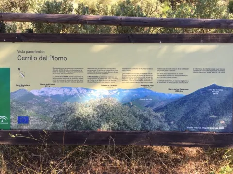
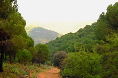
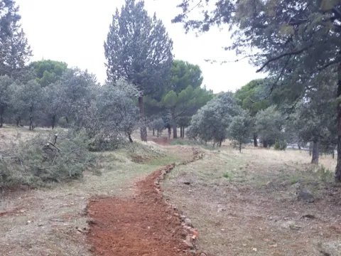
The Cerrillo del Plomo was one of the most productive mines during the Roman period, being one of the most important deposits in Spain for the extraction of galena, both for its production and for the quality of the mineral extracted. The galena is a mineral of the group of sulphides from which lead and silver are extracted.

Under the rule of the Roman Empire, this silver was sent to Rome, while lead was used to make coins, vessels and cover pipes and roofs. In the mid-20th century, the miners called sacageneros removed the bowels of this hill in search of the remains of lead that the Romans did not extract.

Latitud
37.8302
Longitud
-3.4404
Distrito
Ubicación en el mapa
POINT (-3.4404 37.8302)
imagen
Image
Sendero%20Cerrillo%20del%20Plomo%202.jpg
Imagen principal
Activado
imagen
Image
Sendero%20Cerrillo%20del%20Plomo.jpg
Imagen principal
Desactivado
45 min

Nature

icon-intereses-naturaleza

Friends

icon-intereses-amigos

For couples

icon-intereses-en-pareja

Family

icon-intereses-familia

Low-cost tourism

icon-intereses-turismo-low-cost

Solo travel

icon-intereses-viajar-solo
Medium
Sendero Cerrillo del Plomo
1,1 km
On foot
All year round
Desactivado
  • In front of COVID19, keep the safety distance and carry a mask, avoid agglomerations and contact with surfaces, wash your hands frequently, use hydroalcoholic gel and consult the available digital materials. Take care of your health and others.
  • It works to prevent fires. Do not throw cigarettes or any other object that produces combustion.
  • By consuming local products and having companies in the area you will contribute to rural development.
  • He lives with the local people and other users. It respects private property and property.
  • Unwind in a sustainable way: public transport, bike, walk, shared vehicle...
  • Noise is another form of pollution. In silence you will enjoy your experience more.
  • It facilitates the use of people with special needs.
  • The trash doesn't come back alone. Take her with you to the nearest container. Reduce, reuse, recycle.
  • Don't leave a mark on your way through nature.
  • It practices a responsible and committed tourism with the environment. Be a real ecotourist!
  • Respect the facilities at your disposal. We all pay for your maintenance.
  • Check the weather forecast before starting your activity.
  • Avoid going out alone. If you do, it communicates tour and time of return to other people.
  • Extreme caution under adverse conditions and with the occasional presence of animals or motor vehicles.
  • Please provide prior information on the possible existence of cynegetic activity.
  • It has water, sun protection, proper clothes and shoes.
  • It carries a mobile with enough battery in case of emergency (112), but remember that there is not always coverage.
  • Don't even bother animals. You would negatively alter his behavior.
  • For your safety and the safety of the environment, don't get out of the signposted road or take shortcuts.
  • Remember that the capture of animals, light fire, fish and collect plants or minerals is prohibited.
  • If you bring a dog, take him with his strap and make sure he doesn't bother other animals or people.
  • Your safety is our concern, but it's your responsibility.

Thank you for your cooperation!

On the A-4 E-5 Highway, at the height of La Carolina we will take Exit 270, to follow the JA-6100 road, which will lead us to El Centenillo. At the entrance of the village there is a track on the right that descends to the beginning of the path.

Tramo de asfalto o cemento
 
Tramo de pista o camino forestal
 
Tramo de vía pecuaria
 
Tramo de senda
 

Trail Balcón de Despeñaperros

Submitted by brandcode_deweloper on
Id
7396151
Descripción larga

If taken in the sense of the clockwise from the point of start, the path enters
quickly in a pine pine pineapple pineapple pineapple with some
Pines resineros, cypresses and oaks. The first 350 meters of path run through an area
trees with abundant shadows and free of shrubs, as it constitutes the safety zone against
camping fires. This makes this section an ideal site for mushroom search in the autumn.
The path continues another 170 meters through a more intricate area of Mediterranean vegetation in the
that abounds the rosemary and the jars under the tree, which leads us to a spectacular lookout
Panoramic suspended on the old road N-IV. From the viewpoint you have an unparalleled vision
of the Natural Park, as the path is located on the South end. The panoramic view of 180
degrees allows to see the whole mountain of Despeñacos from the Collado de la Estrella, the Port of the King, he
Salto del Fraile, Navavacas, the Castle of Castro Ferral and following the line of the Collado de la
Star to the East, you can see the Paso de Despeñacolos and to its right the Collado de los
Gardens from where the park looks at Aldeaquemada.

Leaving the lookout behind, the path runs 900 meters through an old wooden draw track
completely flat through a lush mixed forest of pine, cypress, oak and cork,
where again the noble bush of the Mediterranean mountain gives a touch of naturality to the visitor
which loses the notion of distance to the people, but which, let us not forget, is just over 1 km from
distance.


Arrived at the end of the track, the path turns abruptly to the right to return to St. Helena
using a wider forest path, which also runs under a canopy of pineapple pine
Great. It is from that point where the only difficulty of the path is found, for during
400 meters is raised by a light cost with a slope about 5% to reach the
limit of the park where again it becomes completely flat. The final section runs through an area of
transition between forest and agricultural space, bordering just the southern perimeter of the campsite
Cracking dogs, passing through their access door and ending right where it started.

The path shows as main attractions its closeness to the people of St. Helena, its affability,
the abundance of shadows for hot days, the great botanical biodiversity and, above
all, the privileged views from the viewpoint that invites to let the imagination fly contemplating
this unparalleled landscape and, why not, to reflect on the countless travelers of so many cultures
who have used this natural passage between the plateau and Andalusia.

Breve descripción

This new path has a length of almost 4 km. and being circular can be performed in both
senses. It starts in the corner that gives access to the Camping Despeñacolos, next to the old section of
the N-IV, on the outskirts of the town of St. Helena.

Latitud
38.4003
Longitud
-3.5201
Distrito
Municipio
Ubicación en el mapa
POINT (-3.5201 38.4003)
imagen
Image
Sendero%20Balc%C3%B3n%20de%20Despe%C3%B1aperros.jpg
Imagen principal
Activado
imagen
Image
Sendero%20Balc%C3%B3n%20de%20Despe%C3%B1aperros1.jpg
Imagen principal
Desactivado
1 h

Nature

icon-intereses-naturaleza

Friends

icon-intereses-amigos

Adventure

icon-intereses-aventura

Culture

icon-intereses-cultura

Sport

icon-intereses-deporte

Eco-friendly

icon-intereses-eco-friendly

For couples

icon-intereses-en-pareja

Family

icon-intereses-familia

Gastronomy

icon-intereses-gastronomia

Municipality

icon-intereses-municipio

Low-cost tourism

icon-intereses-turismo-low-cost

Solo travel

icon-intereses-viajar-solo
Baja
Sendero Balcón de Despeñaperros
3,8 km
On foot
All year round
Desactivado
  • In front of COVID19, keep the safety distance and carry a mask, avoid agglomerations and contact with surfaces, wash your hands frequently, use hydroalcoholic gel and consult the available digital materials. Take care of your health and others.
  • It works to prevent fires. Do not throw cigarettes or any other object that produces combustion.
  • By consuming local products and having companies in the area you will contribute to rural development.
  • He lives with the local people and other users. It respects private property and property.
  • Unwind in a sustainable way: public transport, bike, walk, shared vehicle...
  • Noise is another form of pollution. In silence you will enjoy your experience more.
  • It facilitates the use of people with special needs.
  • The trash doesn't come back alone. Take her with you to the nearest container. Reduce, reuse, recycle.
  • Don't leave a mark on your way through nature.
  • It practices a responsible and committed tourism with the environment. Be a real ecotourist!
  • Respect the facilities at your disposal. We all pay for your maintenance.
  • Check the weather forecast before starting your activity.
  • Avoid going out alone. If you do, it communicates tour and time of return to other people.
  • Extreme caution under adverse conditions and with the occasional presence of animals or motor vehicles.
  • Please provide prior information on the possible existence of cynegetic activity.
  • It has water, sun protection, proper clothes and shoes.
  • It carries a mobile with enough battery in case of emergency (112), but remember that there is not always coverage.
  • Don't even bother animals. You would negatively alter his behavior.
  • For your safety and the safety of the environment, don't get out of the signposted road or take shortcuts.
  • Remember that the capture of animals, light fire, fish and collect plants or minerals is prohibited.
  • If you bring a dog, take him with his strap and make sure he doesn't bother other animals or people.
  • Your safety is our concern, but it's your responsibility.

Thank you for your cooperation!

It starts in the urban centre of Santa Elena, next to the campsite Despeñacolos (C / Infanta Elena
s / n).

Tramo de asfalto o cemento
 
Tramo de pista o camino forestal
 
Tramo de vía pecuaria
 
Tramo de senda
 

Route Santuario-Jabalí

Submitted by brandcode_deweloper on
Id
7394904
Descripción larga

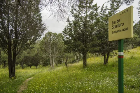
At the beginning of this path is a view of the Sanctuary of the Virgin of the Head, continuing to the East on a forest track. We immediately take a right turn, entering between jars, rosemary and lentils.

The path passes through an ancient herd of cattle, to then cross the forest track of the Membrellejo, used for the access of reels from Andújar and Marmolejo to the Sanctuary during the celebration of the annual Romeria.

It continues between the vegetation of the Mediterranean Mount, it can be seen the Pantano del Encinarejo, and the road that unites the populations of Andújar and Puertollano, beginning a slight down to reach the recreational area of El Jabali, where this path ends

Breve descripción

It is a small walk that will lead us from the surroundings of the Cerro del Cabezo to the Jabali Recreative Area.

Latitud
37.9201
Longitud
-3.0102
Distrito
Municipio
Ubicación en el mapa
POINT (-3.0102 37.9201)
imagen
Image
Ruta%20Santuario-Jabal%C3%AD1.jpg
Imagen principal
Activado
imagen
Image
Ruta%20Santuario-Jabal%C3%AD.jpg
Imagen principal
Desactivado
30 min (solo ida)

Nature

icon-intereses-naturaleza

Friends

icon-intereses-amigos

Adventure

icon-intereses-aventura

Culture

icon-intereses-cultura

Sport

icon-intereses-deporte

Eco-friendly

icon-intereses-eco-friendly

For couples

icon-intereses-en-pareja

Family

icon-intereses-familia

Gastronomy

icon-intereses-gastronomia

Municipality

icon-intereses-municipio

Low-cost tourism

icon-intereses-turismo-low-cost

Solo travel

icon-intereses-viajar-solo
Baja
Ruta Santuario-Jabalí
2 km (solo ida)
All year round
Desactivado
  • In front of COVID19, keep the safety distance and carry a mask, avoid agglomerations and contact with surfaces, wash your hands frequently, use hydroalcoholic gel and consult the available digital materials. Take care of your health and others.
  • It works to prevent fires. Do not throw cigarettes or any other object that produces combustion.
  • By consuming local products and having companies in the area you will contribute to rural development.
  • He lives with the local people and other users. It respects private property and property.
  • Unwind in a sustainable way: public transport, bike, walk, shared vehicle...
  • Noise is another form of pollution. In silence you will enjoy your experience more.
  • It facilitates the use of people with special needs.
  • The trash doesn't come back alone. Take her with you to the nearest container. Reduce, reuse, recycle.
  • Don't leave a mark on your way through nature.
  • It practices a responsible and committed tourism with the environment. Be a real ecotourist!
  • Respect the facilities at your disposal. We all pay for your maintenance.
  • Check the weather forecast before starting your activity.
  • Avoid going out alone. If you do, it communicates tour and time of return to other people.
  • Extreme caution under adverse conditions and with the occasional presence of animals or motor vehicles.
  • Please provide prior information on the possible existence of cynegetic activity.
  • It has water, sun protection, proper clothes and shoes.
  • It carries a mobile with enough battery in case of emergency (112), but remember that there is not always coverage.
  • Don't even bother animals. You would negatively alter his behavior.
  • For your safety and the safety of the environment, don't get out of the signposted road or take shortcuts.
  • Remember that the capture of animals, light fire, fish and collect plants or minerals is prohibited.
  • If you bring a dog, take him with his strap and make sure he doesn't bother other animals or people.
  • Your safety is our concern, but it's your responsibility.

Thank you for your cooperation!

Tramo de asfalto o cemento
 
Tramo de pista o camino forestal
 
Tramo de vía pecuaria
 
Tramo de senda
 

Signposted Trail Camino Viejo: Sections Los Cerrillos-San Ginés

Submitted by brandcode_deweloper on
Id
6474117
Descripción larga

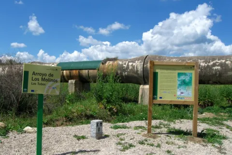
To take this path we will have to go to the northern part of the urban town of Andújar and from the cemetery take the Old Way or the San Amasio Way. The road is a track of land with good firm, up to the kilometer 1.9 where is the area known as Los Tubos, where the track is crossed by a huge tube of the Rumblar Canal.

In the area known as the "Tubos" is located the zero km of the route Camino Viejo - Cordel de los Molinos. From this point on the track through which we travel, it has worse firm, but it is passable by all-terrain vehicles for 900 meters more, until it reaches a rest area for the pilgrims and the sign of the beginning of the path. The starting signal is located next to a metal door that we will have to close to us to start the path on foot, on horse or by bicycle.

Breve descripción

IMPORTANT AVISO

As a preventive measure to prevent the contagion of COVID19, this path must be carried in the sense indicated in the starting sign.

The trail Los Cerrillos is part of the Old Way, used by the pilgrims to climb from Andújar to the Sanctuary of the Virgin of the Head. Part of the site known as Los Cerrillo and reaches the Hermitage of San Ginés, a traditional meeting point for pilgrims.

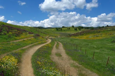
The path gently ascends from the countryside, crosses through areas of livestock pastures and goes into the Sierra, crossing mountains covered with oak trees, cantuesos and jaras. During the flowering season, in April and May, the landscape becomes especially attractive.

It is worth walking this path in order to see an interesting panorama of Andújar and the countryside of the Guadalquivir valley and to go through the intertwined paths excavated on the slate rocks by the continued passage of thousands of pilgrims: walkers, cyclists and riders

Latitud
38.0902
Longitud
-4.0101
Distrito
Municipio
Ubicación en el mapa
POINT (-4.0101 38.0902)
imagen
Image
1636_SS_03.jpg
Imagen principal
Activado
imagen
Image
1636_SS_04.jpg
Imagen principal
Desactivado
imagen
Image
1636_SS_01.jpg
Imagen principal
Desactivado
2 h

Nature

icon-intereses-naturaleza

Friends

icon-intereses-amigos

Adventure

icon-intereses-aventura

Culture

icon-intereses-cultura

Sport

icon-intereses-deporte

Eco-friendly

icon-intereses-eco-friendly

For couples

icon-intereses-en-pareja

Family

icon-intereses-familia

Gastronomy

icon-intereses-gastronomia

Municipality

icon-intereses-municipio

Low-cost tourism

icon-intereses-turismo-low-cost

Solo travel

icon-intereses-viajar-solo
Sendero Señalizado Camino Viejo: Tramos Los Cerrillos-San Ginés
5,5 km
On foot
All year round
Desactivado
  • In front of COVID19, keep the safety distance and carry a mask, avoid agglomerations and contact with surfaces, wash your hands frequently, use hydroalcoholic gel and consult the available digital materials. Take care of your health and others.
  • It works to prevent fires. Do not throw cigarettes or any other object that produces combustion.
  • By consuming local products and having companies in the area you will contribute to rural development.
  • He lives with the local people and other users. It respects private property and property.
  • Unwind in a sustainable way: public transport, bike, walk, shared vehicle...
  • Noise is another form of pollution. In silence you will enjoy your experience more.
  • It facilitates the use of people with special needs.
  • The trash doesn't come back alone. Take her with you to the nearest container. Reduce, reuse, recycle.
  • Don't leave a mark on your way through nature.
  • It practices a responsible and committed tourism with the environment. Be a real ecotourist!
  • Respect the facilities at your disposal. We all pay for your maintenance.
  • Check the weather forecast before starting your activity.
  • Avoid going out alone. If you do, it communicates tour and time of return to other people.
  • Extreme caution under adverse conditions and with the occasional presence of animals or motor vehicles.
  • Please provide prior information on the possible existence of cynegetic activity.
  • It has water, sun protection, proper clothes and shoes.
  • It carries a mobile with enough battery in case of emergency (112), but remember that there is not always coverage.
  • Don't even bother animals. You would negatively alter his behavior.
  • For your safety and the safety of the environment, don't get out of the signposted road or take shortcuts.
  • Remember that the capture of animals, light fire, fish and collect plants or minerals is prohibited.
  • If you bring a dog, take him with his strap and make sure he doesn't bother other animals or people.
  • Your safety is our concern, but it's your responsibility.
  • Thank you for your cooperation!