Saltar al contenido principal

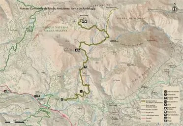
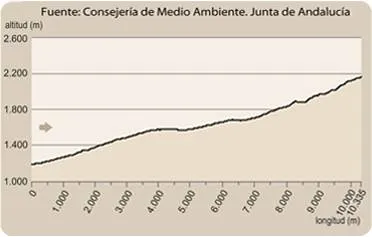
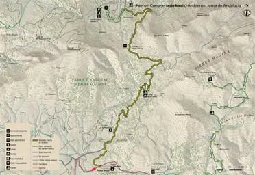
ALTERNATIVE GR 247.1 STAGE 2: Río Madera - Segura de la Sierra

Submitted by brandcode_deweloper on
Id
2573138
Breve descripción

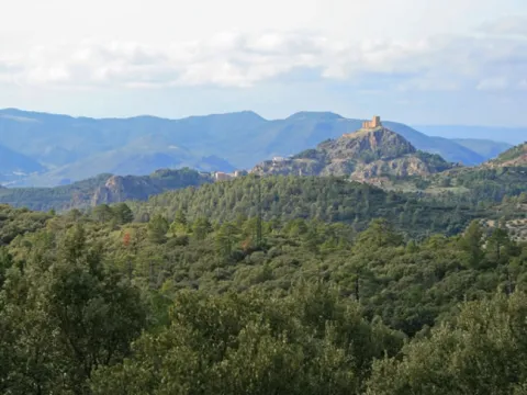
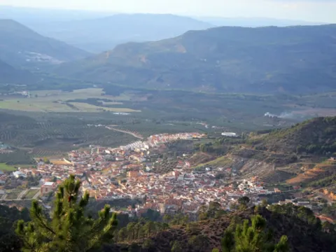
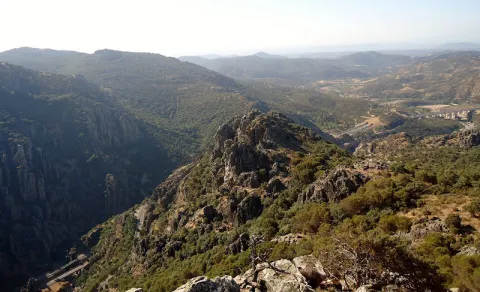
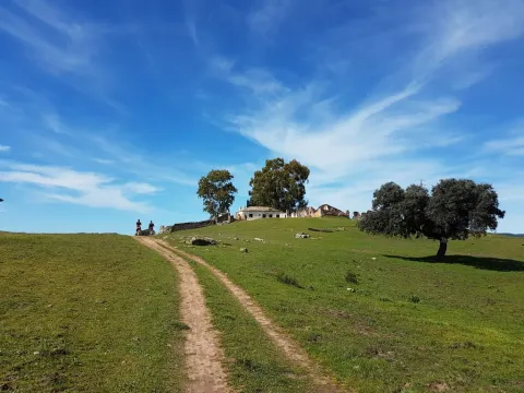
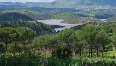
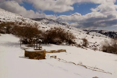
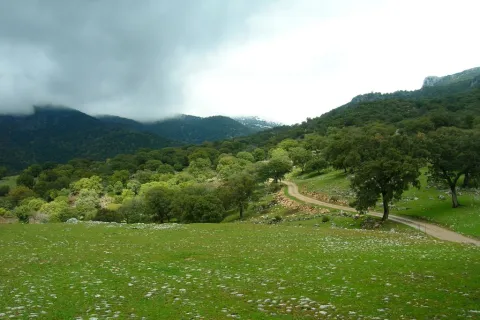
This stage has all the ingredients to be one of the most varied and enjoyable of the Southern Forest Path. It travels through forests that have been described as the best pineapples of laricio in Spain; it passes through the relaxing Valle del Río Madera; it passes through tiny white villages surrounded by orchards and fruit, such as Arroyo Canales and Moralejos; it runs in some of its sections by narrow traditional paths that have been recovered for the practice of hiking; it allows to see wide panorama at some of its points; it makes it easier to know the place of Segura La Vieja, of archaeological interest; and it ends in the Historic-Artistic Set of Segura de la Sierra.

Can you ask for more? Yes, the possibility that offers the walker to combine to his taste various routes along the different signposted roads in the area, developing circular routes to his / her measure.

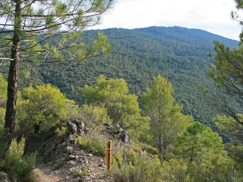
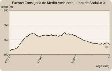
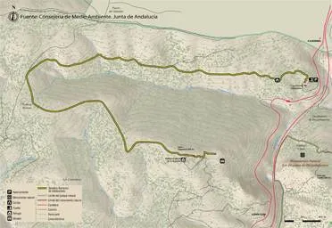
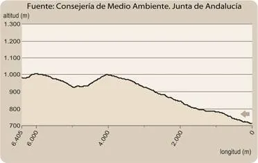
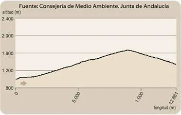
The Stage is a continuous up and down by forest-covered mountains. It starts by making a loop that begins and ends in the Valle de Río Madera, which then travels for 1.7 kilometers to leave it up again on a hillside with dense pine and oak. After the Collado Verjaga the route is facing the village of Moralejos down the well-preserved slopes of the Dehesa Carnicera, full of trees.

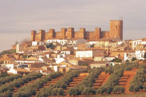
The two districts of Moralejos, the one in the Upper and the one in the Lower, will captivate the walker because they are the purest expression of the rural environment of the mountain villages. Later, if desired, a detour allows you to climb to Segura la Vieja, where there are remains of an old population and from where you can see unforgettable panoramic views. Segura de la Sierra is the golden brooch for a route like this, with its castle, its Arab Bath and its white streets from which time and again we are surprised by the contrast between the intimate and family corners and the vast views that are contemplated.

Latitud
38.1302
Longitud
-2.5701
Distrito
Ubicación en el mapa
POINT (-2.5701 38.1302)
imagen
Image
1.jpg
Imagen principal
Activado
imagen
Image
2.jpg
Imagen principal
Desactivado
imagen
Image
3.jpg
Imagen principal
Desactivado
imagen
Image
4.jpg
Imagen principal
Desactivado
imagen
Image
5.jpg
Imagen principal
Desactivado
imagen
Image
6.jpg
Imagen principal
Desactivado
imagen
Image
7.jpg
Imagen principal
Desactivado
imagen
Image
8.jpg
Imagen principal
Desactivado
imagen
Image
9.jpg
Imagen principal
Desactivado
imagen
Image
10.jpg
Imagen principal
Desactivado
imagen
Image
11.jpg
Imagen principal
Desactivado
imagen
Image
12.jpg
Imagen principal
Desactivado
imagen
Image
13.jpg
Imagen principal
Desactivado
imagen
Image
14.jpg
Imagen principal
Desactivado
imagen
Image
15.jpg
Imagen principal
Desactivado
imagen
Image
16.jpg
Imagen principal
Desactivado
imagen
Image
17.jpg
Imagen principal
Desactivado
5 h 57 min

Nature

icon-intereses-naturaleza

Friends

icon-intereses-amigos

Adventure

icon-intereses-aventura

Culture

icon-intereses-cultura

Sport

icon-intereses-deporte

Eco-friendly

icon-intereses-eco-friendly

For couples

icon-intereses-en-pareja

Family

icon-intereses-familia

Gastronomy

icon-intereses-gastronomia

Municipality

icon-intereses-municipio

Low-cost tourism

icon-intereses-turismo-low-cost

Solo travel

icon-intereses-viajar-solo
Medium
Río Madera - Segura de la Sierra
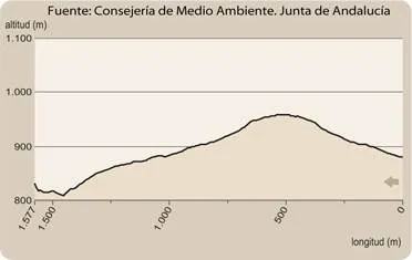
17,6 km
338m
796m
883m
2
1
2
3
On foot
All year round
Activado
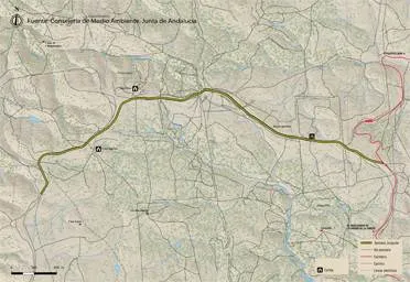
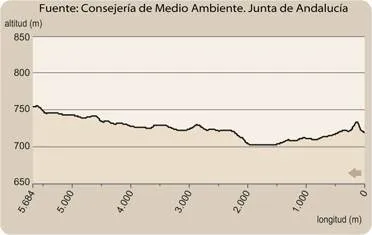
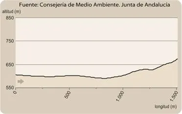
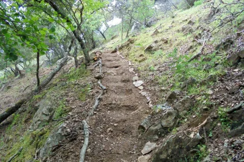
Much of this stage runs along paths. Between points 1 and 3, as well as between 4 and 5, there are sections with strong slopes and very irregular terrain. At the kilometer 12.1 there are stairs.
Arroyo Canales, Cortijo de los Espinos, Valle de Río Madera, Moralejos de Baja, Moralejos de Escalo, La Tejadilla, Segura de la Sierra.

On the path: Segura de la Sierra
Near the path: Orcera

No.

Months governed by admirals

Thematic space of the Maritime Province in Orcera. The larity pines that are seen along this route, with their straight and high trunks, have been one of the keys to the historic development of the Sierra de Segura, as the excellent aptitude of their wood for civil and naval construction made them a very coveted resource. To the point that, as strange as it may seem to us today, there were times when all these mountains belonged to the so-called Segura de la Sierra Maritime Province, whose declaration in 1748 had a strategic importance of first order for the State, which thus ensured the supply of wood for the construction of warships.
On that date, Marine Ordinances came into force, which made the old Ordinances of the Segura Common and its Earth (discussed in Stage 1) a wet paper. There was an undeclared - but drastic - expropriation of the communal mountains of those who lived most of the serrans and a strong social trauma that caused many conflicts.

The neighbors did not benefit from the enormous value of wood, suffering from rigid and repressive management by the Navy authorities, which established a special court in Orcera. The Councils, whose coffers were fed up until then from the sale of wood, were ruined, and the livestock was also severely damaged by the restrictions imposed on them.

The Ministry of the Navy intended to preserve the forest wealth, but failed by the bureaucracy, corruption and conflicts with the Ministry of Finance, with which it was turned in the short ones, causing a strong deforestation of this time it is known that it changed the composition of the forests to a large extent, passing to pinars a large part of the old encinars, complaints and melojars of high ecological value.

This surrealist maritime province lasted until 1836, although the Pine of Segura, as then called the larix pine, continued to contribute a large percentage of the wood with which some of the ships of the largest tonnage were built that were manufactured in the second half of the 19th century.

Wood River

Sierra insurance

Coordenadas / Huso 30S
According to Projection UTM Datum ETRS89
Tramo de asfalto o cemento
18.29%
Tramo de pista o camino forestal
40.74%
Tramo de vía pecuaria
0
Tramo de senda
40.97%

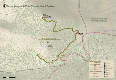
Route card

Km 0

Arroyo Canales (Río Madera)

Esta Etapa comienza en la pequeña aldea de Arroyo Canales, que está a apenas cinco minutos de la de Río Madera. Son muy pocos los habitantes que viven en ellas durante todo el año, pero el paraje no puede ser más seductor, con las pequeñas casitas blancas rodeadas de grandes pinares en el fondo de un fresco y angosto valle.

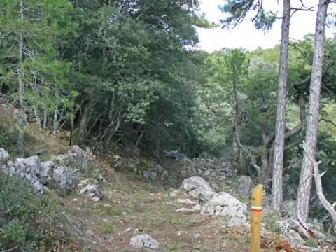
Encontramos el panel de inicio en la carretera que sube hacia El Campillo, a la derecha. Nuestra ruta, que coincide durante 2,5 kilómetros con el GR 147, se interna en el bosque de grandes pinos laricios por senda poco definida en sus primeros metros, por lo que hay que estar atentos a las balizas. A los 300 m la senda ya aparece perfectamente definida y enseguida ganamos altura, apareciendo grandes vistas.

A los 500 metros alcanzamos un pequeño collado en el que tenemos vistas en todas direcciones, destacando, al frente, el monte de El Yelmo. Pronto la subida es más suave, y bajo los pinos crece un cerrado sotobosque de encinas. De cuando en cuando gozamos de estupendas vistas hacia las elevaciones que flanquean el Valle de Río Madera por la vertiente opuesta, destacando el Cerro del Toril y los Calares de Peña Rubia y los Caracoles.

En el kilómetro 1,6 llegamos a otro collado, en medio de un bosque cada vez más maduro, con bellos pinos laricios de copa aparasolada. Cruzamos un arroyo, normalmente seco, y vamos paralelos a él, siempre entre pinos, encinas y majuelos, por un camino poco definido, pero perfectamente balizado.

Km 2,5

Collado

La ruta llega a un tercer collado, bien señalizado porque es muy importante, ya que en él se cruzan dos Etapas del Sendero Bosques del Sur. Una es la Etapa 2, que nos llevaría por la izquierda al Refugio Casa Forestal de El Campillo en 2,5 km, y de frente a Segura de la Sierra por Trujala en 7,5 kilómetros coincidiendo con el GR 147.

La nuestra se dirige de nuevo al Valle de Río Madera, del que hemos partido, abandonando la coincidencia con el GR 147 y girando bruscamente a la derecha, casi a contramano, para dirigirse a Segura de la Sierra por Moralejos en 15,1 kilómetros. Combinando estos dos caminos, más el de Río Madera a El Campillo por La Huelga de Las Vigas, señalizado por la Confederación Hidrográfica del Segura, y la pequeña carretera de Río Madera, el senderista puede diseñar varios recorridos circulares, a cuál más atractivo.

Llaneamos un trecho bajo las encinas, yendo atentos a las balizas, y 200 metros después llegamos a un agradable raso, donde giramos a la derecha para tomar una clara senda tradicional por la que descendemos hacia el Valle de Río Madera. Este tramo es muy atractivo porque al frente y a la derecha se van abriendo grandes panorámicas hacia el otro lado del valle. En el kilómetro 3,6 llegamos al Cortijo de Los Espinos, donde hay una fuente-lavadero al pie de hermosos nogales. La ruta continúa por pista forestal junto a una encantadora navilla con frutales.

Km 4,3

Valle de Río Madera

La ruta llega a la carretera JF-7038 regresando al fondo del valle de Río Madera, ya que lo que hemos hecho es una especie de semicírculo en el sentido de las agujas del reloj. Si quisiéramos completar un bucle para volver a la aldea, solo tendríamos que recorrer 1,6 kilómetros por la carretera hacia la derecha. Nuestra Etapa, sin embargo, gira a la izquierda y discurre por la carretera a lo largo de 1,7 kilómetros.

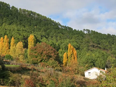
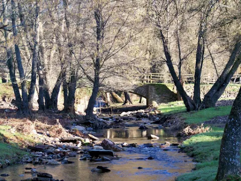
Este tramo, a pesar de ir por vía asfaltada, es uno de los más atractivos de la Etapa, ya que el valle, flanqueado por laderas cubiertas de uno de los mejores bosques de pino laricio de España, está además salpicado de choperas, huertas, frutaledas y pequeños cortijos, en un ameno paisaje donde la huella de la actividad humana tradicional se integra con armonía en su entorno montañoso, transmitiendo una sensación especialmente bucólica en primavera y otoño.

Encontraremos a la derecha un cruce por el que es aconsejable desviarse unos metros para conocer la minúscula y encantadora aldea de Prados de la Mesta. De vuelta a nuestra ruta por la carretera, en el kilómetro 5 pasaremos junto a una fuente a nuestra izquierda, y 500 metros más allá llegaremos al Campamento Juvenil de Río Madera. Avanzando otros 400 metros dejamos a la izquierda el Cortijo de Cerrico Montero, y enseguida abandonamos la carretera.

Km 6

Senda al Collado Verjaga

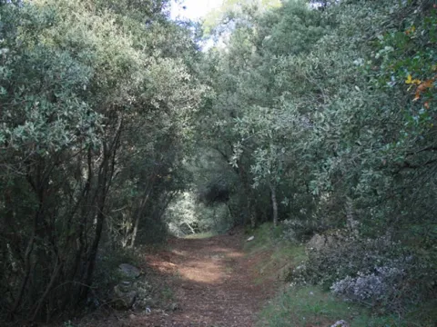
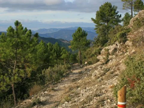
En este punto tomamos una senda que asciende a la izquierda, enfilando hacia el norte. Cambiamos de ambiente, internándonos de nuevo en pleno bosque para salir del valle. Subimos por un impresionante pinar, que más arriba se transforma en un encinar cuyo ambiente umbrío crea un halo mágico como de bosque antiguo.

Llegados al kilómetro 7,2 llaneamos atravesando el Collado Verjaga, para bajar hacia la carretera JF-7016, cambiando de nuevo de ambiente porque hemos abandonado definitivamente el entorno del Valle de Río Madera, apareciendo en algunos momentos ante nuestra vista la inconfundible estampa de Segura de la Sierra con su castillo en lo alto.

Km 7,6

Dehesa Carnicera

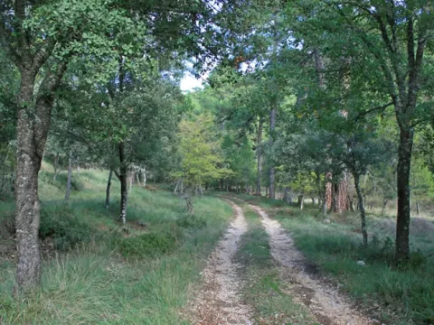
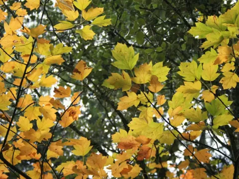
Cruzamos la carretera y continuamos por la pista forestal que aparece justo al frente. Entramos en la Dehesa Carnicera, que es un monte de propios del ayuntamiento de Segura de la Sierra, muy bien conservado. Nuestra pista, estrecha y deliciosa, desciende por un bosque más abierto que el del tramo anterior, con grandes ejemplares de pino laricio y encinas, y salpicado por majuelos y algunos pespejones o perales de monte (Sorbus torminalis) que añaden un toque de colorido en otoño. La presencia de junqueras indica un importante grado de humedad en el suelo durante algunos tramos.

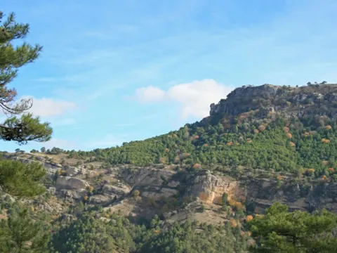
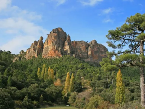
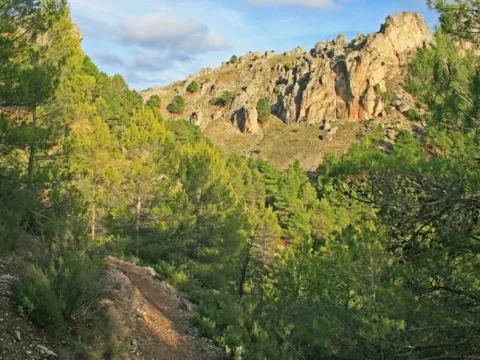
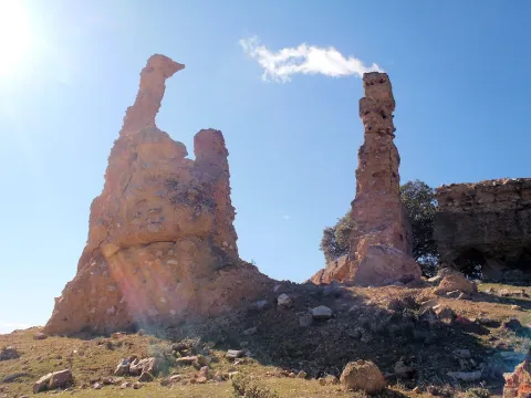
Tras recorrer 1,2 kilómetros por esta pista nos encontramos con otra, más ancha, que es importante, porque hacia la derecha conduce al cercano paraje de Navalcaballo, donde está situado el Centro de Defensa Forestal, y a la izquierda se dirige hacia la aldea de El Robledo, próxima a Cortijos Nuevos. La cruzamos y seguimos al frente por un ancho camino que baja con una notable pendiente en algunos tramos. El bosque se torna más umbrío y cerrado, y en algunos trechos se goza de unas magníficas vistas hacia los rojizos cantiles de Los Poyos de Segura la Vieja.

Km 9,6

Moralejos de Abajo

Nuestra ruta alcanza el fondo del valle del recién nacido Río Trujala, que aún es apenas un arroyo, y tras cruzarlo, entramos en la pequeña aldea de Moralejos de Abajo, con sus sencillas casas blancas, su fuente-lavadero y sus tierras de labor. A partir de aquí la señalización de nuestra Etapa tiene franjas amarillas, rojas y blancas porque coincide con el sendero PR-A 198. Es aconsejable desviarse por ella al menos un trecho y disfrutar de sus buenas vistas para luego volver a nuestra Etapa. Continuamos esta por una ancha pista que sale de la aldea hacia la derecha, teniendo al frente el monte Navalperal.

Km 10,2

Moralejos de Arriba

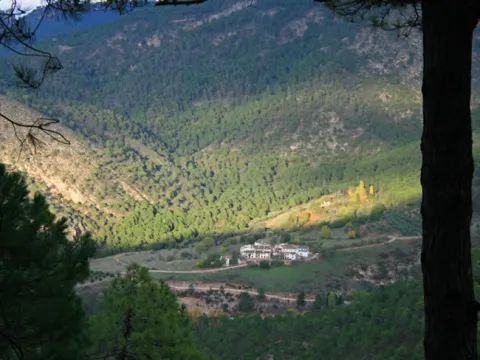
La ruta llega a la carreterita de Moralejos. La aldea de Moralejos de Arriba queda a la derecha, y es imprescindible desviarse unos metros para visitarla. Es algo más grande que Moralejos de Abajo y tiene todos los elementos que hacen tan atractivas a las aldeas de la Sierra de Segura: casas blancas, pequeñas y sencillas, tejados de teja árabe, horno comunitario, lavadero, estrechas callejuelas y hasta una mínima plazuela donde sigue celebrándose la verbena durante las fiestas patronales en verano.

Y todo ello rodeado de un paisaje de ensueño, con la era, las huertas –que se siguen cultivando- y los chopos, los grandes poyos verticales de Segura la Vieja justo encima de la aldea, y a lo lejos las montañas cubiertas de arbolado, como Navalperal y Navalcaballo.

Tras callejear por la aldea volvemos a nuestra ruta, es decir a la carretera, en la que encontraremos una fuente a la derecha. Después de recorrer 400 metros nos desviamos por una senda tradicional que sale a la derecha y se interna en el bosque. Caminamos envueltos de nuevo por el arbolado, viendo el monte de El Yelmo al fondo, y, por tercera vez en esta Etapa, con el placer de recorrer un viejo camino que estaba prácticamente perdido y que se ha recuperado para que siga vivo gracias a la práctica del senderismo.

A los 800 metros aproximadamente de haber iniciado esta senda sale una veredilla no señalizada y poco definida que sube al paraje de Segura la Vieja, cuya visita se recomienda. Para identificar su arranque, debemos estar atentos al pasar junto a unos grandes paredones verticales a la derecha. Unos 200 metros después encontramos dos balizas de continuidad de sendero, y en medio de ambas, una veredilla a la derecha, en la que hay otra baliza de dirección equivocada, ya que la Etapa no sube por ella. También podemos fijarnos en unos montoncitos de piedras que suele haber en el mismo arranque.

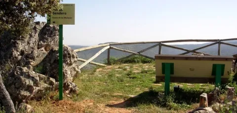
Una vez localizada, subimos por ella y es fácil seguirla, ya que está más definida de lo que parece en un principio, y además hay hitos con piedras que jalonan el camino. Según subimos tenemos a la derecha los grandes riscos de los Poyos de Segura la Vieja, y finalmente alcanzamos una plataforma despejada desde la que se contemplan maravillosas panorámicas en todas las direcciones.

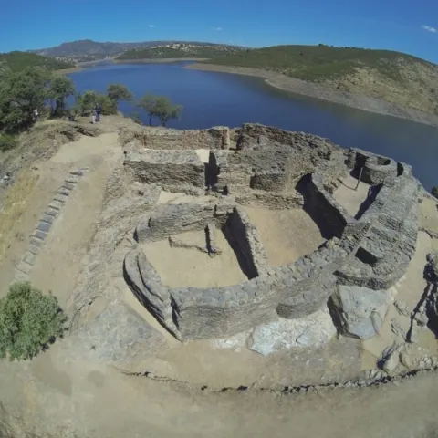
Estamos en Segura la Vieja, y si nos fijamos en el suelo veremos piedras ya casi enterradas que marcan el contorno de antiquísimas edificaciones, ya que en el lugar hubo un asentamiento humano. Se consideró durante mucho tiempo que su origen era ibero, pero investigaciones más recientes se inclinan por hablar de un poblado tardo antiguo o alto medieval.

Según los estudios más recientes, la población hispana musulmana que habitaba este poblado lo habría abandonado a finales del siglo IX o comienzos del X, en tiempos de Abd-al Rahman III, para trasladarse a Segura de la Sierra –entonces denominada Saqura- y disfrutar de unas mejores condiciones de vida.

Volviendo a nuestra ruta, la Etapa continúa por la vieja senda con grandiosas vistas en su último tramo hacia los montes de Navalcaballo y El Yelmo. A partir del kilómetro 11,7, tras una cerrada curva a la derecha, empezamos a bajar y se abre otro mundo ante nuestros ojos, divisando a lo lejos, hacia el oeste, la Sierra de Las Villas, las alineaciones exteriores de la Sierra de Segura y el pueblo de Segura de la Sierra, mientras hacia el norte vemos el monte Peñalta y hacia el nordeste las montañas del entorno de Siles.

Finalmente bajamos por unas escaleras hasta la carretera de Moralejos (kilómetro 12,1), que cogemos a la derecha. Unos 300 metros después llegamos a la carretera JV-7032, que cogemos a la izquierda en dirección a Segura de la Sierra. Caminamos por ella durante 800 metros disfrutando de excelentes vistas hacia el norte, viendo abajo la aldea de Linarejos, más allá el Peñalta, al fondo los montes de El Cambrón y el Puntal de Rayuela (llamado también de La Ajedrea y de Siles), y al final las montañas del vecino Parque Natural de los Calares del Mundo y de la Sima, en la provincia de Albacete.

Km 13,2

Pista de La Tejadilla

En este punto abandonamos la carretera y tomamos una estrecha pista forestal que encontramos a la derecha, por la que caminamos entre pinos negrales, encinas y enebros. En el kilómetro 14,3 encontramos a la izquierda la fuente de La Tejadilla, y unos metros más allá, bajando a la derecha, un pequeño abrevadero, que es un buen lugar para descansar. Más adelante, según va virando nuestra pista hacia el oeste y el sur, se abren vistas hacia Orcera y el monte Peñalta.

Poco antes de finalizar la pista aparece de repente ante nuestros ojos el castillo de Segura de la Sierra en lo alto, ya muy cerca y desde una perspectiva que no es la que habitualmente se tiene desde las vías asfaltadas.

Km 17,6

Segura de la Sierra

La pista de La Tejadilla finaliza en la carretera de Segura de la Sierra. Al frente tenemos la subida al castillo, que alberga el Espacio Temático del Territorio de Frontera, y a la derecha la piscina municipal, pequeña pero con unas vistas impresionantes, y que en verano es el lugar perfecto para acabar la Etapa con un buen chapuzón. Unos 500 metros más adelante llegamos al casco urbano de Segura de la Sierra, declarado Conjunto Histórico-Artístico y unos de los pueblos más bellos e interesantes del Parque Natural por su patrimonio arquitectónico y su espectacular emplazamiento.
Trail Molino del Batán

Submitted by brandcode_deweloper on
Id
2569103
Descripción larga

We will find traces of industrial facilities (batans or mills), of medieval origin, moved by the force of the running waters, a type of renewable energy that in the past was of the few available, and which is now revalued.

Continuing about a hundred and fifty meters along the JA-7.102 road, which has taken us to Miranda del Rey from the E-05 highway, we will find a road crossing that is where we start our path (see on the map). Here we will choose the track to the front, to the west, and we will walk without complications through a plain.

After six hundred meters we will cross the river of the Bañas, which is very close to that of the Noguera to form the Campana River. We will approach that second stream and walk on its left bank about seven hundred meters, northwest direction, until we reach the cortijo de la Noguera, which today became a school of nature. In four hundred meters we reach a hill in which there are two firewalls that serve as the limit of the Natural Park, where there is a barrier that we will have to cross while maintaining our course. The track is flanked by eucalyptus, which will later be replaced by pine trees, also of repopulation. The oak and other indigenous plants grow under these artificially introduced masses, as they are prepared to a particular reconquest. The road makes a uve to cross the stream of the Noguera, which we used to accompany, after which you reach a port with some cornoques around. From here, views are opened to the ravine of the Batan stream, to which we address, and the paths ahead of us can therefore be seen. We walk, in plural, because first we will go down the oblique slope to our right, next to the acequia of the Padilla Jump, until its derivation. The stream is covered by a riverside forest in which there are plenty of strawberries and alles that invite us to stop to enjoy its rich and ambient placid nature, from which is part a water birth with a curious anti-linear (convex folding) crowning it.

Between jaras and rosemos we will take the nine hundred meters to the crossing of the port, from where we will go back down, but now on the main road that is left, in a southwest direction. We are open to good views of the Calderon saw and the Star hill, to the north; and to the west the valley that forms the Dona Dama ravine and the Rope of the Stairs.

Our way, after crossing the waterfall again, runs in parallel to the stream, in which we can see the ruins of ancient mills, including the one that gives name to the path, the Batan Mill and another more flour built at the same time. In a little more than a kilometer of road, we will reach a sharp curve, after which we arrived at the bottom of the ravine where there is a water storage for the fire vehicles and a source, being this the end of the path.

Breve descripción

If we accept the proposal that we are made with this path, we will discover agricultural sites and representative landscapes of Despeñacolos, where the pulse of nature - flora, fauna, hydrography, geology... - still beats with strength, and human work is perceived as a historical challenge in pursuit of coexistence rather than domination.

Latitud
37.7796
Longitud
-3.7849
Distrito
Municipio
Ubicación en el mapa
POINT (-3.7849 37.7796)
imagen
Image
706_SS_01.jpg
Imagen principal
Activado
imagen
Image
Sendero%20Molino%20del%20Bat%C3%A1n.jpg
Imagen principal
Desactivado
2 h 50 min

Nature

icon-intereses-naturaleza

Friends

icon-intereses-amigos

Adventure

icon-intereses-aventura

Culture

icon-intereses-cultura

Sport

icon-intereses-deporte

Eco-friendly

icon-intereses-eco-friendly

For couples

icon-intereses-en-pareja

Family

icon-intereses-familia

Gastronomy

icon-intereses-gastronomia

Municipality

icon-intereses-municipio

Low-cost tourism

icon-intereses-turismo-low-cost

Solo travel

icon-intereses-viajar-solo
Baja
Image
a080e20c-f759-841d-d7ca-6ee1ff0fe4e8?t=1588960487655
Sendero Molino del Batán
20,7 km
980m
980m
1
2
2
2
On foot
All year round
Desactivado

It is recommended to wear safe drinking water and clothing and adequate footwear. Ensure the potability of the water from the sources. Be careful with the traffic. This path can be realized throughout the year. In summer, due to the special conditions of height, the insolation is very strong and requires important solar protection.

- Remains of mills and hydraulic batans of medieval origin.
- Miranda del Rey village.
- Las Nogueras School of Nature.
- Barrio of the Batan stream.

From Jaén, on the E-05 motorway, you have to take Exit 259 to Santa Elena, go to the town and go to the Visitors' Centre Puerta de Andalucía, where you take the road JA-7.102 to Miranda del Rey. We must pass the village house without leaving the road until we find a crossing at 150 m., where the path begins.

TRAIL OF THE CUEVA DE LOS MUÑECOS

Submitted by brandcode_deweloper on
Id
2567104
Descripción larga

The path begins at the Centre for the Interpretation of the Historical and Cultural Heritage of the Natural Park of Despeñacolos (see on the map), which is reached by the road A-6,200 from the E-05 motorway, towards Aldeaquemada. The center has been built on an old aprisco at the foot of the hill of the Castle. On the contrary side of this run through the historic passage of Despeñapeas the highway of the South.

However, on this side where we find the intense traffic of the fast track seems far away. The visit to the centre is certainly recommended, as it provides information on the natural and cultural heritage of the environment and also of this path. Around the center we see places of great ecological significance. On the umbria slopes, facing north, we will see forest formations with tree leaves, like the whine, and shrubs like doves or madroños. On the other hand, in the solana, the mountain is dominated by cobblestones with little sodoscala, made up of pyruetans, jars, rosemary, etc.

The path consists of two sections of about five hundred meters each, starting both from the interpretation center. One goes up to the hill of the Castle - towards the west - and the other goes down to the cave of Los Muñecos, in a southwestern direction. Although the order to travel them is indifferent, as in any case we must return to the interpretation center, we will assume that we will first take the climb to the hill. The sinuous path that we will take goes through a relatively lush encore that disappears around the 920 meters. Then, until the top of the hill, at 961 m, we will see more naked rock than vegetation.

There are in the high remains of a possible Iberian village and a lookout towards the plateau with overwhelming views, with St. Helena to the south and the port of the Muradal to the Plateau. In front, the impressive pettic structure of Mount Los Organos and, under us, the highway that follows the itinerary that with great difficulty opened at the end of the 18th century, as an alternative to the road of Las Ventes (by Los Pedroches) and other itineraries in use between the ports of Cadiz and Sevilla - doors of Américo - and the capital of the kingdom.

After walking the way to the center of interpretation, we will head towards our second destination, the cave of Los Muñecos. We will descend on a soft slope by the skirt of the hill of the Castle, and in parallel to the electric slope, towards the road we arrived for, we will cross the lower part of the same oak that we have already met up to the hill, in which we will also see alcornoques and junips of great bearing.

In two hundred and fifty meters we will reach a point very close to the road, where we will change course to surround the cut we see on our right, in which environment we can distinguish maples of Montpellier and abundant cornicabra. We must be careful with some slopes and pozas of the numerous excavations around here, as we are in a rich area of archaeological deposits, with the cave of Los Muñecos as the center of them, where the path ends.

Breve descripción

The culture of the Iberians keeps many mysteries that may never be explained. Their beliefs are almost unknown, but no one is surprised that they had in these places one of their main places of worship, and even more so that the Romans would take on him to satisfy their gods.

Latitud
37.9801
Longitud
-3.0504
Distrito
Municipio
Ubicación en el mapa
POINT (-3.0504 37.9801)
imagen
Image
7bf891e7cd51422669fbe9bfa4ec577e.jpg
Imagen principal
Activado
imagen
Image
Sendero%20de%20la%20Cueva%20de%20los%20Mu%C3%B1ecos2.jpg
Imagen principal
Desactivado
imagen
Image
Sendero%20de%20la%20Cueva%20de%20los%20Mu%C3%B1ecos.jpg
Imagen principal
Desactivado
1 h 42 min

Nature

icon-intereses-naturaleza

Friends

icon-intereses-amigos

Adventure

icon-intereses-aventura

Culture

icon-intereses-cultura

Sport

icon-intereses-deporte

Eco-friendly

icon-intereses-eco-friendly

For couples

icon-intereses-en-pareja

Family

icon-intereses-familia

Gastronomy

icon-intereses-gastronomia

Municipality

icon-intereses-municipio

Low-cost tourism

icon-intereses-turismo-low-cost

Solo travel

icon-intereses-viajar-solo
Medium
Image
b5e34fb6-b091-5c60-4d06-3974839debc2?t=1588960148343
Image
addfdc00-5c39-b0e1-c182-ea84a4571baa?t=1588960133035
Sendero de la Cueva de los Muñecos
3,2 km
150m
150m
2
2
2
1
On foot
All year round
Desactivado

It is recommended to wear safe drinking water and clothing and adequate footwear. Ensure the potability of the water from the sources. This path can be realized throughout the year. In summer, due to the special conditions of height, the insolation is very strong and requires important solar protection. Caution with the strong slopes of the last stretch and the pozas of archaeological excavations.

- Centre for the Interpretation of the Historical and Cultural Heritage of the Natural Park of Despeñacolos
- Cueva de los Muñecos, which dates back to the 6th century BC and is considered one of the oldest Iberian extra-urban shrines, and also of those who had a certain character of territorial control.
- Cerro del Castillo, at 961 m altitude, old Iberian settlement.
- The organs.

The path begins at the Centre for the Interpretation of the Historical and Cultural Heritage, which is reached by the road A-6,200 which, coming from the highway A-4 (exit in the km 250, towards Cadiz), leads to Aldeaquemada.

Tramo de asfalto o cemento
 
Tramo de pista o camino forestal
 
Tramo de vía pecuaria
 
Tramo de senda
 

Trail Ravine of Valdeazores

Submitted by brandcode_deweloper on
Id
2557141
Descripción larga

We will have to be located in the forest house of Valdeazores, which is accessed from the A-4 motorway, only in the sense of Madrid- Cádiz, by a track that leaves to the right in the km 245.3, two hundred meters after passing the signal that indicates the entrance to Andalusia and shortly before the lookout of the Garden of Despeñacolos. We will climb three hundred meters along this track until we reach a forest house, from which parking is on the path.

We will go north, but at the very least we will be heading towards the west, which is the one that we will keep in the first half of the way to the head of the Valdeazores stream, following at first a water drive. As in much of the way, we will go up a smooth but continuous slope. We will see mixed forests around us that are the result of repopulations, in which pine trees abound in the solanas, and cypresses in the umbria. The indigenous vegetation is gaining ground with the height, also remaining in important stains on the other side of the stream - dark - that have a humid Mediterranean mountain with oaks, alcornoques, complaints, oaks, or oaks. On the riverside there are formations in a gallery of alles and strawberries, splintered with willows, tampas and tampas.

When we have already walked about two and a half miles, we reach a chestnut in which there is a spring that supplies the driving that accompanied us. It is a good place to rest and enjoy the beak of expired leaves, taking strength to continue with the rise. A kilometer later, already at the head of the stream, we will give with the track that goes down from the port of Muladar to the castle of Castro Ferral, which is located about a mile away. We can choose to approach this medieval fortress that protected the passage of La Losa, which was finally taken to the Almohades by Christian armies in the framework of the battle of the Saves of Tolosa. It is in ruins because it was later abandoned and destroyed to prevent its use by outlaws.

If we rule out the variant of the castle on the track we will only do about 50 meters, and we will leave it on a road that leaves it to the right in the direction of the Aviation Collado, as the signs indicate, completing a 180º turn that will set us to the east, walking on the crest of the right bank of the ravine. The humid Mediterranean mountain we saw from the other side is below us, which now again we are surrounded by pine trees.

We will walk two and a half miles further to crown the hill of Los Organos (natural monument), where there is the refuge of the Aviation Collado, a small air surveillance post of the Civil War, later used by pastors and fire devices. Following the path that continues in the same direction that we brought, we will cross a bosquet of pine trees, oaks, alcornoques and moans, to go out to a clear place where there is a small lookout with magnificent views of the Despeñacolos parade, which is where the path ends.

Breve descripción

The Valdeazores stream has a short perpendicular route to the Despeñafueros parlor, where it flows. The path borders its entire basin, a ravine of regular forms covered in one part by a rich and diverse Mediterranean mountain, and in another by coniferous introduced by forest populations. To the considerable natural values of the place are added other of historical or cultural type, related to the strategic character of the parade, from which we will have juicy views from a viewpoint located on it.

Latitud
38.0204
Longitud
-2.7802
Distrito
Municipio
Ubicación en el mapa
POINT (-2.7802 38.0204)
imagen
Image
1928831Master.jpg
Imagen principal
Activado
imagen
Image
Sendero-Barranco-de-Valdeazores-033.jpg
Imagen principal
Desactivado
5 h 30 min

Nature

icon-intereses-naturaleza

Friends

icon-intereses-amigos

Adventure

icon-intereses-aventura

Culture

icon-intereses-cultura

Sport

icon-intereses-deporte

Eco-friendly

icon-intereses-eco-friendly

For couples

icon-intereses-en-pareja

Family

icon-intereses-familia

Gastronomy

icon-intereses-gastronomia

Municipality

icon-intereses-municipio

Low-cost tourism

icon-intereses-turismo-low-cost

Solo travel

icon-intereses-viajar-solo
Medium
Image
8a951538-46cd-102e-4868-5e313957e4c2?t=1588958697173
Image
3668f15d-8b96-b9ff-ca1e-0d0c63f7738d?t=1588958670866
Sendero Barranco de Valdeazores
12,8 km
300m
300m
1
2
2
2
On foot
All year round
Desactivado

It is recommended to wear safe drinking water and clothing and adequate footwear. Ensure the potability of the water from the sources. This path can be realized throughout the year. In summer, due to the special conditions of height, the insolation is very strong and requires important solar protection.

- Parade and step of Parade.
- Arroyo de Valdeazores
- Ruins of the medieval Castle of Castro Ferral
- Natural Monument of the Organs

On the A-4 highway, towards Cadiz, we will take the track that goes right in the km. 245.3, about two hundred metres from the signal that indicates the entrance to Andalusia, which will take us - after going 300 meters - to the forest house of Valdeazores, next to which the path begins.

Trail Viewpoint Reand

Submitted by brandcode_deweloper on
Id
2555234
Descripción larga

La Lancha is a village that rose for the construction of the Jandula dam, started in 1927 and completed four years later. It was inhabited by about 3,000 people in the most active moments. It is about 30 kilometres from Andújar in an unpopulated territory where malaria was endemic at that time. There is only one unasphalted road that reaches the village, the JF-5004, which comes from Los Escoriales for a journey also offered as a path marked by the Natural Park.

Already in La Lancha we must continue on the same road down to the dam, where the path begins. If we have reached here by car, we will leave it in this place to take a look at the Jandula reservoir first from the dam itself, and then make the short path. It has been almost eighty years since this great artificial lake was created, where the waters of the Jandula River are reinstated along about twenty kilometres from its channel, flooding its enclosed valley. The reservoir has a capacity of 322 Hm3 with a water sheet of 1,231 hectares. A new piece introduced in the geography of the saw which, of course, has had an important impact on the landscape, ecology and local and regional economy.

The variety of the local fauna, which we can see with some ease, is a clear example of such an induced transformation. Cormorans, with their lustful black plumages and bronze, are already common and it is not rare to see ducks or garzas. In the water there are species such as black-bass, carp or barb, and also a fish that is only found in these waters and tributaries of the Jandula, called the bogardilla.

From the side of the dam to which we have reached, we will take the road that goes south on the left side of the river, a hundred meters above it. Its appearance gives us clues on the landscapes before the construction of the dam. As we move away from the dam we gain perspectives on it, and we better explain its consideration as a historical monument.

Two hundred metres from the beginning of the road we find a stretch enlarged by a excavation at the foot of the village, which is nothing other than the granite quarry that was opened and exploited only for the construction of the dam and other works related to it, case of the village. Part of the image of integration of this great wall into the landscape is due to its stone coating of the place itself. We can see around some block of granite that was left unused, and also some other witnesses of the agitated activity during the construction of the dam. A little later, the road is close at a point where we end our route.

Breve descripción

This is a brief tour along with the Jandula dam, also known as La Lancha, which in itself is a monumental construction of a high heritage and, of course, economic and social value. It is located in an agribusiness and historically depopulated area of the interior of Sierra Morena. To the value of the Mediterranean mountain that naturally dominates it, this great artificial lake adds diversity to the landscape. The path is a follow-up to another one with a greater path that reaches the dam from the Scoriales.

Latitud
38.0394
Longitud
-4.0511
Distrito
Municipio
Ubicación en el mapa
POINT (-4.0511 38.0394)
imagen
Image
IMG_1821.jpg
Imagen principal
Activado
imagen
Image
Sendero%20Mirador%20del%20Rey.jpg
Imagen principal
Desactivado

Nature

icon-intereses-naturaleza

Friends

icon-intereses-amigos

Adventure

icon-intereses-aventura

Culture

icon-intereses-cultura

Sport

icon-intereses-deporte

Eco-friendly

icon-intereses-eco-friendly

For couples

icon-intereses-en-pareja

Family

icon-intereses-familia

Gastronomy

icon-intereses-gastronomia

Municipality

icon-intereses-municipio

Low-cost tourism

icon-intereses-turismo-low-cost

Solo travel

icon-intereses-viajar-solo
Baja
Image
41aee518-2679-dabc-b969-77dc1aea6436?t=1588958225609
Image
0d6c0d94-c307-8108-88b7-a2d0310c555f?t=1588958239153
Sendero Mirador del Rey
1,2 km
14m
14m
2
2
2
1
On foot
All year round
Desactivado

It is recommended to wear safe drinking water and clothing and adequate footwear. Take special care of possible falls. This path can be realized throughout the year. In summer, due to the special conditions of height, the insolation is very strong which, together with the lack of shadows, requires important solar protection.

- Granitic closed.
- Embalse of important dimensions with variable levels.
- The monumental Jandula dam, designed by the modernist architect Casto Fernández Shaw and associated village.
- granite quarry used for the construction of the dam and the village.

From Andújar you must take the road A-6177, north sense, to the sanctuary of the Virgin of the Head. After moving about 15 Km and passing the Park Visitors Center, you will turn right onto the JH-5002, towards the Jandula reservoir. We travel about 10 km to a crossing where we will have to turn left by the JF-5004. After another 10 Km we will reach the dam from where the path begins to our left

Tramo de asfalto o cemento
 
Tramo de pista o camino forestal
 
Tramo de vía pecuaria
 
Tramo de senda
 

Trail El Junquillo

Submitted by brandcode_deweloper on
Id
2553127
Descripción larga

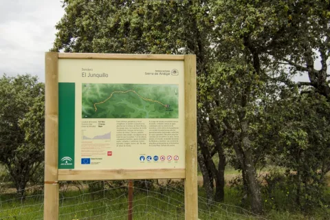
At the beginning of the path you can access the road A-6178 that comes from the shrine of the Virgin of the Head, 19 kilometres from it. We will find the path signs at a road crossing with a track that leaves to the left towards Valdelagrana (see on the map) in a place known as Junquillo. We'll start the road along the track to a geodetic vertex that we'll see very close.

We will do all the way along this track, almost always flanked by fences of farms dedicated to livestock and hunting, and would support the cultivation of cereals. The vegetation varies between real oak forests and more or less dense adhesives. Many other plants of the Mediterranean mountain find here their space, such as the wild pyruetane or pear, of bright and expired leaves, from which we can see some specimens shortly after we start the road. We will also pass in the initial section under a high-voltage line that comes from Puertollano to the Guadalquivir valley to the south, direction in which we will observe the prominent Peñón de Rosalejo (805 m.).

We will leave the Las Losas cortijo to our right, surrounded by a more clear space. Half a kilometre later we will find the so-called moruno oven, a small stone building located between oak trees on the left side of the track.

In just over a kilometer we will reach a crossroads of roads and firewalls. We will have already observed the combination of both, that there are ways through which we have clear margins to serve at the same time as firewalls. This helps to prevent and extinguish fires, which pose a major threat, especially to low-mountain cynegetic farms, which host populations of boar, deer, gamo or muflon, but also to other more clarified spaces, such as dehesas, which have a predominantly livestock use. The high biodiversity of both types of mountains is protected by these infrastructure, and also by complementary ones, such as the rafts that abound in both types of farms.

Almost a kilometer later, we will find another crossing of roads this time belonging to surrounding farms. We will continue forward and a few meters later we will turn south, moving back to a more wooded area.

It is a good place to stop and look at the mountain chains that rise on the horizon in the northwest. About ten kilometres away we will see the Quintana saw, whose summits draw the border of the provinces of Jaén and Ciudad Real, and also of the Natural Park. In it we can distinguish the Burcio from the Pino (1,291 m), the highest peak of the Andalusian Sierra Morena. Further west is the Madrona saw, where the highest levels of all Sierra Morena are reached. Between the two saws is the main step to the famous valley of Alcudia, in which Fuenhot is located, a citizen population that we can see later. Already in the last stretch of the path we pass through a new crossing near a large cordial. A mile later the path ends in a suggestive dehesa next to a Canadian step.

Breve descripción

Here is a suggestive and easy road that travels a very representative space of Sierra Morena and this Natural Park. In it there are the dehesas on almost flat grounds and Mediterranean mountain stains, both populated by numerous animal species, including various birds, easily visible, or mammals, such as deer, boars, foxes or garduñas, difficult to see, but whose traces we will find with some ease. The Madrona and Quintana saws on the horizon, behind these plains, evoke the many legends that these depopulated lands have inspired throughout history.

Latitud
37.9601
Longitud
-3.0203
Distrito
Municipio
Ubicación en el mapa
POINT (-3.0203 37.9601)
imagen
Image
S_DelBronce%20%281%29.jpg
Imagen principal
Activado
imagen
Image
Sendero%20El%20Junquillo.jpg
Imagen principal
Desactivado
2 h 23 min

Nature

icon-intereses-naturaleza

Friends

icon-intereses-amigos

Adventure

icon-intereses-aventura

Culture

icon-intereses-cultura

Sport

icon-intereses-deporte

Eco-friendly

icon-intereses-eco-friendly

For couples

icon-intereses-en-pareja

Family

icon-intereses-familia

Gastronomy

icon-intereses-gastronomia

Municipality

icon-intereses-municipio

Low-cost tourism

icon-intereses-turismo-low-cost

Solo travel

icon-intereses-viajar-solo
Baja
Image
0ce51f4e-fee4-1cb7-b0f8-a5e9b393285f?t=1588957869502
Image
de88ea9c-25e6-d6ee-890c-5d7de505414d?t=1588957887533
Sendero El Junquillo
11,4 km
54m
54m
2
1
1
2
On foot
All year round
Desactivado

It is recommended to wear safe drinking water and clothing and adequate footwear. Ensure the potability of the water from the sources. Be careful with the traffic. This path can be realized throughout the year. In summer, due to the special conditions of height, the insolation is very strong which, together with the lack of shadows, requires important solar protection. The months of October and November are especially recommended, coinciding with the deer's berrhea.

- Mediterranean mountain and oak and cork dehesas.
- Junquillo site.
- Old morun oven.
- Sierra Quintana, with the peak Burcio del Pino (1,291 m.)

On the road A-6178, about 19 kilometres from the shrine of the Virgin of the Head, you reach a crossing with signs to Valdelagrana and Las Tapas, which is where the path begins

Trail El Santuario

Submitted by brandcode_deweloper on
Id
2545140
Descripción larga

If you come from Andújar on the road A-6177 towards the shrine of the Virgin of the Head, we will have to get to its vicinity, thus walking about 30 kilometers, to be located at the point of start of the path, located next to the road two hundred meters before the last crossing to the sanctuary.

We are at the foot of the hill of the Cabezo, the promontory where the sanctuary that we have in front of us is located, less than a kilometre away in a straight line and about 50 meters away. Surrounded by a forest of black pines, we take the way to the south-west, just up to a crossing - at about three hundred meters - where we have to turn 90 degrees to our right. We soon arrived at a cortijo called La Huerta de los Fráiles, a name that makes clear reference to its use by religious guardians of the sanctuary. We will round the building by recovering the south-west direction to keep it alone for two hundred meters, until we reach a crossing at which we will deviate by a track to the right.

We will pass under a high-voltage electric line and we will immediately cross the Membrellar stream, from where we can see panoramic views towards the valley of the Jandula River as it passes through the New Place, an emblematic public mountain for its great ecological and cynetic wealth. We gradually approach the slopes of the hill of the Cabezo and the urbanized space that occupy there various cofradies and facilities linked to the sanctuary and to the famous and multitudinary Romany that is celebrated on the last Sunday of April.

Moving in the same direction on foot of the hill, we will reach the asphalt road on which we start our way, to which we will join on our left to walk it just over 50 meters, always with due caution.

Thus we will reach the steep street of the Sanctuary, which goes up to it with a considerable slope of about three hundred meters. Above the hill ends the path, although here we are offered different offers, such as visiting the sanctuary and its surroundings, or approaching the lookout from where a wide view of Sierra Morena is covered.

Breve descripción

The proverbial depopulation of Sierra Morena, and the consequent preservation of its natural wealth, has here, in the Andújar saw, one of its clearest manifestations. In an agribusiness territory, 30 kilometres from Andújar, the sanctuary of the Virgin of the Head is raised, which finds its meaning in such a strange location. For centuries he has attracted a large number of pilgrims from remote places and year by year, he has concentrated crowds in one of the country's most popular romaneries. The path brings together in its brief journey nature and history, landscapes and tradition.

Latitud
38.0394
Longitud
-4.0511
Distrito
Municipio
Ubicación en el mapa
POINT (-4.0511 38.0394)
imagen
Image
715_SS_01%20%281%29.jpg
Imagen principal
Activado
imagen
Image
Sendero%20el%20santuario.jpg
Imagen principal
Desactivado
46 min

Nature

icon-intereses-naturaleza

Friends

icon-intereses-amigos

Adventure

icon-intereses-aventura

Culture

icon-intereses-cultura

Sport

icon-intereses-deporte

Eco-friendly

icon-intereses-eco-friendly

For couples

icon-intereses-en-pareja

Family

icon-intereses-familia

Gastronomy

icon-intereses-gastronomia

Municipality

icon-intereses-municipio

Low-cost tourism

icon-intereses-turismo-low-cost

Solo travel

icon-intereses-viajar-solo
Baja
Image
0555e93c-2269-03fc-3ed8-8a63f94e61a6?t=1588956745285
Image
ff19adf8-c065-2525-6249-b708ddf99062?t=1588956878234
Sendero El Santuario
3 km
82m
82m
2
1
1
1
On foot
All year round
Desactivado

- Mediterranean mountain and oak and cork dehesas.
- Cortijo La Huerta de los Fráiles.
- Membrellar Arroyo.
- Popular sanctuary on the hill of the Cabezo with various associated infrastructure and equipment.

From Andújar, you must take the road A-6177, north-east sense, to the sanctuary of the Virgin of the Head. After 30 Km we will find the beginning of the path, located next to the road two hundred meters before the last crossing to the sanctuary.

Tramo de asfalto o cemento
 
Tramo de pista o camino forestal
 
Tramo de vía pecuaria
 
Tramo de senda
 

Trail el Rumblar

Submitted by brandcode_deweloper on
Id
2542176
Descripción larga

Sierra Morena is a great natural space of internationally recognized importance. Much of the water resources consumed in the Guadalquivir basin, especially for urban supply, come from its vast territory.

The path begins in one of its water reservoirs and runs through spaces where we will find the explanation of its valued quality, which is no other than that of the conservation of the Mediterranean mountain, the dehesas and other ecosystems where many animals live, including the Iberian lince.

Leaving the town of Baños de la Encina, which well deserves a visit, we will head for the dam of the Rumblar reservoir on the road JH-5044 (5.5 Km). After crossing it, we will find the beginning of the path (see on the map), which runs in its entirety on the unasphalt road JV-5041.

We start the road parallel to the top of the reservoir, to get away from it by the moving Lomas of the Mesonero in a west direction. We are surrounded by a Mediterranean mountain made up of characteristic species, including the oak. A place where many animals that benefit from the water, and also from the microclimate, of the large artificial lake are camped. After two and a half miles of road, the relief and vegetation change radically, entering us in a plain with olive groves and open spaces where they embrace braves. It is a suitable place to see deer, especially during the summer season in autumn.

After crossing a stream and passing through other land of work, we will surround the imposing joint of La Nava de Andújar or Santa Amalia, which has, among other buildings, its own hermitage and school, as there were many families of farm workers. Immediately after the corrijada we return to a more rugged forest land next to the Mosquila saw, whose most outstanding hill we will see in front of us.

Walking the two kilometers of dehesas that separate La Nava from the Friscalejo House we will have the opportunity to see one of the many animals that live here. It won't be hard to see deer if we go quietly and watch. They often come close to the boarders we will see in the surroundings of the house. It is much more difficult to see a lince, but we will be attracted to the collaboration between owners and Administration to protect this emblematic species, from which is reported by signs along the way.

Later on, the path surrounds the House of Gorgogil, putting us at the foot of the Mosquila saw where, after a curve, we will find the birth of the Gorgogil stream. We continue to climb up the hill of the Mosquila which, after a firewall, we find again with a denser and more wooded vegetable cover. To our right, there continue to be dehesas in a flattened land, where we will find once again brava livestock.

If we look at the fences, we will observe the use of granite pilotes, the rocky material that dominates the area. But we will also discover samples of many other uses of this noble stone, such as eating machines and all kinds of works or buildings. And when it comes to geological resources, we approach the Scoriales, where the path ends. This is an old mining enclave from which different types of metals were drawn. Its name is derived from the scum or waste from the exploitation and treatment of minerals, which were accumulated here.

Breve descripción

From Baños de la Encina will go south along the road leading to the Rumblar swamp. Arrived at the junction, we will be diverted by the JH-5044 to the right. After about 5 km, the Rumblar dam is reached, which must be crossed. Next to the relief, the path begins.

Latitud
38.1706
Longitud
-3.7744
Distrito
Ubicación en el mapa
POINT (-3.7744 38.1706)
imagen
Image
Sendero%20el%20Rumblar1..jpg
Imagen principal
Activado
imagen
Image
Sendero%20el%20Rumblar2.jpg
Imagen principal
Desactivado
imagen
Image
Sendero%20el%20rumblar%205.jpg
Imagen principal
Desactivado
7 h 6 min

Nature

icon-intereses-naturaleza

Friends

icon-intereses-amigos

Adventure

icon-intereses-aventura

Culture

icon-intereses-cultura

Sport

icon-intereses-deporte

Eco-friendly

icon-intereses-eco-friendly

For couples

icon-intereses-en-pareja

Family

icon-intereses-familia

Gastronomy

icon-intereses-gastronomia

Municipality

icon-intereses-municipio

Low-cost tourism

icon-intereses-turismo-low-cost

Solo travel

icon-intereses-viajar-solo
Medium
Image
7cb1d67a-f19c-c38c-9426-8492cb08d823?t=1588956233179
Image
0c5e9723-aa4f-d41e-c7e4-3bca7ba6c4e0?t=1588956138798
Sendero el Rumblar
31,8 km
356m
356m
2
1
1
4
On foot
All year round
Desactivado

It is recommended to wear safe drinking water and clothing and adequate footwear. Ensure the potability of the water from the sources. Be careful with the traffic. This path can be realized throughout the year. In summer, due to the special conditions of height, the insolation is very strong which, together with the lack of shadows, requires important solar protection. The months of October and November are especially recommended, coinciding with the deer's berrhea.

- Mediterranean mountain and oak and cork dehesas.
- Presence of Iberian lince and brave cattle.
- Dam del Rumblar (1941), 65 meters high and 126 Hm3 of reservoir capacity.
- The Navy of Andújar.
- The birth of Gorgogil stream.
- Scorial mining enclave.

Leaving the town of Baños de la Encina, which well deserves a visit, we will head for the dam of the Rumblar reservoir on the road JH-5044 (5.5 Km). After crossing it, we will find the beginning of the path (see on the map), which runs in its entirety on the unasphalt road JV-5041.

Circular path

Ascent to Pico Mágina

Submitted by brandcode_deweloper on
Id
2541785
Descripción larga

The rise to the Magina peak (2167 m.) will take you to the roof of the province of Jaén. This level assigns to the Natural Park of Sierra Magina the third altitude of Andalusia, after Sierra Nevada and the Sierra de Baza. The effort is demanding, but it has the reward to know a unique landscape. The Sierras de Cazorla, Segura and the Villas, Sierra Nevada, the Sierra Sur de Jaén, La Loma de Ubeda or the Valle del Guadalquivir are some of the panoramic views from the summit area.
The tour is divided into three sections: the forest area, altiplanicie livestock and high mountain section.
At the beginning of the path, in a curve there is a detour that goes to the Chaganton ravine, which we will not take. Our path is always ascending, on a wide and firm track of land. Zigzagando gains height for four kilometres, while passing through a dense repopulation pine. This first stage of approach begins to show us views, and takes us to the interior of Sierra Magina.

Once the first climb has been crowned, we will be flying along a mile and a half by the Barranco de las Salinas, which serves as a transition to the last stretch of ascension. This is an area of pastures in which we find a very diverse vegetation such as complaints, larice pines and juniper, natural representatives of this bioclimatic floor. The transition ends slightly above the Tincada de la Cruz, a very characteristic livestock construction.

A few hundred meters above the dye the track is over and the path begins, which ascends in the east direction, and is marked enough to follow it without difficulty. Only in conditions of strong snow can the path mark be lost. The Barranco de las Covatillas, the first stretch of the path, leads us to the Port of Bolos, which is located on the east side, towards the Barranco del Garganton and beyond the Valley of the Jandulilla. At this point the path turns left facing north towards the summit area.

From here on the path passes through a stony area, on limestone. The landscape leaves the pineapples behind, and it will be the rake savannas that accompany us to the summit. Only something above we find the fork towards the summit of Miramundos, to the right. We will continue on our path, to the left and gradually gain height. Then we lose height at the head of a ravine slightly cooler. From this point on we start the final stretch until the peak of the Magina peak. The road is adapted to the relief. First by a few rocky steps, to reach a circular rocky depression on the hillside (a dolin or limestone sink), where one of the restored snow wells is. The end is a stone's throw. The maximum level is a high surrounded by other immediate summits (Jails, Peña de Jaén, Miramundos...), so the summit is one more of a crest.

The return will always be in decline, on the same path of ascent, provided that we do not choose other alternatives of return or combination with different paths, only recommended for those who have the experience and information to connect them.

Breve descripción

From the Miramundos peak, we can see a landscape panorama that covers a wide range from Cazorla to Sierra Nevada: to the south, the Sierra Arana and Sierra Nevada granadinas; to the north in the foreground, the summits of Mount Cazorla and, to the west, the towns of Ubeda, Baeza, Sabiote, etc.; to the east the summit of La Morra de Magina and, to the bottom, the mountains of Quesada belonging to the Cazorla mountains; to the west we have the summit of Peña de Jaén and the Almaden.

Latitud
37.6681
Longitud
-3.5742
Distrito
Municipio
Ubicación en el mapa
POINT (-3.5742 37.6681)
imagen
Image
Subida%20al%20Pico%20M%C3%A1gina.jpg
Imagen principal
Activado
imagen
Image
726_SS_12.jpg
Imagen principal
Desactivado
imagen
Image
726_SS_11.jpg
Imagen principal
Desactivado
imagen
Image
726_SS_10.jpg
Imagen principal
Desactivado
7 h 15 min

Nature

icon-intereses-naturaleza

Friends

icon-intereses-amigos

Adventure

icon-intereses-aventura

Culture

icon-intereses-cultura

Sport

icon-intereses-deporte

Eco-friendly

icon-intereses-eco-friendly

For couples

icon-intereses-en-pareja

Family

icon-intereses-familia

Gastronomy

icon-intereses-gastronomia

Municipality

icon-intereses-municipio

Low-cost tourism

icon-intereses-turismo-low-cost

Solo travel

icon-intereses-viajar-solo
Alta
Image
519e64a5-51f1-70de-3dc0-460bf8287fe9?t=1588954464336
Image
5dabdf15-d7c6-706c-033e-dea29636ec30?t=1588954970132
Subida al Pico Mágina
10,3 km
980m
980m
3
2
3
4
On foot
All year round
Desactivado

Caño del Aguadero

This path can be realized throughout the year. In winter, its high mountain conditions can make it complicated, due to low temperatures, snow accumulation, ice, and strong wind showers. There are no drinking water points available on the tour, and sufficient hydration is recommended. In summer, due to similar high conditions, the insolation is very strong, linked to the lack of shadows, will be an important solar protection.
This path has the alternative, on the stretch of high mountain, towards the summit of Miramundos, and from there to the Caño del Aguadero, and the northern side of the massif. This complete alternative would be a different planning, requiring more than ten hours of intense walking, with the added inconvenience of having another car at the end point.

- In spring, botanical endemisms can be seen in flower, such as the Viola cazorlensis or the Lithodora clear (the only world representation of specimens of this species in these areas). Both are small seasonal herbaceous plants. Their very high fragility and the protection to which they are subject, prohibit any handling or taking of samples.
- Livestock landscape in the middle area of the tour, with traditional constructions such as wells and tinada.
- Panoramic of Jaén and adjacent provinces.
- The formation of rake savannas.
- Snow well in the summit area.
- High mountain landscape, with endemisms, geological formations, shelter...
- The sighting of royal eagles in flight, and mountain goats at the summits, is common.

In the km 6.5 of the road A-324 (Huelma-Cambil), direction Camil, as the CEDEFO passes, part to the right a wide lane. Later, coinciding with a cortijo, we found a crossing over a closed curve, the point of beginning of the path.

Tramo de asfalto o cemento
 
Tramo de pista o camino forestal
 
Tramo de vía pecuaria
 
Tramo de senda
 

Trail Paso Puerto de la Mata

Submitted by brandcode_deweloper on
Id
2541394
Descripción larga

The tour is a permanent rise, not very pronounced, but long. This path will take us from the valley bottom to the Sierra Mágina Natural Park summit area, traditional summer grazing sites, high-rise local boarders or pastures. This is therefore a traditional livestock road, from the transsterminery - local movement of cattle from valley to mountain.

The recreational area of Cuadros is the starting point, the place where we can leave our vehicle. The track rises for several kilometres between the pine slopes. In this first stretch, to the right of the track, we will have the view of the deep valleys of mountain torrents that converge and collect all the waters of this sector of the massif. The valley of the river Cuadros, the ravine of Mosquito and Peru, interesting for its cornicabral, vegetation characteristic of this area.

The first stretch of the path ends in the Control of the Valley, building next to a control barrier that has an explanade where we can rest. Depending on the season here we will find water to refresh.
But the stop must be brief because we have not yet made a third of the climb route. On the right side of the road you will find a path, with stone reclining, a path restored years ago in a field of work. It is a shortcut, which we do not recommend for its inclination.

We still have to reach the Era del Curilla, right on the roof of the Barranco del Atanor's head at 1100 meters of altitude; a natural step that connects with the east side of the massif. The era that was located there used the currents between the two sides to feed the wheat by taking advantage of the permanent passage of air.
We are left with the longest stretch, just over eight kilometers still until the end of the climb. During this part of the journey the road is adapted to the slope of the Sierra de la Cruz, drawing the rails, which one behind the other allows us to gain height. The landscape changes to a mountain of salgarean pines, tall tree, combined with cornicabra and even nozzles. Let us not forget that we are on the northern side of Magina, something more humid than the rest of the Sierra. To the left of the road we will find different mortars, or high and isolated hills. On the right we enjoyed the impressive view from the top of the rails we saw at the beginning of the itinerary.

The road loses its inclination, and there is only a plain until the Caño del Aguadero. The tour is flanked by high pastures, traditionally frequented by sheep flocks. When you pass through the Hoya de la Laguna - to the left of the walk - a small dolina or depression in the rocky limestone background, you will be very close to your destination. The appearance of chopos announce the presence of water, of the jets of the spring of the Caño del Aguadero.

The tincture, the fountain and the vents are the end of the road. This place is a resting place in the middle of the massif, and is part of a royal canyon. The meadows, the constant presence of water, the bearing and the shadow of the chopos invite you to spend a good time of rest in this corner of the Andalusian mountain. Peña Grajera (2014 m.) crowns the landscape and reminds us of the high mountain conditions we are in.

The return will be made by moving the way up, or by connecting with other paths of different sides. This option requires careful planning and experience in mountain orientation, in addition to many more hours to return to the villages around the massif.

Breve descripción

This route allows one of the best preserved mountains in the Sierra Magina area, the public mountain Mata Bejid. The main characteristic of this is the dehesa: the clear forest of oaks and complaints of majestic bearing that appear interspersed with mountain pastures and numerous shrubs of the Mediterranean mountain. It also offers the opportunity to visit vestiges of the past, such as the castle of Mata Bejid and its era, declared Good of Cultural Interest.

In short, it is a very complete route with which to enjoy landscapes of great beauty presided by the spectacular image of the Peña de Jaén.

Latitud
37.6681
Longitud
-3.5742
Distrito
Municipio
Ubicación en el mapa
POINT (-3.5742 37.6681)
imagen
Image
2.jpg
Imagen principal
Activado
imagen
Image
1224_SS_06.jpg
Imagen principal
Desactivado
imagen
Image
1224_SS_05.jpg
Imagen principal
Desactivado
4 h 10 min

Family

icon-intereses-familia

Friends

icon-intereses-amigos

Nature

icon-intereses-naturaleza

Adventure

icon-intereses-aventura

Solo travel

icon-intereses-viajar-solo

Culture

icon-intereses-cultura

Gastronomy

icon-intereses-gastronomia

Sport

icon-intereses-deporte

Municipality

icon-intereses-municipio

Low-cost tourism

icon-intereses-turismo-low-cost

Eco-friendly

icon-intereses-eco-friendly

For couples

icon-intereses-en-pareja
Medium
Image
ef42c165-0343-62be-1a8f-0872713fa9be?t=1588952015624
Image
5ccbb9e3-8e93-abdd-12ad-751e55bdc10a?t=1588952061290
GR-7 - Paso Puerto de la Mata
12,88 km
677m
300m
2
2
2
3
On foot
All year round
Desactivado

This path can be realized throughout the year. In winter, conditions in the mountain port, the highest area and surrounded by high mountain peaks, can make it complicated by low temperatures and snow accumulation, although the road route is not complicated. In the course, water points are only available at the beginning (private source in the Mata Behid corrijada) and at the end in the Fuenmayor. However, none is treated water, although they are traditionally used for consumption. In summer the insolation is very strong, linked to the lack of shadows, will be an important solar protection.
This path, once reached the port, offers the possibility to ascend to the peaks Almadén (2032 m.) and Ponce (2005 m.), by paths of unstable firm. Both summits, divided by this mountain port offer possibilities for lovers of the great panoramic. From the Almadén to the north and the Depression of the Guadalquivir, and from the Ponce to the south, overlooking the province of Granada, crowned by the Sierra Nevada National Park. These alternatives would significantly extend the time of implementation, as well as the difficulties.

In the km 13 of the A-324 Road (Cambil-Huelma) there is a sway on the road, where you can park the car, next to the Mata Behid cordial that gives name to these sites. Right here begins an ascending lane by an olive tree, which is marked in the beginning. This path is part of the GR-7, as it passes through the province of Jaén. It is advisable to leave a second vehicle at the end of the path, near the site of Fuenmayor, near the village of Torres.

- In the spring, at the beginning of the path the flowering of the forest of the Adelfar de Cuadros, a formation of the riverside forest formed by huge specimens of tellifas, breaks out.
- In the first third of the ascent, to the right of the track, the Carluco, mountain that hosts the largest cornicabral of Spain (the cornicabra, Pistacia terebinthus, is a shrub characteristic of the Mediterranean vegetation) is raised.
- Landscape of high Mediterranean mountain-Andalusian, in the area of the Caño del Aguadero, with traditional constructions such as abrevadero and tinada. This area is about 1600 meters above sea level. At this point a number of municipal terms coincide, a fact that, increased by its value, has served as a popular dispute of who it belongs to.
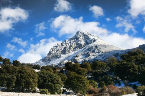
- Geological formations like dolinas, on the last part of the tour.
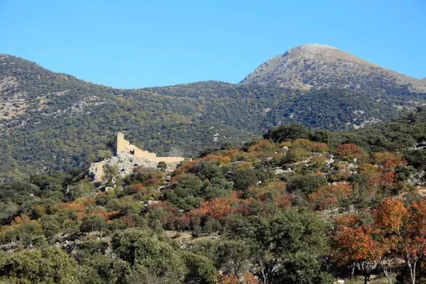
- The sighting of royal eagles in flight, and mountain goats at the summits, is common.

The path begins in a lane that part of kilometer 13 of the A-324 road that unites the towns of Cambil and Huelma, close to the visitor center Mata Bejid.

It has access from the A-324 (Cambil-Huelma) road, at the height of Mata-Bejid. From this town part a road to the west leading to the starting point of the path, located at the crossing of the road with the road A-324.