Saltar al contenido principal

Valdepeñas de Jaén – Noalejo – Campillo de Arenas (C1)

Submitted by brandcode_deweloper on
Breve descripción

A long, demanding route linking mountain and countryside, stringing together historic passes, inland valleys and open landscapes. A mixed-surface itinerary, with prolonged climbs and sustained descents, passing through such distinctive spots as the Cañón de los Pitillos, the Piedra del Palo and the Quejigo del Amo, a Natural Monument. Ideal for experienced cyclists seeking variety and terrain.
The route sets off from Valdepeñas de Jaén, leaving the town to climb through olive-grove hillsides and patches of Mediterranean scrubland. The initial ascent leads to the Puerto de los Carboneros, the first pass of the day, which acts as a transition between slopes and opens up the view towards the Sierra Sur. From here, the route strings together quiet, narrow roads, isolated farmhouses and secluded valleys, before tackling the Cuesta de la Burra and the Puerto de los Vinateros, passes historically linked to livestock droving and muleteers.
The route continues towards the Puerto de los Azores, one of the most rewarding viewpoints along the way, then descends through olive groves and open areas to the outskirts of Noalejo, where the landscape softens and allows for a refreshment stop. From here, the route heads towards Campillo de Arenas, alternating secondary roads and rural tracks, always with Sierra Mágina in the background.
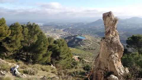
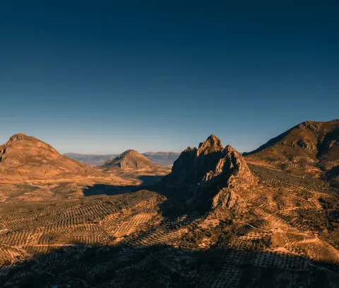
The most mountainous stretch comes when the route enters livestock trails and gravel tracks, following old droving routes such as the Cordel de Jaén. It approaches the Cañón de los Pitillos, where the Valdearazo river carves its way between limestone walls, with the option of a detour to the Mirador de la Piedra del Palo, a natural viewpoint over the tail end of the Quiebrajano reservoir. Further on, the path reaches the area around the Quejigo del Amo (or del Carbón), a monumental tree and symbol of the Mediterranean woodland, before heading back towards Valdepeñas de Jaén along traditional paths through olive groves and ravines.
It is a route that demands stamina, but rewards riders with a rich diversity of landscapes, a real sense of the territory, and the feeling of a complete crossing.
imagen
Image
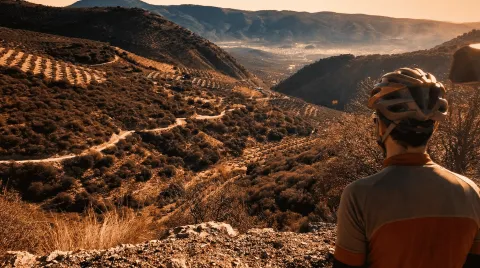
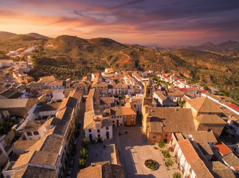
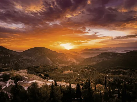
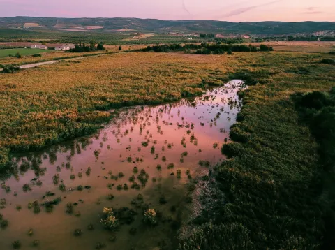
RUTA C1 ATARDECER
Imagen principal
Desactivado
imagen
Image
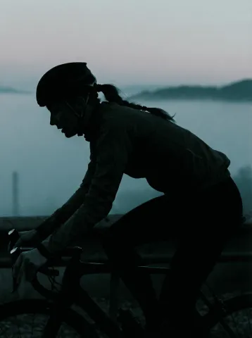
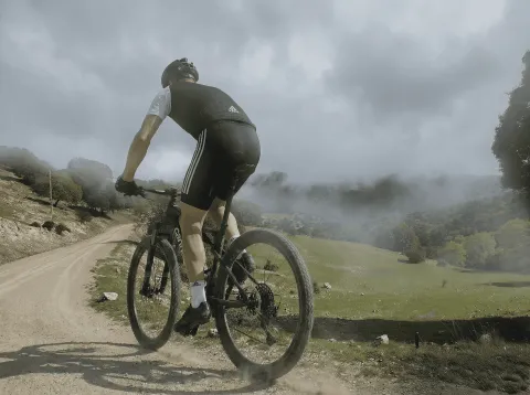
Ciclista
Imagen principal
Desactivado
imagen
Image
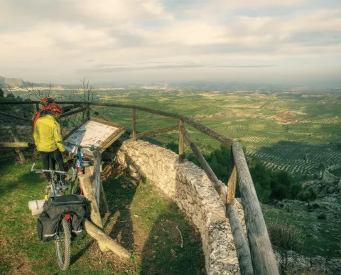
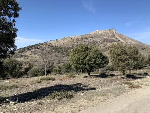
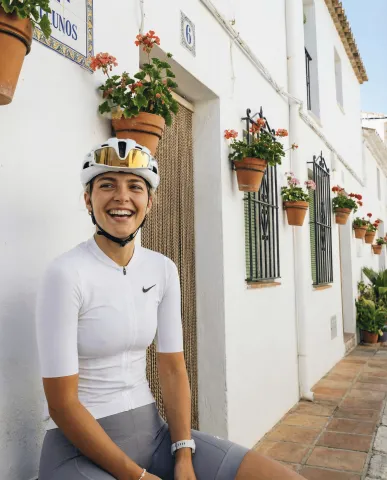
Ciclistas observando la sierra y campiña de Sierra Mágina
Imagen principal
Desactivado
imagen
Image
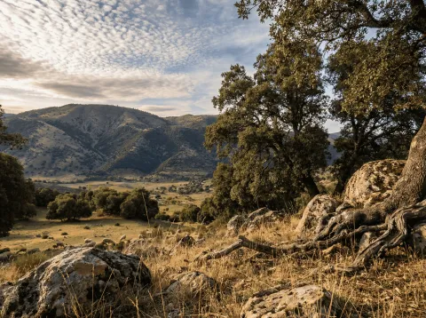
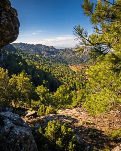
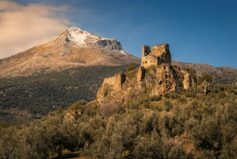
Sierra Mágina
Imagen principal
Desactivado
imagen
Image
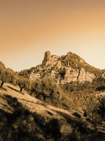
Piedra del Palo
Imagen principal
Desactivado
imagen
Image
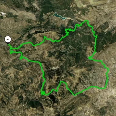
ruta
Imagen principal
Activado
6:30
Puntos del trazado
Latitud
37.5900
Longitud
-3.8200
Latitud
37.52902
Longitud
-3.65422
Latitud
37.5553093
Longitud
-3.6354566
Medium

68,1 km

2.801,0
2.801,0
2.734,0
Desactivado

Route recommended for cyclists with good physical fitness. Check the weather forecast, as there are exposed stretches and stony track sections where the surface can vary. Take care on long descents and at road crossings. Carry enough water and respect livestock trails and fencing. On detours to viewpoints, take extra care near cliff edges.

Route card

Km. 0

La ruta parte del casco urbano de Valdepeñas de Jaén y abandona la localidad por el sur. En un giro a la izquierda tomaremos una carretera vecinal asfaltada que avanza entre lomas de olivar. Un segundo giro a la izquierda nos deja en una vía de mayor continuidad, también asfaltada. Tras unos primeros metros de suave rodaje, la carretera comienza a ganar altura progresivamente, dibujando curvas que ofrecen vistas hacia el valle y los montes que rodean la población. Un paisaje que combina olivar en terraza con manchas de encinar y quejigal en umbrías. A medida que ganamos cota, podremos disfrutar de bonitas vistas hacia la Sierra Sur. El camino discurre entre bancales de olivo y manchas dispersas de matorral mediterráneo, recordando el uso agrícola tradicional de estas laderas. Poco a poco, el paisaje se vuelve más abierto y agreste, con laderas pedregosas y pequeñas vaguadas. El Puerto de los Carboneros (1.340 m) se alcanza al coronar la divisoria, en un collado amplio que actúa de paso natural entre vertientes. Es un buen punto para breve parada: resguardo del viento, ofrece panorámica de sierras calizas subbéticas y marca el final del ascenso principal de este primer tramo.

Km. 4,2

Desde el Puerto de los Carboneros (1.340 m), la ruta continúa en dirección noroeste, por una estrecha carretera asfaltada que desciende suavemente al inicio. A poco más de un kilómetro, el camino bordea el Cortijo de los Carbonerillos, situado a mano derecha, junto al Arroyo de Carboneros, que da nombre al valle y se convierte en una referencia acústica y visual de este tramo. Este cortijo es ejemplo de arquitectura rural ligada al aprovechamiento agrícola y ganadero de estas sierras. Superado este enclave, el trazado gira levemente hacia el norte y comienza a ganar altura de forma progresiva. El perfil se endurece a medida que la carretera serpentea en sucesivas curvas, flanqueada por laderas cubiertas de monte bajo y pinares de repoblación, que se alternan con claros y pequeños barrancos. En el tramo final, la orientación vuelve a ser noroeste, afrontando las rampas más sostenidas que conducen hasta la Cuesta de la Burra (1.440 m). Este collado natural ofrece un respiro al ciclista y una panorámica amplia: hacia el este se distinguen los valles que descienden hacia el río Valdearazo, mientras que hacia el oeste la mirada se abre hacia la campiña olivarera de la Sierra Sur.

Km. 11,5

Desde la Cuesta de la Burra, la ruta continúa en dirección sureste por un camino asfaltado estrecho que se abre paso entre lomas de olivar y manchas dispersas de matorral mediterráneo. El ascenso es moderado, con tramos de subida continuada que exigen pedaleo constante, aunque sin pendientes fuertes. Tras unos dos kilómetros de avance, el itinerario deja a la izquierda varias antiguas caserías vinculadas a la explotación del monte y a la pequeña ganadería tradicional. A lo largo del camino se distinguen barrancos y vaguadas donde aflora la vegetación de ribera —zarzas, adelfas y algún taray—, que contrasta con la monotonía olivarera del entorno. El relieve se hace más abierto conforme nos aproximamos al Puerto de los Vinateros, paso natural situado a unos 2’5 km del inicio del tramo.

Km. 13

Este collado recibe su nombre por ser, según la tradición, lugar de tránsito de arrieros y vinateros que cruzaban entre las sierras y la campiña. Desde este punto, las vistas se amplían al suroeste, hacia la campiña y las laderas que descienden al valle. Desde el Puerto de los Vinateros, el itinerario prosigue en dirección suroeste por un camino de montaña, con un perfil ascendente que gana altura de forma constante. La carretera se estrecha y serpentea entre laderas de olivar y manchas de monte bajo, donde reaparecen encinas y quejigos y es posible encontrar formaciones de matorral mediterráneo como coscojas, lentiscos y jaras. Encontraremos que durante unos 1’9 km el trazado coincide con parte del trazado de GR7. El trazado mantiene una subida progresiva, con algún tramo de mayor pendiente que requiere esfuerzo constante al ciclista. Tras recorrer unos 4,5 km desde el collado anterior, se alcanza el Puerto de los Azores, otro paso natural que conecta estas sierras interiores y que constituye un excelente mirador sobre la Sierra Sur de Jaén.

Km. 18

Desde el puerto, la ruta inicia un descenso moderado en dirección noreste, avanzando por una estrecha carretera asfaltada que se desliza entre vaguadas y lomas suaves. A medida que se pierde altitud, aparecen las primeras referencias del parque eólico Sierra del Trigo, con sus aerogeneradores dominando el horizonte. El recorrido alterna tramos de bajada con suaves ondulaciones, rodeado por un mosaico de olivar y zonas despejadas que evidencian la vocación agrícola del territorio. Finalmente, tras unos 3,8 km de pedaleo, se alcanza la subestación del parque eólico, punto de referencia clara en este sector de la ruta.

Km. 23,5

Desde la subestación del parque eólico, el recorrido continúa en dirección este-noreste unos 5 km por una carretera asfaltada. El trazado avanza entre lomas cubiertas de olivar, intercaladas con manchas de vegetación mediterránea donde prosperan coscojas, jaras y tomillos. El perfil, favorable en algunos tramos, mantiene un suave descenso que permite disfrutar de panorámicas abiertas hacia el valle a medida que alcanzamos las inmediaciones de Navalcán.

Km. 29,6

Desde el paraje de Navalcán, la ruta inicia un descenso progresivo siguiendo un firme de camino rural asfaltado que discurre entre lomas de olivar. El trazado se abre con amplias vistas hacia el valle que se extiende frente a Noalejo, mientras a la espalda quedan los relieves de Sierra Mágina. El camino, cómodo y sin grandes pendientes, avanza entre cortijos dispersos y parcelas de olivar que ocupan casi por completo estas tierras de transición entre la sierra y la campiña. A lo largo del descenso, se atraviesan pequeños barrancos de escorrentía, modelados por la erosión y flanqueados por vegetación mediterránea adaptada a la aridez. Finalmente, tras unos 5’3 km desde Navalcán la ruta alcanza el núcleo urbano de Noalejo, entrando por la zona baja del municipio y remontando ligeramente hasta el centro urbano. El entorno de la Plaza de España es un buen punto para avituallarse y ajustar la ruta antes de continuar hacia el este en dirección a Campillo de Arenas.

Km. 33,8

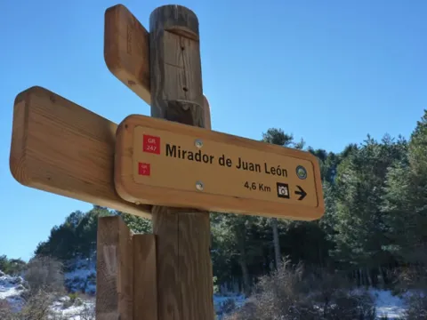
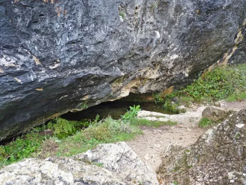
Abandonamos el tramo urbano de Noalejo por la JV-2229 hasta alcanzar el cruce con la N-323, donde tomamos dirección a Campillo de Arenas. Desde este punto, la ruta prosigue por la nacional durante unos 4,5 km en firme asfaltado y de cómodo pedaleo. El itinerario avanza paralelo a la ladera norte de Sierra Mágina, entre un mosaico de olivares en pendiente y pequeños cortijos dispersos que recuerdan el carácter agrícola de esta zona. La carretera, de trazado sinuoso pero cómodo, desciende de manera progresiva siguiendo el corredor natural que conecta ambos municipios. En el horizonte se van perfilando los cerros que protegen Campillo de Arenas, al aproximarnos a la localidad, podremos reconocer el cerro coronado por su castillo medieval, hito visual que anuncia la llegada al municipio. El acceso a Campillo de Arenas se realiza tras un suave descenso final, entrando al municipio por la N-323 y alcanzando sus primeras calles tras unos 4,2 km desde Noalejo. Abandonamos Campillo de Arenas dirigiéndonos al noroeste por la calle Barranquillo hacia la calle Acera del Río. Tras recorrer unos 130 m, giramos a la izquierda para incorporarnos a la JV-2228. Apenas 600 m después, tomamos un carril a la derecha que nos conducirá progresivamente hacia las lomas que cierran el valle. El firme es inicialmente asfaltado, aunque pronto pasa a ser un carril de zahorra compactada, con un trazado cómodo en suave ascenso. Los olivares dominan el paisaje en los primeros kilómetros, hasta que aparecen zonas de monte bajo, plantaciones de almendros y pinares de repoblación que recuerdan la vocación forestal de estas sierras. Este camino coincide en varios tramos con cordel de Jaén, vía pecuaria de gran tradición en la comarca, utilizada durante siglos para la trashumancia y el movimiento de ganados entre la campiña y las sierras. El firme presenta tramos pedregosos e irregulares que requieren precaución en la marcha. El itinerario continúa por el Cordel de Jaén hasta alcanzar una bifurcación claramente señalizada. Si tomáramos el desvío a la derecha, podríamos enlazar con Carchelejo y con la ruta cicloturista C2; mientras que este trazado que recorremos conecta con un tramo del GR 7, perfectamente balizado y coincide con el comienzo de la ruta de senderismo que nos conducirá a la Piedra del Palo. En nuestro caso seguimos de frente, avanzando hacia el Cortijo del Cortijuelo, que se alza como punto de referencia en el camino. La senda gana altura suavemente hasta aproximarse al collado de la Cañada del Sabinar y el paraje del Cañón de Pitillos, labrado por el río Valdearazo. El Valdearazo se encajona de forma espectacular entre altas paredes calizas, describiendo varios meandros que hacen aún más impresionante el cañón. Curiosas formaciones pétreas salpican todo este paraje, como la piedra del Palo, una formación rocosa singular que se erige como hito natural del recorrido y lugar de parada obligada para quienes buscan disfrutar de la grandeza del paisaje y de la naturaleza. A ella podremos llegar tomando un desvío a la izquierda de nuestra marcha que nos conduce al Mirador de la Piedra del Palo.

Km. 50,3

Desde las inmediaciones del Cañón de los Pitillos, la ruta prosigue en dirección suroeste, afrontando un ascenso progresivo por pista pedregosa que requiere precaución en la marcha. El camino se abre paso entre laderas de matorral mediterráneo y coscojares, con tramos donde el desnivel se hace más evidente. Tras recorrer unos 5 km, se alcanza el Collado de los Yeros, paso natural que comunica varios barrancos y ofrece una buena panorámica de las umbrías cercanas. El camino está salpicado de un abrupto paisaje típico mediterráneo con bosques de encinas, alcornoques, pinos y quejigos centenarios, pero de entre todos ellos destaca el Quejigo del Amo o del Carbón. Desde este collado, el itinerario desciende suavemente durante el primer kilómetro, siempre en rumbo oeste-suroeste, bordeando laderas más abiertas. El firme continúa siendo irregular, con presencia de piedra suelta. Poco después, la pendiente se invierte y comienza un desnivel continuo hacia el siguiente hito. Tras un total de 2,7 km desde el collado, se llega al entorno del Quejigo del Amo o del Carbón, ejemplar monumental de gran porte y longevidad. Situado en el municipio de Valdepeñas de Jaén, fue declarado Monumento Natural en 2001. Este ejemplar representativo de la vegetación autóctona mediterránea, está considerado como uno de los de mayores dimensiones del territorio andaluz. Este quejigo constituye no solo un valor natural de primer orden, sino también un símbolo etnográfico ligado a los antiguos usos del monte.

Km. 57

Desde el entorno del monumental Quejigo del Amo, la ruta inicia un tramo descendente que avanza en dirección suroeste. El firme es pedregoso en varios puntos, por lo que conviene extremar la precaución, sobre todo en épocas húmedas. El recorrido atraviesa laderas de monte mediterráneo y olivares hasta alcanzar el Collado del Cañón, paso natural que ofrece amplias vistas hacia los barrancos próximos. A partir de aquí la marcha prosigue entre repechos suaves, alternando descensos y ligeras subidas, hasta alcanzar el Collado de Navalayegua, punto estratégico desde donde se abre el horizonte hacia las estribaciones que rodean Valdepeñas de Jaén. Los últimos kilómetros discurren por caminos tradicionales, entre olivares y pequeños barrancos, recordando la estrecha relación entre este territorio y los usos agrícolas y ganaderos que lo han modelado durante siglos.

Km. 67,7

Finalmente, el itinerario se adentra de nuevo en el núcleo urbano de Valdepeñas de Jaén, cerrando el circuito circular. El regreso al punto de partida permite al ciclista valorar la diversidad de paisajes atravesados: desde los collados serranos y los hitos naturales —como la Piedra del Palo o el Quejigo del Amo— hasta las laderas de olivar y los pasos tradicionales de las vías pecuarias. Un recorrido exigente en su kilometraje y desnivel, pero de gran riqueza cultural, natural y etnográfica, que resume la esencia de Sierra Mágina.

Jaén – Puente de la Sierra – Otíñar – Carchelejo – La Guardia (C2)

Submitted by brandcode_deweloper on
Id
RUT-0019
Descripción larga
Circular route of medium-long distance that connects Jaén with the valleys of the Quiebrajano and the Guadalbullón, linking water, heritage and mountain landscape. The tour combines a progressive rise to the interior of Sierra Magina with a comfortable return through the countryside, passing through enclaves as unique as Otiñar, the Hazadilla Canyon and the natural views of La Guardia. A balanced proposal for cyclists looking for territory, history and variety of environments. The route leaves Jaén, leaving the urban environment behind to roll south on secondary roads across traditional gardens and olive groves. From the first kilometers, the Castle of Santa Catalina is left behind as a visual reference, as the route enters the natural corridor of the Quiebrajano River, a clear transition between the Jiennense countryside and the first mountain foothills. The passage through Puente de la Sierra, a historic recreation place linked to the water and the valley, marks the beginning of the most serrano stretch. From here on, the road accompanies the river between gardens, houses and limestone slopes, with a constant but grateful rise. In this area, the ruins of the Otiñar Castle, embellished on a rocky promontory, and the nearby Abrigo del Toril, one of the most unique sets of rock art in the surrounding area, are highlighted. The rise continues towards the Hazadillas Canyon, a former livestock enclave and access door to the interior saws. The landscape becomes more mountainous: ravines, cascades and repopulation pines alternate with oaks and complaints, providing shade and a feeling of height. This section links with sectors shared with other cycloturist routes and finally leads to Carchelejo, a white core located on the edge of Sierra Magina and excellent balcony over the Guadalbullion valley. From Carchelejo, the itinerary changes its tone. The profile softens and begins a comfortable descent on more open roads, following the historical corridor of the N-323a, an old axis of communication between the saw and the countryside. The pedal is made fluid between endless olive groves, sharing for a few kilometers drawn with other cycloturist routes. The arrival at La Guardia de Jaén, located on the top of a hill, adds a marked heritage component. Its medieval castle and the Renaissance church dominate a wide transition landscape, with open views towards the valley and the mountains. From here, the return to Puente Jontoya and Jaén is made by a favorable route, between gardens, cortijos and river vegetation, closing a circuit that combines nearby mountain, history and water culture. General recommendations Suitable route for cyclists with minimal experience on long routes. The meteorology should be reviewed, especially in the serrano section between Puente de la Sierra and Carchelejo. Attention in long-term and shared sections with time traffic. Take sufficient water and respect natural and heritage enclaves, especially in sensitive areas such as Otinar.
Breve descripción
Circular route of about 62 km leaving Jaén on the Road of Valdecañas towards Puente de la Sierra, it goes back to the Quebrajano valley to the ruins of Otiñar and ascends to Carchelejo and La Guardia on mountain roads, to return later to Jaén on the old N-323a, the service area El Oasis, La Cerradura and the Jontoya valley.
Latitud
37.7796
Longitud
-3.7849
Distrito
Municipio
Ubicación en el mapa
POINT (-3.7849 37.7796)
imagen
Image
c2_1.png
Imagen principal
Desactivado
imagen
Image
c2_2.png
Imagen principal
Desactivado
imagen
Image
c2_3.png
Imagen principal
Desactivado
imagen
Image
c2_4.png
Imagen principal
Desactivado
imagen
Image
c2_5.png
Imagen principal
Desactivado
imagen
Image
c2_6.png
Imagen principal
Desactivado

Sport

icon-intereses-deporte
Baja - Media
Jaén – Puente de la Sierra – Otíñar – Carchelejo – La Guardia (C2)
62,5 km
1575m
Desactivado
Tramo de asfalto o cemento
 
Tramo de pista o camino forestal
 
Tramo de vía pecuaria
 
Tramo de senda
 

Fuenmaandor, Navaparis, altos de Mágina (C3)

Submitted by brandcode_deweloper on
Id
RUT-0018
Descripción larga
Panoramic tour of the north of Sierra Magina with start and end in Fuenmayor. A complete and very scenic layout, which combines asphalt and track sections with long ascends to high balconies such as Mojón Blanco and Peña del Águila, and a more friendly return linking cores with services such as Mancha Real and Pegalajar. Ideal for mixed audience looking for viewpoints, water and rural landscape by pedal. The route starts in the fresh environment of the Recreative Area of Fuenmayor, with the rumor of the spring marking the beginning. From here, it is on a progressive rise towards Navaparís, a stretch that leaves behind olive groves and banks - with the presence of cherry trees in the area - and is gaining a serrano atmosphere. As the route goes up, the landscape moves to oak and whine spots, and traditional water points such as the Navaparís Fountain and the Fountain of Uncle Mouse appear, historically linked to the passage of pastors and walkers. The stretch of height leads to Mojón Blanco, geodetic vertex and clear reference on the route, and continues to the Peña del Águila, one of those viewpoints that justify the effort: to the north the countryside and the villages of the mountain edge are opened; to the south the mountain alignment of Magina is cut. From there, the tour goes comfortably to Mancha Real, a good point for a pause and services, before continuing to Pegalajar. - In the sector of Pegalajar, the route adds up to a very territorial component: the Charca de Pegalajar as an icon of the water in the landscape, and the transition to rural roads and livestock roads leading to the Abradero de Villanueva, an enclave of strong livestock tradition. From here on, the itinerary again gains height in the direction of Mata Bejid, linking with shared sections with other routes of the intermodal system and passing through heritage references such as the Castle of Mata Bejid and its dehesas and pastures environment. The return is resolved by tracks and half-mountain roads that lead back to the Fuenmayor area, with the option to approach (according to signs) the surroundings of the Cascade del Zurreón, before closing the circuit in the recreational area. The result is a round route: glances, dehesa, water and villages, on a varied and very representative pedal day in northern Magina. General recommendations Recommended route for cyclists with a certain custom to long climbs. Check the weather: in the heights there may be wind and sudden changes. Attention to sections of zahorra / track with loose or firm irregular gravel and to sectors marked with the presence of cattle (respect fences and local rules). It has sufficient water and plans stops in cores with services (Real, Pegalajar).
Breve descripción
A circular route of almost 64 km that begins in the Recreative Area of Fuenmayor and ascends between orchards and cherry trees to Navaparís and the Fountain of the Uncle Mouse. From Mojón Blanco, the route continues along the road to the repetitive communications station and follows to the Peña del Eagle, a classic lookout known for the practice of paragliding flights, before going down to Mancha Real. The second half of the route links the Fountain / Mirador of the Seven Piles with the Vereda del Llano de Peñuelas, the Villanueva abrevadero, and the hermitage and the castle of Mata Bejid, before reaching the high areas of the Sierra Magina and returning to Fuenmayor by a forest track that crosses the pine trees.
Latitud
37.8103
Longitud
-3.4501
Distrito
Municipio
Ubicación en el mapa
POINT (-3.4501 37.8103)
imagen
Image
_mg_6408-jpg
Imagen principal
Activado
imagen
Image
c3_1.png
Imagen principal
Desactivado
imagen
Image
c3_2.png
Imagen principal
Desactivado
imagen
Image
c3_3.png
Imagen principal
Desactivado
imagen
Image
c3_4.png
Imagen principal
Desactivado
imagen
Image
c3_5.png
Imagen principal
Desactivado
imagen
Image
c3_6.png
Imagen principal
Desactivado

Sport

icon-intereses-deporte
Media - Alta
Fuenmayor, Navaparis, altos de Mágina (C3)
63,9 km
2320m
Activado

Conexión con Larva (C9)

Submitted by brandcode_deweloper on
Id
RUT-0014
Descripción larga
A linear route of 3.68 km that connects the ciclable C7 with the municipality of Larva, by a 100% asphalt route, with soft levels and very accessible character. It is a short tour, ideal as a link section within the cycloturist network or as a quiet exit to discover the open landscape of the eastern sector of Sierra Magina. The route starts on the JV-3213 road, next to the bridge over the railway tracks, and is heading north towards Larva. The first meters run parallel to the railway line, accompanied by a carrasco pinar that brings shade and freshness. In this section you will travel through the Cordel del Camino de Ubeda to Cabra, an old pecuaria road that adds a clear historical and ethnographic value to the journey. As you advance, the landscape opens between splits and olive groves, with constant views of Sierra Magina on the left and the hills of the Sierra de Larva on the right. After passing by the Cortijo de San Pedro, a living example of the olive culture, the tour gains visual amplitude: the olive sea of La Loma appears and, at the bottom, the summits of the Sierra de Cazorla, Segura and Las Villas. In the final section, after leaving behind the Cortijo de Caro, the slope gradually increases and the ascent to Larva begins, with wide panoramic views of the Jiennense olive and the reliefs that close the horizon. The route concludes in Larva, a quiet village that invites you to walk and complete the day with a visit to its natural environment, such as the La Cañada area. General recommendations Route suitable for all types of public and road or gravel bicycles. Caution at the beginning, next to the JV-3213. On hot days, the shadow is limited outside the initial pinar. It is recommended to bring sufficient water and always respect the rural environment and the livestock routes.
Breve descripción
A short-distance Itinerary that connects the surroundings of Jódar with the municipality of Larva through a quiet and very landscaped route, running between pinars, spartizales and extensive olive trees on local roads and old livestock roads. The route advances along the railway road and old cortijos, offers wide panoramic views of Sierra Magina, the Sierra de Larva and the olive sea of La Loma, and culminates in the cozy village of Larva, with access to nearby natural spaces such as the Natural Park of La Cañada.
Latitud
37.6502
Longitud
-3.2504
Distrito
Municipio
Ubicación en el mapa
POINT (-3.2504 37.6502)
imagen
Image
_mg_4011-jpg
Imagen principal
Activado
imagen
Image
c9-2.jpg
Imagen principal
Desactivado
imagen
Image
c9-1.jpg
Imagen principal
Desactivado
imagen
Image
c9-3.jpg
Imagen principal
Desactivado

Sport

icon-intereses-deporte
Baja
Conexión con Larva (C9)
3,68 km
87m
Desactivado

Cambil – Mata Bejid – Huelma –Arbuniel (C4)

Submitted by brandcode_deweloper on
Id
RUT-0010
Descripción larga
Circular Itinerary of about 56 km that leaves and returns to Cambil, linking some of the most representative landscapes and nuclei in the western sector of Sierra Magina. It combines comfortable asphalt, sections between olive groves and steps through water and heritage enclaves such as Mata Bejid, Huelma and Arbuniel. A balanced route, designed to enjoy the landscape, villages and recreational areas, with progressive levels and good pedal rhythm. The route begins in Cambil, a serrano municipality with a marked historical character, from where the A-324 is taken towards Huelma. The first kilometers advance between olive lomas and limestone reliefs that announce the saw, with open views and a fluid pedal. Soon the surroundings of Mata Bejid, home and place are very linked to the rural memory of Magina, where the hermitage, the fountain and the silence of the mountain invite a brief pause. The Mata Bejid Visitors' Center and the Peralejo Recreative Area are located very close to the site, which is a real entrance door to the heart of the massif. This section concentrates several values of the territory: well-preserved public mountain, pine trees, oak trees and the connection with larger trails. The tour continues to the area of the Fuensanta, where the hermitage and its natural environment reinforce the cultural and devotional character of the saw, before reaching the Fuente de la Teja, with its old restored washers, one of the most grateful points to stop. The arrival in Huelma provides services and heritage: castle, church and urban parks mark a change of pace before leaving the core for the JA-4204 heading to Arbuniel. The route runs between olive groves and fields of cultivation, following a more open and agricultural landscape until the detour to Arbuniel, where water is once again a protagonist. The birth of the Arbuniel River and its recreational area, with acequias, shadow and constant rumor, offer one of the most fresh and unique enclaves of the entire route. From Arbuniel, the return to Cambil is done by linking local roads and steps under the A-44, with wide views of the mountains that close the valley and a comfortable profile that allows to enjoy the final pedal. The circuit is closed again in Cambil, completing a varied day that sums up well the relationship between water, olive, saw and villages in this sector of Magina. General recommendations Suitable route for road cycling and light gravel. See the weather, especially in summer, and plan stops in Huelma and Arbuniel for avituallation. Attention at the crosses with the A-44 and the N-323a and respect the signage. It has enough water, although you will find sources and recreational areas along the route. Ideal to enjoy without haste, combining pedal and small cultural stops.
Breve descripción
Circular route of about 56 km with start and end in Cambil that ascends through the A-324 towards Mata Bejid and the Visitors Center, continues between olive groves and Mediterranean mountain towards Huelma and Arbuniel, where the birth of the Arbuniel River is visited, and returns back to Cambil after linking with the N-323a and several accesses to the A-44, combining rural roads, landscapes of Magina and small recreational areas.
Latitud
37.6681
Longitud
-3.5742
Distrito
Municipio
Ubicación en el mapa
POINT (-3.5742 37.6681)
imagen
Image
1.jpg
Imagen principal
Activado
imagen
Image
c4_1.png
Imagen principal
Desactivado
imagen
Image
c4_2.png
Imagen principal
Desactivado
imagen
Image
c4_3.png
Imagen principal
Desactivado
imagen
Image
c4_4.png
Imagen principal
Desactivado
imagen
Image
c4_5.png
Imagen principal
Desactivado
imagen
Image
iglesia huelma 2.jpg
Imagen principal
Desactivado

Sport

icon-intereses-deporte
Baja - Media
Cambil – Mata Bejid – Huelma –Arbuniel (C4)
55,7 km
1329m
Activado

Cabra del Santo Cristo · Estación de Huesa · Alicún de Ortega · Estación de Cabra del Santo Cristo (C7)

Submitted by brandcode_deweloper on
Id
RUT-0009
Descripción larga
Circular route of about 63 km that connects Cabra del Santo Cristo with the station of Huesa and Alicún of Ortega, along the eastern sector of Sierra Mágina. The itinerary combines railway heritage, agricultural landscapes and some of the most unique reliefs of the region, such as the badlands and cascades of Alicún. It is an accessible and very contrasting proposal, where the reading of the territory - rail, spartum, olive and erosion - accompanies each section. The route starts in the Municipal Park of Cabra del Santo Cristo and gains height gently to the Mirador de Cabra, the first balcony of the route, from which the transition between the olive countryside and the foothills of Sierra Magina is recognized. From here, the route descends to the Salado stream, rolling in parallel to the railway track, which acts as the driving thread of the landscape. In this sector there are the first contrasts: very eroded white soils, attached rambles and repopulation pines that soften the aridity. Before arriving at the station of Huesa, it is worth the detour to the ravine of the nuns, where an interesting set of houses is preserved - cave linked to the exploitation of the spartum and to the railway history of the late 19th and early 20th century. The station, opened in 1898, is a good place to stop and understand the importance of the train in the articulation of this territory. From Huesa, the route is directed south and south-west, through a more open landscape dominated by olive groves and dehesas. In this section we still see the traces of the 2015 fire in the Peña del Cambrón, now in the process of natural regeneration and repopulation. The relief is gently waved until, as it approaches Alicún de Ortega, the landscape changes radically. The access to Alicún runs between badlands and cascades, one of the most striking geomorphological sets in the province: hillsides surrounded by erosion, deep rambles and abrupt profiles that offer a very different visual experience than that of the serrano olive tree. After reaching the surroundings of Alicún de Ortega, the route turns back to the west, maintaining a comfortable pedal between cultivated and empty lomas where the riverside vegetation reappears. The return reaches the Cabra Station of the Holy Christ, another relevant railway enclave. From here there is the option of a short detour to visit the Milenaria Encine, a unique example for its size and longevity. The last section runs by local road between olive groves, already in a soft profile, until they return to the urban centre of Cabra del Santo Cristo, where the routes C6 and C7 are combined and the circuit is closed. General recommendations Road suitable for road cycling and light gravel, suitable for mixed public with a certain physical base for its mileage. It is necessary to protect from the sun in the open sections and in the Badlands area, where the shadow is scarce. It carries sufficient water between stations and villages, and extreme caution in crosses with local roads and in the railway diversions. Respects fragile environments (cascades, casas- cave) and always stay in the signposted layout.
Breve descripción
Circular route of about 63 km that part of the Municipal Park of Cabra del Santo Cristo, ascends to its viewpoint and descends to the Arroyo del Salado and the station of Huesa, following the old railway corridor. From there it continues between olive groves and regenerated hillsides to the badlands and cascades of Alicún de Ortega, to return by olive looms and rambles attached to the station and back to the urban town of Cabra del Santo Cristo.
Latitud
37.6804
Longitud
-3.3802
Distrito
Ubicación en el mapa
POINT (-3.3802 37.6804)
imagen
Image
1.jpg
Imagen principal
Activado
imagen
Image
c7.jpg
Imagen principal
Desactivado
imagen
Image
c7-1.jpg
Imagen principal
Desactivado
imagen
Image
c7-2.jpg
Imagen principal
Desactivado
imagen
Image
c7-3.jpg
Imagen principal
Desactivado
imagen
Image
c7-4.jpg
Imagen principal
Desactivado

Sport

icon-intereses-deporte
Baja - Media
Cabra del Santo Cristo · Estación de Huesa · Alicún de Ortega · Estación de Cabra del Santo Cristo (C7)
62,5 km
1304m
Activado
Tramo de asfalto o cemento
 
Tramo de pista o camino forestal
 
Tramo de vía pecuaria
 
Tramo de senda
 

Bélmez de la Moraleda – Cabra de Santo Cristo -Solera (C6)

Submitted by brandcode_deweloper on
Id
RUT-0008
Descripción larga
Circular route of about 50 km that runs through the Jandulilla valley from Bélmez de la Moraleda to Cabra del Santo Cristo and Solera, alternating olive slopes, pine trees and limestone reliefs. It is an accessible route, with moderate slopes and comfortable descents, with a firm majority asphalt. It stands out for its clear reading of the territory: valley water, panoramic balconies and a very visible heritage (hermitage, lookout and castle), with the option of looking at the ibera footprint of the Cortijo del Pajarillo. The route begins in Bélmez de la Moraleda, leaving on local roads between olive groves and small loins that soon open their eyes to the saws that close the Jandulilla corridor. In the first kilometers there is the possibility of a (non-compulsory) detour to the castle of Bélmez and the caves of Baltibañas, before continuing to the valley. The itinerary gains character by joining the corridor of the Jandulilla River, where the landscape becomes more serrano: the olive tree is mixed with pinars and limestone florings. After crossing the river, the route begins a progressive rise to Cabra del Santo Cristo, with a change of tone that announces the transition to drier landscapes. In this section stands the Hermitage of the Holy Christ of Burgos, a good point for a short stop, and later the Mirador de Cabra, from which is recognized the southern façade of Sierra Magina and the saws that open to the east. The arrival in Cabra del Santo Cristo allows to regroup and avituallar in an urban environment with services. On the way out, the tour continues on local roads between olive lomas and small hills, with comfortable pedal and good views. On the way there is a detour to the Casa de la Pradera, a useful point for cyclists for their equipment linked to the maintenance and cleaning of bicycles. The stretch towards Solera returns the protagonism to the relief: the pedany is located at the foot of Mount Morron, with the Castle of Solera dominating the landscape as a visual milestone. Very close, a lookout allows to expand the panorama over the valley and the alignment of Magina. From here, the route returns to the Jandulilla corridor and links back to the road back to Belgium. In this sector, the Iberian Sanctuary of the Cortijo del Pajarillo is close, a reminder of the historical depth of the territory (visitable according to access and conditions of the moment). The circuit is closed again in Bélmez de la Moraleda, with a comfortable ending that invites you to finish the day by walking through the city centre. General recommendations A path suitable for mixed audiences with minimal experience in medium exits. See weather and wind, especially in open and looking areas. Attention to links and main road crossings; always in line and with visible elements. It has enough water and takes advantage of stops in Cabra del Santo Cristo and Solera to rest. In sensitive enclaves (caves / archeology), it respects signs and prevents access to unconditioned areas.
Breve descripción
From Bélmez de la Moraleda, this route proposes a route of about 50 km to Cabra del Santo Cristo and Solera, crossing the valley of the Jandulilla between hillsides of olive and pine. The Hermitage of the Holy Christ of Burgos, the Mirador de Cabra, the cyclist support point of the Casa de la Pradera and the castle of Solera on Mount Morron are highlighted. Very close, the Iberian sanctuary of the Cortijo del Pajarillo recalls the strong Iberian tradition of the territory.
Latitud
37.6701
Longitud
-3.3903
Distrito
Ubicación en el mapa
POINT (-3.3903 37.6701)
imagen
Image
1.jpg
Imagen principal
Activado
imagen
Image
c6.jpg
Imagen principal
Desactivado
imagen
Image
c6-1.jpg
Imagen principal
Desactivado
imagen
Image
c6-2.jpg
Imagen principal
Desactivado
imagen
Image
c6-3.jpg
Imagen principal
Desactivado

Sport

icon-intereses-deporte
Baja - Media
Bélmez de la Moraleda – Cabra de Santo Cristo -Solera (C6)
49 km
1153m
Activado

Bedmar – Jódar – Paraje Natural Alto Guadalquivir - Úbeda – Baeza (C8)

Submitted by brandcode_deweloper on
Id
RUT-0007
Descripción larga
A circuit of about 80 km that connects Bedmar with Jódar, Alto Guadalquivir and the Renaissance cities of Ubeda and Baeza, before returning to the starting point. The itinerary combines local roads, agricultural roads and bici lanes, with moderate ascends, a firm majority asphalt and a clear reading of the territory: river valley, olive countryside and historical heritage. It is a varied and very complete proposal, ideal for road cycling and light gravel. The route begins in Bedmar, heading north on the JV-3032 between olive groves, with early views of the Serrezuela de Bedmar and the Sierra Magina summits. The passage through the Lavadero de Bedmar recalls the historic relationship of the municipality with the water before leaving the asphalt to take compact tracks towards Salmerón and the Lavaderos de la Fuente Garciez, a good place to make a first stop. The entrance to Jódar marks the transit to the Guadalquivir valley. After crossing the urban centre, the route is heading east, alternating agricultural roads and road sections to reach the vicinity of the river. The crossing of the Puente de Ubeda la Vieja is one of the main points of the tour: here the Guadalquivir appears as the central axis of the landscape, accompanied by the view of Iltiraka and the ruins of Ubeda la Vieja, which provide a historical dimension to the itinerary. Very close, the detour to the Laguna de la Herradura allows you to discover a small wet area of great environmental value. From the valley, the tour gradually gains height in the direction of Ubeda, crossing the La Loma countryside, an infinite sea of olive groves on soft wavy hills. The arrival in this city, declared World Heritage, invites a longer stop to discover its historic centre and to regain strength. The route continues to Baeza by a bike lane parallel to the A-316, a comfortable and secure stretch that connects two of the most important Renaissance assemblies of Andalusia. After leaving Baeza behind, the tour is back towards the south, crossing the Guadalquivir along the Mazuecos bridge, a masterpiece of Renaissance engineering, and returning to the Bedmar Valley. The final part is between olive groves and small runoff barrels, with the possibility of a brief detour to the Cerro de Fique to enjoy a wider view of the Serrezuela and the mountain alignations of Sierra Magina. The return to Bedmar ends a long but balanced route, in which river landscape, countryside and urban heritage occur in a harmonious way. General recommendations Road and gravel bike-suitable route, with considerable mileage that requires good schedule planning and avitualations (Jódar, Ubeda and Baeza are key points for this). In summer it is recommended to avoid the central hours of the day due to the shortage of shade in the countryside. Pay attention to the crossings with communal roads and always respect the signposted route, especially in the river and agricultural areas.
Breve descripción
The Itinerary of almost 80 km that links the Guadalquivir valley with the plains of La Loma, connecting Jódar, Ubeda and Baeza on local roads and bike lanes. The tour crosses the Puente de Ubeda la Vieja, looks at the Mirador de Itiraka, offers the detour to the Laguna de la Herradura and ascends to the Renaissance cities of Ubeda and Baeza before returning to the Puente de Mazuecos and the Cerro de Fique.
Latitud
37.8244
Longitud
-3.3956
Distrito
Municipio
Ubicación en el mapa
POINT (-3.3956 37.8244)
imagen
Image
1.jpg
Imagen principal
Activado
imagen
Image
c8.jpg
Imagen principal
Desactivado
imagen
Image
c8-1.jpg
Imagen principal
Desactivado
imagen
Image
c8-2.jpg
Imagen principal
Desactivado
imagen
Image
c8-3.jpg
Imagen principal
Desactivado
imagen
Image
c8-4.jpg
Imagen principal
Desactivado
imagen
Image
c8-5.jpg
Imagen principal
Desactivado

Sport

icon-intereses-deporte
Baja - Media
Bedmar – Jódar – Paraje Natural Alto Guadalquivir - Úbeda – Baeza (C8)
86,7 km
1363m
Activado
Tramo de asfalto o cemento
 
Tramo de pista o camino forestal
 
Tramo de vía pecuaria
 
Tramo de senda
 

Torres - Hondacabras - Fuenmaandor - Puerto de Torres - Castillejos - Mata Bejid - Centro de visitantes del Natural Park

Submitted by brandcode_deweloper on
Id
2639034
Descripción larga

From Torres, and through the Pila Pellenda parquet, a mountain road is started towards Albanchez de Magina. A few four kilometres away we find a right turn, which gives access to the youth camp area Hondacabras. These sites were cattle's rest on the freckles that passed through these mountains. In this place begins a forest track between pine trees that gradually ascends for 4 Km, something beyond the Nita Fountain. When we get to the crossing we will change direction to make the promotion to the Port of the Mata. The floor of the track is firm, but we will find some outstanding ramps that the less experienced can invite them to take off their bikes. In 3.5 km the port is reached, a step between mountains - some above 2,000 meters. The landscape is a gift for the view: all the southern side of the Natural Park, mountains more than 2,000 meters of altitude (Almadén, 2.036 m., Ponce, 2.006 m and Cerro Cárceles, 2.061 m.), and dehesas in height of complaints, flocks of sheep..., and on the horizon the province of Granada. The rest of the way is down. Five and a half kilometres from the port we arrived at the Castlejo de Mata Bejid, a beautiful place that housed a garrison, which watched this passage on the Middle Ages border, and that until the first half of the 20th century it housed several families of settlers who cultivated the dehesas along the way. This castle was donated to the city of Jaén by the Catholic Kings in 1494, in reward for the services provided in the conquest of Cambil and Alhabar. Two kilometers of olive trees take us to the Cambil-Huelma road. At this point it is worth looking at the corrijada of Mata Bejid, where the spirit of the belle époque with rural dyes is still revived. It is a private property that has an interesting chapel, gardens, house of the gentlemen and even a garage of regionalist style. From here we can choose to go down to the town of Cambil, by the course of the Oviedo River (5 Km.), or better to get close to the new Visitors Center of the Natural Park just three km away. In addition to information from all over the Park, the centre has a shop, meringers, children's games, fountain, services and a walk area for people with reduced mobility.

Breve descripción

This route crosses the Sierra Magina massif by immediate areas to the high mountain. The tour begins and ends at the limits of the Natural Park, from south to north, through it completely.

Latitud
37.7917
Longitud
-3.5447
Distrito
Municipio
Ubicación en el mapa
POINT (-3.5447 37.7917)
imagen
Image
22394163Master.jpg
Imagen principal
Activado
imagen
Image
camping0.jpg
Imagen principal
Desactivado
imagen
Image
13277673.jpg
Imagen principal
Desactivado
imagen
Image
parque-natutal.jpeg
Imagen principal
Desactivado

Nature

icon-intereses-naturaleza

Friends

icon-intereses-amigos

Adventure

icon-intereses-aventura

Culture

icon-intereses-cultura

Sport

icon-intereses-deporte

Eco-friendly

icon-intereses-eco-friendly

For couples

icon-intereses-en-pareja

Family

icon-intereses-familia

Gastronomy

icon-intereses-gastronomia

Municipality

icon-intereses-municipio

Low-cost tourism

icon-intereses-turismo-low-cost

Solo travel

icon-intereses-viajar-solo
Torres - Hondacabras - Fuenmayor - Puerto de Torres - Castillejos - Mata Bejid - Centro de visitantes del Parque Natural
Desactivado

Route Cabra del Santo Cristo

Submitted by brandcode_deweloper on
Id
2638783
Descripción larga

If you prefer to save your promotion to Cabra, you can start your pedal in this town, but the beginning and end of the route will be very disconnected.

From here there are almost 20 km of solitary plains (including the detour and the visit to the Cabra Station), along the secondary road of the altiplano. The tour is very quiet because of the few slopes - except some ramps - and because of the near absence of road traffic. The road has a sufficiently cyclable floor, passing through repopulation pines, olive groves and high cerealist fields. The area consists of a succession of rural areas, with large panoramic to the south, with the permanent image of the summits of the Sierra Nevada Natural Park (province of Granada). To the north the summits of the Natural Park of Sierra Magina rise.

The last stretch is a continuous descent from the pedanean town of Solera to the valley of the Jandulilla River. Solera is a small town with a tiny old town set up around the ruins of a rocky castle that was watching the medieval border. This 15 km stretch ends in Huelma, where you can eat in one of its restaurants, and visit the Vandelvirian Church and its castle, both monuments of the Andalusian Renaissance.

Breve descripción

Unpublished route, near the Natural Park of Sierra Magina. The tour is divided into three sections: The first kilometers - just over 10 - represent a rise from the valley of the Jandulilla River to the high plane of Cabra of Holy Christ. This stretch stands out for the subdesert landscapes, a little known beauty of unique shapes and colors. From here there are still 7 Km. without slope to the town of Cabra of Holy Christ. In this town, one of the historic places of the espartera industry in southern Spain, you must visit its interesting church or eat at Casa Herminia restaurant.

Latitud
37.727883
Longitud
-3.377833
Distrito
Ubicación en el mapa
POINT (-3.377833 37.727883)
imagen
Image
31692175.jpg
Imagen principal
Activado
imagen
Image
Ruta%20Cabra%20del%20Santo%20Cristo.JPG
Imagen principal
Desactivado

Nature

icon-intereses-naturaleza

Friends

icon-intereses-amigos

Adventure

icon-intereses-aventura

Culture

icon-intereses-cultura

Sport

icon-intereses-deporte

Eco-friendly

icon-intereses-eco-friendly

For couples

icon-intereses-en-pareja

Family

icon-intereses-familia

Gastronomy

icon-intereses-gastronomia

Municipality

icon-intereses-municipio

Low-cost tourism

icon-intereses-turismo-low-cost

Solo travel

icon-intereses-viajar-solo
Ruta Cabra del Santo Cristo
All year round
Desactivado

53 km of asphalt roads with occasional traffic.

Coordenadas / Huso 30S
30S x = 466705 and = 4175691