Saltar al contenido principal
icon-intereses-cultura-del-toro

Granites of La Puerta de Segura

Submitted by brandcode_deweloper on
Id
876209
Descripción
Descripción larga

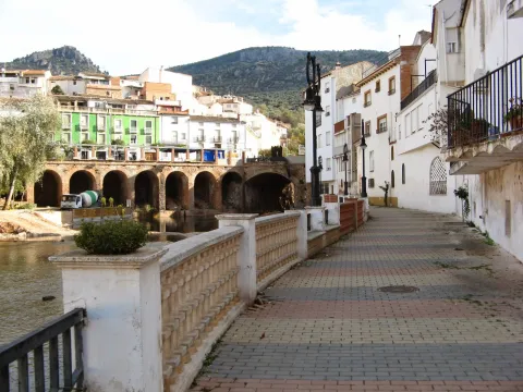
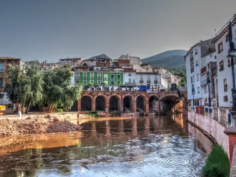
Aflation of paleozoic granite surrounded by prebetic (triasic) materials with which it has a relationship of inconformity. Part of the village is built on the granite, which force a meandro in the Guadalimar River.

These are pink-coloured granules in afloor, in which large quartz and feldspar crystals are distinguished, in general unmeteorized. They are part of a recently exhumed paleorelieve after the erosion of the triastic clays and herring that cover them regionally. This is the granitic outcrop of the Central Iberian Zone of the southernmost Iberian Massif and further into the Betic Externs.

Source: Inventory of Georresources of Andalusia. Environmental Council. Junta de Andalusia.

Breve descripción

Granites of The Safe Gate

Ubicación
Latitud
38.079566
Longitud
-4.164839
Distrito
Municipio
Ubicación en el mapa
POINT (-4.164839 38.079566)
Tipos de punto de interés
Imágenes carrusel
imagen
Image
puerta-segura%20%281%29.jpg
Imagen principal
Desactivado
Imágenes cabecera
imagen
Image
la_puerta_segura_1.jpg
Imagen principal
Activado
Loading map
Preparing points of interest and routes...

Gorge of Hornos

Submitted by brandcode_deweloper on
Id
913080
Descripción
Descripción larga

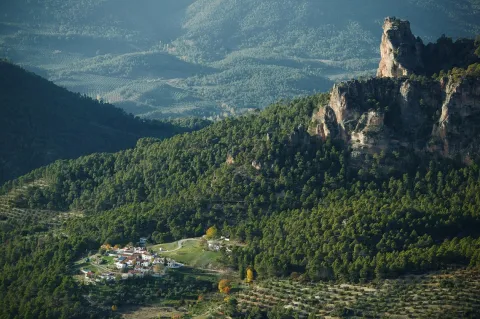
Half a mile from Hornos, on the right, you will find the look at Las Celadillas. Later on, do not stop visiting the charming village of La Capellanía, whose crossing is well marked to the left. From there you can walk along the signposted path PR-A 150, which is close to the steep slopes of the Yelmo Chico and allows you to contemplate a wide range of views. The A-317a road itself lends itself to the walk, as it has very little traffic since the new A-317 road was built from Hornos to Santiago de la Espada.

Breve descripción

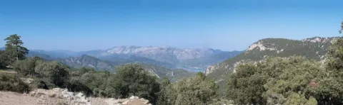
It is a long and deep valley all along the winding road A-317a, which rises at first between olive groves and then between closed pine trees, which are of carrasco pine in the lower area, black pine in the middle altitude strip and larix pine in the higher parts. Mixed with them, the oak trees and other species of the Mediterranean forest abound, forming a landscape of remarkable longitude.

Ubicación
Latitud
38.210827
Longitud
-2.685734
Distrito
Municipio
Ubicación en el mapa
POINT (-2.685734 38.210827)
Tipos de punto de interés
Imágenes carrusel
imagen
Image
Aldea%20de%20La%20Capellan%C3%ADa%20y%20valle%20de%20La%20Garganta%20-%20copia.jpg
Imagen principal
Desactivado
Imágenes cabecera
imagen
Image
hornos1.jpg
Imagen principal
Activado
Loading map
Preparing points of interest and routes...

Hermitage of the Señor de las Lluvias

Submitted by brandcode_deweloper on
Id
4619143
Descripción
Descripción larga

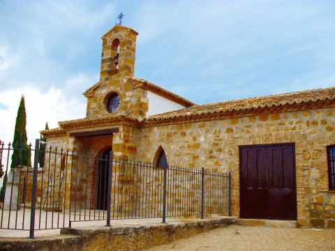
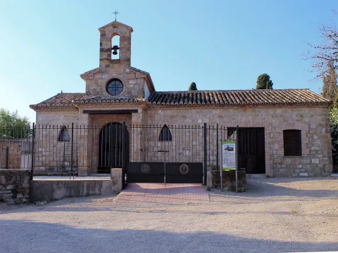
It is the only hermitage that is preserved in the 18th century Mengibar. It is located next to the Municipal Cemetery and was formerly known as Ermita del Humilladero. Today, it houses five images that process in the Holy Week of Mengibarians, including the Christ of the Rain that is traditionally entrusted in the years and periods of drought, hence its name.

Breve descripción

It is a small hermitage, of three narrow ships, the canyon vault centre and the adjoining sides separated from the centre by two large arches of half point brick seen.

Telecomunicaciones
Sitio web
https://mengibarturismo.com/
Teléfono de contacto
677 222 285
Correo electrónico
turismo@aytomengibar.com
Ubicación
Código Postal
23620
Latitud
37.964740
Longitud
-3.807580
Dirección
Camino de Mengíbar, 2
Distrito
Municipio
Ubicación en el mapa
POINT (-3.80758 37.96474)
Tipos de punto de interés
Imágenes carrusel
imagen
Image
La%20Ermita%20del%20Se%C3%B1or%20de%20las%20Lluvias.JPG
Imagen principal
Desactivado
Imágenes cabecera
imagen
Image
main_image_97252.jpeg
Imagen principal
Activado
Microsite al que pertenece
Loading map
Preparing points of interest and routes...

Hermitage of the Cristo del Llano

Submitted by brandcode_deweloper on
Id
5868386
Descripción
Descripción larga

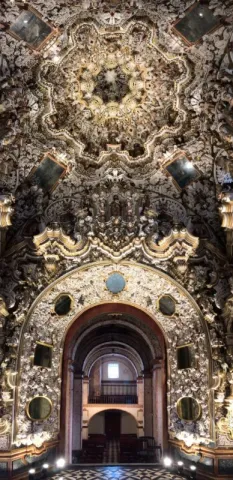
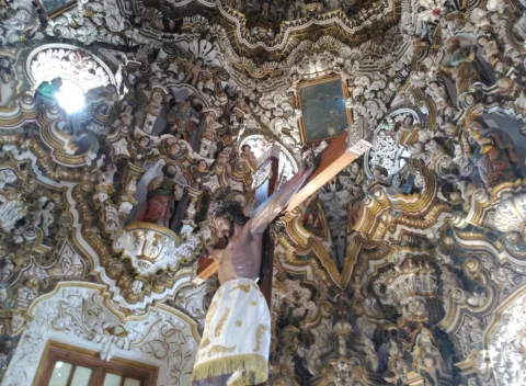
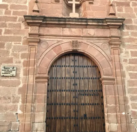
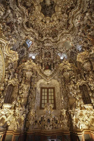
It is a shrimp-tower in spadna that dominates by its volume the rest of the temple, whose interior stands out by its funning decoration with geometric and vegetable elements that fill its walls to frescoes with scenes of the New Testament that close the vault in height. It is a building built of reddish stone of regular cut and seat, with a ship with high choir at the feet to which it is accessed through a staircase inserted into a volume attached on the west side; cruise and high presbytery on steps, behind which the shrimp is available.

Breve descripción

Work of the 17th century, extended in its header with one of the most impressive shrimp of the Andalusian baroque.

Telecomunicaciones
Sitio web
www.laencinaturismo.com
Teléfono de contacto
953 613 029
Correo electrónico
info@laencinaturismo.com
Ubicación
Código Postal
23711
Latitud
38.175190
Longitud
-3.774800
Dirección
Plaza de La Ermita, 1
Distrito
Ubicación en el mapa
POINT (-3.7748 38.17519)
Tipos de punto de interés
Imágenes carrusel
imagen
Image
2.jpg
Imagen principal
Desactivado
imagen
Image
1.jpg
Imagen principal
Desactivado
imagen
Image
3.jpg
Imagen principal
Desactivado
Imágenes cabecera
imagen
Image
_MG_1989.jpg
Imagen principal
Activado
Horario
Monday to Friday: 13: 15 - 14: 15. Saturdays, Sundays and holidays: 11: 00 - 14: 00 and 16: 30 - 18: 30.
Microsite al que pertenece
Loading map
Preparing points of interest and routes...

Hermitage of San Ginés

Submitted by brandcode_deweloper on
Id
4696780
Descripción
Descripción larga

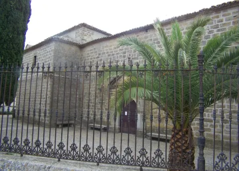
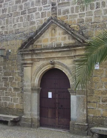
Dedicated to the village master. It has a half-point and triangular front cover.

The present 18th century hermitage was inaugurated in 1763. This is raised on a previous one, raised by the Arabs themselves in the 12th century, devotees of this saint.

This hermitage is in charge of the new plant of Don José Gallego and Oviedo del Portal, master of the work of the Cathedral of Jaén. The economic contribution of the Council and contributions of the faithful were needed for its construction.

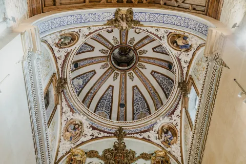
At present the hermitage has the shrimp of the Patron, which is of the square floor, raises four arcosols that form the pechines on which the vault is raised, covering all the surfaces (eardrums, transdotes and intrados of arches and intrados of the vault) with paintings to the fresco where the main element is the sinuous and undulant stem on which the vault is raised, whether it is masking funds with the figures of the Evangelists in the pechines, or the musical angels in the vault; this pictorial jewel is due to the Pants.

In addition to the shrimp, there are six magnificent altarpieces in which different saints are located.

Breve descripción

It is located at the exit of the village on the roads of Ubeda and Torreperogil.

Telecomunicaciones
Sitio web
https://sabiote.com/guia-virtual/ermita-de-san-gines-de-la-jara-2/
Teléfono de contacto
953 773 002
Ubicación
Código Postal
23410
Latitud
38.064930
Longitud
-3.313120
Dirección
C/ San Ginés, 5
Municipio
Ubicación en el mapa
POINT (-3.31312 38.06493)
Tipos de punto de interés
Imágenes carrusel
imagen
Image
Ermita%20de%20San%20Gin%C3%A9s.jpg
Imagen principal
Desactivado
imagen
Image
Ermita%20de%20San%20Gin%C3%A9s2.jpg
Imagen principal
Desactivado
imagen
Image
Ermita%20de%20San%20Gin%C3%A9s3.jpg
Imagen principal
Desactivado
Imágenes cabecera
imagen
Image
SABIOTE%20088-2.JPG
Imagen principal
Activado
Microsite al que pertenece
Loading map
Preparing points of interest and routes...

Santa María de los Reales Alcázares Collegiate Church

Submitted by brandcode_deweloper on
Id
5742066
Descripción
Descripción larga
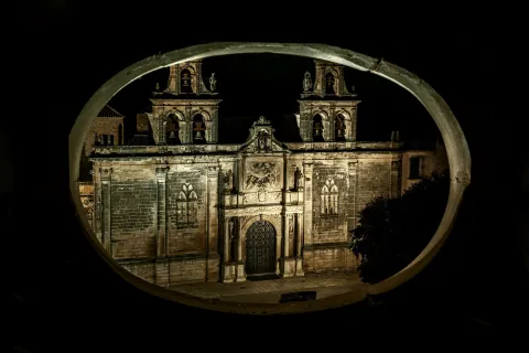
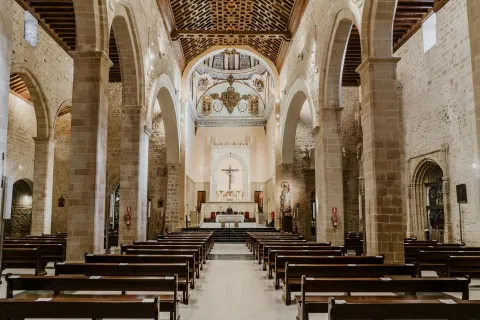
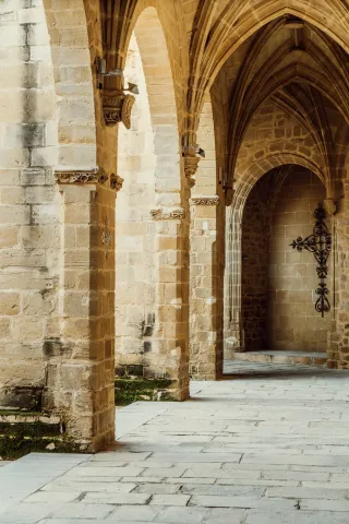
It contains an interesting Cloister from the 15th century as well as noble chapels from the 15th and 16th centuries and numerous pieces of metalwork and painting of maximum artistic representation. Part of the most representative sequences of the movie "Capitán Alatriste" were filmed in this location. Its connection with San Juan de la Cruz is given because the relics of San Juan de la Cruz were guarded and venerated in the Collegiate Church from the exclaustration of the Discalced Carmelites in 1836 until their return in 1905.
Breve descripción
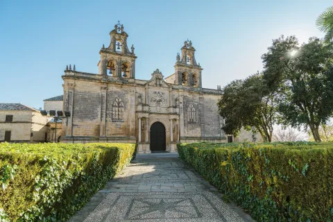
This temple, Iglesia Parroquial Mayor de Úbeda, constitutes the most significant superposition of architectural styles in the city. On the main doorway, late Renaissance like the side doorway, the relief of the Adoration of the Shepherds stands out, based on a portrait by the Italian painter Zuccaro. The eastern gate, called Consolada, is emblematic for being where our Father Jesús Nazareno makes his departure at dawn on Good Friday.
Ubicación
Código Postal
23400
Latitud
38.007080
Longitud
-3.368340
Dirección
Plaza Vázquez de Molina
Municipio
Ubicación en el mapa
POINT (-3.36834 38.00708)
Tipos de punto de interés
Imágenes carrusel
imagen
Image
plaza-vazquez-de-molina69-jpg
Imagen principal
Desactivado
imagen
Image
basi-ulica-de-santa-mari-ua-de-los-reales-alca-uzares80-hdr-jpg
Imagen principal
Desactivado
imagen
Image
basi-ulica-de-santa-mari-ua-de-los-reales-alca-uzares67-jpg
Imagen principal
Desactivado
imagen
Image
basi-ulica-de-santa-mari-ua-de-los-reales-alca-uzares89-hdr-jpg
Imagen principal
Desactivado
Imágenes cabecera
imagen
Image
plaza-vazquez-de-molina16-1-jpg
Imagen principal
Activado
Microsite al que pertenece
Loading map
Preparing points of interest and routes...

Baeza Bullring Exhibition Center

Submitted by brandcode_deweloper on
Id
1571463
Descripción
Descripción larga

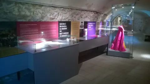
It also includes documentation and pieces such as the first entrances and posters, capotes, bullfighter suits and bull heads such as the "Vantanero" of the Saltillo livestock, dealt with by the sword Rafael Molina Lagartijo on the day of its inauguration or the bull Escobedo of the Livestock of Don Sancho Dávila, treated on the day of the centenary of the Baezan coso by the sword José Ortega Cano. The visit begins in the area of the vault; reception area and visitors that hosts the exhibition area linked to the history of the square. The itinerary includes the tour of the toriles, corrals, cavalries, chapel and nursing.

Breve descripción

The exhibition centre is located in the Plaza de Toros de Baeza, opened on May 18, 1892. The sample is displayed in vitrines, panels with the text in several languages, interactive screens, audiovisual room and environmental sound in the torile area that collects the bulls' shearing work in the days of running.

Telecomunicaciones
Sitio web
www.baeza.net
Teléfono de contacto
953 740 150
Correo electrónico
turismo@baeza.net
Ubicación
Latitud
37.993920
Longitud
-3.460650
Dirección
C/ Sor Felisa Ancín, s/n
Municipio
Ubicación en el mapa
POINT (-3.46065 37.99392)
Imágenes carrusel
imagen
Image
09-Rehabilitacion-anillo-Plaza-de-Toros-plaza-general.jpeg
Imagen principal
Desactivado
imagen
Image
IMG_2733_960x640.JPG
Imagen principal
Desactivado
Imágenes cabecera
imagen
Image
Museo%20Taurino%20de%20Baeza.jpg
Imagen principal
Activado
Microsite al que pertenece
Loading map
Preparing points of interest and routes...

Basilica and Royal Sanctuary of Nuestra Señora de la Cabeza

Submitted by brandcode_deweloper on
Id
910348
Descripción
Descripción larga
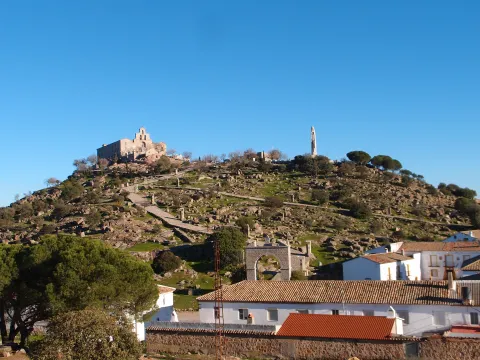
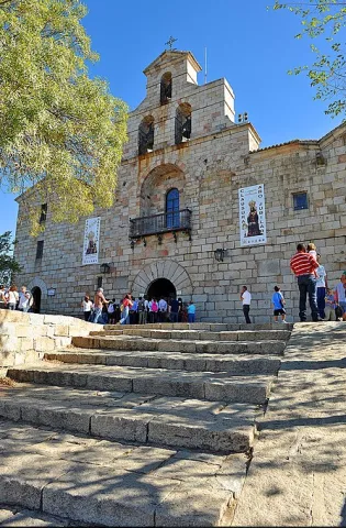
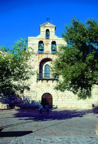
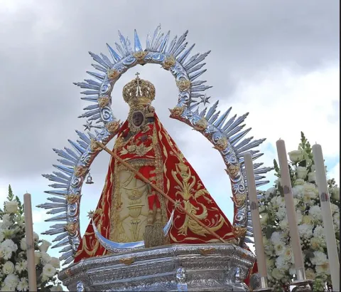
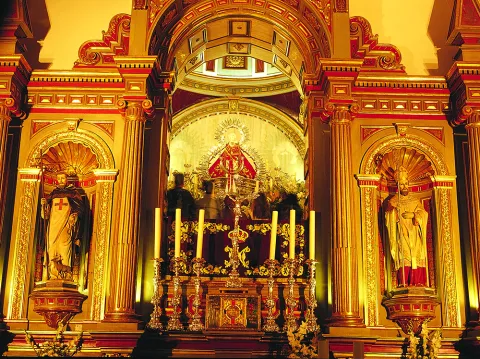
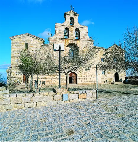
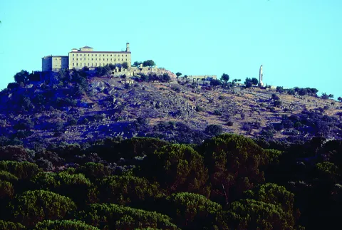
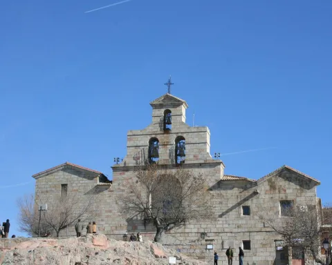
Nothing remains of the primitive hermitage, since throughout the 16th century and on its foundations, a sanctuary was built, a large part of it destroyed during the last Civil War (1936-1939). The siege and defense of the Sanctuary of the Virgin of Cabeza was magnified by the Franco regime. But until it became a parish headquarters, the Sanctuary has gone through different vicissitudes since its origin. According to all indications, the construction works began in 1287 and ended in 1304, first being a small hermitage that the people of Andújar built in the heart of Sierra Morena. However, the expansions and reforms have been almost constant throughout the ages, reaching their maximum splendor in the 16th century, between 1530 and 1590, when it became a Sanctuary, very similar to the one we know today. In 1945 the architect Prieto Moreno, conservator of the Alhambra, directed the restoration works of the architectural complex, which became one of the most precious symbols of the national Catholicism of the dictator Francisco Franco. The pilgrimage continues to be celebrated, as is custom and tradition, on the last Sunday of April, although the image that is venerated, carved by the Granada sculptor Navas Parejo, is not the original one, since it disappears in strange and still unclear circumstances in the aforementioned contest. Thanks to the Book of Chapters of the Brotherhood (1554-1565), preserved in the Diocesan Archive of Jaén (made known by J. Domínguez, R. Frías and S. Lázaro), we know numerous data about the level of work on the new Renaissance church during these years, although the process began years ago; The new factory began at the head, with the large main chapel being built between the years 1534 and 1541 according to a late Gothic plan, being separated from the rest by a beautiful Renaissance railing. The works on the rest of the temple passed through various hands and circumstances. The Trinitarian Community has addressed two new expansions. The first consisted of raising the projecting floor, building another pavilion in the rear area of ​​the North wing. Thus, the entire structure of the cloister patio was completed in a harmonious and functional way. The second phase was carried out in 1965 in the entire north wing, adding a three-story building to expand the rooms of the Trinitarian priests who attend to worship, permanently since 1930. The central nave is separated from the Main Chapel by a 16th century grille, restored by the School of Arts and Crafts of Granada, which closes an opening with a semicircular arch. The High Altar has a large space in the center, behind which is the Virgin's dressing room; carving by José Navas Parejo, which replaced the old one that disappeared during the civil war. The side chapels of the nave are occupied by different altars, containing various images, such as a Crucified by the sculptor Mariano Benlliure, the Virgin of Pilar, Blessed Marcos Criado, San Juan Bautista de la Concepción, the Holy Trinity and the Virgin of Carmen. In the choir there is a magnificent organ, a gift from the Civil Guard, inaugurated by the famous master organist Guridi. Behind the Main Chapel is the sacristy. In 1555, the master stonemason Domingo de Azpeitia undertook to build a temple with three naves with column supports, however, at the express wish of the prelate Don Diego Tavera (1555-1560), this approach was radically transformed, prohibiting the execution of the pillars. Don Diego Tavera sent Andrés de Vandelvira to give new plans for the church, as noted in the minutes of April 27, 1558 of the aforementioned Book of Cabildos. Vandelvira eliminated the pillars with the idea of ​​designing a different, larger church, with a single nave with chapels-niches open to it. In 1559, Vandelvira visited the works and presented new plans for its conclusion, as well as the design of the main façade. For less than a year the construction was under the control of Francisco del Castillo “El Mozo”, and the Brotherhood even required a certain report from Hernán Ruiz II. In 1562, the Brotherhood requested a new inspection of Andrés de Vandelvira, but he did not respond. In any case, the project continued with the stonemasons proposed by Vandelvira, Juan Martínez and Domingo de Jay, who executed what remained following the guidelines and the plan designed by the Master. This must have been the case, as can be seen from the description of the temple that Salcedo de Olid made in the 17th century: “It has a nave without columns (...) and the main chapel is distinguished, majestic and very attractive.” Based on the remains preserved after its destruction in 1936, the Vandelvirian temple actually included a church with a large nave, covered with a barrel vault and niche chapels, which was separated from the main chapel by a powerful main arch. From the exterior, quite compact, only the façade at the foot is notable with three axis elements: doorway, balcony and belfry. The ornamental nudity of the complex is contemporary with the latest work of Andrés de Vandelvira. The Trinitarian Community has addressed two new expansions. The first consisted of raising the projecting floor, building another pavilion in the rear area of ​​the North wing. Thus, the entire structure of the cloister patio was completed in a harmonious and functional way. The second phase was carried out in 1965 in the entire north wing, adding a three-story building to expand the quarters of the Trinitarian priests who attend to worship, permanently since 1930. OTHER NON-ARCHITECTURAL ARTISTIC MANIFESTATIONS. A Museum has been installed in the Sanctuary with diverse and varied pieces of varying artistic quality. Among all of them, we highlight two paintings from the 17th century with representations of the famous Nuestra Señora de la Cabeza Pilgrimage, an image lost in the last Civil War of 1936-1939. After the war, a new carving was commissioned from the Granada workshops of Navas Parejo, which is the one that has been venerated in Cabezo ever since. One of the few pieces saved from the destruction of the said Sanctuary was the grille of the main chapel, restored in 1941 at the School of Arts and Crafts of Granada. Hired in 1564, it depicts the apparition of the Virgin to the shepherd of Colomera. LITERATURE In the middle of the Civil War, the military rebellion in the province of Jaén failed, a group of civil guards along with their families settled in the Sanctuary of the Virgen de la Cabeza, this being the scene of a bloody siege by the Republican troops. A monument commemorates this event at the entrance to the Sanctuary and if you look closely, traces of shrapnel can still be seen on the side walls of the Basilica. Miguel Hernández will journalistically describe the assault of this siege, transmitting in detail its development, which will last from September 14, 1936 to May 1, 1937, when the besieged surrender. Southern Front. Number 15, May 13, 1937 (...) "The building of the Head dawns before the bloody and dark dawn. In it I saw the representation of a tricorn monster... (...)

Breve descripción
Basilica and Royal Sanctuary of Nuestra Señora de la Cabeza
Ubicación
Código Postal
23740
Latitud
38.179340
Longitud
-4.035280
Dirección
Carretera del Santuario
Distrito
Municipio
Ubicación en el mapa
POINT (-4.03528 38.17934)
Tipos de punto de interés
Imágenes carrusel
imagen
Image
Basi_lica_de_la_Cabeza_1.jpeg
Imagen principal
Desactivado
imagen
Image
Anotaci%C3%B3n%202020-04-16%20082134.jpg
Imagen principal
Desactivado
imagen
Image
Mon504.jpg
Imagen principal
Desactivado
imagen
Image
Captura%20Virgen%20de%20la%20Cabeza.PNG
Imagen principal
Desactivado
imagen
Image
Mon030%20%281%29.jpg
Imagen principal
Desactivado
imagen
Image
Mon134.jpg
Imagen principal
Desactivado
imagen
Image
Mon506.jpg
Imagen principal
Desactivado
Imágenes cabecera
imagen
Image
11072966_740607829371873_2670746898130716885_o%20%285%29.jpg
Imagen principal
Activado
Horario
Every day: 09:00 - 14:00 and 16:30 - 20:00.
Loading map
Preparing points of interest and routes...

Ravine of the Arroyo Gargantón

Submitted by brandcode_deweloper on
Id
7983989
Descripción
Descripción larga

Location: To the west of the city centre, in the natural park of Sierra Magina.
Distance: 7 km.
Medium: By vehicle tourism and on foot.
Access route: By a lane that leaves directly from the city centre, until you reach a mountain road that access the enclave.

Breve descripción

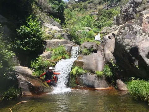
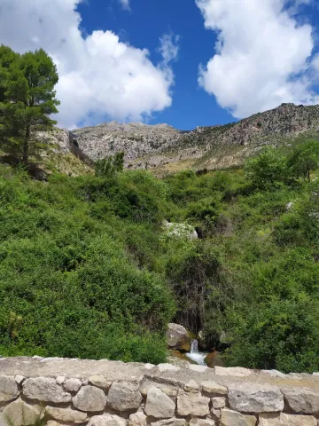
Interesting mountain side that stands out for the presence of white thorn or majolets and cornetals, among other plant formations. The rocky walls next to the Garganton serve as a refuge to a wide variety of birds, such as the royal victor, the black collar or the fences.

Telecomunicaciones
Sitio web
www.belmezdelamoraleda.es/el-municipio/patrimonio-natural.html
Teléfono de contacto
953 394 002
Ubicación
Código Postal
23568
Latitud
37.714142
Longitud
-3.399714
Distrito
Ubicación en el mapa
POINT (-3.399714 37.714142)
Tipos de punto de interés
Imágenes carrusel
imagen
Image
Barranco%20del%20Arroyo%20Gargant%C3%B3n.jpg
Imagen principal
Desactivado
Imágenes cabecera
imagen
Image
Barranco%20del%20Arroyo%20Gargant%C3%B3n2.jpg
Imagen principal
Activado
Microsite al que pertenece
Loading map
Preparing points of interest and routes...

Recreational Area La Recta

Submitted by brandcode_deweloper on
Id
2980342
Descripción
Descripción larga

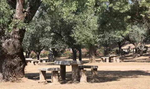
La Recta is a recreational area that has barbecues and tables and is accessed by a signposted path. Its characteristic vegetation is made up of the typical riverside forests of the Sierras de Andújar Natural Park: alarms, sargas, talles, strawberries, which serve as a refuge to faunistic species such as royal herons, zampullines, water cocks, otters. Very close is a watershed to give water to the abundant deer of this saw, next to the dam of the Encinarejo

Breve descripción

It is accessed by the road J-5010 of Andujar to the Sanctuary of the Virgin of the Head, turning left by a track leading to the New Place, very close to the Jandula River.

Telecomunicaciones
Sitio web
www.turismodeandujar.com/areas-recreativas
Teléfono de contacto
953 504 959
Correo electrónico
turismodeandujar@andujar.es
Ubicación
Código Postal
23740
Latitud
38.154730
Longitud
-4.021100
Dirección
Carretera A-6177
Distrito
Municipio
Ubicación en el mapa
POINT (-4.0211 38.15473)
Tipos de punto de interés
Imágenes carrusel
imagen
Image
%C3%81rea%20recreativa%20La%20Recta%202.jpg
Imagen principal
Desactivado
imagen
Image
%C3%81rea%20recreativa%20La%20Recta%203.jpg
Imagen principal
Desactivado
Imágenes cabecera
imagen
Image
%C3%81rea%20recreativa%20La%20Recta%20%281%29.jpg
Imagen principal
Activado
Microsite al que pertenece
Loading map
Preparing points of interest and routes...