Saltar al contenido principal
icon-intereses-cultura-del-toro

Recreational Area La Aliseda

Submitted by brandcode_deweloper on
Id
5867211
Descripción
Descripción larga

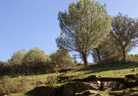
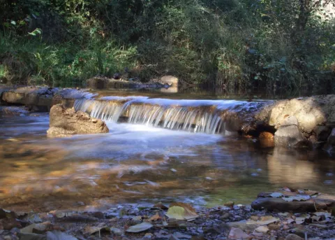
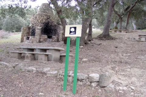
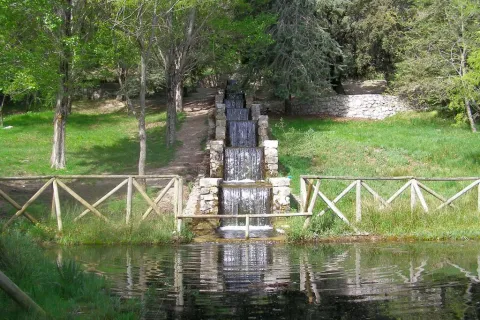
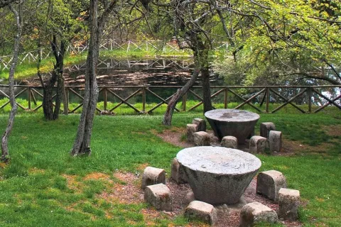
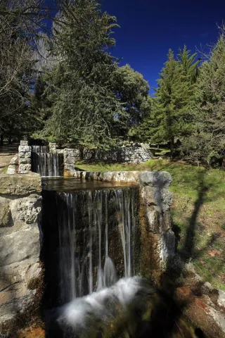
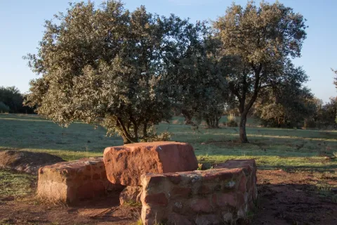
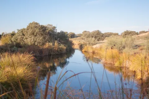
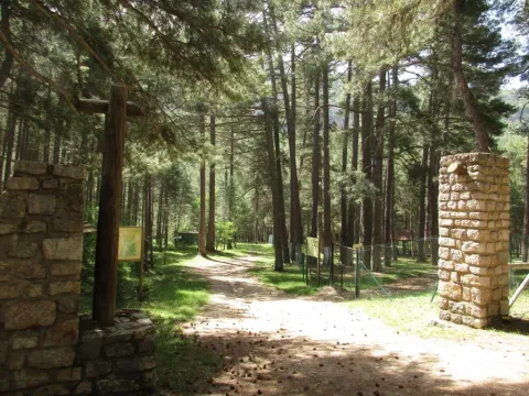
It occupies a wonderful valley in the southern foothills of Sierra Morena, next to the Natural Park of Despeñacolos. Here they grow a great variety of aromatic plants and beautiful trees of different species, such as pine trees, oak trees, alcornoques, chestnuts, willows, abounding the plateau from which this place takes the name. There is also a small river of crystalline waters on a stony bed called "La Campana."

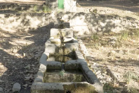
In the geological aspect, there are iron pyrite, which is why the waters of one of its many springs are ferruginous. This area where La Aliseda is located, was in its time part of a large mining center where the gallena filons abound with a lot of silver.

Breve descripción

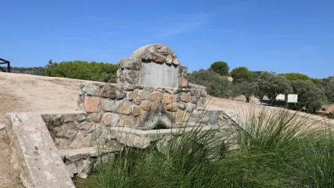
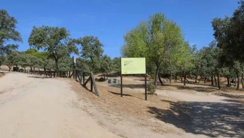
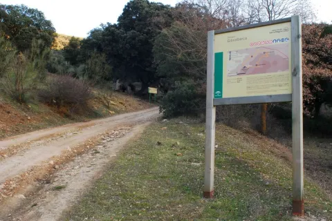
La Aliseda is currently a recreational area of great landscape value, located in the municipal term of Santa Elena (Jaén) and five kilometres from the population centre. We can get to it on the JA-7100 district road that we will take from the motorway of Andalusia A4 at Exit 258 or 266.

Telecomunicaciones
Sitio web
www.espaciosnaturalesdejaen.com/espacios/9-area-recreativa-la-aliseda.html
Teléfono de contacto
953 401 240
Ubicación
Código Postal
23213
Latitud
38.330910
Longitud
-3.575760
Distrito
Municipio
Ubicación en el mapa
POINT (-3.57576 38.33091)
Imágenes carrusel
imagen
Image
13.jpg
Imagen principal
Desactivado
imagen
Image
11.jpg
Imagen principal
Desactivado
imagen
Image
10.jpg
Imagen principal
Desactivado
imagen
Image
natural9.jpg
Imagen principal
Desactivado
Imágenes cabecera
imagen
Image
14.jpg
Imagen principal
Activado
Loading map
Preparing points of interest and routes...

Jabalí Recreational Area

Submitted by brandcode_deweloper on
Id
2981139
Descripción
Descripción larga

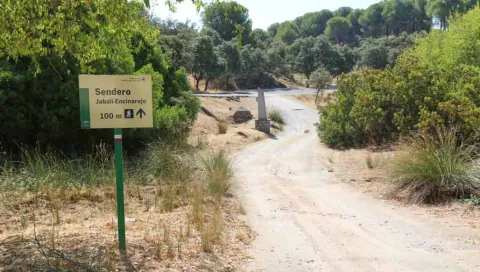
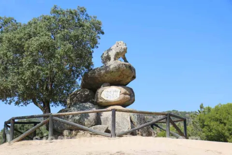
The recreational area of the Jabali is distinguished by the abundance of oak trees surrounded by pine trees, very characteristic of the Sierras de Andújar Natural Park, to which it belongs. It is perfectly equipped to celebrate a family picnic, with tables, banks, barbecues, containers, and even a fountain. His name is given by the remarkable stone sculpture of the lone boar who presides over the space, the work of local artist Luis Aldehuela. The enclave links with the path that connects El Jabali with the Encinarejo.

Breve descripción

It is accessed by the road J-5010, from Andújar to the Sanctuary Virgen de la Cabeza, diverting about 5 km. before reaching the Basilica, right on one of the road's margins. The vehicles can be parked in the same recreational area.

Telecomunicaciones
Sitio web
www.turismodeandujar.com
Teléfono de contacto
953 508 200
Correo electrónico
turismodeandujar@andujar.es
Ubicación
Código Postal
23740
Latitud
38.183160
Longitud
-4.015840
Dirección
Carretera A-6178
Distrito
Municipio
Ubicación en el mapa
POINT (-4.01584 38.18316)
Tipos de punto de interés
Imágenes carrusel
imagen
Image
sierra-de-andujar-42.jpg
Imagen principal
Desactivado
imagen
Image
sierra-de-andujar-38.jpg
Imagen principal
Desactivado
imagen
Image
sierra-de-andujar-40.jpg
Imagen principal
Desactivado
imagen
Image
sierra-de-andujar-39.jpg
Imagen principal
Desactivado
Imágenes cabecera
imagen
Image
sierra-de-andujar-43.jpg
Imagen principal
Activado
Microsite al que pertenece
Loading map
Preparing points of interest and routes...

Recreational Area Dehesa del Oso

Submitted by brandcode_deweloper on
Id
3964833
Descripción
Descripción larga

There are two ways to access the Bear Dehesa:

  • From the village of Onsares, you have to leave on the road to Villarrodrigo and, within 3 km, we take the forest track that leaves on our right. We follow her without taking any of the detours that go back to Onsares to the right. At 6, 5 km from the time we took this lead, we got to the recreational area.
  • From the A-310 road between Siles and La Puerta de Segura, at point 17, we take a forest track passing through the village of La Pendolera. After 14.8 km, without being separated by any detour, we reached the Dehesa del Oso. The initial section of this track passes through the area where the works of the Siles dam are currently being carried out.

If we access from Siles, it is appropriate to stop for a while in the small village of La Cañada the Lord.

The whole area is covered by an impressive black pine pineapple with oaks, complaints and dense Mediterranean bush.

From the Dehesa del Oso you can go by forest track to the village of El Bellotar, 5 km, already located in the province of Albacete. To do this, we have to follow the Cambrón route and, in which we will see at the end of 0.7 km (collado de Las Lagunillas), follow the front rather than turn right towards El Cambrón. From El Bellotar you can get off by asphalt road to the charming village of Villaverde del Guadalimar and close a circuit back to Siles.

Breve descripción

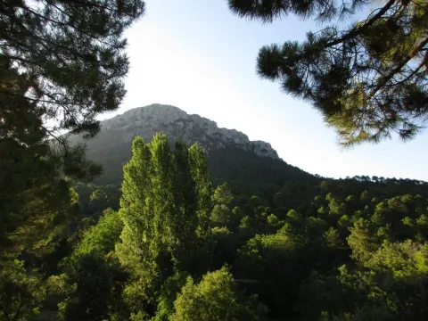
This small recreational area, next to an old forest house, is located at the foot of the Cambrón, a pétrea mole whose walls rise almost vertical on a pine sea, at the northern end of the Natural Park. The name of the place evokes the presence of the bear in these saws until the mid-18th century. There is a fountain with abundant flow, tables to eat, small meadows and beautiful walnuts. It is the starting point for climbing the Cambrón along the signposted route PR-A 173.

Telecomunicaciones
Sitio web
www.lasierradesegura.org/parajes-naturales/dehesa-del-oso/
Correo electrónico
villarrodrigo@promojaen.es
Ubicación
Código Postal
23393
Latitud
38.462640
Longitud
-2.580450
Distrito
Municipio
Ubicación en el mapa
POINT (-2.58045 38.46264)
Tipos de punto de interés
Imágenes carrusel
imagen
Image
2%20%281%29.jpg
Imagen principal
Desactivado
Imágenes cabecera
imagen
Image
image_175589.jpeg
Imagen principal
Activado
Horario
24 h.
Loading map
Preparing points of interest and routes...

Recreational Area of Linarejos

Submitted by brandcode_deweloper on
Id
881739
Descripción
Descripción larga

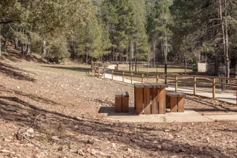
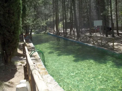
Here's what it takes to spend a quiet day in the middle of nature. You have a large parking area, meringeros with chairs and wooden tables, a fountain, a kiosk-bar (open only in summer) and a charming piscina-dam very busy in the months of hottest.

The presence of water attached to the lush and closed forest around this area allows, when there is little human activity, the mammals of the saw to move freely around. The bouquet, boar or even muflon have been seen a few meters from the recreation area.

But the minuscule life is the queen of the area: invertebrates like the dragonfly, and a very delicate crustacean like the native river crab are raised in the remnants of the stream of Linarejos. Your visit must, by obligation, be respectful of the inhabitants of the mountain, avoiding unnecessary noises and removing any waste from the place.

We suggest:

  • Take a walk to the canyon that the Guadalquivir River has tasted in the Cerrada del Utrero. It's about following the track that comes out next to the kiosk of the recreational area and turning left to go next to the stream. Do it with caution because in the end you arrive at the spectacular jump of Linarejos, where you don't have to look too much.

In Cazorla take the Sierra road (A-319) until the crossing known as the Empalme del Valle. Turn right on the JF-7092 road and after passing the bridge over the Guadalquivir River (4 km from the Empalme) follow the left track (JF-7091). 2 km from this bridge we turn left by a track that arrives, after a kilometre to the recreational area.

Breve descripción

Through the Arroyo de Linarejos and wrapped in a lush vegetation, this recreational area is one of the most accessible and popular in the Sierra de Cazorla. The site is a sample of the most important that encloses the saw: crystal streams surrounded by a green mantle, lush riverside vegetation, freshness, pine and wild animals around. Here we can start and finish some simple routes that will allow us to know the surroundings.

Ubicación
Latitud
37.922990
Longitud
-2.911570
Dirección
Camino de la Huelga
Municipio
Ubicación en el mapa
POINT (-2.91157 37.92299)
Tipos de punto de interés
Imágenes carrusel
imagen
Image
Natu223.jpg
Imagen principal
Desactivado
imagen
Image
2.jpg
Imagen principal
Desactivado
Imágenes cabecera
imagen
Image
3%20%281%29.jpg
Imagen principal
Activado
Loading map
Preparing points of interest and routes...

Recreational Area of Gibralberca

Submitted by brandcode_deweloper on
Id
2981114
Descripción
Breve descripción

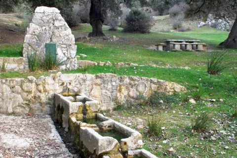
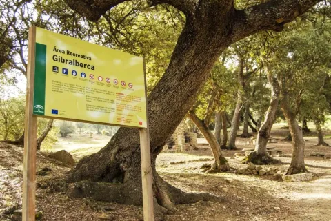
The recreational area of Gibralbca, at 1,200 metres of altitude, is a fuente- abrevadero whose waters come from the stream of the same name. Located between alamos, centenary oak and thorns, in the middle of a meadow, from this point we have impressive views of Mount Almadén (1,883 m), in the natural park of Sierra Magina. In addition, many forest birds, riverbanks and, above all, red squirrels can be observed in the moms that preside over it.

Telecomunicaciones
Sitio web
www.cambil-arbuniel.es
Teléfono de contacto
953 300 427
Ubicación
Código Postal
23560
Latitud
37.674840
Longitud
-3.498170
Dirección
Carretera A-324
Distrito
Municipio
Ubicación en el mapa
POINT (-3.49817 37.67484)
Tipos de punto de interés
Imágenes carrusel
imagen
Image
717_AR_02.jpg
Imagen principal
Desactivado
imagen
Image
717_AR_01.jpg
Imagen principal
Desactivado
imagen
Image
717_AR_04.jpg
Imagen principal
Desactivado
imagen
Image
722_SS_01.jpg
Imagen principal
Desactivado
Imágenes cabecera
imagen
Image
717_AR_03.jpg
Imagen principal
Activado
Microsite al que pertenece
Loading map
Preparing points of interest and routes...

Recreational Area of Fuenmayor

Submitted by brandcode_deweloper on
Id
2980282
Descripción
Descripción larga

Fuenmayor in a camping area and a road, located in the middle of a large mass of trees, with plenty of water, as there is a spring there. The recreation area extends along the Fresnos de Fuenmayor stream, with a source of water jumps and a pond, as well as stationery, banks and picnic tables. The Fuenmayor is surrounded by long chopos between which you can see and hear some birds of forest and riverside like the listed reyezuelo, the common agateador or the cascade lavender.

Breve descripción

To the south of the town, in the Natural Park of Sierra Mágina, right on the slopes of the Almadén peak, about 7 km. Torres. The recreational area is accessed through an asphalt road that leaves the village and leads directly to Fuenmayor.

Telecomunicaciones
Sitio web
www.juntadeandalucia.es
Teléfono de contacto
954 544 438
Ubicación
Código Postal
23540
Latitud
37.750750
Longitud
-3.516820
Dirección
Carretera de Mancha Real
Distrito
Municipio
Ubicación en el mapa
POINT (-3.51682 37.75075)
Tipos de punto de interés
Imágenes carrusel
imagen
Image
ar%20Fuenmayor.jpg
Imagen principal
Desactivado
imagen
Image
ar%20Fuenmayor%202.jpg
Imagen principal
Desactivado
imagen
Image
ar%20Fuenmayor%203.jpg
Imagen principal
Desactivado
Imágenes cabecera
imagen
Image
18.jpg
Imagen principal
Activado
Microsite al que pertenece
Loading map
Preparing points of interest and routes...

Recreational Area Burguillos

Submitted by brandcode_deweloper on
Id
6615992
Descripción
Descripción larga

Mount Burguillos is one of the most significant elevations of the border area between Sierra Morena and the countryside.

The recreational area of Burguillos is equipped with tables, banks and barbecues, as well as sources, an artificial lagoon, parking area, a bar-restaurant and a Nature Hall.

The area is frequented by people who want to share a field meal with their friends or family, take a walk in the middle of nature or simply contemplate the rich biodiversity that Burguillos has.

The area of the Dehesa de Burguillos, also known as the Villa, is home to a Mediterranean forest of oak trees, alcornoques and complaints, a bucolic livestock area and a beautiful closed area through which the Rumblar River passes after leaving the dam. In addition, the land is splattered with spectacular rounded blocks of granite called "bowling" and of cavalry stones, as well as carrocal features of this area of Sierra Morena.

From the recreational area there are numerous hiking routes, all signposted and of medium-low difficulty, being able to intertwine with each other, highlighting one that goes into the mountain under adhesado to the Rumblar River and another that runs through the so-called Cerro de las Trinches, where trenches used in the Civil War are located.

Breve descripción

The Burguillos recreational area is located 5 kilometres north of the town of Bailén, within the area known as the Dehesa de Burguillos, a city-owned public mountain.

Ubicación
Latitud
38.138960
Longitud
-3.811280
Distrito
Municipio
Ubicación en el mapa
POINT (-3.81128 38.13896)
Tipos de punto de interés
Imágenes carrusel
imagen
Image
natural28_223.jpg
Imagen principal
Desactivado
imagen
Image
natural28.jpg
Imagen principal
Desactivado
imagen
Image
natural28_224.jpg
Imagen principal
Desactivado
Imágenes cabecera
imagen
Image
natural28_227.jpg
Imagen principal
Activado
Microsite al que pertenece
Loading map
Preparing points of interest and routes...

Los Negros Camping Area

Submitted by brandcode_deweloper on
Id
5928053
Descripción
Breve descripción

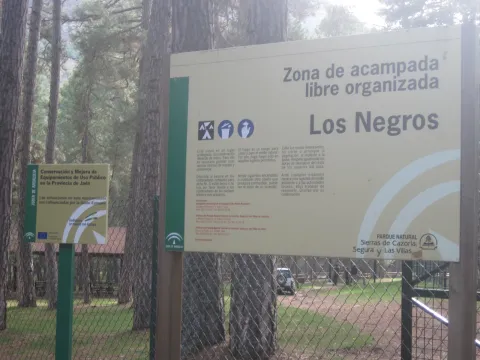
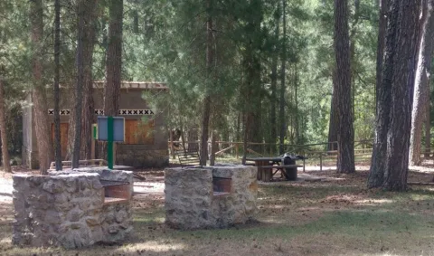
This ZALO is located in the valley of Rio Madera, a few kilometres after its birth, next to the road in the Canyon of Poyo Torres and very close to the river line. It is located in an area where the larix pine forest predominates, with a sotoforest of ferns, which denotes the moist nature of the environment.

Ubicación
Latitud
38.317340
Longitud
-2.575560
Distrito
Municipio
Ubicación en el mapa
POINT (-2.57556 38.31734)
Tipos de punto de interés
Imágenes carrusel
imagen
Image
Los%20Negros%203.jpg
Imagen principal
Desactivado
imagen
Image
Los%20Negros.jpg
Imagen principal
Desactivado
Imágenes cabecera
imagen
Image
3%20%281%29.jpg
Imagen principal
Activado
Loading map
Preparing points of interest and routes...

Transport Rivera Bus

Submitted by brandcode_deweloper on
7087086
Descripción larga

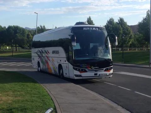
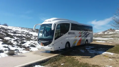
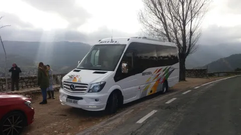
Rivera bus is a company specialized in the transport of passengers by road with more than 30 years of experience in the sector and that stands out for its: varied and modern fleet of vehicles,
high level of reliability in the provision of services, excellent value for money, excellent and close to the customer.

Teléfono
629 531 494 / 629 071 624
Sitio web
https://www.riverabus.es/
Correo electrónico
jrivera@riverabus.es
Código Postal
23600
Latitud
37.708910
Longitud
-3.968220
Dirección
Av. Príncipe Felipe, 144
Distrito
Municipio
Ubicación en el mapa
POINT (-3.96822 37.70891)
imagen
Image
bus9.jpg
Imagen principal
Activado
imagen
Image
bus2.jpg
Imagen principal
Desactivado
imagen
Image
bus6-57pn7v.jpg
Imagen principal
Desactivado

Friends

icon-intereses-amigos

Adventure

icon-intereses-aventura

Culture

icon-intereses-cultura

Culture of the Bull

icon-intereses-cultura-del-toro

Sport

icon-intereses-deporte

For couples

icon-intereses-en-pareja

Family

icon-intereses-familia

Gastronomy

icon-intereses-gastronomia

Municipality

icon-intereses-municipio

Nature

icon-intereses-naturaleza

Business

icon-intereses-negocios

Seniors

icon-intereses-senior
Loading map
Preparing points of interest and routes...

Santiago García. Vintage vehicle rental

Submitted by brandcode_deweloper on
7058284
Descripción larga

A recognized trajectory in the sector for years in which Santiago García is involved in each case in the final rescue which involves relaunching a historical vehicle, including the legal and administrative part of its start-up.

Thanks to the daily effort, there are many vehicles that are redocumented year after year and they recover the power to return to our streets and roads.

For years we have been engaged in restoration and this has allowed us to have a wide knowledge of the history of the automotive.

For all this, we can now offer you from:

- Processing of vehicle documentation.

- Vehicle reports.

- Sale of old and classic vehicles.

- Rental of vehicles for cinema, TV, advertising spots, etc.

- Rental of vehicles for weddings, events, etc.

Teléfono
609 230 955
Sitio web
http://www.sgclasicos.com/
Correo electrónico
info@sgclasicos.com
Código Postal
23200
Latitud
37.772886
Longitud
-3.788329
Dirección
Carretera Madrid-Cádiz, Km. 267,6
Distrito
Municipio
Ubicación en el mapa
POINT (-3.788329 37.772886)
imagen
Image
logo-Top.png
Imagen principal
Activado
imagen
Image
shutterstock_1445554379.jpg
Imagen principal
Desactivado

Friends

icon-intereses-amigos

Adventure

icon-intereses-aventura

Culture

icon-intereses-cultura

Culture of the Bull

icon-intereses-cultura-del-toro

Sport

icon-intereses-deporte

For couples

icon-intereses-en-pareja

Family

icon-intereses-familia

Gastronomy

icon-intereses-gastronomia

Municipality

icon-intereses-municipio

Nature

icon-intereses-naturaleza

Business

icon-intereses-negocios

Seniors

icon-intereses-senior
Loading map
Preparing points of interest and routes...