Saltar al contenido principal

Mágina Peaks and Miramundos Zone

Submitted by brandcode_deweloper on
Id
5846349
Descripción
Breve descripción

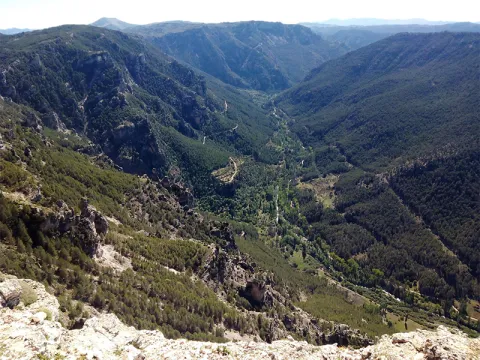
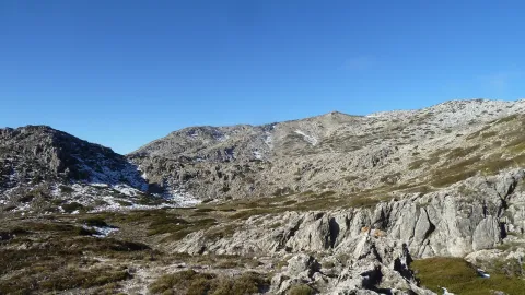
In this summit crest is the roof of the province: the Pico Magina, with 2,167 meters of height, which is the third highest altitude of Andalusia, after the massizos of Sierra Nevada and the Sierra de Baza. The vegetation and conditions are typical of the high Mediterranean mountain.

Ubicación
Latitud
37.730270
Longitud
-3.445830
Distrito
Ubicación en el mapa
POINT (-3.44583 37.73027)
Tipos de punto de interés
Imágenes carrusel
imagen
Image
17%20Magina.JPG
Imagen principal
Desactivado
imagen
Image
naturaleza_14268337_20191208114422%20%281%29.jpg
Imagen principal
Desactivado
imagen
Image
9788440Master%20%282%29.jpg
Imagen principal
Desactivado
Imágenes cabecera
imagen
Image
P1240066%20%282%29.jpg
Imagen principal
Activado
Microsite al que pertenece
Loading map
Preparing points of interest and routes...
Hondacabras Camping Area

Submitted by brandcode_deweloper on
Id
2980330
Descripción
Descripción larga

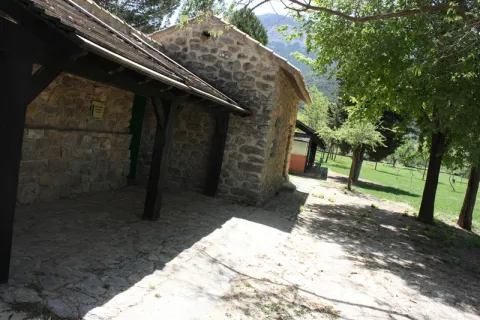
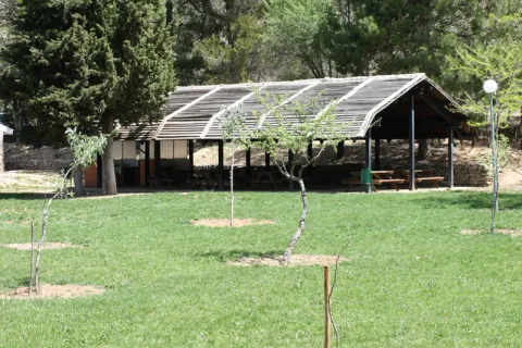
The landscape surrounding this equipment, located on the rest of a pecuary road, is typically olive-growing and invites hiking. The facilities, with a capacity for a hundred people, have areas for tents, roofed dining, kitchen, toilets and showers.

Breve descripción

It is accessed from the JA-1107 road that goes from Torres to Albanchez de Magina; after walking about two km, in the middle of a curve, to the right, it connects a lane that, with a total length of one kilometre, leads us directly to this camping area of the Sierra Magina Natural Park called Hondacabras.

Telecomunicaciones
Sitio web
www.juntadeandalucia.es
Teléfono de contacto
953 363 011
Correo electrónico
informacion@juntadeandalucia.es
Ubicación
Código Postal
23540
Latitud
37.768770
Longitud
-3.495980
Dirección
Carretera JA-3107
Distrito
Municipio
Ubicación en el mapa
POINT (-3.49598 37.76877)
Tipos de punto de interés
Imágenes carrusel
imagen
Image
acampada%20Hondacabras.jpg
Imagen principal
Desactivado
imagen
Image
acampada%20Hondacabras%202.jpg
Imagen principal
Desactivado
imagen
Image
acampada%20Hondacabras%203.jpg
Imagen principal
Desactivado
Imágenes cabecera
imagen
Image
acampada%20Hondacabras%204.jpg
Imagen principal
Activado
Microsite al que pertenece
Loading map
Preparing points of interest and routes...

Santa Potenciana Hermitage Archaeological Site

Submitted by brandcode_deweloper on
Id
4524002
Descripción
Breve descripción

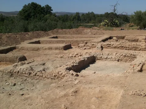
The excavations of the Archaeological site Hermitage Santa Potenica de Villanueva de la Reina have been presenting new findings, withnew materials and structures that confirm this area as a historic crossing of cultures between large cities. An archaeological site that has, in five years, achieved great results andtake the municipality of Villanueva de la Reina to specialized and prestigious forums.

Telecomunicaciones
Sitio web
www.redjaen.es/francis/?m=c&o=93197
Teléfono de contacto
953 537 110
Ubicación
Código Postal
23730
Latitud
38.027860
Longitud
-3.912560
Distrito
Ubicación en el mapa
POINT (-3.91256 38.02786)
Tipos de punto de interés
Imágenes carrusel
imagen
Image
Yacimiento%20Ermita%20Santa%20Potenciana.jpg
Imagen principal
Desactivado
Imágenes cabecera
imagen
Image
Yacimiento_de_la_Ermita_de_Santa_Potenciana.jpg
Imagen principal
Activado
Microsite al que pertenece
Loading map
Preparing points of interest and routes...

Archaeological Site Terrazas del Guadalimar

Submitted by brandcode_deweloper on
Id
7971552
Descripción
Descripción larga

The human occupation of the environment of what is today Beas de Segura is very old. The first human testimonies of the Sierra de Segura appear in this site, in the area of Puente Moccho, a name that is designated to an extensive outdoor habitat next to the terraces of the Guadalimar River. There are materials from the Lower and Middle Paleolithic of the dawn of the last glaciation (between 100,000-10,000 BC).

This place was the passage of important mammals, it had abundant fishing resources and abundant raw material for the manufacture of carved stone tools, highlighting rolling edges and pebbles worked in quartdate.

The remains of the Lachelian political industry of this place were discovered in 1913 by Cabré and the Abad Breuil and part of them are found in the Provincial Museum of Jaén, in the Archaeology Section, room 1: Prehistory.

Breve descripción

It is the oldest archaeological site in the province of Jaén, so the oldest pieces that are preserved in the provincial archaeological museum are those from this site.

Telecomunicaciones
Sitio web
www.beasdesegura.es
Correo electrónico
aytobeas@yahoo.es
Ubicación
Código Postal
23280
Latitud
38.253863
Longitud
-2.889467
Dirección
Paseo de la Constitución, 1
Distrito
Municipio
Ubicación en el mapa
POINT (-2.889467 38.253863)
Tipos de punto de interés
Imágenes carrusel
imagen
Image
Yacimiento%20Arqueol%C3%B3gico%20Terrazas%20del%20Guadalimar2.jpg
Imagen principal
Desactivado
Imágenes cabecera
imagen
Image
YACIMIENTO%20ARQUEOL%C3%93GICO%20TERRAZAS%20DEL%20GUADALIMAR%20PUENTE%20MOCHO.jpg
Imagen principal
Activado
Loading map
Preparing points of interest and routes...
Roman Villa of Bruñel

Submitted by brandcode_deweloper on
Id
919543
Descripción
Descripción larga

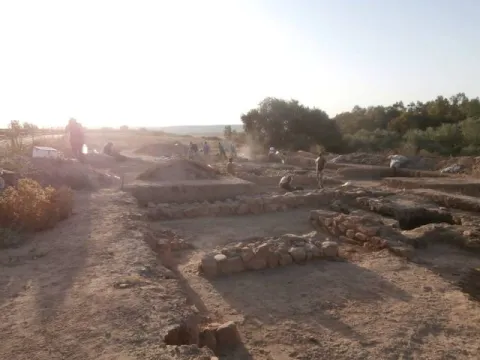
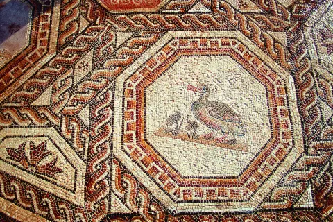
Most of these buildings are based as a second residence during the High Empire, although with the crisis of the third century and the insecurity of the cities many great aristocrats withdraw to their villages. As the residence becomes, the luxury and refinement of which the rich mosaics and the beginning of the walls of the different rooms are preserved as a testimony. Next to the Palaciega area there were other units with stables, with forges, alfares and, ultimately, everything necessary to be self-sufficient away from the city. Over time, the cities lost their importance, had to wafer to avoid dangers and the cultural spotlights that had gone out.

If we know nothing about the inhabitants of these luxurious rooms, we know less about those people who left the city to take refuge in these villas. They helped defend property in exchange for being able to cultivate a piece of land with which to get what is necessary to feed. Here is the origin of what would be the vasalage in the Middle Ages. Nor do we know how the craftsmen made these great mosaics, nor their living conditions, would they know that they represented the images they reproduced with the tesels? and the last inhabitants at the end of the fourth century?

Breve descripción

The villa of Bruñel represents the typical model of Roman villa that begins to extend during the Lower Empire.

Ubicación
Latitud
37.842982
Longitud
-3.066921
Municipio
Ubicación en el mapa
POINT (-3.066921 37.842982)
Tipos de punto de interés
Imágenes carrusel
imagen
Image
Mon167.jpg
Imagen principal
Desactivado
imagen
Image
quesada.jpg
Imagen principal
Desactivado
Imágenes cabecera
imagen
Image
DQxszNiU8AAV39W.jpg
Imagen principal
Activado
Loading map
Preparing points of interest and routes...
Marcas de calidad

Valley of the Segura

Submitted by brandcode_deweloper on
Id
914042
Descripción
Descripción larga

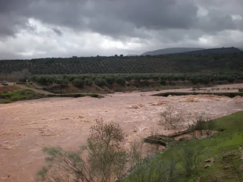
The inhabited cores around the valley were able to take advantage of the river's passage by creating small channels and waterfalls. You will see great walnuts and some orchards by the villages, irrigated with a pure crystalline water. At this point, the river still has the presence of the common trout, a species that only lives in especially clean waters.

After Las Anchuricas the valley goes to Las Juntas de Miller, where the Segura receives its second tributary, the Zumeta River. Together they cross the provincial limit that is located there, entering the province of Albacete. In this place a hydroelectric power plant was erected in the 1950s to take advantage of the flow of these two rivers.

The valley offers pleasant visits around it that will allow you to get to know the Sierra de Segura in depth. Among others, we recommend:

  • Visit the village of La Toba, a place where water is the great protagonist. If the cold water does not impress you, you can go up to the birth of La Toba, which is found in a curious cave well known in the region.
  • Rest next to the reservoir of Las Anchuricas. The water and the high mountains have created this peaceful place, of which you will surely have to leave.
  • Walk around some of the nearby villages such as La Fuente del Esparto, La Peguera del Madroño or Las Gorgollitas. The latter offers an exciting view of the valley.
  • Seating water in the impressive fountain of The Four Caños, between the Anchuricas reservoir and Miller's Boards.
Breve descripción

In the village of Huberga Utrera, the Segura River receives its first tributary, the Madera River. From this point on the Segura, with an already important flow, goes through its valley through bridges - one of them built by the Romans - and visiting villages that were born on its bank and thanks to it survived. The road goes parallel to the river, and on its sides there are impressive calares with magnificent views of the Sierra. As you pass the village of La Toba, the river falls into the charming reservoir of Las Anchuricas.

Ubicación
Latitud
38.298857
Longitud
-2.651877
Distrito
Ubicación en el mapa
POINT (-2.651877 38.298857)
Tipos de punto de interés
Imágenes carrusel
imagen
Image
valle.jpg
Imagen principal
Desactivado
Imágenes cabecera
imagen
Image
valle-del-segura.png
Imagen principal
Activado
Loading map
Preparing points of interest and routes...
Valley of the Segura

Submitted by brandcode_deweloper on
Id
2980198
Descripción
Descripción larga

The road goes parallel to the river and, on its sides, there are impressive calares with magnificent views of the saw. As you pass the village of La Toba, the river remains in the charming reservoir of Las Anchuricas, one of the most beautiful of the Sierras de Cazorla Natural Park, Segura and Las Villas, The valley offers pleasant visits around you that will allow us to know more about the Sierra de Segura, such as the village of La Toba, a place where water is the great protagonist, or the nearby populations of La Fuente del Esparto, La Peguera del Madroño or Las Gorgollitas.

On the JF-7038 road, from The Utrera Strike to Miller's Boards.

Breve descripción

In the village of Huberga Utrera, the Segura River receives its first tributary, the Madera River. From this point on, the Segura, with an already important flow, advances through its valley through bridges and visiting villages that were born on its bank and that survived thanks to it.

Ubicación
Código Postal
23298
Latitud
38.118420
Longitud
-2.670480
Dirección
Carretera A-317
Distrito
Municipio
Ubicación en el mapa
POINT (-2.67048 38.11842)
Imágenes carrusel
imagen
Image
R%C3%ADo%20Segura%20%28La%20Toba%29.jpg
Imagen principal
Desactivado
Imágenes cabecera
imagen
Image
9.jpg
Imagen principal
Activado
Loading map
Preparing points of interest and routes...

Shaded Hillside of Cabeza Gorda

Submitted by brandcode_deweloper on
Id
660013
Descripción
Descripción larga

Traditional constructions have only been modified, although the most rewarding is the view that you can enjoy from the village that really constitutes a natural balcony open to an overwhelming landscape in which stands out on the whole Calar del Cobo with the Puntal of the Mass.

If you like them, you can't stop visiting the Umbria, as it's a very good area for the collection of these mushrooms. In addition, a delicious unmarked road leads to the nearby village of Cabeza Gorda, located on the opposite side of a mountain, which is naturally called Morro de Cabeza Gorda.

Breve descripción

Despite being called the Umbria de Cabeza Gorda we are in front of a village located on a solana, with vegetation typical of the Mediterranean forest. You can see an isolated house around an explanade belonging to the ancient era, next to which there are some cherry trees and a fountain that welcome us.

Ubicación
Latitud
38.183050
Longitud
-2.626130
Distrito
Ubicación en el mapa
POINT (-2.62613 38.18305)
Tipos de punto de interés
Imágenes carrusel
imagen
Image
1137903Master.jpg
Imagen principal
Desactivado
imagen
Image
unnamed%20%281%29.png
Imagen principal
Desactivado
Imágenes cabecera
imagen
Image
8.jpg
Imagen principal
Activado
Loading map
Preparing points of interest and routes...
Marcas de calidad

Toya and Hornos Princely Tombs

Submitted by brandcode_deweloper on
Id
308552
Descripción
Descripción larga

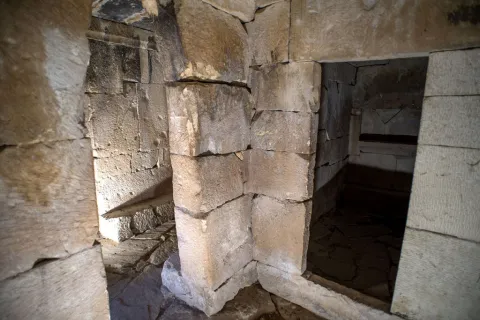
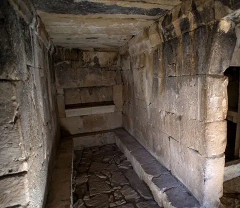
The camera has rectangular floor with three ships. The greater than the sides, and these to the right and left, have an antecedent that is accessed by false arches with simulated capitel in their jambas. In the interior of the receptacles we can observe banks and poyetes to deposit the cineries and the joules. The side and central ships have niches on the walls to receive offerings. The construction of about four meters in length by almost three meters wide is made with large armchairs adjusted to the time of its assembly and covered by a structure of large slabs. The whole construction is of a monumental character, cyclopean by the size of some armchairs and dintels. In terms of its content, we must refer to the recovered, and among all this we highlight the Greek ceramics of red figures, especially the crateras and the metal elements among which the remains of a car stand out. His chronology includes it within the Iberian culture of the end of the S. V and the beginning of the IV before Christ. The aim of this stop is to show how a main funeral chamber is and its meaning in the context of the Iberian aristocratic society. The Centre of the Principesque Tombs of Peal allows you to know the theme of the life of the ultratumba and the funeral rites.

Breve descripción

In the well-known Cerro de la Horca, very close to the village of Toya and the famous castle-archaeological site of its same name, is the great tomb known as the funeral chamber of Toya.

Telecomunicaciones
Sitio web
www.viajealtiempodelosiberos.com
Teléfono de contacto
953 730 075
Correo electrónico
info@viajealtiempodelosiberos.com
Ubicación
Código Postal
23460
Latitud
37.911830
Longitud
-3.127110
Dirección
Carretera Peal de Becerro a Toya
Municipio
Ubicación en el mapa
POINT (-3.12711 37.91183)
Tipos de punto de interés
Imágenes carrusel
imagen
Image
peal-becerro-tumbas%20%283%29.jpg
Imagen principal
Desactivado
imagen
Image
img-porcuna.jpg
Imagen principal
Desactivado
Imágenes cabecera
imagen
Image
peal-becerro-tumbas-ok.jpg
Imagen principal
Activado
Horario
Make visits.
Loading map
Preparing points of interest and routes...

Travertines of the Río Borosa

Submitted by brandcode_deweloper on
Id
877964
Descripción
Descripción larga

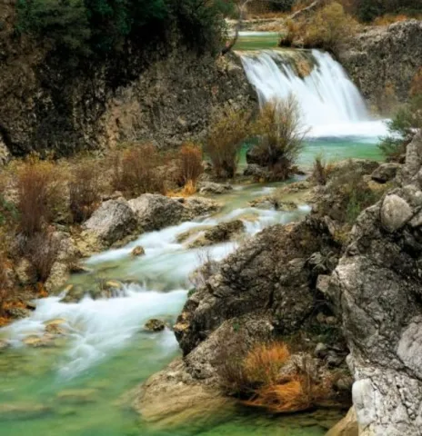
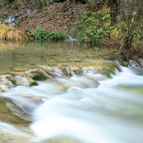
The upper part of the Borosa River, has a scalated profile for the development of pozas and waterfalls in which travertine terraces are formed with spectacular botroidal calcite morphologies that were precipitated during the most humid and warm periods of the Quaternary.

Although travertine appear throughout the river, the highest concentration is located in the sector between the organ jump and the electric power plant. Its formation is due to the precipitation of calcite caused by the tear-up of the river waters produced by the turbulent regime of the water leaps in the areas with the greatest slope. This precipitation occurs in areas of dense vegetation receding elements of plants and producing subvertical sheets known as cascade facies.

Breve descripción

Travertinos del Río Borosa

Ubicación
Nombre
Río Borosa
Latitud
38.298857
Longitud
-2.651877
Distrito
Ubicación en el mapa
POINT (-2.651877 38.298857)
Tipos de punto de interés
Imágenes carrusel
imagen
Image
5%20%284%29.jpg
Imagen principal
Desactivado
Imágenes cabecera
imagen
Image
borosa.png
Imagen principal
Activado
Horario
Tuesday to Friday: 10: 00 - 14: 00. Tuesday to Saturday: 18: 00 - 20: 00. Saturdays and Sundays: 10: 00 - 13: 30.
Loading map
Preparing points of interest and routes...