Saltar al contenido principal

Villanueva del Arzobispo

Submitted by brandcode_deweloper on
Id
787624
Perfil de redes sociales
Facebook
https://www.facebook.com/villanuevadelarzobispo/
Twitter
https://twitter.com/ayuntvillanueva
Instagram
https://www.instagram.com/turismo_vva_del_arzobispo/?hl=es
Descripción
Breve descripción

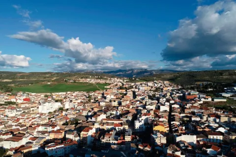
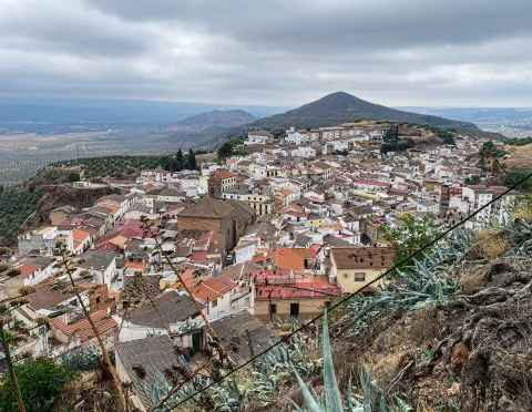
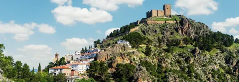
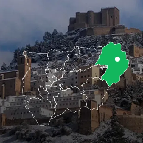
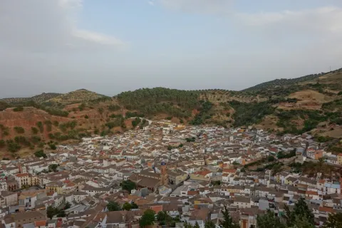
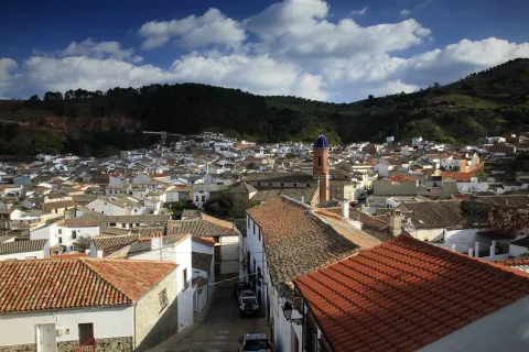
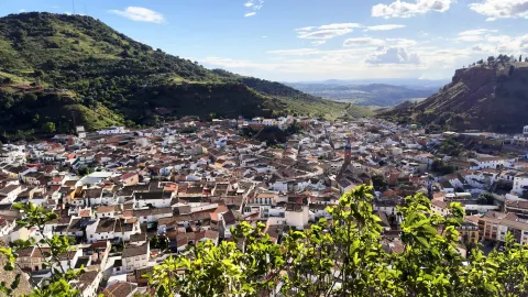
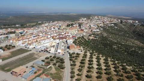
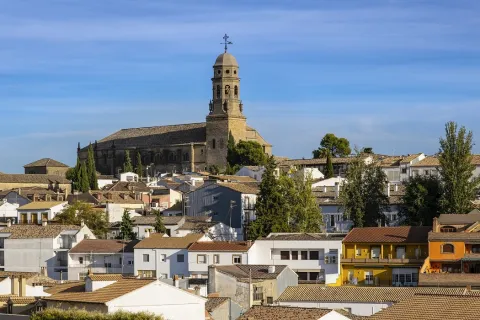
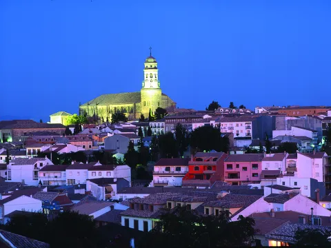
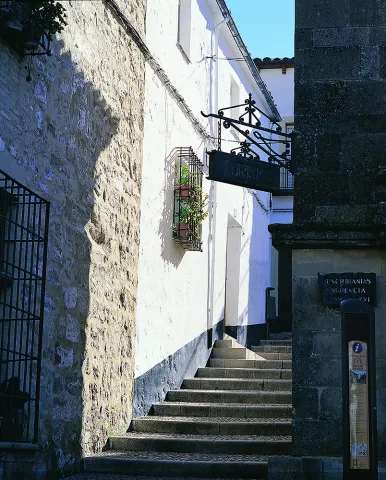
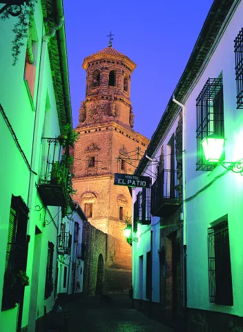
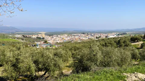
Villanueva del Archbishop is a population in the the eastern end of the region of the Villas. Part of its term is included in the Natural Park of the Sierras de Cazorla, Segura and Las Villas, where there are many areas of extraordinary environmental and landscape value.

The geographical situation of the municipality should be noted, as it is the meeting area of four comarcas: County and their red lands, the Loma and its extensive olive fields, Safe with the largest natural park of Jaén of extraordinary beauty and that of Las Villas, made up of four municipalities, Villanueva being one of them. The Conistorio also includes the localities of Gútar and Montesina Barrio.

An important area is irrigated by the rivers Guadalquivir and Guadalimar, which leads to fertile lands that favour agricultural crops, including large olive fields.

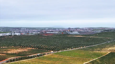
Its economy is based primarily on the olive cultivation and obtaining olive oil. It also has an industry mineral water bottling machine.

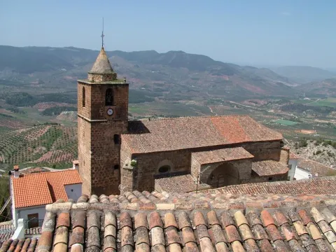
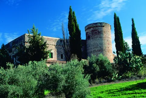
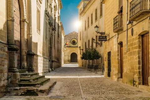
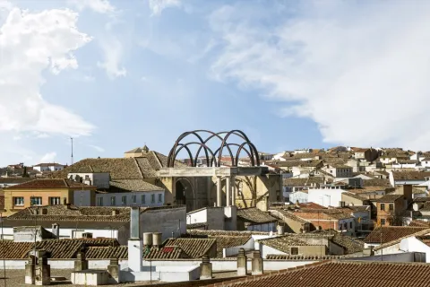
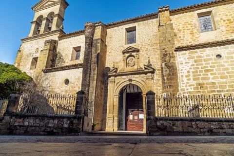
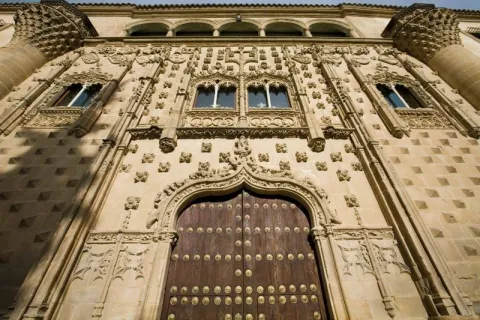
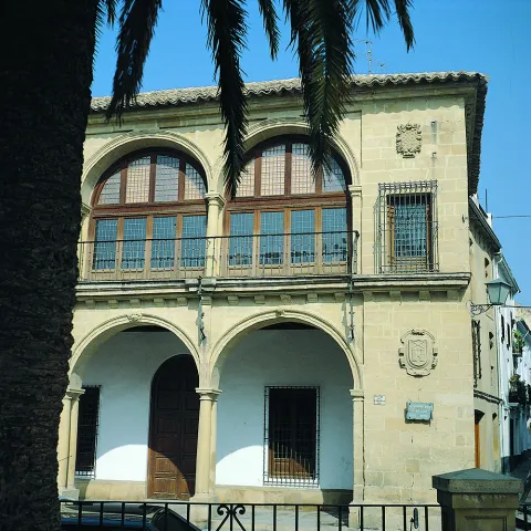
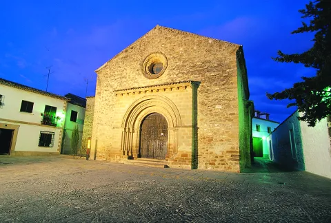
Its monumental heritage is important. Among others are the church of San Andrés, the church of the Vera Cruz, the Convent of Sana Ana, the bullring, the Calvary Sanctuary, the House of Arcos and, on the outskirts, the Sanctuary of the Virgin of the Fuensana.
Telecomunicaciones
Teléfono
607 184 628 
Sitio web
www.villanuevadelarzobispo.es
Fax
953 451 278
Correo electrónico
turismovillanuevadelarzobispo@gmail.com
Ubicación
Nombre
Villanueva del Arzobispo
Latitud
38.168770
Longitud
-3.007650
Ubicación en el mapa
POINT (-3.00765 38.16877)
Imágenes
imagen
Image
532806cd-619f-7cc9-44c2-092f56943a53?t=1599779812435
Imagen principal
Desactivado
imagen
Image
7990b2d2-d948-48a8-a614-11375318478c?t=1599779812524
Imagen principal
Desactivado
imagen
Image
738190d2-92fe-d42a-cd21-dee89312ab66?t=1621521463540
Imagen principal
Desactivado
imagen
Image
fccf37b3-51ea-0d40-d2d3-208d29d4b0fb?t=1599779812628
Imagen principal
Desactivado
imagen
Image
98803030-2a13-91ec-885d-33c12edb2ac3?t=1599779812669
Imagen principal
Desactivado
imagen
Image
ab294870-3b1c-2c43-c6d9-d9e82cd58348?t=1621521463664
Imagen principal
Desactivado
imagen
Image
fa16b75d-5183-daa9-6ae1-50f481dec7f2?t=1621521463705
Imagen principal
Desactivado
imagen
Image
4ead314e-cf27-6335-e563-707c37a36d70?t=1621521463848
Imagen principal
Desactivado
imagen
Image
80863fbc-ff97-c637-eddd-c388f63d4e11?t=1599779812778
Imagen principal
Desactivado
imagen
Image
660ffa23-8ba0-ab1e-b463-727ca59414bb?t=1621521463960
Imagen principal
Desactivado
imagen
Image
52d201af-c51c-763e-9c0c-8ef4115edc82?t=1599780126028
Imagen principal
Desactivado
imagen
Image
88ddd9fb-5893-6275-8058-a9c69b5ed6e2?t=1621521464134
Imagen principal
Desactivado
imagen
Image
73c4d06c-c93d-e031-dd46-d8ed1d675189?t=1599780126074
Imagen principal
Desactivado
imagen
Image
69c1c5b9-c705-6242-ea11-b4458d3a582b?t=1599780267391
Imagen principal
Desactivado
Información adicional
Curiosidades
  • Punto de información en el Ayuntamiento: Avda. de la Constitución 5, lateral derecho del edificio.

  • https://villanuevadelarzobispo.es/turismo/  

  • OFICINA DE TURISMO 
    Avenida de la Constitución Nº5. Tel. 607 184 628
 

Imágenes cabecera
imagen
Image
Villanueva del Arzobispo
Imagen principal
Desactivado
Datos de interés

Tourist area: Serras de Cazorla, Segura and the Villas
Distance to the capital (km): 99
Altitude over sea level (m): 688
Extension (km2): 177
Number of inhabitants: 7,703
Gentillo: Villanovens
Postal code: 23330

Videos
Video file
Cultura
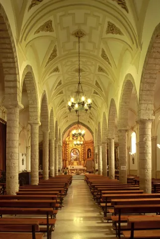
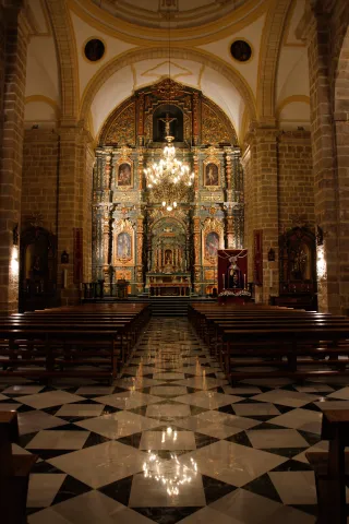
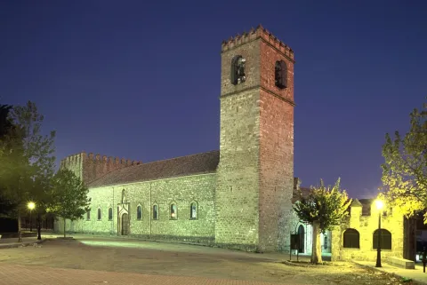
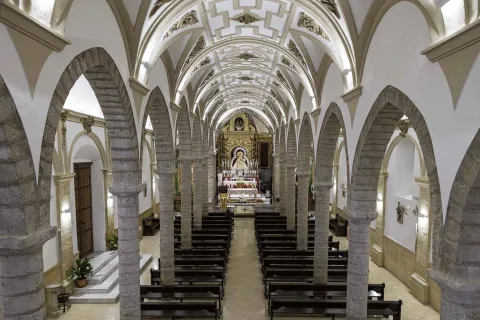
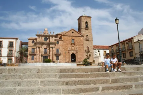
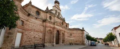
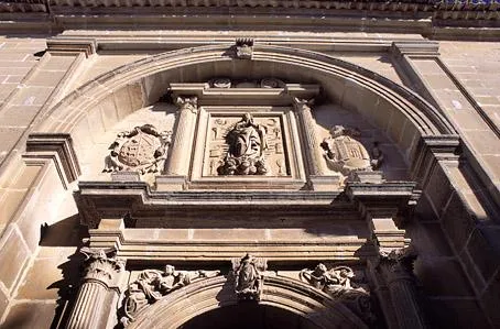
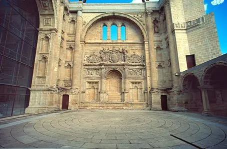
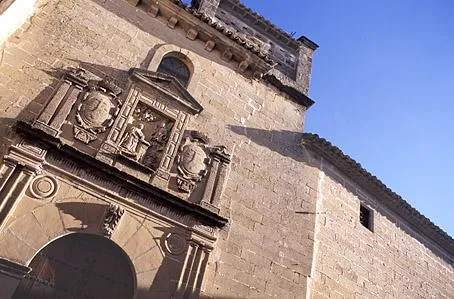
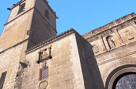
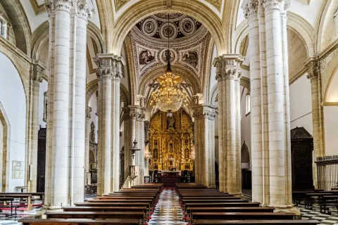
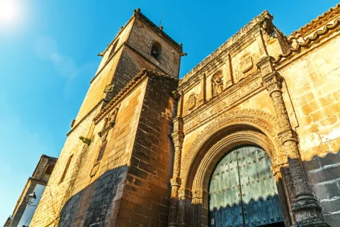
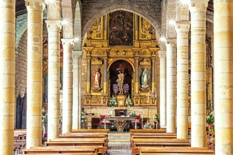
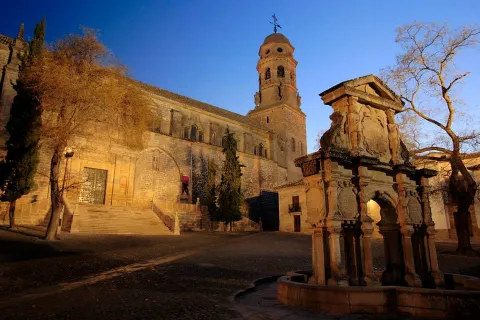
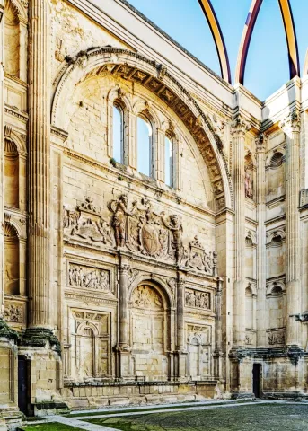
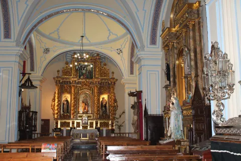
  • The Church of St. Andrew. It dates from the 16th century and is located in the historical center of the town. It rose on the pillars of the ancient medieval fortress, from which two of the four original towers, attached to the temple, are preserved, perfectly synthesizing the military and religious architecture. It has a mixture of different architectural and artistic styles: the Renaissance, Gothic baroque and classicist, due to its long construction. On top of the main door, which is of a classicist style, we observe a hornaine that contains the image of St. Andrew and that crown a half-point arch. Inside it consists of a single ship with side chapels that are linked through half-point arches on a ledge that runs through the temple. The major altarpiece is baroque. It has been declared Good of Cultural Interest and Spanish historical heritage.

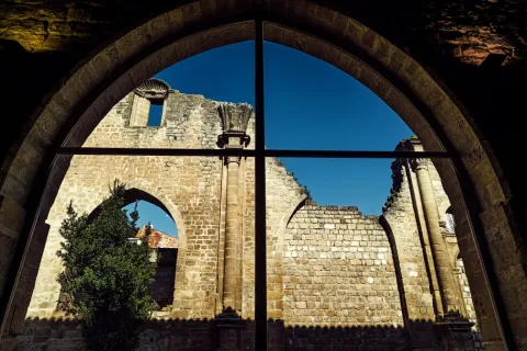
  • Convent of Santa Ana. It is located in the old town. It was founded in 1540 and from the beginning became one of the most important of the Four Villas. In the walls of the refectory, the 16th century wall paintings and the shield of Santo Domingo are preserved. Inside is the church of Santa Anawith baroque altarpiece and a courtyard with Renaissance arches.

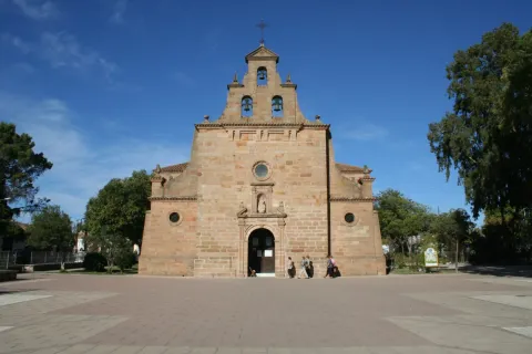
  • The church of the Vera Cruz. Built in the 16th century, with a Renaissance style façade. It consists of one ship in two sections, with chapels on each side. In its interior we find an extraordinary size of the Christ of the Vera Cruz, work of Mariano Benlliure, which replaced the primitive image stolen during the civil war. Rest on an extraordinary 1899 silver cross. The Christ of the Vera Cross is the patron of the town.

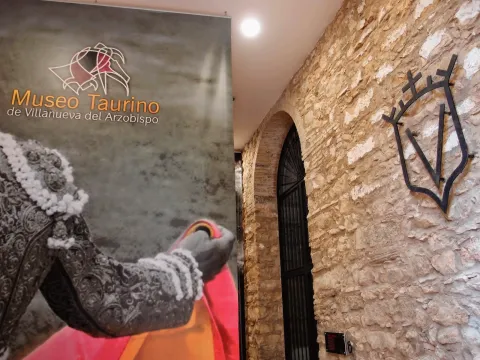
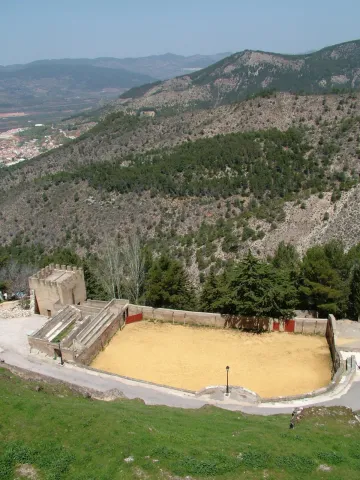
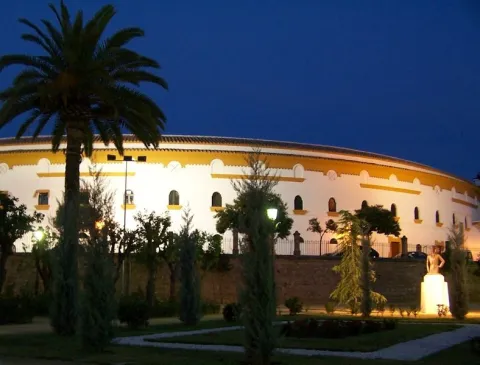
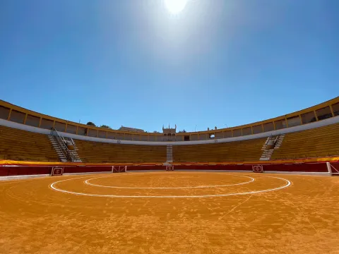
  • Toros Square. Built in 1928 it is neomudéjar style, where the use of brick and horseshoe arches that provide originality and elegance stands out. It is one of the largest bulls in the province, has all the necessary services and capacity for 6,000 people. The interior of the square houses the Taurino Museum of Villanueva del Archbishop.

  • Sanctuary of the Fuensana. It is of Romanesque style and was founded in the 13th century. It has subsequently been reformed. Because of its construction and the existing matacans it is considered that it was first a defensive fortress. Here is the image of the patron of Villanueva of the Archbishop, the Virgin of the Fuensanta. It has been governed by the Trinitarian religious order since 1884. The patron's holiday is held on September 8.

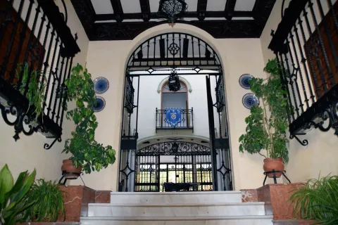
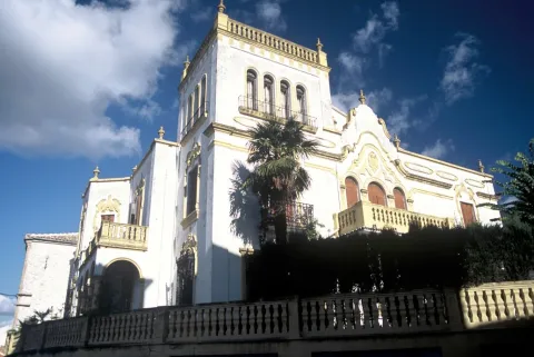
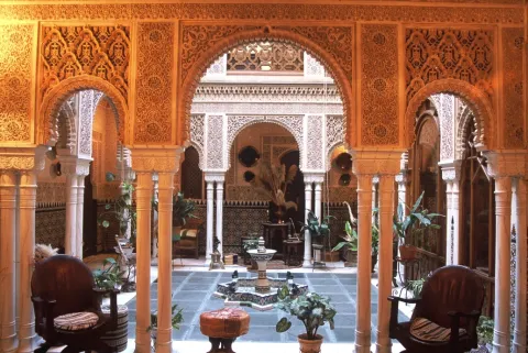
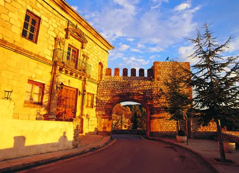
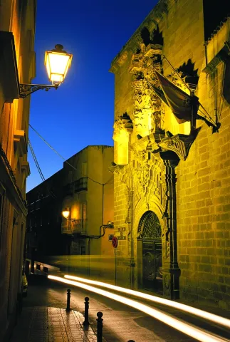
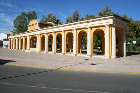
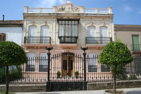
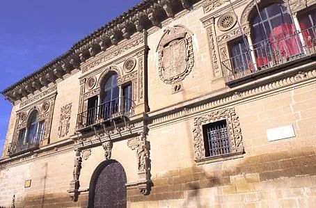
  • House of the Arches. It was built in 1928. With Renaissance lines on the fronts, they are combined with the baroque filiggranes of the bars and the Andalusian ceramics that kill the facade. It is chaired by six arches crowned by so many other ceramic vases. Its courtyard is a Nazi replica that imitates the palaces of the Alhambra. This building received the provincial beautification award.

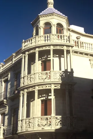
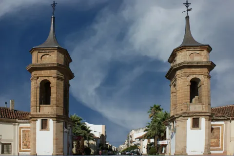
Other heritage monuments: Hermitage of Jesus of the Mount, Hermitage of Saint Blas, Viaducto / Old railway way. The municipality is splashed with lordship houses like the Palacete de la Familia Cosano, Old Casino or Commercial Circle, House of the Arches, House of the Vélez Family or Sagrada Familia Palaceamong others.

Naturaleza

Villanueva del Archbishop is one of the four villas that, together with Villacarillo, Iznatoraf and Sorihuela del Guadalimarthey make up the region called Las Villas.

A town where there are many sites of extraordinary environmental and landscape value that are the gateway to the fascinating Sierra de las Cuatro Villas.

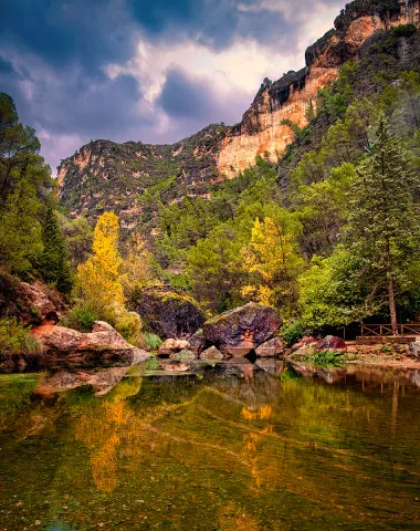
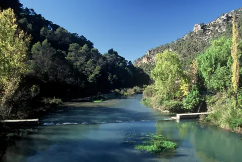
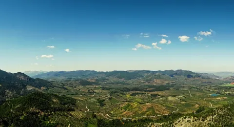
By its municipal term the rivers run Guadalquivir and Guadalimarwhich add beauty to the landscape, wealth to both vegetation and fauna. Surrounded by a sea of olive trees and cereal fields, part of its territory is included in the Natural Park of the Serras de Cazorla, Segura and Las Villas.

It is one of the localities where the vegetation has a greater variety, along with the species of the Alta mountain, such as the laricio pine or the acebo, coexist with other species that develop at a lower height, such as the black pine, the tejo or the boj and with those that develop in the lower area: melojo oak, the oak, the oak, the cucumber, olive trees, and other endemic and aromatic plants.

To this vegetation we will add the one that develops on the banks of the rivers: chopos, willows, mumberas, tarais...

The fauna, in line with the plant variety and the many habitats in the term, is also abundant and diverse.

To the raptures and scavengers of the mountains, eagles, broken bones, lethonated vultures, are joined the species, both of major hunting, deer, maflon, boar; as of minor hunting, rabbit, hare, parrots, gits, badges, kernels...

Without forgetting the typical birds of the olive tree, which either live in it, or feed on the migratory movements: curuca, verderon, zorzal, petirroja... Nor fail to mention the fauna of the rivers of crystal waters in their high courses: trout, barbo, nutrites, salamandra... Just like reptiles and amphibians.

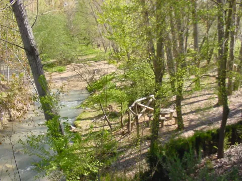
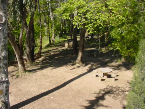
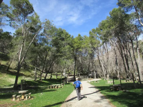
A privileged world where Nature is the main attraction of these lands. Nothing better than to discover it in one of the many places in municipal terms, we will point out two recreational areas and have good accessibility:

  • The Charco of the Pringue or Charco of the oil. Located about 20 km. of the city centre, is a recreational area that has a water remnant in the same river Guadalquivir. It has a wall and a gate, which allows to empty it completely. The water outlet is a roundabout, which in addition to continuously renewing the water from the remnant, serves to allow us to pass from one side to the other of the river. The name so curious, is because they tell that a donkey loaded with pear of oil precipitated from the narrow upper path and fell into the remnant, stained with oil water.
  • Cueva del Peinero. It is one of the most abrupt and steep places in the park. Its natural exit is the impressive throat where the river runs Avocados Grande, cThe crystal clear waters descend into successive waterfalls. On the contrary, in the recreational area, the river is sorely and silently spread between the thick vegetation of willows, chopos and nozzles. The huge lanterns that close the site rise more than 600 meters, forming scalated poyos covered with fully virgin vegetation by the difficult access. It tells the tradition that this cave was inhabited in the summer by a craftsman who was dedicated to making boj wood utensils, very abundant material in the area, and among other objects, made hair combs.

Fiestas y Eventos

The main parties in Villanueva del Archbishop are:

  • San Antón. January 17. They turn on "luminaires" in different places and the neighbors gather around drinking the traditional artisan wine.
  • San Blas. It is held on February 3. This day the villanovens come to the hermitage of the Holy, lighting a lumnaria around it and celebrating the tradition of passing the garrot through the throat so that San Blas will protect their health throughout the year.
  • Holy Week. Living representations are held dating back to the 17th century. They stand out for their realism and expressiveness. The different cofradies and cofrades process throughout the week. It has a great heritage in sizes and images that represent the passion of Christ.
  • Festivals of the Christ of the Vera Cross. These parties are held in the days before and after May 3. On that day, the Christ goes out in procession through some streets of the town and blesses the fields in the era of the Virgin of the Head. Verbenas and cultural activities accompany religious acts.
  • San Isidro. It is celebrated on May 15 and is the patron of farmers. In the parish of San Andrés The Eucharist is celebrated, followed by a procession with the Holy one on the streets, accompanied by tractors, agricultural machinery, horses... And at the end of the day a sisterhood meal is held.
  • San Fernando. It is held in Gútar May 30 with a traditional Eucharist, meals, drinks and verbena.
  • Corpus Cristi. The streets of the procession tour are embellished with flowers, carpets, paintings, plants to magnify the passage of Corpus Cristi. End of May, early June.
  • The Night in White. In July, with increasing demand and participation, a cultural night is celebrated: theatre, guitar, music bands, little children, dances... A very cultural and emotional night.
  • Festivals of Our Lady of the Fuensana. Between 7 and 11 September, the great days of Villanueva del Archbishop take place. On the 7th and 8th, in the morning, the procession and the traditional Romeria are held in the vicinity of the Sanctuary. From that day on the party is moved to the city centre with taurino shows, concerts and lots of activities. The final clasp put it, the last day, the fireworks.
Gastronomía

The gastronomy is traditional and varied, highlighting these dishes:

  • Cod onions, Cod stew, potatoes and onion.
  • Ajoharina, tomato saffrito, potatoes and eggplants with red pepper, garlic, cumins and water. Add flour to thinner.
  • Whites, salty, hard and crispy cakes accompanied by tomato and raw beans.
  • Garlic, rice with chopped onion, pig blood, butter and fences.
  • Gachamita, potatoes, garlic, oil, flour and water.
  • Other: Pipirrana, crumbs, gachas, "sleeping" cakes.

Warehouse:

  • Drunk, mass of flour, roasted olive oil, spirits, lemon, cinnamon and sugar.

Typical drinks:

  • Membile or fig liquor, crow, misteland traditional came from San Antón.

Historia

In the Arab era, Villanueva del Archbishop, was one of the fortresses that reinforced the village of Iznatoraf. It was a village like a few inhabitants, called "La Moraleja." The Arabs who lived in those places chose it as a leisure area, where horse races were organized and the artisans set up their workshops.

After the conquest by Fernando III of Iznatoraf, the village of "La Moraleja" was donated by the king, in the early 13th century, to Cazorla's advance.

The town as such in 1396, thanks to the request made by the Archbishop of Toledo to King Henry III, who granted him a Letter from Privilegio which is preserved in the Town Hall of the Villa. By this Charter the city was founded with all the privileges possible at that time: market, police and cessation of the payment of taxes to Iznatoraf. But an obligation was imposed on him: to lift a wall with two doors and to close the city in five years.

The municipality became the most important core of Señorío de Cazorlawith several flour mills on the Guadalquivir River.

Miguel de Cervantes lived for some time in this village as a tax collector.
Why did the municipality get this name? Villa, for the title given; new, because until that moment it did not exist as such and Archbishopin honor of Mr Pedro Tenorio, who was called the ecclesiastical office.

The city was moving forward and Philip II granted him criminal jurisdiction in 1573.

During War of IndependenceThe people became a refuge for guerrillas who harassed the French troops. As a result of these events, some convents were damaged and the Charter of Privilegio disappeared. After many years she appeared in Linares, she was restored and kept well guarded in the City Hall because she is the oldest document we have.

In 1920 he received the title of City from King Alfonso XIII.
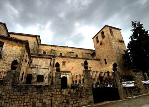
Loading map
Preparing points of interest and routes...
Imagen principal
imagen
Image
Villanueva del Arzobispo
Imagen principal
Activado

Vilches

Submitted by brandcode_deweloper on
Id
787264
Perfil de redes sociales
Facebook
https://www.facebook.com/profile.php?id=100068958337736
Descripción
Breve descripción

Vilches is a municipality located in the north of Jaén, in the district of El Condado, located in the foothills of Sierra Morena. The pedanias of Guadalén and Miraelrio are also part of it.

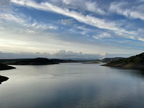
Its municipal term is crossed by the Guadalén, Guarrizas and Guadalimar rivers, which pour their waters in the reservoirs of Guadalén, La Fernandina and Giribola, respectively.

Its varied landscape has great tourist potential, highlighting its areas of environmental interest, reservoirs, oak dehesas, extensive olive trees, farmland, not forgetting its cynetic and fish resources.

The historical-artistic heritage is relevant. The church of San Miguel, the hermitage of the Virgin of the Castle, the remains of the castles of Vilches and Giribola, belonging to the Route of the Castles and the Battle of Jaén, and archaeological sites such as Giribola, of Iberian times, are highlighted.

Telecomunicaciones
Teléfono
953 63 00 75
Sitio web
www.turismovilches.com
Correo electrónico
turismo@vilches.com
Ubicación
Nombre
Vilches
Latitud
38.211660
Longitud
-3.512960
Distrito
Municipio
Ubicación en el mapa
POINT (-3.51296 38.21166)
Imágenes
imagen
Image
c4eb1866-6864-211d-8b8d-5d6240b72c0e?t=1687277240860
Imagen principal
Desactivado
imagen
Image
e203e5aa-0c7b-55bc-bb18-7f2ad2a50893?t=1687277240664
Imagen principal
Desactivado
imagen
Image
36f5d348-3269-39d2-d70f-6d5b005c43c2?t=1687277240761
Imagen principal
Desactivado
imagen
Image
61e83072-e72e-55d4-da7b-2cbab669b212?t=1585852470283
Imagen principal
Desactivado
imagen
Image
b8aaede2-095b-503f-349d-1f204fe0ddee?t=1687277240934
Imagen principal
Desactivado
imagen
Image
de02a0ed-f04e-7e2f-c703-d8c7d6baea37?t=1687277240590
Imagen principal
Desactivado
Imágenes cabecera
imagen
Image
Vilches
Imagen principal
Desactivado
Datos de interés

Tourist area: Sierra Morena / Sierras de Andújar and Despeñacolos
Distance to the capital (km): 80
Altitude over sea level (m): 543
Extension (Km2): 273
Number of inhabitants: 5086
Gentillo: Vilcheños
Postal code: 23220

Videos
Video file
Cultura

Its artistic heritage includes:

  • Church of San Miguel Archangel, This church dates back to the last third of the 16th century. The main cover is simple and with a half-point arch. It appears decorated with a stone shield made of quarry, typical of the Renaissance and Spanish mannerism. On a side it has a cover with a tile image of the Virgin of the Castle. The tower is of rectangular floor, which is unusual, and with relief decoration of the bell tower, similar to work in brick. The interior is one-ship and at the bottom is a half-barrel vault with the arms shields of Bishop Calderón. The majestic baroque altarpiece of the 18th century, the work of sculptor Diego de Briones, the chapel in which the so-called "trophies" of the battle of the Navas de Tolosa are kept (1212) and, in another chapel, a canvas of the Final Judgment are kept.
  • Ermita- shrine of the Virgin of the CastleHe rose in the 18th century on the ancient church of Santiago, at the top of the hill of the castle. It houses the image of the patron of Vilches, who every August 14, on the occasion of the holidays in his honor, is brought down in procession to the parish of San Miguel.
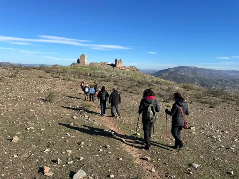
  • Vilches Castlelocated on a high hill to which it gives name and from where you can enjoy a wonderful view, is the castle of Vilches. A fortress castle that played a very important role as a point of defense of the high Guadalquivir, served as a refuge for the inhabitants of the environment in the face of the advance of Christian troops during the Reconquest and starred in famous war episodes, in the Middle Ages, between Arabs and Christians. Although we know that the hill has been populated since the time of the Iberians, the origins of the castle are uncertain. There are only a few remains of the fortress: a esquinero turret, known as "Cube de la Villa," part of another turret and a passage with a slightly pointed vault of armchair. With the passage of the years and the consolidation of Christian culture, much of the towers and parts of the walls of the castles were used to build small churches and hermitage. In the courtyard of arms the church of Santiago was built, on which the hermitage of the Virgin of the Castle was later built. It was declared Good of Cultural Interest in 1985.
  • Archaeological site of Giribola. It is an archaeological site of great importance located in the confluence of the Guadalimar and Guadalén rivers, from where you can enjoy excellent panoramic surroundings. From what has been known so far, it is known that it was home to an Iberian city, which some scholars associate with Orisia, which was destroyed in the Second Punio War, a prehistoric sanctuary, a Paleocrist or Visigode cenobium and a Almohad castle built after the battle of the Tolosa Navas.
Naturaleza

TheNorthfrom the term Vilches extends through Sierra Morena, with altitudes reaching 800 m. The vegetation in this higher part is very varied and is associated with the Mediterranean forest: encinars, alcornocals, complaints. There are also shrubs and areas of wood pine plantations.

More to Southin the foothills of Sierra Morena, with altitudes between 400 and 500 m., the adhesitated surfaces and pastures predominate. With a soft orography of constant undulations, where the olive grove predominates and we also find low mountain with acuchals and madroños.

Here live numerous animal species, such as birds, mammals and arthropods, easily observable in their natural habitat.

Thewet areass are around the reservoirs(Guadalén, Girirbola and Fernandina), in theriver banksGuadalén, Guadalimar and Guarrizas. The banks of the rivers and streams welcome mimberas, tarays, adelfas and other tree species such as the white chopo or the black Alamo.

The reptiles abound, highlighting the populations of theleprous galapagoin the rivers Guadalén and Guarrizas, as well as theViper de Latastein the Sierra. They will also be easily observable fishing and real eagles, common and black vultures, royal owls, lynches, gines, badges, etc.

Fiestas y Eventos

Vilches is a municipality of deep-rooted traditions, with popular celebrations, both religious and profane, that take place throughout the year and with activities for all ages.

  • San Antónwhich is held on 17 January. The streets are filled with bonfires of olive branches, which come from the pruning of these trees, to honor the pattern of the animals.
  • San Sebastián, Vilches pattern, which is held on January 20. That day the saint leaves his hermitage to process the streets.
  • Carnival parties, in which the neighbors participate, in which they dress up and sing mockery cokes (the City Council awards the best). They take place in the Caves del Zahaní district.
  • Holy Week. A week marked by religious acts and processions from Palm Sunday to Resurrection Sunday.
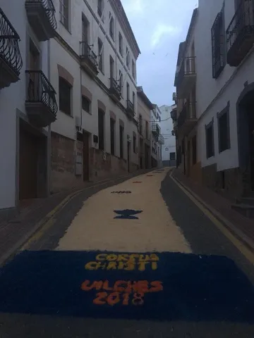
  • Festival of Corpus Christi. After Mass, in the church of St. Michael, the Lord will take a tour of the people accompanied by children of first communion. It is tradition to paint the streets using multi-color sawdust to reproduce allegorical drawings to the day of Corpus.
  • Saint GregoryOn May 9, in the neighborhood of the Mesones, a mass is held in the church of St. Gregory. At the end of the day, the rosses of blessed bread are distributed and the image of the saint is moved to the church of San Miguel.
  • Patrons in honor of the Virgin of the Castleon the 14th of August the transfer of the patron from her hermitage to the parish is carried out, remaining there until 8 September. The next day, on the 15th, the Holy Mass is celebrated in his honor and the floral offering. The festivities will last five days, in which there will be sports events, enclosures, capeas, gastronomic samples and popular verbenas.
  • The Vilches bell-bearers, they are a gang of Vilcheños who, when Christmas comes, go through the streets, singing their stanza. They sing ancient and villain senses. It is a tradition in which Arab reminiscent is observed, both in its melodies and in its stanza. The song is initiated by a soloist and the chorus chorus. The accompaniment is very unique: guitar, bandurry, laud, bell, triangle, Spartan alpargata, plow, wooden drawer, almirez and saucers.
Gastronomía

Vilches is a municipality very fond of its traditions and this is also reflected in its gastronomy. Meat obtained from hunting is often used to make its dishes.

We highlight among the best known:

  • The harls, a hare stew, flour, tomato, onion, olive oil and pepper.
  • The countrysideA stew with hare and potatoes.
  • The brain, on this dish is cod, with onion, tomato and olive oil, which takes the lead.
  • The crumbswhich consists of bread, garlic, olive oil, all accompanied by some products from the slaughter of the pig.

From the pastry shop we want to highlight:

  • PapajotesIt's traditional sweet. This dessert is consumed at breakfast or at snack, and is one of the most widespread sweets in the province.
  • Sweet peas for the Day of All Saints.
  • Tickles, drunks and flowersHoly Week.
  • Bake and bread with matalauva in San Gregorio.
Historia

In the municipal term of Vilches, about a hundred archaeological sites have been invented. From the Copper age the field of Santagon. The occupation of this settlement had to end at the beginning of the Bronze Age, when the consolidation of metallurgical activity and the fertility of the surrounding lands involved the emergence of small villages in the area, some of them fortified, such as the Cañada de Malaguo, Giribola or Cerro Santo. This settlement has the novelty of having a large defensive tower.

In the Iberian stage, GiridanceThe metallurgical centers were controlled from here. The town has an urban layout defined by streets, houses and public areas, delimited by a large wall. From this Iberian period, many settlements and small fortifications have been invented, including the first occupation of the castle hill.

In the Roman times Vilches is identified as BaesucciAccording to a stone located on the hill of the castle. The Emperor Vespasian granted him the title of municipality. In Santagon, remains of ancient villas with mosaics have been found in the noble areas.

Also the people Visigode He settled in Vilches. A visigode architrabe has been found and is preserved in the Jaén Provincial Museum.

It's in the Islamic period when the current Vilches site is consolidated, being occupied from 711. It was part of al- Andalus for five centuries, from the first years of the 8th to the 13th century. This long period makes Vilches a typical Muslim cityfrom which we can guess vestiges today. As the 12th century progressed, the castle of Vilches became very vulnerable by the proximity to Despeñacolos, where the Spanish-Latvian troops practiced acts of harassment over the possessions of al- Andalus.

In 1212, the Christian kings of Castile, Aragon and Navarra, beat the Muslims in the the battle of the ships of Tolosa. Three days later, the castle is conquered and the population exterminated, which will force this area to be repopulated with inhabitants from beyond Sierra Morena. The Christians will stay in the Vilches castle And the Muslims will return to Giribola.

It will be King Fernando III who gives up the territory of Vilches to the Council of Baeza, until Felipe IVin 1627, release him and grant him the The title of Villa.

The number of Vilches with railway station, already in 1900.

Loading map
Preparing points of interest and routes...
Imagen principal
imagen
Image
e2fdf917-2e2c-2a08-49fc-21c32566e218?t=1687277240494
Imagen principal
Activado

Segura de la Sierra

Submitted by brandcode_deweloper on
Id
751057
Perfil de redes sociales
Facebook
https://www.facebook.com/ayuntamiento.segura/
Youtube
https://www.youtube.com/channel/UC0tAxfUQ5z6fv74Z3R6BrGg
Instagram
https://www.instagram.com/seguradelasierra_/
Descripción
Breve descripción

Segura de la Sierra is a beautiful villa located in the heart of the Sierra de Segura, located in the northeast of Andalusia. It is certainly one of the most beautiful peoples in Andalusia and, as such, is part of the most beautiful Peoples Network in Spain.

Segura gives name to a river, to a region and is synonymous with history. Visiting this town we can pack history and heritage in its urban centre or taste nature in its maximum expression in the many villages of its large municipal territory.

From its castle, of Muslim origin, you can see impressive panoramic views of the whole area, which is distinguished by its wide serrania, with an enormous natural and forest wealth. It is part of the Natural Park of the Sierras de Cazorla, Segura and Las Villas, the largest protected area in Spain.
This wonderful environment, its streets and historical corners make Segura de la Sierra has been declared a Historical-Artistic Set and Pintoresque Park.

Segura de la Sierra and its high peaks served to illuminate the best literature of the Renaissance, by the hand of Jorge Manrique, author of the "Cops to the death of my father."

Telecomunicaciones
Teléfono
953 480 280
Sitio web
www.seguradelasierra.es
Fax
953 481 012
Correo electrónico
administracion@seguradelasierra.es
Ubicación
Nombre
Segura de la Sierra
Latitud
38.298850
Longitud
-2.651870
Distrito
Ubicación en el mapa
POINT (-2.65187 38.29885)
Imágenes
imagen
Image
18670190-05e7-df1b-a17a-e92e0d671cef?t=1603979935869
Imagen principal
Desactivado
imagen
Image
despegue-el-yelmo-jpg
Imagen principal
Desactivado
imagen
Image
84676aeb-bfa8-a851-5550-3b4d15c74706?t=1621445408264
Imagen principal
Desactivado
imagen
Image
6fde7b00-3201-46c4-e6c3-528a9d11093d?t=1595353573804
Imagen principal
Desactivado
imagen
Image
a66e4f4c-435d-565a-2c1d-47799e04c4ce?t=1595353573833
Imagen principal
Desactivado
imagen
Image
4e21d820-8e51-89a4-0274-af8aeb2894f0?t=1621445408309
Imagen principal
Desactivado
imagen
Image
8668c55e-f4f0-0979-0f1b-fbd53f037c7e?t=1621445408354
Imagen principal
Desactivado
imagen
Image
78496ace-41be-4e6a-cd26-a6097356a63d?t=1621445408397
Imagen principal
Desactivado
imagen
Image
d1c73291-0577-d6d3-7c68-b4cea6f8ac35?t=1595353574079
Imagen principal
Desactivado
imagen
Image
5a350abd-951a-6543-e791-3a83e2a39938?t=1621445408446
Imagen principal
Desactivado
imagen
Image
307ca2fa-ccf4-8ce0-302a-896577682bb1?t=1595353574160
Imagen principal
Desactivado
imagen
Image
4d621b1f-d10e-8b22-6bc0-9c2c2c218615?t=1621445408494
Imagen principal
Desactivado
imagen
Image
b5bce32c-dbd5-c32b-b191-af98ea79ea34?t=1621445408543
Imagen principal
Desactivado
imagen
Image
aeb6f7e7-dfc2-de87-6f7f-daaaadba363b?t=1621445408593
Imagen principal
Desactivado
imagen
Image
49a44de3-3e7c-ef37-cfb0-56a999ea436d?t=1602789076574
Imagen principal
Desactivado
Información adicional
Imágenes cabecera
imagen
Image
segura-de-la-sierra1-jpg
Imagen principal
Desactivado
Datos de interés

Tourist area: Serras de Cazorla, Segura and the Villas
Distance to the capital (km): 160
Altitude over sea level (m): 1145
Extension (Km2): 224
Number of inhabitants: 1986
Gentillo: Segureños
Postal code: 23379

Videos
Video file
Cultura

The villa offers the physiognomy of past times, preserving its steep and silent streets. From its rich and varied heritage, we highlight:

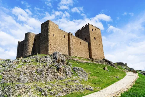
  • Castle.Of Mudejar origin, eternal vigil located in the highest of the village and surrounded by an old wall that still retains some turreons. The tower of tribute, which reaches 18.50 m in height and from which you can see impressive panoramic views of the Segura saw. Inside the castle we find: chapel, adarves, covered with wood and roofed in two waters, aljibe and Arab baths.
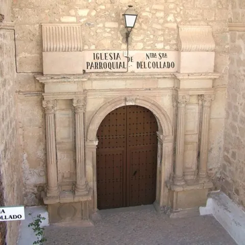
  • Parish Church of Saint Mary of the Collado. It was built in the 16th century on the site of the old Romanesque temple. The Napoleonic troops set it on fire and would be restored between 1814 and 1817. Its only ship is rectangular and of vaulted roof. On the outside, his tower built with masonry. With a quadrangular plant, it has its first body with a flask and a second body covered with an octagonal pyramid on which a forged iron cross goes. He has accumulated a rich religious iconography during his history.
  • City Hall. Other Renaissance paradigm, old house of the Society of Jesus. It opens with an arched arch of highlighted keys, to which they flank crate pilastras and dotal column. The second body is embellished by a curved balcony, a triangular fronton decorated with tacos and noble oval shields with plucked helmets.
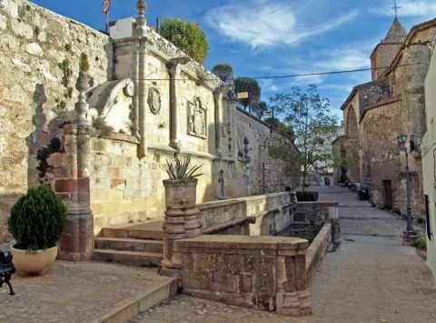
  • Imperial source. A monument that reflects the transition between the Gothic and the Renaissance. It is built in front of the church and dates from the year 1517. Presents a large fronton divided into three streets separated by Ionian columns. A large shield with the weapons of Carlos V. is displayed on the central street
  • Casa de Jorge Manrique. The façade has a half-point arch decorated with vegetable motifs, flanked by crate pilasters and complemented by small Ionian columns. The nobility shield of arms of the Figueroa, the mother family of Jorge Manrique, was carved in stone.
  • Church of the Jesuit. It is built in the last quarter of the 16th century. It has Renaissance decoration, with a half-point arch with reliefs of the apostles. This building has now been remodeled and turned into an event and exhibition room.
  • Bull's Square. It is located on the outskirts of the village in the old courtyard of weapons and chivalry. It's one of the oldest and most curious, being quadrangular.
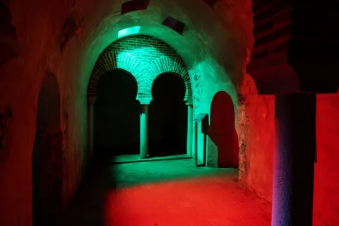
  • Arab baths (hammam). Used not only for hygiene and toilet, but also as social assembly centres. They were used by both men and women, but at different times. They consist of three longitudinal ships, corresponding to thecold room, the most external,tempered and hot, the innermost. They were tied with double horseshoe arch and canyon vault with skylights. It is estimated to be built between the 11th and 12th centuries.
  • Wraith and defense. Many sections of the local walls can still be observed. One of the best preserved is the water tower, It is called that because its mission was to protect a water spring that supplied the plateau. Other still preserved are: The Era tower, the School tower and the Snow well. The latter space was used to store water and snow during the winter period and then to use them through drains that existed at the bottom.
  • Access doors. The way to access the Segura de la Sierra fortification was 4 doors: The New, the Gontar, the Catena and the Orcera.


Naturaleza

Segura de la Sierra is located in the center of the mountains to which it gives name, the entire municipal term is part of the PN Sierras de Cazorla, Segura and the Villas.

The flora, when there is such a great difference in height in the municipal term, it is different: high mountainLet's find the pino laricio, flexible and resin-rich wood, and lacquer; half mountain live the black pine, whose wood is very resistant to rot and can reach 45 m in height and tejoof slow growth, but of a longevity that can reach the age of 5,000; low mountainthe Pine carrasco, complaining, melojo oak, the oak, the oak, the coscoja, olive and other endemic and aromatic plants.

The fauna is also, like the flora, very diverse. So, we'll meet. Rapist birds and scavengers(eagles, lethand vultures, alimoche vultures...), animals of major game(deer, muflon, gamo, boar...) and minor hunting (perdiz, rabbit, hares, crow, crows, tortoises, doves and foxes).

They also live in various species of fish, like trout, barbo, boga, etc., andmammals,Like bat, mountain cat, chickenpox, badger, otter, fox and gin.

An area with enormous natural and forest wealth, place to feel that nature is alive.
 

Fiestas y Eventos

The Segureños celebrate the following parties:

  • Patrons of the Virgin of the Rosary. They have a place of 4-8 Octoberand are celebrated in honor of the patron. On the 8th the most emotional act takes place: the procession of the Virgin on the shoulders of the women of Segura. During these days there are taurine celebrations, which are held in the peculiar square of quadrangular bulls, and serrano bolus competitions.
  • Saint Vincent. It is the patron saint of the town and is celebrated the January 22. In his honor fire is on in the extramides of the villa. It is a custom that is very rooted in the saw that the winter festivities turn on "Luminaires"(bonfires). This is the day of" La Pura "(8 December), in Saint Lucia (13 December), Christmas Eve, New Year's Eve, San Antón (17 January), in San Vicente (22 January) and ending at the Candelaria (2 February).
  • Romeria de San Isidro. It is the pattern of the New cuts, the most important pedany of the many that Segura has. It is held in the area of the Lomilla, by the village The Ojuelo.
Gastronomía

The gastronomy of Segura de la Sierra is rich and full of tradition, has been able to combine the agricultural customs with those of the pastors or those dedicated to the works of the wood, carried out by the cut of pine trees in this saw.

The diversity of the dishes that we find in the town is characterized by the use of the products we find in the area: olive oil, mountain meat in hunting season (boar, perdiz, rabbit, soybean sheep) and, in concrete seasons, mushrooms and niscalos (guízcanos) or asparagus that are so well given in the saw.

  • Galians, bread cakes, rabbit and spices.
  • Andrajoswith flour, meat and spices.
  • The Migasof bread, to which is added chorizo, torrezos...
  • The Gachamita, flour and potato that is accompanied by all kinds of dressing, both sweet and salty.
  • Lamb to the young shepherd, pastoralist chard, lamb in cabañil garlicIn all these dishes, the base is the same: the following sheep's meat.
  • Pisto gandul, made of goat, lamb or rabbit and is to then consume in fairs or evenings. Hence the name of the gangul.
  • Cecinaof sheep's or goat's meat that has been cured.
  • Ajopringueis consumed in the massacres and is made with the pig liver It's a bit.

In pastry, the bake, a dessert of oil cake that carries a hard egg in the middle.

Historia

The history of the term Segura de la Sierra dates back to the 4th millennium BC, according to the many archaeological sites that testify to the human presence in those times.

Very close to the city centre is the settlement called The Old Onea few kilometres from the village of Moralejos and that it has always been attributed to peoples as Iberians and Phoenicians, being later the scene of wars between Romans and Carthaginians.

But it is, no doubt, with the Islamic people (781) when the population they call Saqura lived the golden era as a strong square in the area. In the 9th and 10th centuriesAfter the collapse of the Cordoba caliphate, Segura de la Sierra has several periods of independence that make it important.

It will be conquered by the Christian troops, becoming dependent on the Order of Santiago by the donation of Alfonso VIII. In 1243, with King Fernando III, he passed to the crown of Castile and within the kingdom of Murcia until 1833, the year in which the current province of Jaén was created.
In 1517, after the visit by Carlos I to the square, the fountain is built in his honor. A Renaissance source, though clearly of transition. In 16th century had a a time of great splendor, provided by the large amount of wood produced in its territory and which, transported by the Guadalquivir River, supplied all of Andalusia.

In 18th century, the State has converted the saw, under the name of saw of Segura, Maritime Province, No doubt you need wood for the construction of your ships. The Napoleonic invasion (1810) turned the population into a huge stake, destroying the files and taking part of its history.

illustrious characters:

  • Jorge Manrique (1440-1479), a Spanish poet and author of "Cops for my father's death," considered one of the capital works of Spanish literature. The origin of his birth is discussed with Paredes de Nava (Palencia)
Otra información

We want to place on record two traditions that are very deep-rooted in Segura de la Sierra:

  • The serrana jack. Of the popular dances of Segura de la Sierra, no doubt, the serrana jota is the one with the greatest personality. It is interpreted alone or with whole or half-ways, usually, in popular parties.
  • Via living crucis. It is interpreted by the neighbors of the village and is developed in different places of the town, with excellent views of the Segura saw.
     
Loading map
Preparing points of interest and routes...
Imagen principal
imagen
Image
53a920a5-6491-8831-30ac-3d989e48192e?t=1603979644641
Imagen principal
Activado
Literatura

This town may have been the birthplace of the warrior-poet, since his father was Commander of Segura de la Sierra, the most important commandery of the Order of Santiago. In fact, the Manrique family home is still preserved today.

Segura de la Sierra pays tribute to the poet not only by marking the Manrique family home, but also by building part of its tourism offer around Jorge Manrique, dedicating several rooms of the castle to interpretation spaces devoted both to the poet and to the Order of Santiago.Segura de la Sierra also pays tribute to the illustrious writer with a statue-monument and with a magnificent viewpoint offering sweeping views of the Natural Park from the village itself.

The tribute to Jorge Manrique culminates with the biennial Jornadas Manriqueñas, an event combining academic and leisure activities as a way of honouring this illustrious figure.

Santisteban del Puerto

Submitted by brandcode_deweloper on
Id
750817
Perfil de redes sociales
Facebook
https://www.facebook.com/Santisteban-del-Puerto-356879824344518/
Descripción
Breve descripción

Santisteban del Puerto is a municipality in the district of El Condado, of which it occupies the central strip and is erected in the main center of the region.

It is located in the foothills of Sierra Morena, to the north of the province, in the Loma de Chiclana, between the Guadalimar and Montizón rivers.

The mountain spaces are abundant, especially in the northern half. Most of the surface is not cultivated, with wood and natural meadows predominant.
The cultivated lands are basically devoted to olive trees.

The economy revolves around the olive grove, the almazara industry, the sheep cattle and the larger and smaller cynegetic activity, without forgetting the hotel.

In relation to its architectural heritage, the church of Santa María del Collado stands out, in it the Renaissance, baroque and silver styles are mixed. The 15th century church of San Esteban, Gothic and the Museum of Jacinto Higueras.

Telecomunicaciones
Teléfono
953 402 112
Sitio web
www.santistebandelpuerto.es
Fax
953 402 424
Correo electrónico
santisteban@promojaen.es
Ubicación
Nombre
Santisteban del Puerto
Latitud
38.248430
Longitud
-3.206180
Distrito
Ubicación en el mapa
POINT (-3.20618 38.24843)
Imágenes
imagen
Image
976b7b1b-160c-39cb-9ad2-e688c8639eb0?t=1595425513394
Imagen principal
Desactivado
imagen
Image
aee6a063-30ab-69cd-08a1-0d8f72af4931?t=1595425560348
Imagen principal
Desactivado
imagen
Image
02e4b92a-313f-225e-fc99-01573197eff9?t=1621444513085
Imagen principal
Desactivado
imagen
Image
98a1b640-1935-3050-973e-f7da7a31a259?t=1621444513137
Imagen principal
Desactivado
Información adicional
Imágenes cabecera
imagen
Image
Santisteban del Puerto
Imagen principal
Desactivado
Datos de interés

Tourist area: Sierra Morena
Distance to the capital (km): 104
Altitude over sea level (m): 681
Extension (km ²): 373
Number of inhabitants: 4,472
Gentillo: Santistebeños
Postal code: 23250

Videos
Video file
Cultura
  • Church of Santa María del Collado. It is the main of its churches, built between the 13th and 18th centuries on another Visigode of the 7th century. It consists of three ships, separated by columns with unique visigoths capitals of the early church. The deck is made of wood. The central apse to which it is accessed by an arch pointed from the silery includes a silverware that communicates with the baroque shrimp. In its interior the plastic art: the wooden gate of the chapel, the carved wooden altarpiece and the choir's silery. In exteriumr, the two covers, one Gothic with pointed bow and the other Renaissance; the Renaissance portico with five sillery arches, supported by brick pillars on the basements of a quarry. Declared Good of Cultural Interest in 1978.
  • Church of St. Stephen. It is started in the 15th century and is prolonged in the following. The medieval factory shows basic plant. The central ship is separated from the sides by half-point arches based on pillars. In his outside the masonry, the red brick with neogotic elements of the cover and the neomudéjars of the tower, to which it covers a conical polygonal dome of blue ceramic.
  • Egido hermitage. The Hermitage of the Egido or the Collado, to which the legend relates to the parition of the Virgin, was built in 1624. There's almost nothing left of his primitive Romanesque trail. It is the result of reconstructions of different times. In the interior it stands out its magnificent wooden cover with armor of tradition mudejar to two waters in pair and row.
  • San Esteban Castle. A fantastic look at the historic centre of Santisteban del Puerto, declared Good of Cultural Interest in 1985. Few remains remain of it or of other fortifications such as the Castle of Torre Alver or the Tower of Ero, all declared Good of Cultural Interest. Although the configuration of an altomedieval organic urbanism in its historical center has been preserved, it has been worth it that it has also been declared Good of Cultural Interest.
  • Poyato Tower. It is a tower of tribute, belonging in its time to a rural castle of the 13th century.
  • Archaeological heritage. The Iberian period pieces found in the estate of Perotito and are currently in the National Archaeological Museum (Madrid). In the municipality of Santisteban there are also the coats of the Cerro de la Caldera, the Alamedilla and the Morciguilla de la Cepera, and the Cave of Apolinario, all declared Good of Cultural Interest.
Naturaleza

Santisteban del Puerto is located in the Sierra Morena foothills, its urban core in which white houses predominate is loaded with history. The location of its old castle offers excellent panoramic views from where we can see the beautiful layout of its urban centre.

Within the Natural Heritage of Santisteban del Puerto there is a wide variety of endangered species of Mediterranean mountain like, for example, the black vulture, the Iberian lince, the royal eagle and the leonate vulture. Animals who find their last shelters in these spaces.

In this town, olive groves, livestock and forest resources draw a diverse and high environmental quality landscape.

Among the many natural enclaves that the municipality has, we mention:

  • Footprints of Dinosaurs: This is a set of 24 dinosaur tracks which extend over an area of about 20 m ². Scientists attribute the prints to a arcosaur, a 230 million-year-old bipedo. The place is perfectly conditioned to visit, with information panels and recreational area for the little ones. It is located only 1 km away. of the city centre. It has been declared by the Junta de Andalucía Monumento Natural.
  • The Whale: It's located 30 km away. to the west of the town, by the river Gloves. It is a magnificent place to discover the flora and fauna typical of the Sierra Morena massif, especially the Mediterranean forest.
  • The Butcher. It is a municipal estate and an ideal place for the practice of major hunting, deer, boar, muflons, let's go... We can enjoy looking at the typical plant species of the Mediterranean forest and an interesting alcornocal. It is located to the north of the town, in the heart of Sierra Morena.
  • The Vultures. Another extraordinary place to discover the fauna and flora of Sierra Morena, especially the Mediterranean forest. It is located to the north of the town, just to the limit with the province of Ciudad Real, near the river Guadalén. To get to him, we'll have to go up with him. "Sierra lane" for 30 km.

Several rivers go through the municipal term: El Guadalquivir by the south, delimiting the term for several kilometres with the neighbouring town of Villacarillo; the river Montizon which crosses the municipal term in the north of the city centre; and the Guadalén and Gloves, further north.

That is why the riverside forests next to the rivers, chopos, willows, strawberries, mimberas, tarays... they draw a color brush with the passage of the seasons, especially striking during the fall. Reptiles, amphibians, trout and barbos complete the rich and varied fauna of Santisteban del Puerto.

Fiestas y Eventos

Among the parties held in Santisteban del Puerto, we mention:

  • St. Stephen, on December 26. It's the party of Pattern. In his honor that day will rise a monumental stake.
  • Saint Anton, January 17. It continues with the tradition of burning fires. It is the feast that closes the festive cycle of Christmas, as announced by the saying: "As far as San Antón, Pascuas are, and if there is a dungeon as far as San Fabian" (20 January).
  • La Candelariaon February 2. The night before will be on Lamps to celebrate. To light the lamps will be used "ramon" of the olive pruning. This day, the Municipal Corporation, accompanied by the "mayordomy," will go to light lumbres in front of the house of the Big Brother and the Mayordomo, inviting the present to sweets and liquors.
  • Pentecost parties. They are the patron parties in honor of the patron, The Most Holy Virgin of the Coronado Necklace, popularly called "Pascumayo Party." The events begin on Palm Sunday, continue on Resurrection Sunday, on Monday and Tuesday Easter, until the Monday of Pentecost, when the call takes place "Taking the picture"in which, through a particular rite, it is designated who will take over the "mayordomy," and which among other missions, has the one to organize the holidays of the Virgin of the following year.
  • Another event that cannot be missed at the parties are the uprooted Broad cattle coils.
  • San Marcos, April 25. Date of departure "Get the devil away." and to take a bake, which by its form is called "San Marcos rosco."
  • Mayo night. It is a popular party at which at 12: 00 p.m. on the night of April 30, the sanctistebeños and visitors go up to the church of Santa María del Collado to sing the "Mayors.", one Jota who welcomes a month, accompanied by the Band of Music and the Tuna.
Gastronomía

As in many other places, the sanctistebeans use in the kitchen the ingredients that the environment provides them: mountain meat (rabbit, hare), mushrooms, slaughter products, fruits and vegetables from their gardens.

The slaughter of the pig is a tradition very rooted in Santisteban del Puerto, not only for the products that are obtained from it and that will use in the kitchen the rest of the year, but also because the killing has always been synonym of party, of neighbouring harmony and family reunion. By preparing special dishes to pay tribute to the guests on that day, it is the case that "Ajopuerco."

Among the most traditional dishes are:

  • "Ajopuerco," that is made with the pig liver, grated bread, almonds, onion and parsley, leaving it to cook later in the pan.
  • "Paid potatoes."That in other places you call the poor potatoes. They consist of potatoes cut into thin slices, with onions, peppers, parsley, passed through the frying pan. A tasty dish that can be eaten alone or as a companion of meat or fish.
  • "Covered with rice," It is a typically sanctisterean, forceful dish that served as a reconstituent of the forces after a hard working day.
  • "Andrajos with hare". It has as ingredients water, flour and salt for wafers. In the frying pan a saffrito of tomato, garlic, onion, green pepper, a little spicy and rabbit, hare or partridge. When cooked the meat is added the wafers and let be boiled. They're served in the same pan.
  • "Ajoharina": A saffrito is made with tomato, onion, potato and eggplant. In the frying pan, dry red peppers are tasted, once toast is crushed in the mortar with cumins and salt. When everything is ready, water is added and at the end flour is to be weighed.
  • "Acholamalo.". They eat potatoes, dry peppers, tomato and salt. Once cooked they are crushed in the mortar and water is poured from the cooking of the potatoes, and oil, onion and cod are added.

Piping: Most sweets are associated with the festive cycle:

  • "Roscos de San Marcos", have their origin in the traditional bakes that were prepared with painted eggs.
  • "Charity.", which are held at the parties of Pentecost in honor of the Patron, the Virgin of the Collado. Three pieces of collation are distributed, some "bakers of charity" and a piece of bull meat.
Historia

The first settlers have bequeathed us a great set of Rupestrian Paints, including the the cave of Apolinario mid-fourth millennium BC

During Bronze age, II millennium BC, and linked to the consolidation of the metallurgy of Sierra Morena, there was an intense occupation of these lands with several villages.

The origins of current location date Iberian stage, a oppidum (fortified village), identified as Ilurgeia. This town would leave us the treasures of "Experts"(currently at the Archaeological Museum of Madrid) and the"Alameda"(at the Provincial Archaeological Museum).

During the Roman era the Via Augusta and fortification of peoples.
It is the Visigoths who change the Roman name of Ilugo for San Estebanfrom which the present name derives.

During Islamic period is mentioned as Sant Astiban or Sant Istiban.

From the al- Andalus period we have remained strong like that of San Esteban, Torrealber or Poyato.

The Christian conquest was carried out by Fernando III in the year 1,226. Your son, Alfonso X Santisteban as a village to Ubedawhich would be for a short time, since in 1285 Sancho IV granted the Villa Real's privilege.

From the 14th to the 19th century, Santisteban's history was linked to the House of the Benavids. In this situation it will remain until 1,812, the year when the Cortes de Cadiz decreed the abolition of the Lordships.

For many years there have been disputes over the demarcation of municipal terms between the three towns that made up the county, Santisteban, Castellar and Navas de San Juan.

Loading map
Preparing points of interest and routes...
Imagen principal
imagen
Image
Santisteban del Puerto
Imagen principal
Activado

Linares

Submitted by brandcode_deweloper on
Id
741239
Perfil de redes sociales
Facebook
https://www.facebook.com/TurismodeLinares
Twitter
https://twitter.com/TurismoLinares
Youtube
https://www.youtube.com/user/turismolinaresofi
Descripción
Breve descripción

This popular and important city is located to the north of the province of Jaén, in the first foothills of Sierra Morena and close to the depression of the high Guadalquivir. It enjoys a privileged geographical location as a road crossing close to the main roads of the south peninsular.

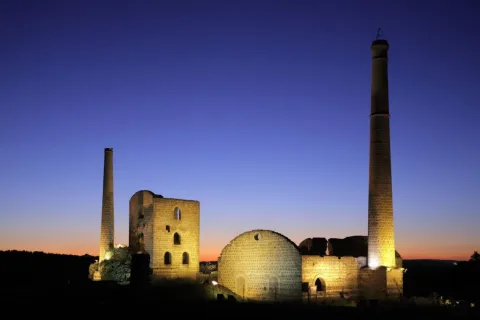
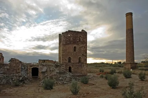
Linares has amining heritageof the most important and best preserved in Spain. In their lands it is common to see remains of chimneys and other industrial vestiges, silent witnesses of a past of mining splendor that left in Linares an architecture linked to industry and to bourgeois and proletarian society.

The basilica of Santa María la Mayor, a mixture of Gothic and Renaissance style, or the Marquis hospital, of a neo-Gothic style, are two good samples of its artistic heritage.

Especially interesting is the archaeological legacy of the archaeological ensemble of the Iberian city of CatulusJust five miles from the city. It was in Roman times one of the ten most important cities of the Peninsula, thanks to its mines of lead and silver, of which today there remain vestiges as important as the mosaic of the Amores, the mosaic of the Octogones, a palleocrist of glass of the 4th century or the sculpture of the Lion, of the IIa centuries. C.

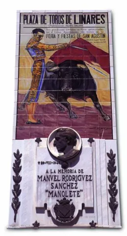
On the other hand, Linares owns a remarkable monumental ensemble, as well as the owner of an accused and musical character. The bullring square of Santa Margarita, located on the side of the emblematic promenade of Linarejos, has witnessed great afternoons and tragedies such as the death, in 1947, of the right hand Manolete. In addition, the city in which the famous guitarist Andrés Segovia was born has a long musical tradition linked to the taranta, a flamenco song born around mining.

The La Garza golf course is the only one in the province of Jaén. It is located a few kilometers from the city, in a privileged enclave with the mining landscape as a backdrop.

Telecomunicaciones
Teléfono
953 648 810
Sitio web
www.ciudaddelinares.es
Fax
953 648 813
Correo electrónico
ayuntamiento@aytolinares.es
Ubicación
Nombre
Linares
Latitud
38.092880
Longitud
-3.635550
Distrito
Municipio
Ubicación en el mapa
POINT (-3.63555 38.09288)
Imágenes
imagen
Image
717b4559-d8aa-43fd-4c6c-9c08a1541fd7?t=1620666050927
Imagen principal
Desactivado
imagen
Image
e4f5be42-25eb-8780-b90c-b1581819c8ba?t=1620666050609
Imagen principal
Desactivado
imagen
Image
39d78aac-4357-f5c4-91ae-a3d9d63960dd?t=1585838352419
Imagen principal
Desactivado
imagen
Image
703abb91-4bea-1ffb-3037-438af2c5bb18?t=1585838354473
Imagen principal
Desactivado
imagen
Image
42160d5d-b5b9-5fa8-da43-ff885202d248?t=1620666050784
Imagen principal
Desactivado
imagen
Image
5cb04542-9fff-58cb-7826-c022d4be2e83?t=1620666050980
Imagen principal
Desactivado
imagen
Image
278f0651-1ac2-64cb-c271-07d8e3a236e0?t=1585838353321
Imagen principal
Desactivado
imagen
Image
d28ffb7b-e8b5-2882-e0d7-b55f650ecb22?t=1620666050684
Imagen principal
Desactivado
imagen
Image
4a291902-03f8-1724-b60a-6cf3613c0eec?t=1620666050832
Imagen principal
Desactivado
imagen
Image
c7bc271c-c88c-b709-bb90-1ee3ea569ef8?t=1585777337631
Imagen principal
Desactivado
imagen
Image
de6c8ca4-32fa-3650-f257-539779c5466c?t=1603125039699
Imagen principal
Desactivado
imagen
Image
0e513dc5-1b59-8502-fbbe-4fb055c3a80f?t=1620666051035
Imagen principal
Desactivado
imagen
Image
663b4497-8d8e-f89e-2699-1b166c9c5197?t=1603138489292
Imagen principal
Desactivado
Información adicional
Curiosidades

ÁREA DE TURISMO
Iglesia, 5 – 23700 Linares, Jaén
Tel.: 953 10 01 83
http://www.turismolinares.es/
Email: turismo@aytolinares.es

Imágenes cabecera
imagen
Image
Linares
Imagen principal
Desactivado
Datos de interés

Touristic area: Sierra Morena / Jaén Toro Culture / Linares- La Carolina / Sierras de Andújar and Despeñacolos
Distance to the capital (km): 49
Altitude over sea level (m): 419
Extension (Km2): 196
Number of inhabitants: 57,414
Gentilicon: Linarians
Postal code: 23700

Videos
Video file
Cultura

Linares has a varied set of buildings (churches, palaces, solariegal houses) of different styles and times, from the simplicity of the Romanesque to the preciosism of the modernist buildings of the 19th and 20th centuries linked to their past of mining splendor.

The Basilica of Santa Maria la Mayorbuilt during the 13th to 15th centuries, with a mixture of Gothic and Renaissance styles, it has a beautiful silver altarpiece.

The city of Cástulo It has a historical trajectory of more than 4000 years, a history in which the presence and influences of Mediterranean cultures have been reflected, which have left their mark on the site and its territory. Cástulo offers us a heritage that we gradually recover from archaeological research, a legacy that we must know and protect.

The city has also not wanted to forget what its past was, good proof of it are the museums we found in it: Archaeological Museumin which the remains of previous civilizations that occupied these lands are preserved, and the Centre for the Interpretation of the Mining Landscapewhere we find samples of the mining works, pieces and videos on the location of the mining heritage in the region. And with the statue of the Miner, the inhabitants want to pay tribute to the generations who laid the foundations of the city that today is Linares.

The Casa - Museum of Andrés Segoviaor Raphael MuseumWe are reminded of illustrious people who took the name of Linares all over the world.

Naturaleza

As it is located in the first foothills of Sierra Morena, Linares has a beautiful natural location and enclaves.

The spaces of greatest landscape value are found to the north of its municipal term. The best example of this is the natural monument of "The Bat.". To the spectacular tour of the river Guarrizas during its high course, the beauty of the Roman bridge of Vadollane, which is part of the Via Augusta.

Linares enjoys an extensive network of trails of a small route duly marked that they travel part of their natural and mining heritage, and that they can be visited on foot, on horse or by bike, adding one more incentive to the visit of this area. Sendas that complement with "Green routes"whose tracks take advantage of the old railway tracks.

The set of plant species in the municipality of Linares is distributed in three well-defined spaces:

  • The countryside, on which much of the surface is intended for olive trees and dried cereals.
  • The dehesas, for livestock use and in which the tree species that stands out is the oak.
  • The pastures, little or no trees, which are used for cattle pasture or grasses or forage.

Next to the rivers Guadalimar, Guadiel and Guarrizas we find the vegetation called the riverside: strawberries, willows, white wings...

Fiestas y Eventos

Among the most rooted parties in the tradition of the Linarians, we have:

  • Holy Week, declared as the National Tourist Interest Party of Andalusia, a week with a mixture of party and veneration.
  • San Agustín Fairalong with Holy Week is Linares' most important holiday. They take place between August 27 and September 1. Among the most diverse activities, there are also bullfighting in the Santa Margarita.
  • Ibero-Roman Festivals of CatulusMay. A wide range of programming and activities immerse the city of Linares and the Archaeological Set of Catulus in its Ibero-Roman past. Historical recreations of a Roman circus, camps, workshops, parades, combat tactics, gastronomy, guided tours and gladiator struggles, among others, are the sign of identity of this tourist-cultural event.
  • Santa Barbaraon December 1. In these days Linares wants to remember his past mining with different demonstrations of trades in the mine and other activities for all ages that includes a multititling road through the mining district.

In addition to these most named, the May Crosses, Christmas, Carnival and the party of VoteIt's next to the hermitage of Linarejos.

Gastronomía

Linares has made the Tampoo a delicious sign of identity and one of the city's greatest attractions. Tabernas and bars fine-tune their ingenuity to make the exquisite tapas culinary miniatures that never fail to accompany the drink for free.

The Spanish gastronomy is very linked to the gastronomy of the province: olive oil as a common denominator of its peas and salads, not to mention sour olives, which are common as an appetizer. Among the most traditional are: gazhas, migas, gazpacho, andrajos, pipirrana and anis roses.

It also has others of clear mining descentsuch as potatoes with cod, potatoes with pimenton, mining and soaking based on orange salad, cod, olives, onions and olive oil.

In the letters of the Linarian restaurants, tradition, variety and innovation are given hand, and the most intense flavors are made of. It stands out among its local creations, the characteristic white sweet chachepol, a delicious biscuit soaked in syrup and spirit.

Historia

The history of Linares has always been very linked to the mining. The lead filons of their lands attracted different peoples and cultures to this enclave. It was a claim for the Tartessa, Greek, Phoenician, Carthaginian, Visigodic and Arab peoples. Of all of them, archaeological vestiges have been found in the area.

Within the municipal term was founded in the 6th century BC the Iberian city of Catuluswhich would later become the capital of Oretania (a large territory that also included areas of Ciudad Real and Albacete) with great mining, agricultural and flourishing trade wealth.

They would also exploit these mines for the extraction of lead and silver. To ensure control of the main mining sites, General Anibal took the Princess Ibera Homily (born in Catulus), but without success, as the Carthaginians were defeated.

The Romans will magnify this city through all kinds of privileges (such as the continued coining of their own currency), making Catulo a city with first-class infrastructure such as hot springs, aljibes and even a forum and an amphitheater. The wealth of Catulus was such that chronists of the size of Estrabón, Polibio, Plinio el Viejo or Tito Livio speak of it in their writings. With the wars, Cástulo disappeared, and the population took refuge in the atalaya of the mines, becoming dependent on Baeza. The current city owes its name to a place close to Cástulo, called Linarium.

Liners it does not appear in the historical archives until 1155, reign Alfonso VII, which at that time was a village that depended on Baeza. In the mid-16th century, thanks to agriculture and livestock, commercial activity and the population are increasing, giving Philip II the title of villa. During the 17th and 18th centuries, mining activity increases considerably and focuses on lead extraction.

As early as the 19th century, the city is considered one of the most important centers in the province of Jaén. With the arrival of the new machinery and mining techniques, as well as the development of the rail as a means of transport of the mineral, Linares reaches its further progress. The intense mining activity attracts migrants to the new jobs generated by mining and makes the population more than six-fold in a short time. In 1875, King Alfonso XII granted him the title of city.

The mining area Liners - The Carolina would become the first producer of lead of the world. The first labour movements are emerging as a result of wage inequalities between workers and employers.

But in the 20th century, mining activity is beginning to decline to the point where all mines are closed. In parallel, a powerful industry, of which Santana Motor It's the flagship.
With the arrival of the 21st century and the end of Santana Motor, the activity of the city is focused on the services as one of its main economic axes.

Otra información

There are many people born in the city of Linares who have had an outstanding career in their professional activity:

  • Andrés Segovia, guitarist and composer.
  • Raphael, singer.
  • Sebastian Palomo Linares, bulldozer.
  • Carmen Linares, flamenco singer
  • Francisco Baños, plastic artist.
  • Miguel Ángel Belinchón Bujes, Belin, plastic artist (grapher).
Loading map
Preparing points of interest and routes...
Imagen principal
imagen
Image
Linares
Imagen principal
Activado

La Carolina

Submitted by brandcode_deweloper on
Id
739288
Perfil de redes sociales
Facebook
https://www.facebook.com/AyuntamientoLaCarolina
Twitter
https://twitter.com/aytolacarolina
Youtube
https://www.youtube.com/channel/UCBY6A3TaSP3JqhViYdshufw
Instagram
https://www.instagram.com/ayto_la_carolina/
Descripción
Breve descripción

La Carolina is a city at the foot of Sierra Morena and the Caraway, natural mountain port that links Castilla with Andalusia.

Its area is made up of extensive olive trees, but also the dehesas and the half-mountain areas populated by oak and pine trees. It is easy to find abandoned mine chimneys, clear signs of their past related to this activity.

It was the capital of the New People of Sierra Morena, a political project by the enlightened king, Charles III, in 1767. The main objective was to colonize and take advantage of the lands of Sierra Morena and to provide security to the mountain port, as it was a very unsafe place, where bandits and malefactors were camping. The population is made of settlers who came from central Europe, France and Germany mainly. A close collaborator of King Charles III, Pablo de Olavide, would be appointed responsible for the project, with the title of Superintendent of the New Populations of Sierra Morena.

The municipality of La Carolina is composed of five population centres: La Carolina, as main, Navas de Tolosa, La Fernandina, la Isabela and the Guindo. It is surrounded by natural areas such as the nearby Natural Park of Despeñacolos, the Fernandina reservoir or the small urban nucleus of the Guindo, which evokes its mining past.

In its artistic heritage are: The Palace of the Intendente Olavide, in Baroque style; the parish church of the Immaculate Conception, the seat of the ancient Carmelite foundation of San Juan de la Cruz, the Torrecillas del Molino de Viento and the Torres de la Aduana.

Telecomunicaciones
Teléfono
953 660 034
Sitio web
www.lacarolina.innovasur.es
Fax
953 681 626
Correo electrónico
info@lacarolina.es
Ubicación
Nombre
La Carolina
Latitud
38.274240
Longitud
-3.615270
Distrito
Municipio
Ubicación en el mapa
POINT (-3.61527 38.27424)
Imágenes
imagen
Image
f91faa0d-bd7e-a921-740d-33c048ef2e8f?t=1619532688353
Imagen principal
Desactivado
imagen
Image
1aacd6bf-6d2b-6336-9456-d95923815de8?t=1594142871900
Imagen principal
Desactivado
imagen
Image
9e49b509-9667-17c5-697b-fc861d03bf8c?t=1619532688419
Imagen principal
Desactivado
imagen
Image
e2b43921-6f14-e958-7cb1-de980f088f48?t=1594142869986
Imagen principal
Desactivado
imagen
Image
131f904e-ba6e-379c-daec-e19a7d0d88b4?t=1619532826514
Imagen principal
Desactivado
imagen
Image
4b85bd84-f1c0-34bb-d56a-a343c5bea6c1?t=1619532688547
Imagen principal
Desactivado
imagen
Image
07cad3d1-017c-774f-16d7-c166133050a9?t=1619532688596
Imagen principal
Desactivado
imagen
Image
fc7e8a03-c91f-3245-be11-c83899c22fe4?t=1603128351869
Imagen principal
Desactivado
Información adicional
Imágenes cabecera
imagen
Image
La Carolina
Imagen principal
Desactivado
Datos de interés

Tourist area: Sierra Morena / Sierras de Andújar and Despeñacolos
Distance to the capital (km): 66
Altitude over sea level (m): 595
Extension (km ²): 201
Number of inhabitants: 15,261
Gentilicon: Carolinenses
Postal code: 23200

Videos
Video file
Cultura
  • The municipal term of La Carolina is full of archaeological vestiges from Prehistory. Places like La Calera, El Minado or El Ochavo, so they testify. We met with Rupéstre art fields like Dona Lady, the Puntal or the Guindo. And also former mining holdings, mainly Roman, like Fountain Spis, or El Guindo.
  • The Church of the Immaculate Conception, built as a church of the convent of the barefoot Carmelites of the Peñuela, after the Colonization it is extended to serve as a parish to the nascent population. It has undergone several reforms over the years, and in 1899 the tower was built.
  • Palacio del Intendente Olavide, which was the residence of Mr Pedro Olavide, executive of the Sierra Morena Repopulation project. It was built in 1775, in neoclassical style and is located in the center of the village, right next to the parish church.
  • La Carolina Museum,The Centre for the Interpretation of the History of Mining in the New Populations of Jaén, integrated in the majestic building of the Palacio del Intendente Olavide, offers countless possibilities of knowledge, culture, history and research of the city, with the latest technologies, an unbeatable infrastructure and a human team that make it an inescapable cultural and tourist resource when visiting the city.
  • The Customs Towers, neoclassical style and airy architecture flank the main entrance to the city coming from Madrid.
  • Castillo de Navas de Tolosa: For more than two hundred years, it served as a defense and vigilance for the Muslim kingdom of what we know today as the passage of Despeñacolos, once Paso del Muradal. Today the silhouette of its tower stands out in a typical Sierra Morena dehesa in which you can also see braves.

Other monuments of interest are:

  • Hermitage of San Juan de la Cruz.
  • Monument to San Juan de la Cruz.
  • Old jail.
  • Monolitos de la Fundación.
  • Monument to the Battle of the Navas de Tolosa.
  • Mining heritage.
Naturaleza

Its enclave at the foot of Sierra Morena and at the limits of the Natural Park of Despeñacolos, makes La Carolina a municipality especially attractive to nature lovers. The visitor has the opportunity to enjoy a landscape full of contrasts, with steep mountains and wide dehesas, on which it is easy to see majestic birds.

The cultivated land represents only 10% of its extent, mostly dedicated to olive trees. The main agricultural activities are the cultivation of olive trees, livestock and hunting, greater and lesser. It also highlights its mining landscape, heritage of an industry that supported the life of the Carolinians: remains of abandoned mines, lavatories, remains of smelters...

The vegetation is very abundant and heterogeneous: olive, oak, cork, chestnut, eucalyptus, alms and oaks. The fauna, both in larger game animals (boar, goose, cords, reels...) and smaller (rabbits, hares, parrots, quail) is very abundant. There are also cattle of wild cattle, sheep and goats.

Part of the term La Carolina covers the mountains of Sierra Morena to the north, while towards the south the landscape becomes adhesitated, thus offering beautiful and contrasting landscapes. In the area of saw, the highest peak of the mountain range, La Estrella, with 1,300? m altitude. The nearby Natural Parks of Despeñacolos to the East and the Sierra de Andújar to the West.

To the South, the Embalse de La Fernandina allows sports fishing and presents beautiful images of the Mediterranean forest, being an ideal place for the development of a rich extensive livestock.

The villages abound in their term as well as the natural sites, making La Carolina a municipality of special human and natural appeal. It has three urban cores or pedanias, these being:

  • The village of Los Guindos, to the north of the term and in the surroundings of the saw, evokes its mining past.
  • Aldea La Fernandina: presents one of the simplest traces of the New Populations, of rectilinear and orthogonal design.
  • Aldea La Isabela: The route of this village, presents reminiscent of the European city of the Enlightenment.
Fiestas y Eventos

In addition to the Christmas and Carnival celebrations, the most rooted celebrations in the town are as follows:

  • Festivals of the Foundationthey are held from 3 to 5 July, in an attempt to link present and past from La Carolina, to value in a fun way its history, traditions and origin. The acts include the reading of the court and the tribute to the Colonoan act to claim the persons who still keep foreign surnames.
  • May Fair, has its origin in a cattle party that is very famous and that competed with the most important in Spain. A Selected livestock morphological competition (berrenda cow, seaweed sheep and serrana goat)
  • Festivals of San Juan de la Cruz, Patron from La Carolina. The last weekend of November is held. The tradition of Shake a live pig after the celebration of the Eucharist.
  • San Carlos Borromeo, which is celebrated on November 4 and is also co-patron of the city.
  • Romeria de San Isidroon the 15th of May, and is celebrated with a Romeria to the natural area of La Aliseda, a beautiful recreational area that is located in the village of Santa Elena, at the foot of Despeñacolos.
  • Carnivals, of the most renowned in the province of Jaén.
Gastronomía

Hunting is very present in the local gastronomy, so among the most traditional dishes we have:

  • Monkey meat, first adobada and then stew in sauce.
  • Pate of perdiz, typical Jaén dish that was born on these lands.
  • Scattered perdiz, a dish that can get cold.
  • Chickpeas, which is consumed preferably in Lent.
  • Migas and Pipirrana.
  • Jars with hare.
  • Trick asparagus.
  • Cod wet.

In the pastry shop, the following are typical:

  • Sweet gazes of the holiday of All Saints.
  • Summer gazhas: with fish and peppers, according to the recipe of the miners who came from Almería and Granada.
  • Oil nuts, Rice with milk, fried milk and drunks.
Historia

In the 18th century, the enlightened king Carlos III and its ministers (Aranda, Jovellanos and Campomans) decide to create the New Populations in Sierra Morena. At the head of the repopulation he put the Superintendent Pedro Olavidewho would be responsible for the settlement of settlers from France, Germany, the Netherlands and Switzerland.

In 1767, the The strength of the New Populationsestablishing the regulations and rules governing these new settlements, different from those of the rest of the country. This year, and near La Peñuela, a former Carmelite convent, La Carolina is founded, which would be the capital of all the new settlements in Sierra Morena.

The beautiful city of La Carolina is the best example of the city of Enlightenment. It is known as the City Jewel of the Holy Kingdom. This was designed as a Roman camp; that is, following two axes that are crossed, one from N to S, which is called cardo and another called decumano, from E to O that in the City Hall square is where they are, indicating this crossing the city center, according to the design of Simon Desnaux, supervised by Olavide. The avenues of Las Huertas and Juan Carlos I are the main lines for the division of the land. The result of its urbanization is an orthogonal mesh that divides it into squares, with streets and straight and wide avenues.

In the mid-19th century, La Carolina began the exploitation of its rich Argentine lead filons. Previous mining work already existed, but it will now be when a large-scale exploitation begins that will lead you, in the early and mid-20th century, to become the world's largest Argentine lead producer along with the nearby Linares, under the territorial delimitation of Linares- La Carolina mining district.

This led to a strong immigration of workers from nearby provinces that significantly changed their demography and sociology, even to the birth of populations around these farms such as El Centenillo or El Guindo.

But the mining crisis meant the closure of all the mines in the 1970s. Thus today, the buildings linked to this activity have become part of the landscape as witnesses to its industrial past, being inscribed in the catalogue of the Institute of Historical Heritage of Andalusia.

For a few decades, La Carolina has been in the industrialization sector and is now a city full of future.

Otra información

The village of The Guindsbecause of its geographical location it is a great place to make astronomical observations, especially in the autumn and winter months. In fact, it is included as a Mirador within the "Reserve Certification and Starlight Tourist Destination of Sierra Morena."

Loading map
Preparing points of interest and routes...
Imagen principal
imagen
Image
La Carolina
Imagen principal
Activado

Carboneros

Submitted by brandcode_deweloper on
Id
726651
Perfil de redes sociales
Facebook
https://es-es.facebook.com/ExcmoAyuntamientodeCarboneros/
Descripción
Breve descripción

Carboneros is a small municipality in the northern part of Jaén, and is located on the southern façade of Sierra Morena, next to the Madrid- Sevilla motorway.

In its municipal term, the adhesitated land in which some wineries have been installed prevails, and is also rich in minor hunting. Currently its economic base is the cultivation of olive trees. And in it, we can distinguish three areas: the northern area, with very strong slopes between 700 to 1300 m of altitude; the southern area, close to Vilches, Linares and Baños of the oak, which has a soft morphology and with moderate slopes, linked to the Guadiel and Guadalén rivers; and a central area of relief varied from 6 to 500 meters.

This population was founded in 1768, at the initiative of King Charles III, as part of the illustrated project that was named "Nuevos Poblos de Sierra Morena y Andalucía," and which were governed by a specific Population Force for these new settlements.

In the vicinity, there are other population centres dependent on Carboneros: La Mesa, El Acebuchar and Los Cuelos.

The parish church of the Immaculate Conception, built in the second half of the 18th century, in a neoclassical style, stands out from its artistic heritage, with two Tuscan pilasters and two large side niches.

Telecomunicaciones
Teléfono
953 661 179
Sitio web
www.carboneros.es
Fax
953 661 104
Correo electrónico
ayuntamiento@carboneros.es
Ubicación
Nombre
Carboneros
Latitud
38.230190
Longitud
-3.631390
Distrito
Municipio
Ubicación en el mapa
POINT (-3.63139 38.23019)
Imágenes
imagen
Image
1d899c1c-7483-9905-be68-cd90f48d4e6c?t=1594226959186
Imagen principal
Desactivado
imagen
Image
fde63a40-497e-3f49-8251-c8ac096c1920?t=1594226958578
Imagen principal
Desactivado
imagen
Image
cd0206a5-431d-e71f-4719-4d80f6122e79?t=1594226957871
Imagen principal
Desactivado
imagen
Image
39ec2a92-f048-2810-8642-ce63928f6bd9?t=1617623069429
Imagen principal
Desactivado
imagen
Image
39594e3d-0fd9-92d9-d1d7-442ac012d448?t=1594227035862
Imagen principal
Desactivado
imagen
Image
b3057608-2098-2fe5-dd8b-b60e232f7904?t=1594226956305
Imagen principal
Desactivado
Imágenes cabecera
imagen
Image
carboneros
Imagen principal
Desactivado
Datos de interés

Tourist area: Sierra Morena / Sierras de Andújar and Despeñacolos
Distance to the capital (km): 60
Altitude over sea level (m): 403
Extension (km ²): 58
Number of inhabitants: 691
Gentillo: Carbonerenes
Postal code: 23211

Videos
Video file
Cultura

From the artistic heritage we highlight:

  • The parish church of La Immaculate Conceptionwhich is its most significant building, built in the last third of the 18th century, has an architectural packaging within the purest neoclassical. Its back-moving cover is of magnificent silvery and features pilasters on the corners. The central body is half-point arch, crowned by a fronton and two large niches. On the second floor there are four large bones.
  • The Posite, located in front of the church is a work of dyed masonry, also from the last third of the 18th century. It stored the farmers' grains as a reserve for famine times.

Naturaleza

Carboneros is delimited by two rivers, the Gloves and Rumble. They and their main tributaries, La Campana, Guadiel, Guadalén, travel and drain the lands of their municipal term.

Its enclave in the southern part of Sierra Morena makes it especially attractive for nature lovers. Here we have the opportunity to enjoy a landscape full of contrasts: to the north, with more steep mountains, and in the central and southern area with adhesitated spaces and the presence, mainly, of oak trees; they are ideal places for extensive livestock.

It has an abundant and heterogeneous vegetation, highlighting the olive, oak, cork, chestnut, oaks, eucalyptus...

Of his fauna We point out the abundance of small game animals: hares, rabbits, partridges, quail... We meet with cattle cattle, sheep and goats. And it is very easy to witness the majestic flight of the multiple rapes that overfly these territories.

The environment of the reservoirs presents beautiful images of the Mediterranean forest, which makes us connect with the characteristic nature of Sierra Morena.

The reservoir of La Fernandina is a leisure area for the carbonarians and visitors where they can perform outdoor and aquatic recreational activities.

Fiestas y Eventos

The people of Carboneros founded by settlers from different countries of Central-Europe have as their patron, as in other populations, the "Immaculate Conception," and celebrate the parties in their honor from 7 to 9 December.

These other festivities are also celebrated:

  • Festivals of the Foundation, take place in August with different activities and competitions. To recall the Central European origin of its predecessors.
  • Romeria de San Isidro, the next weekend to the 15th of May, the feast of San Isidro Labrador, carry the image in procession to El Acebuchar, where in an improvised altar the Eucharist is celebrated. The next day the image is returned to Carboneros.
  • Day of the Cross, which takes place in the pedany of La Mesa, so called for being located in a flat promontory.
  • "Party of the Eggs", takes place on Sunday of Resurrection, and the neighbors decorate cooked eggs on Saturday to add them to the "piirrana" on Sunday. A party that seems to have its origin in the European settlers who colonized the lands of Sierra Morena.

Gastronomía

The unique location of Carboneros, located between the saw, the olive field and the Madrid- Sevilla motorway, has led to the development of a varied and rich gastronomy. The hunting and the animals that are raised in this area have a special protagonism, without forgetting the pure olive oil, an ingredient that can never be missed in the kitchen.

Among the dishes with the most roots in the area, we highlight:

  • "Hare to the belly", chopped meat and saffrite cooked in white wine or beer, accompanied by peppers, raw tomatoes, onion and guindilla. The hare is left in a sauce that simulates the mud, hence the name of this dish.
  • Roast, be it lamb, choto or pig.
  • Of the massacres, which on cold or rainy days it seems that the body asks for these stronger meals, we have: orza loin, turreznos for the crumbs, chorizo, morcilla...
  • For the days of departure to the field: "Comine salad.", "Gachas of pebble flour", provided they are accompanied by a tasty "Pipirrana".
  • "I kiss the roast.", has its motive in the truckers who carried the fish from the Andalusian coast to Madrid.
  • "Potting of chickpeas with cod", a dish that is not missing on the tables during Holy Week.
  • In pastry, traditional "flowers" during Holy Week and "sweet peas." on the Day of All Saints.

Historia

The name of "Carboneros" it mentions its wealth and ancient mining activity that dates back to the times of General Cartaginese Anibal.

The written sources of the silver mines in the area of Catulus mention the Well of Baebelo, identified in the mining village of Palazuelos, in the municipal term of Carboneros. In this mine, large amounts of silver were obtained.

After the Roman conquest, the mine continues to operate as the sources and ceramic materials testify.

The current urban and landscape configuration has the imprint of the people of Colonization founded by the king Charles III in 1767, within the New villages of Sierra Morena.

In Carboneros the process begins with the construction of five houses, a church, a prison compound and a posite. The process was consolidated and the population continued to increase, while specializing in olive cultivation. The new planning, in addition to seeking a new social project, also carries out a different urbanism, with straight streets, with a main street that flows into the square, in which the church and the buildings of the civil and religious powers are located.

Dependents of Carboneros, several villages are created as The Ajuchar, The Bureau and The necks. It is sought with these new population centres, that the peasants dwell closer to the lands they have to cultivate to avoid investing time in displacement.

These new sites are built under the classic precepts of symmetry and order that were established for the rest of the locations of the Colonization.

In 2017, the 250 anniversary of the New Populations was celebrated in this town, and in others around it, with the organization of numerous events and activities, including an International Congress.

Otra información

Carboneros presents diversity of craft activities related to processing of plant fibres (esparto, anea, pita and wicker), with wood (ebanistería, artisanal production and furniture restoration), textiles (embroidery, ball lace, mesh, crochet), the forge, the quarry and food processing (pastry, chacinas, jams and liquors).

Today, an effort is being made to ensure that these artisanal knowledge is maintained and transmitted to the new generations.

"The Oil of Life" It is the name that receives the solidarity program of the sponsorship of olive trees, which the Lumière Foundation has been developing for a decade, but which in recent years is transcending internationally thanks to the participation of institutions of great social importance. This solidarity initiative contributes, through the sponsorship of olive trees, to the financing of different social and cultural projects throughout Spain, in order to protect the environment and promote the conservation of the centenary olive trees of the Spanish geography, and includes the transfer of what was collected to NGOs, associations or foundations, upon request, so that they can develop their own social, cultural, sports or environmental projects.

To "El Oil de la Vida" has recently joined the City of Carboneros, which on 24 September 2019 signed with Antonio Mayoralas, president of the Foundation, a cooperation agreement to work together on the solidarity program of the sponsorship of olive trees giving the City a place that will host the headquarters of the programme that the Lumière Foundation develops for all of Andalusia. In addition, on December 13 of that same year, the Lumière Foundation signed with Scholas in, the Vatican, the agreement to sponsor an olive tree for its holiness The Pope located in Carboneros, under the motto "Take care of an olive tree, take care of life."

Loading map
Preparing points of interest and routes...
Imagen principal
imagen
Image
carboneros
Imagen principal
Activado

Baeza

Submitted by brandcode_deweloper on
Id
725103
Perfil de redes sociales
Facebook
https://www.facebook.com/aytobaeza/
Twitter
https://twitter.com/AytoBaeza
Instagram
https://www.instagram.com/aytobaeza/
Descripción
Breve descripción

Baeza is located in the same geographical centre of the province of Jaén, located in the region of the Loma of which its western capital is considered.

Located near the Guadalquivir River, in a landscape of fertile land of orchards, olive groves and cereal. The absence of non-agricultural land reduces the areas of natural interest to the Guadalquivir River and the wetlands of the Lagoon Grande, of great ecological wealth and the largest in the province.

Baeza is a city where the Renaissance is shown in all its splendor, in both civil and religious monuments: palaces and churches that alternate with white houses, portades, porticos, towers, squares and fountains.

Its period of splendor dates back to the 16th and 17th centuries, although the city has been outstanding since remote times.

Telecomunicaciones
Teléfono
953 740 150
Sitio web
www.baeza.net
Correo electrónico
sac@baeza.net
Ubicación
Nombre
Baeza
Latitud
37.995930
Longitud
-3.474130
Municipio
Ubicación en el mapa
POINT (-3.47413 37.99593)
Imágenes
imagen
Image
6b113f25-c234-0491-af2f-c149a865afa8?t=1603923180029
Imagen principal
Desactivado
imagen
Image
a65f89b4-654e-e046-fdbd-d44fa6641988?t=1603922557103
Imagen principal
Desactivado
imagen
Image
6310a5e2-e849-e7b1-582a-468d48f758f0?t=1586171131274
Imagen principal
Desactivado
imagen
Image
1f236e61-7713-a025-2f0d-35391af76a7d?t=1603922557227
Imagen principal
Desactivado
imagen
Image
8a202e8f-385a-5f9e-3afe-569acec987a4?t=1616522299103
Imagen principal
Desactivado
imagen
Image
795a0c33-4ee3-408e-1c13-b816123adc64?t=1586171132490
Imagen principal
Desactivado
imagen
Image
b6010740-bf62-6b8e-ab23-6d9f76897f5b?t=1586171132143
Imagen principal
Desactivado
imagen
Image
750eeda9-773d-709d-2383-372d10701650?t=1586171130098
Imagen principal
Desactivado
imagen
Image
a78c862d-3c74-cde9-6ff9-b69630560ce4?t=1586171131756
Imagen principal
Desactivado
imagen
Image
beac10cd-9668-0c22-7db3-9966e5eda5b3?t=1586171132006
Imagen principal
Desactivado
imagen
Image
479bc6c3-babf-eaef-7fb3-b4ad8b635e5b?t=1616522299289
Imagen principal
Desactivado
imagen
Image
f361a4e0-b515-6e7c-a7dc-ff14c67688ec?t=1616522299347
Imagen principal
Desactivado
imagen
Image
81e8d636-ef0d-91e5-2750-3f56d6d04808?t=1616522299408
Imagen principal
Desactivado
imagen
Image
b1ddae0a-a5ee-4323-53d3-54bc68526d9a?t=1616522299473
Imagen principal
Desactivado
imagen
Image
0dee5670-1fe0-cbf4-5867-9147345e2afe?t=1616521131504
Imagen principal
Desactivado
imagen
Image
81d1e198-9d29-279e-149f-081024b27891?t=1586171130396
Imagen principal
Desactivado
imagen
Image
39a7fbfd-9aa2-1cac-c7d3-238c006f5a28?t=1616522299547
Imagen principal
Desactivado
imagen
Image
e016a9da-4297-fc04-4d3c-dfa579da9552?t=1586171130697
Imagen principal
Desactivado
imagen
Image
2b452c6d-15df-a819-aa50-e54921bbd0de?t=1616522299619
Imagen principal
Desactivado
imagen
Image
805356f8-60e7-d8f0-2e25-1edd5ebffa4d?t=1602694728132
Imagen principal
Desactivado
imagen
Image
7172efae-cdfc-d5aa-a347-037b6d6b16aa?t=1616522299688
Imagen principal
Desactivado
imagen
Image
36d285cc-5d64-d9a0-6e84-7ad58f539a76?t=1616522299749
Imagen principal
Desactivado
imagen
Image
bc9f53d4-3a83-f0a9-e1da-c486d747724b?t=1616522299815
Imagen principal
Desactivado
imagen
Image
0da7acd2-1162-bbf8-8c3d-d3a3d8140eaa?t=1603105398568
Imagen principal
Desactivado
imagen
Image
f1c392af-765a-3f53-d9a0-c0b6b9acfb77?t=1603105767022
Imagen principal
Desactivado
imagen
Image
2c724b20-61d7-99b1-e423-f4292a646491?t=1603106229722
Imagen principal
Desactivado
imagen
Image
eaa9f592-f374-8747-0f22-1cadb4e98585?t=1603106434496
Imagen principal
Desactivado
imagen
Image
02cdf257-dfc8-6b82-5816-a0ba6ba51dc1?t=1603106654931
Imagen principal
Desactivado
imagen
Image
8791fed9-36c1-40e4-b1a6-95e267986d8d?t=1603106857711
Imagen principal
Desactivado
imagen
Image
62bf1f22-afbd-c0da-1f93-ce52788b8636?t=1603107417445
Imagen principal
Desactivado
imagen
Image
79f98f41-2429-b937-f94c-827a88cb386c?t=1603107482920
Imagen principal
Desactivado
imagen
Image
086c140f-fab0-c0f1-595b-9eeda08b0616?t=1616522299958
Imagen principal
Desactivado
imagen
Image
59d90e88-c35f-3adb-7dbd-d51422bb9b63?t=1644243699085
Imagen principal
Desactivado
Información adicional
Curiosidades

Oficina de Turismo
Plaza del Pópulo, s/n, 23440
953 779 982
otbaeza@andalucia.org

Imágenes cabecera
imagen
Image
catedral-de-baeza176-2-jpg
Imagen principal
Desactivado
Datos de interés

Tourist area: Ubeda / Baeza
Distance to the capital (km): 48
Altitude over sea level (m): 769
Extension (Km2): 194
Number of inhabitants: 16012
Gentilicon: Baezanos
Postal code: 23440

Videos
Video file
Cultura

To understand today's Baeza, we have to go back to the first inhabitants who settled in the place known as the Alcázar hill, in the Bronze Age, evolving to the Iberian city Viatia or Vivatia, passing to the Roman era, when Biatia was one of the most important cities.

It would be the Muslims who made up the city's murary limits, some of which were remade in the 16th century. After the Christian conquest the epoch of splendor of Baeza begins. The new Christian Baeza begins to grow out of the world, where religious buildings are the most representative.

  • The Cathedral. It is the most representative building in the square. In this enclave there could have been a Roman temple, over which Muslims raise a mosque and, in 1227, under the Marian advocation of the "Nativity", the cathedralicia headquarters is erected. In the 16th century, a reform is carried out, which will be the one that prints the Vandelvirian Renaissance seal to the building. The cover was drawn in 1587 by Juan Bautista Villalpando with "relief of the Nativity of the Virgin." The base of the tower is believed to be the mosque's miner, adding in time of Vandelvira the body of the bells and the deck.
  • Church of Santa Cruz. This work dates from 13th century, of late Romanesque style and preserved after the Christian conquest. The exterior is austere, highlighting its two covers with half-point arquivolts. The interior consists of three ships.
  • Ruins of the convent of San Francisco(extracamides). This work could have been one of the most important of the Andalusian Renaissance, but a number of misfortunes have prevented it, among these, the Lisbon earthquake of 1775 that brought down the vault of the major chapel. In this funeral and conventual complex, Vandelvira developed all its genius. The Latin cross church, which is accessed by a half-point arch that frames the entire cover, still remains with the relief of San Francisco and a tondo with the Virgin, which now give way to a large auditorium.
  • Old House of Correction and Prison, current City Hall(extracamides). It was built in 1520 as a prison at the request of Charles I. Since 1867 it has been home to the City Council. It is composed of the prison, with a more sober cover on which Justice and Charity are represented, and the house of the corridor with rich silver decoration. On the upper floor we find tripartite balconies with the shields of Philip II, the corridor and the city. It is topped with cornice decorated with membranes highlighted with figures. The Salon de Plenos has a Renaissance potter (horizontal and intertwined wooden ceiling) from the convent of San Antonio.
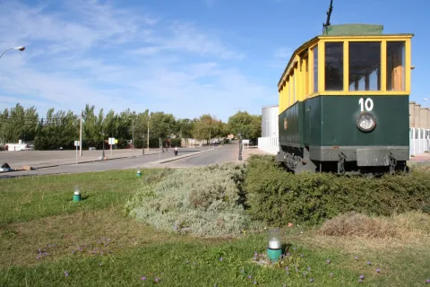
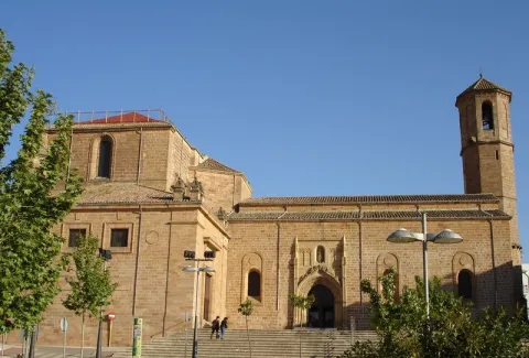
  • Church of St. Andrew. Building from the early 16th century, which held the title of a schoolgirl from 1764 to 1852. The silver-style cover, next to the square tower, stands out. The interior is a large main ship made up of arches pointed with side chapels.
  • Jabalfifth Palace.In front of the church of Santa Cruz, the Jabalfifth palace, one of the highest exponents of the isabelin Gothic style, was built in the late 15th century. The isabelin Gothic We find it on the outside, with decoration based on diamond tips, pineapple nails, fronts, florons, ties, pinacles, mocaronas and heraldic shields. The facade it is overcome with five arches of half-point Renaissance period, as well as the courtyard of the late 16th century. Today it is the seat of the Antonio Machado International University.
  • The St. Mary's Square, Baezan monumental heart, concentrates the largest number of monuments: the cathedral, the conistorial houses, the fountain of Saint Mary; the seminary of St. Philip Neri, with its picturesque facade plagued with cheers, current headquarters of the International University of Andalusia or the house-palace of Rubin de Ceballos, behind the cathedral.
  • The Populo Square, framed by the door of Jaén and the arch of Villalar, is one of the most emblematic squares of the city, where we find the plateresque cover building of the old Escribanías, today the headquarters of the tourist office of the Junta de Andalucía, the old Carnicerías and the source of the Lions in the center.
     
Naturaleza

Baeza is located in a dominant place in the region of the Loma and on the right bank of the Guadalquivir River. The city is located on three hills and the small valley that remain in the middle, in a rather high position over the Guadalquivir valley, a situation conducive to being a very important square in ancient times. It is surrounded by the Guadalquivir rivers to the south and Guadalimar to the north.

A site that as we walk through the walls allows us to contemplate the immense sea of olive trees that is presented to us all around us. From the sights of this walk, you can see the beautiful picture of the Guadalquivir valley, the extensive olive trees, the Cazorla saw, the Segura and Sierra Mágina saw, with the villages of Jimena, Mancha Real, Bedmar and Garciez in the distance.

The predominant vegetation is the olive tree, but next to the river and the lagoon Grande we find what we call the gallery forest: white, mimberas, tarais, black, and other species of bushes. A vegetation that with the change of the seasons draw a color brush in the landscape, especially in the autumn season.

The fauna of the town is the one of the Jienese countryside: hares, rabbits, deer, foxes, parrots, quail... They are also easy to see the storks and a wide variety of prey birds. Without forgetting the fauna that lives next to the river line and in the vicinity of the lagoon Grande.

The absence of non-agricultural land reduces areas of natural interest to the river margins and to the wetlands of the Great Lagoon with a special ecological interest.

  • Laguna Grande: This permanent lagoon that suffers significant level fluctuations, is fed from the Torres River through irrigation channels. Precisely for maintaining water during summers, this wetland is particularly important for waterbirds, it is an ideal place for food and shelter. Around the water, in addition to the vegetation of carrizos, spadañas and juncos stands out the presence of tarajes, alamos, fresnos and zarzas, where there is plenty of the visitor and I shelter the fauna of the place, among which we can mention: common fence, real anade or common porron, highlighting the fly bird, where we can see the nests of this small bird, hanging from the trees of this natural place. The locals of both the Bishop's Bridge and Baeza are willing to visit this beautiful natural site.


Fiestas y Eventos

Among the parties with the most roots among the neighbors of Baeza, we highlight:

  • La Candelariaon February 2. On the eve of the feast of the Holy One celebrates the Candelaria, typical of the blessing of the donuts of Saint Blas, protector of the throat, in the parish of El Salvador.
  • Holy Week. Between Andalusian and Spanish, the Holy Week of Baeza, declared of National Tourist Interest, stands out for the artistic richness of its steps. About 20 cofradies process through its streets and squares, in this jewel of the Andalusian Renaissance. Its creation dates back to the 16th century, when the co-fradia of the Vera Cruz, one of the oldest in Andalusia and Spain, emerged. One of the most beautiful moments of Baezan Holy Week, occurs on the morning of Good Friday, with the departure of the fellowship of Our Father Jesus Nazarene and the Cross of St. Helena, better known by the name "El Paso"; when the Nazarene Christ gives the blessing to his mother, through an articulated mechanism, when the images are crossed.
  • May CrossesMay 1. In different plazoletas and neighborhoods of the old town, altars are covered with the only theme of the exaltation of the Holy Cross.
  • Annual city fair. It is celebrated on August 15, the feast of its patron saint, Santa María del Alcázar.
  • Romeria de la Yedra. It is celebrated around the feast of the Nativity of the Virgin (8 September).
  • The Yedra, a pastry of Baeza, located 7 km. to the north of this, and where there is the Marian sanctuary of Our Lady of the Rosel and the Holy Christ of the Yedra. The Romeria itself is celebrated on Saturday day 7, the day when the Virgin travels through the city of Baeza and goes back to her shrine of La Yedra, accompanied by horses, carriages, reels and carrots, all covered with flowers.
  • Corpus Christi. With reminiscent of the 15th and 16th centuries. Procedural custody is certainly the goldsmiths of the city.

The annual calendar of celebrations is completed with the festivities of San Isidro Labrador, the pattern of farmers, Saint Christopher, pattern of the driving industry,Our Lady of Carmen and Council parties of Baeza in honor of San Andrés.


Gastronomía

The gastronomic culture is based on its history and geography. In many of its dishes you can find cultivated influences of Roman, Jewish, Islamic, Moorish and Mudejar cuisine.

The traditional cuisine is merged with the seasons and with the festivities, as well as the basic raw materials of the earth and all irrigated with the liquid gold of the olive fields of Baeza.

Among the indigenous dishes are:

  • The orza loin. It is a typical dish of the slaughter, which is used as a preservative, frying the fresh back on a slow heat in its own butter to which different spices, nails, cinnamon, pepper... are added... and then introduced into the orza. It is also done with the chorizos of the slaughter and thus are preserved all winter.
  • Cod to the baezan. In a saffrito of onion, tomato, peas and roasted peppers made from strips, you will add the already fried cod.
  • Pipirrana. In which peppers, tomatoes, garlic, onions and olive oil are used. A refreshing dish that can't be missed in summer.
  • Andrajos. Red pepper, green pepper, onion, garlic, laurel, olive oil, pepper, white wine, vegetables and hare or rabbit. All flavoured with peppermint. For the dough, flour and water.
  • "Sick-cooked"or" dizzy chickpeas, "a dish that tries to take advantage of the remains of another meal. In a pan with oil we chopped onion and added the chickpeas, which when mixed with the spoon are broken. It is added fried tomato and eggs that are mixed and cut.
  • "Eyes." or "Masoil". It consists of a bread of extra virgin oil, pepper and anise. The name comes from being the eighth part of the mass of a bread.

Warehouse:

  • Virolos, typical pebbles.
  • Butter cakes with nuts.
  • Torrijas, a way to take advantage of the bread left over.
  • Fried milk: It's about bounced and fried milk.
  • Papajotes, It's a frying pan. A mass of fried flour and bounced with sugar and cinnamon.
  • Oil ice cream, with milk, sugar, egg yolks and oil ingredients.


Historia

Atalaya over the Guadalquivir valley, its alcázar assured the Spanish rear in the constant threat of the Islamic kingdoms located to the west and south of Guadalquivir.

Baeza is now known for its olive production, its abundant monumental legacy (declared World Heritage by Unesco in 2003) and for hosting the International University of Andalusia.

Its main economic activity is agriculture, linked to the olive and the olive industry, although monumental tourism has developed the activity of the hotel.

Its churches, palaces and towers are a monumental set in which the different architectural styles take place, although the Renaissance and the Gothic isabelin are of particular importance. From its rich architectural heritage, it stands out the cathedral (16th century), the church of Santa Cruz (13th century), the convent of San Francisco, the City Hall and the church of San Andrés, all of the 16th century.

In short, the historic centre of Baeza is one of the most important monumental ensembles of the world renaissance.


Culture

To understand today's Baeza, we have to go back to the first inhabitants who settled in the place known as the Alcázar hill, in the Bronze Age, evolving to the Iberian city Viatia or Vivatia, passing to the Roman era, when Biatia was one of the most important cities.

It would be the Muslims who made up the city's murary limits, some of which were remade in the 16th century. After the Christian conquest the epoch of splendor of Baeza begins. The new Christian Baeza begins to grow out of the world, where religious buildings are the most representative.

  • The Cathedral. It is the most representative building in the square. In this enclave there could have been a Roman temple, over which Muslims raise a mosque and, in 1227, under the Marian advocation of the "Nativity", the cathedralicia headquarters is erected. In the 16th century, a reform is carried out, which will be the one that prints the Vandelvirian Renaissance seal to the building. The cover was drawn in 1587 by Juan Bautista Villalpando with "relief of the Nativity of the Virgin." The base of the tower is believed to be the mosque's miner, adding in time of Vandelvira the body of the bells and the deck.
  • Church of Santa Cruz. This work dates from 13th century, of late Romanesque style and preserved after the Christian conquest. The exterior is austere, highlighting its two covers with half-point arquivolts. The interior consists of three ships.
  • Ruins of the convent of San Francisco(extracamides). This work could have been one of the most important of the Andalusian Renaissance, but a number of misfortunes have prevented it, among these, the Lisbon earthquake of 1775 that brought down the vault of the major chapel. In this funeral and conventual complex, Vandelvira developed all its genius. The Latin cross church, which is accessed by a half-point arch that frames the entire cover, still remains with the relief of San Francisco and a tondo with the Virgin, which now give way to a large auditorium.
  • Old House of Correction and Prison, current City Hall(extracamides). It was built in 1520 as a prison at the request of Charles I. Since 1867 it has been home to the City Council. It is composed of the prison, with a more sober cover on which Justice and Charity are represented, and the house of the corridor with rich silver decoration. On the upper floor we find tripartite balconies with the shields of Philip II, the corridor and the city. It is topped with cornice decorated with membranes highlighted with figures. The Salon de Plenos has a Renaissance potter (horizontal and intertwined wooden ceiling) from the convent of San Antonio.
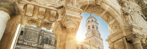
  • Church of St. Andrew. Building from the early 16th century, which held the title of a schoolgirl from 1764 to 1852. The silver-style cover, next to the square tower, stands out. The interior is a large main ship made up of arches pointed with side chapels.
  • Jabalfifth Palace.In front of the church of Santa Cruz, the Jabalfifth palace, one of the highest exponents of the isabelin Gothic style, was built in the late 15th century. The isabelin Gothic We find it on the outside, with decoration based on diamond tips, pineapple nails, fronts, florons, ties, pinacles, mocaronas and heraldic shields. The facade it is overcome with five arches of half-point Renaissance period, as well as the courtyard of the late 16th century. Today it is the seat of the Antonio Machado International University.
  • The St. Mary's Square, Baezan monumental heart, concentrates the largest number of monuments: the cathedral, the conistorial houses, the fountain of Saint Mary; the seminary of St. Philip Neri, with its picturesque facade plagued with cheers, current headquarters of the International University of Andalusia or the house-palace of Rubin de Ceballos, behind the cathedral.
  • The Populo Square, framed by the door of Jaén and the arch of Villalar, is one of the most emblematic squares of the city, where we find the plateresque cover building of the old Escribanías, today the headquarters of the tourist office of the Junta de Andalucía, the old Carnicerías and the source of the Lions in the center.
     

Nature

Baeza is located in a dominant place in the region of the Loma and on the right bank of the Guadalquivir River. The city is located on three hills and the small valley that remain in the middle, in a rather high position over the Guadalquivir valley, a situation conducive to being a very important square in ancient times. It is surrounded by the Guadalquivir rivers to the south and Guadalimar to the north.

A site that as we walk through the walls allows us to contemplate the immense sea of olive trees that is presented to us all around us. From the sights of this walk, you can see the beautiful picture of the Guadalquivir valley, the extensive olive trees, the Cazorla saw, the Segura and Sierra Mágina saw, with the villages of Jimena, Mancha Real, Bedmar and Garciez in the distance.

The predominant vegetation is the olive tree, but next to the river and the lagoon Grande we find what we call the gallery forest: white, mimberas, tarais, black, and other species of bushes. A vegetation that with the change of the seasons draw a color brush in the landscape, especially in the autumn season.

The fauna of the town is the one of the Jienese countryside: hares, rabbits, deer, foxes, parrots, quail... They are also easy to see the storks and a wide variety of prey birds. Without forgetting the fauna that lives next to the river line and in the vicinity of the lagoon Grande.

The absence of non-agricultural land reduces areas of natural interest to the river margins and to the wetlands of the Great Lagoon with a special ecological interest.

  • Laguna Grande: This permanent lagoon that suffers significant level fluctuations, is fed from the Torres River through irrigation channels. Precisely for maintaining water during summers, this wetland is particularly important for waterbirds, it is an ideal place for food and shelter. Around the water, in addition to the vegetation of carrizos, spadañas and juncos stands out the presence of tarajes, alamos, fresnos and zarzas, where there is plenty of the visitor and I shelter the fauna of the place, among which we can mention: common fence, real anade or common porron, highlighting the fly bird, where we can see the nests of this small bird, hanging from the trees of this natural place. The locals of both the Bishop's Bridge and Baeza are willing to visit this beautiful natural site.


Celebrations and Events

Among the parties with the most roots among the neighbors of Baeza, we highlight:

  • La Candelariaon February 2. On the eve of the feast of the Holy One celebrates the Candelaria, typical of the blessing of the donuts of Saint Blas, protector of the throat, in the parish of El Salvador.
  • Holy Week. Between Andalusian and Spanish, the Holy Week of Baeza, declared of National Tourist Interest, stands out for the artistic richness of its steps. About 20 cofradies process through its streets and squares, in this jewel of the Andalusian Renaissance. Its creation dates back to the 16th century, when the co-fradia of the Vera Cruz, one of the oldest in Andalusia and Spain, emerged. One of the most beautiful moments of Baezan Holy Week, occurs on the morning of Good Friday, with the departure of the fellowship of Our Father Jesus Nazarene and the Cross of St. Helena, better known by the name "El Paso"; when the Nazarene Christ gives the blessing to his mother, through an articulated mechanism, when the images are crossed.
  • May CrossesMay 1. In different plazoletas and neighborhoods of the old town, altars are covered with the only theme of the exaltation of the Holy Cross.
  • Annual city fair. It is celebrated on August 15, the feast of its patron saint, Santa María del Alcázar.
  • Romeria de la Yedra. It is celebrated around the feast of the Nativity of the Virgin (8 September).
  • The Yedra, a pastry of Baeza, located 7 km. to the north of this, and where there is the Marian sanctuary of Our Lady of the Rosel and the Holy Christ of the Yedra. The Romeria itself is celebrated on Saturday day 7, the day when the Virgin travels through the city of Baeza and goes back to her shrine of La Yedra, accompanied by horses, carriages, reels and carrots, all covered with flowers.
  • Corpus Christi. With reminiscent of the 15th and 16th centuries. Procedural custody is certainly the goldsmiths of the city.

The annual calendar of celebrations is completed with the festivities of San Isidro Labrador, the pattern of farmers, Saint Christopher, pattern of the driving industry,Our Lady of Carmen and Council parties of Baeza in honor of San Andrés.


Gastronomy

The gastronomic culture is based on its history and geography. In many of its dishes you can find cultivated influences of Roman, Jewish, Islamic, Moorish and Mudejar cuisine.

The traditional cuisine is merged with the seasons and with the festivities, as well as the basic raw materials of the earth and all irrigated with the liquid gold of the olive fields of Baeza.

Among the indigenous dishes are:

  • The orza loin. It is a typical dish of the slaughter, which is used as a preservative, frying the fresh back on a slow heat in its own butter to which different spices, nails, cinnamon, pepper... are added... and then introduced into the orza. It is also done with the chorizos of the slaughter and thus are preserved all winter.
  • Cod to the baezan. In a saffrito of onion, tomato, peas and roasted peppers made from strips, you will add the already fried cod.
  • Pipirrana. In which peppers, tomatoes, garlic, onions and olive oil are used. A refreshing dish that can't be missed in summer.
  • Andrajos. Red pepper, green pepper, onion, garlic, laurel, olive oil, pepper, white wine, vegetables and hare or rabbit. All flavoured with peppermint. For the dough, flour and water.
  • "Sick-cooked"or" dizzy chickpeas, "a dish that tries to take advantage of the remains of another meal. In a pan with oil we chopped onion and added the chickpeas, which when mixed with the spoon are broken. It is added fried tomato and eggs that are mixed and cut.
  • "Eyes." or "Masoil". It consists of a bread of extra virgin oil, pepper and anise. The name comes from being the eighth part of the mass of a bread.

Warehouse:

  • Virolos, typical pebbles.
  • Butter cakes with nuts.
  • Torrijas, a way to take advantage of the bread left over.
  • Fried milk: It's about bounced and fried milk.
  • Papajotes, It's a frying pan. A mass of fried flour and bounced with sugar and cinnamon.
  • Oil ice cream, with milk, sugar, egg yolks and oil ingredients.


History

It's in the Copper age, 3rd millennium BC, when they appear the first villages. Most of them were walled and their economy was based on agriculture and livestock.

In the Iberian period, 7th century BC, the hill of the Alcázar is considered a consolidated town.

During the 2nd and 1st centuries BC, in full Roman Empire, appears in several sources as Vivatia or Biatia. It acquires great importance due to its location, as it is a mandatory step on the commercial route Catulo - Málaga.

The territory of Biatia would be occupied in the second decade of the eighth century by Muslim troops. This time the city is known as Bayyasa.

Christian kings will take the city and lose it again on several occasions. But it will be Fernando III "the Holy One" who finally conquered it in 1227, and considered it as a bridge head in the reconquest of Al-Andalus, for this reason it is given to the city of privileges and a court, the "Fuero de Cuenca."

The presence of the Catholic Church is restored, establishing in Baeza the episcopal seat in the 13th century. From this date on, the most important religious and conventual orders were present in the city.

It will be in the 16th century when Baeza reaches its maximum architectural splendor with the foundation of the University, among other public buildings of interest. The apogee will continue in the 17th century, is the century of the greatest conventional apogee.

The 18th century will be of decline. With the war of Baeza Independence, he suffers considerable human and economic losses. Excessive demands and contributions would also help. The deamortization of Mendizábal, which brought the disappearance of the convents, was very remarkable.

The mainly agricultural economy, increases production and increases the area dedicated to olive trees to the detriment of other arable crops.

In 1966Baeza was declared "Historical-Artistic Set", which was a take-off in tourism services, increased by the Declaration in 2003 by UNESCO, in Baeza as World Heritage.

University tradition is recovering with headquarters Antonio Machado of the International University of Andalusia.
 

Otra información

Other monuments that form part of their heritage are:

  • Old college.
  • Old Seminary of San Felipe Neri.
  • Casa Estudio de Manuel Garrido.
  • Museum of Baeza.
  • Casa-studio Diego Lozano, Father Sifon.
  • Antonio Moreno Museum.
  • Museum of the Olivo Culture.
  • Old Carniceries.
  • Civil Audience and Public Writings 16th Century.
  • Gaspar Becerra Exhibition Room.
  • Church of El Salvador
  • Church of St. Paul
  • Forgiveness door and streets adjacent to the Cathedral.
     
Loading map
Preparing points of interest and routes...
Imagen principal
imagen
Image
c1150e7f-a3ee-92c6-f4dd-7d7b9b44728d?t=1603979507918
Imagen principal
Activado
Literatura

The city has had a great influence on distinguished authors such as Antonio Machado and Federico García Lorca, who had a momentous meeting here.

Not forgetting the important presence of San Juan de la Cruz in Baeza and the family ties linking Jorge Manrique to this town.

Recreational Zone río San Juan

Submitted by brandcode_deweloper on
Id
1909649
Descripción
Descripción larga

It is a very quiet area, surrounded by endless olive fields, where there are fountains with drinking water, barbecues, tables and seats. In the river you can practice, in season, fishing of the common trout and the barb, or practice swimming.

Breve descripción

This recreational area is located in the area known as the Palomillas Bridge

Ubicación
Latitud
37.540246
Longitud
-4.039030
Dirección
Carretera comarcal JV-2236 de Sabariego a La Rábita, en su cruce con la carretera N-432 Granada - Badajoz.
Distrito
Municipio
Ubicación en el mapa
POINT (-4.03903 37.540246)
Imágenes carrusel
imagen
Image
4%20%281%29.jpg
Imagen principal
Desactivado
imagen
Image
1%20%281%29.jpg
Imagen principal
Desactivado
imagen
Image
10.jpg
Imagen principal
Desactivado
Imágenes cabecera
imagen
Image
3%20%281%29.jpg
Imagen principal
Activado
Microsite al que pertenece
Loading map
Preparing points of interest and routes...

Recreational Zone La Cañada

Submitted by brandcode_deweloper on
Id
4691127
Descripción
Breve descripción

It is a perfectly equipped road that has an interesting look, a water source and an information panel on landscape interpretation.

Telecomunicaciones
Sitio web
www.pinademontalgrao.es/content/complejo-la-canada
Teléfono de contacto
953 781 500
Correo electrónico
ayuntamiento@larva.es
Ubicación
Código Postal
23591
Latitud
37.758500
Longitud
-3.200520
Dirección
C/ Conde Torrerando, 22
Distrito
Municipio
Ubicación en el mapa
POINT (-3.20052 37.7585)
Tipos de punto de interés
Imágenes carrusel
imagen
Image
Area%20Recreativa%20La%20Ca%C3%B1ada.jpg
Imagen principal
Desactivado
Imágenes cabecera
imagen
Image
9085_0nw5ulj32ahczt4o.jpg
Imagen principal
Activado
Horario
24 h.
Microsite al que pertenece
Loading map
Preparing points of interest and routes...