Saltar al contenido principal

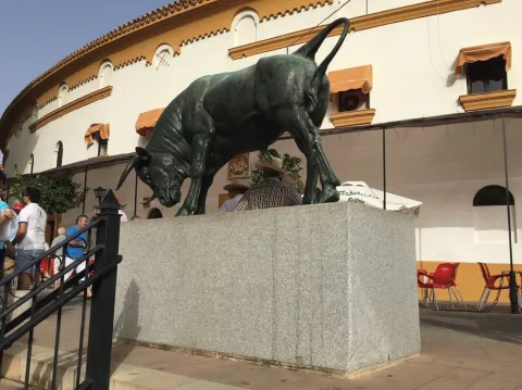
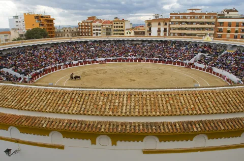
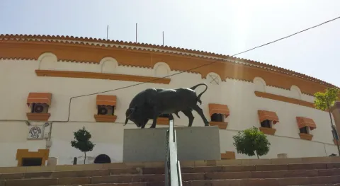
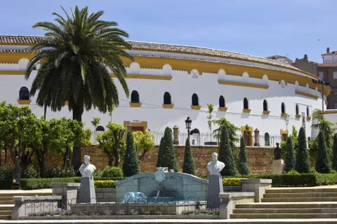
Bullring of Villanueva del Arzobispo

Submitted by brandcode_deweloper on
Id
1563946
Descripción
Descripción larga

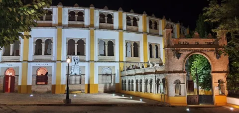
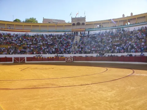
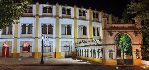
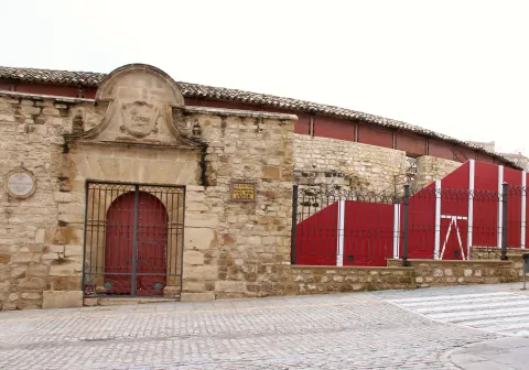
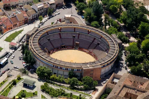
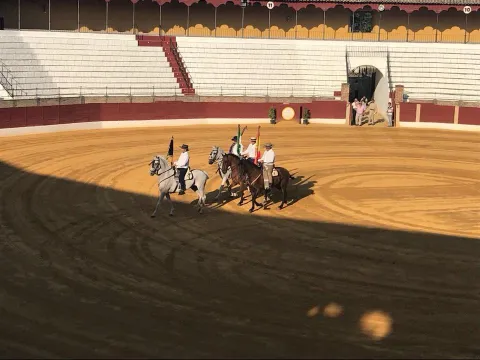
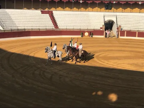
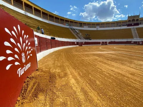
It was designed by the architect Mr Angel Arbex, Commander of Engineers. It was opened on 10 September 1928 by the rejonador Antonio Cañero and the matadores Manuel Jiménez Chicuelo, "El Algabeño" and Vicente Barrera before eight bulls of the cattle-making of Veragua.

This monument marks the architectural explosion of the 1920s in Villanueva del Archbishop, since to it would be added the House of the Arches, the Old Casino of the Commercial Circle, etc.

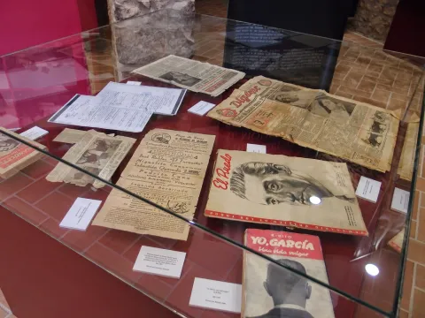
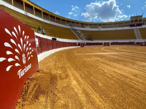
The 3rd Category Square has a capacity for 6,000 spectators. It is one of the most important Taurino things in the province of Jaén and through which the first figures of the Toreo have passed, from Manolete to the brothers Rivera Ordóñez, the Cordobés, Fandi... witnessing great taurine evenings and other cultural events of the villa.

Breve descripción

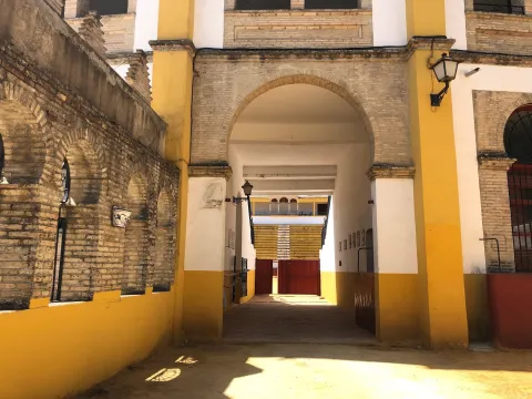
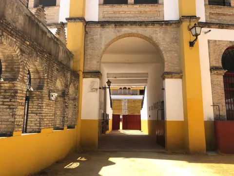
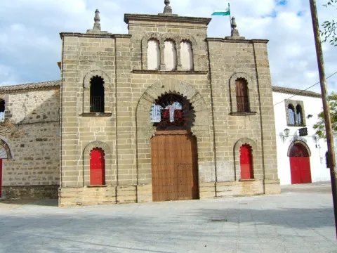
The Archbishop's Plaza de Toros de Villanueva is Neomudéjar style, with use of brick and horseshoe arches.

Telecomunicaciones
Sitio web
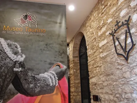
www.villanuevadelarzobispo.es/museo-taurino/
Teléfono de contacto
639 955 416
Correo electrónico
lamoralejaserviciosturisticos@gmail.com / turismo@villanuevadelarzobispo.es
Ubicación
Código Postal
23330
Latitud
38.162722
Longitud
-3.007320
Dirección
C/ Fuensanta, s/n
Ubicación en el mapa
POINT (-3.00732 38.162722)
Tipos de punto de interés
Imágenes carrusel
imagen
Image
16047678658039ca5c677-a731-4e34-ad3c-7fd9740e17b42254242240483307573.jpg
Imagen principal
Desactivado
imagen
Image
1604767365180126482876139755464677.jpeg
Imagen principal
Desactivado
imagen
Image
1604767869996A0436615-D3EB-4647-9691-2C55843102FB6154242950581307528.jpeg
Imagen principal
Desactivado
imagen
Image
160476787171270170C86-6429-4532-9AFE-4C6AAC4E610F7267178523688453260.jpeg
Imagen principal
Desactivado
imagen
Image
1604767359041112508596545032774690.jpeg
Imagen principal
Desactivado
Imágenes cabecera
imagen
Image
PlazaVillanueva.jpg
Imagen principal
Activado
Loading map
Preparing points of interest and routes...

Bullring of Úbeda

Submitted by brandcode_deweloper on
Id
10871902
Descripción
Descripción larga

It was built on the grounds occupied by the Garden of the Convent of San Nicasio, reusing the materials of this and another ancient convent, which was that of San Antonio. It opened in 1857, being one of the first five built in our country. Traditionally, in Ubeda, the races were held in squares and streets, until the 19th century, when the bullfighting squares began to be built throughout Spain, adopting a certain similarity for their circular and progressive plant, with the Roman amphitheaters. This work is an exponent of the decimononic architecture in the city, with the incorporation of the use of cast iron, typical of this century, in the corrido balconage and rails with interesting outings of sticks and balconds. The square consists of two floors and a capacity of 5,000 spectators. There are two covers, that of the Great Gate, intellized and topped with a shield in which a taurino lance is represented, and that of the interior, which is from the 16th century, perhaps from the convent of San Nicasio. The first figures of the bullfighting have passed through this square. Here took the alternative one of the best bullfighters in the entire history of the country, "Lagartijo," on September 29, 1864. There are currently runs at the San Miguel Fair, between September 29 and October 4, as well as other musical and artistic events throughout the year.

Breve descripción

Known as the Coso of San Nicasio, it is a historic building included in the General Catalogue of Andalusian Historical Heritage. The bullring square on Sagasta Street is incorporated into the apple in front of the Santiago Hospital, so its circular form is not seen outside.

Telecomunicaciones
Sitio web
https://www.turismodeubeda.com/index.php/es/
Teléfono de contacto
953 750 440
Correo electrónico
alcaldia@ayuntamientodeubeda.com
Ubicación
Código Postal
23400
Latitud
38.010844
Longitud
-3.376250
Dirección
C/ Sagasta, 10
Municipio
Ubicación en el mapa
POINT (-3.37625 38.010844)
Tipos de punto de interés
Imágenes carrusel
imagen
Image
16047678658039ca5c677-a731-4e34-ad3c-7fd9740e17b42254242240483307573.jpg
Imagen principal
Desactivado
imagen
Image
1604767365180126482876139755464677.jpeg
Imagen principal
Desactivado
imagen
Image
1604767869996A0436615-D3EB-4647-9691-2C55843102FB6154242950581307528.jpeg
Imagen principal
Desactivado
imagen
Image
160476787171270170C86-6429-4532-9AFE-4C6AAC4E610F7267178523688453260.jpeg
Imagen principal
Desactivado
imagen
Image
1604767359041112508596545032774690.jpeg
Imagen principal
Desactivado
Imágenes cabecera
imagen
Image
Plaza%20de%20Toros%20%C3%9Abeda.jpg
Imagen principal
Activado
Microsite al que pertenece
Loading map
Preparing points of interest and routes...

Bullring of Santa Margarita

Submitted by brandcode_deweloper on
Id
6066942
Descripción
Descripción larga

The square has a capacity of 9,000 spectators. Circular with an alley of 1.30 meters high, it consists of three floors: lying, standing and gallery, to which they lead four stairs, one at each access door to the enclosure. Among its dependencies is cavalry, corrals, ten chickers, concierge, administration, bullfighting room, lockers, nursing and desolate.

Full of history and legend, in which memorable afternoons have been lived, the best priests and rejoners have tried luck in their course. But the one that remains recorded in the collective memory of the hobby and for which the Linares coso is worldwide known, was for the mortal capture of Manuel Rodríguez Sánchez "Manolete" on August 29, 1947, for the myura called Isero. Next to the ring door there is a ceramic and marble plate commemorative of that tragic afternoon of the Royal Fair and Fiestas of San Agustín.

Breve descripción

The square of Linares, known as Santa Margarita, built in stone, brick, iron and wood, was built in the last third of the 19th century, specifically between the years 1865 and 1867, when it was inaugurated. This thing has one of the largest rings in the world and consists of three floors. He has witnessed the emergence of numerous Linaran matators and historical epic afternoons. This square is also offered as a space for concerts and unique events in the city center.

Telecomunicaciones
Sitio web
www.turismolinares.es/planifica-tu-visita/itinerarios/linares-taurina/
Teléfono de contacto
953 690 849
Correo electrónico
turismo@aytolinares.es
Ubicación
Código Postal
23700
Latitud
38.097860
Longitud
-3.631525
Dirección
C/ Argüelles, s/n
Distrito
Municipio
Ubicación en el mapa
POINT (-3.631525 38.09786)
Tipos de punto de interés
Imágenes carrusel
imagen
Image
2.jpg
Imagen principal
Desactivado
imagen
Image
1.jpg
Imagen principal
Desactivado
imagen
Image
santa-margarita.jpg
Imagen principal
Desactivado
imagen
Image
3.jpg
Imagen principal
Desactivado
Imágenes cabecera
imagen
Image
Coso%20Santa%20Margarita%20de%20Linares.jpg
Imagen principal
Activado
Microsite al que pertenece
Loading map
Preparing points of interest and routes...

Bullring of Jaén

Submitted by brandcode_deweloper on
Id
10871582
Descripción
Descripción larga

The first run was held on 18 October 1960 with the unfinished work and was in charge of the bullfighters "Pedrés," Gregorio Sánchez and Victor Quesada. The official inauguration of the coso took place two years later with a sign formed by the swords Diego Puerta, Paco Camino and Palmeño. On October 18, 2010, coinciding with the celebration of the San Lucas Fair, it commemorated the 50th anniversary of the first walk in the square, with a cumshot by José Carlos Venegas, Enrique Ponce and El Juli. It has a capacity for more than 10,000 spectators and a restoration area in the lower area of the square.

Breve descripción

The current square also called Alameda thing, is the work of the architect Antonio María Sánchez and stands on the old square opened on August 15, 1847, which disappeared in the mid-20th century.

Telecomunicaciones
Sitio web
https://www.tauroemocion.es/index.php/plazas/jaen
Teléfono de contacto
953 241 100
Correo electrónico
administracion@tauroemocion.com
Ubicación
Código Postal
23002
Latitud
37.767602
Longitud
-3.783212
Dirección
Alameda de Adolfo Suárez, 2
Distrito
Municipio
Ubicación en el mapa
POINT (-3.783212 37.767602)
Tipos de punto de interés
Imágenes cabecera
imagen
Image
FNz8c6hXsA4oQ4t.jpg
Imagen principal
Activado
Microsite al que pertenece
Loading map
Preparing points of interest and routes...

Bullring of Baeza

Submitted by brandcode_deweloper on
Id
1563321
Descripción
Descripción larga

This square was built in 1892 using neo-Mudejarianism as a style, both inside and on the outer gates, where horseshoe arches predominate. Some of the materials were reused from some churches and property abandoned after the deamortization, as well as from the remains of the first Plaza de Toros.

It consists of three floors: laying, stand, palches and second stand. It also has two cavalries, corrals for the cattle of ligia, covered poultry to verify the section and corraleta, six chickers, bulldozers room, chapel, nursing, administration, pallet of drag, butcher and ticket office.

The square offers the possibility of organizing events for incentives and congresses, concerts and shows.

Breve descripción

The bullring of Baeza is an example of 19th century architecture, with a clear eclectic language.

Telecomunicaciones
Sitio web
www.baeza.net/servicios_municipales/oficina-de-turismo/
Teléfono de contacto
953 740 150
Correo electrónico
turismo@baeza.net
Ubicación
Código Postal
23440
Latitud
37.993910
Longitud
-3.460650
Dirección
C/ Diego de Hoces, 2
Municipio
Ubicación en el mapa
POINT (-3.46065 37.99391)
Tipos de punto de interés
Imágenes carrusel
imagen
Image
Baeza2.jpg
Imagen principal
Desactivado
imagen
Image
Plaza-toros-baeza-e1525518123140.jpg
Imagen principal
Desactivado
Imágenes cabecera
imagen
Image
Baeza2%20%284%29.jpg
Imagen principal
Activado
Horario
Thursday to Sunday: 10: 30 - 13: 30. Spring and autumn: 16: 30 - 19: 30. Summer: 18: 00 - 21: 00. Winter: 16: 00 - 18: 30. Guided tour on request.
Microsite al que pertenece
Loading map
Preparing points of interest and routes...

Square de Santa María

Submitted by brandcode_deweloper on
Id
918485
Descripción
Descripción larga

The Church of Santa Maria was the most important monument of the advance of Cazorla. As a Renaissance, his inspiration is attributed to Andrew of Vandelvira or one of his disciples. It is built on the Cerezuelo River, taking advantage of the vault that covers the river and crosses the entire Plaza.

It is not the only unique building we find there: the House of the Clérigos, the Thematic Center of Threatened Species, the old Conistorial Houses (in an alley above the square) or the Fountain of the Chain (built in 1605) are some of the many visits we can make here.

In the square we also find nice restaurants that offer a great sample of local cuisine. To enjoy these dishes in the quiet dusk is one more reason to often go to this suggestive square.

We suggest:

  • Visit the ruins of Santa Maria, know its history and its curious construction. You can order information from the tourist office (953 71 01 02).
  • Up by the river Cerezuelo, passing the ruins of Santa María in the direction of the castle of La Yedra, and walking along one of the small routes that begin in this area. An information panel will help you to better know this area of the city.

In Cazorla, we leave the Plaza de la Constitución, in the center of the village. From here follow Doctor Muñoz Street to La Corredera Square. At the end of this, we turn right and immediately left, following the signs to the Castle of La Yedra. After passing by the balcony of Zabaleta and crossing the street José Salcedo Cano - a narrow and steep street with numerous pots in its balconies - we reached the Plaza de Santa María.

Breve descripción

Reaching the Old Square or Santa Maria Square through the old town of Cazorla is a surprise for the walker. The open space with the high slopes of the Peña de los Halcones, the Gilillo peak or the castle of La Yedra make it difficult for you to see what you have at your height. But at your height there is a beautiful square full of history and charm, where the ruins of the Church of Santa Maria demand the attention of the many travelers who come to this place.

Ubicación
Latitud
37.912893
Longitud
-3.003887
Municipio
Ubicación en el mapa
POINT (-3.003887 37.912893)
Tipos de punto de interés
Imágenes carrusel
imagen
Image
6%20%282%29.jpg
Imagen principal
Desactivado
Imágenes cabecera
imagen
Image
7%20%281%29%20%281%29.jpg
Imagen principal
Activado
Loading map
Preparing points of interest and routes...
Marcas de calidad

Rock Paintings in Santiago-Pontones

Submitted by brandcode_deweloper on
Id
650155
Descripción
Descripción larga

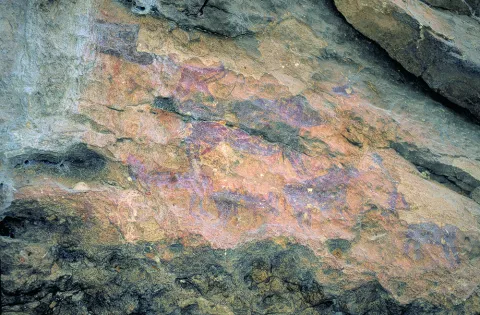
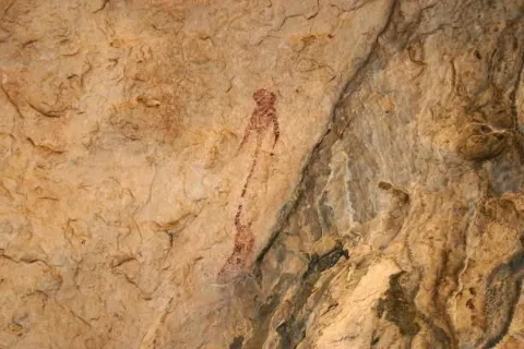
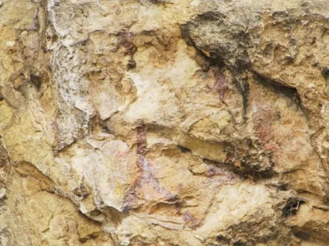
The simple fact of seeing a seed germinate and growing plants, or of observing animals and the birth of women, made these people wonder about the origin of life. These thoughts were those that moved to the walls of the caves as a representation of facts related to daily life and its world of beliefs. We can imagine one of the inhabitants of the Cave of Birth preparing the pigments, mixing them with animal fat, improvising a brush with animal hair and getting ready to paint a scene. I'd be thinking of painting a composition with a hunting scene, fight, dance trying to tell a moment, a scene of life.

The rock paintings represent one of the most important cultural manifestations of prehistory, as they have helped to know some aspects of these societies to learn a little more about their life forms, fauna, flora and the world of their beliefs. What reasons could lead our ancestors to translate the manifestations of daily life and their beliefs into caves and coats? Maybe they were sanctuaries?

Breve descripción

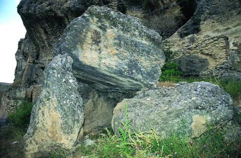
In the saws of Segura and Cazorla there are numerous coats and caves with rock paintings that are part of what is known as the Rupéstre Levino Art and which have been declared a World Heritage Site. We are talking about a very remote time, about 10,000 A.E. We must think of the inhabitants of the Caves of the Engarbo or the Cave of the Birth, for example, the latter being one of the few excavated and allowing to know the passage from Paleolithic to Neolithic. It is a time of great changes in the way of life in which human beings move from being a predator to domesticating vegetables and animals to getting plenty of food and storing it to avoid moving continuously.

Ubicación
Latitud
37.772886
Longitud
-3.788329
Ubicación en el mapa
POINT (-3.788329 37.772886)
Tipos de punto de interés
Imágenes carrusel
imagen
Image
Mon149.jpg
Imagen principal
Desactivado
imagen
Image
Natu149.jpg
Imagen principal
Desactivado
imagen
Image
pinturas_rupestres.jpg
Imagen principal
Desactivado
Imágenes cabecera
imagen
Image
IMG_4324-1.jpg
Imagen principal
Activado
Loading map
Preparing points of interest and routes...

Cánava Pine Forest

Submitted by brandcode_deweloper on
Id
5845162
Descripción
Descripción larga

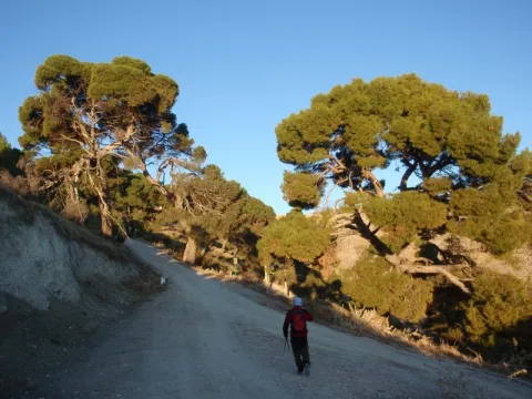
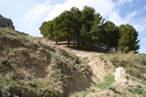
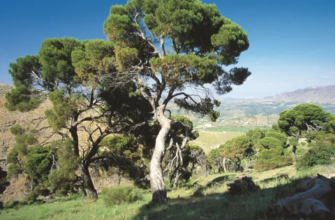
The Pinar de Cánava is an interesting forest ecosystem that has the carrasco pine as its protagonist. The uniqueness of this pineapple, of about 120 copies, is found in its high degree of naturality and, above all, in its longevity, with pine trees between 100 and 250 years old.

This pineapple has great value as an educational resource, as it offers a unique opportunity to understand the different stages of ripening of a forest. In addition, the appearance of a pine can be observed at a stage near old age. In front of the typical forms of young pineapples with straight trunks and conical cups, they contrast the twisted specimens of this Natural Monument. Its rounded, parasol-shaped cups remind of other tree species. The bush in this forest has almost disappeared. This complex aspect is the one that every forest would have in a natural way, but man's intervention changes this process, tending towards greater simplicity.

Breve descripción

Protected natural space, as a natural monument, of 5 ha of extension. The municipal term of Jimena. Interesting pine that shows the relish vegetation, ancient of the area. We could consider it a plant landscape, witness to ancient vegetation.

Ubicación
Nombre
Cerro de la Atalaya
Latitud
37.841470
Longitud
-3.478850
Distrito
Municipio
Ubicación en el mapa
POINT (-3.47885 37.84147)
Tipos de punto de interés
Imágenes carrusel
imagen
Image
image_248193.jpeg
Imagen principal
Desactivado
imagen
Image
imagen-166-pinar-jpg
Imagen principal
Desactivado
Imágenes cabecera
imagen
Image
Monumentos_naturales_2%20%281%29.jpg
Imagen principal
Activado
Microsite al que pertenece
Loading map
Preparing points of interest and routes...

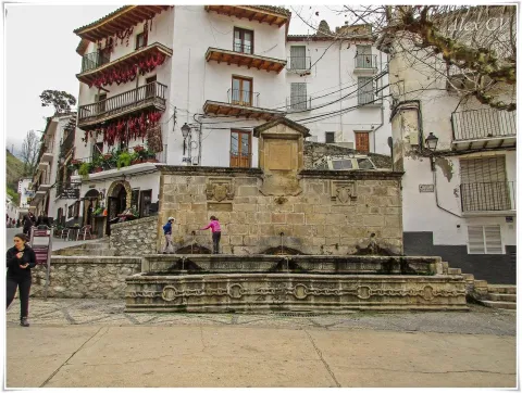
Drinking Trough Fountain

Submitted by brandcode_deweloper on
Id
910704
Descripción
Descripción larga

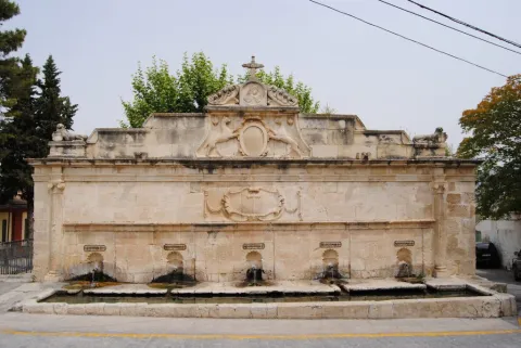
Precisely, to the cloister of the said convent, Mr Gonzalo Messía Carrillo Fonseca, I Marqués de La Guardia, commissioned the execution of an exempt fountain, crowned by the Magdalena and dated 1577, which has been attributed to Francisco del Castillo "El Mozo," currently located in the courtyard of the Excel. Provincial Council of Jaén. Years earlier, and perhaps to commemorate the appointment as I Marqués de La Guardia, Gonzalo Messía ordered to raise a pilar-abrevadero at the entrance of the population, near the Dominican convent, to serve as a water supply to the neighbors and their animals. This beautiful space, threatened with splendid gardens, over time became a plateau made up of the source itself and a nobility house of silery built according to the date of 1814.

The pilar-abrevadero, in a landscape and built of silary stone, is formed by a wall articulated by two bodies and attic. In the first body there are five caños of bronze out of avenerated hornazas that pour abundant waters on a rectangular pillar, in the second a beautiful frame was carved with hanging cloth with the inscription allusive to the comitant and the date of execution: "This work command to do the Iltmo. Mr. Don Gonzalo Mexia Carrillo, my lord. Year 1566." Throughout this second body there is an internment supported at the ends in Ionian striated columns. In the center of the attic two canes, with the garruches of the Messia family, hold an oval shield on the mould with the crown of Marquis and the following inscription "Plaza de Isabel II Reina Constitucional," with which this place has been known since. In its origin the dogs held the shield with the weapons of Don Gonzalo Messia Carrillo; it is overcome with a fronton with a central relief flanked by fins and crowned with a Cross, to the ends and bearing the cross of Santiago have settled two lying lions (all very redone).

Although the tracist of this beautiful pillar is not known, the stylems incorporated in it, columns with alternating sticks, the scroll with cloth (similar to the carved ones in the City Palace of Ubeda), the molding of the inlet and the cut-off hides of the shield held by the canes point to a possible intervention by Andrés de Vandelvira. Professor Galera Andreu expresses himself in this respect: I do not believe that the public source is not at his hand, despite the reforms (...) to be highlighted by the small scale of the columns attached in an application to the reverse of what was done in the chapel of the Benavides in Baeza. The set was restored by the local workshop school in 1991.

Breve descripción

Monument of the Historical-Artistic Set. Declared 06 / 07 / 1983 To the Messies, lords and Marquis of La Guardia, the architectural wealth preserved in this villa is largely due. Thanks to its performance, not without taste, the old Bajomieval fortress adapted to the new palaciegos (typical of the reign of the Catholic Kings) with a beautiful tarootic cover and encouraged the foundation of a convent run by the Dominicans, in which consecrated architects such as Andrés de Vandelvira and Francisco del Castillo "El Mozo" would intervene throughout the 16th century.

Telecomunicaciones
Sitio web
www.laguardiadejaen.com/tu-ciudad/historia/
Teléfono de contacto
953 327 100
Correo electrónico
ayuntamiento@laguardiadejaen.es
Ubicación
Código Postal
23170
Latitud
37.744720
Longitud
-3.693890
Dirección
C/ Escuelas, 11
Distrito
Ubicación en el mapa
POINT (-3.69389 37.74472)
Tipos de punto de interés
Imágenes cabecera
imagen
Image
Pilar%20Abrevadero%20%281%29.jpg
Imagen principal
Activado
Loading map
Preparing points of interest and routes...

Peaks of the Guadiana

Submitted by brandcode_deweloper on
Id
913424
Descripción
Descripción larga

The Guadiana Menor is a very young river from the geological point of view. Until about 10,000 years ago, its basin was a large salty lake, to which it provided its waters and sediments numerous streams from Sierra Nevada, Filabres and the Macizo de Cazorla and Segura. Its current course arose in an accidental and violent way, perhaps due to the breaking of one of the margins of the lake produced by an earthquake, excavating deep ravines, leaving out the yermas clays, loaded with plaster and salts, rolling edges and marine sands, a means that makes it difficult to survive the living beings that inhabit them.

The depression that bears its name from this river is the most arid area in the province and one of the driest in Europe, recording annual rainfall that very rarely exceeds 250 mm. The consequence is that of a semidesertic, rotational and beautiful landscape, populated by highly specialized Stepparian vegetables to the middle, most herbs and small matas. Its biological uniqueness is enormous, having an endemic character (very small geographical area) more than half of the species present in the area. This proportion is only comparable to the biological exclusivity of the high betic mountain, where we find most of the most well-known endemisms in the Natural Park.

We suggest...

  • Make the Desert Route, described in the Tourist Guide of Hinojares.
  • Visit the Mirador del Lirio, with stunning views of the valley and the desert of the Natural Park. It is accessed (it is signposted) from the village of Fontanar, which is located about 5 Km from Pozo Alcón.
  • Other unique points of this recommended visit are the necropolis ibera de los Castellones de Ceal, next to the village of Ceal, and the Salinilla de Chillar, located very close to Hinojares.

To visit the Picos del Guadiana and to visit the subdesert area of the Natural Park that corresponds to the Valle del Guadiana Menor, we will use the road section of the A-315 that links Bone with Pozo Alcón and Hinojares. The view of the Picos is at the beginning of these, in an enranche of the previous way, about 14 km from Hinojares and 19 km from Pozo Alcón.

Breve descripción

The geoforms of the valley of the Minor Guadiana, originating from the slow and inexorable erosive processes, are extremely striking. An enclave of great geomorphological interest, proposed as a natural monument: the Picos del Guadiana, stands out. It is a limestone crest where the petreous strata, arranged vertically, emerge from a cone of soft clays, forming a rocky alignment that resembles the teeth of a saw. The most imaginative say that it is the fossil of a colossal dinosaur that died by the river, without considering that there was no such channel in the Jurassic and that some of those prehistoric animals were huge, but not so much.

Ubicación
Latitud
37.702695
Longitud
-2.935057
Municipio
Ubicación en el mapa
POINT (-2.935057 37.702695)
Tipos de punto de interés
Imágenes carrusel
imagen
Image
picos.jpg
Imagen principal
Desactivado
Imágenes cabecera
imagen
Image
8040409Master.jpg
Imagen principal
Activado
Loading map
Preparing points of interest and routes...