Saltar al contenido principal

Jaén – Puente de la Sierra – Otíñar – Carchelejo – La Guardia (C2)

Submitted by brandcode_deweloper on
Id
RUT-0019
Descripción larga
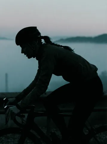
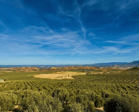
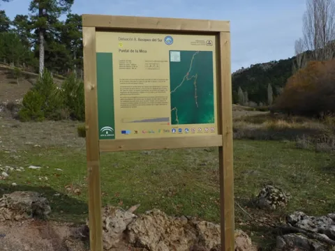
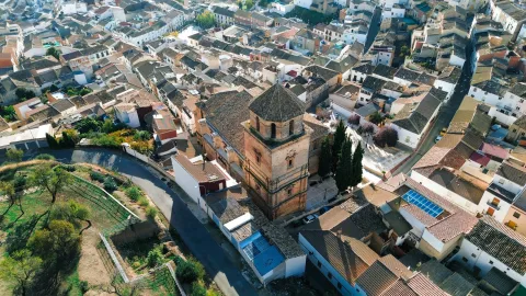
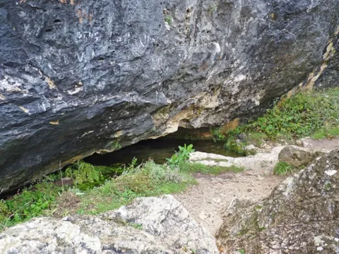
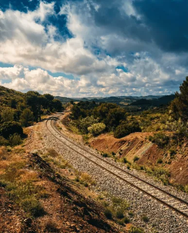
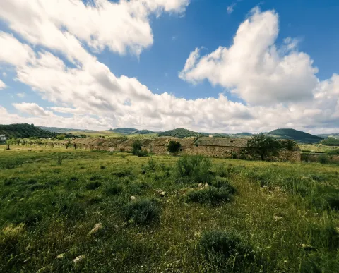
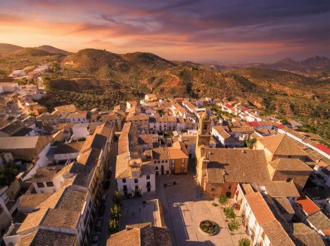
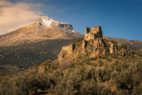
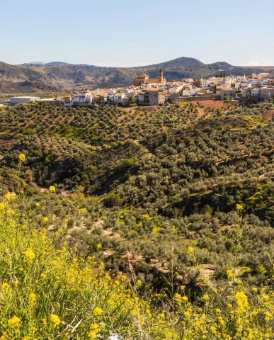
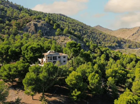
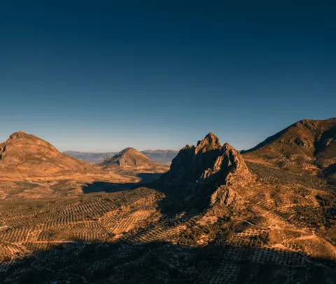
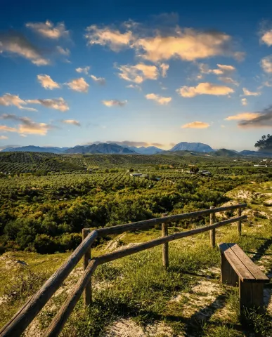
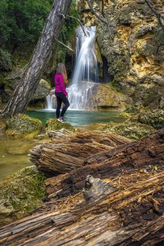
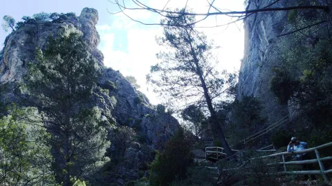
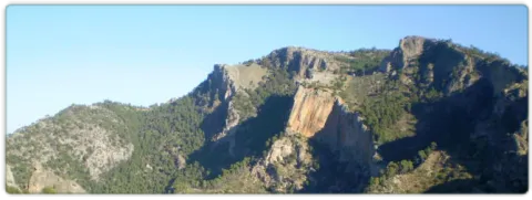
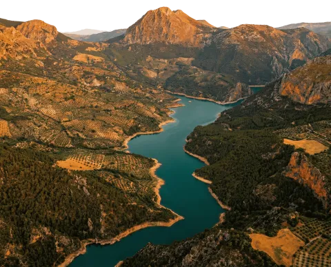
Circular route of medium-long distance that connects Jaén with the valleys of the Quiebrajano and the Guadalbullón, linking water, heritage and mountain landscape. The tour combines a progressive rise to the interior of Sierra Magina with a comfortable return through the countryside, passing through enclaves as unique as Otiñar, the Hazadilla Canyon and the natural views of La Guardia. A balanced proposal for cyclists looking for territory, history and variety of environments. The route leaves Jaén, leaving the urban environment behind to roll south on secondary roads across traditional gardens and olive groves. From the first kilometers, the Castle of Santa Catalina is left behind as a visual reference, as the route enters the natural corridor of the Quiebrajano River, a clear transition between the Jiennense countryside and the first mountain foothills. The passage through Puente de la Sierra, a historic recreation place linked to the water and the valley, marks the beginning of the most serrano stretch. From here on, the road accompanies the river between gardens, houses and limestone slopes, with a constant but grateful rise. In this area, the ruins of the Otiñar Castle, embellished on a rocky promontory, and the nearby Abrigo del Toril, one of the most unique sets of rock art in the surrounding area, are highlighted. The rise continues towards the Hazadillas Canyon, a former livestock enclave and access door to the interior saws. The landscape becomes more mountainous: ravines, cascades and repopulation pines alternate with oaks and complaints, providing shade and a feeling of height. This section links with sectors shared with other cycloturist routes and finally leads to Carchelejo, a white core located on the edge of Sierra Magina and excellent balcony over the Guadalbullion valley. From Carchelejo, the itinerary changes its tone. The profile softens and begins a comfortable descent on more open roads, following the historical corridor of the N-323a, an old axis of communication between the saw and the countryside. The pedal is made fluid between endless olive groves, sharing for a few kilometers drawn with other cycloturist routes. The arrival at La Guardia de Jaén, located on the top of a hill, adds a marked heritage component. Its medieval castle and the Renaissance church dominate a wide transition landscape, with open views towards the valley and the mountains. From here, the return to Puente Jontoya and Jaén is made by a favorable route, between gardens, cortijos and river vegetation, closing a circuit that combines nearby mountain, history and water culture. General recommendations Suitable route for cyclists with minimal experience on long routes. The meteorology should be reviewed, especially in the serrano section between Puente de la Sierra and Carchelejo. Attention in long-term and shared sections with time traffic. Take sufficient water and respect natural and heritage enclaves, especially in sensitive areas such as Otinar.
Breve descripción
Circular route of about 62 km leaving Jaén on the Road of Valdecañas towards Puente de la Sierra, it goes back to the Quebrajano valley to the ruins of Otiñar and ascends to Carchelejo and La Guardia on mountain roads, to return later to Jaén on the old N-323a, the service area El Oasis, La Cerradura and the Jontoya valley.
Latitud
37.7796
Longitud
-3.7849
Distrito
Municipio
Ubicación en el mapa
POINT (-3.7849 37.7796)
imagen
Image
c2_1.png
Imagen principal
Desactivado
imagen
Image
c2_2.png
Imagen principal
Desactivado
imagen
Image
c2_3.png
Imagen principal
Desactivado
imagen
Image
c2_4.png
Imagen principal
Desactivado
imagen
Image
c2_5.png
Imagen principal
Desactivado
imagen
Image
c2_6.png
Imagen principal
Desactivado

Sport

icon-intereses-deporte
Baja - Media
Jaén – Puente de la Sierra – Otíñar – Carchelejo – La Guardia (C2)
62,5 km
1575m
Desactivado
Tramo de asfalto o cemento
 
Tramo de pista o camino forestal
 
Tramo de vía pecuaria
 
Tramo de senda
 

Despegue de la Peña del Águila

Submitted by brandcode_deweloper on
Id
RUT-0016
Descripción larga
The Peña del Águila is located a few meters from the lookout of the same name, in the municipal term of Mancha Real. Its access is simple from the road up to the Almadén summit, making it one of the most comfortable and common flight points in Sierra Mágina. Located almost 1,200 metres above sea level, this enclave has a Northwest orientation, also allowing the flight with wind components from West and North. The take-off area has an approximate size of 200 m ², offering sufficient space to prepare the candle with comfort. Because of its aerological characteristics and its kind relief, it is an ideal place for both start-up flights and for those who seek to propose longer distance tours under favourable conditions. History and consolidation as a flight area The history of the Peña del Eagle dates back to the 1990s, when the newly created Paragliding Club Pegalajar Flight Centre began to systematically explore new flight areas in the province. Those years marked the beginning of the development of the paragliding in Sierra Magina, laying the foundation for what is today a consolidated network of takeoff. Some of the first flight concentrations of the region were held in Mancha Real in the 1990s. More recently, the Spanish Precision Paragliding Championship was held in 2022, a modality that tests the skill of the pilot in the approach and grounding. The area is currently frequented by the Peña el Eagle Flight Club and by numerous pilots who visit Sierra Magina attracted by the beauty of the environment and the regularity of its conditions. The proximity to Pegalajar allows to alternate flight days between both enclaves easily, enriching the experience. Security recommendations Always consult the weather forecast and assess the intensity and direction of the wind before taking off. Use equipment approved and in good condition. On start flights, have supervision of experienced technicians or pilots. Respect the take-off and landing areas as well as the natural environment. La Peña del Eagle is a natural balcony where the flight is integrated with the landscape: take off on the olive sea, gain height on the loins and feel that, between glances and crests, Sierra Magina invites to walk, run and fly.
Breve descripción
The Peña del Águila is located a few meters from the lookout of the same name, in the municipal term of Mancha Real. Its access is simple from the road up to the Almadén summit, making it one of the most comfortable and common flight points in Sierra Mágina.
Latitud
37.7801
Longitud
-3.4603
Distrito
Municipio
Ubicación en el mapa
POINT (-3.4603 37.7801)
imagen
Image
_mg_4644-jpg
Imagen principal
Activado

Nature

icon-intereses-naturaleza
Despegue de la Peña del Águila
Desactivado

Conexión con Larva (C9)

Submitted by brandcode_deweloper on
Id
RUT-0014
Descripción larga
A linear route of 3.68 km that connects the ciclable C7 with the municipality of Larva, by a 100% asphalt route, with soft levels and very accessible character. It is a short tour, ideal as a link section within the cycloturist network or as a quiet exit to discover the open landscape of the eastern sector of Sierra Magina. The route starts on the JV-3213 road, next to the bridge over the railway tracks, and is heading north towards Larva. The first meters run parallel to the railway line, accompanied by a carrasco pinar that brings shade and freshness. In this section you will travel through the Cordel del Camino de Ubeda to Cabra, an old pecuaria road that adds a clear historical and ethnographic value to the journey. As you advance, the landscape opens between splits and olive groves, with constant views of Sierra Magina on the left and the hills of the Sierra de Larva on the right. After passing by the Cortijo de San Pedro, a living example of the olive culture, the tour gains visual amplitude: the olive sea of La Loma appears and, at the bottom, the summits of the Sierra de Cazorla, Segura and Las Villas. In the final section, after leaving behind the Cortijo de Caro, the slope gradually increases and the ascent to Larva begins, with wide panoramic views of the Jiennense olive and the reliefs that close the horizon. The route concludes in Larva, a quiet village that invites you to walk and complete the day with a visit to its natural environment, such as the La Cañada area. General recommendations Route suitable for all types of public and road or gravel bicycles. Caution at the beginning, next to the JV-3213. On hot days, the shadow is limited outside the initial pinar. It is recommended to bring sufficient water and always respect the rural environment and the livestock routes.
Breve descripción
A short-distance Itinerary that connects the surroundings of Jódar with the municipality of Larva through a quiet and very landscaped route, running between pinars, spartizales and extensive olive trees on local roads and old livestock roads. The route advances along the railway road and old cortijos, offers wide panoramic views of Sierra Magina, the Sierra de Larva and the olive sea of La Loma, and culminates in the cozy village of Larva, with access to nearby natural spaces such as the Natural Park of La Cañada.
Latitud
37.6502
Longitud
-3.2504
Distrito
Municipio
Ubicación en el mapa
POINT (-3.2504 37.6502)
imagen
Image
_mg_4011-jpg
Imagen principal
Activado
imagen
Image
c9-2.jpg
Imagen principal
Desactivado
imagen
Image
c9-1.jpg
Imagen principal
Desactivado
imagen
Image
c9-3.jpg
Imagen principal
Desactivado

Sport

icon-intereses-deporte
Baja
Conexión con Larva (C9)
3,68 km
87m
Desactivado

Cerro Golondrina

Submitted by brandcode_deweloper on
Id
RUT-0012
Descripción larga
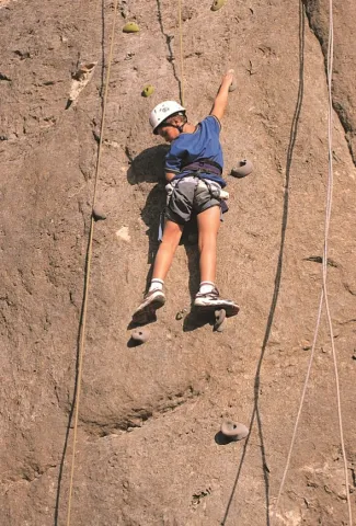
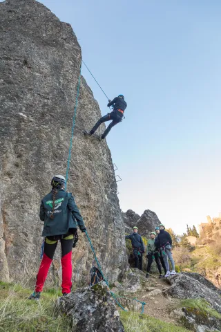
Cerro Golondrina is a rock formation located at the foot of the Sierra Magina Natural Park, a few kilometres from Jódar and Bedmar. It stands out for its vertical plates full of holes, its open environment and its wide views over the environment, making it one of the most unique climbing areas of the region. It is a school of a sports and classic character, with demanding ways both technical and psychological, where a correct reading of the terrain is essential. The rock, of high quality in general, has in some sections sharp and safer edges more distanced on the older routes, which reinforces its character of compromised escalation. Sector Country: The Country Sector is the main sector of Cerro Golondrina. It was equipped in 2012 by Carlos del Campo and has about 20 tracks, mostly of sports climbing, although it also has classic tours. The tracks are developed on vertical hole plates, with technical climbing and maintenance. Due to the length of some routes and the distance between insurance on certain routes, the use of 80-meter rope is recommended for greater safety. Representative routes: Extreme Ubeda (6c +) Sefarad (V +) Knives (6b) Lala (6c) The sector also includes classic routes, such as the main Spolon, with a tour of approximately 100 meters, which provides a more alpine character to the area. Access The access is made by road to Mancha Real, then continued by the A-320. After passing Bedmar, it is linked with the A-401 in the direction of Huelma. At about 500 meters, you can park to the right in a small rest area located next to the entrance to an unobvious track. From the parking lot, the road is crossed and raised directly to the base of the walls, reaching the first tracks in approximately 10 minutes on foot. Orientation and recommended time The main direction of the hill is south-west, although there are sectors with north-west orientation. These features allow you to climb in spring and autumn as the best times, although the area can be practical for much of the year by selecting the tracks and the time.
Breve descripción
Cerro Golondrina is a rock formation located at the foot of the Sierra Magina Natural Park, a few kilometres from Jódar and Bedmar. It stands out for its vertical plates full of holes, its open environment and its wide views over the environment, making it one of the most unique climbing areas of the region.
Latitud
37.8204
Longitud
-3.4502
Distrito
Municipio
Ubicación en el mapa
POINT (-3.4502 37.8204)
imagen
Image
1.jpg
Imagen principal
Activado
imagen
Image
1 (15).png
Imagen principal
Desactivado

Sport

icon-intereses-deporte
Cerro Golondrina
Spring and autumn
Desactivado

Cambil – Mata Bejid – Huelma –Arbuniel (C4)

Submitted by brandcode_deweloper on
Id
RUT-0010
Descripción larga
Circular Itinerary of about 56 km that leaves and returns to Cambil, linking some of the most representative landscapes and nuclei in the western sector of Sierra Magina. It combines comfortable asphalt, sections between olive groves and steps through water and heritage enclaves such as Mata Bejid, Huelma and Arbuniel. A balanced route, designed to enjoy the landscape, villages and recreational areas, with progressive levels and good pedal rhythm. The route begins in Cambil, a serrano municipality with a marked historical character, from where the A-324 is taken towards Huelma. The first kilometers advance between olive lomas and limestone reliefs that announce the saw, with open views and a fluid pedal. Soon the surroundings of Mata Bejid, home and place are very linked to the rural memory of Magina, where the hermitage, the fountain and the silence of the mountain invite a brief pause. The Mata Bejid Visitors' Center and the Peralejo Recreative Area are located very close to the site, which is a real entrance door to the heart of the massif. This section concentrates several values of the territory: well-preserved public mountain, pine trees, oak trees and the connection with larger trails. The tour continues to the area of the Fuensanta, where the hermitage and its natural environment reinforce the cultural and devotional character of the saw, before reaching the Fuente de la Teja, with its old restored washers, one of the most grateful points to stop. The arrival in Huelma provides services and heritage: castle, church and urban parks mark a change of pace before leaving the core for the JA-4204 heading to Arbuniel. The route runs between olive groves and fields of cultivation, following a more open and agricultural landscape until the detour to Arbuniel, where water is once again a protagonist. The birth of the Arbuniel River and its recreational area, with acequias, shadow and constant rumor, offer one of the most fresh and unique enclaves of the entire route. From Arbuniel, the return to Cambil is done by linking local roads and steps under the A-44, with wide views of the mountains that close the valley and a comfortable profile that allows to enjoy the final pedal. The circuit is closed again in Cambil, completing a varied day that sums up well the relationship between water, olive, saw and villages in this sector of Magina. General recommendations Suitable route for road cycling and light gravel. See the weather, especially in summer, and plan stops in Huelma and Arbuniel for avituallation. Attention at the crosses with the A-44 and the N-323a and respect the signage. It has enough water, although you will find sources and recreational areas along the route. Ideal to enjoy without haste, combining pedal and small cultural stops.
Breve descripción
Circular route of about 56 km with start and end in Cambil that ascends through the A-324 towards Mata Bejid and the Visitors Center, continues between olive groves and Mediterranean mountain towards Huelma and Arbuniel, where the birth of the Arbuniel River is visited, and returns back to Cambil after linking with the N-323a and several accesses to the A-44, combining rural roads, landscapes of Magina and small recreational areas.
Latitud
37.6681
Longitud
-3.5742
Distrito
Municipio
Ubicación en el mapa
POINT (-3.5742 37.6681)
imagen
Image
1.jpg
Imagen principal
Activado
imagen
Image
c4_1.png
Imagen principal
Desactivado
imagen
Image
c4_2.png
Imagen principal
Desactivado
imagen
Image
c4_3.png
Imagen principal
Desactivado
imagen
Image
c4_4.png
Imagen principal
Desactivado
imagen
Image
c4_5.png
Imagen principal
Desactivado
imagen
Image
iglesia huelma 2.jpg
Imagen principal
Desactivado

Sport

icon-intereses-deporte
Baja - Media
Cambil – Mata Bejid – Huelma –Arbuniel (C4)
55,7 km
1329m
Activado

Cabra del Santo Cristo · Estación de Huesa · Alicún de Ortega · Estación de Cabra del Santo Cristo (C7)

Submitted by brandcode_deweloper on
Id
RUT-0009
Descripción larga
Circular route of about 63 km that connects Cabra del Santo Cristo with the station of Huesa and Alicún of Ortega, along the eastern sector of Sierra Mágina. The itinerary combines railway heritage, agricultural landscapes and some of the most unique reliefs of the region, such as the badlands and cascades of Alicún. It is an accessible and very contrasting proposal, where the reading of the territory - rail, spartum, olive and erosion - accompanies each section. The route starts in the Municipal Park of Cabra del Santo Cristo and gains height gently to the Mirador de Cabra, the first balcony of the route, from which the transition between the olive countryside and the foothills of Sierra Magina is recognized. From here, the route descends to the Salado stream, rolling in parallel to the railway track, which acts as the driving thread of the landscape. In this sector there are the first contrasts: very eroded white soils, attached rambles and repopulation pines that soften the aridity. Before arriving at the station of Huesa, it is worth the detour to the ravine of the nuns, where an interesting set of houses is preserved - cave linked to the exploitation of the spartum and to the railway history of the late 19th and early 20th century. The station, opened in 1898, is a good place to stop and understand the importance of the train in the articulation of this territory. From Huesa, the route is directed south and south-west, through a more open landscape dominated by olive groves and dehesas. In this section we still see the traces of the 2015 fire in the Peña del Cambrón, now in the process of natural regeneration and repopulation. The relief is gently waved until, as it approaches Alicún de Ortega, the landscape changes radically. The access to Alicún runs between badlands and cascades, one of the most striking geomorphological sets in the province: hillsides surrounded by erosion, deep rambles and abrupt profiles that offer a very different visual experience than that of the serrano olive tree. After reaching the surroundings of Alicún de Ortega, the route turns back to the west, maintaining a comfortable pedal between cultivated and empty lomas where the riverside vegetation reappears. The return reaches the Cabra Station of the Holy Christ, another relevant railway enclave. From here there is the option of a short detour to visit the Milenaria Encine, a unique example for its size and longevity. The last section runs by local road between olive groves, already in a soft profile, until they return to the urban centre of Cabra del Santo Cristo, where the routes C6 and C7 are combined and the circuit is closed. General recommendations Road suitable for road cycling and light gravel, suitable for mixed public with a certain physical base for its mileage. It is necessary to protect from the sun in the open sections and in the Badlands area, where the shadow is scarce. It carries sufficient water between stations and villages, and extreme caution in crosses with local roads and in the railway diversions. Respects fragile environments (cascades, casas- cave) and always stay in the signposted layout.
Breve descripción
Circular route of about 63 km that part of the Municipal Park of Cabra del Santo Cristo, ascends to its viewpoint and descends to the Arroyo del Salado and the station of Huesa, following the old railway corridor. From there it continues between olive groves and regenerated hillsides to the badlands and cascades of Alicún de Ortega, to return by olive looms and rambles attached to the station and back to the urban town of Cabra del Santo Cristo.
Latitud
37.6804
Longitud
-3.3802
Distrito
Ubicación en el mapa
POINT (-3.3802 37.6804)
imagen
Image
1.jpg
Imagen principal
Activado
imagen
Image
c7.jpg
Imagen principal
Desactivado
imagen
Image
c7-1.jpg
Imagen principal
Desactivado
imagen
Image
c7-2.jpg
Imagen principal
Desactivado
imagen
Image
c7-3.jpg
Imagen principal
Desactivado
imagen
Image
c7-4.jpg
Imagen principal
Desactivado

Sport

icon-intereses-deporte
Baja - Media
Cabra del Santo Cristo · Estación de Huesa · Alicún de Ortega · Estación de Cabra del Santo Cristo (C7)
62,5 km
1304m
Activado
Tramo de asfalto o cemento
 
Tramo de pista o camino forestal
 
Tramo de vía pecuaria
 
Tramo de senda
 

Bélmez de la Moraleda – Cabra de Santo Cristo -Solera (C6)

Submitted by brandcode_deweloper on
Id
RUT-0008
Descripción larga
Circular route of about 50 km that runs through the Jandulilla valley from Bélmez de la Moraleda to Cabra del Santo Cristo and Solera, alternating olive slopes, pine trees and limestone reliefs. It is an accessible route, with moderate slopes and comfortable descents, with a firm majority asphalt. It stands out for its clear reading of the territory: valley water, panoramic balconies and a very visible heritage (hermitage, lookout and castle), with the option of looking at the ibera footprint of the Cortijo del Pajarillo. The route begins in Bélmez de la Moraleda, leaving on local roads between olive groves and small loins that soon open their eyes to the saws that close the Jandulilla corridor. In the first kilometers there is the possibility of a (non-compulsory) detour to the castle of Bélmez and the caves of Baltibañas, before continuing to the valley. The itinerary gains character by joining the corridor of the Jandulilla River, where the landscape becomes more serrano: the olive tree is mixed with pinars and limestone florings. After crossing the river, the route begins a progressive rise to Cabra del Santo Cristo, with a change of tone that announces the transition to drier landscapes. In this section stands the Hermitage of the Holy Christ of Burgos, a good point for a short stop, and later the Mirador de Cabra, from which is recognized the southern façade of Sierra Magina and the saws that open to the east. The arrival in Cabra del Santo Cristo allows to regroup and avituallar in an urban environment with services. On the way out, the tour continues on local roads between olive lomas and small hills, with comfortable pedal and good views. On the way there is a detour to the Casa de la Pradera, a useful point for cyclists for their equipment linked to the maintenance and cleaning of bicycles. The stretch towards Solera returns the protagonism to the relief: the pedany is located at the foot of Mount Morron, with the Castle of Solera dominating the landscape as a visual milestone. Very close, a lookout allows to expand the panorama over the valley and the alignment of Magina. From here, the route returns to the Jandulilla corridor and links back to the road back to Belgium. In this sector, the Iberian Sanctuary of the Cortijo del Pajarillo is close, a reminder of the historical depth of the territory (visitable according to access and conditions of the moment). The circuit is closed again in Bélmez de la Moraleda, with a comfortable ending that invites you to finish the day by walking through the city centre. General recommendations A path suitable for mixed audiences with minimal experience in medium exits. See weather and wind, especially in open and looking areas. Attention to links and main road crossings; always in line and with visible elements. It has enough water and takes advantage of stops in Cabra del Santo Cristo and Solera to rest. In sensitive enclaves (caves / archeology), it respects signs and prevents access to unconditioned areas.
Breve descripción
From Bélmez de la Moraleda, this route proposes a route of about 50 km to Cabra del Santo Cristo and Solera, crossing the valley of the Jandulilla between hillsides of olive and pine. The Hermitage of the Holy Christ of Burgos, the Mirador de Cabra, the cyclist support point of the Casa de la Pradera and the castle of Solera on Mount Morron are highlighted. Very close, the Iberian sanctuary of the Cortijo del Pajarillo recalls the strong Iberian tradition of the territory.
Latitud
37.6701
Longitud
-3.3903
Distrito
Ubicación en el mapa
POINT (-3.3903 37.6701)
imagen
Image
1.jpg
Imagen principal
Activado
imagen
Image
c6.jpg
Imagen principal
Desactivado
imagen
Image
c6-1.jpg
Imagen principal
Desactivado
imagen
Image
c6-2.jpg
Imagen principal
Desactivado
imagen
Image
c6-3.jpg
Imagen principal
Desactivado

Sport

icon-intereses-deporte
Baja - Media
Bélmez de la Moraleda – Cabra de Santo Cristo -Solera (C6)
49 km
1153m
Activado

Bedmar – Jódar – Paraje Natural Alto Guadalquivir - Úbeda – Baeza (C8)

Submitted by brandcode_deweloper on
Id
RUT-0007
Descripción larga
A circuit of about 80 km that connects Bedmar with Jódar, Alto Guadalquivir and the Renaissance cities of Ubeda and Baeza, before returning to the starting point. The itinerary combines local roads, agricultural roads and bici lanes, with moderate ascends, a firm majority asphalt and a clear reading of the territory: river valley, olive countryside and historical heritage. It is a varied and very complete proposal, ideal for road cycling and light gravel. The route begins in Bedmar, heading north on the JV-3032 between olive groves, with early views of the Serrezuela de Bedmar and the Sierra Magina summits. The passage through the Lavadero de Bedmar recalls the historic relationship of the municipality with the water before leaving the asphalt to take compact tracks towards Salmerón and the Lavaderos de la Fuente Garciez, a good place to make a first stop. The entrance to Jódar marks the transit to the Guadalquivir valley. After crossing the urban centre, the route is heading east, alternating agricultural roads and road sections to reach the vicinity of the river. The crossing of the Puente de Ubeda la Vieja is one of the main points of the tour: here the Guadalquivir appears as the central axis of the landscape, accompanied by the view of Iltiraka and the ruins of Ubeda la Vieja, which provide a historical dimension to the itinerary. Very close, the detour to the Laguna de la Herradura allows you to discover a small wet area of great environmental value. From the valley, the tour gradually gains height in the direction of Ubeda, crossing the La Loma countryside, an infinite sea of olive groves on soft wavy hills. The arrival in this city, declared World Heritage, invites a longer stop to discover its historic centre and to regain strength. The route continues to Baeza by a bike lane parallel to the A-316, a comfortable and secure stretch that connects two of the most important Renaissance assemblies of Andalusia. After leaving Baeza behind, the tour is back towards the south, crossing the Guadalquivir along the Mazuecos bridge, a masterpiece of Renaissance engineering, and returning to the Bedmar Valley. The final part is between olive groves and small runoff barrels, with the possibility of a brief detour to the Cerro de Fique to enjoy a wider view of the Serrezuela and the mountain alignations of Sierra Magina. The return to Bedmar ends a long but balanced route, in which river landscape, countryside and urban heritage occur in a harmonious way. General recommendations Road and gravel bike-suitable route, with considerable mileage that requires good schedule planning and avitualations (Jódar, Ubeda and Baeza are key points for this). In summer it is recommended to avoid the central hours of the day due to the shortage of shade in the countryside. Pay attention to the crossings with communal roads and always respect the signposted route, especially in the river and agricultural areas.
Breve descripción
The Itinerary of almost 80 km that links the Guadalquivir valley with the plains of La Loma, connecting Jódar, Ubeda and Baeza on local roads and bike lanes. The tour crosses the Puente de Ubeda la Vieja, looks at the Mirador de Itiraka, offers the detour to the Laguna de la Herradura and ascends to the Renaissance cities of Ubeda and Baeza before returning to the Puente de Mazuecos and the Cerro de Fique.
Latitud
37.8244
Longitud
-3.3956
Distrito
Municipio
Ubicación en el mapa
POINT (-3.3956 37.8244)
imagen
Image
1.jpg
Imagen principal
Activado
imagen
Image
c8.jpg
Imagen principal
Desactivado
imagen
Image
c8-1.jpg
Imagen principal
Desactivado
imagen
Image
c8-2.jpg
Imagen principal
Desactivado
imagen
Image
c8-3.jpg
Imagen principal
Desactivado
imagen
Image
c8-4.jpg
Imagen principal
Desactivado
imagen
Image
c8-5.jpg
Imagen principal
Desactivado

Sport

icon-intereses-deporte
Baja - Media
Bedmar – Jódar – Paraje Natural Alto Guadalquivir - Úbeda – Baeza (C8)
86,7 km
1363m
Activado
Tramo de asfalto o cemento
 
Tramo de pista o camino forestal
 
Tramo de vía pecuaria
 
Tramo de senda
 

Cerrada del Utrero and Cascada de Linarejos

Submitted by brandcode_deweloper on
Id
930180
Descripción larga

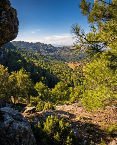
The Guadalquivir made this canyon narrow and deep, leaving some streams - like that of Linarej- hanging on the heights. When this stream is at the throat it forms the spectacular Cascade of Linarejos, which after standing in some pozas joins the Guadalquivir to descend to the valley.

The path is 1.6 km and on its circular route it surrounds the "Peñón del Lanchón" to return to the road in a pleasant walk of about 45 minutes.

In the final part of the road - just before returning to the asphalt - you reach a pine-resinero or black forest (Pinus pinaster) that was used to obtain the resin with which the water used to be made. In these trees you will see the furrows that the resineros opened to allow the exit of this sap.

We suggest:

  • Observe the numerous rupicular birds that nest on the rocky wall in front of our path, as we pass the waterfall of Linarejos. You will see small species, such as the victor, the lone rocher or the white lavender, sharing space with much larger ones like the leonate vulture.
  • Get to know the small town of Vadillo-Castril, where the old Rife sawmill was and today it is the home of two agencies of great importance for the Natural Park: the School of Forest Capataces and the Forest Defense Center.
Breve descripción

The site known as Cerrada del Utroo-Linarejos is an amazing natural work sculpted by the Guadalquivir in the limestone that surrounds it. The path is on foot, and it will allow you to appreciate the sharp rocks and objades created by water over hundreds of thousands of years. It is a charming walk where the labiérnago, the cornicabra, and the willow accompany you to one of the most photographed places in the Park: the "horse tail" or Cascada de Linarejos.

Latitud
37.9054
Longitud
-2.9553
Municipio
Ubicación en el mapa
POINT (-2.9553 37.9054)
imagen
Image
cascada_de_linarejos_g.jpg
Imagen principal
Activado
imagen
Image
arroyo-de-linarejos-jpg
Imagen principal
Desactivado

Family

icon-intereses-familia

Friends

icon-intereses-amigos

Nature

icon-intereses-naturaleza

Adventure

icon-intereses-aventura

Solo travel

icon-intereses-viajar-solo

Culture

icon-intereses-cultura

Gastronomy

icon-intereses-gastronomia

Sport

icon-intereses-deporte

Municipality

icon-intereses-municipio

Low-cost tourism

icon-intereses-turismo-low-cost

Eco-friendly

icon-intereses-eco-friendly

For couples

icon-intereses-en-pareja
Cerrada del Utrero y Cascada de Linarejos
Desactivado

El Aguardentero

Submitted by brandcode_deweloper on
Id
929850
Descripción larga

We deviate from the road, in order to see, upstream, a spectacular leap of water, with a large poza in its base, whose waters look an emerald green by the reflection of the lush vegetation surrounding it. Let us take our way back, to reach a small hill, with a very particular silhouette. It is the Paso del Aguartedo, place of impressive views towards the countryside.

The path is conditioned and low, with a serpentating route, on a steep and rocky slope. On our left we found a striking oquity - an ashtray - where the shepherds used to keep their cattle. Below we reach a small lookout, where the path is fork. We follow the one on the right, until we get back to the channel to contemplate the majestic cascade of the Osera, perhaps one of the highest and beautiful waterfalls of Andalusia.

We continue along the path marked, by the narrow and steep ravine, enjoying the multiple pozas of the channel, to a walkway that crosses the river and back the path to the Odera lookout. If at this point we continue along the road that goes parallel to the channel, we will reach the explanade of La Osera, place where the vehicles are left when it is accessed from Mogón.

For these wonderful places it is very easy to observe the flight of the leonate vulture. The real eagle is also present and, if we look well, we can even see the little perdicular eagle.

We suggest:

  • In a place like this, where water is the protagonist, spring is, of course, the most splendid season.
  • The path can also be done in the ascending sense, starting from Mogon.

The most recommended option is to make the path down. From the reservoir of Aguascebas, the walk is 4.5 km, from the km 18.8 of the road JH-7155 (Transversal de las Villas). At this point, to our left are the houses of the reservoir and, right behind it, we can observe an old quarry, where the path starts.

Breve descripción

This path will allow you to discover one of the most charming environments in the Las Villas mountains. It runs along the natural channel of the river Aguascebas Chico, where we will discover unusual and unexpected corners. Following him, on our right, we found fenced land of ancient crops and a small cortijo half-melting. This place is known as "Las Ramblillas." In the deep valley you can see the river Aguascebas Chico.

Latitud
38.1901
Longitud
-2.6903
Municipio
Ubicación en el mapa
POINT (-2.6903 38.1901)
imagen
Image
aguardentero.jpg
Imagen principal
Activado
imagen
Image
El%20Aguardentero.png
Imagen principal
Desactivado
imagen
Image
15483593Master.jpg
Imagen principal
Desactivado

Nature

icon-intereses-naturaleza

Friends

icon-intereses-amigos

Adventure

icon-intereses-aventura

Culture

icon-intereses-cultura

Sport

icon-intereses-deporte

Eco-friendly

icon-intereses-eco-friendly

For couples

icon-intereses-en-pareja

Family

icon-intereses-familia

Gastronomy

icon-intereses-gastronomia

Municipality

icon-intereses-municipio

Low-cost tourism

icon-intereses-turismo-low-cost

Solo travel

icon-intereses-viajar-solo
Baja
El Aguardentero
Desactivado
Tramo de asfalto o cemento
 
Tramo de pista o camino forestal
 
Tramo de vía pecuaria
 
Tramo de senda