Saltar al contenido principal

Observación Astronomómica Privada

Submitted by brandcode_deweloper on
Id
329162
Descripción larga

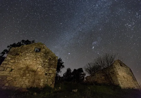
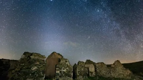
You can enjoy a rich dinner in a great accommodation, and end the night by admiring the wonderful night sky of the largest Starlight Reserve on the planet by the hand of astronomy experts and through large telescopes... These are some of the attractions of this very special getaway.

INCLUDE

  • Dinner at the selected accommodation.
  • Hotel night with breakfast.
  • Transfer from the hotel to the observation point.
  • Private and exclusive astronomical observation.
  • Assistance of a specialist monitor during observation.
  • Use of a high-end astronomical telescope.
  • Session of astronomical photographs of memory.
  • Cup of wine or cava and I tentpedo.

NOT INCLUDED

  • Transfer to the selected accommodation.
  • Lunch.
  • Any expenditure or concept not referred to in the "Includes" section.
  • Transfer to the Viñas de Peñallana Visitors Center and tasting of local and artisanal products of Sierra Morena (see follow-up to the trip at the last step of the reservation).

Itinerary

DAY 1

12: 00 h. - Arrival to the selected accommodation.

- Free lunch.

17: 00 h. - Free visit to the Virgin of the Head Sanctuary and the natural environment.

- Dinner at the accommodation.

21: 30 h. - 4 × 4 to the observation point.

22: 00 h. - Private and exclusive astronomical observation:

  • Introduce talk to astronomy.
  • Workshop of star recognition and constellations.
  • Astronomical observation with high-end telescopes.
  • Session astronomical photography of memory.
  • toast under the stars (light snack and copy of wine or cava)

02: 00 h. - End of observation. Transfer to the hotel. (Approximate time)

DAY 2

10: 30.

12: 00. - End of our services.

* Optional complement:Degustation of local and artisanal products from Sierra Morena at the Viñas de Peñallana Visitors Center.

    INFORMATION FROM THE DRAWAL

    The town of Andújar is located at the foot of Sierra Morena, constituting the entrance door by anthonomasia to the Natural Park of its same name. Because Andújar is a saw, Andújar is the Guadalquivir river that bathes it and divides it between the oaks and pedestals to the north and the sodomy countryside to the south.

    Andújar is a monumental city, rich in heritage and emblem of a typical architecture that demonstrates a high past. A 13 Km from Andújar is the Viñas de Peñallana Visitors Center, an ideal place to inform you about the visit to the Natural Space and to know the main values of it. Following the road, we enter the Sierra de Andújar Natural Park until we reach the Sanctuary of the Virgin of the Head next to which is the accommodation. It is a great rock sanctuary located in the heart of Sierra Morena, where much of the Sierra is seen from its privileged location. It is a place of pilgrimage famous for its rosemary and its great cultural and ethnographic value.

    The Natural Park of the Sierra de Andújar is a special place, a wild and infinite place, where the loins and valleys covered with oak trees extend to where the view reaches. Eagles, vultures, deer and a multitude of other species live in these areas, being the undisputed lord of these vast lands the Iberian Lince, for here it cherishes its most extensive population.

    Breve descripción

    Visit the emblematic Sanctuary of the Virgin of the Head, walk beautiful trails and recreate among the dehesas of the Sierra de Andújar Nature Park.
    Latitud
    38.183252
    Longitud
    -4.349458
    Ubicación en el mapa
    POINT (-4.349458 38.183252)
    imagen
    Image
    observacion-privada.jpg
    Imagen principal
    Activado
    imagen
    Image
    observacion%20astronomica.jpg
    Imagen principal
    Desactivado

    Nature

    icon-intereses-naturaleza

    Observación Astronómica Privada

    Desactivado

    - The prices expressed are final, including I.V.A.

    - The programmes indicated are permanent throughout the year, although depending on the station, they may include activities complementary to those detailed as optional or recommended, with the aim of making the stay on the Route of the Castles and the Battle of Jaén as attractive and varied as possible within authenticity.

    - The hours may be adjusted according to the host of the service.

    - Except those expressly indicated, proposals do not require a minimum number of persons.

    - It is recommended to consult availability and prices according to dates, days of stay and number of passengers.

    - The accommodation is mostly three-star hotels.

    - Depending on availability, the accommodation may vary to a similar or higher category.

    - Foreign visitors will be able to have an English-speaking guide, from their arrival at the destination. Service with supplement.

    - If necessary, transfer service is available with collection from the airport of Granada-Jaén Federico García Lorca. Service with supplement.

    - Consult prices, conditions and availability for special dates, individual supplement, children's discounts and cot service, Internet connection,...

    Coordenadas / Huso 30S
    30S x = 381814 and = 4227008
    Tramo de asfalto o cemento
     
    Tramo de pista o camino forestal
     
    Tramo de vía pecuaria
     
    Tramo de senda
     

    GR-247 "Bosques del Sur"

    Submitted by brandcode_deweloper on
    Id
    2980378
    Descripción larga

    The largest hiking route in Spain's largest natural space. The Southern Forest trail offers 478 kilometres marked, along 21 main stages and 11 derivations. In addition, it has 3 variants, composed of two sections each, that help subdivide the layout, and make a version adapted to our interests and time available. Its journey leads to the births of the rivers Guadalquivir and Segura, entering us by the mosaic of landscapes of this mountain: high mountain peaks, castles, forests, rivers and waterfalls, traditional roads, altiplanicies, villages and villages still inhabited, historical sets, olive groves, gardens. A great way to discover the flight of the broken bones, the cleanest waters, the conversation with the transhuman pastors, the way to live in the mountain villages..., a collection of experiences and the authenticity of the most extensive saws of Andalusia. Most of the stages begin and end in places close to basic services: sources, villages or villages, campsites and other accommodation, camping areas or near roads. Other sections have only emergency shelters without services, built to provide these areas of the GR. Some stages go through very remote places, without telephone coverage, often subject to high mountain conditions that can leave us isolated (snow, wind, and low-zero temperatures in winter, or lack of water and permanent insolation in summer), so we should be informed about the conditions before we start the route; in addition to having enough to awaken. We will never leave the route, we will always follow the rules of use of the GR and the shelters, as well as the instructions of the natural park staff. It respects all the rules of protected space as you walk the path and use its equipment.

    Breve descripción

    The first stage of the path of a large route Southern Forests begins in the recreational area of Peña del Olivar, located in the Natural Park Sierras de Cazorla, Segura and Las Villas. This area is accessed through the town of Siles, taking the road A-310, in the direction of Las Acebeas; after going about two kilometres we will meet the Peña del Olivar. It is one of the best-equipped public-use equipment of the park with tables, fountain, children's games, bar, terrace, etc., and in summer even with an exceptional natural bathroom area.

    Latitud
    38.388517
    Longitud
    -2.581781
    Distrito
    Municipio
    Ubicación en el mapa
    POINT (-2.581781 38.388517)
    imagen
    Image
    N_ID_34.jpg
    Imagen principal
    Activado
    imagen
    Image
    GR247%20Bosques%20del%20Sur.jpg
    Imagen principal
    Desactivado

    Nature

    icon-intereses-naturaleza

    Friends

    icon-intereses-amigos

    Adventure

    icon-intereses-aventura

    Culture

    icon-intereses-cultura

    Sport

    icon-intereses-deporte

    Eco-friendly

    icon-intereses-eco-friendly

    For couples

    icon-intereses-en-pareja

    Family

    icon-intereses-familia

    Gastronomy

    icon-intereses-gastronomia

    Municipality

    icon-intereses-municipio

    Low-cost tourism

    icon-intereses-turismo-low-cost

    Solo travel

    icon-intereses-viajar-solo
    GR-247 "Bosques del Sur"
    Activado
    Coordenadas / Huso 30S
    30S x = 536524 and = 4249006

    Route Antigua estación FFCC de Jódar

    Submitted by brandcode_deweloper on
    Id
    2854331
    Descripción larga

    About 6 km away is Jódar, the largest town in Sierra Mágina. We'll be on the A-401 road. Jódar stands out for the offer of services, and for the castle that hosts one of the two Visitors' Centers of the natural park of Sierra Magina.

    Our tour runs along the eastern side of Sierra Magina. Little by little and for 18 km the landscape of olive trees on a subdesert mountain.

    To the right we will find the detour to Bélmez de la Moraleda. The waters of the Garganton River assigns to the green landscape and the presence of gardens. The main attraction of the town is the famous faces of Belgium, a curious phenomenon that attracts its own and strangers to this small town.

    On the A-401, our walk will continue for 12 km towards Huelma. Almost at the end of the tour we find the pedany of Cabritas, a scattered rural habitat that hides dozens of ancient mills and gardens that for centuries, and from the Middle Ages made this place a vergel of fruit and vegetables.

    Attention to the detour in the A-324, which in only three km leads us to the centre of Huelma, a town that offers us restoration services, and two jewels of the Andalusian Renaissance, the Church of the Immaculate Conception, the work of Andrés de Vandelvira, and the castle that watches the village from above.

    Breve descripción

    It is the route that links the Loma de Ubeda and the Guadalquivir River with the core of Sierra Magina.

    The railway station of Jódar, is adjacent to the municipal term of Ubeda. In this station, in disuse, millions of tons of wood that came floating through the Guadalquivir from the Serras of Cazorla and Segura were embarked at another time. Similarly the spatter production of Jódar and Cabra of Saint Christ also used these railway docks to begin their long journey.

    Latitud
    37.913346
    Longitud
    -3.348917
    Distrito
    Municipio
    Ubicación en el mapa
    POINT (-3.348917 37.913346)
    imagen
    Image
    9961866Master.jpg
    Imagen principal
    Activado
    imagen
    Image
    PARQUE_NATURAL_CAZORLA%2C_SEGURA%2C_LAS_VILLAS._SIERRA_DE_SEGURA.jpg
    Imagen principal
    Desactivado
    imagen
    Image
    R45.jpg
    Imagen principal
    Desactivado

    Nature

    icon-intereses-naturaleza

    Friends

    icon-intereses-amigos

    Adventure

    icon-intereses-aventura

    Culture

    icon-intereses-cultura

    Sport

    icon-intereses-deporte

    Eco-friendly

    icon-intereses-eco-friendly

    For couples

    icon-intereses-en-pareja

    Family

    icon-intereses-familia

    Gastronomy

    icon-intereses-gastronomia

    Municipality

    icon-intereses-municipio

    Low-cost tourism

    icon-intereses-turismo-low-cost

    Solo travel

    icon-intereses-viajar-solo
    Ruta Antigua estación FFCC de Jódar
    All year round
    Desactivado

    50 minutes (excluding stops).

    Coordenadas / Huso 30S
    30S x = 469330 and = 4196258
    Tramo de asfalto o cemento
     
    Tramo de pista o camino forestal
     
    Tramo de vía pecuaria
     
    Tramo de senda
     

    Route cicloturista de Andújar a Baños de la Encina

    Submitted by brandcode_deweloper on
    Id
    2641192
    Descripción larga

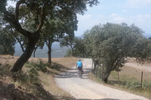
    We left Andujar in the direction of the Peñallana vineyards through the Ctra. J-501. In the km. About 14,400, after passing the Los Pinos Restaurant, we take a road that comes out to the right; we go into it we will get to Los Escoriales, leave to our left a dish of bulls or tentadero and, at about 100 m., we will get a track to the right that we will take; here we can observe an interesting darkness occupied preferably by alcornocals, at some points as a mature or climate community on a sediment-type substrate. When we begin to descend, we will leave to our right the Cerro del Moro, an elevation that maintains a well-developed shroud, we will pass through the house of the Gorgojil and the Nava de Andújar, dehesa ganadera and place of transit that allows to observe the typical topographic relief of Sierra Morena and the crops of the geological domain of Guadalquivir, coming to the reservoir of the Rumblar, a sheet of water perfectly attached to the steep relief and, from here, to Baños de la Encina, one of the four municipalities that make up the Natural Park of Sierra de Andújar, the whole of the city of the town of the city of the city of the city of the city of the city of the city of the town of the city of the city of the city of the town of the city of the city of the town of the city of the city of the town of the city of the city of the city of the city of the town of the town of the town of the town of the town of the town of the town of the town of the town of the town of the town of the town of the town of the town of the town of

    Breve descripción

    Unbeatable views of the local castle. First Km by road and soft profile.

    Stage without any complication.

    Latitud
    38.17381
    Longitud
    -3.844715
    Distrito
    Municipio
    Ubicación en el mapa
    POINT (-3.844715 38.17381)
    imagen
    Image
    16811388.jpg
    Imagen principal
    Activado
    imagen
    Image
    Ruta%20cicloturista%20de%20And%C3%BAjar%20a%20Ba%C3%B1os%20de%20la%20Encina.jpg
    Imagen principal
    Desactivado

    Nature

    icon-intereses-naturaleza

    Friends

    icon-intereses-amigos

    Adventure

    icon-intereses-aventura

    Culture

    icon-intereses-cultura

    Sport

    icon-intereses-deporte

    Eco-friendly

    icon-intereses-eco-friendly

    For couples

    icon-intereses-en-pareja

    Family

    icon-intereses-familia

    Gastronomy

    icon-intereses-gastronomia

    Municipality

    icon-intereses-municipio

    Low-cost tourism

    icon-intereses-turismo-low-cost

    Solo travel

    icon-intereses-viajar-solo
    Ruta cicloturista de Andújar a Baños de la Encina
    In Bicycle, Horse, on foot
    All year round
    Desactivado
    Coordenadas / Huso 30S
    30S x = 426011 and = 4225437
    Tramo de asfalto o cemento
     
    Tramo de pista o camino forestal
     
    Tramo de vía pecuaria
     
    Tramo de senda
     

    Mancha Real - Summit of Almadén - Torres

    Submitted by brandcode_deweloper on
    Id
    2638904
    Descripción larga

    The tour begins in Mancha Real and ends in the neighboring town of Torres; therefore a route that makes it easier to leave a car in each village to organize the return after the route. If you are going to complete the tour you will need water, some food to replenish strength and a coat for the high mountain area. In Mancha Real you will only have to ask about the rise to the Almadén peak or the TV repeater - the summit is located a set of telephone and telecommunications antennas. Any neighbor will know you have to go south of the village, next to the Pila Fountain and the municipal pool. There, and on permanent rise by repopulation pineers, the lane rises from the repeater by which you will pedal for 10 km of climb next to the Sierra de la Peña del Eagle. The ascent will take you from the 850 m from Mancha Real to the plains of Bercho and Peña Blanca at 1,400 m. on the Jiennense countryside, where the landscape of mountain plains is appreciated, an area that was described in the Middle Ages, in the Chronicle of the Constable and the Book of the Alphony X Mountain, as... "an important place of major hunting, rich in boars, wolves, deer, bears and a closed vegetation." Two kilometers of plain and we are on the detour for the big climb, the step towards the high mountain: the Almadén summit pedaling by track. It's six and a half miles of ramps and sweat, but the effort is worth it. The summit, if the day is clear, is a privileged viewpoint in Andalusia. To the north is the entire great depression of Guadalquivir, closed by the horizon of Sierra Morena. The east shows you the other peaks of more than 2,000 meters from the Sierra Magina massif. To the south you will see the Sierra Nevada Natural Park horizon in Granada. The drop of the same 6.5 Km. (watch out for curves and speed!) leads us back to the previous crossing. From here a new stretch of 4 Km. by cherry plantations accompanies us to Navaparís, one of the most cuddly sources in the area. 2.5 kilometers more and you are on the local road - asphalt - that will take you in permanent descent (another 2.5 km more) between orchards, cherry fields and small cords to the Torres River, and the town of the same name.

    Breve descripción

    For mountain bike lovers in pure state. Large levels, long ascends, roads of changing floors, with several hours of pedal and with little water. The first ten kilometres are outside the Sierra Magina Natural Park. The rest of the journey goes through the protected natural space.

    Latitud
    37.7856
    Longitud
    -3.6156
    Distrito
    Municipio
    Ubicación en el mapa
    POINT (-3.6156 37.7856)
    imagen
    Image
    cycling-1527260_1280.jpg
    Imagen principal
    Activado
    imagen
    Image
    8613_0py6f5ox1mdut7an.jpg
    Imagen principal
    Desactivado
    imagen
    Image
    40143113.jpg
    Imagen principal
    Desactivado
    imagen
    Image
    Campos_de_cerezos_y_Torres_al_fondo.jpg
    Imagen principal
    Desactivado

    Nature

    icon-intereses-naturaleza

    Friends

    icon-intereses-amigos

    Adventure

    icon-intereses-aventura

    Culture

    icon-intereses-cultura

    Sport

    icon-intereses-deporte

    Eco-friendly

    icon-intereses-eco-friendly

    For couples

    icon-intereses-en-pareja

    Family

    icon-intereses-familia

    Gastronomy

    icon-intereses-gastronomia

    Municipality

    icon-intereses-municipio

    Low-cost tourism

    icon-intereses-turismo-low-cost

    Solo travel

    icon-intereses-viajar-solo
    Mancha Real - Cumbre de Almadén - Torres
    Desactivado

    34 km of lanes and mountain slopes, in addition to the end by a local road paved with occasional traffic.

    Tramo de asfalto o cemento
     
    Tramo de pista o camino forestal
     
    Tramo de vía pecuaria
     
    Tramo de senda
     

    Route Cabra del Santo Cristo

    Submitted by brandcode_deweloper on
    Id
    2638783
    Descripción larga

    If you prefer to save your promotion to Cabra, you can start your pedal in this town, but the beginning and end of the route will be very disconnected.

    From here there are almost 20 km of solitary plains (including the detour and the visit to the Cabra Station), along the secondary road of the altiplano. The tour is very quiet because of the few slopes - except some ramps - and because of the near absence of road traffic. The road has a sufficiently cyclable floor, passing through repopulation pines, olive groves and high cerealist fields. The area consists of a succession of rural areas, with large panoramic to the south, with the permanent image of the summits of the Sierra Nevada Natural Park (province of Granada). To the north the summits of the Natural Park of Sierra Magina rise.

    The last stretch is a continuous descent from the pedanean town of Solera to the valley of the Jandulilla River. Solera is a small town with a tiny old town set up around the ruins of a rocky castle that was watching the medieval border. This 15 km stretch ends in Huelma, where you can eat in one of its restaurants, and visit the Vandelvirian Church and its castle, both monuments of the Andalusian Renaissance.

    Breve descripción

    Unpublished route, near the Natural Park of Sierra Magina. The tour is divided into three sections: The first kilometers - just over 10 - represent a rise from the valley of the Jandulilla River to the high plane of Cabra of Holy Christ. This stretch stands out for the subdesert landscapes, a little known beauty of unique shapes and colors. From here there are still 7 Km. without slope to the town of Cabra of Holy Christ. In this town, one of the historic places of the espartera industry in southern Spain, you must visit its interesting church or eat at Casa Herminia restaurant.

    Latitud
    37.727883
    Longitud
    -3.377833
    Distrito
    Ubicación en el mapa
    POINT (-3.377833 37.727883)
    imagen
    Image
    31692175.jpg
    Imagen principal
    Activado
    imagen
    Image
    Ruta%20Cabra%20del%20Santo%20Cristo.JPG
    Imagen principal
    Desactivado

    Nature

    icon-intereses-naturaleza

    Friends

    icon-intereses-amigos

    Adventure

    icon-intereses-aventura

    Culture

    icon-intereses-cultura

    Sport

    icon-intereses-deporte

    Eco-friendly

    icon-intereses-eco-friendly

    For couples

    icon-intereses-en-pareja

    Family

    icon-intereses-familia

    Gastronomy

    icon-intereses-gastronomia

    Municipality

    icon-intereses-municipio

    Low-cost tourism

    icon-intereses-turismo-low-cost

    Solo travel

    icon-intereses-viajar-solo
    Ruta Cabra del Santo Cristo
    All year round
    Desactivado

    53 km of asphalt roads with occasional traffic.

    Coordenadas / Huso 30S
    30S x = 466705 and = 4175691

    Peñas de Castro and Monte del Canjorro

    Submitted by brandcode_deweloper on
    Id
    2619220
    Descripción larga

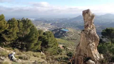
    A hundred meters past the restaurant we take a lane to the left that after passing by a house leads us to the lordory Casería del Portichuelo, located just at the foot of the hill that make up the two rocks that form the picturesque rocky set. We go up through the olive grove to the hill (840 meters) from which we see the other side of the rocks towards the payment of Pedro Coes and the valley that forms the Jaén River.

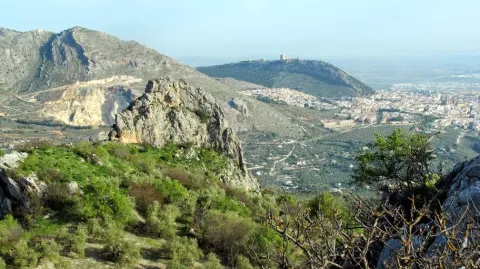
    If we want to try to ascend to the pointed major summit of the Peñas, we will look on the hill for a sidewalk that we will take to the left towards the north rock. The sidewalk passes over the pine tree that falls between the two rocks and borders the rocky wall. In this area there are a lot of climbing pathways and in a fracture on the wall a cave (Secret Cave) in which there are anthropomorphic rock paintings (some up to 65 cm). After crossing an area of mountain and crossing a wire of cattle, it flows into a small, straight meadow surrounded by pine and olive trees. To the right of that meadow, semi-hidden between the weeds, it begins to climb towards the ridge. From here the ascension begins that becomes quite difficult, as the line of crest is very pending and we will find ourselves with complicated swamps. We will have to be careful with the rocky abyss that are forming on our right: in about twenty minutes we will be at the top of this unique mountain. There are remains of an Arab turret in it. Here we will enjoy one of the best panoramic views of the region of Jaén, as we are right in the geographical center of it, in a pettic atalaya 945 meters high and without any obstacle to the view.

    From the hill we have another less risky option: to go down to the other side by reference to the ruins of a medieval turret, a little further down to the cortijo of Pedro el Cruel. After a mile we will be in the cortijo, behind which a path that leads us in twenty minutes to Mount Canjorro, the final foothold of the Peñas de Castro. It is an interesting climbing area, with abundant caves, from which you can see the setting of the river from above and the valley of Los Villares.

    Breve descripción

    The approach will always be by vehicle, from the city of Jaén. There are two options. For its eastern part, taking the road to the Sierra Bridge, in the Km 2.5 three hundred meters after the restaurant Casería de Cristóbal, take a particular road (Pedro Coes lane) with strong slope to the right that borders the Peñas, taking a track to the right paved cement that reaches its base. On the western side, from the Villares road to the Portichuelo (Km 4). This latter possibility will allow us a more comfortable ascent to the rocks, as we must overcome less height. We can leave the vehicle next to the El Mirador Restaurant, shortly before arriving at the port.

    Latitud
    37.9143
    Longitud
    -3.0072
    Distrito
    Municipio
    Ubicación en el mapa
    POINT (-3.0072 37.9143)
    imagen
    Image
    3914419.jpg
    Imagen principal
    Activado
    imagen
    Image
    Pe%C3%B1as%20de%20Castro%20y%20Monte%20del%20Canjorro.jpg
    Imagen principal
    Desactivado

    Nature

    icon-intereses-naturaleza

    Friends

    icon-intereses-amigos

    Adventure

    icon-intereses-aventura

    Culture

    icon-intereses-cultura

    Sport

    icon-intereses-deporte

    Eco-friendly

    icon-intereses-eco-friendly

    For couples

    icon-intereses-en-pareja

    Family

    icon-intereses-familia

    Gastronomy

    icon-intereses-gastronomia

    Municipality

    icon-intereses-municipio

    Low-cost tourism

    icon-intereses-turismo-low-cost

    Solo travel

    icon-intereses-viajar-solo
    Peñas de Castro y Monte del Canjorro
    Desactivado

    Approximate distance: 8 Km (one-way only)
    Difficulty: Low. High on the ascent to the Peña.

    Tramo de asfalto o cemento
     
    Tramo de pista o camino forestal
     
    Tramo de vía pecuaria
     
    Tramo de senda
     

    Monte Jabalcuz

    Submitted by brandcode_deweloper on
    Id
    2619117
    Descripción larga

    After crossing this new neighborhood, before reaching the Arroyo Riocococrotico, a kilometer beyond the urbanization (by the old road, in what was the direction towards Jaén) a track (very steep in its first meters) appears to the left of the road that we will have to take to start the ascent to Mount Jabalcuz. A little more than a mile from its beginning we will find a barrier that prevents the passage of motor vehicles. From there the road ascends with a soft slope on the north side of the mountain between small trees of young pine trees. At half a mountain slope the track is headed towards its western end, towards the Air Port (1331 m) between Jabalcuz and the Devil's Crest, a sharp limestone that contrasts with the rounding of the mountain we are going to climb. The track up to the port continues to the opposite side towards Torredelfield. We will take the left turn to the summit.

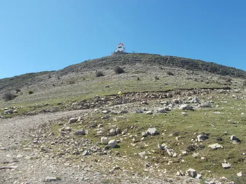
    From the Port of Air the pines are finished, a bioclimatic floor with high mountain plant cover is reached. We will continue our march towards the top, from which we are still separated three and a half kilometres. The road ends 100 meters from the summit (1614 m) where there is a fire guard house. From this privileged viewpoint, the village of Los Villares, the Betic Cordilleras with Sierra Nevada are seen to the south and to the North Jaén and the Guadalquivir Valley, full of villages, as a backdrop of Sierra Morena. The descent we will do on the same path we have brought. Arriving at the Air Port, you could choose to descend to the Torredelfield side, to a track of similar characteristics, also with restricted motor traffic. This option is more long, unless a vehicle was previously approached to the access barrier. In the event of choosing this route, the connection with the Green Way of Oil is recommended, either by all-terrain bike or on foot.

    Breve descripción

    The approach can be done by vehicle from Jaén. We take to the south of the city the road of Los Villares and just leave the town centre we find a detour of access to the Fuente de la Peña. It is a spring that supplies some castors and former public lavatories. Two or three kilometers further we find a detour to the right that leads us to an urbanization built around the old Jabalcuz Spa, very busy during the first quarter of the last century, but currently in a state of ruin and waiting for a next rehabilitation. Within the spa there is a source of calcium sulfated water that arises at about 30 degrees of temperature.

    Latitud
    37.6804
    Longitud
    -3.7802
    Distrito
    Municipio
    Ubicación en el mapa
    POINT (-3.7802 37.6804)
    imagen
    Image
    Jabalcuz_-_anpalacios.jpg
    Imagen principal
    Activado
    imagen
    Image
    Monte%20Jabalcuz1.jpg
    Imagen principal
    Desactivado

    Nature

    icon-intereses-naturaleza

    Friends

    icon-intereses-amigos

    Adventure

    icon-intereses-aventura

    Culture

    icon-intereses-cultura

    Sport

    icon-intereses-deporte

    Eco-friendly

    icon-intereses-eco-friendly

    For couples

    icon-intereses-en-pareja

    Family

    icon-intereses-familia

    Gastronomy

    icon-intereses-gastronomia

    Municipality

    icon-intereses-municipio

    Low-cost tourism

    icon-intereses-turismo-low-cost

    Solo travel

    icon-intereses-viajar-solo
    Monte Jabalcuz
    Desactivado

    Approximate distance: 10 km (one-way).
    Difficulty: Low.

    Cañada de las Hazadillas-Cruz de la Chimba

    Submitted by brandcode_deweloper on
    Id
    2615165
    Descripción larga

    We take the track that leaves next to the Hall of Nature in the direction of Llanos de Palomares; about 1 Km we will find a crossing where an indicator tablet points a 4x4 route to the village of Cárchel. We take the right track cut by a chain, ignoring a right turn, also cut. We follow it for 1.5 Km until we reach the plateau where the port of the Cross of Chimba is located, through the Llanos de Navalopos, some curious depressions possibly of glacial origin. Just as the track becomes a street, we abandon it and turn to our left we seek a shelter that is located at the end of the plateau at 1154 m next to the steep slope that falls to the Quebrajano Valley.

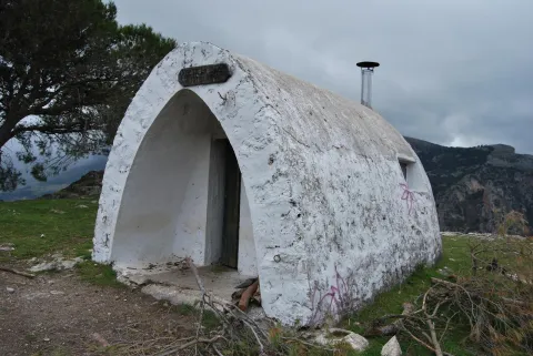
    A great deal of caution if you take this walk with children, since the landings in the shelter are gigantic. From there we have magnificent panoramic views of the Pandera and the whole valley with the city of Jaén in the background. We return to the sidewalk and after passing by the portillo of the Madroñales it descends to the fountain of the Cañada de las Hazadillas.

    Breve descripción

    Vehicle approach from Jaén: by the Quebrajano road to the Hazadillas Canyon. One of the paths to know in depth the Parque Periurbano Monte de la Sierra.

    Latitud
    37.6204
    Longitud
    -3.8202
    Distrito
    Municipio
    Ubicación en el mapa
    POINT (-3.8202 37.6204)
    imagen
    Image
    4605310Master.jpg
    Imagen principal
    Activado
    imagen
    Image
    Ca%C3%B1ada%20de%20las%20Hazadillas-Cruz%20de%20la%20Chimba.jpg
    Imagen principal
    Desactivado

    Nature

    icon-intereses-naturaleza

    Friends

    icon-intereses-amigos

    Adventure

    icon-intereses-aventura

    Culture

    icon-intereses-cultura

    Sport

    icon-intereses-deporte

    Eco-friendly

    icon-intereses-eco-friendly

    For couples

    icon-intereses-en-pareja

    Family

    icon-intereses-familia

    Gastronomy

    icon-intereses-gastronomia

    Municipality

    icon-intereses-municipio

    Low-cost tourism

    icon-intereses-turismo-low-cost

    Solo travel

    icon-intereses-viajar-solo
    Cañada de las Hazadillas-Cruz de la Chimba
    Desactivado
    Tramo de asfalto o cemento
     
    Tramo de pista o camino forestal
     
    Tramo de vía pecuaria
     
    Tramo de senda
     

    Cortados de La Veleta

    Submitted by brandcode_deweloper on
    Id
    2599161
    Descripción larga

    Some tractor rounds arise to the right and left and are introduced into the agricultural farms, but the lane offers no doubt. The olive trees cover almost the entire slope and will accompany us along the climb. At 20 minutes' walk, right on a very closed curve, a crossing appears. In this case you will choose the way on the right that goes up with a strong slope. 10 minutes later a less obvious lane will be left.

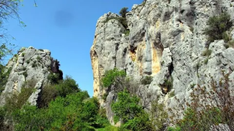
    The road then approaches the rocky pharallions and, shortly before reaching the top, it forges. The left branch reaches the edge of the calcareous wall and in a few minutes, the Cave of the Contadero is now transformed into a small serrano sanctuary.

    From this point, the route follows the path that runs along the same edge of the slope. After framing a fence of wires is introduced into the rough flat calcareous area. First the naked and sharp rock makes it difficult to march and then the bushes. Despite these drawbacks, in 35 minutes the edge of the impressive cuts of La Veleta is reached. The improvised lookout is not suitable for those suffering from vertigo. At this point extreme precautions if the route is done with children or dogs. There is a risk of vacuum falls.

    Breve descripción

    On the road to Valdepeñas de Jaén and next to the Los Knights Restaurant, it starts a lantern of land that is basically in line with the route of an old feral road, the Royal Canyon of the Revoltilla. The first section of the tour runs along this livestock road. Just to start walking, you have to leave the road to an urbanization to the right. At the same time, the panoramic views over Los Villares are being opened.

    Latitud
    37.6102
    Longitud
    -3.8404
    Distrito
    Ubicación en el mapa
    POINT (-3.8404 37.6102)
    imagen
    Image
    7330823.jpg
    Imagen principal
    Activado
    imagen
    Image
    turismoActivo6.jpg
    Imagen principal
    Desactivado

    Nature

    icon-intereses-naturaleza

    Friends

    icon-intereses-amigos

    Adventure

    icon-intereses-aventura

    Culture

    icon-intereses-cultura

    Sport

    icon-intereses-deporte

    Eco-friendly

    icon-intereses-eco-friendly

    For couples

    icon-intereses-en-pareja

    Family

    icon-intereses-familia

    Gastronomy

    icon-intereses-gastronomia

    Municipality

    icon-intereses-municipio

    Low-cost tourism

    icon-intereses-turismo-low-cost

    Solo travel

    icon-intereses-viajar-solo
    Cortados de La Veleta
    Desactivado
    Tramo de asfalto o cemento
     
    Tramo de pista o camino forestal
     
    Tramo de vía pecuaria
     
    Tramo de senda