Saltar al contenido principal
icon-intereses-senior

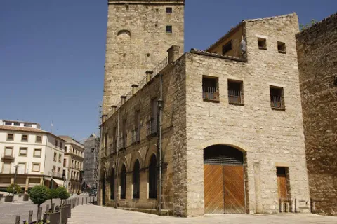
Former Civil Guard Barracks

Submitted by brandcode_deweloper on
Id
8103250
Descripción
Descripción larga

Located in the northern part of the population, at the beginning of it.

Breve descripción

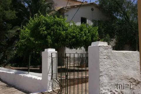
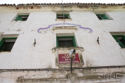
Today abandoned building, it retains on its facade the emblem of the civil guard. It highlights the greenish color of its main door and windows.

Telecomunicaciones
Correo electrónico
ayuntamiento@carboneros.es
Ubicación
Código Postal
23211
Latitud
38.232766
Longitud
-3.630393
Dirección
C/ Escolástica, 8
Distrito
Municipio
Ubicación en el mapa
POINT (-3.630393 38.232766)
Tipos de punto de interés
Imágenes carrusel
imagen
Image
Antiguo%20Cuartel%20de%20la%20Guardia%20Civil%202.jpg
Imagen principal
Desactivado
Imágenes cabecera
imagen
Image
Antiguo%20Cuartel%20de%20la%20Guardia%20Civil.jpg
Imagen principal
Activado
Loading map
Preparing points of interest and routes...
Former Convent of Santo Domingo

Submitted by brandcode_deweloper on
Id
910634
Descripción
Descripción larga

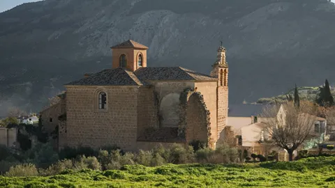
The Former Convent of Santo Domingo, in La Guardia de Jaén, is one of the most distinctive landmarks of the Renaissance of the South. Declared a Historical Monument in 1975, it preserves the former conventual church — today the Parish of the Assumption —, part of the cloister, and the remains of the conventual palace, forming an ensemble of great historical and artistic interest.

Founded in the 16th century by Don Rodrigo Messía Carrillo and Doña Mayor de Fonseca, lords of La Guardia with ties to Salamanca, the Dominican convent began construction in 1538. From 1542 onwards, the work took on a new dimension with the involvement of Andrés de Vandelvira, one of the great masters of the Andalusian Renaissance, who introduced innovative architectural solutions in the main chapel and the transept.

The main chapel, with its octagonal floor plan, follows models found in Alonso de Vandelvira's Libro de las Traças (Book of Designs) and is structured through a carefully applied Classical order. The transept is covered by a domed vault with a lantern, resting on four corner piers, creating a space of great balance and clarity. Inside, a remarkable iconographic programme is preserved, with coffered ceilings decorated with Dominican saints, prophets and apostles, as well as reliefs by Juan de Reolid depicting the Passion and Resurrection of Christ.

The ensemble reflects the dialogue between Castilian influences — stemming from the Salamanca background of its founders — and the mastery of the Jaén Renaissance, in collaboration with other stonemasons such as Domingo de Tolosa and Francisco del Castillo. Despite the transformations brought about by the disentailment (desamortización) and its later uses, the former convent still retains Renaissance coffered ceilings, remains of mural painting, a sacristy with a 1547 wooden ceiling (alfarje), and an 18th-century black jasper washbasin.

The Former Convent of Santo Domingo is today part of the Renaissance of the South Route, standing as an outstanding example of religious architecture linked to the figure of Vandelvira and to the artistic splendour of the 16th century in the province of Jaén.

Calle Escuelas, 11. 23170, La Guardia de Jaén 
Information and bookings
953 32 71 00

Breve descripción

A space where Vandelvira's architecture converses with five centuries of memory

Telecomunicaciones
Teléfono de contacto
953 327 100
Ubicación
Código Postal
23170
Latitud
37.744720
Longitud
-3.693890
Dirección
C/ Escuelas, 11
Distrito
Ubicación en el mapa
POINT (-3.69389 37.74472)
Tipos de punto de interés
Imágenes carrusel
imagen
Image
thumb%20%281%29.png
Imagen principal
Desactivado
Imágenes cabecera
imagen
Image
Convento_Santo_Domingo_La_Guardia.jpg
Imagen principal
Activado
Loading map
Preparing points of interest and routes...
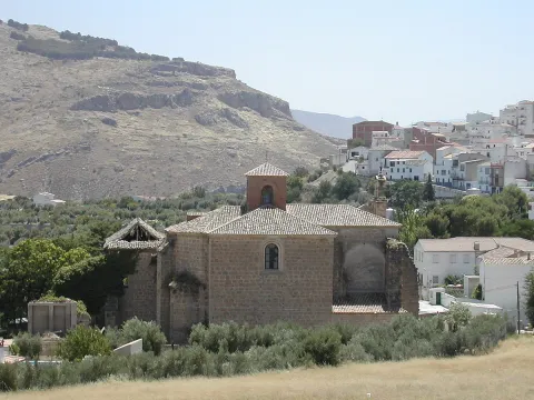
Former Convent of Capuchinos

Submitted by brandcode_deweloper on
Id
1913837
Descripción
Descripción larga

From 1835, with the arrival of the deamortizations, it passed into private hands and became houses and oil factory. The original facade was modified in the 20th century with the construction of a double-step artistic and large windows. From the interior, only the basic structure of the church is maintained, which consists of a single ship with side chapels and a lobby at the feet.

It currently houses the Historical Archive and the Public Library.

Breve descripción

At the southern end of the Paseo de los Alamos is located this ancient convent, built in the mid-17th century.

Telecomunicaciones
Sitio web
www.alcalalareal.es
Teléfono de contacto
953 583 506
Ubicación
Código Postal
23680
Latitud
37.460750
Longitud
-3.921570
Dirección
C/ Obispo Ceballos, 1
Distrito
Municipio
Ubicación en el mapa
POINT (-3.92157 37.46075)
Tipos de punto de interés
Imágenes carrusel
imagen
Image
FOC29443.jpg
Imagen principal
Desactivado
Imágenes cabecera
imagen
Image
Alcal%C3%A1%20la%20Real%20Poblaci%C3%B3n%207.jpg
Imagen principal
Activado
Horario
Monday to Friday: 10: 00 - 14: 00 and 16: 00 - 20: 00. Saturday: 10: 00 - 14: 00.
Microsite al que pertenece
Loading map
Preparing points of interest and routes...
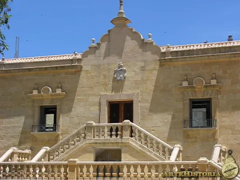
Former Town Hall of Larva

Submitted by brandcode_deweloper on
Id
8088700
Descripción
Descripción larga

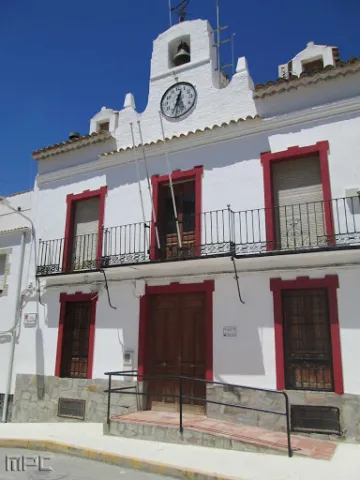
Among the Caserio de Larva is the old Town Hall, located in an altozano, with narrow walls, large symmetrical and verticalized voids, adapted to the slight level of heights of the street, and which is distinguished from the typology of the houses surrounding it by a prismatic, higher fronton, which hosts a watch and a small bell, following the model of the consistory houses of the illustrated colonization.

Breve descripción

The lands of Larva have been populated since the oldest prehistory, a town sponsored by its location near the Guadiana Menor, on the communication road that joined the Alto Guadalquivir with Levante. One kilometre from the city centre is the Iberian settlement of Cerro de Castellón, dated between the 2nd and 1st century BC. It is a fortified enclosure located at the top of a hill isolated in the middle of the plain, which remained occupied in Roman times.

Telecomunicaciones
Sitio web
www.larva.es/el-municipio/patrimonio-historico.html
Teléfono de contacto
953 781 500
Ubicación
Código Postal
23591
Latitud
37.759340
Longitud
-3.201280
Dirección
Paseo de Andalucía, s/n
Distrito
Municipio
Ubicación en el mapa
POINT (-3.20128 37.75934)
Tipos de punto de interés
Imágenes carrusel
imagen
Image
Antiguo%20Ayuntamiento%20larva2.jpg
Imagen principal
Desactivado
Imágenes cabecera
imagen
Image
Antiguo%20Ayuntamiento%20larva%20%281%29.jpg
Imagen principal
Activado
Microsite al que pertenece
Loading map
Preparing points of interest and routes...
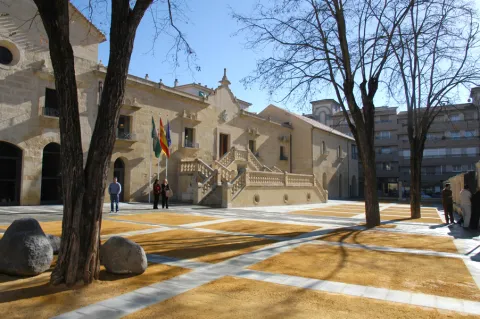
Former Town Hall of Escañuela

Submitted by brandcode_deweloper on
Id
8089950
Descripción
Descripción larga

Own building of the late 19th and early 20th century.

Breve descripción

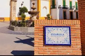
Archaeological remains found in the surroundings of Escuela have seen the human presence in this municipality since the 3rd millennium BC. In the place known as Pozo de Marisancho there appeared remains of dark ceramic belonging to this period of the Copper Age. From its Iberian past several places of remarkable interest are known; in the same well of Marisancho, Iberian ceramics decorated with geometric motifs of bands or circles were collected.

Telecomunicaciones
Sitio web
www.escanuela.es/el-municipio/patrimonio-historico.html
Teléfono de contacto
953 345 101
Ubicación
Código Postal
23657
Latitud
37.878700
Longitud
-4.033380
Dirección
Plaza de la Constitución, C/ Maestra, 1
Distrito
Municipio
Ubicación en el mapa
POINT (-4.03338 37.8787)
Imágenes carrusel
imagen
Image
ayuntamiento%20esca%C3%B1uelas2.jpg
Imagen principal
Desactivado
Imágenes cabecera
imagen
Image
ayuntamiento%20esca%C3%B1uelas.jpg
Imagen principal
Activado
Loading map
Preparing points of interest and routes...
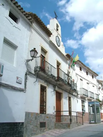
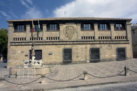
Old Butcheries

Submitted by brandcode_deweloper on
Id
2293082
Descripción
Descripción larga

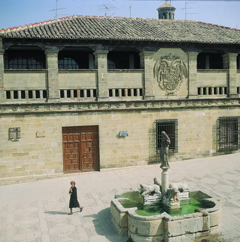
As the original building was larger than the space it was going to occupy, the solution was to "fold" the ends and fold them on the sides. The building consists of two bodies. In the first body there is a door and three windows, to the right we find the shield of the corridor, and to the left that of the city. The second body is formed by a lookout with square pillars interrupted in the center by the shield of Charles V.

The butcher's shop had a slaughterhouse on the ground floor and a sale on the top. Its uses have varied over time: municipal slaughterhouse, skin dryer, municipal archive, museum etc. It is currently the seat of the courts.

Breve descripción

The building was built in 1547 during the reign of Charles V. Originally it was in extramueros, but in the middle of the S. XX it moved to the Plaza del Populo to complete its configuration.

Telecomunicaciones
Sitio web
www.baeza.es
Teléfono de contacto
953 740 150
Ubicación
Código Postal
23440
Latitud
37.991740
Longitud
-3.470330
Dirección
Plaza del Pópulo, s/n
Municipio
Ubicación en el mapa
POINT (-3.47033 37.99174)
Tipos de punto de interés
Imágenes carrusel
imagen
Image
Mon207.jpg
Imagen principal
Desactivado
imagen
Image
unnamed.jpg
Imagen principal
Desactivado
Imágenes cabecera
imagen
Image
Baeza-Antigua_Carniceria-20110918.jpg
Imagen principal
Activado
Horario
External visit.
Loading map
Preparing points of interest and routes...
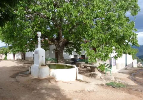
Hamlet of Fuentefría

Submitted by brandcode_deweloper on
Id
8146351
Descripción
Descripción larga

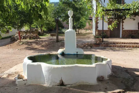
We highlight the source that is located in the centre of the village, where you can reach a track in good condition that leaves south from Collado Mahón (on the road from Torres de Albanchez to Villarrodrigo). The source of the work and with two years pours to two semicircular pillars. The water is the toima of a spring in an olive grove about 300 m south-west.

Breve descripción

In this village we will have the opportunity to contemplate beautiful views of the Natural Park. Near the settlement we can visit the Fucofría fountain, a water spring located at the foot of Mount La Cordera.

Telecomunicaciones
Teléfono de contacto
953 494 005
Ubicación
Código Postal
23391
Latitud
38.415062
Longitud
-2.676886
Dirección
Carretera de Torres de Albanchez
Distrito
Ubicación en el mapa
POINT (-2.676886 38.415062)
Tipos de punto de interés
Imágenes carrusel
imagen
Image
fuente%20de%20Fuenfr%C3%ADa3.jpg
Imagen principal
Desactivado
imagen
Image
fuente%20de%20Fuenfr%C3%ADa2%20%281%29.jpg
Imagen principal
Desactivado
Imágenes cabecera
imagen
Image
fuente%20de%20Fuenfr%C3%ADa%20%281%29.jpg
Imagen principal
Activado
Horario
is
Loading map
Preparing points of interest and routes...
Aqueduct

Submitted by brandcode_deweloper on
Id
4540839
Descripción
Descripción larga

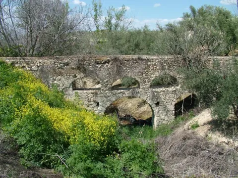
In Hornos de Peal, one of the pedanias of Peal de Becerro, is still in operation an old aqueduct, which has been built by Roman, which continues to challenge the passage of time and that of a river that crosses it below by deteriorating it.

Ubicación
Código Postal
23460
Latitud
37.913500
Longitud
-3.112890
Municipio
Ubicación en el mapa
POINT (-3.11289 37.9135)
Tipos de punto de interés
Imágenes carrusel
imagen
Image
acueducto.jpg
Imagen principal
Desactivado
Imágenes cabecera
imagen
Image
Monumentos7AcueductodeHornosdePeal.jpg
Imagen principal
Activado
Loading map
Preparing points of interest and routes...
Centro Comercial Abierto de Andújar

Submitted by brandcode_deweloper on
368830
Facebook
https://www.facebook.com/cca.andujar
Breve descripción

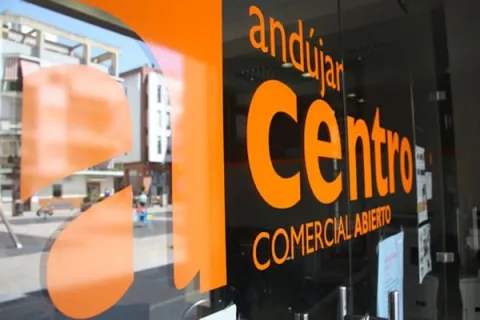
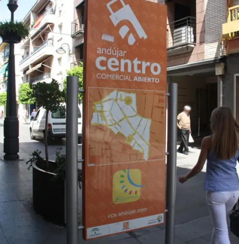
The Open Commercial Centre of Andújar has been officially recognized as the Open Commercial Centre of Andalusia by the Tourism and Trade Council of the Junta de Andalucía. The Chamber of Commerce and Industry of Andújar, which manages the Open Commercial Centre, was aware yesterday of the need to overcome the need for official recognition and will place the municipality of Andújar in the small group of Andalusian cities that have this quality distinction.

Teléfono
953 511 997
Sitio web
http://www.cca-andujar.com/
Correo electrónico
info@cca-andujar.com
Nombre
Centro Comercial Abierto de Andújar
Código Postal
23780
Latitud
38.04029
Longitud
-4.05462
Dirección
Pza. Rivas Sabater
Ciudad
Ubicación en el mapa
POINT (-4.05462 38.04029)

"

  • San Francisco Street
  • Calle Corredera de Capuchino
  • Ollerias Street
  • August 12 Avenue
  • Square of the Constitution
  • Calle Ibáñez Marín
  • Calle Ramón y Cajal
  • Calle Los Hornos

"

imagen
Image
cca-andujar
Imagen principal
Activado
imagen
Image
centro comercial
Imagen principal
Desactivado
imagen
Image
centro comercial
Imagen principal
Desactivado
Loading map
Preparing points of interest and routes...
Centro Comercial Abierto de Jaén

Submitted by brandcode_deweloper on
368859
Breve descripción

"

It is in 1,997 that the first actions aimed at the establishment of the Open Commercial Centre in the city of Jaén take place and, having known some of the few initiatives that exist on that date of CCA's, it is concluded that although the associated germ already existed, essential actions were lacking in terms of accessibility, parking, pedestrian and semi-pedestrian in the area where the Open Commercial Centre was intended to develop.

This is why a waiting time is spent until November 2000 the Association of Traders "Las Palmeras," whose name is taken from the old Plaza de las Palmeras, today of the Constitution, geographical center of the location area, in charge of the planning, organization and subsequent management of the Open Commercial Centre "Las Palmeras" in Jaén.


"

Teléfono
953 25 86 31
Sitio web
https://www.comerciojaen.com/centro-comercial-las-palmeras/
Teléfono de contacto
953 22 80 58
Código Postal
23003
Latitud
37.77240
Longitud
-3.78609
Dirección
Av. de Madrid, 32
Ciudad
Ubicación en el mapa
POINT (-3.78609 37.7724)

"

From that moment to this day, the CCA "Las Palmeras" has been iCCA Las Palmeras Banderolasdo consolidating, increasing the number of shops involved in it, the provision of services and the activities and campaigns carried out, having on several occasions been awarded and awarded at the Andalusian level.

  • Navas de Tolosa Street.
  • Station tour.
  • Constitution Square.
  • Dr. Civera Street.
  • Calle Madre Soledad Torres Acosta.
  • San Clemente Street.

"

imagen
Image
Centro Comercial Abierto de Jaén
Imagen principal
Activado
imagen
Image
Centro Comercial
Imagen principal
Desactivado

"

Monday to Thursday: 09: 00 - 14: 00 and 17: 00 - 20: 00. Friday: 09: 00 - 14: 00.

"

Loading map
Preparing points of interest and routes...