Saltar al contenido principal
icon-intereses-senior

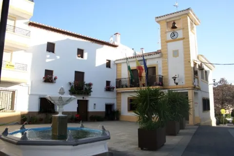
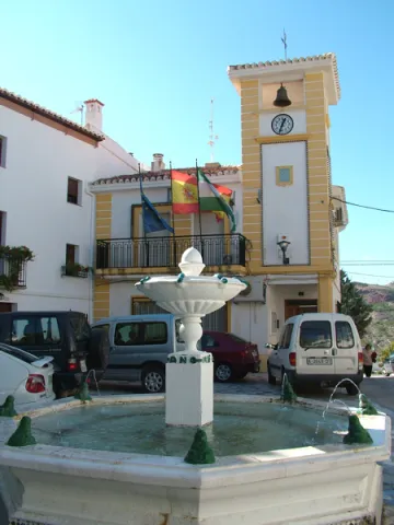
Town Hall of Noalejo

Submitted by brandcode_deweloper on
Id
4867653
Descripción
Breve descripción

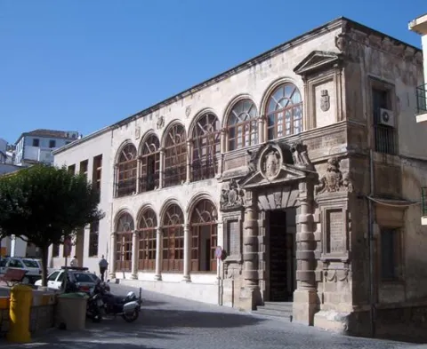
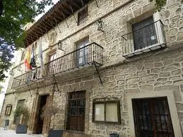
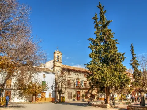
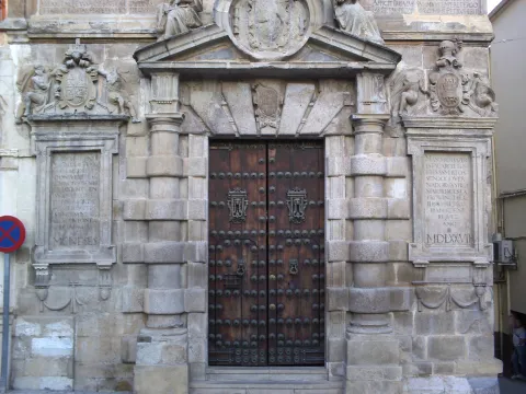
Building built at the end of16th century. At first it was a convent under the title of Our Lady of the Assumption, and this is the reason for the small image that presides over the facade. In the 18th century it became for the first time the House of the Council. The original construction corresponds to athree-storey building and swordsmanI had a bell with three crunches. It had different units anda central courtyard.A big ladderimperial two meters, immense and majestic, raised us to the second floor. On the third floor the schools were installed.

Telecomunicaciones
Sitio web
www.noalejo.es
Teléfono de contacto
953 306 134
Correo electrónico
noalejo@andaluciajunta.es
Ubicación
Código Postal
23140
Latitud
37.529460
Longitud
-3.653660
Dirección
Plaza España, 1
Distrito
Municipio
Ubicación en el mapa
POINT (-3.65366 37.52946)
Tipos de punto de interés
Imágenes carrusel
imagen
Image
noalejo.jpg
Imagen principal
Desactivado
Imágenes cabecera
imagen
Image
noalejo3.jpg
Imagen principal
Activado
Microsite al que pertenece
Loading map
Preparing points of interest and routes...
Town Hall of Hinojares

Submitted by brandcode_deweloper on
Id
4591486
Descripción
Descripción larga

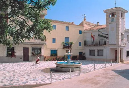
With three heights and bounds, the most outstanding is that of the balcony on the first floor, in a vertical line with the access door, and crowned by a small attic with a watch that imitates that of the municipalities colonized in the 18th century, but which is located not in the center but on one of the sides of the building, and on which a small bell is installed.

Breve descripción

The other significant building of Hinojares is the City Hall, also in the same line of architectural austerity and without concessions to decoration and aesthetics.

Ubicación
Latitud
37.715363
Longitud
-2.999162
Dirección
Plaza Constitución, 14
Municipio
Ubicación en el mapa
POINT (-2.999162 37.715363)
Tipos de punto de interés
Imágenes carrusel
imagen
Image
AYNT%20HINOJARES.jpg
Imagen principal
Desactivado
imagen
Image
AYNT%20HINOJARES%202.jpg
Imagen principal
Desactivado
Imágenes cabecera
imagen
Image
113.jpg
Imagen principal
Activado
Loading map
Preparing points of interest and routes...

Old Town Hall, Former Prison, and Cabildo

Submitted by brandcode_deweloper on
Id
2293022
Descripción
Descripción larga

The construction is part of an ambitious plan for the beautification of the city of Martos, seeking to create a capital worthy of the Endowment according to its Roman legacy. Urbanistically the façade of the Cárcel would vertebrate the space of the main square of the city (current Plaza de la Constitución), also remodeling the nearby church of Santa Marta and the Sanctuary of Nuestra Señora de la Villa, and having in the central part of the square the Fuente de Neptuno, disappeared work of which we have references in the History of the Peña de Martos de Diego de Villalta. In addition to this intervention in the main square, new roads and spaces would be built, such as the street and the square of the Fuente Nueva, the district of the Heras, the street of the Albollón, etc., and a series of convents and churches were also founded.

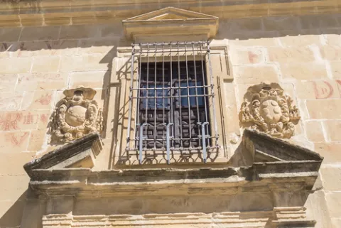
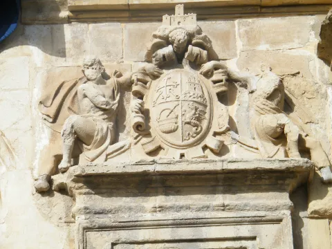
The main façade of the Prison is structured as a double gallery of half-point arches supported by dogrous columns (four arches on the lower floor and six on the upper floor), the cover being located in a decentralized way on the right side (on which a blind balcony is available as a temple, topped with a straight fronton). In the jets of the central part of the upper arcade we find heraldic shields, killing the whole facade with a large cornice.

Breve descripción

The building was built by the architect Francisco del Castillo between 1557- 1577 on behalf of Governor Pedro Aboz Enríquez and Mr Antonio de Padilla Meneses, Justice Mayor of Calatrava in the Kingdom of Jaén.

Telecomunicaciones
Sitio web
www.martos.es
Teléfono de contacto
953 704 005
Ubicación
Código Postal
23700
Latitud
37.722920
Longitud
-3.965830
Dirección
Plaza de la Constitución, 21
Distrito
Municipio
Ubicación en el mapa
POINT (-3.96583 37.72292)
Tipos de punto de interés
Imágenes carrusel
imagen
Image
Martos-Escudo-C%C3%A1rcel.jpg
Imagen principal
Desactivado
imagen
Image
P1100304-1024x768.jpg
Imagen principal
Desactivado
imagen
Image
Martos_-_Portada_del_Ayuntamiento_K03.jpg
Imagen principal
Desactivado
Imágenes cabecera
imagen
Image
main_image_43929.jpeg
Imagen principal
Activado
Horario
External visit.
Loading map
Preparing points of interest and routes...

Rock Art of Quesada

Submitted by brandcode_deweloper on
Id
10895687
Descripción
Descripción larga

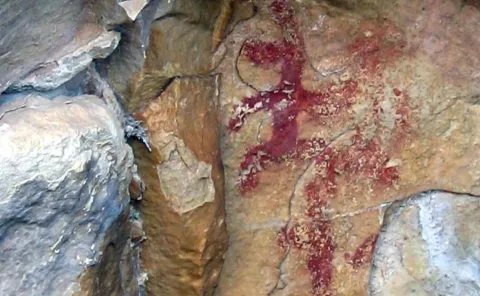
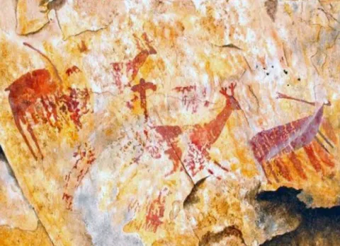
These more or less realistic but generally schematic manifestations reproduce human beings, animals and symbols, forming isolated scenes. The representations not only evoke and report part of daily life, but leave us witness to its complex and mysterious spirituality.

World Heritage Site

The Sierra de Quesada houses one of the most prominent rock art sets in Alto Guadalquivir for the many coats and caves where these first inhabitants left their art. In 1998 it became part of the UNESCO catalogue as World Heritage Site.

Outdoor museums

These sites can be considered as authentic outdoor museums of incalculable value, whose preservation concerns each and every fellow citizen. When visiting them, we must remember that we contemplate figures made by the primitive man, not least human and intelligent, more than 4,000 years ago. It's all by law, Cultural Interest Property.

Visit the paintings

Visiting these places can be difficult and frustrating, not only because of their access; it can be dangerous, but because sometimes their conservation status is the least poor; and it is recommended that they be visited with a specialist. For this purpose, before scheduling the visit, it is advisable to consult with someone familiar with the place (to advise and guide) or even to be accompanied by a responsible local guide (it is advisable to contact local authorities or associations).

The Abrigo de Manolo Vallejo, the Abrigo de el Encasiero, the Abrigo del Cerro Vitar and the caves of the ivy and Cabrera stand out. In addition to the rock paintings, there were ceramics and lytics that have made it possible to give the first human occupation of these lands in the third millennium. C.

Breve descripción

The Rupestre Art, "art on rock," is composed of the pictorial manifestations that our remote ancestors left on the walls of numerous covacas and petreous coats of our saws, in prehistoric times (in our region, from the Neolithic, to the Bronze Age).

Ubicación
Código Postal
23480
Latitud
37.843173
Longitud
-3.069630
Municipio
Ubicación en el mapa
POINT (-3.06963 37.843173)
Tipos de punto de interés
Imágenes carrusel
imagen
Image
pinturas%20rupestres%20quesada%202.jpg
Imagen principal
Desactivado
imagen
Image
pinturas%20rupestres%20quesada%203.jpg
Imagen principal
Desactivado
Imágenes cabecera
imagen
Image
pinturas%20rupestres%20quesada.jpg
Imagen principal
Activado
Microsite al que pertenece
Loading map
Preparing points of interest and routes...
Marcas de calidad

San Lorenzo Arch

Submitted by brandcode_deweloper on
Id
12675639
Descripción
Descripción larga
We can highlight some curiosities: -   It was the place where the body of the monarch Ferdinand IV, king of Castile, who died in Jaén, was laid to rest.  -   Juan de Olid (secretary of Constable Iranzo) and his wife Randelez are buried inside. -   Maximilian of Austria was baptized in 1555, who, if recognized, would be the half-brother of Philip the Fair. It can be visited by prior reservation with one of the authorized companies and guides: Association of Official Guides: 606 68 23 03 Claritas Tourism: 678 77 50 43 Lizard Tours: 953 71 52 15 For more information, contact the Municipal Tourism Office: 953 19 04 55
Breve descripción
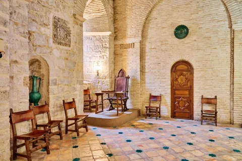
Building that was part of the extinct Iglesia de San Lorenzo (erected between the 13th and 14th centuries). After the demolition of said temple in 1825, the arch was preserved, housing inside a room on the upper floor (which at the time would be the Sacristy) and a small chapel on the ground floor. It has been listed as a National Monument since 1877 and its interior contains Moorish tiles and coffered ceilings. It is currently owned by the Jaén City Council and is used as the headquarters of the Jaén association “Amigos de San Antón”. The San Lorenzo arch also stands out for the enormous historical legacy it holds, having been veiled by the monarch Ferdinand IV, king of Castile, who died in Jaén and which Eslava Galán himself attests to in The Templars and the Table of Solomon. (…) The same tradition assures that they watched over the monarch's body, or even buried it, in the Arco de San Lorenzo de Jaén. (…) The Templars and Solomon's Table. Chapter 21. Another historical milestone that the Arco de San Lorenzo treasures is that Juan de Olid, secretary of Constable Iranzo, lies here. Historical and also literary milestone, because Juan de Olid is the hero that Juan Eslava Galán uses to go “En busca del unicornio”. The author also mentions this fact in The Templars and the Table of Solomon (…) Juan de Olid and his wife were buried in the parish of San Lorenzo, belonging to the hospital founded by Don Luis (…) The Templars and Solomon's Table. Chapter 22.
Ubicación
Código Postal
23002
Latitud
37.766541
Longitud
-3.792381
Dirección
C/ Almendros Aguilar, 27
Distrito
Municipio
Ubicación en el mapa
POINT (-3.792381 37.766541)
Tipos de punto de interés
Imágenes carrusel
imagen
Image
arco-de-san-lorenzo-j-a-partal-1-1-jpg
Imagen principal
Desactivado
imagen
Image
arco-de-san-lorenzo-j-a-partal-3-jpg
Imagen principal
Desactivado
Imágenes cabecera
imagen
Image
arco-de-san-lorenzo-1-jpg
Imagen principal
Activado
Loading map
Preparing points of interest and routes...

Arch of la Plaza

Submitted by brandcode_deweloper on
Id
4485954
Descripción
Descripción larga

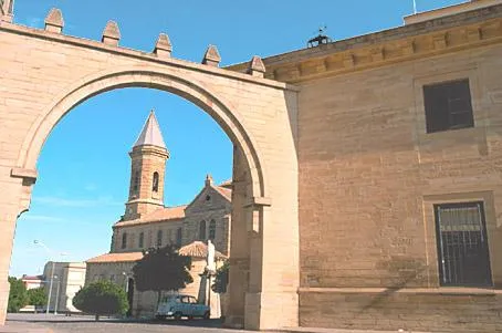
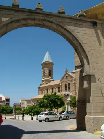
The religious, administrative and social centre is the Plaza de Andalucía, of generous proportions and houses with arqueras and balconades, to which it is accessed through a replacement arch of another of Gothic origin. This arch, which was the gateway to the medieval fortress of the old walled enclosure, was rebuilt in 1952 over the ancient medieval arch.

Telecomunicaciones
Sitio web
www.porcuna.es
Ubicación
Código Postal
23790
Latitud
37.870160
Longitud
-4.184900
Distrito
Municipio
Ubicación en el mapa
POINT (-4.1849 37.87016)
Tipos de punto de interés
Imágenes carrusel
imagen
Image
Arco%20de%20la%20Plaza%20Porcuna%20%281%29.jpg
Imagen principal
Desactivado
Imágenes cabecera
imagen
Image
Arco%20de%20la%20Plaza%20Porcuna.jpg
Imagen principal
Activado
Loading map
Preparing points of interest and routes...

Arch of la Encarnación

Submitted by brandcode_deweloper on
Id
4659054
Descripción
Breve descripción

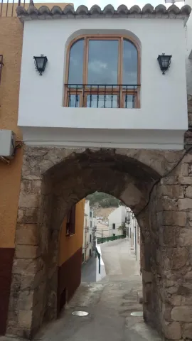
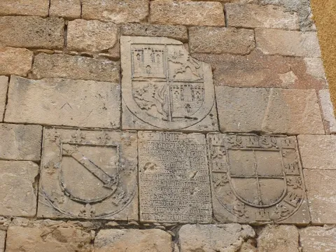
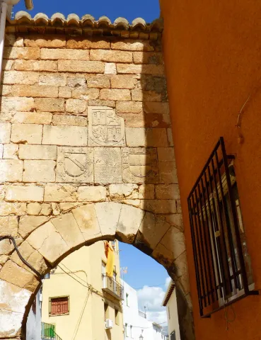
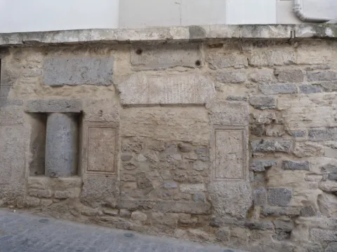
On the Arc of the Incarnation of Pegalajar, a pointed arch that was the main entrance door to the castle of Pegalajar, is a commemorative stone surrounded by heraldic shields. The stone is recorded in relief with a textual gothic letter, in some parts damaged. The writing box of the stone is distributed in relief lines where the photographs are attached. It uses some abbreviations and the concealment of some letters at the end or in the middle of the word. Words are usually separated by scores. Head the tombstone the word "Jheits ", framed in two crosses, religious invocation usual at the beginning of all public writings, followed by the date, the reference to the king reigning and then the ordinator of it and the type of work commemorative. The transcription of the stone is as follows:

Telecomunicaciones
Sitio web
www.ayto-pegalajar.org
Correo electrónico
pegalajar@promojaen.es
Ubicación
Código Postal
23110
Latitud
37.738970
Longitud
-3.649050
Distrito
Municipio
Ubicación en el mapa
POINT (-3.64905 37.73897)
Tipos de punto de interés
Imágenes carrusel
imagen
Image
arco%20de%20la%20encarnaci%C3%B3n%202.jpg
Imagen principal
Desactivado
imagen
Image
arco%20de%20la%20encarnaci%C3%B3n.jpg
Imagen principal
Desactivado
Imágenes cabecera
imagen
Image
10486986676_87a2769dfe_b.jpg
Imagen principal
Activado
Microsite al que pertenece
Loading map
Preparing points of interest and routes...
Former San Felipe Neri Seminary (current UNIA headquarters)

Submitted by brandcode_deweloper on
Id
5965089
Descripción
Breve descripción

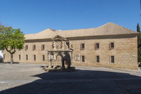
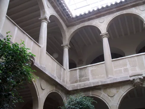
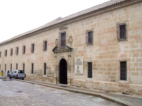
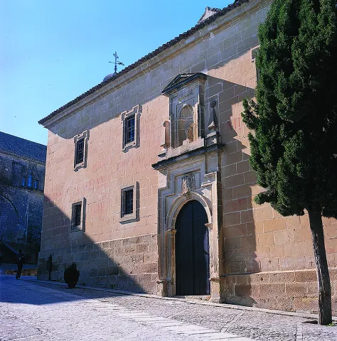
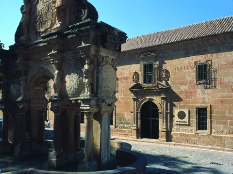
Founded as a seminary in 1660 by the bishop of Jaén, Fernando Andrade de Castro. The works were carried out by Eufrassio López de Rojas, author of the façade of the Cathedral of Jaén. It ceased to be used for the purpose of 1969. From the outside stands the façade that looks at the square of Santa Maria with two high floors where critical and festive cheers decorate its stones. The interior features a courtyard with narrow Tuscan columns and double arqueria. Today it houses the Antonio Machado headquarters of the International University of Andalusia.

Telecomunicaciones
Sitio web
www.baeza.es
Teléfono de contacto
953 742 775
Ubicación
Código Postal
23440
Latitud
37.990432
Longitud
-3.468978
Dirección
Plaza Santa María, s/n
Municipio
Ubicación en el mapa
POINT (-3.468978 37.990432)
Tipos de punto de interés
Imágenes carrusel
imagen
Image
shutterstock_670115896.jpg
Imagen principal
Desactivado
imagen
Image
seminario-felipe.jpg
Imagen principal
Desactivado
imagen
Image
Baeza_-_Seminario_de_San_Felipe_Neri_1.jpg
Imagen principal
Desactivado
imagen
Image
Mon016.jpg
Imagen principal
Desactivado
imagen
Image
Mon547.jpg
Imagen principal
Desactivado
Imágenes cabecera
imagen
Image
shutterstock_670115821.jpg
Imagen principal
Activado
Horario
Monday to Friday: 09: 00 - 14: 00. Saturday, Sunday and holidays closed.
Loading map
Preparing points of interest and routes...
Former Pósito - Ciudad y Museum of Raphael Interpretation Centre

Submitted by brandcode_deweloper on
Id
2343550
Descripción
Descripción larga

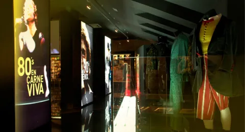
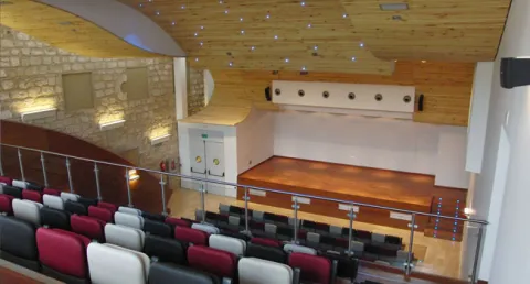
Today turned into a cultural and tourist space, this Interpretation Center of the city, welcomes in its interior the brightest pages of local history, the evolution of its urbanism and all its Art and Culture where the Toreo and the Flamenco in Linares have a prominent place. This building, in turn, houses the Museum of Raphael, a English universal singer, the Tourist Information Office, souvenir shop, a Linear Documentation Centre, temporary exhibition room and the Municipal Auditorium, able to host congresses and events of all kinds.

Based on a conceptual recreation of the Santa Margarita Thing, which was erected as one of the largest rings in the world in 1866, the visitor will be immersed in a 360-degree enveloping projection. Six exhibition spaces are offered that explain the importance of the city in the history of the party and its main representatives; such as Palomo Linares, Paco Bautista, Curro Díaz, José Fuentes, Curro Vázquez and so up to 20 great matadores.

In addition, taking advantage of Linares' world fame for being the city where the right-hand Cordobe Manuel Rodríguez Sánchez 'Manolete' lost his life in a tragic evening of bulls, the City Council promotes the tourist product "Linares, after the legend of Manolete," which allows groups to know wineries, museums, scenarios of special relevance, such as the Santa Margarita Coso and the Los Marqueses Hospital, or the Flemish peñas of the city.

Breve descripción

The building of the Old Posite, was built in the second half of the 18th century as a grain warehouse, by then the Villa de Linares, transformed years later into prison, in 1975 became a special education school.

Telecomunicaciones
Sitio web
www.elpositolinares.es
Teléfono de contacto
953 100 183
Correo electrónico
turismo@aytolinares.es
Ubicación
Código Postal
23700
Latitud
38.092871
Longitud
-3.634982
Dirección
Iglesia, 5
Distrito
Municipio
Ubicación en el mapa
POINT (-3.634982 38.092871)
Imágenes carrusel
imagen
Image
MuseoLinares.jpg
Imagen principal
Desactivado
imagen
Image
raphael27.jpg
Imagen principal
Desactivado
imagen
Image
espacios_expos.jpg
Imagen principal
Desactivado
imagen
Image
espacios_auditorio.jpg
Imagen principal
Desactivado
Imágenes cabecera
imagen
Image
0_3726_1.jpg
Imagen principal
Activado
Horario
Winter: Wednesday to Sunday 10: 00 - 14: 00 and 17: 00 - 19: 00. Summer: Wednesday to Sunday 10: 00 - 14: 00 and 18: 00 - 20: 00.
Loading map
Preparing points of interest and routes...
Marcas de calidad

Former Hospital of San Miguel

Submitted by brandcode_deweloper on
Id
1487115
Descripción
Descripción larga

The first fact of the existence of the Hospital of San Miguel is given by Jimena Jurado "Historia o Anales del Municipio Albense Urgavonense" 1643, arguing that already in 1488 a total of six hospitals are quoted in Arjona (Santa María, San Miguel, San Juan, Santiago, San Bartolomé, Santa Olaya).

Another data showing the antiquity of these Hospitals was found in 1542, when the Supreme Pontiff issued his Bula to make an inventory of the number of hospitals in Spain, calling for the elimination of those who by their poverty did not meet basic needs. In response to the Bula, the lobby next to the officers of the village's cofradies meet and decide to reduce all hospitals to one, leaving only the Hospital of San Miguel, which was better located and more capable.

As far as the location is concerned, there is no doubt that it occupied the left side of what is now Hospital Street and the old La Plaza Street (now Cervantes). The most obvious evidence of its location is found in a drawing from 1628, published by Don Juan González in "Historia de la Ciudad de Arjona" 1905.

At the end of the 17th century the family of the perpetual regior of the villa Corrales Javalera serves it as endowments, highlighting the breadth of its rooms, highlighting an oratory above all. From this date on, the historical reviews that refer to the above-mentioned hospital are remarkable, highlighting that of Don Pascual Madoz, who, in his "Geographical, Statistical and Historical Dictionary of Spain" 1845 writes "Arjona...... has a Hospital entitled San Miguel, with public prayer, founded in 1665 by Don Bernabé Corrales Javalera...... The hospital is in charge of an administrator and has a surgeon and nurse to assist the suffering humanity of both sexes that is admitted to it."

The progress of the centuries, the new laws inherited from the French tradition, public hygiene and urban police, close the location of the hospital. These ordinances put in place the mechanisms for the new location of the Hospital, June 1863 in a Act of the Council "the governor is asked to allow the House of the King and to temporarily enable the hospital..." This house located in the square of Santa María belongs to Don José Pérez de Herrasti, which gives way for a modest price, thus increasing the works to transfer the Hospital to that place, leaving the works completed in 1868, as demonstrated by the letter that the Architect d. José María Cuenca (architect of the province), emits the mayor of the town.

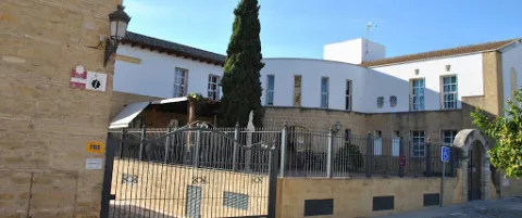
Since then and after having undergone several remodelations such as that in 1924, in which part of it was sank, it has served as a reference in the cure of the sick, specializing in primary care, until in the 1990s when a new hospital complex in Arjona is built. The site that occupied this hospital, suffered a series of remodeling at the end of the 20th century, passing through the center of Youth Information, until today becoming the Museum of Arts and Costumbres Juan Eslava Galán and the Archaeological Museum City of Arjona, next to the old people's residence "Fundación Corrales Javalera," which follows the legacy used by the Bernabé Corrales Javalera in the second Mitad of the 17th century.

Breve descripción

Today's missing building, which was erected at the site that today occupies the town council. The date of its construction is not known, but through the study of different sources it is brought closer to the 13th century, framed in the context of the Christian reconquest under the baton of Fernando III the Holy. In 1244 Arjona is conquered and as such began to form Cofradias under the title of a saint, to whom the aid goes to the most disadvantaged.

Telecomunicaciones
Sitio web
www.visitarjona.com/cultura/otros-monumentos/antiguo-hospital-de-san-miguel
Teléfono de contacto
953 523 325 / 953 523 641
Ubicación
Código Postal
23760
Latitud
37.935170
Longitud
-4.054660
Dirección
C/ Cervantes, 9
Distrito
Municipio
Ubicación en el mapa
POINT (-4.05466 37.93517)
Tipos de punto de interés
Imágenes carrusel
imagen
Image
Antiguo%20Hospital%20de%20San%20Miguel.jpg
Imagen principal
Desactivado
Imágenes cabecera
imagen
Image
arjona-hospital01.jpg
Imagen principal
Activado
Loading map
Preparing points of interest and routes...