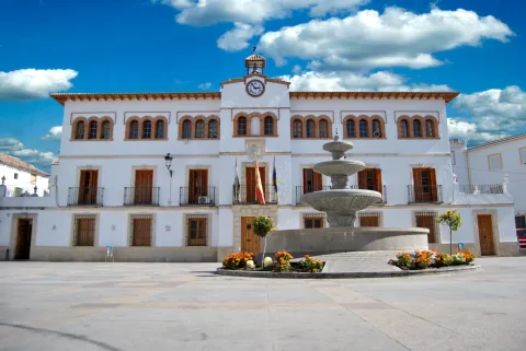
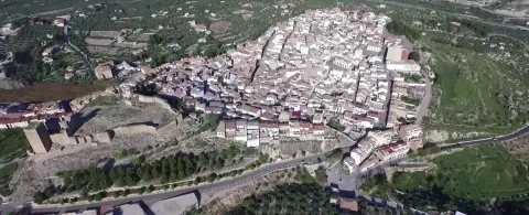
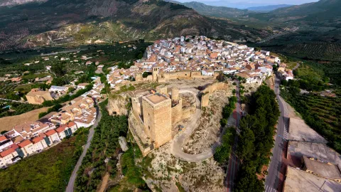
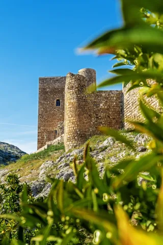
Torres
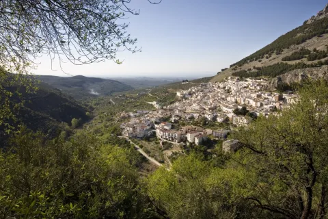
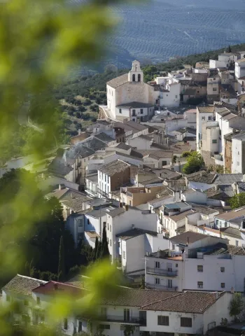
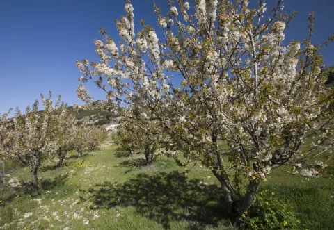
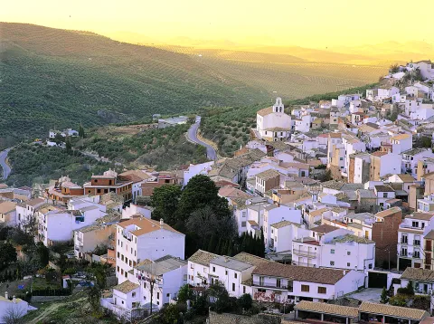
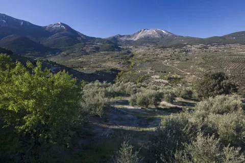
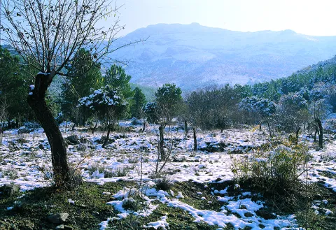
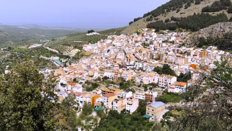
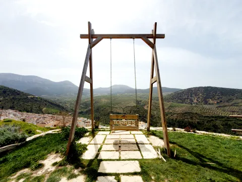
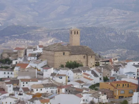
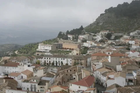
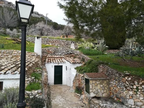
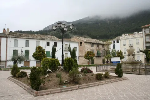
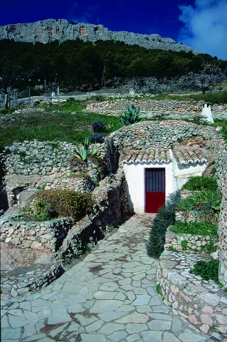
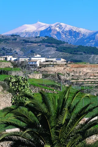
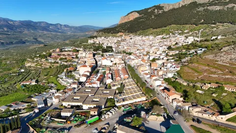
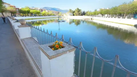
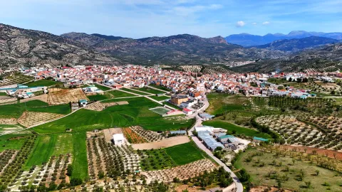
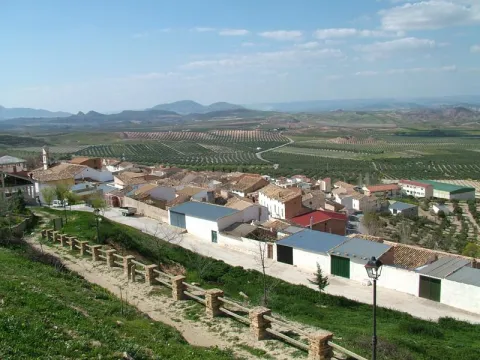
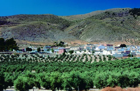
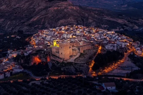
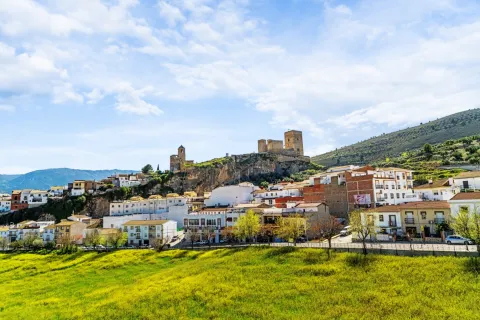
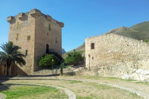
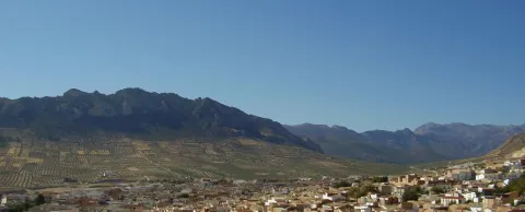
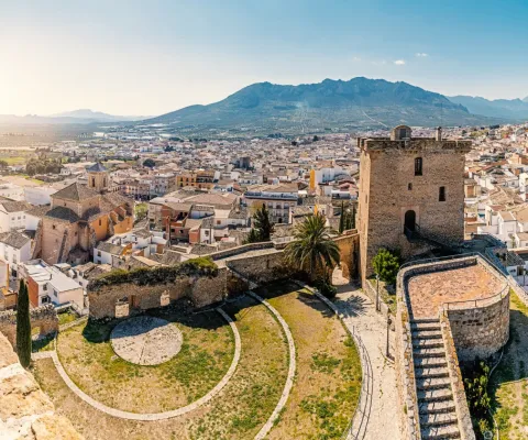
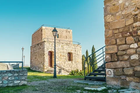
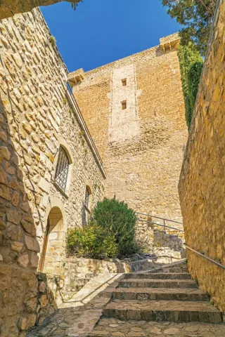
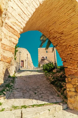
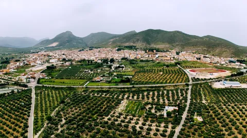
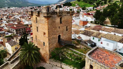
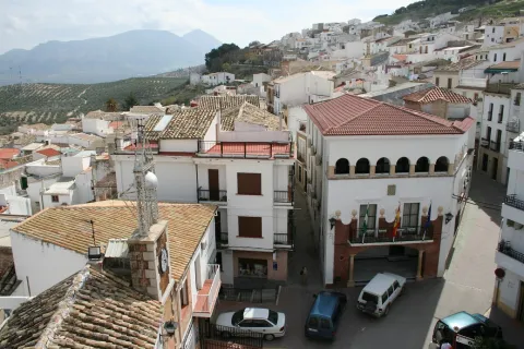
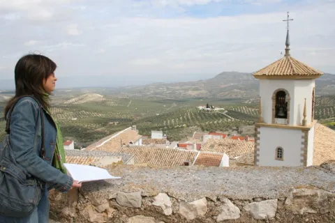
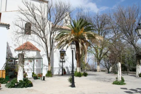
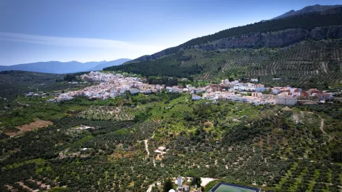
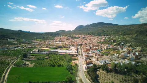
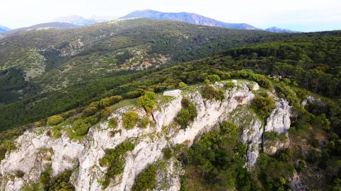
Location of the Sierra Mágina region and located in the skirt of the hill of the Old. Its term is found within Natural Park of Sierra Magina and offers spectacular landscapes, mainly in spring, with the flowering of the cherry trees. Because of its geographical location it has abundant water springs. Its altitude, more than800 m,causes temperatures to be pleasant in summer and cold in winter.
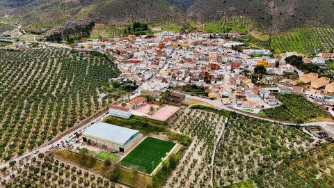
Torres has a population of more than a thousand eight hundred neighbors and its municipal term extends along the length and width of about eighty square kilometres, by the Torres River Valley. The olive in the lower lomas of the town and the high summits that extend through the Natural Park. The major summit is Almadén, which rises above 2,032 meters.
In addition to the cultivation of the olive tree, being about a third of irrigation, and the gardens, we must highlight the of the cherry. The wide plantations of this fruit make Torres one of the most important cherries producers.
Concejalía de Turismo del Ayto. de Torres
Plaza de España, 1
23540 Torres | Jaén
953 363 011 - Ext. 28
info@torresturismo.es
Distance to the capital (km): 31
Altitude over sea level (m): 888
Extension (km ²): 80
Number of inhabitants: 1,665
Gentillo: Torreños
Postal code: 23540
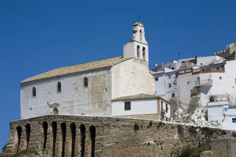
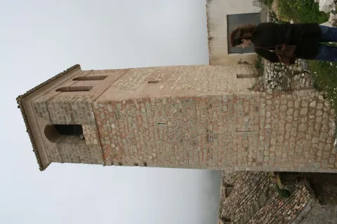
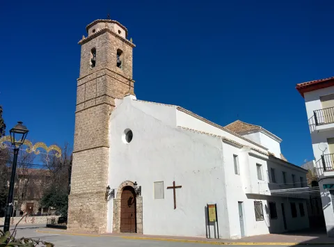
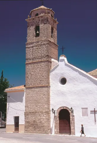
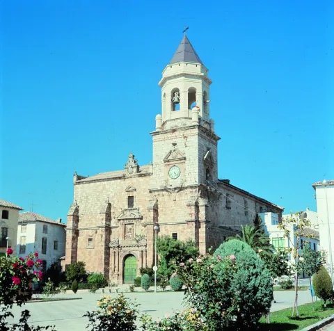
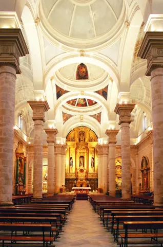
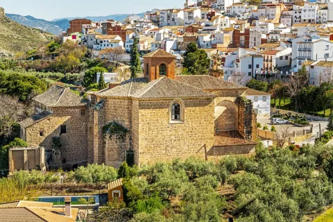
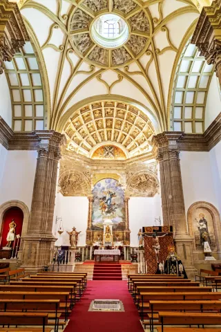
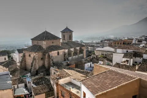
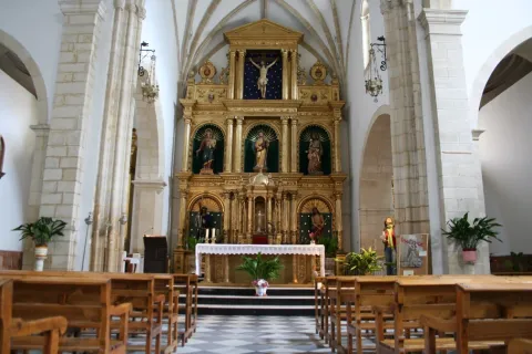
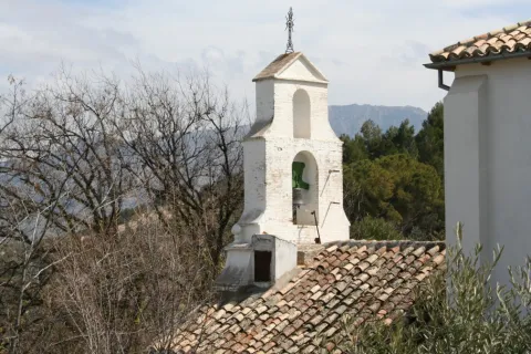
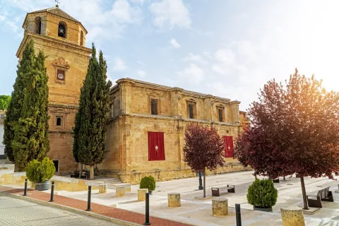
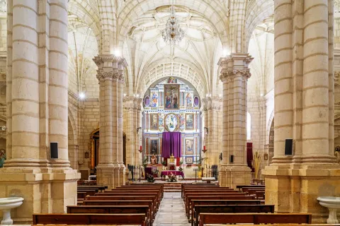
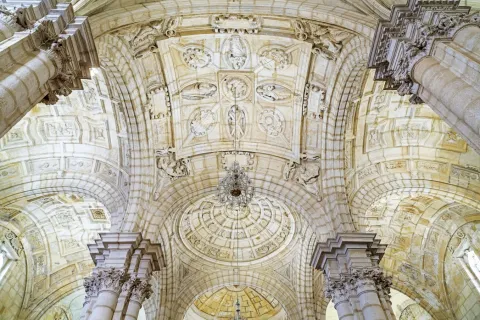
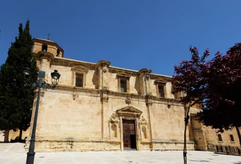
Church of Santo Domingo de Guzmán: It is found in a steep terrain, sustained by contrasts that draw eight arches of stone seen. The Renaissance church was built between the 16th and 17th centuries. Inside it extends into a single ship divided into three sections, covered by vaulted vaults. There is a chorus at the feet and chapels of baroque tardo style with venerated images at local Holy Week. One of the baptismal batteries of the temple is of Mudejar Gothic style.
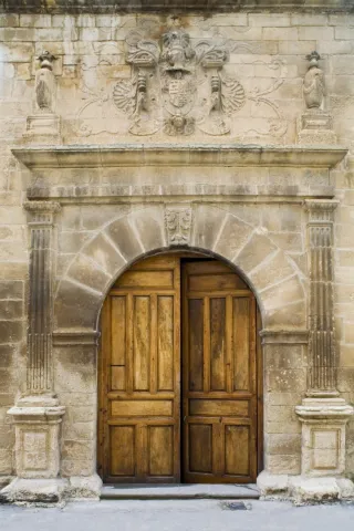
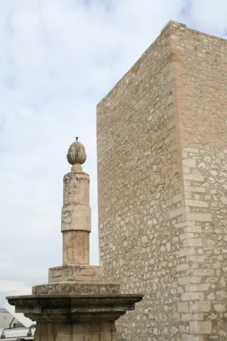
The Palace of the Cobos: The call of the Marquis de Camarasa was built in the 16th century, the works were to be completed in 1565, as it appears in the inscription of the friso on the cover. Renaissance style, remember the splendor that the people lived from the moment Carlos I sells it to his secretary D. Francisco de los Cobos. The cover is divided into two bodies by an injunction. At the bottom is a half-point arc with acanto highlighted key and framed by acanto pilasters. The upper body is crowned laterally by two vases on pedestal and in the center a shield with a dome and cross of Santiago between columns decorated with reliefs. In 1997 it was included in the catalogue General of the Historical Heritage of Andalusia.
- The Church of the Holy One: It is made up of stone and built in the 20th century and consists of a single ship with presbytery on steps and chorus at the feet. The exterior is very simple and the main facade finished in hastial. Of this Church we are interested in its interior where it is preserved an oil on canvas with the iconography of Ecce Homo of the 17th century: a sitting Christ that responds to the baroque aesthetics of the dark, another 18th century oil of the Divine Pastor of popular theme and great chromatic contrast and of the 20th century, a wooden size of a Crucified, with careful anatomical study.
- The Cave of the Morron: It is one of the great Paleolithic-era rock sanctuaries they are located in the Alto Guadalquivir. The paintings are in a small room in the Cave. These are two different chromatism, one red and one black. It is very likely that we are facing a sanctuary in which the paintings have a magical propitiatory purpose for hunting, which was the main means of life of the surrounding populations. These rock paintings have been declared Good for Cultural Interest.
On the outskirts is "The Bridge" which is as popularly known the bridge that Andrés Vandelvira built in 1565, on behalf of Maria de Mendoza.
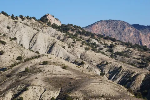
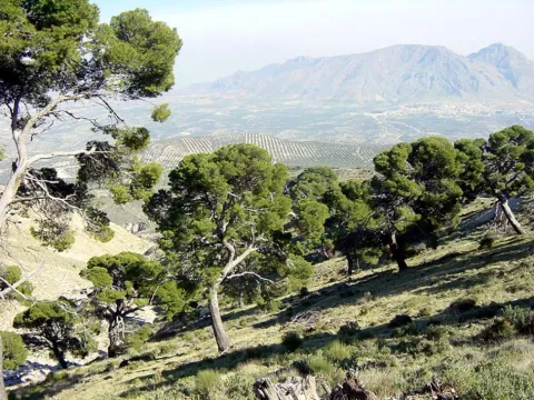
The municipal term of Torres has an area of 80 km2of which much are included in the Natural Park of Sierra Mágina, with large areas of tree vegetation in which indigenous pine trees, oak trees and complaints predominate; shrubs (majuelo, juniper, torvisco...). Very abundant are also the aromatic plants (rosemary, alhucema and thyme).
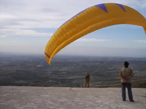
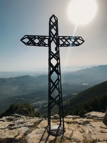
Currently takes advantage of this saw to do sport in nature: hiking, mountain bike, climbing, bulder, free flight... It has views with splendid panoramic views of the mountain environment.
Between her fauna big highlights Rape (perishable eagle, common fencing), Rape night (royal owl, mocha and autillo) and mountain goats in the rocky areas.
Torres has interesting places from where to observe the spectacular panorama of the surroundings of the town:
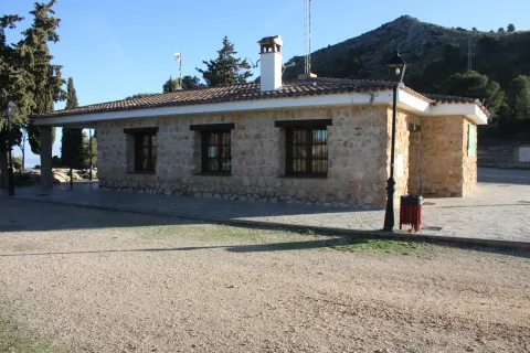
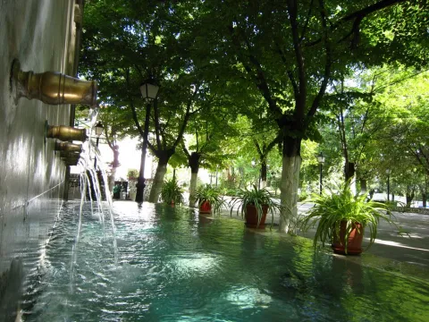
- Fuenmayor recreational area. Fuenmayor in a camping area and a road, located in the middle of a large mass of trees, which has plenty of water as there is a spring there. The recreation area extends along the Fresnos de Fuenmayor stream, with a source of water leaps and a pond, as well as stationery, banks and picnic tables. The Fuenmayor is surrounded by long chopos between which you can see and hear some birds of forest and riverside like the listed reyezuelo, the common agateador or the cascade lavender. It is located to the south of the town, in the Natural Park of Sierra Magina, just on the slopes of the Almadén peak, about 7 km. Torres. The recreational area is accessed through an asphalt road that leaves the village and leads directly to Fuenmayor.
- Mount Aznaitín. Authentic the milestone of the Natural Park It reaches 1,720 m. This is one of the most significant mountain units in the Park. The panoramic views are impressive. On this mountain is the Cave of the Morron, which retains primitive remains of rock paintings. It is located to the north of the town, just on the border with the term Jimena.
- Monteacto. At 1,683 m high it is a natural lookout exceptional to view beautiful and impressive panoramic views of the Natural Park. It is located to the southeast of the town, on the border with the municipal term of Albanchez de Mágina.
- Area of Hundacabras Apampada: The landscape surrounding this equipment, located on the rest of a pecuary road, is typically olive-growing and invites hiking. The facilities, with a capacity for a hundred people, have areas for tents, roofed dining, kitchen, toilets and showers.
It is accessed from the JA-1107 road that goes from Torres to Albanchez de Magina; after walking about two km, in the middle of a curve, to the right, it connects a lane that, with a total length of one kilometre, leads us directly to this camping area of the Sierra Magina Natural Park called Hondacabras.
- Patrons of Our Father Jesus of the Column,between 20 and 24 September. During these five days the festive activities are many and very varied, indicated for all ages. Children's shows and games, concerts, verbenas, sports and cultural activities, taurino show, traditional games are organized. By this time everything is fun in the streets and squares of Torres.
- Christmas party.The next weekend to the 20th of May marks the feast of the Jornaleros, a religious holiday in which the Crucified Christ is sold. On Sunday morning a Mass is held in honor of Christ, in which the children of Torres make their First Communion and in the afternoon the Christ of the Jornaleros goes out in procession, adorned with spikes and brown bread, which will be distributed back to the church to the attendees. In addition to religious acts, several playful activities are also organized, such as pasacalles and verbenas. The uniqueness of this party is that the request for donations by the houses to cover the expenses is maintained. The organization is in charge of "the Brothers of the Lord," which are usually four couples who are relieved each year.
- Festival Imagina Funk.During two days of July you can enjoy the best funk music bands on the national and international scene. An indispensable date for those who feel the funk's call inside and want to feel the magnificent atmosphere of the festival and its surroundings.
The region of Sierra Mágina has an ancient tradition "matancera," hence some dishes of its gastronomy are products derived from the "slaughter of the pig, " like the orza loin, chorizo mass, onion bite, "rye"orbitun, "name given to the mass of the black muzzle, which once cooked is served hot and taken with tender bread.
- Migas with torrezos and chorizos: Made of bread, garlic, olive oil, chorizo and torreznos.
- Pates with garlic: Potatoes, bread, garlic, choriceros peppers, cumins and olive oil are needed.
- Mojili torreño: It is an austere gazpacho, which only has tomato, garlic, olive oil, vinegar, bread, water and salt.
- The morrococcus: Traditional turreño dish with which the chickpeas that are left over from the cooking are used, to which tomato, potato, oil and cooked broth are added.
Pens and Licores.
It has a wide pastries such as jets, made with a mass of milk and flour, old papayos, bannazos, whites, alfajores... For liquors: guindas in spirits, nuts, risol and exquisite ponches.
In the municipal term of Torres is one of the oldest evidence of the human presence in the province of Jaén,the cave of Morron, Paleolithic period.
The urban centre From Torres it must have originated, between the 8th and 9th centuries, in one of the alqueras that according to Arab sources populated the area of Sumuntan (Sierra Magina) and which was located on the banks of the Torres River.
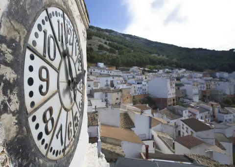
Because of its location in the border area between Muslims and Castilians, it had a very uncertain activity during the Middle Ages, was taken by some and recovered by others on several occasions. In 1231 was conquered by Fernando III integrated inside the Alfoz de Baezawhere she remained until she was donated to the Order of Calatrava, which began important works of protection, building a new alcazar and building a defensive wall around the population. Of both, virtually nothing is preserved except for the remains in the Wall Clock.
During 15th centuryTorres was a battlefield between the masters of this Order and the supporters of Henry IV. As the conquest progressed, Torres moved away from the border and the population was increasing. It is believed that these new inhabitants came from Cuenca, Valencia and the Catalan area. For them, life under the mandate of the co-ordinators was not easy, until 1486 the Capitulation of Arjonilla,which limited mutual rights and obligations.
In the 16th century, given the economic needs of Charles I, he sold the territories of the Order, Torres among them, to his secretary Francisco de los Cobos. Here he ordered to build his house palace and the bridge that today is known as The Bridge.
Pegalajar
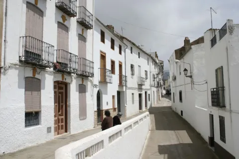
Municipality of west of the Sierra Magina regionwhose municipal term is entered by the north-east end in the Natural Park of Sierra Magina, which is part of the Subbetica and which offers beautiful and spectacular landscapes. The town is located at the feet of the Serrezuela, at 798 m above sea level, where the spring of the Fuente de la Reja that supplies the Charca and the Huerta, elements exclusive the local landscape of Pegalajar.
The municipal term of Paste occupies a extension of 80 km2and is located in the valley of the Guadalbullion River, about 18.8 km. from the city of Jaén. Pedany The lock is part of the municipality.
The olive tree, become practically monoculture, occupies the descending slopes of the numerous peaks that coronate the geomorphology of Pegalajar, focusing on the south and east and occupying approximately half of the municipal term.The economy is based on olive trees and the oil industry.
In the municipality of Pegalajar there are 26 Property declared Heritage Real estate of Andalusia, six of them too Good for Cultural Interest. Let us quote: The Church of Santa Cruz, Tower of the Head, Arc of the Incarnation, Castle of the Peñuelas, Medieval Arrabal, Conistory House, hermitage of the Virgin of the Snow, The Fountain of the Reja, the Charca and the Huerta, the Molinos, the Plaza de Toros, the Caves of the Serrezuela...
Tourist area: Sierra Magina
Distance to the capital (km): 21
Altitude over sea level (m): 818
Extension (Km2): 79
Number of inhabitants: 3145
Gentilicon: Pegalajeños
Postal code: 23110
- Pegalajar City Council: Its construction is linked to the repopulation of the southern part of Jaén in the time of Charles V. It preserves the 18th century facade. It is fully rebuilt and only maintains its original track, the two-story cover of the 17th century.
- Church of the Holy Cross: Built in the castle's enclosure in the 16th century Renaissance style. Its two covers with a very sober decoration are of mannerist style and in its interior, stands out the baroque altarpiece, from which only the top is preserved. The bell tower is the ancient tower of homage. It's declared Good of Cultural Interest in 1985.
- Castle of the Peñuelas: In Christian chronicles it is cited as a Muslim fortress. Two different fortifications can be observed in the remaining remains. A previous one with a walled interior, with two entrance doors. One of them was protected by two circular turreons and the second was defended by two square turreons. He had another turret higher than the previous ones that today is the bell tower of the Church. The second outer enclosure is later, more damaged and served as an extension to the primitive fortification. One of its doors that is in good state of conservation is known as Arc of the Incarnation. Declared Good of Cultural Interest.
- Tower of the Head: It was built between 1462 and 1470, Although it is likely to rise on the ruins of a previous one. It is part of a set of towers that crossed the province, such as the atalaya de la Pedregosa located in Serrezuela de Pegalajar. Declared Good of Cultural Interest
- Arc of the Incarnation: It is about the main access door to the enclosure and the old castle of Pegalajar. It forms a pointed arch on which there is a commemorative stone in Gothic letter and two shields. The arms shield on the left belongs to a family linked to the Order of Calatrava and the shield on the right is from the city of Jaén. On top of all the above is the shield of Fernando III the Holy. It's kept in good condition. In the 19th century the chapel of La Incarnación was built in the adarve. It was declared Historical Monument in 1985.
The Sticking Garden along with the Charca, is a Good Cultural Interest, for being an emblematic model of man-nature interaction.
The Serrezuela de Pegalajar is a Mediterranean mountain, with a large mass of pino carrasco repopulation, natural regeneration cells and other shrubs (majelo, juniper, torvisco...). Very abundant are also the aromatic plants (rosemary, alhucema and thyme). Between her fauna There's big. Rape (perishable eagle, common fencing), Night rapes (royal owl, mocha and autillo) and mountain goats in the rocky areas.
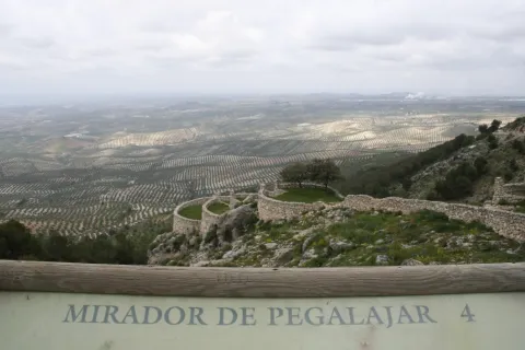
Currently takes advantage of this saw to do sport in nature: hiking, mountain bike, climbing, bulder, free flight... It has two views with splendid panoramic views of the mountain environment, and a recreational area known as "Seven Pillas."
Paste has numerous natural sites of high interest both environmental and cultural. Between them We stand out the following:
- The Charca. It's a reservoir that collects the waters of the birth of the Fuente de la Reja since medieval times. In the beginning it was a simple dam with a containment stone wall and gates that regulated the water output through a network of kilometres of waterfalls, which allowed to water the orchard and olive lands located south of the urban core, distributed in banks. A spring that has never been enough to fertilize all the lands that extend at a decreasing level towards the Guadalbullion River. On the other hand, the years of drought the flow of the source is significantly reduced.
- Source of the Reja. It is the natural spill of the underground aquifer and origin of the hydraulic system of the garden pegalajareña. A legend tells, that a lavender discovered the image of the Virgin of Grace in this place, building in his honor a hermitage over the source itself.
- Recreative area "Seven Pills." This area is 2 km away. from Pegalajar, it is given this name due to the source in the vicinity and it is called in the same way. A space with merenderos and viewpoints from which an extraordinary panorama of the countryside, Sierra de Cazorla, Jaén capital and the municipal term of the municipality are obtained. Here is the flight center Seven Pills dedicated to the practice of the Paragliding.
Other areas of interest They deserve to be visited: Valle del Guadalbullón (The Lock) and Bercho Valley.
- Carnival: The arraigo among the pegalajareños is so important that after the Spanish Civil War, the festival of the masks continued to be celebrated.
- Party in honor of the Virgin of Grace:Commemorated on the first Sunday of May. The participants go to the hermitage of the Virgin, located in the area where the spring of the Fuente de la Reja is located. A Mass is held in his honor and later the procession through the streets of the people.
- San Gregorio Nacianceno: Devotion to this saint goes back to 1670, When the people decide to hold a feast and process the saint every year to rid the field of plagues.
- Virgin of the Snow:: Between 4 and 8 AugustThe patron parties are held in honor of the Virgin of the Snow, with many activities dedicated to all the groups. The Flamenco Festival, to which there are notable figures at national level. Also the bulls and bullfights, which are held in the Plaza de Toros opened in 1919 and have many followers.
- Flamenco Festival: A special mention is required of the Festival of Flamenco Art of Pegalajar, which has been held since 1969 and where each year it is honoured to different prominent figures of Flamenco Art.
In Pegalajar we find a very varied gastronomy whose fundamental base are the products of the garden. Among the most traditional dishes we have:
- Pipirrana: with tomato, garlic mallet, cooked egg, salt, olive oil.
- Peanuts: soup garlic, chorizo red pepper.
- Cazolilla: made from a traditional conserved called "tomato cake" consisting of dry tomato forming a large cake, which makes a sauce to which a saffrito of onion and cod is added.
- Bercho rice: with potatoes and vegetables from the garden or with "peppers."
Warehouse:
- Papajotes: fried mass of flour, milk, sugar and egg.
- Fried skillet peas and nuts, sugar "tostah," roscs and almond stained...
- Home licenses of endrin, purple or the mistel and wine of the country.
The first documented references date back to the Bronze Age. It has been found in the Cueva de los Majuelosdiscovered in the 1970s of the last century, a collective burial with human remains and instruments carved in bone and silex, polished stone, ceramic remains...
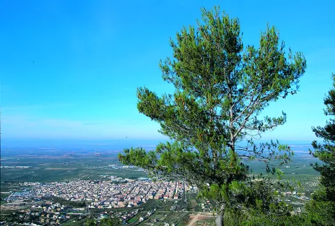
Another of the prehistoric references is the hill of Tower of the Head in which the remains of the Copper, Bronze, Iberian, Roman and medieval epoch are mixed.
From the Roman era, deposits have been located scattered by the municipal term, corresponding to small necropolis and villas that indicate the existence of a scattered habitat, with an agro-livestock economy. One of these. necropolis is the Port Altowhere there is also a pottery of the seedling land, pieces of Roman teagula and a stone-carved altar. There are other locations, such as the Canteruelathe Charcons, even in the vicinity of the Torre de la Cabeza has been located Roman ceramics made around.The four militaries found in 1975 in The lock They make known to us the existence of an important Roman road passing through this town. The insecurity of the area in the Middle Ages is reflected in the disappearance of the Roman houses scattered by the term and occupation of the natural strength of the Peña de los Vultreswhere it was built a pebble that is still preserved.
The origin of the villa is from the time of Al-Ándalus. Their existence revolves around the Source of the Tea, aquatic origin of La Charca. With peace and the rise of the caliphate between the X and XI centuries should have to expand the network of accesses and banks that form the Paste orchard.
The Christian conquest took place next to that of Jaén by Fernando IIIwhich also took over the castle of Pegalajar. The primitive Muslim compound was expanded after the conquest, with the construction of a second compound and strengthening of the first one with circular towers more resistant to the gunpowder attack.
From the conquest in 1246, was a village of Jaén, was part of its alfoz and its proximity to the Muslim kingdom of Granada made it a fundamental defense of this city, until the end of the Reconquest in 1492. On this date he loses the strategic value of his castle, but not its economic importancebecause at the feet of the fortress a fertile vega of orchards and olive trees, inherited from the Arabs.
The origin of the population of Pegalajar after the Reconquista was linked to the city of Jaén, on whom it depended administratively. This population was formed by men in the 13th century from several Spanish areas.
In 1559 King Philip II granted Pegalajar a real privilege for which he recognized him. Jaén's exemption and the title of the villa in exchange for a service to the Crown of a significant amount of maravedis. The municipality begins a period of economic and demographic improvement.
After XVII crisis, increased by the tabs and famine in the 18th century, there is a slow population growth leading to the expansion of the agricultural land and the various production, which was maintained until mid-term 20th century where, as in the rest of the province, a important emigration to cities in search of a better life.
Noalejo
Noalejo is a municipality located in the southwestern end of the Sierra Magina region, already on the border with the province of Granada, with an extension of 49 km2.
The municipality of Naparteño comprises two cores Population: Noalejo and Hoya de Salobral.
Su extended term of 30 km. of length and a maximum of 3 km. width, extends as a the border between the provinces of Jaén and Granadathrough it the main channels of communication between the two provinces, highlighting the A-44 (Sierra Nevada- Tropical Coast highway). In Noalejo The pastures and the oak mountains, sometimes very well preserved, stand out.
Economic activity of the town revolves around the olive and its processing industry. It is also grown almond and the gardens in Navalcán and in the Vega of the Alminares River. Gozan of a lot of fame the pork sausages which are made in this municipality.
The main architectural jewel of the municipality is the church of Our Lady of the Assumption, built between 1570 and 1575. It's a mudejar plant and has a single ship.
Plaza España, 1, 23140 Noalejo
Tourist area: Jaén and Sierra Magina
Distance to the capital (km): 47
Altitude over sea level (m): 1100
Extension (Km2): 50
Number of inhabitants: 2294
Gentilicon: Noyeño
Postal code: 23140
Details of your artistic heritage:
- Church of Our Lady of the Assumption. It is one-ship, rectangular in shape and has a structure of Mudejar tradition. It was ordered to be built by the founder of the municipality, Dª Mencía de Salcedo. Inside it is the canvas of the patron of Noalejo, the Virgin of Bethlehem, as well as a copy of the Holy Sheet of Turin of the 16th century, both of which are belonging to Dª Mencía de Salcedo. It also houses an original size of the Immaculate Conception, one of the few not destroyed during the Civil War. A four-body square tower was then erected, not including that of the bells. Coronating the set, a small octagonal base capitel with small circular windows.
- Abrego de Navalcán. They have been declared Good of Cultural Interest in 1985. Its chronology dates from the Copper Age, mid-3rd millennium BC. It belongs to the rock art of the Mediterranean arc and is located in a coat above the Navalcan Abrigo, where remains of a human settlement have appeared. They are performed in a schematic way with three groups of figures that seem to stage a dance.
- Hermitage of the Virgin of Bethlehem. Open to the public in 1910, although it has been the subject of several remodeling. It is formed by a rectangular ship with a small bell tower on its main façade that occupies three bells. The side facade is made of stone with small windows that give light to the interior of the ship.
- City Council. Building built in the late 16th century. At first it was a convent under the title of Our Lady of the Assumption, and this is the reason for the small image that presides over the facade. In the 18th century it became for the first time the House of the Council. The original construction corresponds to a three-storey building, which housed a bell with three crunches. It had different dependencies and a central courtyard. A large two-metre imperial staircase, immense and majestic, raised us to the second floor. On the third floor the schools were installed.
Noalejo, with an extension of 49 km ²It's an elongated 30-km-long strip of land. for a maximum of 3 km. wide. For those 30 kilometers it makes border between the provinces of Granada and Jaén.
We can say that practically the whole term is a natural place, although we can highlight the places of Navalcán, Nava Alta, Nava Baja, Sierra de la Granadina, Navalbunny or the Alta Coloma saw.
A landscape in which The mountains stand out (Sierra del Trigo, 1681 m.; Sierra de la Alta Coloma, 1606 m.), the hills (Santa Merced, Cerro Prieto and Cerro de la Mesa in the Hoya de Salobral), lomas (the most outstanding is the Loma de las Viñas) and the forests (like the pine trees of Cerro Prieto and Navalcán, and also of oak trees).
The term Noalejo presents the typical Mediterranean forest, characterized by housing a xerophyll vegetation, plants adapted to drought. The oaks, coscojas, cornicabra, torvisco, aulagas, rosemary and white jara predominate.
In the riverside areas we will find mixed deciduous forests, composed of chopos, willows, olmos, zarzamora, endrino...
Without forgetting the importance of mycology and between it: the cardo mushroom, the cane mushroom and the wild mushrooms.
From the fauna, we will find the typical species of the Mediterranean and mountain mountain: major hunting species: boar, muflon...; minor hunting (rabbit, perdiz, zorzales...); Insectivorous birds living in the olive tree, and the forest-specific fauna of gallery by the river line; amphibians and reptiles.
But the best way to know the landscape, fauna and flora of this territory is to visit one of the many places that offer us, among them all, we highlight:
- Navalcan. It is located to the west of the town, in the foothills of the mountain set of the South Sierra. It's a karmic depression where we can observe slices, caves, river courses, Mediterranean flora and fauna. The valley is like a small oasis in the middle of an increasingly agribusiness orography. A place to observe the panoramic views of the region and the starting point of hiking routes that discover the area.
- Navalta and Navalbunny. They are fenced valleys surrounded by pine and oak. Places very visited by mushroom seekers in spring and autumn. They are also spaces of livestock holding (ovine and caprine), there are several cortijos dedicated to this work.
- Sierra del Trigo. This is an important mountain port, from where we can see stunning panoramic Sierra Sur, Sierra Mágina, Sierra de Arana and Sierra Nevada. In two of his tops, The Nevazos and Cerro del Hoyo Cigarronesdifferent phases of the wind park.
Among the many festivities held in Noalejo, we highlight:
- Saint Anton, January 17. The day before is done "lumbres" to celebrate the master of the animals and to ask the saint to protect the animals of the house. It is a custom that over the years seems to be falling.
- The Virgin of Bethlehem, take place from 14 to 19 August. It's the big parties. and the ones most expected by the neighbors. They were changed from the date of October to the current date of August so that those outside the town can be present. The Virgin rises to the hermitage on Saturday in a procession that begins at 22: 00, walking the streets of the village and then ascending to the hermitage where a salve will be sung. Sunday is repeated again the procession with an estimated duration of four hours.
Among the many activities planned there is no lack of "bulls" of braves.
- Real Fair "Villa de Noalejo," 5-7 September. Inside the municipal pavilion, the village merchants set up their stands to promote the sale of their products. There are numerous visits to the surrounding villages.
- Virgin of the Rosary. It takes place on October 7. The party starts with the Rosario de la Aurora 7: 00. In the afternoon, at 8: 00 p.m., the procession takes place with the image of the Virgin who walks the streets of Noalejo. The large number of lit torches that light the road is very striking.
The gastronomy of Noalejo is based mainly on the products derived from the slaughter of the pig.
This town, with its altitude (the city centre is more than 1000 m.), is ideal for healing sausages. This morning tradition has led to the survival of a dish known to the "San Antonio pot," The ingredients are: white beans and dried beans in soak, to which is added a payroll of pork products: spinach, salt ribs, ham bone, an ear and pig tail, all well boiled next to a garlic head, an onion and pepper.
Another typical dish is the "Noooooooooooo," and a vianda that usually prepared the shepherds on the mountain for dinner. It is a hot soup made with water, vinegar, olive oil, ground garlic, salt and ground pepper. In addition, after boiling, a slice of previously roasted bread is added.
In addition, it has these Other dishes: bonus cake, green olives, stuffed eggs, old clothes and shepherd's crumbs.
From the pastry shop We point out: Christmas, sweet gachas, wind coffins...
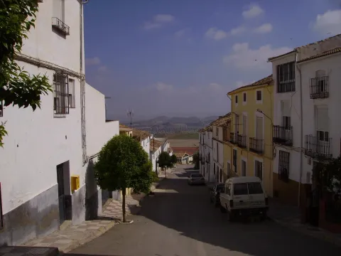
The oldest testimonies of the human presence in the term of Noalejo are the cave paintings of Navalcan's coatwhich had to be carried out between the end of the Neolithic and the Bronze Age.
The foundation of Noalejo as a village of lordship goes back in the early 16th century. In its history we can set four stages:
- From 1492 to 1500. Because of the inability of Granada and Jaén to establish the provincial limits, the "entertaining"which consisted of leaving land unattached to any specific locality to be enjoyed by the inhabitants of both jurisdictions. The strip of land occupied by Noalejo would be "challenged" by Granada and Jaén. It soon became a source of conflict.
- From 1530 to 1554. In these years there is the acquisition of the "misfortune" of the term Noalejo by Ms Mencía Salcedowhich will begin to to rotate the land to work land. This action will have the opposition of the neighbors because they run out of cattle pastures.
- Between 1554 and 1599, Ms Mencía Salcedo to buy from the crown the civil and criminal jurisdiction of the terms of the questioning.
- From 1560 in Go ahead. A problematic stage of adaptation to the new situation, in which both Mencía Salcedo and his successors will be faced with continuous lawsuits, until they get confirmation of their privilege.
Noalejo was founded by Ms Mencía Salcedo, which is the most important character in the history of the municipality and is surrounded by a certain legendary dye by the neighbors. (Mencía Salcedo was a woman at the service of the Royal House of Charles V and his son, Philip II).
In 1568 the municipality was assigned by Bula to the Abbey of Alcalá la Real and when the abbey was abolished in 1851, it was finally integrated into the diocese of Jaén.
At the end of the 20th century, the fall in the profitability of agricultural land was one of the causes of the caused emigration to cities, industrial and tourist centres, with a significant decline in the number of inhabitants.
Mancha Real
The population of Mancha Real is located east of the capital, in the foothills of Sierra Magina and more specifically at the foot of the Eagle Peña. It's only 19 km. from the city of Jaén.
Its municipal term, a long strip of land, is one of the most industrial municipalities of the province, extending from the foothills of Sierra Mágina, to the south, to the Guadalquivir River, to the north.
To the south of the term are the forest lands of the municipality, descending from here to the Guadalquivir River and becoming an olive countryside.
The town of Sotogordo also belongs to Mancha Real.
In addition to having a great olive tradition, it was one of the industrial cores the most powerful of the province, especially the sectors of wood, the information technology with the manufacture of computers and industry of manufacturing of tools and agricultural machinery.
To the southwest of the town, just 3 km. of the urban core, next to the Natural Park of Sierra Magina, is the Eagle Peña, an area of great environmental interest.
The church stands out from its architectural heritage Parish of San Juan Evangelista, the Old Convent of the Barefoot Carmelites, the Torre del Risquillo and the Castle of Riez, the last two in the municipal term.
Tourist area: Sierra Magina
Distance to the capital (km): 19
Altitude over sea level (m): 770
Extension (km ²): 97
Number of inhabitants: 11,264
Gentillo: Manchegos or Mancharealeños
Postal code: 23100
- Parish Church of San Juan Evangelista, is the most important monument in the town. Declared Good of Cultural Interest in 1983, it was built in various phases between the 16th and 18th centuriesThe names of the most prestigious architects such as Andrés de Vandelvira, a master in the construction of the Jaén Cathedral, are linked to the building. The trail presents a temple of three ships with the flat header, columnary and sacristy supports, with vaulted vaults on the side and spherical ships at the central. The main coverof extraordinary bill and beautiful composition, mannerist, made of stone and structured as an altarpiece. Its most striking elements are the half point arc that opens the door, the double Ecstasy columns that flank her, ornamental grounds as diamond tips or structuressuch as pilasters and semicircular parties. The tower and with the first body without decoration to whom they point strong foothills; second body with balconies with a half-point arc on imposts, crate pilasters and triangular front with shield on the eardrum; body of bells, presents vases on the four corners on which the octagonal body is raised, which it holds, in turn, a pyramidal chapitel.
- Convent of the Barefoot Carmelites of Real Mancha. From this convent, founded by San Juan de la Cruz in 1586, is preserved a small part of the facade, a canvas divided into three sections by pilasters, the smooth sides and the central with the door. It consists of a half-point arch on imposts with highlighted key and jambas supported in the zócalo. The axis of the pilassas is crowned with pyramidal pinacles.
- Torre del Risquillo. They are remains of a bajomieval tower (tower of the homage of the old castle), probably from the 13th century that conserves 4 m high and is located on a small hill a few meters from Cortijo Risquillo.
- Castle of Ríez. It is integrated into the Cortijo de Ríez, and is an ancient fortress existing in the Auringi countryside. It is erected next to the Roman road from Guadix to Catulus. This fortress was destroyed by the northern barbarians who left only the foundations. In the time of Fernando III, the Holy One was rebuilt by the Arabs and looted and burned. He protected Baeza's path with Jaén.. At the foot of the remains of the enclosure are various archaeological pieces such as a mill and a catapult bullet. It's been declared Good of Cultural Interest.
The municipal term of Royal ink consists of 98.78 km2 surface, with a height of 757 m above sea level. In general terms, we can say that it is an agricultural municipality, right on the border between Sierra Mágina and the southern countryside of Jaén, where the areas covered by the crops, mainly olive trees, dominate.
The highest altitude areas are located in the south of the municipality, in the foothills of Sierra Mágina, The Morron with 1540 m. and the White Mojon with 1495 m altitude, are the ceilings of the municipality. In the term of Real Mancha, they are distinguished four ecosystems:: forest and forest land, agricultural ecosystems, rivers and humid areas and modified ecosystems.
The forest ecosystem is located in the South of the municipality, where pine, oak, oaks and complaints predominate. In agricultural ecosystem the dominant species is olive, as well as other arable or cereal crops.
The wetlandsnear the river basin, in Mancha Real, have an extension lowwhich would be located to the north, near the Guadalquivir River.
The modified ecosystems would be made up of those areas where removed indigenous vegetation to dedicate it to olive crops or recreational areas.
The fauna of the term the small game cynetic species, hares, clumsy pigeons, rabbits, partridges, badges; olive fauna: carbonaries, cobblestones, owls, cernikals, hawks...; and reptiles: lizard, hocucuda viper, salamanchees, creams...
Eagle Peñaan area of environmental interest:
Although it is outside the limits of the Natural Park, the Peña del Eagle saw, it can be considered as entrance door to the Natural Park of the Sierra Magina.
With the recently conditioned access and trails, it offers us the possibility to make a circular route that will allow us to observe the fantastic panoramic of many points in the province, while we discover the vegetation that dominates this area.
On the rise we will crown The Morron and The White Mojónfrom where we can see El Almadén and El Aznaitín as representatives of Sierra Magina. A good choice is to get close. to the recreational area from where we'll get some spectacular views of the municipality from Real Mancha.
The festival of Mancha Real is wide and unique, from which we highlight the following celebrations:
- San Joséon March 19. The importance of the wood sector is felt the celebration of the day of San José, patron of the carpenters, and in its honor a monumental failure in the style of the Levine. A party that is considered to be of Regional Tourist Interest.
- Holy Week. During Holy Week, the four cofradies of the town process through the streets of Mancharrealeña reminiscent of the Passion of Jesus.
- San Marcoson April 25. Real Mancha pattern.
- The "Monkeys." The 2nd and 3er September Sunday. A party with an ancient tradition in which there is no lack of procession. The night before they gather in the square and go all over the town singing some popular coffins (16th and 17th centuries), inviting people to participate the next day at the party.
- Romeria and Feria in honor of the Virgin of the Rosary. The Romeria, which has no specific date, is held for a weekend. The people of the village go up to the hermitage and encampa all weekend in the surroundings of the sanctuary of the Virgin to accompany her. The Saturday Mass is held in the sanctuary to which all the rosemary people attend. The Sunday The transfer from the Sanctuary to the Church of the people takes place. After the Romeria, in the following days the Fair is held in on the 7th of October, day of the Virgin of the Rosary. In those days the "target" morning or the most diverse attractions for big and small.
- The Immaculate Conceptionon December 8. It's the Patrona de Mancha Real.
In the municipality the industry of making sausages, where natural products preserved in oil have been processed, stands out. One of the most popular is the morcilla. The basic ingredients are: pork butter, onion and pig blood; and the main fences: sweet pimenton, cinnamon, nutmeg, nail, caravan, salt, oregano and optionally the thyme.
The typical dishes coincide with those of the Sierra Magina region and all of them revolve around olive oil:
- The Calandrajos. They have as ingredients water, flour and salt for wafers. In the frying pan a saffrito of tomato, garlic, onion, green pepper, a little spicy and rabbit, hare or partridge. When cooked the meat is added the wafers and let be boiled. They're served in the same pan.
- The Migas. It was a dish used to take advantage of hard bread. They are fried in a frying pan of garlic teeth, to which the bread is added until it is touched. The crumbs are usually served with fried peppers, torreznos, sardines, grapes and melon.
- Pipirrana: a salad in which tomatoes, cooked eggs, green peppers, onions, tuna are chopped...
- Gazpachos, which carry almost the same ingredients as the piirfrog, but are batted and left with the liquid presentation.
In the pastry shop:
- The Sweet Gachas. They are made from roasted flour, bread, milk, cinnamon, sugar, olive oil and matalahúva or anis. They're typical of All Saints Day.
- The Boring. Made with a bread made of oil and egg cooked in the center. It's consumed on Easter.
- The Drinks. Oil, wine, flour, a little anise and sugar.
- Other: Roscos, gusanillo...
The first signs of human presence on the lands de Mancha Real go back to Paleolithic, in the settlement of the Soguero. In Neolithic, V and IV millennium BC and the Bronze age, III millennium BC, there was a proliferation of settlements in the area, including those of Piedras Gil, Cerro Moreno, Cerro Alcalá and Peñaflor.
From the Iberian stage has been recorded in the settlements of El Toril and Las Casicas. From the Roman times is located in Cerro Alcalá la Ossigi Latonium.
During Islamic period the area was populated by small villages or houses; one of them is that of Peñaflora which had between 20 and 30 houses.
After the Christian conquest, this population was kept scattered around control towers, including Peñaflor, Requillo, the Sordo Tower, etc.
The current core population was founded by Carlos V in 1537 and the villa took the name of The Jaén Manchuelafor being dependent on this city. The reason for its foundation is in the process of repopulating these lands after the completion of the Reconquista for the defense of the roads.
The boom and consolidation of the population, determined the struggle for Jaén's independence. Philip II, 1557, granted the title of villa and thus the independence of the city of Jaén, not without having paid the amount of 58,000 reais.
The importance that La Manchuela de Jaén acquired is a testimony to the stop on the regio journey of Philip IV in 1653which led the jurists of the village, in thanks to the king for his visit, to decide that they will henceforth be called e Real-time.The population continued to develop to 11264, and today it is a people, for its industry and agriculture, with a hopeful future.
Larva
Larva is a small population located to the southeast of the provincein the corridor that separates the Sierras del Pozo and Sierra Magina. Its territory is on the slope towards the Guadiana Minor River.The rainfall and vegetation are scarce and the erosion very strong, producing large ravines and torrenteres that make up a semi-desert landscape.
More than half of the municipal term is dedicated to pastures, tumiliars and splitsthe number of forest tree species, sometimes the result of repopulation.The economy of its inhabitants is exclusively and subsistence, dependent on cereals, olive, caparra and sheep.
From its artistic heritage, the church of St. Peter the Apostlebuilt in the 18th century, it has a simple structure both outside and inside and El Castellón, remains of an ancient Iberian cyclopian fortress of the II and I centuries a. C.
Tourist area: Natural Park of Sierra Magina
Distance to the capital (km): 87
Altitude over sea level (m): 720
Extension (Km2): 42
Number of inhabitants: 500
Gentilicon: Larveños
Postal code: 23591
- The Parish Church of St. Peter the Apostle. Built at the end of the century XVII has a simple structure both inside and outside. Its facade is articulated in two bodies, with greater development in height than in length, without ornamentation and its door intoned with slightly curved bow. It overcomes a small tower that, in addition to performing the bell tower function, singles out the church and underlines the highest height compared to the rest of the buildings.
- Old Town Hall. whose façade has a watch and a bell, according to the model of the conistory houses of the illustrated colonization. It currently hosts the municipal hostel.
- Urban hull. Maybe it's Larva's most attractive. Sitting on a soft slope, between the saws of the Well and Cabrillawith a capricious layout of its streets, light slopes, uni or multifamily houses with a marked rural accent.
- The Tissue of the Moors. It is a medieval settlement just a few meters from the city centre.
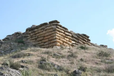
- El Castellón. Located in the Cerro del Castellón, the remains of an Iberian cyclopean fortress from the 2nd and 1st centuries are preserved. C. It is a walled enclosure with a quadrangular structure and a aljibe inside it and with limestone armchairs that reach a meter and a half in length.
- Cerro Castellón: This fortress is located on the top of a hill isolated between the plains of Larva. These remains have been dated between the 1st and 2nd centuries BC. It is a rectangular cyclopeia fortress built in dry stone. In the interior of this one is a plateau of regular armchairs, smaller than those of the outer walls. Fragments of ceramic decorated with Iberian-type geometric bands and medieval ceramic with incise decoration have been found.
- Virgin of Majada Blanquilla A mile from the village, on the way to Cabra del Santo Cristo, there is an olive farm known among the neighbors as Majada Blanquilla. It is located in the highest area of Larva, and in it is the highest point of the Sierra de Larva with 1144 meters above sea level. It is here at this point, built by the hand of man, where there is a small sanctuary with a Marian image becoming a place of pilgrimage, and a perfect hiking route for the most experienced.
- Museum of People's Arts and Cosmos, where we will be able to know all kinds of traditional items and instruments, among which are the tools of the labrance and the slaughter.
Larva is located in a privileged place between two natural parks in the province of Jaén. In a panoramic view, if we place ourselves in the urban centre looking north, the Sierra Magina Natural Parkand to the right the Natural Park of the Sierra de Cazorla, Segura and Las Villas. The cities of the World Heritage of Ubeda and Baeza. The Sierra de Larva is born on our back with pronounced slopes and with the dominant presence of the Mediterranean bush, with abundant matas of rosemary and thyme.
Special mention deserves the spartum, which was so important in history to go away.
In the tree extract the carrasco pines predominate. The top of this mountain is at 1,144 m of altitude, known as Crow of the Picones.
Over the last few decades the landscape has changed, according to agricultural needs. The fields we see, originally you have been occupied by large extensions of cereal crops. Over time, the steppe landscape has undergone a great transformation, leaving way for the cultivation of the olive tree, and occupying the largest area for agricultural use, the cultivation of the cereal being relegated to a second position.
The rainfall is low.
The economy of its inhabitants is exclusively agricultural and subsistence, dependent on cereals, olive, caparra and sheep. It houses a rich fauna: clumsy pigeon, abubilla, jineta, badger, boar, rabbit... and is an enabling ground for activities such as hiking, cycling and climbing, among others.
On the road to the Cañada Real you will find the farm of The Laguna. It is a flood area, where in years of rain and snow a natural lagoon abounds, becoming a special place that houses various species of birds and amphibians.
Another place of great natural appeal for the visitor is the Area of "The Pozuelo. "It is reached by the road that is born from" La Casería "to the Sierra. A place of special interest for nature lovers, in it there are three springs, two of them accessible for the visit: the Fuente- the Caño and the Fuente- the Cueva.
A few meters from these are the Cave of the Joso, a geological figure known colloquially as "coat" whose use is intended to keep livestock. This place is ideal for adventure sports.
Recreational area La Cañada: This is a perfectly equipped area with a interesting view, of a water source, an information panel on landscape interpretation and the panoramic area that is visible from there.
The visitor of this town can enjoy two festive cycles: those related to fire, and the great festivities and fairs.
Fire-related festivals:
- Saint Lucia, is held on December 13. The Larveños celebrate this day by lighting the "luminaires," thus preserving the tradition from the time they belonged to Cabra del Santo Cristo, where they celebrated this holiday with the burning of bonfires, around which they eat, drink, dance and sing.
- Saint Anton, January 17. A day when the "luminaires" will be re-lit on whose asses the chorizos of the killing will be roast.
- La CandelariaFebruary 2. With it, the cycle of festivities where the rite of fire is exalted is closed. It is a tradition for the children to come with baskets in which they wear roscoons, a rhyme of rosemary and, if necessary, a few pigeons, to commemorate the Purification of the Virgin Mary, who went to the temple of Jerusalem to offer two tortoises to the priests.
Cycle of the great festivities and fairs:
- San MarcosApril 25. It's the Co- pattern of the town. There are three days of festive and religious events in which the images of San Marcos and Nuestra Señora de los Dolores process the town. The image of Saint Mark does so on the 25th and the image of the Virgin processes on the 26th.
- San IsidroMay 15. A pagan party extinguished and recovered a few years ago, when the saint was processed and impartially mounted on a tractor, accompanied by the parishioners of the village up to a raft near the municipality holding a mass in his honor. On returning to the church, some of the village's neighbors brought drink and food, other tables and music, and this is how the rosemary of San Isidro in Larva.
- San Pedro Fair. The festive cycle is closed with the celebration that takes place in the first days of August, dedicated to San Pedro in which the dances and the hubs will last several days.
This feast was originally held on June 29, the feast of St. Peter and Paul, but the presence on those dates of the wheat mieses and parvas in the ages were at serious risk of fire with the launch of the rockets. For this reason, and also so that on the days of the feast there may be those larveños that during the year are found outside the town.
The gastronomy, which is part of the cultural heritage of the town, we have to highlight the products derived from the slaughter, such as the exquisite chorizos or the adobado loin.
The following dishes are also rooted in tradition:
- Andrajoseither with hare, rabbit or fish.
- Gachas. In summer time they are prepared with roast red peppers, green peppers and a lot of tomato.
- Sweet peas with toastwhich are consumed on the Day of All Saints.
- Potting of cod and Cod, typical dishes for Lent and Easter time.
Of the pastry: Home empanadillas, dumb stained, flowers (fine fried mold), skillet rosks, drunks, "friar ears" and solillos.
In Larva there have been up to 4 ovens, but depopulation and low profitability made them close. Peoples such as Cabra del Santo Cristo or Peal del Becerro, spread to the municipality of bread.
The geographical location of Larvain the corridor that joined the Alto Guadalquivir, the depressions of Ubeda and Baeza, Guadix and Levante, makes these lands populated since the oldest prehistory.
The place of origin of the present Larva is located in the Iberian settlement of Cerro del Castellóndated between the 2nd and 1st century BC It is a fortified enclosure located on a rigged hill in the middle of a plain, which remained occupied in Roman times. The armchair walls are preserved and a large sealant inside. In the Arab era, this place was identified with the name of Ullawa, which refers to the holding of "Wednesday Market". Very close is the castle shelter of the Woven of the Moorsa fortification on a top.
The compound was divided into two spaces: the lower to house the animals, while the superior, identified as a castle, served as a shelter for the neighbouring populations. Larva is likely to be a property dependent on this settlement.
During the 13th century, Larva He was on the Castellano-Nazarí border, playing an important role in the control of both Muslim and Christian riots, the latter settled on the land of the advance of Cazorla.
Until 1836, Larva belonged to Quesadathe date on which the neighbors request the dependency of the municipality of Cabra of the Holy Christ. The dependence on the new town would last almost a century, until 1924, when it became a minor local entity.
It would be in 1936 when its segregation as an independent municipality was consolidated. After the Civil War, the population recovered, with 2,061 people being registered in 1950.
From this decade on, people are losing their population because of the emigration of people to both the large cities, Madrid, Barcelona, Valencia, and foreign nations. It currently has 450 inhabitants, one of the localities with the lowest population in the province.
La Guardia de Jaén
Small municipality located in the west of the Sierra Mágina region, a few kilometres from the capital. The urban core, located at the eastern end of the Cerro de San Cristóbal, looking at the Guadalbullion River, conserves the tipism of its white houses and its steep and narrow streets.
Among the natural enclaves of interest of La Guardia are the Cerro de San Cristóbal, whose summit is repopulated with pine trees, and the Vega of the Guadalbullón river itself, which continues to preserve an abundant riverside vegetation.
La Guardia offers many possibilities for walking, horse or bicycle excursions, such as the Cañada del Santo or the banks of the Guadalbullion River. Of archaeological interest are the settlements of Guadaola (period of emiral), the Roman villa of the Yuca, or the different Ibero-Roman necropolis of Las Eas de San Sebastián and Barranquillo.
The castle, of Arab origin, which was remodeled as a palacio-citadel by the Messias in the 14th and 15th centuries, is the main architectural jewel of the town, along with the parish Church of the Assumption, a work of the 16th century that was originally convent of the Dominicans.
Descarga la app:
- Android: https://play.google.com/store/apps/details?id=com.deditec.laguardiadigital
- iOS: https://apps.apple.com/es/app/la-guardia-digital/id6453025656
http://laguardiadejaen.com/tu-ciudad/informacion-turistica/
Plaza San Pedro, s/n
953 327 100
Tourist area: Jaén and Environment
Distance to the capital (km): 10
Altitude over sea level (m): 645
Extension (Km2): 38
Number of inhabitants: 4465
Gentilicon: Guards
Postal code: 23170
The most important monuments of La Guardia are:
- Castle of the Jaén Guard. It is a fortress of considerable dimensions, settled on Iberian vestiges. Most of its defensive structure was built in the period of Al-Ándalus, with subsequent remodeling, mainly of the alcázar to serve as a church or palaciega residence in the 15th and 16th centuries. From the Tower of Tribute a stunning panoramic that shows us Sierra Magina, Sierra Morena and the fields of La Loma.
- Old convent of Santo Domingo. The church is the best preserved building of the Old Convent of Santo Domingo de La Guardia, the rest being in advanced state of ruin or hidden by the reforms of the last century when it is occupied by an almazara. After the deamortization and abandonment of the church of Santa Maria on the grounds of the castle, the church of the convent was converted into Parish of Our Lady of the Assumption.Decoratively, the temple is of a pure classicist style, typical of the Vandelvira of the second half of the 16th century, hired in 1542 by the Dominicans for its project and execution. With a one-ship Latin cross plant, respecting the patterns of the Dominican order, it stands out its header, in which the date of 1556 is recorded. A Renaissance work of great beauty that has been declared Artistic Historical Monument, protected as Good of Cultural Interest in 1975.
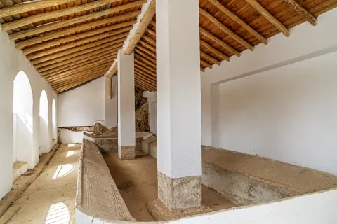
- Public laundry of the Second Republic. A place with a special charm, in which it still seems to be impregnated by the atmosphere that the people occupied in daily hygiene created every day. The utensils they used and which have been donated by the neighbors can still be seen in it. On the first floor is the Fountain Lavadero Museum.
- Set Plaza Isabel II. It's another major enclave in La Guardia. The historical set was built to illustrate the greatness of the Marquise granted by King Philip II in 1556 to the first Marquis of La Guardia, Gonzalo Messia Carrillo de Fonseca.
The square concentrates several monuments concerning the 16th century and the Renaissance:
- The Source of the five years, they are bronze and they used the water of a local spring.
- The Source of Mary Magdalena, a central fountain topped with a sedent virgin that belonged to the ancient convent of the Dominicans.
- Sole house of the Ochoa familywhich was built in 1813 and which seems to preside over the square.
The Jaén Guard is a town on horseback between Sierra Sur and Sierra Mágina.
Since privileged area at 635 m altitude The Guadalbullan River is dominated in its search for Guadalquivir, Sierra Morena, Sierra Mágina and the fields of the region of La Loma, most of which are populated by olive trees.
Its vegetation in the high area, slopes and top of Cerro San Cristóbal, is the one of the Abrupt and steep land, highlighting the repopulation pines on the top and slopes of the hill, as well as shrubs and aromatic plants. The rest of the land is colonized by olive trees except for the area of the Vega del Guadalbullón on whose fertile land fruit trees, cereals, maize and vegetables grow.
The fauna is the characteristic of the small hunt: hares, rabbits, partridges, foxes and numerous rapacious birds nesting on the steep rocks of the hill. In the area near the river, the typical avifauna of the gallery forests.
The best way to get to know this area and discover the living nature is to walk one of the many paths that are serpentating for its municipal term. One of the most representative and best panoramic on the region is the so-called "San Cristobal Hill Path."
The path ascends by the area of Monte Prieto, and descends by the vicinity of the Peña de San Cristóbal, the point of beginning and ending being the municipality of La Guardia itself. We will find the impressive coat of Cave, with remains of human occupation from the Neolithic. At the flat summit of the Cerro de San Cristóbal you can enjoy a pleasant walk between the pines. The north and south slopes have spectacular views, being authentic natural views of the mountain reliefs of the south and the province of Jaén.
The set of parties held in La Guardia, the Guardeños are grouped into two blocks: the major parties (San Sebastián and Divina Pastora), and, on the other hand, the rest of events and celebrations.
- Celebrations in honor of San Sebastián. He is the patron of La Guardia and are the most loved by the neighbors, and especially by those who emigrated and return to their own in these days of feast. The 20 January and last from the 19th to the 22nd. It is a feast of agricultural origin, and the tradition consisted of taking the image of the saint to the ages, the place where the harvest was torn.
- Fair and Festivals of Our Lady The Divine Pastor. The day is celebrated 10 August and its origins are related to the world of agriculture and the blessing of crops and crops.
- Fair and Festivals of our Patron Our Lady of the Rosary. They take place around the first Sunday of Octoberand are characterized by one of the oldest traditions: the Song of the Aurora Or just La Aurora. It consists of the departure of a group of people, the "auroros"in the early morning, accompanied by musical instruments, they go through the streets of La Guarda singing to call the brothers of the brotherhood to the prayer.
- Romeria de San Sebastián. The Third Sunday of May in honor of the patron saint, a tradition of more than four centuries. It is held in the natural area and recreational area called "Allanadas del Santo." The rosemary begins with the transfer of the image of the saint to his hermitage, located in this place. In the morning the Mass is held, and in the afternoon the saint is processed in the surroundings of the hermitage.
La Guardia's gastronomy presents a wide variety of flavors, textures and ingredients, whose secret lies in the Arab reminiscent of typical recipes. A whole culinary mosaic that has been enriched throughout history to this day.
Among the most typical dishes, we highlight:
- Wigs: is a stew made with wheat cakes, clams, bowels, meat and different vegetables.
- Cod, a typical dish that is consumed especially at Easter.
- CatsThe bread is added chorizo, ham, peppers... and other ingredients that change depending on the time of year.
- Pomegranates.
They are also made sweets that are typical of this locality:
- Pumpkin, the dessert par excellence of La Guardia. It is made with pumpkin, pepper and sugar.
- Gusanillo, a typical gardena confectionery.
- Sweet peas, which are consumed on the Day of All Saints, on November 1.
- Other: fried rosses and Peach punch.
The San Marcos slope The Guard is a strategic enclave, a silent witness to the different peoples and cultures that have passed through this place. The remains that have been found thus attest to it from the Neolithic to the present. For this reason, La Guardia is known as "Cult Gate."
Apart from its important border role between Castile and Granada, what really distinguishes La Guardia from other border areas is the location of a ancient and illustrious population settled in the current location For centuries. The Guard was an important Iberian oppidium called Bastia lie About 1500 years ago.
During the Roman era it will reach its highest splendor. He was known as the Great Mentess. A strong, economic, social and political city. With a population that reached 5000 mentesans. They exploded the gold from their mines, which came to Rome, and coined coins.
With the Muslim invasion In the eighth century, the city was looted and burned. It will be during this century when the construction of the castle's defensive structures begins.
In 1244, Fernando III El Santo conquered the city and again became a defensive bastion of Castile in the Guadalbullion Valley until the conquest of Granada.
With the taking of Granada and the loss of value as a strategic and defensive position, it begins its stage of peace and immerses itself in the Modern Age.
Family Messiah is established here in the 16th century, modifying the castle to adapt it as a palaciega residence, reusing the existing tower as a church dedicated to Santa Ana. The bell tower is built on it and will be the Parish church until the mid-19th century.
Also in the 19th century, the Ochoa family sits in the municipality and decides to build a solarium house next to the fountain of the Pilar de los Messia.
Little remains of the glory of Mentesa, since since the 19th century its main sustenance was agriculture and oil and flour mills, an economy that precipitates the migrations of the people during the post-war period.
At present, its situation near the capital has encouraged the revitalization of the municipality.
Jódar
A population belonging to the Sierra Magina region, located to the north-east of it, in a landscape composed of large extensions of olive trees on one side and saws on the other.
It is the most populated municipality of the region, its southwestern end is included in the Natural Park of Sierra Magina, which is part of the Subbetica and offers beautiful and spectacular landscape. The Guadalquivir, Jandulilla and the Arroyo de la Countess rivers go through their municipal term.
The cultivation of olive trees, asparagus and spartum-related crafts are part of their economic activity.
Among its artistic heritage are the Parish Church of the Assumption, the Muslim Castle, the Church-Sanctuary of the Christ of Mercy, the surroundings of the church, streets and squares where you can see traditional buildings of the region with its peculiar layout and the cave houses.
The Artistic Historical Set of Jódar has been in the cultural interest of Andalusia since 2014. Since 1983, together with the Castle and the Church of the Assumption, but the declaration as opened is from the Ministry of Culture.
Museo de Jódar (Punto de información turística de Jódar)
Casa Municipal de la Cultura
Calle Juan de Mata Carriazo, 4. 2ª Planta - 1ª Puerta.
Tfno: 953 784 012
Web: www.saudar.com
correo@saudar.com
Horario: De lunes a viernes, de 8 a 15 horas (verano: de 8 a 14 horas).
Domingos: De 11 a 13 horas.
Tourist area: Sierra Magina
Distance to the capital (km): 54
Altitude over sea level (m): 600
Extension (km ²): 149
Number of inhabitants: 11,667
Gentilicon: Galduriens
Postal code: 23500
- The Church of the Assumptionbuilt between the 16th and 17th centuries, of classical Renaissance façade and of great proportions. It has a Latin cross plant, with chapels among the contrasts. The deck is of canyon vault and dome on breast on the cruise. The presbytery, the major chapel and the cruise are 1775. The tower of the mid-17th century is decorated with episcopal shields and the neoclassical cover is one of the best in the province for its proportions. Located on the wall is the valuable "Ibero-Latin inscription of Galdur," mythological city and ancient cradle of Jódar, is from the 1st century BC
- Jódar Castle. In the historical core of Jódar, on a rocky podium is the castle, mentioned in documents of 860. It is known that the castle is erected in Iberian times, as indicated by the inscriptions found in one of the armchairs, cthe most dean of the province and one of the oldest in Andalusia. It takes on importance in Muslim times with the Muladian revolts. This fortress has two towers of tribute, one of Arab origin and one raised by Christians. Both are almost square, in the Old Tower the entrance is located at the height of the first floor and has two series of saetera. The New TowerIt consists of a central wall and a central wall. Its saetries similar to those of the North Tower and the interior decks are vaulted vaults of the 16th century. It preserves mudejar stucco remains. Both towers have been restored. The South Tower is currently the Reception and Interpretation Centre of the Natural Park of Sierra Magina. The North Tower has been enabled to recreate and make known the history of the castle and the municipality.declared Historical Monument, under the protection of Good Cultural Interest, in 1985.
- Sanctuary Church of the Christ of Mercy. It was built in 1700 on an ancient hermitage. It is of one ship and there is an extraordinary size of the 16th century of the Christ of Mercy. A baptismal stack of 1660 must also be highlighted.
- Tower of the Pinars, declared Well of Cultural Interest, as Historical Monument in 1985. It sits at the southeast end of a hill that controls the right bank of the Jandulilla River, so its strategic position is beyond doubt. The tower is circular, with a door in height, which divides it into two bodies; the lower one is fully solid and the upper one has a small room also circular. It has an irregular masonry-based mating with plaster argamase, the same material that is used to cover the entire surface of the tower.
Jódar is located to the north-east of the Sierra Mágina region, in the skirts of the Cerro de San Cristóbal, belonging to its southwestern end to the Sierra Magina Natural Park. From here its territory descends to the Guadalquivir rivers and Jandulilla where the crop fields are given.
Half the territory is farmland in which the olive tree is the majority crop. In the vegas of the rivers, horticultural crops are produced and in the dry cereals.
Economic activity is based on olive groves and the olive industry, although it is raising high expectations for cultivation and industrial processing of vegetables.
The main altitudes of the term are the peaks Carboneras (1,511 m.), the saw La Golondrina (1,258 m.), Jodar's. (1,200 m.) and Altarillas (1066).
To the north of the municipality are the reservoirs bathing this area of the municipal term: Ms Aldonza, Pedro Marín and La Cerrada Bridge, and Natural area of Alto Guadalquivir, along with the river sections between them. Also declared as Special Protection Area for Birds (ZEPA); and Special Conservation Zone (ZEC).
In these mountains the Mediterranean vegetation in which the oak is frequent prevails. In the Vega del Jandulilla the sparthals abound, the result of the abandonment of cereal cultivation due to the scarcity of rains. In the course of the Jandulilla River, the tarays, alffas, common cane and canals are abundant between the main flora.
Of the fauna, the spartal birds, including granivorous birds such as the cogujada, the calandria, totovia and the common terra, draw attention.
- Garden of the Cora:Located in the heart of the city centre, it is a unique garden that houses the recovery of more than 400 types of missing seeds and plants. It has formed a reservoir of mother plants recovered from extinction.
- Hiking route the Pocco:From the peri-urban park of Traschatina is a marked hiking route called "El Pocico" that ascends through the skirt of the Sierrezuela de Jódar and has as its goal the hill of San Cristóbal, where one of the most wonderful views of the province, the valleys of Guadalquivir, Guadiana Menor and Jandulilla, or the Lomas of Ubeda and the saws of Cazorla and Magina, are seen, as well as an unparalleled view of the city.
- Via Verde "El Paso" Y Barranco Del Cañaveral:Next to the old Royal Road to Granada, called "El Paso," you will find the Barranco del Cañaveral, a small gift splashed with alffas and juncos, in which ruins of several flour mills can be observed, including the call of Marcón, a true monumental relic. The area was splattered with watchtowers from the Middle Ages, on its wide road we found remains of industrial archaeology of the irrigation channel of the Jandulilla River, as well as one of the largest landlords in the area. The royal road ends on the Roman bridge of the Guadalquivir River, called "The old bridge" next to the ruins of "Ubeda la old."
Among the most popular parties, they include:
- Holy Week. Its origins are they go back to the 16th century. It is one of the most prestigious and rooted celebrations in Jódar. Currently is considered one of the most important and popular in the province of Jaén. It stands out for the quality of its sizes of famous imaginers and for the solemnity of its steps.
- Festivals of Corpus Christi. The streets through which the procession passes are embellished with the ornaments of palm trees, banners with Eucharistic motifs, altars where the best joules and many others are displayed. The floor is rugged with joint, mastranzo and drawings made with colored sawdust. The Most Holy One goes in a magnificent step and in an overgold silver Custody of the year 1669.
- Festivals of the Cross of May, 2 and 3 May. They are celebrated from the beginning of this century in honor of the Most Holy Christ of Mercy, pattern of Jodar. Two monumental arches of flowers are raised, popular altars with crosses also of flowers. The day 3 is held the procession of the Christ of Mercy that goes through most of the streets of the population, and after the end of the religious act, Christ returns to his hermitage.
- Festivity of San Isidro, May 15. Every 14 May it is moved to San Isidro from its hermitage located in the "Fuente Garcíez" to Jodar. The following day, after the Eucharistic celebration, the Holy one returns to his hermitage, but accompanied by riders with chained horses, gilded reels for the occasion many rosemary who will spend the holiday between dances and singers taking as their stage the beauty of Sierra Magina.
- Real September Fair. Founded by Royal Decree of Elizabeth II in 1837. As in Jódar, traders and farmers had no date to meet and be able to sell and deal with all genders, it was decided that the fair would be held on September 2.3 and 4. Today, many activities are planned, but we highlight their important bullfighting that have in sign the main taurine figures and the lively verbenas that are very busy.
The gastronomy of Jódar is rich and varied, based on the products of the earth. We have to highlight the quality of your olive oil that enters as an ingredient in most of your dishes. We highlight those with the greatest roots:
- Pipirrana. It is a salad with tomatoes, green peppers, onion, cucumbers, olive oil salt and tuna.
- Gazpacho of the reapers. Warm stew based on chunks of cake and accompanied by meat from small game pieces, such as rabbit, perdiz or hare.
- "The Morrococo." They are cooked chickpeas, tomato, onion, olive oil, salt and cumin.
- Gachamas. Made of flour, water, olive oil, salt and potatoes. To accompany, longanize, pancake, chorizo...
- Andrajos. flour cakes with tomato saffrito, onion, garlic, red pepper, and sometimes cod or rabbit.
- The capers. Salted or curved capers that are taken as an appetizer mainly.
In pastry: The "twists," the wine roses, empanadas and chickpeas.
- The "risol"is a traditional drink made of coffee, sugar, cinnamon, rose petals and spirits.
The human presencea in the vicinity of Jódar is documented from prehistory, being the site of The Quebrades the oldest known, dated towards the third millennium a. C.
The remains of the Ibero-Roman period, following the course of the Jandulilla River, including the funeral stone found in the old Villa Xandulilla or the Sphinx del Jandulilla located in Alamus cutamong others.
During Middle age the area remained heavily populated by Islamic settlements, with several alqueras and a castle shelter. In the 10th century it was considered an important urban core and noted oil producer.
About 1,229, the produces the Christian conquest of the city by the troops of Fernando III. From this moment on the town is growing in population and importance, so Alfonso X gives it the title of Villa Leal and the Fuero de Lorca.
During the 15th century it belonged to several owners, and the Catholic Kings created the Largest of Jodar, giving it to the Sanchez Day of Carvajal, his major guard.
The 16th century is prosperous and churches and buildings are built. The work of the spartum It also favours many of its inhabitants, on the contrary, in the following two centuries in which secular hunger, forced migrations and the terrible epidemic of the plague, which occurred in 1681, drastically reduce the population, which doubled in the 19th century and this caused problems, including the lack of housing and which many families moved to live in caves.
With the arrival of the railway and improvements in access, new migrants arrive, exceeding 10,000 inhabitants.
In 1919, Alfonso XIII, gives the villa thecity title, and to the City Council the treatment of Very impressive..
Jimena
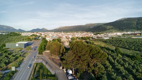
Jimena is a town located to the south of the province, on the north side of Sierra Mágina, in a landscape that alternates the olive groves, fruit trees and orchards with saw areas.
One reason the municipality is known for its production of figs and brewers.
In the municipal term we can distinguish two well-differentiated areas: the south-east sector of mountain orography and is included in the Natural Park of Sierra Magina; the rest of the term is a land of cultivation in which the olive monoculture predominates.
The economic activity is based on the olive tree and its processing industry, and is completed with the cultivation of the fig tree for the use of the figs and the brewers.
From its cultural heritage, the cave paintings of the Cueva de la Graja, of the schematic style, are especially noteworthy. We also have to quote the Castle that was raised in the Middle Ages and delivered in 1434 to the Order of Calatrava, and the Parish Church of Santiago el Mayor, of Gothic style, although rebuilt in 1960.
Punto de información del Parque Natural de Sierra Mágina:
Castillo de Jimena. C/ Audiencia, 5
De lunes a viernes, de 9 a 14 horas.
Sábados y domingos, de 10 a 14 horas.
El Ayuntamiento de Jimena ha creado un moderno portal turístico para visibilizar los atractivos turísticos del municipio.
https://jimenaturismo.grupofortalezas.com/
Actividad subvencionada por la Diputación Provincial de Jaén. Herramientas digitales de promoción turística (ejercicio 2022)
Tourist area: Sierra Magina
Distance to the capital (km): 38
Altitude over sea level (m): 606
Extension (km ²): 48
Number of inhabitants: 1,675
Gentilice: Jimenates or Jimenians
Postal code: 23530
- Church of Santiago the Major. It is of three ships highlighting the central ship, and it owes its name to the day in Fernando III won Jimena to the Arabs in 1234. The initial factory of the church is gothic, with elements as significant as vegetable capitals, the pointed backbone that opens the perspective to the major chapel or the starry vault that covers it.His first roof was to move, and the first cover with a half-point bow, you were humming ruthless and wide davelas with ménsula in the key, like the strippers and the aldero piled, show Renaissance prints, which contrasts with the gothic cornice from the outside of the header. The current roofing, the three altarpieces of the header, the size of the Virgin of the Rosary and the square-floor tower, date from the reconstruction of 1960.
- Hermitage of Our Lady of Remedies. It is a temple of small dimensions and harmonious architecture, plant in the form of a Latin cross and camerín for the patron, was built in 1910.
- Castle. Su tower of tribute, the only thing preserved in its integrity, recalls the medieval importance of this castle to strengthen with that of Bedmar, the border line. It appears with the shields that evoke the power of the Marquis de Camarasa, successors of the family of the Cobos, to whom Charles I gave the castle expropriating it to the Order of Calatrava. It has been declared Good of Cultural Interest in 1985.
- Cave of the Graja. It's a shallow coat with rock paintings in which up to seven groups of figures belonging to the schematic style have been located, with red tones. It is attributed to Neolithic period, III millennium BC
Jimena is located in the centre of the province of Jaén, with an area of 48.04 km ² and an average altitude of 774 m above sea level. It is located at north-west of the region of Sierra Mágina, whose southeast portion is of mountain orography and included in the Natural Park of Sierra Magina. The rest of the territory is the land in which it predominates the olive tree.
The economy is based on olive cultivation and in the processing industry, being completed with the cultivation of the fig tree to use the Breva and the fig.
So that we can get an idea of the scale of brewery production that is harvested, we will say that in 2013 they were collected About 60,000 kg of brews. Of all production, approximately 10% is distributed in the province of Jaén, 25% reach the markets of Andalusia and the challenge is exported to Barcelona, Madrid and Valencia.
In its near environment has the following heights and peaks: Aznaitin (1794 m.), Air Caves (1364 m) and Atalaya (760 m)
As regards its vegetation It is common for the oak trees, whimsical, carrasco pine and salgareño, apart from the olive tree as the emblematic tree of the municipality.
In the municipality of Jimena la fauna is very diverse, among many, species as emblematic as the grubb, brown chotocabra, perdicera eagle, seedling eagle, cappuccino herryillo, pelegrin hawk, roquer plane, pale aguilucho or rastro gavilan, royal eagle or flow eagle, royal owl, common badger, fox, boar, gineet or musk cat, goo, deer, staircase, creek, viperine...
One of the best alternatives to get good views of the municipality is to approach one of the various areas in the environment, among the most visited are:
- Mount Aznaitín. It's a real landscape milestone. It is one of the most significant landscape units in the Natural Park of Sierra Magina. The panoramic views that are seen are really spectacular. It is only 6 km away. of the town.
- Pinar del Lancar. It is an indigenous pine of great value due to its testimonial character as a typical species of the Mediterranean forest. 5 km. of the urban core of Jimena.
In addition to the traditional Christmas and Easter holidays, in the municipality of Jimena these other days are commemorated:
- "Lumbres" of Saint Lucia, on December 13. On the eve of the day, there are fires on which rosets of corn and wine are eaten, accompanied by songs and dances.
- San Marcos, March 25. The saint is honored, as is done in many other municipalities of Sierra Mágina, thanking him for having delivered the people from a plague of locusts that threatened their crops to rise.
- Corpus Christi. Since the 16th century, there has been a record that the "Maroon bull.", better known as "Thin bull.", forerunner of the current "bull of fire" of the patron parties.
- Day of the Cross, May 3. A party with a religious part which consists of the procession to the fields of Our Father Jesus on the Cross. And another pagan part the "Guys of Rice", which are dolls made of old clothes filled with paper, which have a pot or a mud pot as their head, and which in jetty positions are placed on the streets of the village with signs in which some event in the village is referred to in a tone of lance. They'll end up being the target of a claw or a burn.
- Party in honor of Our Lady of Remedies. They are held from 7 to 10 September. On September 7, the image is brought from his hermitage to Jimena, where he will remain until the 10th, and on this day he will be taken back to his the sanctuary of CanavaAt the foot of the saw.
- As a colophone of the parties they will run to several "fire bulls", metal artifacts that are placed on the back of the carriers and are releasing sparks, flares and "raceous rockets" causing the consequent jolgorium among the spectators.
The Jimena brewers have been famous since then, which in addition to being an important complement to the local economy, are also reflected in some dishes of gastronomy.
Among the most traditional dishes, we highlight:
- "Wheat.", is the most sharp dish of the jimenata gastronomy, and consists of a very elaborate stew where the wheat grains are previously crushed and peeled in a stone mortar and once clean the shell are soaked, for the next day to cook it with a chopped onion, a red tomato, green beans and some cod or bowls.
- "Borullos.", is a farinacea vianda of wide presence in the traditional cuisine of some places of Magina, they are named "talarines"It is a broth in which vegetables and hare meat are cooked next to a mass of peeled flour.
- "Morococcus"it is a dish that is not only present in the kitchens of Mágin, but also in those of La Loma. It is made with very crushed cooked chickpeasadded the broth and a generous chorreton of olive oil, some fried peppers. All this will be cooked until you get a mashed, which will sometimes be added a chopped onion.
- Other dishes: the pipirrana and The papajotes.
In the pastry shop: rosses fried in the frying pan, alfajores, fig bread, brewing cheese...
Jimena has a rich legacy of prehistoric times, a group of rock paintings in the Cave of La Graja, which shows the existence of groups of pastors who lived between the IV and the III millennium BC in the Southern Serras.
Another settlement of this time is that of Cerro Alcalá, fundamental reference for the prehistory and ancient history of this town.
In the Iberian stage Cerro Alcalá will be one of the oppid which will remain occupied in the following centuries until Roman times.
In the Arab period there was an intense occupation of the municipal term of Jimena by small rural or rural populations.
This population had several fortifications for shelter how Source of Moro, Cerro Alcalá or San Estabin. Jimena (Xemena) could have been another of these castles or a fortified house after the conquest of Granada.
The municipality of Jimena will be conquered by Fernando III the day of Santiago of the year 1234, and integrated into the lands of the Council of Baeza. After several changes in membership, in 1434, King John II gave the municipality to the Order of Calatrava which was the commission of Torres, Canena, Jimena and the heiress of Recena.
In the 16th century, Jimena, aligned next to Baeza participated in the communal conflict in the Castile of Carlos V, and even served as a hidden reduction to communeros. And years later it was sold by Carlos V to his secretary, Francisco de los Cobos. From then on, Jimena will become the Lord of Francis of the Cobos and after his descendants. the Marquis of Camarasauntil the extinction of the lordship privileges in 1812.
Huelma
Huelma is a important location located to the south of the region of Sierra Magina, right on the provincial border with Granada.The third north of the municipality is included in the Natural Park of Sierra Magina, where you reach heights that exceed 2,000 m to go down to the Jandulilla Rivereast of the municipal term. Solera is a population that was annexed to Huelma in 1975.It is an important municipality in the region from an economic point of view. The main industry is the Manufacture of furniture of wood, with national and international markets, and which has been able to be renewed despite times of crisis.The ceramic and textile industry. It has important assets for cultural, nature and sport tourism.
The United Nations agriculture is the most employed, followed by the Services sector,the olive tree is the largest crop, followed by cereal, while fruit and vegetable crops are almost testimonial. Within the industrial fabric there is a oil packaging which belongs to the Designation of Origin of Sierra de Magina.
The livestock It also takes on special relevance, it is raised livestock, sheep, and sows. The exploitation of the montesine sheep, originating in the mountain areas of the province of Granada and the south of the province of Jaén, is noteworthy.Huelma is a compulsory stop in the tourist product "Travel to the time of the Iberians," as it offers a Iberian field dated in the 4th century BC in the place the "Cortijo Pajarillo. "
With regard to his historical-artistic heritage, his castle which stands on a promontory of strong earrings. It is of interest to the parish Church of the Immaculate of the 16th century.
Distance to the capital (km): 50
Altitude over sea level (m): 1100
Extension (km ²): 250
Number of inhabitants: 6051
Gentilice; Flakes
Postal code: 23560
The beautiful urban town of Huelma, made up of a set of white streets and houses, located under the remains of its castle, make up a harmonious and attractive set that has valued their cataloguing as Historical-Artistic Set in 1971.
From its rich heritage we highlight:
- Huelma or Alburquerque Castle. It is located on the outskirts of the city centre of Huelma, on a hill that dominates the entire population. The strength we contemplate today was probably built by the Lord of the villa, the Duke of Albuquerque, in the first half of the 16th century. On that same place there was a Muslim castle from which only some of the canvases of the wall and the Great peel inside the castle. A quadrangular plant with 4 cylindrical towers, one in each corner, united with each other by a wall cloth and an open door in a half-point arch at ground level. On the west side it stands directly on a large peñasco, cut to peak, which is already a great fortress.
- Church of the Immaculate Conception. It is considered as a jewel of Renaissance architecture in the province of Jaén. The most great artists of the time: Diego de Siloé, Francisco del Castillo el Viejo, Andrés de Vandelvira and Francisco del Castillo el Joven. The building presents basic plant divided into 3 ships. The header of the flat tester church is covered with canyon vault with cassettes. The southern façade is of great elegance and balance, based on Italian models. He's got the body of peeled bells.
- Ibero Sanctuary of Pajarillo. It's a oppidum ibero found in the pastry of Cabritas de Huelma, dates from 4th century BC, and the sculptures found are found in the Provincial Museum of Jaén. The figures found are: a wolf, a warrior, two taps, a young boy and a carnivore. This sanctuary is located in the Jandulilla River Valley, the commercial pass between Murcia and the Guadalquivir Valley.
- Castle of Solera. Here, on a hill, are the remains of a Nazari castle built in the 13th century. From it you can see splendid views of the Vega in which the Jandulilla and Garganton rivers converge.
- Hermitage of Our Lady of the Fuensana. Located about 7 km. of the population, in the heart of Sierra Magina, the sanctuary of Fuensanta is the epicenter of the devotion of the strikers to be the house of their excellent patron.
A very important part of the municipality of Huelma is crossed from south to north by the river Jandulilla, dividing it into two similar extension areas. On the left bank of the river is the Mágina saw massif and the town de Huelma. On the right margin, the Cabra saw and the historical core of Solera.Approximately 10% of the area of the municipal term is included in the Sierra Magina Natural Park. There are several signposted itineraries such as the healthy route of the Cordel del Salado, the road of the Borregueras or the path of ascending to the Magina peak that will offer us amazing panoramic views of the region.
The routes by the karst of Sierra Magina will allow us to observe meadows, bushes, sabinars and the vegetation of the summits (blue lead, fine piorno, mountain ruse, thyme and alfacarensis herring), as well as karst formations, snow wells, perdicular eagles, grey colalba, and capillants.
The low areas are covered with olive and almond plantations, mainly, although there are also frequent coals, complaints and pineapples of carrasco and salgareño pine.
- Holy Weekwhich has a unique character within the region, it has the collaboration of numerous cofradies and its processional parades are attended by many neighbors either by devotion or by tradition.
- May parties and September romance. These are the parties in honor of the Virgin of Fuensanta, patron of Huelma. The first Sunday of May is produced the transfer of the Virgin of the Fuensana and of Saint Lucia from the sanctuary to the parish church, each year participating a greater number of carrozas and rosemary.The first Sunday of September the Romeria in the Sanctuary of the Virgin of Fuensanta.Since the 16th century, the fellowship of Our Lady of Fuensanta and Saint Lucia has organized this pilgrimage that is held every year on the first Sunday of September. The events begin with the reception of the subsidiary cofradies of Cambil, Solera and Torres and the road to the sanctuary. After the Eucharist, the size of the Virgin is processed, which is accompanied on her throne by the image of Saint Lucia. In a typical rosemary environment, a campera day is spent in which you have to drink the water from the well of the sanctuary, to which many miracles have been attributed.
- Carnival. He's very popular. Since 1989, there has been a competition for groups of Chirigotas and Comparsas, as well as dances. To close the festivities, the "Carnival Filler" is celebrated.
- August Fair. Also called by Saint Augustine. During the parties the Expooluma Show Fair and the "La Serranilla de Magina" competition is held.
- Popular holidays in the municipalities, each of the villages belonging to Huelma also celebrate the day of their feast: in May are the Feasts of San Isidro in Solera; in June are the Feasts in Cabritas de Huelma; in July the Feasts in La Calesera and La Unión Plaza Nueva; and in August are the Feasts of the Emigrant in Solera, the Villa and Campo del Moral.
Huelma's gastronomy is succulent and varied. They highlight strong dishes like the "scallops", bean peas with cod, chotto al ajillo, andrajos with cod, andrajos with hare. It is typical of the "cucumbers" on Holy Week.
In the field of pastry there is a large variety of sweets: "roscos," "flowers," "drunks," "buds," "polvorons," "stained," "moles eggs," "papajotes," "membillo meat," "gachas" and the typical "Hornazo" for Resurrection Sunday.
One of the most important milestones in the history of Huelma is the presence in these lands of a Heroic shrine of the Iberian era, specifically on the so-called hill "The Pajarillo"which can be given in the 4th century BC This sanctuary would be the entrance door to a territory controlled by an Iberian aristocrat on the Jandulilla River, and whose headquarters would be located in Ubeda. In Roman timesin the third century AD repopulate these lands the high valley of Jandulilla with small farms.
During the Muslim era we are living moments of great splendor in Huelma. From the conquest of the Iberian Peninsula by this civilization, it is when the present core arises around the hill where the castle is located. This Muslim fortification will become a key piece in the Middle Ages border struggles between the kingdoms of Castile and Granada.
The Nazaris They will possess it. to the late date of 1438, year in which it is conquered by Mr Íñigo López de Mendoza, I Marqués de Santillana. King John II will be granted it in a lordship, and years later, in 1474, Henry IV elevates the Lordship to the category of Vizcounty and then County in the person of D. Beltrán de la Cueva, I Duke of Albuquerque. Hence the castle was built at this time on the remains of the ancient Muslim fortress, also known as the "Castle of the Dukes of Albuquerque."
After the end of the Granada war, 1492, Huelma entered a period of political and economic stability during the first half of the 16th century, thanks to the repopulation and the cultivation of new lands. These years of economic bonus will be reflected in the undertaking major religious and civil worksas is the parish church.
It will be in the late 16th and early 17th century when there is a decline in the population due to crises and epidemics. The War of Independence will be the entry of French troops into Huelma who will destroy the fortress.