Saltar al contenido principal

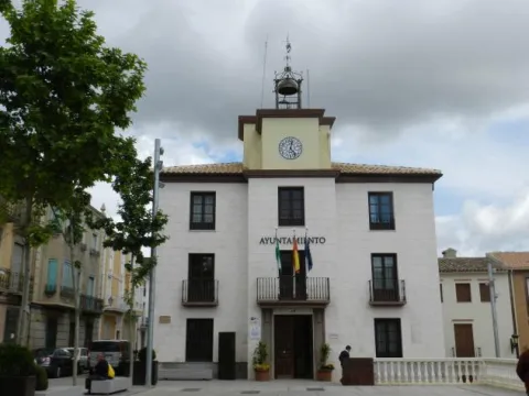
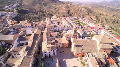
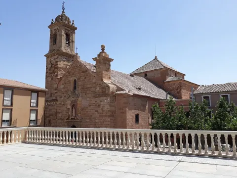
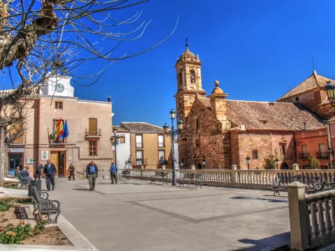
Cárcheles

Submitted by brandcode_deweloper on
Id
727103
Perfil de redes sociales
Facebook
https://www.facebook.com/AyuntamientoCarcheles
Twitter
https://twitter.com/AytoCarcheles
Descripción
Breve descripción

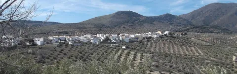
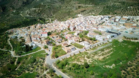
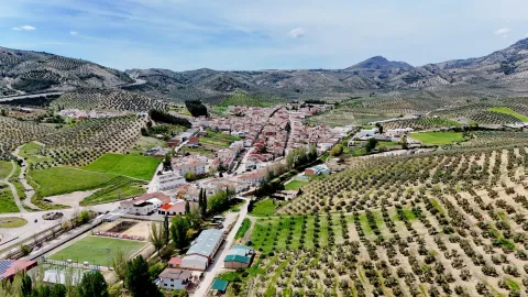
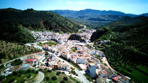
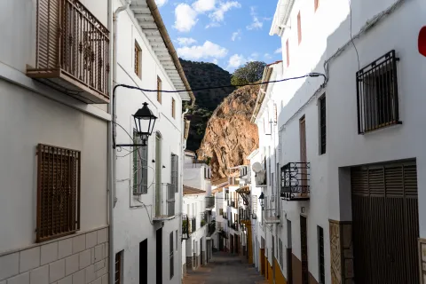
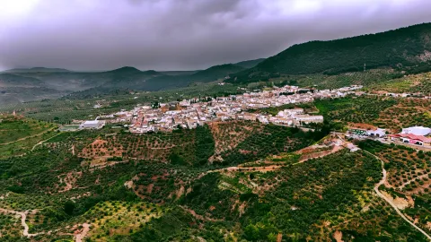
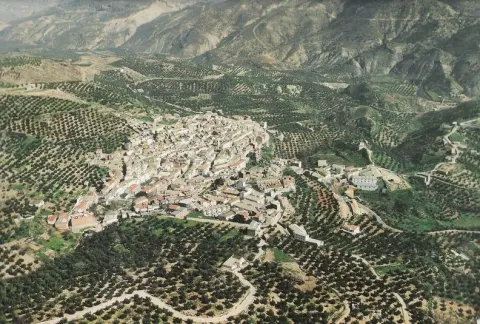
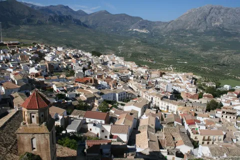
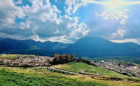
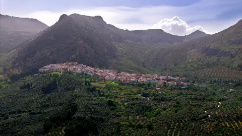
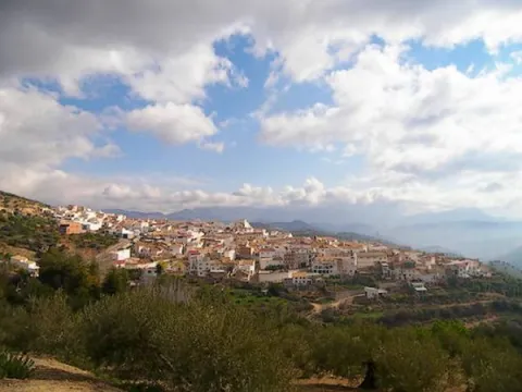
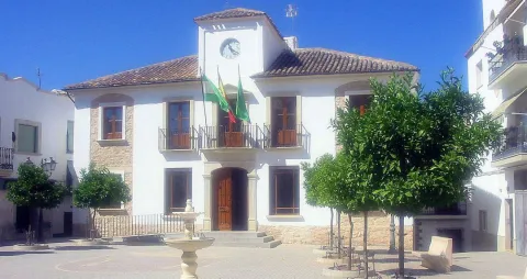
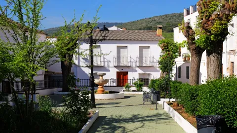
Cárcheles is a small municipality made up of fusion of Carchel and Carchelejo carried out in 1974. It is located in the south of the province of Jaén, in the heart of Sierra Sur, occupying the northeastern slope of the Sierras de los Grajales and of Alta Coloma until its municipal end to the Guadalbullon River.

The olive tree marks the life of their people, constituting the economic pillar of the municipality. Cárcheles oil is included in the designation of origin "Sierra Magina." The pig processing meat industry is also of great importance.

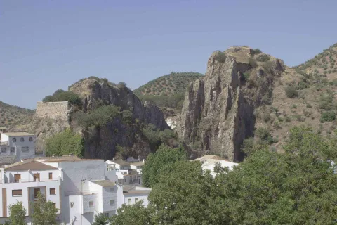
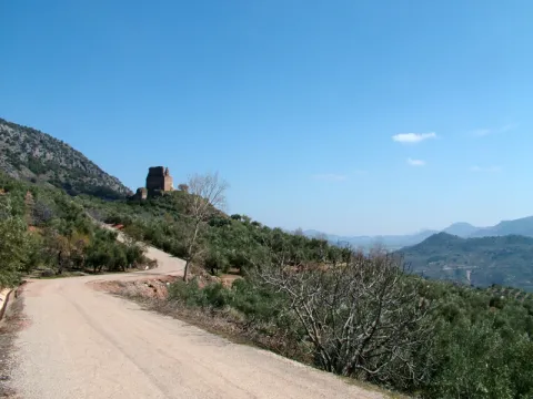
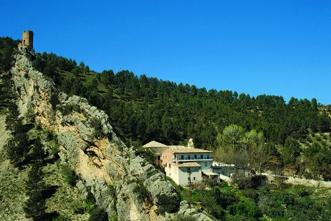
The relief is abrupt and mountainous. It has a wide variety of natural sites such as the Barrio del Monastery, the Cueva del Puerto de las Palomas, Cazalla and the Convent. Ideal sites to take excursions and to which you can go using all kinds of transport.
Telecomunicaciones
Teléfono
953 302 291
Sitio web
www.carcheles.es
Fax
953 302 395
Correo electrónico
webmaster@carcheles.es
Ubicación
Nombre
Cárcheles
Latitud
37.652990
Longitud
-3.636370
Distrito
Municipio
Ubicación en el mapa
POINT (-3.63637 37.65299)
Imágenes
imagen
Image
7909ed1c-06e4-adc7-eb16-fef1b94d88b5?t=1594224670051
Imagen principal
Desactivado
imagen
Image
65175805-0c7c-bb46-f068-5a90da2fb918?t=1594224670481
Imagen principal
Desactivado
imagen
Image
3b141679-05ed-84a9-2e92-5f7ff0e25f2e?t=1594224671288
Imagen principal
Desactivado
imagen
Image
004b5a33-2a1d-cae4-02f8-30897257ee42?t=1594224670819
Imagen principal
Desactivado
imagen
Image
9719a73a-0102-a944-81fb-73b4c5fed994?t=1617643962856
Imagen principal
Desactivado
Imágenes cabecera
imagen
Image
carcheles
Imagen principal
Desactivado
Datos de interés

Tourist area: Jaén and Environment

Distance to the capital (km): 32

Altitude over sea level (m): 810

Extension (Km2): 41

Number of inhabitants: 1550

Gentillo: Carcheleans or Carcheleans

Postal code: 23191

Visit the cultural website of Open by Art:

https: / / abiertoporarte.com /

Videos
Video file
Cultura

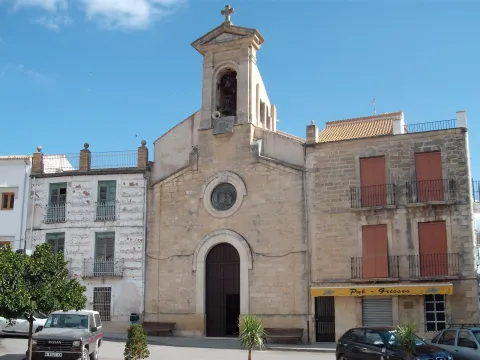
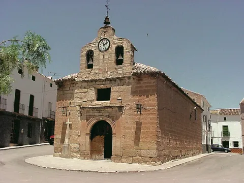
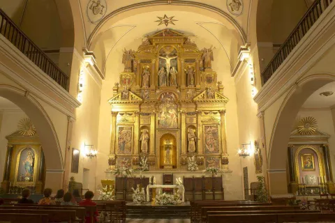
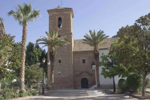
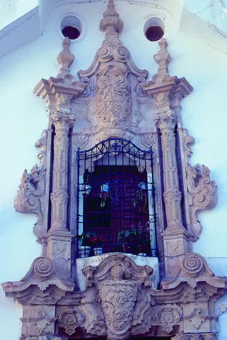
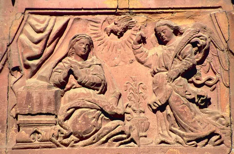
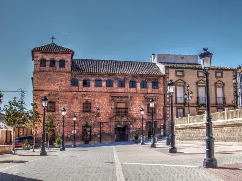
From its artistic heritage stands the church of Our Lady of Angels of Neoclassical style Carchelejo and the church of Our Lady of Remedies de Cárchel, raised by an old visionary cemetery

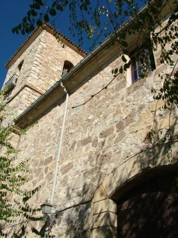
  • Church Our Lady of the Angels of Carchelejo, built at the end of the 18th century, in a neoclassical style, it rises on a previous 16th century that had suffered severe destruction as a result of the 1680 earthquake.
  • Church of Our Lady of the Remedies of Cárchel, rectangular floor and neoclassical style, is the first quarter of the 18th century although it is built on previous walls of good larger armchairs, belonging to another ancient church. Next to an ancient courtyard of the church, a visigode tombstone appeared in the 1960s, documenting the existence of a visigode burial in the area. This stone is currently exposed in the Visigoda Room of the Jaén Museum.
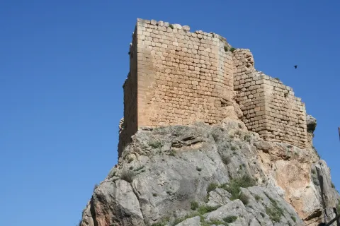
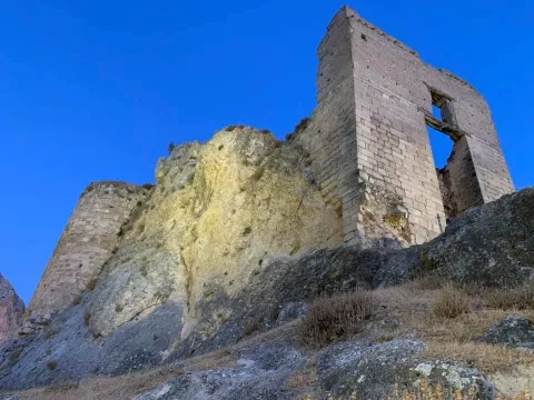
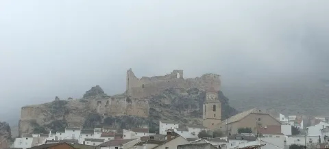
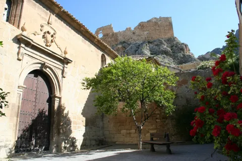
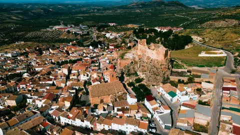
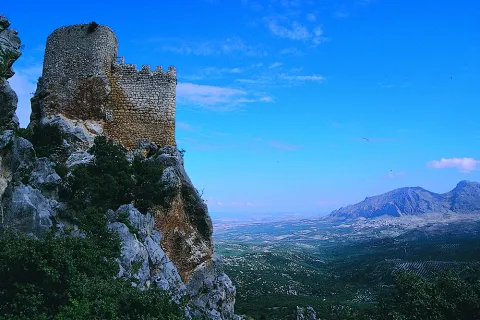
  • Ruins of the Castlejo de Cárchel, of Muslim origin and in its surroundings have appeared a multitude of Spanish-Muslim ceramic remains. Among the archaeological remains found in the area a head of a clay figure, which possibly indicates the survival of the Iberian exvotes in the Muslim era, is particularly striking.
  • Ruins of Castellón, archeological complex in Cazalla formed by a necropolis with about 15 tombs perfectly identified. The existence of a village next to the necropolis and a fortress or turret, now called Castellón, is found.

Both castles served as a defense of these valleys in times of struggle between Christians and Muslims. Over time, the ruins and the memory of a time in which Sumuntán (now Cárcheles) was a militarized zone because it was a border between Castile and the Nazari kingdom of Granada. In addition, each village has its hermitage (that of San Marcos).

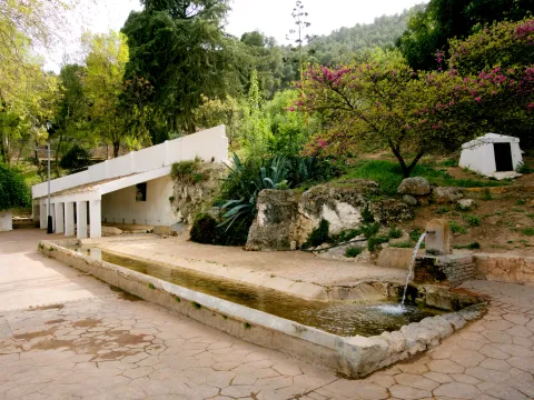
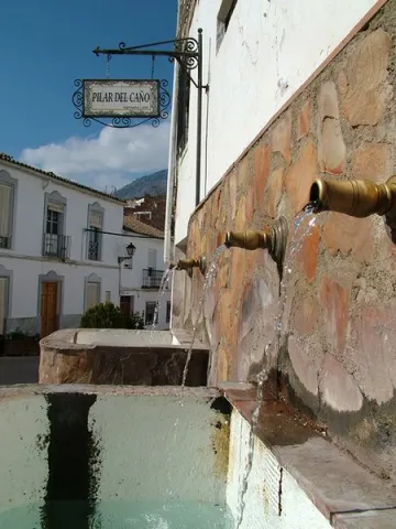
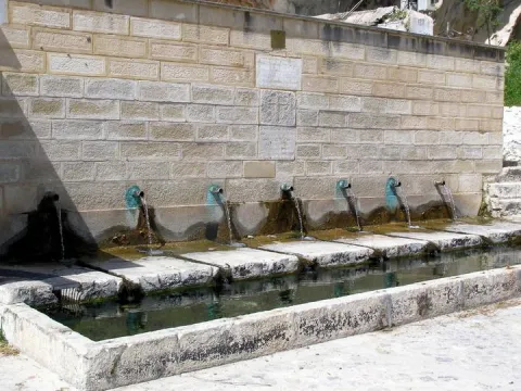
  • Seafarers and sources, built in stone, which remember the importance of beasts in rural life until motor vehicles began to replace them. The Fountain of Carchelejo, composed of six pilons, stands out.
  • Construction of dry stone, a technique that does not use any type of argamase to unite the stones, is something characteristic of this area. They used it both to build monuments, houses or walls on the linds of their lands.
  • Other historical remains: Cazalla Convent, sacred place for the various cultures that passed by here (celtiberos, Iberos, Carthaginians, Romans, Muslims, Catholic orders), the present Cortijo del Convent atesores an amazing historical legacy to know of which stands out the facade of the ancient monastery of the Basili (XVII- XVII- XVIII centuries), remains ofteagles (tiles) Roman in the Sale of the Ramona.
Naturaleza

Cárcheles is located in the region of Sierra Magina, a mountain massif integrated into the Subbetic System and extending to the centre and south of the province of Jaén. The municipality of Cárcheles, until reaching the river Guadabullón, set the limits of Sierra Magina on the west side.

The land of the town, although mountainous, the slopes are soft and very arid, in which the preferred crop is the rain olive tree. Although there are also almonds and cherry, or low thyme, lentils or cornicabres.

The most characteristic fauna of the area are rabbits, hares, foxes, as well as a wide variety of rapacious birds that nest in the many rocky areas of the area.

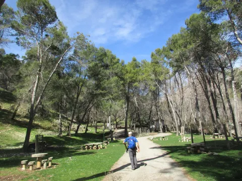
The municipality of Cárcheles has many places in which you can make interesting walks and excursions, both on foot and by bicycle. Among them are the Barranco del Monastery, the Cave of the port of the Palomas, Cazalla and the Convent.

The town council has a "Guide to Carcheles trails" which are part of the project "Approaching Landscapes" which has consisted in the recovery and value of traditional roads, by creating interpretative routes of its heritage.

Fiestas y Eventos

Among the festive events of Cárcheles are the following:

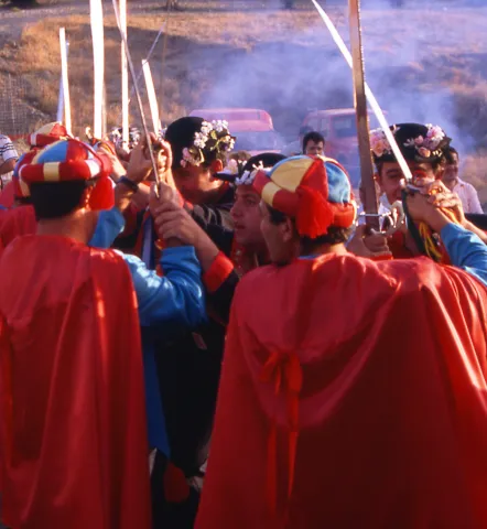
  • Patronal parties of Carchelejo, are held in mid-August in honor of the Virgin of the Rosary and of San Roque. To highlight the "Advances of Moors and Christians" in which the embassies or representations have a literary origin, a dramatic genre related to the Romancero and the Baroque theatre. A celebration that has been declared Good of Regional Tourist Interest of Andalusia.
  • Virgin of the Remedies, is held in the town of Cárchel in late August.
  • San Antoniowhich is held on June 13, and is a night party around a small altar of the saint until the arrival of the Brotherhood of the Virgin of the Head.
  • San Antón, takes place on January 17, but the night before they become lumbres, and the neighbors gather around them until high hours of the night. For a few years now, the tradition of the "San Antón cochinillo," which is raised by the village's neighbours throughout the year, has been restored.
  • The Lumbres of Saint Luciawhich take place on December 13.
Gastronomía

The traditional gastronomy of Cárcheles is marked by the culture of olive oil and by the products derived from the slaughter of the pig, while at the same time it is closely linked to the religious festivities, and the rhythm of the tasks of the crops in the field.

So, during the collection of the olive, dishes like the crumbs or birdsand are consumed from the killing: chorizos, morcillas, ham...

On Carnival Sunday it is made a cooked where a filling has been prepared before. During Lent and Holy Week, there is a predominance of lent bakes and dishes as can be "sour cod".

With the arrival of the summer, dishes made with vegetable products, such as the salads and the famous "piirrana".

On the feast of All Saints, the Gachas and cod.

Other dishes are: "carneret" which is made with olive oil, picatostes, garlic... but without meat; and "overuse"where the base is the beans.

Historia

The first documentary references of the peoples date from the second half of the 13th century, when the King Alfonso X The Wise, donated to the bishop of Jaen the castle of Cárchel. However, we find evidence and traces that will discover the passage through these places of ancient civilizations.

There are authors who identify Cárchel as "Karka", old city, bastena (Ibero village).
Throughout the first century, various Roman settlements occupied the territory and later it was the Visigoths who settled on these lands.

In the 1960s, a visigoda stone, well preserved, and several burials appeared next to the church of Cárchel. This stone is currently in the Provincial Museum of Jaén.

The Muslims called "Sumuntan" to the lowlands of Magina. The stay in these territories ranges from the eighth to the thirteenth centuries.

During these five centuries they substantially improved the agricultural system received from the Romans: they improve the irrigation systems, getting better use of the water (construction of sows, wells, aljibes, lacquers...) and also incorporate new crops, fruit and vegetables mainly.

When Christian occupation begins, Sumultan (current Cárcheles) is the border between Castile and the Nazari kingdom of Granada. As a result of the militarization, military strengths are maintained and improved, but the region is depopulated and it is not until the conquest of Granada by the Catholic Kings when the repopulation begins, passing these peoples to belong to Cambil for many years. At the end of the 18th century, Cárchel, Carchelejo and Cazalla are segregated and formed as their own entities for the first time, and the City Council is located in Carchelejo.

The maximum demographic splendor of the two nuclei begins to decline from the civil war. Already in the 1950s, and much more in the 1960s, there is a strong emigration caused by the poor agricultural development of the region, which is typical of all areas dependent on a single crop, making the economy very vulnerable. Against this economic and demographic reality, in the year 1974 are merged again the two municipalities of Cárchel and Carchelejo forming one with the name of Cárcheles, as it had been until 1843.
Loading map
Preparing points of interest and routes...
Imagen principal
imagen
Image
carcheles
Imagen principal
Activado

Campillo de Arenas

Submitted by brandcode_deweloper on
Id
726420
Perfil de redes sociales
Facebook
https://es-es.facebook.com/ayuntamiento.campillodearenas
Descripción
Breve descripción

Campillo de Arenas is a small municipality belonging to the region of Sierra Mágina, located on the southwestern end of the province, in the heart of Sierra Sur, in the valley of the Campillo River, which will then be Guadalbullion before pouring its waters in the Guadalquivir.

Mountain area where the cereals and abundant olive groves alternate with areas of saw of forest grounds, permanent pastures, topolars and splits, drawing together an ideal landscape for walking and performing outdoor activities.

The natural enclaves are abundant, highlighting the surroundings of the Quebrajano swamp and the Hazadillas Canyon, as well as the limestone of Puerta de Arenas, which is located about 7 km away. of the town.

The main economic activity is that derived from the olive tree, which reaches 33% of its term. It follows in importance the activities derived from the processing industry of pigs and milk, with an important production factory. All this, complemented by the breeding of birds, goats and pigs. The oil stands out for its quality, and is marketed under the Sierra Magina Name of Origin.

As a historical building, the Parish Church Our Lady of the Incarnation, of Renaissance shape, stands out.

Telecomunicaciones
Teléfono
953 309 550
Sitio web
www.campillodearenas.es
Fax
953 309 424
Correo electrónico
general@campillodearenas.es
Ubicación
Nombre
Campillo de Arenas
Latitud
37.555979
Longitud
-3.635565
Distrito
Municipio
Ubicación en el mapa
POINT (-3.635565 37.555979)
Imágenes
imagen
Image
f741b6d4-5f18-ae8d-934d-ac144ab0acab?t=1616779016427
Imagen principal
Desactivado
imagen
Image
3ace59d2-8496-aa06-198c-c2d267b7e5d2?t=1586350931240
Imagen principal
Desactivado
imagen
Image
89722a8a-cb55-f46f-7145-0a838cae4674?t=1586350933268
Imagen principal
Desactivado
imagen
Image
294f656b-d3f2-fbbe-e147-0b2f1b1e9e10?t=1586350933117
Imagen principal
Desactivado
Información adicional
Curiosidades

https://www.campillodearenas.eu/es_es/

El municipio dispone en los lugares de interés turístico, de códigos QR para mejorar la experiencia de los visitantes.

Imágenes cabecera
imagen
Image
campillo de arenas
Imagen principal
Desactivado
Datos de interés

Tourist area: Jaén and Environment
Distance to the capital (km): 38
Altitude over sea level (m): 864
Extension (km ²): 114
No. of inhabitants: 1977
Gentillo: Campillenses
Postal code: 23130

Videos
Video file
Cultura

His artistic heritage highlights:

  • Church of Our Lady of the Incarnation. At the end of the 16th century the construction of the parish church began, in the place where it occupied a small chapel dedicated to the Most Holy Sacrament. From Renaissance style, with Handmade mudejar, carved in quarry stone and armchair. It will be many years before the Major altarpiece. Its style was Renaissance of transition to Baroque, decorated with elements of the time, without too many ornaments. The organ was not placed in the choir until the 18th century, and the bells until well advanced in the 19th century. He lost all his artistic wealth in the 1936 Civil War. It has been restored, the improvements made being remarkable.
  • Hermitage of the Blessed Virgin of the Head. Its construction can be located in the early 18th century. The silver lamp revered with dedication to the Virgin of 1741 and the numerous offerings that are preserved in the sacristy of the hermitage are proof of the fervor towards the Virgin.
  • Hermitage of Saint Lucia. The story of this hermitage dates back to 1858. The devotees who went through Sand Gate they stopped to pray before the Holy one, represented in a picture hanging on one of the walls of the rock, then an image located on a furnace next to the tunnel. The first hermitage was raised with the alms they were depositing. The blessing of the building was attended by devotees from the whole region. The successive reforms made to it have completely disfigured its initial aspect.
Naturaleza

The best way to discover the characteristics of nature in this privileged environment of Sierra Magina, is to approach one of these natural enclaves to live the landscape, fauna and flora of this territory. We will detail some of them:

  • Arenas Gate Park. It is a limestone that has a wall of about 400 m. caused by the river erosion of the Campillo River and surrounded by a mountainous area. The vegetation is typical of the Mediterranean forest and covered with olive groves. In this beautiful place is the hermitage of Saint Lucia.In the late 1990s the "Sand Gate recreational area" which offers different activities: bird observation, botanical garden, hiking and also has a road with a recreational area, thus completing the ludic-didactic offer of the area.
  • La Peñuela it is a cozy road and recreational area with a lookout where to enjoy spectacular panoramic views. It has shade areas and also has a fresh water source. It's close to the urban core.
  • Sierra del Campillo or Sierra de Alta Coloma. It is a national heritage in the heart of Sierra Sur. It is the mountain division with the province of Granada. Its altitude allows us to enjoy impressive views: to the south, the Natural Park of Sierra Nevada, and to the north-east the Natural Park of Sierra Magina. A Mediterranean mountain area, with high-value geological and vegetable formations, such as oaks, complaints, junips and savannas. Some other enclaves within this saw would be: the ravine of the Monastery, the Quebrajano reservoir, River Valdecarazos, the stone of the Palo, Netherlands Prados cortijo or Look at the Alberquilla.

The fauna of Campillos de Arenas is very varied, and here we find birds as emblematic as the grubb, the perdicular eagle, peregrino hawk...; mammals like the common badger, boar, mountain goat... as well as various reptiles.

Fiestas y Eventos

The second weekend of August is celebrated in honor of the Patron, The Virgin of the Head, popularly known as Moors and Christians.

The events begin on the afternoon of Saturday when the Virgin is processed, taking place during the first journey "forward" of the military representations between Moors and Christians. After midnight the Virgin of the Head will again process. On Sunday morning there will be new struggles between both sides, they will cross the swords in a primitive ritual dance of great plastic beauty. It will end with the parliament of the ambassadors of Moors and Christians.

It also has the "bells"that in the morning of Sunday, accompanied by bells, guitars and banduries, will sing "Las coplas de la aurora," traditional popular compositions of salutation to the Virgin, inviting everyone to participate with the prayer of the rosary.

On February 2, the party of La Candelaria, which is popularly known as "day of the birds.", since the children attend the Mass and procession of the Virgin of the Rosary with bouquets of rosemary made of bread, painted in multiple colors and with feathers.

On Pentecost Sunday the Saint Lucia's Romeria. On this day it goes from Romeria to the Arte de Arenas hermitage dedicated to Saint Lucia. The devotion to the saintly protector of the sight comes from immemorial times, so is a document dated 1837, which speaks of the existence of a picture of the saintly placed on a stone of the riverbed and which was destroyed by the shooting of the bandits, which for this reason became blind.

The Sunday following the day of Ascension is held a Romeria to the hill of the Arab castle, where there is a hermitage dedicated to the Ascension of the Virgin. There is a mass of thanksgiving and the fields are blessed. He is popularly known with the party of cigars.

Gastronomía

There is news about the gastronomy of Camillo de Arenas since the 18th century, as it was a stop and a fonda of the travelers who were going to Granada. They highlighted the scented partridges, the garlic rabbit and the products derived from the pig, among others.

The production of pig products. Different types of chorizo, bites, loin, ham, longanizas, which here they call sausage.

A cooking with chickpeas and pork products is prepared, accompanied by a gazpacho made from olive oil, garlic, vinegar and bread miga.

On Easter the sign dish is the "potting of white beans with chickpeas and cod"traditional Good Friday food. For the days of vigil, cod meatballs are also prepared in fried or broth cod, encebollated cod and beehive tortilla.

In the days of great celebrations, roast or stew of lamb, goat, choto or rabbit are prepared.

In the pastry shop they have a great assortment:

  • Christmas Eve, are a cake of bread with oil, matalahúva, almonds, nuts, raisins and sugar. Although it was like Christmas Eve, it is now consumed throughout the year.
  • AlmondsThey're some sweets of clear Moorish origin.
  • Dust, gusanillos, floricillas and pestidos.

Historia

Camillo de Arenas was founded by Real Cédula de la Queen Doña Juana, but it would be Carlos I who gave him the title of a villa in 1539.

The numerous remains found in different places of the town show that it was inhabited in prehistoric times of the Paleolithic and the Neolithic.

An argaric village has been found in the excavations at Puerta de Arenas. The buried sites found are large slabs with remains of individuals and their ajuars in bronze and mud vessels. There is also a record of the existence of Iberian populations.

The abundant remains found, pieces of vessels, Roman tiles, lacquered glass rings, bronze cups and recently in the corrijada of Casablanca, two bronze figures representing the goddess of agriculture and a rooster, show that the Romans had here camps.

The tombs found next to the corrijada of Casablanca correspond to visible burial. At the beginning of the 20th century, a visiotic treasure was found, made up of glass beads, a copper bracelet, handkerchiefs, pins and a buckle. The pins have the head of a scrap, where a piece of stone or glass was set. This treasure was acquired by the National Archaeological Museum.

The Arab remains are of great interest, for being a Christian-Arab border during the Reconquest. We have in the Cerro del Castillo the historical ruins of a fortress that was part of the Nazarite Kingdom of Granada for many centuries, until it was conquered by the Catholic Kings.
During the Independence War, a battle between constitutional troops and the French army took place in the Sand Campillo.

The knights who were traveling in the old steps were reunited in the typical Campesian inn, with many of the illustrious characters who visited this town.

Otra información

In one of its saws, shared with the municipalities of Noalejo and Valdepeñas de Jaén, the Sierra del Trigo wind park.

Another curiosity of this town is the production of chorizos that carry among its ingredients sheep's or goat's meat. They give us the indication that you have to consume them soon to prevent them from getting too hardened.

Loading map
Preparing points of interest and routes...
Imagen principal
imagen
Image
campillo de arenas
Imagen principal
Activado

Cambil

Submitted by brandcode_deweloper on
Id
726294
Perfil de redes sociales
Facebook
https://www.facebook.com/ayuntamientodecambil/
Twitter
https://twitter.com/aytocambil?lang=es
Descripción
Breve descripción

Cambil is a municipality located in the south of the province of Jaén and integrated into the Sierra Mágina region. Its municipal term ascends from the Guadalullon River to the south, to the summit of Mount Almadén, the second highest peak of the province. Regored by the rivers Villanueva, Oviedo and Cambil, between fields of cereals, olive trees and fruit.

It is of great interest that the population centres in its term, such as the village of Arbuniel, with a great wealth of water and good weather in summer, make it an ideal place to spend the summer months; or the corrijada of Matabejid, highlighted by the peculiar historical architecture of its constructions.

From the artistic heritage of Cambil, the church of Our Lady of the Incarnation, from the end of the XVI, built in the Renaissance style, stands out. He keeps an extraordinary Renaissance altarpiece from Sebastián Solís.

And also, the Old Hospital, raised in the second half of the 18th century and which is one of the most baroque examples of the province of Jaén.

    Telecomunicaciones
    Teléfono
    953 961 599
    Sitio web
    www.cambil-arbuniel.es
    Fax
    953 961 696
    Correo electrónico
    ayuntamientocambil@gmail.com
    Ubicación
    Nombre
    Cambil
    Latitud
    37.676840
    Longitud
    -3.564920
    Distrito
    Municipio
    Ubicación en el mapa
    POINT (-3.56492 37.67684)
    Imágenes
    imagen
    Image
    d33bc3a9-f232-f251-6b78-a6f430dc6292?t=1585576072643
    Imagen principal
    Desactivado
    imagen
    Image
    5b0fa44f-ec9b-0367-18d9-37822510cdda?t=1616174025504
    Imagen principal
    Desactivado
    imagen
    Image
    2a8a3d78-9893-da68-8d6f-fdfc326f8dfb?t=1585576072117
    Imagen principal
    Desactivado
    imagen
    Image
    2805d7be-df5e-d332-82d2-1f61e4807f94?t=1585576070079
    Imagen principal
    Desactivado
    imagen
    Image
    e29a7b00-d085-f745-8318-b2651f873861?t=1585152488274
    Imagen principal
    Desactivado
    imagen
    Image
    f5a943c2-8333-043c-1c86-89f0aee44ea5?t=1585576068494
    Imagen principal
    Desactivado
    imagen
    Image
    fab3b723-93e3-911c-2441-ae7a68e69096?t=1585576068162
    Imagen principal
    Desactivado
    imagen
    Image
    b02e8f76-d7f5-a19c-4ddb-d3c9b146d21c?t=1603136354445
    Imagen principal
    Desactivado
    imagen
    Image
    b5660670-8dbf-fba1-e515-08dcc324b28d?t=1603138798603
    Imagen principal
    Desactivado
    imagen
    Image
    68856994-720e-0150-e135-2619d62d9167?t=1603139571321
    Imagen principal
    Desactivado
    Imágenes cabecera
    imagen
    Image
    cambil
    Imagen principal
    Desactivado
    Datos de interés

    Tourist area: Sierra Magina
    Distance to the capital (km): 32
    Altitude over sea level (m): 822
    Extension (Km2): 140
    No. of inhabitants 2,703
    Genuine:
    Postal code: 23120

    Videos
    Video file
    Cultura

    From the artistic heritage of Cambil we highlight the following points of interest:

    • Castles of Cambil and Alhabar. The castle of Cambil It is located on the left bank of the Camil River and above a high rock flask, with a wall that falls vertical on the channel. The castle of Alhabar is located on the right bank of the same river, on another rocky flask and in front of the castle of Cambil. Both castles were declared "Good of Cultural Interest" in 1985.
    • Historical helmet, declared Good of Cultural Interest in 2012: located at the foot of two hills crowned by the castles of Cambil and Alhabar, crossed by the River Cambil, and around a historic road: that of Arbuniel. The image that characterizes its historical ensemble is generated by a set of crouched buildings with steep roofs of Arab tile, solarium houses in the lower area, and narrow and winding streets with straps and adarves in the upper parts.
    • Castle of Mata Bejidit is located between the mountains of Magina and Almadén, it seems to be of Christian construction from the early 14th century. Its function is essentially strategic and, by its size, it had the capacity to accommodate a small garrison. Also declared Good of Cultural Interest in 1985.
    • Our Lady of the Incarnation Parish Churchbuilt in the late 16th century, the exterior is sober and compact. Already inside, the main altar has an extraordinary Baroque altarpiece attributed to Sebastian de Solís.
    • Old Hospital of Poor Passengers, raised in the second half of the XVIII and on whose facade the exuberance of the baroque is noticed, being considered one of the most baroque monuments of the province.
    • Single houses: House of the Salazares and House of the Palace in Calle Real, both of them also show baroque facades of the 18th century.
    • Prehistoric reptile tracks, just a mile from Cambil, we found a trace of eight traces of the arcosaur reptile. Several of them are currently in a ballot box inside the conistory building.

    Naturaleza

    Change is the municipality that brings the most area to the Natural Park of Sierra Mágina, 25% of its territory is within it.

    The municipal term extends all the west side from the Guadabullón River until Almadén peak, with an altitude of 2,036 m, in Sierra Magina. For this reason we will find a great variety of both fauna and flora.

    At the same time, this variety at the altitude of the land will allow us to have places from which we can observe extraordinary panoramic views, both of the Jiennense countryside and of the fertile valleys that form the basins of the numerous river courses that travel these slopes.

    The paths and recreational areas that spatter the territory show the diversity and natural wealth of these lands; among the most interesting are: water route and olive groves, Torrecilla route, the Salt Arroyo or the birth of the Arbuniel River, without forgetting the environment of the gradual birth of the Mata in Mata Bejid. In fact, in its term is one of the two Visitors' Centres of the Natural Park of Sierra Magina, the C. Visitors of Mata Bejidfrom which several signposted paths are based: Up to the Pico Magina and Miramundos, El Peralejo, Puerto de la Mata and Sendero Gibralberca.

    To go through these places is to feel nature in its greatest splendor: thus we will find numerous sources, acequias, charcas, river births that go down the slopes to meet the Oviedo and Villanueva rivers. Also with remains of construction related to agricultural uses and old livestock.

    In addition, climbing routes are availablein the same centre of Cambil; thus, in the rock Castillo there are 7 perfectly equipped ways.

    The vegetation is very varied and we will find oaks, complaints, olive trees, cornicabra, alamos, etc. with examples of considerable bearing the Chopos of Mata Bejid,which exceed 30 m in height and 7.5 m in diameter.

    Something similar can be said of the fauna of the area, because here we can find ourselves: the Hispanic goat, the badger, the boar, the gin, the grubby... while it will be very easy to observe the majestic flight of the royal eagle or other rapes.

    But if there's an identifier of your territory, it's water. Ríos, springs, acequias, fountains, etc., model the area of the valley, both in the same town of Cambil, vertebrated by the river, and in Arbuniel, where the sound of the water as a background soundtrack accompanies the visitor from Birth to the very streets of its urban town, on a spicy tour of acequias, light factories, mills, laundry, etc.

    These heritage elements linked to water, and those that have remained the fruit of past agricultural and livestock activities, give the natural environment of Cambio a predominant ethnographic and landscape character.

    Fiestas y Eventos

    Among the parties with the most roots and tradition are:

    • San Antón, San Sebastián, Candelaria and San Blas. On January 17, the feast of San Antón, is blessed to the animals and become "lumbres," which is extended until the 20th of the same month, the day of San Sebastián, with the procession of the saint and the lumbres are repeated. In the Candelaria, on February 2, the fire returned to the village square made with the branches that carry the bakers. And on February 3, in San Blas, doughnuts are blessed and "lumbres" return.
    • Patrons of the Holy Christ of the Marble. It is celebrated the last weekend of February, when the canvas containing the image of Christ is taken to its hermitage, where it will be veiled all night, as it happened in the legend around the image. The next day, Sunday, the image returns to the parish.
    • Patrons of the Blessed Virgin of the Rosarywhich took place on 15 August, since its original celebration was moved in October. This very day a cattle fair is held.
    • St. Anne's Day. "Cultural Week":The holiday of Santa Ana is celebrated on July 23, and a cultural week begins in which the City Council has a large number of sports and play activities.
    • Tambora, a feast that has been held since time immemorial on the day of the Immaculate Conception. On the night of the 7th, a drum is used to carry out the prayer, hence the name of the holiday. The image of the Virgin is processed at 24, 4 and 6 hours in the morning, accompanying the songs with a sound drum.
    • Holy Week.With the arrival of Easter, a period of religious and customary acts that make the people full of incense begin in Cambil.
    • "Historical Recreation" Day in Arbuniel: In August, the neighbors starred in a tour of the different historical stages of the town.
    • Top Trail Magina, a mountain race born in Cambil and ascends to the highest peaks of Jaén. It's quite a reference for the most demanding athletes.
    • Magina Bike, in March, andSan Blas Urban Challenge.

    Gastronomía

    In the gastronomy of Cambil, three elements are common: olive oil, present in all its dishes, which most of the ingredients are from its own harvest or from the rivers and mountains of its surroundings, and which are usually dishes with quite a caloric contribution, as the works in the field consume a lot of energy.

    • Carnerete, is a dish with a lot of energy, as it has a pancake, chorizo, morcilla, fried tomato and meat broth.
    • Almorony, a potation of beans to which various vegetables are added.
    • Brown beans with chorizo.
    • Cod.
    • Crab from the Arbuniel River in salsa.
    • CigaretteThis vegetable is added to the chorizo.
    • Migas.
    • Migas of flour.
    • Cake cakes.

    In the pastry shop they highlight:

    • Sweet peas, are made with milk, flour and chickenpox above.
    • Aguacebámade of water, barley, hazelnut, cinnamon, vanilla and sugar.
    • Guides in spirits.

    Historia

    The oldest testimonies of the territory of Cambil are located in the tunnel of Saint Lucia, where they were found Bronze Age burial (II millennium BC)

    From the year 182 to. C. The romanization of this region begins. They've been found. sarcophages, remains of columns and capitals in Arbuniel.

    The core of Cambil takes on importance from Islamic domination and is already cited in the 12th century (Qanbil). It was divided into two small villages separated by the river and protected by two small castles to ensure its defence.

    The town will be definitely taken from the Nazarian Kingdom in the year 1485 by the Catholic Kings, with the help of six thousand men who arrived from Jaén and the first use of artillery. In thanks to this help, the Catholic Kings determined that Camil would become part of the Jaén Council.

    He will be King Philip II, in 1558who emancipates Cambil from the tutelage of Jaen and orders that the lands of Arbuniel be added.

    In 1676 the segregation of Cambil of the population of Carchelejo including Carchel and Cazalla (today, Cárcheles).

    And it will be in 1862 when it is incorporated to Change the territory of Mata Bejid, which until then had been under Jaén's jurisdiction.

    Already in the 20th century, with the proclamation of the 2nd Republic and the beginning of the Civil War, Cambil is occupied by the Republican side, being bombed by Jaén and its surroundings by the "Legion Condor."

    In the 1960s, Cambil, like the other populations of Sierra Mágina, suffered from emigration from many of its people to the industrial centres and large cities of Spain and Central Europe.

    Loading map
    Preparing points of interest and routes...
    Imagen principal
    imagen
    Image
    cambil
    Imagen principal
    Activado

    Cabra de Santo Cristo

    Submitted by brandcode_deweloper on
    Id
    12461093
    Perfil de redes sociales
    Facebook
    http://facebook.com/aytocabradelsantocristo
    Twitter
    https://twitter.com/aytocabrasc
    Instagram
    https://www.instagram.com/aytocabrasc/
    Descripción
    Breve descripción

    It is a municipality in the Sierra Mágina region and occupies the eastern space of it, it is located looking to the Sierra de Cazorla and the Guadiana Menor river, in a space of arid and eroded lands that make up unique natural spaces in the province.

    The municipality consists of three population centres, Cabra del Santo Cristo, Cabra Station and Huesa Station.

    The municipal term combines the landscape of olive and almond trees with large extensions of pine trees, oak trees, with the shrubs, piorns, romals and tumolar, within a geography of contrasts, in part marked by low rainfall.

    In the landscape a millennial oak declared Good of Natural Interest and the bridge over the Salado stream is 109 m high and 300 m long.

    The economy of the goats is mainly based on the production of olive oil, there are currently two mills in operation. The cultivation of almond is also of great importance.

    Cabra presents a rich historical past, highlighting its neolithic caves, Roman remains and findings of a small treasure of visigode coins.

    Telecomunicaciones
    Teléfono
    953 397 002 / 670 990 911
    Sitio web
    www.aytocabradelsantocristo.com
    Fax
    953 397 300
    Correo electrónico
    info@aytocabradelsantocristo.com
    Ubicación
    Nombre
    Cabra de Santo Cristo
    Latitud
    37.703620
    Longitud
    -3.286700
    Distrito
    Ubicación en el mapa
    POINT (-3.2867 37.70362)
    Imágenes
    imagen
    Image
    01123155-jpg
    Imagen principal
    Desactivado
    imagen
    Image
    cabra-del-santo-cristo4-jpg
    Imagen principal
    Desactivado
    imagen
    Image
    2018-07-18-jpg
    Imagen principal
    Desactivado
    imagen
    Image
    cabra-del-santo-cristo3-jpg
    Imagen principal
    Desactivado
    imagen
    Image
    nacimiento-de-salvador-gudu-jpg
    Imagen principal
    Desactivado
    imagen
    Image
    olmedo-jpg
    Imagen principal
    Desactivado
    imagen
    Image
    cabra-del-santo-cristo2-jpg
    Imagen principal
    Desactivado
    imagen
    Image
    mon472-jpg
    Imagen principal
    Desactivado
    imagen
    Image
    cabra-del-santo-cristo5-jpg
    Imagen principal
    Desactivado
    Información adicional
    Curiosidades
    Imágenes cabecera
    imagen
    Image
    cabra del santo cristo
    Imagen principal
    Desactivado
    Datos de interés

    Distance to the capital (km): 73
    Altitude over sea level (m): 942
    Extension (Km2): 186
    Number of inhabitants: 1779
    Gentillo: Cabrileño
    Postal code: 23550

    Videos
    Video file
    Cultura
    • Cabra Castle of the Holy Christ. It is located on a rigged hill called Cerro San Juan, where the castle and the old town of Cabra are located. It is of Roman origin, with subsequent Muslim and Christian settlements in the 13th century, to which the remains that can still be seen corresponded. The plateau is currently planted with olive trees and a palomar has been built on the top. It is a polygonal plant construction from which remains of three towers remain. From the walls of the castle there is still a canvas of almost 20 m., built with irregular masonry attached with hard lime and sand argamase. The fortress would be intended only to be a refuge for the population in the event of danger.
    • Our Lady Church of the Expectation and Sanctuary of the Holy Christ. The church dates back to the 17th century. It is a single ship on a Latin cross plant, with half-point hornant chapels on imposts. It has two covers, the main one at the foot of the temple, and a simpler one on a side.The cover The main is three-story, in the lower, half-point vanity on imposta, decorates its transdotes with pearls, beads and an acanto leaf on the key; the second floor is occupied by a hornadine and in its interior an image of the Virgin on shell; on the third floor a triangular front is placed on another curved, and both parties by a shield.The Tower It is a square floor and is divided into three bodies, the first two smooth and the bell tower.Holy Christ of Burgos. The parish church is the sanctuary of the Holy Christ of Burgos, a pilgrimage centre for people from different populations, recalling a tradition dating back to the 17th century. A gothic canvas that was moved 1637, and that from then on the population of the Señorío de Cabrillas would be called Cabra of the Holy Christ.
    • Big House, from the 17th century, Mudejar Baroque style. It is a wide rectangle divided into three floors of height and with a torre-mirador, very common typology in Granada.
    Naturaleza

    The term Cabra from the point of view of vegetation has an enormous variability, because it is found to be part of the last foothills to the east of Sierra Magina and also of the valley of the Guadiana Menor, characterized by its aridity.

    The vegetation is very abundant having to colonize different climate floors from 460 to 1433 m., as well as different types of soils: saline, plaster, limestone, etc.

    It combines the landscape of olive trees and almonds with large extensions of pine and oak trees, with the shrubs, piorns, romals and tumbling within a geography of contrasts.

    The millennial oak and Bridge over the Salado stream with 109 m high and 300 m long.

    Hosges a rich fauna: Torcaz pigeon, abubilla, jineta, badger, boar, rabbit... and is an enabling ground for activities such as hiking, cycling and climbing, among others.

    Among the recreational places of the population, the surrounding area Place of Birth offer an ideal space for sharing a field day and enjoying nature.

    Other locations of interest to visit would be:

    • The centenary oak located at the Cabra Station.
    • Hiking in the Earth Bridge, a badlands landscape of Las Ramblas.
    • Montosa Head Hill, a geological place of interest of underwater volcanic activity.

    Fiestas y Eventos

    The main holiday activities in the town of Cabra, in addition to Christmas, carnival and Easter, are as follows:

    • Saint Anton, January 17. It's traditional to light "Lamps"on the night before.
    • San SebastiánJanuary 20. On this day is celebrated the arrival of the canvas of the Holy Christ from the city of Burgos.
    • La Candelariaon February 2.
    • Romeria of the Virgin of the Immaculate, the day 1 May. This day the transfer of the Virgin to the Cabra Station takes place. And the first Sunday, June, another Romry is done to realize the reverse path, to take the image of the Virgin from the Cabra Station to Cabra of the Holy Christ.
    • Patrons in honor of the Holy Christ of Cabra. They take place from August 14 to 18.
    Gastronomía

    The gastronomy is based on the local products of the orchard, hunting and livestock. In addition, extra virgin olive oil will be the central element of the cabriwood cuisine, an oil with the designation of origin Sierra Magina.
    Among the most characteristic dishes are:

    • Rings with hare, a dish that is made with products and spices of the earth such as peppermint.
    • Pimenton, It is a soup made from bockerons and crutches.
    • Typical products of pig killing: a.

    Historia

    For some remains of joules found in the caves of La Liota and the Barranco de la Sima, in the Sierra Cruzada, we have to assume that the first inhabitants of these lands were associated with Traveller populations dedicated to grazing.

    The villages corresponding to the age of the Copper and Bronze, which would be located in the Kangilones, Montosa head and Barranco mill, they would be located along the stream "Royo" which below will be called Salado.

    These lands were part of the passing area that connected the southern Mediterranean coasts to those of the East (Levante), an important reason for human presence in these places. The finding of metal idols confirms the existence of Iberian populations.

    As well as the finding of coins or a Roman mill, tombs, and even suspicions of the existence of a necropolis, are compelling evidence of the presence of the Roman people.

    From the Visigoda era we know the finding of what has been called the "treasurer," which was a currency with the inscription "Chisdasvinto Rex."

    As far as Muslim domination is concerned, we have little information on the early stages. We know that Fernando III the Holy takes the villa in 1245And it shall be King Alfonso X the Wise, who will give it to him, together with Santiesteban, to the city of Ubeda.

    With the conquest of Granada the instability on this border disappears and Carlos V orders the Council of Ubeda to repopulate the site of the CabrillaThat's the name of the population then. In 1545 there would be the arrival of the first 50 neighbours, and a little later another 100 would arrive. The new rotated and sown lands of cereal begin to bear fruit and it is noted that the demographic increase is noticeable, by the end of the 16th century the town already had 600 inhabitants. The construction of the church of Santa Ana begins, under the title of Our Lady of the O.
    A few years later, without the reasons being clear, the construction of a second church begins, Our Lady of Expectation, the present parish.

    The 17th century will be the aura period for the town of Cabrillas. During this century, forestry (pastures, shrubs...) is moved to rotate these lands and grow them from cereal, with the resulting increase in production.

    And to this modification in cultivation we must add the arrival of the image of the Christ of Burgos, a fact that would change life in this villa. On January 19, the feast of San Sebastián, of 1637, a bartender that carried the belongings of the Guadix Corridor in two mules loses the burden because of a temporary, with the exception of a canvas with the copy of the image of the Christ of Burgos. The waitress where the bartender, who was crippled with one arm, took refuge, healed by just touching the image. The miracle spread through the area and soon the devotees of the most diverse localities came to pray before the image.

    A fact that meant changing the name of "Cabrilla" for "Cabra of the Holy Christ".
    There were so many gains that the church that it was decided to extend the church by its header. The big house is set up on these very dates, the town increases its number of inhabitants and a glass factory is created, which, together with the craft with the spartum, decide to carry the objects produced by the people to sell them.

    The arrival of in 1899 it was a new push for the increase of the population, with jobs in the construction of the roads and in the construction of the new houses in the town, reaching the 6,741 inhabitants.

    The times of bad crops, as well as the industrialization in the manufacture of objects such as glass or spartum, and the post-war years, they assumed the exodus to the great cities for many of the inhabitants, thus the population began to decline to the present 1800.

    Loading map
    Preparing points of interest and routes...
    Imagen principal
    imagen
    Image
    cabra del santo cristo
    Imagen principal
    Activado

    Bélmez de la Moraleda

    Submitted by brandcode_deweloper on
    Id
    726028
    Perfil de redes sociales
    Facebook
    https://es-es.facebook.com/groups/163629585573/
    Descripción
    Breve descripción

    Municipality of the region of Sierra Magina located in the eastern center of it and of agricultural and livestock vocation. Most of its municipal term, including the urban core, is part of the Sierra Magina Natural Park.

    It is in the eastern part of the term where the areas of cultivation are concentrated, and where only a few small extensions of fruit break the supremacy of the olive tree. The local economy is based on the olive grove, mainly, and complemented by the fruit and some sheep cattle in the deforested lands of the saw.

    De Bélmez de la Moraleda has to be noted its medieval Castle, which was declared a Historical Monument in 1985, the Muslim torreons of Lucero and the Sun and the famous "Caras de Bélmez," a paranormal phenomenon that broke into the kitchen of a house near the local Church in 1971 and has not yet been scientifically explained. His visit has since been required and there have been many experts in paranormal phenomena who have come there and no certain explanation has yet been given on the matter.

    Telecomunicaciones
    Teléfono
    953 394 002
    Sitio web
    www.belmezdelamoraleda.es
    Correo electrónico
    belmez@dipujaen.es
    Ubicación
    Nombre
    Bélmez de la Moraleda
    Latitud
    37.723370
    Longitud
    -3.383690
    Distrito
    Ubicación en el mapa
    POINT (-3.38369 37.72337)
    Imágenes
    imagen
    Image
    b0d4fe64-ee23-7010-aeba-dc5f959d62f4?t=1586173619826
    Imagen principal
    Desactivado
    imagen
    Image
    a3270bd2-f85f-027a-ec93-f7bf565923bf?t=1586257314416
    Imagen principal
    Desactivado
    imagen
    Image
    3c034ffe-c020-4fae-f76d-c75e8d621375?t=1586257314196
    Imagen principal
    Desactivado
    imagen
    Image
    24c41d1e-6b82-fd8b-cffa-ea7907aa7295?t=1586257314306
    Imagen principal
    Desactivado
    imagen
    Image
    cd63b7de-e559-1828-9e99-17ebb7a66ad7?t=1586257314053
    Imagen principal
    Desactivado
    imagen
    Image
    5af03fe9-6e2a-cccb-eddd-e77a32330616?t=1586257313910
    Imagen principal
    Desactivado
    imagen
    Image
    4441b25f-cb14-2cfb-a7ea-4daf989f626a?t=1586257313733
    Imagen principal
    Desactivado
    Información adicional
    Imágenes cabecera
    imagen
    Image
    belmez
    Imagen principal
    Desactivado
    Datos de interés

    Tourist area: Sierra Magina
    Distance to the capital (km): 69
    Altitude over sea level (m): 825
    Extension (Km2): 49
    No. of inhabitants: 1833
    Gentillo: Belmoralenses
    Postal code: 23568

    Videos
    Video file
    Cultura
    • Bélmez Castle. Surrounded by the Picacho de Carboneras, at the crossing of Granada towards the Mágina serrania, controlling the passage to Bedmar along the valley hill, near the Jandulilla River, the castle of Belgium was for Muslims an ideal enclave for both the border defence of Granada and the practice of punishment incursions in the kingdom of Jaén. Located about three kilometres from the present population, near a clear water spring, it was consolidated as one of the Nazi border strong squares and it was not possible to conquer it by Baezan hosts until almost half the 15th century. The element that remains as a historic milestone is the tower of tribute, which must be raised, on its rectangular basis, until it reaches three floors. The work is externally made of masonry, more or less regular, intermixed with rips, presenting silery at angles and holes and four saetas well ready for defense. Inside the alternate masonry with plaster and brick and pointed shajones arches that reinforce domes as well as slightly pointed others. The alcazarejo also had four square-floor and one rectangular. The albacara (the outer walled enclosure) was of masonry filled with stones and mud and occupied a wide extension. The castle of Bélmez was declared in 1985.
    • Torres del Lucero and del Sol.The castle of Bélmez was surrounded by a series of watchtowers that protected it as it was attached between saws. The most consistent of those who remain standing is the Torre del Lucero, close to the population and vigilante of the southwestern route to Huelma. With a cylindrical shape, it was protected by a small walled enclosure, which evolved inside the massif to the terrace through superimposed interior rooms covered by semi-spherical vaults. Also circular, of masonry and with similar types of vaults, the Tower of the Sun or of Belgium served for the control of the southeast. Both strong towers declared Cultural Interest Goods in 1985.
    • Chincoya Castle.This castle is literally famous for being quoted in the Cantiga 185 that is attributed to Alfonso X El Sage, which takes on the popular tradition that tells of the Virgin's involvement in a miracle that favored a Christian warden in front of an Arab warden "and treacherous." It is a strong square located in front of the Noblin Castlejo, to the right of the river. Despite the ruinous state in which we see it today, it shows that it was a castle harmonically planned by a master of works who knows his profession. In 1985 it was declared Good of Cultural Interest.
    • Other monuments.Other defensive monuments located in the municipal term are the mentioned Castillejo del Cortijo de Neblín and the Castillejo del Barranco de Aguas Amarguillas, both declared Cultural Interests.

    Fiestas y Eventos

    San Antón - 16 January - when fires are lit and around them are consumed rosets and roast pumpkins. By San Marcos - the 25th of April - the saint has been processed by the people following the route of the sources to ask for water for the fields. It was customary to sing litanies begging the saint for rain. The image of San Marcos carries a bull at its feet, which, being of small size, is popularly known as the "San Marcos Dog," which is thrown into the waters of a well located in the place known as El Nacimiento when the procession passes by.

    From the 20th to the 22nd of August, the parties in honor of the Virgin of Peace and the Lord of Life, although these were celebrated earlier for the day of St. Andrew - the 30th of a bridegroom. During these major celebrations the "Relations" take place in Bélmez de la Moraleda, parties of Moors and Christians that can be considered as a continuation of those held in the village of Bélmez in May, also having as an argument the rescue of the painting of Our Lord of Life, in the hands of the Moors host, by Christian troops. These representations last two days, in which the pattern is solemnly processed. The texts were collected and verified in the 1950s by the poet Antonio Guzmán Merino, who must give the original texts of the late 18th century.

    Gastronomía

    The crumbsthe rhinestones with hare and Chotto al ajillo.

    Owners of Easter are the flowers, also called flakesand vigil potages with chickpeas, cod or breads.

    Historia

    The municipal term of Bélmez de la Moraleda offers us some settlements of the Iberian and Roman times of great interest and which clearly illustrate some of the historical and geographical circumstances of the environment. And among the latter, the character of passage, of transit between the current province of Granada and the Alto Guadalquivir through the valley of the Jandulilla River, which, turned into a true parade at some points. This strategic situation explains the location in the Iberian era of a settlement, the so-called Bélmez Entrance, located two hundred metres from the crossing of the road that goes up to the present town. It is a small hill with a soft profile on the river's Vega.

    Although no remains of on-site infrastructure have been found, many stone blocks are visible and must have been part of a strategic and small construction. Although the surface remains are not very abundant, among other reasons for the deterioration of the top of the hill, here would be a fortified enclosure, a tower for the control of the passage. Among the materials located has been identified a cover of an earring urn, a characteristic ceramic form, linked to a chronological moment that must be located in the so-called Old Horizon of the Iberian world, that is, before the second half of the 5th century before our age.

    From Ubeda la Vieja, right at the point of confluence of the Jandulilla with the Guadalquivir, it is the only settlement dated at that time, which makes it exceptional, also serving to explain some historical issues of great interest. We know that the passage through the Jandulilla Valley reached its greatest intensity during the 4th century BC, when the trade in Greek products was more intense and when the aristocracy of Ubeda la Vieja extended its control throughout the river valley, from the mouth to the hill of the Pajarillo in Huelma. The location of the Bélmez Entrance is to point to an occupation or at least control of the valley from an older moment. However, no archaeological elements have been found to allow us to think of a true agricultural exploitation of the valley and it seems that it does not begin until a later moment, according to the few indications we have, around the beginning of the second century before our age.

    Very later in time another settlement, the so-called Barranco de Hornillos Bajo, shows us the occupation of the environment of Belgium in Roman times, although the limited information does not allow us to specify the specific moment of the occupation of the site. Located next to the river, on a hillside, we observe the presence of archaeological remains that confirm it. We are certainly faced with the presence of a rustic villa, an agricultural farm that will later have continuity in medieval times. The present town of Bélmez de la Moraleda is located a few kilometres from the medieval town that gave rise to it. Much of this region was dominated during the ninth century by the Muladi family of b. Habil, and the "castles" of which the Arab sources speak would mostly be fortified small places. The population lived in the villages that controlled these shelters.

    So far we do not know whether Belgium already existed, although it seems very credible, since in 945, a few years after Abd'alRahman III submitted the whole region, a mosque was erected, as indicated by the inscription commemorating its construction. It is possible that this was a building jointly carried out by a group of villages, a solution that small populations adopted very often to "cover costs." But it cannot be ruled out that Belgium had already reached enough entity to provide itself with such construction.

    However, the name Bélmez is not mentioned in the texts until the beginning of the 14th century. Belgium is a word of Arab root, meaning "protected place." In addition, the word "velmez" has been left in Spanish with the meaning of clothing that was put on the shirt to prevent the loriga and other annoying garrison in the body, which reaffirms the sense of protection. And the castle of Bélmez is in fact located inside a small Vega, protected by a mountain circle, so the towers of the Sun and the Lucero were built in the nearby heights to monitor the environment.

    All this indicates that between the X and XIV centuries there were a number of changes in the physical structure of this town - and of other similarities - and in the way of controlling the territory. Between the X and XII centuries the scheme would be similar to that of the previous one, that is, many villages - including Belgium - which jointly have places of fortification for cases of danger. Then, especially from the end of the 13th century, in the face of the threatening Spanish presence, the population seems to be concentrated in some localities, which are surrounded by walls.

    It is what Arab sources call "hisn" (plural "husun") and what castellans call "castles." It is the case of Belgium, taken in 1316 by the infant Don Pedro. But the Spanish crisis and the Nazi counter-attack will allow Muslims to recover some of the populations in the saw. And in some such as Bélmez they will do important works, so that when it is again conquered in 1448, the Spanish chronist already distinguishes between the population ("the place") and the castle itself. It is the latter that has been described on several occasions as much older than it actually is. The last transformation will be the change of location of the population, as we have said before, although, along with the remains of the Islamic settlement, there remains a cordijada that has kept the name. The taking and conquest of the castle of Bélmez in 1448 by Don Fernando de Villafañé came to mean in fact the end of the Islamic rule in the villa.

    However, this conquest was only if it mitigated the context of struggles and struggles that had characterized its most recent past. A good test of this will be the numerous avatars through which the fortress of Belgium will pass through the years between 1464 and 1477, which are framed within the inner struggles that characterized most of the reign of Henry IV. Thus, in 1464 the castle suffered the assault and taking of the infant Don Alfonso; in 1465 the one favored by Don Juan de Vera; in 1476 the attempt to conquer the second viscount of Huelma and the commanding officer of Bedmar and Albanchez... Conflicts that were to a large extent explained, on the one hand, according to the control it allowed on the road to Granada and, on the other, to a no less important control on important areas of excellent pastures in Sierra Magina. This is evident in the case of disputes such as those held with the village of Huelma and, above all, the one held with the farmers of Ubeda for matters of portances and quintos, which will last at the end of 208 years.

    These conflicting years gave way, in the 16th century, to a new type of litigation, this time of administrative character. In 1501 the Catholic Kings donated the castle of Bélmez and its terms, which since the 14th century had remained attached to the Lordship of Jódar, to the council of Granada, "on the condition that this council paid Alonso de Carvajal all the money that the kings owed him for the commitment of Belmez and that it was with a life character Alonso de Carvajal alcaide de Belmez." This donation will rereproduce old disputes about the possession of Bélmez, especially since the end of 1513, after the death of Don Alonso de Carvajal on Italian lands. The disputes were finally settled with the possession that Don Diego de Carvajal obtained from it, that is, in exchange for a census paid to the city of Granada.

    And it was this fact that, in the end, it was another of the transcendental changes that are going to take place in the history of Belgium in the 16th century: the modification, since 1534, of the location of its population core, propitiated by the attitude taken since those dates by that lord when he began to give land as a lease to some farmers, who began to rotate the dehesa and to build their houses near the birth of the Moraleda. This attitude already had its background in the villa in some information of 1510, when it was possible to distribute land to potential resettlers in view of the fact that many fields offered a marked aspect of inculcated and with more than irregular exploitation.

    In the 16th century most of the land was intended for the cultivation of wheat, barley, flax and hemp, as well as the presence of caprine, pigmeat, cattle and cavalry. In addition, the collection of spartum and juniper, of wood or hunting, as well as the land intended for pasture, were its most important activities. This little varied throughout the Modern Age, given that in the mid-19th century the cultivation and collection of wheat, barley, rye, corn, bellot, chickpeas, beans and all kinds of seeds, fruits and vegetables remained characteristics of an economy strongly turned to agricultural and livestock activities, the latter focusing on the livestock, the goat and to some extent the pigs. And all this developed by a population of about 896.

    At the end of the 19th century, the image had hardly been altered: the land of pastures (1,712 hectares) and of mountains (1,670 hectares) stood out to some extent on the cereal crop (1,326 hectares) and on the olive tree (116 hectares). A century later, this is, at the end of the 20th, the productive physionomy of the town has changed: the 1,679 hectares of olive trees are very much over 51 for herbaceans or 128 for fruit. In addition to the important role of the olive tree, the area of pastures (1,673 hectares) will also remain privileged.

    These superficial magnities and this agricultural image were accompanied by a poorly claimed peasant and labor-related social scenario in the 19th century at the same time as in the 20th century. The agricultural problems resulting both from the effects of the crisis of the persistence and from the finisecular agricultural crisis and the modernization processes undertaken from the crisis have increased the agricultural social question, which has repeatedly led to unemployment and hunger. In this sense, the statistical data provided in 1930 / 31 on unemployed in Belgium is more than illustrative: 75% of its workers' and peasants' census.

    It should not be surprising that it is precisely in these years, as was also the case in other neighbouring municipalities, when the trade union and political discourse of the class is deeply calmed in its working population: the constitution of the local section of the FNTT is 1932, and those of the PCE and the FRCA of 1937. The political translation of this situation was to some extent in line with what was said: in 1931 the PSOE's candidacy for the legislative elections will be successful for the first time in the municipality, although in the 1933 legislative elections right-wing candidates will achieve the electoral triumph, which will remain in 1936 within the so-called National Block.

    This social conflict in the first half of the 20th century will be accompanied by a certain degree of demographic vitality: if in 1900 the town was to add a total of 1,488 inhabitants, in 1930 they had increased to 2,177, to reach 2,588 in 1950, which meant its highest demographic moment. From this date, and throughout the second half of the 20th century, the municipality has experienced a situation, first - especially in the 1960s - of some setback and then of the maintenance of its 2,000 inhabitants. It begins to open something beyond Belgium, towards the Guadalquivir.

    Loading map
    Preparing points of interest and routes...
    Imagen principal
    imagen
    Image
    belmez
    Imagen principal
    Activado

    Bedmar y Garcíez

    Submitted by brandcode_deweloper on
    Id
    725662
    Perfil de redes sociales
    Facebook
    https://www.facebook.com/Ayuntamiento-de-Bedmar-y-Garciez-1055296757848162/
    Descripción
    Breve descripción

    A municipality that extends to the feet of Sierra Magina, with a landscape of abrupt land, dedicated to the cultivation of cereal and olive trees.

    It belongs to the Natural Park of Sierra Magina, which is part of the Subbetica and offers beautiful and spectacular landscapes. In terms of vegetation, there are frequent cobblestones, complaints, carrasco pine and salgareño. Its rich and varied fauna is also important.

    It is made up of the towns of Bedmar and Garcíez, the first being the most important. Bedmar has a magnificent church and Garciez an interesting palace, both Renaissance.

    Its territory extends from the Guadalquivir River to the north to the high summits of Sierra Mágina to the south, so the municipal term is included in the limits of the Sierra Mágina Natural Park, being varied and rich in both natural and transformed spaces. The area of the Adelfal de Cuadros, a riverbank forest on the river Cuadros, is a small area.

    From the heritage point of view, the architecture of interest of Bedmar and Garcíez is represented by the parish Church of Our Lady of the Assumption, built between the 15th and 18th centuries, without forgetting the Castle of Bedmar, declared Historical Monument, or the Palace of the Marquis of Viana.

    Telecomunicaciones
    Teléfono
    953 760 043
    Sitio web
    www.bedmargarciez.es/index.html
    Fax
    953 760 043
    Correo electrónico
    alcaldía@bedmargarciez.es
    Ubicación
    Nombre
    Bedmar y Garcíez
    Latitud
    37.822000
    Longitud
    -3.411800
    Distrito
    Municipio
    Ubicación en el mapa
    POINT (-3.4118 37.822)
    Imágenes
    imagen
    Image
    95ef46a6-350d-f327-89dd-192089a59ceb?t=1585575500688
    Imagen principal
    Desactivado
    imagen
    Image
    122c882d-61f0-81a7-5c1f-0dc475ad3a62?t=1585574688529
    Imagen principal
    Desactivado
    imagen
    Image
    46db3a60-36f3-5941-abd0-237bce9f38ad?t=1616677473625
    Imagen principal
    Desactivado
    imagen
    Image
    496ed207-8cff-84dc-949f-f87a28e00bc7?t=1616677473690
    Imagen principal
    Desactivado
    imagen
    Image
    bebbd022-8d3f-54b5-e617-cde614f3d0be?t=1585575500881
    Imagen principal
    Desactivado
    imagen
    Image
    7b753b03-1e4f-247a-a0ab-981f9a568e1f?t=1585575500444
    Imagen principal
    Desactivado
    imagen
    Image
    2453d98b-6d9c-cd80-45a2-5807a15eb38d?t=1603118867360
    Imagen principal
    Desactivado
    imagen
    Image
    7c758a75-8ebd-d7f9-e738-4d3b592bf661?t=1616677473955
    Imagen principal
    Desactivado
    imagen
    Image
    d5436218-7826-96fd-4c1f-2bbc921b681c?t=1616677474165
    Imagen principal
    Desactivado
    imagen
    Image
    6eff8490-6421-9bcc-08f9-eac91f8832af?t=1616677474399
    Imagen principal
    Desactivado
    Información adicional
    Imágenes cabecera
    imagen
    Image
    bedmar
    Imagen principal
    Desactivado
    Datos de interés

    Tourist area: Sierra Magina
    Distance to the capital (km): 48
    Altitude over sea level (m): 643
    Extension (Km2): 119
    Number of inhabitants: 2682
    Gentillo: Bedmareño and Garcileño
    Postal code: 23537

    Videos
    Video file
    Cultura
    • Church of Our Lady of the Assumption of Bedmar.The most artistic religious building in Bedmar is the parish church of Nuestra Señora de la Asunción, near the castle, built on a rift of the land, with magnificent silery and remarkable covers. The oldest, Gothic part, are the header and the cruise, with starvaults of tercelets. The three ships have docile columns and half-point arches Renaissance. Its quadrangular tower, with four half-point arches to locate the bells, is made octagonal in the second body. It has two magnificent 18th-century pulpits and a baptismal 16th-century pile.

      Its covers are of simple structure but of great ornamental interest. The main one, of the XVII, opens with a half-point arch, between Ionian columns, geometrically decorated with mannerist-style breaks. In the center a hornadine houses a sculpture of the Immaculate. It has two other covers, both with a half-point bow; the north of 1570, with flamboyant care at the ends of the cornice, which is attributed to Francisco del Castillo "el Mozo" and his brother Benito; and the south, dated 1620, with an oval shield, aletons and pinnacle.
    • Palace of the Marquis de Viana.Among the civil architecture is the Marquis de Viana Palace, in the old Garcíez Lordship, built in 1548 by Sánchez de Quesada and Leonor de Acuña Day, with a structure and initially gothic elements that were expanded in the following two centuries. It is organized around a rectangular courtyard with galleries with Renaissance works in marble; but the major reforms occurred in the XVIII, to which the upper gallery belongs. The cover opens in the archboard on imposts with acanto key, is framed in marble stone by two pilasters with Ionic capitals, and it is topped by a frieze opening decorated with bucumbers. Recently, in 2006, it was declared Good of Cultural Interest.

    • Square Sanctuary.In the relations of Philip II, 1575, the great devotion felt in the region by the Virgin of Cuadros, whose sanctuary, five kilometres from Bedmar, was raised in 1615, forming together with a medieval turret and mill.

      Its outer appearance is little stylized but viscous by its volumetric contrasts. Made of masonry, the cover framed by molded cornice opens with a half-point arch on imposts with smooth transdotes. On its axis is raised a high swordsman of two bodies, the lower one with two arches also of half point and the upper one with one, triangular front and vases. It keeps a cover in a carved stone that belonged to the Marquis de la Cueva palace.

    • Old and New Castles.Throughout the Middle Ages, Bedmar and Garcíez was an important bastion for the defense of Guadalquivir and the protection of Baeza from Muslim attacks. His well-known castles bear witness to his strategic importance. The Old Castle was raised in the place known as the Serrezuela, well adapted to the rocky terrain, with work of calicanto and masonry reinforcements. But the need for a better stronghold of containment on border territory in front of the powerful Granada caused, from 1411, the order of Santiago to raise the New Castle, in the present population, more in line with the new artillery techniques, better equipped to repel attacks and with more polyorthopetic and aesthetic refinements. Both castles were declared Cultural Interest Property in 1985.
    • Square Tower.Four kilometres from Bedmar to the south the torre-atalaya de Cuadros rises. Of cylindrical structure, narrow saetries and regular masonry, it strengthened the defense of the kingdom of Jaén in this border line. In 1985 it was declared Good of Cultural Interest.
    • Parish Church of the Assumption of Garciez. The cover presents a half-point arch on imposts with highlighted key in which the date of its construction, in 1574, appears. It consists of a single ship with flat tester, covered by a half-barrel vault with lunetes, while the presbytery is covered with a half-orange vault.
    Naturaleza
    • Birth of the Cuadros River.Also known as "Senda de los Adelfares, "it is a forest in gallery, made up of adelfas, which develops along the birth of the Cuadros River. It is the most extensive formation in southern Spain, with a high degree of conservation.
    • Serrezuela from Bedmar.This natural enclave is characterized by the presence of extensive spartum formations, raw material for one of the most important crafts in the region.

    • Bedmar Valley.From a landscape point of view, the plant formations that develop on their slopes, such as the cornicabral, the tiles, the high mountain pine, etc. This valley also stands out for the presence of ferocious gardens that are irrigated by the waters of the river.

    Fiestas y Eventos

    Bedmar retains its festive cycle based on the agricultural works with some customs that still endure and others that have been diluted over time.

    So it's traditional to light fires the the eve of San Antón - 16 January - around which chops and popcorn are usually taken, and on whose flames the young men jump, helping themselves with sticks and rods as if they were pertigas.

    The same custom of lighting lumbers existed to San Sebastián and for the Candelaria, where the eve of this feast the Bedmareans used to go to the countryside to take the "rosque" of that day, accompanied by beans, which have become their tradition next to the oil and the bacalate for the day of Andalusia.

    For the Easter of Resurrection traditional hornazos continue to be made. Until not many years ago the day of St. John was celebrated by placing branches of fig trees on the bedmarean doors, not without those who placed horns on them, rather than with an offensive sense of hidden infidelities, with the sense of abundance and prosperity that symbolizes the mythical "horn of abundance."

    The 15 August the Virgin of the Rosarywhere the aurora is sung with guitars, banduries and violins. In the early years of the 1990s of the 20th century, the August Fairs, of a playful and cultural character, were established as a tribute to the Bedmaran migrants who, during this month, return to their people on holiday, today, are known as the traditional CULVE, with sports, lucicas and culturate them during the months of June, July and August. During these parties, a monumental piirrana is usually shared, which is tasted by all the neighbors, concluding with a popular verbena held in the park of Pilarejo.

    It is the ritual with which the parties of his patron San Marcoswhich last between the 23-26 Apriland in which the saint is processed to the outskirts of the village to bless the fields and bring water for the crops. During those days, a stew of dry beans is prepared and so-called San Marcos rosches are made, which will be distributed among the neighbors after the procession.

    But without a doubt the funniest party in Bedmar is the Romeria de la Virgen de Cuadroswhich takes place on the last Sunday of October. It was traditionally done on the 25th of that month, moving on the 25th of September from its hermitage in the area of Cuadros to Bedmar, where it is venerated by all the neighbors. The Virgin of Cuadros is devotly held as the Lady and Mother of Sierra Magina, celebrating this rosemary since the 16th century.

    Gastronomía

    They enjoy Bedmar and Garciez from the cuisine of Sierra Mágina, from which the products of their gardens and the slaughter of the pig are no other. From the first, their "peas"rehogados in the oil of having fried some garlic, a picataste and a dry red pepper, letting them cook, and grabbing some eggs when they start to boil.


    No less tasty are the "asparagus in salsa"or scaffolding, or the tender beans that it was tradition to eat in the field accompanying the"rosca de la Candelaria"or the mashed with the crushed dry beans once they have been cooked with a tomato saffrito. It is not foreign to these Bedmarian lands that are widely extended by our provincial cuisine."rye"whether they are of game meat, rabbits or hares, but above all with cod, clams and squid.


    Exquisite porridge of the pig that is made on these lands are both the "onion bite" and that of rice, where it is cooked with the bowl and the butter and is served with various herbs and spices such as the oregano, the pimenton, the nutmeg, the caravan, or the anise grains with nail and cinnamon. Highlights the call here "butyfarra"made with the liver of the pig and with the parts of the head previously cooked, crushed and embossed, not forgetting the loin of orza that with so much mastery is prepared on these lands. Very traditional is the call"filling"so typical of the time of Carnival, and today food of the whole year, where minced meat, bacon, pieces of ham and chorizo, eggs beaten with parsley and grated bread, are soaked in a chest, or in the stomach of a pig, and is cooked in the same pot as the cooked one, then opened in the dish to be distributed and served as an accompaniment of the pot.


    For the Easter of Resurrection the traditional ones are still made "bake"and during the patron parties of Garcíez those called for it"roscos de San Marcos. "

    Historia

    The lands that now occupy the core of Bedmar have been inhabited since Prehistory, which is no wonder, if we take into account the large number of natural caves and coats that exist on these slopes of Sierra Magina. The Iberian period corresponds to the archaeological sites of the Cornetales and the Cerrillo de los Ayozos, and the vestiges found at other points allow to document the Roman and visigoda presence in the area. It is precisely in this last period, the Visigode, when the village of Bedmar begins to take shape.

    The original core was in Peña Marta, with a wall belt to shelter the inhabitants of the valley. The strategic situation of Bedmar, dominating the valley of the Guadalquivir River, encouraged the construction of new defenses from the early moments of the Muslim conquest. Thus, in the eighth century, a second defensive belt was raised and the castle was built. At this time it was called Bedmar "al-Matmar," which means silo and, by extension, cave. The term is likely to refer to the cave that opens on the rocky wall that dominates the city. A cave that was integrated into the primitive fortified set of which, still today, remains: two canvases, part of the towers and an aljibe attached to the rocks.

    As a border land, the history of Bedmar is sour in those centuries. Several times conquered by the Castilians and many others recovered by the Muslims, they resisted losing this bulwark on the northern limit of the Nazarite kingdom. The castle of the city, the torreon de Cuadros, the small castle of Fuensucia or the torreon of Fique, between Bedmar and Baeza, are some constructions of its defensive system. It was not the struggle, but a peace treaty (the one in Seville in 1310 between Fernando IV and King Nasr) that determined the passage to the Christian domain of the city. Yet a century later, in 1417, the Nazarites of the Kingdom of Granada would try to take the castles of Bedmar and Albanchez by surprise, but they did not.

    At that point, the villa already belonged to the Order of Santiago and, with the end of the Granada War, these lands, so far very insecure, are repopulated. Thus in the 15th century new houses are built, at first close to the castle, but then overflowing the limits of the fortress. The Catholic Kings granted the privilege of the villa to Bedmar, which was later endorsed by Charles V. King Philip II authorized his sale to Don Alonso de la Cave in 1512. Already separated from the Order of Santiago, Bedmar was the head of a marquee. As a lordory villa, it experienced a significant growth and urban renewal. From the 17th century are the main buildings: the chapel of Cuadros, the church of the Assumption, the church of the Conception... In 1882 Alfonso XII granted the city council the treatment of most illustrative and reaffirmed his shield of arms.

    Dominating the opposite bank of the Cuadros River, over a Altozano, is Garcíez. This core, originating in one of the villages of the term, has a signory origin. In 1973 a Voluntary Fusion Record was launched with

    Loading map
    Preparing points of interest and routes...
    Imagen principal
    imagen
    Image
    bedmar
    Imagen principal
    Activado

    Albanchez de Mágina

    Submitted by brandcode_deweloper on
    Id
    13774281
    Perfil de redes sociales
    Facebook
    https://es-es.facebook.com/AlbanchezMagina/
    Twitter
    https://twitter.com/albanchezm
    Descripción
    Breve descripción

    A population located to the south of the province, between soft hills, olive fields and fruit. Its term belongs to the Natural Park of Sierra Magina, which is part of the Subbetica and offers beautiful and spectacular landscapes. In its municipal term is the highest elevation of the province of Jaén, the Pico Magina. In terms of vegetation, there are frequent cobblestones, complaints, carrasco pine and salgareño. Its rich and varied fauna is also important.

    Albanchez de Mágina (formerly called Albanchez de Ubeda until 2000) is a municipality in the region of Sierra Magina, in the province of Jaén, Andalusia. Most of the municipal term, as well as the urban core, are within the Sierra Magina Natural Park. In its municipal term is located the highest elevation of the province of Jaén, the Pico Magina, with 2,167 meters of altitude.

    Access to the town is made on the A-320 road, with a detour in the population of Jimena on the J-3105 road or from Torres on the Port of Aznaitín (JA-1107). Distance from Jaén, 40 km., Ubeda and Baeza at 35 km., Cazorla at 55 km. and Granada 117 km.

    Telecomunicaciones
    Teléfono
    953 347 009
    Sitio web
    www.albanchezdemagina.es
    Correo electrónico
    ayuntalbanchezdemagina@hotmail.com
    Ubicación
    Nombre
    Albanchez de Mágina
    Latitud
    37.791990
    Longitud
    -3.467870
    Distrito
    Ubicación en el mapa
    POINT (-3.46787 37.79199)
    Imágenes
    imagen
    Image
    albanchez de mágina
    Imagen principal
    Desactivado
    imagen
    Image
    albanchez-de-magina-poblacion-2-jpg
    Imagen principal
    Desactivado
    imagen
    Image
    albanchez-de-magina-poblacion-3-jpg
    Imagen principal
    Desactivado
    imagen
    Image
    mon288-jpg
    Imagen principal
    Desactivado
    imagen
    Image
    mon126-2-jpg
    Imagen principal
    Desactivado
    imagen
    Image
    mon484-2-jpg
    Imagen principal
    Desactivado
    imagen
    Image
    mon095-2-jpg
    Imagen principal
    Desactivado
    Información adicional
    Imágenes cabecera
    imagen
    Image
    albanchez de mágina
    Imagen principal
    Desactivado
    Datos de interés

    Tourist area: Sierra Magina

    Distance to the capital: 45

    Altitude over sea level (m): 862

    Extension (Km2): 39

    Number of inhabitants: 1228

    Gentillo: Albanchecinos

    Postal code: 23538

    Videos
    Video file
    Cultura
    • Castle.The castle of Albanchez de Mágina dominates and presides the village, which is located on the first ridge of the Sierra de los Castillejos. Despite its small dimensions and its inner narrows, its arriseach position makes it extremely difficult to access. Of presumably Christian origin, its construction was made with argamasa and it had to rise late, in the Middle Ages, in the early 14th century, as an alternative to another Muslim castle from which there are only remains, built with tapial in the lower and closer to the people. The castle was linked to the Order of Santiago, which created the command of Bedmar and Albanchez.

      What is preserved from it is its alcazarejo, built with masonry, which consists of two small, impressive nuclei because of its exterior appearance and the closing of the rock on which it sits, but with little internal capacity to house troops and beings. The highest core is a narrow rectangular platform that enables a small interior space. The entrance opens to the terrace of a rectangular floor turret that housed two cameras: one top, covered with a half-barrel vault, now melted, and one lower, a aljibe, with slightly pointed vault and remains of the stucco that covered it.

      The castle also had a small courtyard of triangular weapons with almond parapet and saetera windows, a square terrace with albarrana to defend over the cliff, protective walls, today practically destroyed, and rounded corners outside as it was a calatravo castle. It was declared Good Cultural Interest in 1985.
    • Church of the Assumption. The parish church of Albanchez de Magina, a Renaissance church, has the dignity of simplicity and austerity in both design and execution. On the north wall is identified a sober facade with a half-point arch, the key of which is marked by a mensula, and which supports imposts on jambas. The cover is topped by an internment. Its interior structure is marked by three ships, the largest being the central, which also stands out hierarchical in the outer volumetric because it has a higher height. The inner spaces are separated by columns and semi-columns crowned with Tuscan capitals. Its presbytery is flat and covered by a half-barrel vault.
    • Watch tower. XXXTorreon century square floor built with masonry. It is topped by a bell tower of cast iron structure built in 1883.
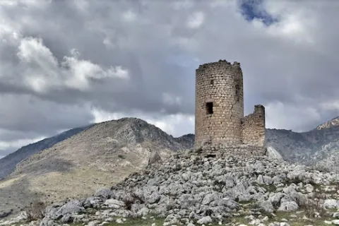
    • Source of the seven years. Pilar abrevadero with front of armchairs, and public laundry, example of traditional rural architecture related to the use of water for the consumption and irrigation of gardens, which possibly goes back to the 16th century. View with excellent views over the garden, olive and saw landscape.
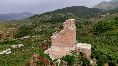
    • Silk source. Source and public laundry that gives name to the area where the bushes were grown. The production and trade of silk, introduced by Muslims, was one of the economic bases of Albanchez until the 18th century.
    Naturaleza

    • Source of the Espino. It is a water birth located in the middle of the Mediterranean mountain, with geological and vegetable formations of high natural value.
    • The Boiler of Uncle Wolf and the left-handed.It is a set of river pods and a waterfall inside a cave, all in a very mountainous environment.
    • The Serrezuela and the Port of the Aznaitin.Mountain area with stunning landscape views of the region.
    • Hutar site. Natural site at the birth of the Hútar Arroyo, located 2 km. of the town. Recreational area with barbecues, bar- restaurant, swimming pool and sports court, between springs and abundant vegetation. The waters of Hútar have historically been used for irrigation and as a driving force for the flour mills in Albanchez.
    • The Caño del Aguaderon area. Water birth at 1,800 meters of altitude in a high mountain environment. Area of pastures traditionally dedicated to pasture, so the fountains, pilares- abrevadero and huts or pastor's cabins abound. The altitude of the saw allows the presence of birds that nedify above 1,500 meters, such as the Red Roquer, the Grey Collalba and the Royal Eagle.
    • The Turcal. Geological formation with an abrupt relief of slices and rocky florings containing so-called algal bowls or fossils from the seabed 16 million years ago.
    • Path of Great Tour GR (E4)that crosses the province of Jaén runs through the term of Albanchez.
    • The Dehesa. The site is located in the place where the first limestone rocky outings of the base of Mount Aznaitín, which has a high landscape value, appear. In 2003, ten Escalada Days were opened which with different degrees of difficulty are a great opportunity to encourage and / or practice this sport.

    Fiestas y Eventos

    • The Festival of the Candelaria on February 2, also known as Rosca Day. During the Mass there are a few thistles that are spread among the attendees. It is considered that those who take them are protected from the diseases of the throat and stomach.
    • In Albanchez, the habit of overthrowing the mozzas remains. The bordes are the fruit of the enea. They are collected during the summer and stored in the house chambers, in the straits, to dry. The Carnival Sunday They are taken out to throw them at the girls. When peeling them, they take off a white and melosous fuzz that adheres to the hair and clothes. It is said that the more a girl is loved, the more bordered she must throw her suitor in her face, so that that day the streets of the village will be carpeted with the annoying hairchair, in so curious "demonstration" of love.
    • The day 3 of May with the procession of Rosario de Los Hachones the employers' parties of San Francisco de Paulaheld from 3 to 6 May. The participants go through the streets carrying hashons or teas made with spartum and fish. At the passage of the procession, four luminaires, large laces of wood and olive branches, are put on, to which salt is cast to grow and prevent the passage of the comitiva. The light of the hashons and luminaries in the darkness of the night recalls the dawn of the Aurora, in a ritual that synthesizes the character of fire as a magical-symbolic element and the Christian tradition of prayer of the Rosary.
    • Procession in honour of San Francisco de Paula on May 4, Albanchez pattern, crop protector and rain propitiator. During the journey the neighbors cast wheat, from the balconies, on the paths of the throne, as a symbol of thanks for the given and begging harvest for the coming.
    • The night of San Juan a tradition related to falling in love is celebrated. The moors place the hangings on the doors of the mores, with different meaning depending on the type of ornament: the flowers are proof of affection, the branches of fig tree mean that the moose is a little locuel, the parra's sarment indicates that they have seen it drink wine, and a cardo, that its character is hard.
    • The day 1 August the day of the gazhaswhere in most houses the August gazhas are eaten, made with flour, water, pepper and tomato. It is popular belief that eating the hot gaches in the middle of summer, the heat will be kept throughout the winter, especially during the olive collection. In the collection of the olive that is cold is that it has not eaten the gazhas of August 1. At present, there is a competition on that day for the production of gachas in the Natural Area of Hútar, during a holiday and the coexistence of all those who do not want to spend the winter cold.

    Gastronomía


    Its gastronomy of Moorish origin is rich and varied, preserving the peculiarity of possessing the only Maize stew which can be taken throughout the province of Jaén. It is a summer dish where the corn grains, once crushed in the mortar, will give body to a broth made from a saffrito of peppers, beans, tomato and fresh guindilla, which will then be cooked with pepper, saffron, cumin, garlic and salt.

    Another of the traditional Czech Albanian dishes is called flakes, which are only a variant of the rags with hare, in which the mass is threaded laboriously to form small pieces of the size of the swollen corn, accompanied by orchard products such as green peppers, potatoes, eggplants and beans.

    The heritage of the Andalusian gastronomy is present in much of the recipes and culinary habits that are preserved in Albanchez, such as the rye, made with lamb blood, and consumed in all relevant celebrations, the bordullos and the peas of corn and wheat. In the chapter of sweets, the almondmade of ground almond, egg, cinnamon, sugar and lemon scraping.

    For dessert, the flakes, which can be taken with sugar and cinnamon or honey; or the not less almond almonds, delicious conjunction of meringue, sugar and almonds passed through the oven. Unforgivable as dessert of the traditional weddings of old was the refreshing melon saladand as dessert or snack of the autumn evenings the no less traditional weddings, so called to the pitancero sponsales of a dry fig, preserved in flour, and a piece of walnut, almond or peeled acorn that is placed inside.

    Historia

    The oldest news in the history of Albanchez is found in the Cueva de los Skeletos, in the The Fuckers' place. It was discovered in the 19th century by peasants. It was the finding of several skeletons, sitting in semicircle and armed with arrows, whose tips were acute pedernals, with knives and spears also of pedernal. The researchers have identified him with a multiple burial of the Age of the Bronze. In the municipal term, several treasuries of coins and several inscriptions have been found, of which some researchers have deduced the existence of a buried Roman city, Campanjana.

    The urban core of Albanchez must have originated between the 7th and 9th centuries, when the peasant population used the rock, under which the people lie, to seek refuge. By the 11th century the wall of the population would be built, which was then above the current one. From this primitive fortification remain the remains of a square tower.

    After the Spanish conquest the castle was built on the rock, although it is difficult to specify who built it, for during the middle age Albanchez belonged to various lords, although above all it belonged to the Order of Santiagor. In 1309 Fernando IV grants the villa to this Order of Santiago, which created the Bedmar and Albanchezwhose presence lasted, at intervals, until the 19th century. From the news in the leagues we know that he belonged to the Lordship of Jodar, until in 1338 Ruy Fernández He sold it to the Ubeda Council for 1,500 maravedis. Albanchez was dependent on Bedmar until the infant Enrique de Aragón the villa was made independent by privilege given in Valladolid on 18 November 1419, later confirmed by other kings.

    After the reconquest there was a demographic increase supported by the repopulation measures and movements, the development of an economy of a marked agricultural character and the raising of partridges and pigeons and goats, lanar and cattle. The economic decline of the state in the 17th century accentuates this situation in Albanchez due to its subsistence economy. The fact that it is evidenced by the state of ruin that the castle had at this time or the sinking of the roof of the parish temple.

    The 18th and first half of the 19th century meant a shy attempt to recover. This is demonstrated by the reconstruction of the church giving rise to the current one. Another of the most significant facts is the definitive disappearance of the Enabling to the heat of measures such as the Demortization of Mendizábal in 1836.

    Loading map
    Preparing points of interest and routes...
    Imagen principal
    imagen
    Image
    albanchez de mágina
    Imagen principal
    Activado

    Recreational Zone La Cañada

    Submitted by brandcode_deweloper on
    Id
    4691127
    Descripción
    Breve descripción

    It is a perfectly equipped road that has an interesting look, a water source and an information panel on landscape interpretation.

    Telecomunicaciones
    Sitio web
    www.pinademontalgrao.es/content/complejo-la-canada
    Teléfono de contacto
    953 781 500
    Correo electrónico
    ayuntamiento@larva.es
    Ubicación
    Código Postal
    23591
    Latitud
    37.758500
    Longitud
    -3.200520
    Dirección
    C/ Conde Torrerando, 22
    Distrito
    Municipio
    Ubicación en el mapa
    POINT (-3.20052 37.7585)
    Tipos de punto de interés
    Imágenes carrusel
    imagen
    Image
    Area%20Recreativa%20La%20Ca%C3%B1ada.jpg
    Imagen principal
    Desactivado
    Imágenes cabecera
    imagen
    Image
    9085_0nw5ulj32ahczt4o.jpg
    Imagen principal
    Activado
    Horario
    24 h.
    Microsite al que pertenece
    Loading map
    Preparing points of interest and routes...

    Mágina Peaks and Miramundos Zone

    Submitted by brandcode_deweloper on
    Id
    5846349
    Descripción
    Breve descripción

    In this summit crest is the roof of the province: the Pico Magina, with 2,167 meters of height, which is the third highest altitude of Andalusia, after the massizos of Sierra Nevada and the Sierra de Baza. The vegetation and conditions are typical of the high Mediterranean mountain.

    Ubicación
    Latitud
    37.730270
    Longitud
    -3.445830
    Distrito
    Ubicación en el mapa
    POINT (-3.44583 37.73027)
    Tipos de punto de interés
    Imágenes carrusel
    imagen
    Image
    17%20Magina.JPG
    Imagen principal
    Desactivado
    imagen
    Image
    naturaleza_14268337_20191208114422%20%281%29.jpg
    Imagen principal
    Desactivado
    imagen
    Image
    9788440Master%20%282%29.jpg
    Imagen principal
    Desactivado
    Imágenes cabecera
    imagen
    Image
    P1240066%20%282%29.jpg
    Imagen principal
    Activado
    Microsite al que pertenece
    Loading map
    Preparing points of interest and routes...

    Hondacabras Camping Area

    Submitted by brandcode_deweloper on
    Id
    2980330
    Descripción
    Descripción larga

    The landscape surrounding this equipment, located on the rest of a pecuary road, is typically olive-growing and invites hiking. The facilities, with a capacity for a hundred people, have areas for tents, roofed dining, kitchen, toilets and showers.

    Breve descripción

    It is accessed from the JA-1107 road that goes from Torres to Albanchez de Magina; after walking about two km, in the middle of a curve, to the right, it connects a lane that, with a total length of one kilometre, leads us directly to this camping area of the Sierra Magina Natural Park called Hondacabras.

    Telecomunicaciones
    Sitio web
    www.juntadeandalucia.es
    Teléfono de contacto
    953 363 011
    Correo electrónico
    informacion@juntadeandalucia.es
    Ubicación
    Código Postal
    23540
    Latitud
    37.768770
    Longitud
    -3.495980
    Dirección
    Carretera JA-3107
    Distrito
    Municipio
    Ubicación en el mapa
    POINT (-3.49598 37.76877)
    Tipos de punto de interés
    Imágenes carrusel
    imagen
    Image
    acampada%20Hondacabras.jpg
    Imagen principal
    Desactivado
    imagen
    Image
    acampada%20Hondacabras%202.jpg
    Imagen principal
    Desactivado
    imagen
    Image
    acampada%20Hondacabras%203.jpg
    Imagen principal
    Desactivado
    Imágenes cabecera
    imagen
    Image
    acampada%20Hondacabras%204.jpg
    Imagen principal
    Activado
    Microsite al que pertenece
    Loading map
    Preparing points of interest and routes...