Saltar al contenido principal

Pond and Orchard Irrigation Systems de Pegalajar

Submitted by brandcode_deweloper on
Id
5848991
Descripción
Breve descripción

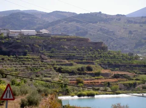
Set qualified by the Council of Culture of the Junta de Andalucía as a Place of Ethnological Interest, and included in the General Catalogue of Historical Heritage of the Junta de Andalucía. System of Muslim-medieval origin, for the storage of water, irrigation and exploitation of a system of traditional gardens in banks built in masonry. It is currently in serious danger of deterioration and change of use, despite its protection.

Ubicación
Latitud
37.740730
Longitud
-3.645870
Distrito
Municipio
Ubicación en el mapa
POINT (-3.64587 37.74073)
Tipos de punto de interés
Imágenes carrusel
imagen
Image
huerta3%20%282%29.jpg
Imagen principal
Desactivado
Imágenes cabecera
imagen
Image
huerta-banc%20%282%29.jpg
Imagen principal
Activado
Microsite al que pertenece
Loading map
Preparing points of interest and routes...
Mountain Range of the Trigo

Submitted by brandcode_deweloper on
Id
4867768
Descripción
Breve descripción

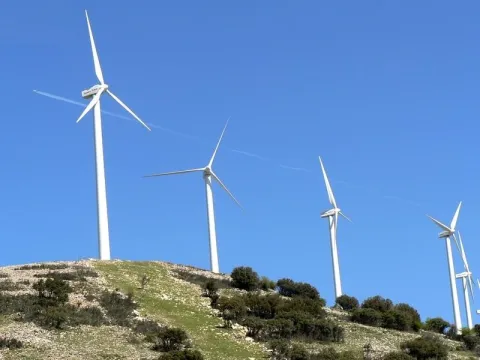
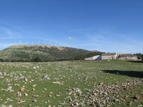
This is an important mountain port, from where we can seestunning panoramicSierra Sur, Sierra Mágina, Sierra de Arana and Sierra Nevada. In two of his tops,The NevazosandCerro del Hoyo Cigarronesdifferent phases of thewind park.

Ubicación
Código Postal
23140
Latitud
37.515210
Longitud
-3.738680
Distrito
Municipio
Ubicación en el mapa
POINT (-3.73868 37.51521)
Tipos de punto de interés
Imágenes carrusel
imagen
Image
SierraTrigo.jpg
Imagen principal
Desactivado
Imágenes cabecera
imagen
Image
Sierra_del_Trigo01.jpg
Imagen principal
Activado
Microsite al que pertenece
Loading map
Preparing points of interest and routes...
Mountain Range of Campillo

Submitted by brandcode_deweloper on
Id
4555300
Descripción
Descripción larga

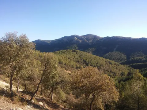
Mediterranean mountain area, also called Sierra de Alta Coloma, with high-value geological and vegetable formations such as oaks, complaints, junips and savannas. The following enclaves are highlighted: the Monastery ravine, the Quebrajano reservoir, the Valdecarazos river, the Palo Stone, the Netherlands Prados cortijo or the Alberquilla lookout.

Location: Sector west of the municipal term.

Distance: 3-7 km.

Medium: by all-terrain vehicle, by bike and on foot.

Access route: By the JV-2.228, which leaves directly from the urban centre, and through agricultural and forestry roads.

Ubicación
Latitud
37.555995
Longitud
-3.635602
Distrito
Municipio
Ubicación en el mapa
POINT (-3.635602 37.555995)
Tipos de punto de interés
Imágenes carrusel
imagen
Image
sierracampillo1.jpg
Imagen principal
Desactivado
Imágenes cabecera
imagen
Image
sierracampillo.jpg
Imagen principal
Activado
Microsite al que pertenece
Loading map
Preparing points of interest and routes...

Small Mountain Range of Pegalajar

Submitted by brandcode_deweloper on
Id
5848471
Descripción
Breve descripción

Landscape of high interest to be located in the vicinity of Pegalajar, where the cave house district is located, some of them for rent. On the northern side there are stunning views of the capital, Jaén, and the Guadalquivir River countryside. To the south the Serrezuela looks at the massif of Sierra Magina and the valley of the Guadalbullion River.

Ubicación
Latitud
37.742398
Longitud
-3.661094
Distrito
Municipio
Ubicación en el mapa
POINT (-3.661094 37.742398)
Tipos de punto de interés
Imágenes carrusel
imagen
Image
serrezuelapegalajar1.png
Imagen principal
Desactivado
Imágenes cabecera
imagen
Image
serrezuelapegalajar.png
Imagen principal
Activado
Microsite al que pertenece
Loading map
Preparing points of interest and routes...

Small Mountain Range of Bedmar

Submitted by brandcode_deweloper on
Id
5845460
Descripción
Breve descripción

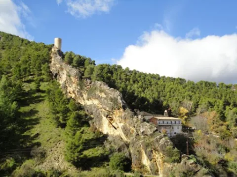
A very steep limestone formation that is located east of the town of Bedmar and above it. On the other side of these scarves is the neighbouring town of Jódar. The climbing lovers will find here magnificent ways to practice their favorite sport. In the center of it you can see an obscene with an Arab wall known as the Air Cave.

Ubicación
Latitud
37.832416
Longitud
-3.423530
Distrito
Municipio
Ubicación en el mapa
POINT (-3.42353 37.832416)
Tipos de punto de interés
Imágenes carrusel
imagen
Image
serrezuelabedmar1.png
Imagen principal
Desactivado
Imágenes cabecera
imagen
Image
serrezuelabedmar.png
Imagen principal
Activado
Microsite al que pertenece
Loading map
Preparing points of interest and routes...

Iberian Sanctuary el Pajarillo

Submitted by brandcode_deweloper on
Id
4652660
Descripción
Breve descripción

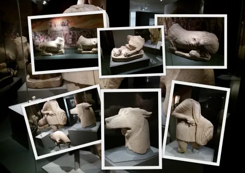
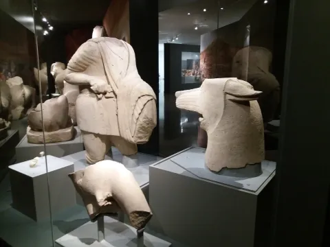
TheSanctuaryHeroic of ElDuck, inHuelma, is the place where the well-known sculptural ensemble in which a wolf and a hero are faced, surrounded by other animals such as lions and taps and placed on a stone tower, in sum in a monumental context of great importance.

Telecomunicaciones
Sitio web
www.redjaen.es
Ubicación
Código Postal
23560
Latitud
37.647300
Longitud
-3.455180
Distrito
Municipio
Ubicación en el mapa
POINT (-3.45518 37.6473)
Tipos de punto de interés
Imágenes carrusel
imagen
Image
el%20santuariodel%20pajarillo.jpg
Imagen principal
Desactivado
Imágenes cabecera
imagen
Image
santuario.jpg
Imagen principal
Activado
Microsite al que pertenece
Loading map
Preparing points of interest and routes...

Sanctuary of Cuadros

Submitted by brandcode_deweloper on
Id
7974744
Descripción
Descripción larga

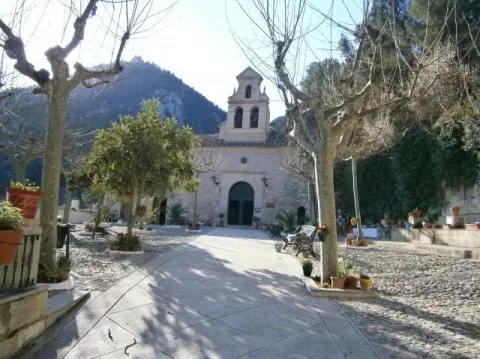
u external appearance is low stylized but viscous by its volumetric contrasts. Made of masonry, the cover framed by molded cornice opens with a half-point arch on imposts with smooth transdotes. On its axis is raised a high swordsman of two bodies, the lower one with two arches also of half point and the upper one with one, triangular front and vases. It keeps a cover in a carved stone that belonged to the Marquis de la Cueva palace.

Its plant is rectangular and consists of a single ship covered with false plaster canyon vault, with false fajon arches that are based on arquitrabed pilasters. Both the ship and the presbyterium - which is accessed by a reduced spinal arch and covered with a half-orange vault on the breast - are decorated with geometric and plant thematic motifs. The choir stands at the feet and is supported by two columns with shoes. The shrimp has a polygonal plant, was built in the early 18th century and has undergone various reforms and modifications.

It is possible that the devotion to the Virgin of Cuadros may be extended to the Middle Ages as it corresponds to a very active region militarily in the Christian conquest and with a primarily agricultural activity. The relaunch of his worship was based on the model of popular religiosity promoted by the Council of Trent and on the ecclesiastical policy carried out in the province by Bishop Dávila. The importance of both the process and the claim of the pilgrimage of rosemary of the Sanctuary of the Virgin of Cuadros exceeds its artistic and monumental value.

Breve descripción

In the relations of Philip II, 1575, the great devotion felt in the region by the Virgin of Cuadros, whose sanctuary, five kilometres from Bedmar, was raised in 1615, forming together with a medieval turret and mill.

Telecomunicaciones
Sitio web
www.bedmargarciez.es/el-municipio/patrimonio-historico.html
Ubicación
Código Postal
23537
Latitud
37.790090
Longitud
-3.408750
Dirección
JV-3222
Distrito
Municipio
Ubicación en el mapa
POINT (-3.40875 37.79009)
Tipos de punto de interés
Imágenes carrusel
imagen
Image
santuario%20de%20cuadros%20bedmar2.jpg
Imagen principal
Desactivado
Imágenes cabecera
imagen
Image
santuario%20de%20cuadros%20bedmar.jpg
Imagen principal
Activado
Microsite al que pertenece
Loading map
Preparing points of interest and routes...

Castillejo Ruins

Submitted by brandcode_deweloper on
Id
4405889
Descripción
Breve descripción

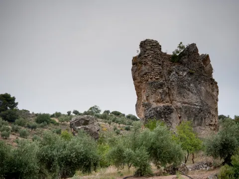
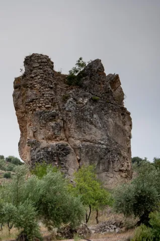
The Castlejo de Cárchel is of Muslim origin and in the surrounding areas there have been many fragments of Spanish-Muslim ceramic glazed and unglazed, and among all the archaeological remains found in the area, stands the head of a clay figure, found in 1997 by the child José M. Ruiz. It is possibly a survival of Iberian exvotes in Muslim times.

Telecomunicaciones
Sitio web
www.carcheles.es/el-municipio/patrimonio-historico.html
Teléfono de contacto
953 302 291 / 953 302 003
Correo electrónico
Webmaster@carcheles.es
Ubicación
Código Postal
23192
Latitud
37.634510
Longitud
-3.640960
Distrito
Municipio
Ubicación en el mapa
POINT (-3.64096 37.63451)
Tipos de punto de interés
Imágenes carrusel
imagen
Image
270px-Castillo_de_C%C3%A1rchel_24J_14.jpg
Imagen principal
Desactivado
imagen
Image
castillejo.jpg
Imagen principal
Desactivado
Imágenes cabecera
imagen
Image
castillejlo.jpg
Imagen principal
Activado
Microsite al que pertenece
Loading map
Preparing points of interest and routes...
Jandulilla River

Submitted by brandcode_deweloper on
Id
8114425
Descripción
Descripción larga

Former Xandulilla. Influent on the left bank of the Guadalquivir River. Collect the waters from the northeastern face of the Sierra Magina massif. The associated valley is given the same name. Unwind in the Guadalquivir River, in the area of Ubeda the old one. The Arab geographer Al-Zuhrí, mentions him by the name of Wadi-l-Ard, or Rio de la Tierra.

He named the former population of Xandulilla, of which there are many archaeological remains of great importance spread throughout the area. In the 17th century it was known as "Villa de Felix" with its own jurisdiction. It is a river with a normally low and variable flow rate and without regulatory structures. It is born under the Port of the Gallardos, also known in its first stretch as Rio Huelma, its main tributaries, both on the left are the Gualijar River and the Garganton River that are born in the main massif of Magina and after a very short journey they result in the Jandulilla, apart from numerous intermittent rags and ramps.

Breve descripción

The Jandulilla River is a short river in the south of Spain, tributary to the left bank of the Guadalquivir River that runs through the province of Jaén and collects the waters of the northeastern face of the Sierra Magina massif. The associated valley is given the same name. Unwind in the Guadalquivir River, in the area of Ubeda la Vieja.

Telecomunicaciones
Teléfono de contacto
953 390 210
Ubicación
Código Postal
23560
Latitud
37.650300
Longitud
-3.459550
Distrito
Municipio
Ubicación en el mapa
POINT (-3.45955 37.6503)
Imágenes carrusel
imagen
Image
r%C3%ADo%20Jandulilla%202%20%281%29.jpg
Imagen principal
Desactivado
Imágenes cabecera
imagen
Image
r%C3%ADo%20Jandulilla.jpg
Imagen principal
Activado
Microsite al que pertenece
Loading map
Preparing points of interest and routes...
Cánava Pine Forest

Submitted by brandcode_deweloper on
Id
5845162
Descripción
Descripción larga

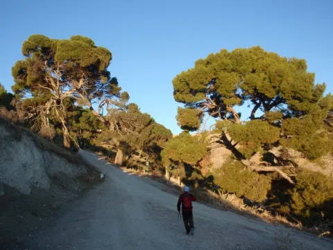
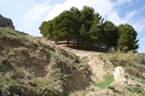
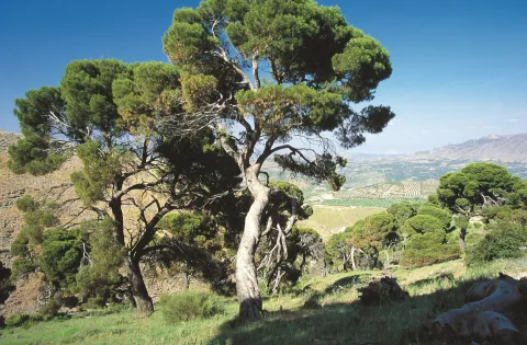
The Pinar de Cánava is an interesting forest ecosystem that has the carrasco pine as its protagonist. The uniqueness of this pineapple, of about 120 copies, is found in its high degree of naturality and, above all, in its longevity, with pine trees between 100 and 250 years old.

This pineapple has great value as an educational resource, as it offers a unique opportunity to understand the different stages of ripening of a forest. In addition, the appearance of a pine can be observed at a stage near old age. In front of the typical forms of young pineapples with straight trunks and conical cups, they contrast the twisted specimens of this Natural Monument. Its rounded, parasol-shaped cups remind of other tree species. The bush in this forest has almost disappeared. This complex aspect is the one that every forest would have in a natural way, but man's intervention changes this process, tending towards greater simplicity.

Breve descripción

Protected natural space, as a natural monument, of 5 ha of extension. The municipal term of Jimena. Interesting pine that shows the relish vegetation, ancient of the area. We could consider it a plant landscape, witness to ancient vegetation.

Ubicación
Nombre
Cerro de la Atalaya
Latitud
37.841470
Longitud
-3.478850
Distrito
Municipio
Ubicación en el mapa
POINT (-3.47885 37.84147)
Tipos de punto de interés
Imágenes carrusel
imagen
Image
image_248193.jpeg
Imagen principal
Desactivado
imagen
Image
imagen-166-pinar-jpg
Imagen principal
Desactivado
Imágenes cabecera
imagen
Image
Monumentos_naturales_2%20%281%29.jpg
Imagen principal
Activado
Microsite al que pertenece
Loading map
Preparing points of interest and routes...