Saltar al contenido principal

Drinking Trough Fountain

Submitted by brandcode_deweloper on
Id
910704
Descripción
Descripción larga

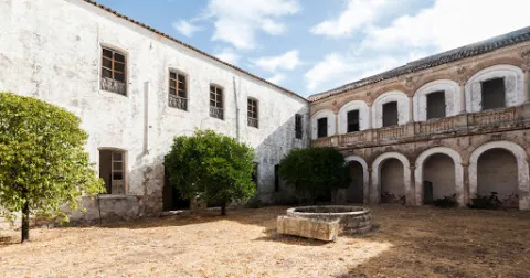
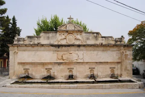
Precisely, to the cloister of the said convent, Mr Gonzalo Messía Carrillo Fonseca, I Marqués de La Guardia, commissioned the execution of an exempt fountain, crowned by the Magdalena and dated 1577, which has been attributed to Francisco del Castillo "El Mozo," currently located in the courtyard of the Excel. Provincial Council of Jaén. Years earlier, and perhaps to commemorate the appointment as I Marqués de La Guardia, Gonzalo Messía ordered to raise a pilar-abrevadero at the entrance of the population, near the Dominican convent, to serve as a water supply to the neighbors and their animals. This beautiful space, threatened with splendid gardens, over time became a plateau made up of the source itself and a nobility house of silery built according to the date of 1814.

The pilar-abrevadero, in a landscape and built of silary stone, is formed by a wall articulated by two bodies and attic. In the first body there are five caños of bronze out of avenerated hornazas that pour abundant waters on a rectangular pillar, in the second a beautiful frame was carved with hanging cloth with the inscription allusive to the comitant and the date of execution: "This work command to do the Iltmo. Mr. Don Gonzalo Mexia Carrillo, my lord. Year 1566." Throughout this second body there is an internment supported at the ends in Ionian striated columns. In the center of the attic two canes, with the garruches of the Messia family, hold an oval shield on the mould with the crown of Marquis and the following inscription "Plaza de Isabel II Reina Constitucional," with which this place has been known since. In its origin the dogs held the shield with the weapons of Don Gonzalo Messia Carrillo; it is overcome with a fronton with a central relief flanked by fins and crowned with a Cross, to the ends and bearing the cross of Santiago have settled two lying lions (all very redone).

Although the tracist of this beautiful pillar is not known, the stylems incorporated in it, columns with alternating sticks, the scroll with cloth (similar to the carved ones in the City Palace of Ubeda), the molding of the inlet and the cut-off hides of the shield held by the canes point to a possible intervention by Andrés de Vandelvira. Professor Galera Andreu expresses himself in this respect: I do not believe that the public source is not at his hand, despite the reforms (...) to be highlighted by the small scale of the columns attached in an application to the reverse of what was done in the chapel of the Benavides in Baeza. The set was restored by the local workshop school in 1991.

Breve descripción

Monument of the Historical-Artistic Set. Declared 06 / 07 / 1983 To the Messies, lords and Marquis of La Guardia, the architectural wealth preserved in this villa is largely due. Thanks to its performance, not without taste, the old Bajomieval fortress adapted to the new palaciegos (typical of the reign of the Catholic Kings) with a beautiful tarootic cover and encouraged the foundation of a convent run by the Dominicans, in which consecrated architects such as Andrés de Vandelvira and Francisco del Castillo "El Mozo" would intervene throughout the 16th century.
Telecomunicaciones
Sitio web
www.laguardiadejaen.com/tu-ciudad/historia/
Teléfono de contacto
953 327 100
Correo electrónico
ayuntamiento@laguardiadejaen.es
Ubicación
Código Postal
23170
Latitud
37.744720
Longitud
-3.693890
Dirección
C/ Escuelas, 11
Distrito
Ubicación en el mapa
POINT (-3.69389 37.74472)
Tipos de punto de interés
Imágenes cabecera
imagen
Image
Pilar%20Abrevadero%20%281%29.jpg
Imagen principal
Activado
Loading map
Preparing points of interest and routes...

Natural Area Alto Guadalquivir

Submitted by brandcode_deweloper on
Id
2190557
Descripción
Descripción larga

The whole area of this artificial wet area - with an increasingly important water vegetation belt - is surrounded by crops.

The palustre vegetation of these swamps is basically made up of eneas and canes, accompanied by beets and tarays and on their shores are mainly developed the alms.

While, as far as fauna is concerned, an abundant and varied community of aquatic birds is concentrated in these reservoirs of Alto Guadalquivir, highlighting the colony of squid (species catalogued as threatened at community level), royal ducks and spoons, as well as imperial porrones and garzas.

The total area of this natural area, whose reference locations are Ubeda and Jódar, is 663 hectares.

Breve descripción

To the south of the famous hills of Ubeda, the Guadalquivir River was repressed in the 1950s in a succession of three small reservoirs: Doña Aldonza (301 hectares), Pedro Marín (240 hectares) and Puente de la Cerrada (122 hectares).

Ubicación
Latitud
37.779600
Longitud
-3.784910
Municipio
Ubicación en el mapa
POINT (-3.78491 37.7796)
Tipos de punto de interés
Imágenes carrusel
imagen
Image
Natu178.jpg
Imagen principal
Desactivado
imagen
Image
Natu179.jpg
Imagen principal
Desactivado
imagen
Image
Natu237.jpg
Imagen principal
Desactivado
Imágenes cabecera
imagen
Image
Natu049%20%281%29.jpg
Imagen principal
Activado
Loading map
Preparing points of interest and routes...

River Area of Cuadros

Submitted by brandcode_deweloper on
Id
2980270
Descripción
Descripción larga

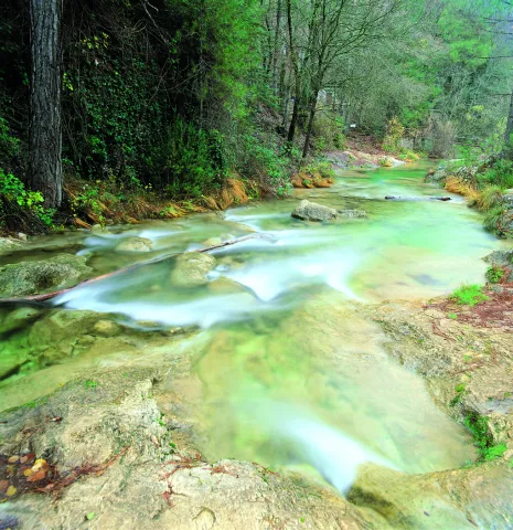
Also known as "Senda de los Adelfares," it is a forest in a gallery made up of adelfas that develops along the birth of the Cuadros River, in the Natural Park of Sierra Magina. It is the most extensive formation in southern Spain with a high degree of conservation.

Breve descripción

Next to the shrine of the Virgin of Cuadros, south of the city centre, about 4 km. of Bedmar; access directly by the road JV-3.222.

Telecomunicaciones
Sitio web
www.bedmargarciez.es
Teléfono de contacto
953 760 002 / 953 760 043
Correo electrónico
alcaldía@bedmargarciez.es
Ubicación
Código Postal
23537
Latitud
37.787590
Longitud
-3.408670
Dirección
Carretera JA-4111
Distrito
Municipio
Ubicación en el mapa
POINT (-3.40867 37.78759)
Tipos de punto de interés
Imágenes carrusel
imagen
Image
nacimiento-rio-cuadros-1-jpg
Imagen principal
Desactivado
imagen
Image
nacimiento-rio-cuadros-jpg
Imagen principal
Desactivado
Imágenes cabecera
imagen
Image
%C3%81rea%20recreativa%20de%20Cuadros.jpg
Imagen principal
Activado
Microsite al que pertenece
Loading map
Preparing points of interest and routes...

Caño del Aguadero Natural Site

Submitted by brandcode_deweloper on
Id
1891235
Descripción
Descripción larga

Area of pastures traditionally dedicated to pasture, so the fountains, pilares- abrevadero and huts or pastor's cabins abound. The altitude of the saw allows the presence of birds that nedify above 1,500 meters, such as the Red Roquer, the Grey Collalba and the Royal Eagle.

Access by land lane from the nearby town of Bedmar.

13 Km tour, then walk routes.

Breve descripción

Water birth at 1,800 meters of altitude in a high mountain environment.

Ubicación
Latitud
37.791993
Longitud
-3.467877
Dirección
Caño del Aguadero
Distrito
Ubicación en el mapa
POINT (-3.467877 37.791993)
Tipos de punto de interés
Imágenes carrusel
imagen
Image
725_SS_03.jpg
Imagen principal
Desactivado
Imágenes cabecera
imagen
Image
725_SS_05.jpg
Imagen principal
Activado
Microsite al que pertenece
Loading map
Preparing points of interest and routes...

Palace of the Marqueses de Viana de Garcíez

Submitted by brandcode_deweloper on
Id
5857980
Descripción
Descripción larga

The building has been of great importance for the Garcíez community, both at the economic and social level, which transcends the history of the lordship itself and its successive owners, as well as in the urban configuration of the town.

Despite the numerous remodeling it has suffered over time, the building maintains the original structure of an Italian Renaissance palace. From the artistic point of view, it is a unique building in the panorama of the 16th century architecture in the province. The six covers, part of the porticated galleries of the two courtyards, decorated with Renaissance, medallion and heraldic motifs, as well as the magnificent staircase. The palace is located in the central area of the historic town of Garciez. Its main facade of marked horizonality and powerful volume stands out among the different surrounding constructions.

Breve descripción

It is one of the large civil buildings of Renaissance style built in the province of Jaén. It was raised by the heirs of the former Garciez County Lordship, whose origin dates back to the Christian Conquest and remained as heritage inherited until the 20th century by the Marquis of Viana Castromonte.

Ubicación
Latitud
37.832416
Longitud
-3.423530
Dirección
Plaza del Rey Juan Carlos I, 1
Distrito
Municipio
Ubicación en el mapa
POINT (-3.42353 37.832416)
Tipos de punto de interés
Imágenes carrusel
imagen
Image
unnamed.jpg
Imagen principal
Desactivado
Imágenes cabecera
imagen
Image
Mon231%20%281%29.jpg
Imagen principal
Activado
Microsite al que pertenece
Loading map
Preparing points of interest and routes...

Palace of the marqueses de Camarasa

Submitted by brandcode_deweloper on
Id
5858362
Descripción
Descripción larga

This house is the most outstanding civilian building as an architecture of the people and must be judged, at the same time, as a sign of their power through this special ornamental treatment of classical cover and the symmetrical composition of the facade that confers on it that seal of the palace as a dwelling, centre of dominion and administrative control of a territory.

The cover It is divided into two bodies by an injunction.At the bottom is a half-point arc with acanto highlighted key and framed by acanto pilasters. The upper body is crowned laterally by two vases on pedestal and in the center a shield with a dome and cross of Santiago between columns decorated with reliefs.

On the other hand, distribution of the inner space It does not correspond strictly to that of rooms and housing, but to that of the depositary of the goods in kind that, as income due to the lord, had to be collected there. This aspect is above that of housing in the general consideration of the property. This deposit primacy is well justified by the agreement of the Marquis, whose residence since the end of the 16th century was not even in the land of Jaén, but in Valladolid. This primary function is demonstrated by the two large ships that run on the second floor along the entire body of the house and on whose access bank there is still an allusion to the date of construction of the barn.

In 1997 it was included in the catalogueGeneral of the Historical Heritage of Andalusia.

Breve descripción

As it appears in the inscription of the friso of the cover, in 1565 the house was finished - the palace of the Marquis of Camarasa, also known as house-palace of the Cobos. Renaissance style,remember the splendor that the people livedfrom the moment Carlos I sells it to his secretary D. Francisco de los Cobos.

Ubicación
Latitud
37.783665
Longitud
-3.508898
Dirección
C/ Prior Higueras, 2
Distrito
Municipio
Ubicación en el mapa
POINT (-3.508898 37.783665)
Tipos de punto de interés
Imágenes carrusel
imagen
Image
DSCF5542.JPG
Imagen principal
Desactivado
Imágenes cabecera
imagen
Image
Palacio_Marqueses_de_Camarasa.jpg
Imagen principal
Activado
Microsite al que pertenece
Loading map
Preparing points of interest and routes...

Cerrillo Salido Necropolis

Submitted by brandcode_deweloper on
Id
4281438
Descripción
Descripción larga

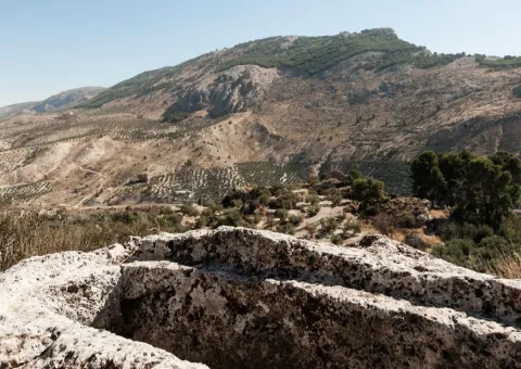
According to the research, it is a necropolis whose extension would surround the entire town, making it one of the most important at the national level.

In 1954, the first archaeological excavation was carried out, 22 tombs of which only 7 remained intact. The inspected tombs had an ovoid and excessively elongated form, not keeping a certain orientation.

Next to this visigoda necropolis - just 30 metres - is another Muslim era.

Breve descripción

Located in the municipality of La Guardia, just 500 metres from the urban core, is this Visigoda period site whose tombs are excavated in the rock.

Ubicación
Latitud
37.742568
Longitud
-3.693708
Distrito
Ubicación en el mapa
POINT (-3.693708 37.742568)
Tipos de punto de interés
Imágenes carrusel
imagen
Image
Mon06510%20%281%29.jpg
Imagen principal
Desactivado
imagen
Image
Mon0610%20%281%29.jpg
Imagen principal
Desactivado
imagen
Image
Mon065120%20%281%29.jpg
Imagen principal
Desactivado
Imágenes cabecera
imagen
Image
40.jpg
Imagen principal
Activado
Microsite al que pertenece
Loading map
Preparing points of interest and routes...

Navalta y Navalconejo

Submitted by brandcode_deweloper on
Id
8094809
Descripción
Descripción larga


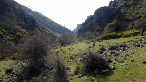
Location:To the west of the town, in the foothills of the mountain set of the South Sierra.
Distance:7 km.

Medium:Tourism vehicle.

Access route:Taking the road leading to the Hoya del Salobral.

Breve descripción

These are fenced valleys surrounded by burning and painting, which are located next to the road leading to Navalcán. They are very visited in the fall by cardo mushroom seekers. The livestock holding (sheep and goats) is very present in this area, with several cortijos in the surroundings dedicated to this work.

Telecomunicaciones
Sitio web
www.noalejo.es/el-municipio/patrimonio-natural.html
Teléfono de contacto
953 306 134
Ubicación
Código Postal
23140
Latitud
37.528500
Longitud
-3.660950
Distrito
Municipio
Ubicación en el mapa
POINT (-3.66095 37.5285)
Tipos de punto de interés
Imágenes cabecera
imagen
Image
Navalta%20y%20Navalconejo..jpg
Imagen principal
Activado
Microsite al que pertenece
Loading map
Preparing points of interest and routes...

Navalcán

Submitted by brandcode_deweloper on
Id
4867827
Descripción
Breve descripción

Depression of karmic origin that belongs to the typical landscape of the Mediterranean mountain. At the same time, we will be able to see a large number of sections, caves, river courses, Mediterranean flora and fauna.

Ubicación
Código Postal
23140
Latitud
37.529021
Longitud
-3.654217
Distrito
Municipio
Ubicación en el mapa
POINT (-3.654217 37.529021)
Tipos de punto de interés
Imágenes carrusel
imagen
Image
navalcan1.jpg
Imagen principal
Desactivado
Imágenes cabecera
imagen
Image
navalcan1-600x450.jpg
Imagen principal
Activado
Microsite al que pertenece
Loading map
Preparing points of interest and routes...

Source of the River Arbuniel

Submitted by brandcode_deweloper on
Id
8091520
Descripción
Descripción larga

It is one of the most cuddly and important springs in Sierra Magina, being the pride of the shrubs. Although water sprouts through limestone rocks and liasic dolomies of an aquifer, it has a marked saline character because it arises in the breast of margas with triasic plaster.

The waters of the birth are collected in an artificial construction raft that stores them and leads by a system of waterfalls that runs throughout the village.

Next to the birth is one of the four power plants that used the waters of the river for the production of electricity.
This beautiful area is conditioned with a meringero area that allows visitors to enjoy a picnic in a unique natural environment.

The river course is channeled in a multitude of waterfalls that give wealth to the land of the municipality and irrigate many hectares of land. Previously it gave impetus to flour and oil mills, while it is currently used for the irrigation of the olive tree, true economic engine of the area.

The space has a magnificent road with barbecues, banks, tables, stationery, a small bar and children's playground, where you can spend a pleasant day surrounded by nature and where you can take advantage of the freshness of the place and the shadows of the trees.

In the birth of the Arbuniel you can see ducks and river crabs, which inhabit in its channel thanks to the great amount of lime of its waters, and abundant trout.

Breve descripción

The Birth of the Arbuniel River, also known as The Birth of Water, is located on the slopes of Mount Torre de Gallarín, in the vicinity of the urban town of Arbuniel (Cambil), within the region of Sierra Magina.

Telecomunicaciones
Sitio web
www.cambil-arbuniel.es/municipio/patrimonio-natural/nacimiento-de-arbuniel/
Ubicación
Código Postal
23193
Latitud
37.624420
Longitud
-3.540790
Dirección
Camino del Álamo, 3. Arbuniel
Distrito
Municipio
Ubicación en el mapa
POINT (-3.54079 37.62442)
Imágenes carrusel
imagen
Image
Nacimiento%20del%20r%C3%ADo%20Arbuniel2.JPG
Imagen principal
Desactivado
imagen
Image
Nacimiento%20de%20Arbuniel.jpg
Imagen principal
Desactivado
Imágenes cabecera
imagen
Image
Nacimiento%20del%20r%C3%ADo%20Arbuniel3.jpg
Imagen principal
Activado
Microsite al que pertenece
Loading map
Preparing points of interest and routes...