Saltar al contenido principal

Museum of Historia Local de Jódar

Submitted by brandcode_deweloper on
Id
2343646
Descripción
Descripción larga

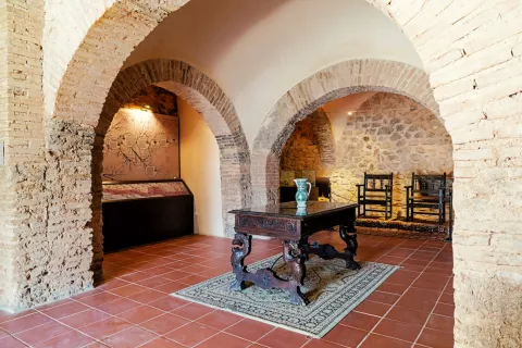
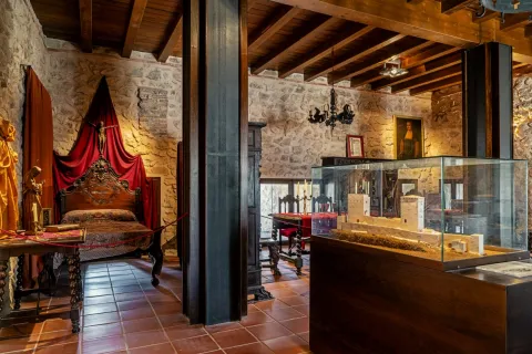
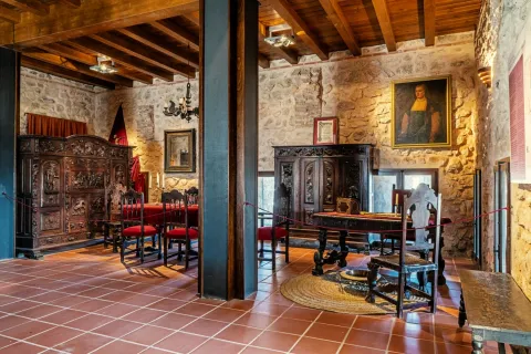
The Museum is divided into seven rooms:

1. "Narciso Mesa Fernández" Culture Hall with conference room, Galdurian theme library and authors and the "Saudi" Phototeca and video library since the mid-19th century.

2. City History Room.

3. "José María Balboa Ruiz" room dedicated to popular arts and customs with the reconstruction of a house and various trades.

4. Room "T.E. Traschina." Dedicated to popular arts and customs, with spaces for popular religiosity, media and historical memories.

5. Hall of the spartum crafts and olive culture.

6. Temporary exhibition room.

7. The "Brilop" Naif art museum that collects the pictorial legacy of Blas T. Rivera López.

Breve descripción

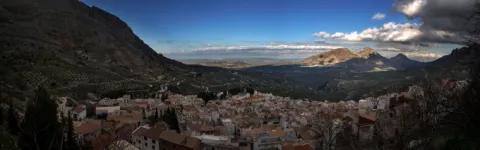
Since 1983, the "Saudar" Cultural Association has been doing a informative and research work on the historical, artistic, cultural and traditional origins of the population. We believe that we are contributing to the protection, conservation, knowledge and dissemination of it and we have materialized this in a Museum. The one we know today as the Jodar Museum, which is a "time walk" to get to know the city in close contact, "Jodar, naturally simple."

Telecomunicaciones
Sitio web
www.saudar.com
Teléfono de contacto
635 602 704
Correo electrónico
asociacion.saudar2@gmail.com
Ubicación
Código Postal
23500
Latitud
37.844560
Longitud
-3.352210
Dirección
C/ Juan de Mata Carriazo, 4, 2º, 1ª puerta
Distrito
Municipio
Ubicación en el mapa
POINT (-3.35221 37.84456)
Tipos de punto de interés
Imágenes carrusel
imagen
Image
Castillo%20de%20Jodar6.jpg
Imagen principal
Desactivado
imagen
Image
Castillo%20de%20Jodar9%20%281%29.jpg
Imagen principal
Desactivado
imagen
Image
Castillo%20de%20Jodar8%20%281%29.jpg
Imagen principal
Desactivado
imagen
Image
Castillo%20de%20Jodar10%20%281%29.jpg
Imagen principal
Desactivado
Imágenes cabecera
imagen
Image
Castillo%20de%20Jodar4.jpg
Imagen principal
Activado
Horario
Monday to Friday: 11: 00 - 13: 00.
Microsite al que pertenece
Otros servicios

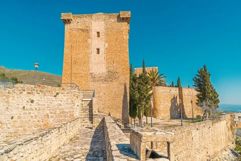
Visitors' Center "Sierra Magina Natural Park" (South Tower) and "Xodar" Interpretation Center of the Castle's History (North Tower). Saturdays, Sundays and holidays, from 11: 00 to 13: 00. Friday, Saturday and holidays, from 16: 00 to 18: 00. For concerted visits by cultural groups on another schedule call 635 602 704 or email: culture and festivities The visit will have a guide from our association.
Loading map
Preparing points of interest and routes...

Mount Aznaitín

Submitted by brandcode_deweloper on
Id
5693260
Descripción
Descripción larga

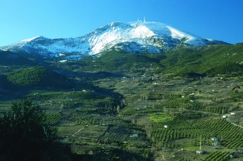
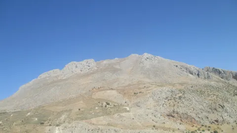
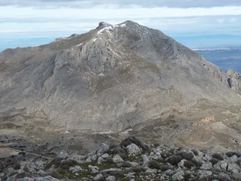
In the Aznaitín, some plant endemisms typical of Sierra Magina are maintained. At its summit the municipal terms of Jimena, Torres and Albanchez de Mágina, whose populations are located at their feet, as do the prehistoric caves, where the former inhabitants left their mark for posterity. Not in vain the Aznaitin impregnated the pupil of Antonio Machado from the far Baeza and incorporated him into his poetry.

Breve descripción

The Az-Naitín (Nathin in local dialect) is a mountain located in Sierra Magina, Jaén, Spain. The origin of the toponymy in Arabic would be Isnatin or Asnatin, and it is noted that it can come from its ancient name in ibero as Neitin, which refers to the great iberous god Neton, the god of Thunder and fire, which according to the legend dwells in the mountain. It has a special visual appeal, especially from the East side or from the Guadalquivir valley. It has a considerable altitude, 1745 m, which allows to see much of the province of Jaén.

Ubicación
Latitud
37.841370
Longitud
-3.476880
Distrito
Municipio
Ubicación en el mapa
POINT (-3.47688 37.84137)
Tipos de punto de interés
Imágenes carrusel
imagen
Image
3.jpg
Imagen principal
Desactivado
Imágenes cabecera
imagen
Image
4.jpg
Imagen principal
Activado
Microsite al que pertenece
Loading map
Preparing points of interest and routes...

Viewpoint of the Keep / Tower de Cuadros

Submitted by brandcode_deweloper on
Id
2980306
Descripción
Descripción larga

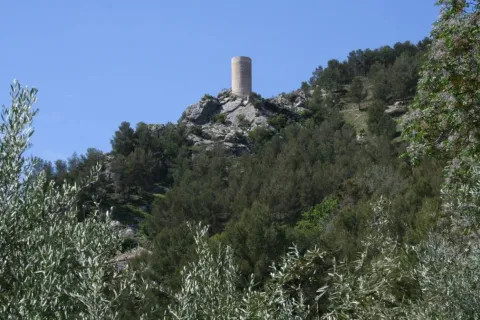
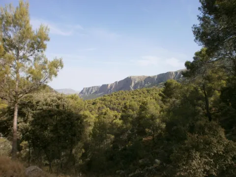
It is a watchtower, of Arab origin, perfectly conditioned as a lookout that offers the visitor beautiful views of the valley of the Cuadros River, surrounded by gardens and crops, and part of the Natural Park of Sierra Magina. It is accessed through the signposted path of the Viñas and is a privileged place to contemplate one of Europe's largest highland forests, whose glasses intertwine with each other by forming a plant vault that barely lets the sky see.

Breve descripción

The lookout is located near the recreational area El Adelfal de Cuadros, near the shrine of the Virgin of Cuadros, south of the city centre, about 4 km. of Bedmar; access directly by the road JV-3.222.

Ubicación
Código Postal
23537
Latitud
37.789330
Longitud
-3.409500
Dirección
Camino de Fresneda a Cuellos
Distrito
Municipio
Ubicación en el mapa
POINT (-3.4095 37.78933)
Tipos de punto de interés
Imágenes carrusel
imagen
Image
Mon443.jpg
Imagen principal
Desactivado
Imágenes cabecera
imagen
Image
20.jpg
Imagen principal
Activado
Microsite al que pertenece
Loading map
Preparing points of interest and routes...

Viewpoint of the Pico Almadén

Submitted by brandcode_deweloper on
Id
2980318
Descripción
Descripción larga

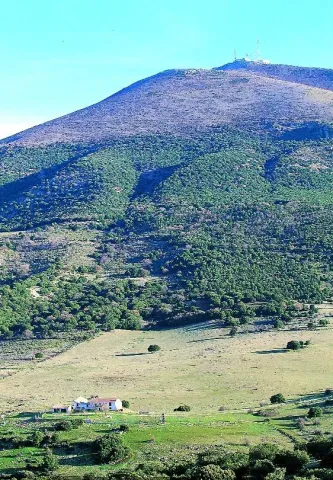
At 1,883 m above sea level, the visual basin is 360º, and can be seen from the Almadén almost the entire province, even the tops of Sierra Nevada. From the botanical point of view, the Almadén peak offers an interesting snapshot of the different bioclimatic floors, from the Mediterranean to the Mediterranean, which exist in the Natural Park of Sierra Magina.

Breve descripción

In Mancha Real we will take, by the Alameda de las Pillas, the so-called road of the Repetidor, that in a constant and zigzagueante ascent of 35 km. that leads us to the top of the Almadén, one of the ceilings of the province where the municipal boundaries of Cambil, Pegalajar and Torres converge

Ubicación
Código Postal
23120
Latitud
37.725060
Longitud
-3.466650
Dirección
Carretera A-324
Distrito
Municipio
Ubicación en el mapa
POINT (-3.46665 37.72506)
Tipos de punto de interés
Imágenes carrusel
imagen
Image
Natu363.jpg
Imagen principal
Desactivado
Imágenes cabecera
imagen
Image
21.jpg
Imagen principal
Activado
Microsite al que pertenece
Loading map
Preparing points of interest and routes...

Viewpoint of the Castle of Albanchez de Mágina

Submitted by brandcode_deweloper on
Id
2980294
Descripción
Descripción larga

The town of Albanchez de Magina is accessed from the capital by the A-316 in the direction of Ubeda: After going about 12 km, to the right, we will turn to the A-320 in the direction of Mancha Real. In this town we will take the JA-3106 road towards Torres. Finally, from here we will head for the JA-1107 to Albanchez, which is about 12 km away.

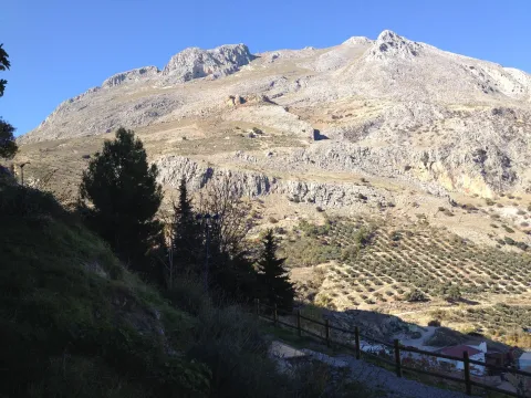
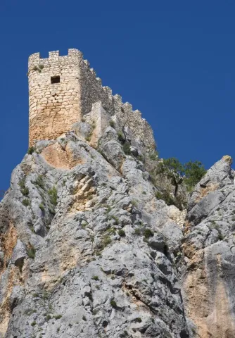
Albanchez de Mágina clings over the rocky skirmish of Mount Aznaitín (1,745 meters), headed towards the vertigo of a wide and deep valley watered by the often-flowing channel of the Albanchez River. On the needle of a sharp farallon lies its rocky castle of Arab origin, becoming an unbeatable lookout over the northern geography of this mountain massif of the Natural Park of Sierra Magina.

Breve descripción

The rise to this rock castle is already worth it. The feeling is to be attached to the nest of a rapacious bird on the walls of Mount Aznaitin, on the valley of the Cuadros River.

Ubicación
Código Postal
23538
Latitud
37.790110
Longitud
-3.468140
Distrito
Ubicación en el mapa
POINT (-3.46814 37.79011)
Tipos de punto de interés
Imágenes carrusel
imagen
Image
miradoralbanchez.jpg
Imagen principal
Desactivado
imagen
Image
63503204d18160dd6a733e989b70c404_L.jpg
Imagen principal
Desactivado
Imágenes cabecera
imagen
Image
19.jpg
Imagen principal
Activado
Microsite al que pertenece
Loading map
Preparing points of interest and routes...

Viewpoint Campos de Larva

Submitted by brandcode_deweloper on
Id
8094285
Descripción
Descripción larga

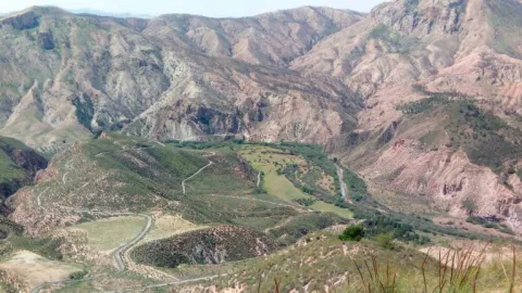
Over the past decades, the landscape of Larva has changed according to agricultural needs. The fields seen, originally, have been occupied by large cereal crops, being the main food support for their inhabitants. Over time, the steppe landscape has undergone a great transformation, leaving the cultivation of the olive tree, and occupying the largest area for agricultural use, passing to a second level the cultivation of the cereal.

Breve descripción

One of the most unknown corners of the Sierra Magina region is the village of Larva. Larva is located in a privileged place between two Natural Parks in the province of Jaén.

Telecomunicaciones
Teléfono de contacto
953 781 500
Correo electrónico
ayuntamiento@larva.es
Ubicación
Código Postal
23591
Latitud
37.760203
Longitud
-3.202937
Distrito
Municipio
Ubicación en el mapa
POINT (-3.202937 37.760203)
Tipos de punto de interés
Imágenes carrusel
imagen
Image
MIRADOR%20larva%20%281%29.jpg
Imagen principal
Desactivado
Imágenes cabecera
imagen
Image
MIRADOR%20larva2.jpg
Imagen principal
Activado
Microsite al que pertenece
Loading map
Preparing points of interest and routes...

Plains of Palomares-Cárcheles

Submitted by brandcode_deweloper on
Id
5849330
Descripción
Breve descripción

Altiplanicie in height, surrounded by mountains. Border space between the municipal terms of Los Cárcheles and Jaén. It is ideal for all-terrain bike and hiking and is accessible, by unasphalted slopes, from the Monte de la Sierra peri-urban park (Jaén) and from Carchelejo (Cárcheles).

Ubicación
Latitud
37.636740
Longitud
-3.639830
Distrito
Municipio
Ubicación en el mapa
POINT (-3.63983 37.63674)
Tipos de punto de interés
Imágenes carrusel
imagen
Image
Llanos%20de%20Palomares-C%C3%A1rcheles.jpg
Imagen principal
Desactivado
Imágenes cabecera
imagen
Image
Llanos%20de%20Palomares-C%C3%A1rcheles1.jpg
Imagen principal
Activado
Microsite al que pertenece
Loading map
Preparing points of interest and routes...

The Moors' Tiles

Submitted by brandcode_deweloper on
Id
8211317
Descripción
Descripción larga

It is possibly the Muslim castle referred to in the 1243 delimitation between the episcopal headquarters of Baeza and the Archbishop of Toledo. Known as Ullurauam. In a territory between the Jandulilla River and the Guadiana Minor River, which would be identified as Larva. It is located near the current population of Larva, on a well-ridden hill, with a polygonal plant and two enclosures. Its construction is of tapial alternating with masonry. It keeps its perimeter walled and several towers. Then, because of the border situation and the demographic vacuum, this castle would run the same destination as that of Cabra, abandoned in a neutral area. Roman remains have also been found as a tegola.

Breve descripción

Since the 13th century Larva was integrated into the Spanish-Nazi border, playing an important role in the villages of the minor Guadiana, in 1243 there were conflicts in the delimitations between the episcopal headquarters of Baeza and the archbishopric of Toledo.

Telecomunicaciones
Correo electrónico
ayuntamiento@larva.es
Ubicación
Código Postal
23591
Latitud
37.760080
Longitud
-3.202320
Distrito
Municipio
Ubicación en el mapa
POINT (-3.20232 37.76008)
Imágenes carrusel
imagen
Image
Tejar%20de%20los%20Moros2.jpg
Imagen principal
Desactivado
imagen
Image
El%20Tejar%20de%20los%20moros.jpg
Imagen principal
Desactivado
Imágenes cabecera
imagen
Image
Tejar%20de%20los%20Moros3.jpg
Imagen principal
Activado
Microsite al que pertenece
Loading map
Preparing points of interest and routes...

Las Cimbras

Submitted by brandcode_deweloper on
Id
5846924
Descripción
Breve descripción

Great beauty rocky scarves that are attached in the urban case of Torres, next to the municipal pool. For its accessibility, climbing routes have been installed, for which it is necessary to be a federated sportsman or to hire the services of an authorized service company.

Ubicación
Latitud
37.689185
Longitud
-3.821449
Distrito
Municipio
Ubicación en el mapa
POINT (-3.821449 37.689185)
Tipos de punto de interés
Imágenes carrusel
imagen
Image
4781171%20%282%29.jpg
Imagen principal
Desactivado
Imágenes cabecera
imagen
Image
1934914Master%20%282%29.jpg
Imagen principal
Activado
Microsite al que pertenece
Loading map
Preparing points of interest and routes...

Las Cabritas

Submitted by brandcode_deweloper on
Id
5845992
Descripción
Breve descripción

Area of old gardens and mills belonging to the municipality of Huelma. Until well into the 20th century it was one of the most fruitful gardens in the province of Jaén. It cultivated multiple varieties of fruit and vegetables. Some of these varieties were inherited from ancient crops of the Middle Ages.

Ubicación
Latitud
37.695120
Longitud
-3.432440
Distrito
Municipio
Ubicación en el mapa
POINT (-3.43244 37.69512)
Tipos de punto de interés
Imágenes carrusel
imagen
Image
Las_Cabritas_%28Huelma%29.jpg
Imagen principal
Desactivado
Imágenes cabecera
imagen
Image
Las_Cabritas.jpg
Imagen principal
Activado
Microsite al que pertenece
Loading map
Preparing points of interest and routes...