Saltar al contenido principal

Graja Cave

Submitted by brandcode_deweloper on
Id
5692889
Descripción
Descripción larga

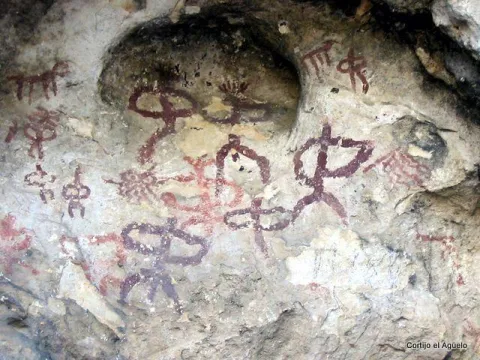
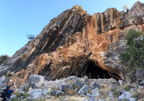
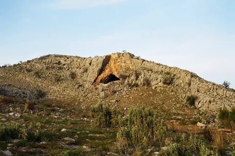
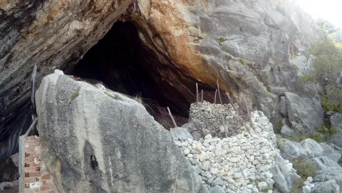
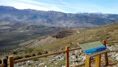
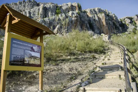
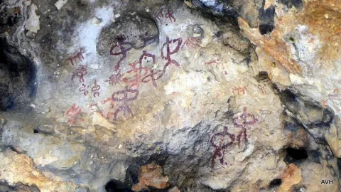
The great presence of limestone and the karmic effects make our province abundant the caves and coats that served as a home for those who lived these lands thousands of years ago. The Cueva de la Graja is an example of this; this rocky coat located at the north end of the Aznaitín at 750 meters high houses rock art manifestations with an age of 2000 to 5000 years before our age. The cave can be visited by requesting it previously in the City of Jimena.

Breve descripción

At the north end of the Aznaitin massif, in the area known as "the Cimbra," is the Cueva de la Graja. It is really a 6-meter-deep coat by 6-wide, which in its highest part reaches 5 meters. In addition to offering wonderful views from its 750 meters of altitude, this coat houses rock art manifestations that were made between 2000 and 5000 years before our era. Made with pigments obtained through the mixture of iron oxide, clays and animal fats; the paintings represent rites and grazing work. Declared an Artistic Historical Monument in 1924, the cave can be visited on request in the City of Jimena.
Telecomunicaciones
Sitio web
www.lugaresmiticosdejaen.com/es/articulos/lugares/cueva-de-la-graja
Correo electrónico
ayuntamientodejimena@gmail.com
Ubicación
Código Postal
23530
Latitud
37.833960
Longitud
-3.473090
Distrito
Municipio
Ubicación en el mapa
POINT (-3.47309 37.83396)
Tipos de punto de interés
Imágenes carrusel
imagen
Image
12.jpg
Imagen principal
Desactivado
imagen
Image
13.jpg
Imagen principal
Desactivado
Imágenes cabecera
imagen
Image
11.jpg
Imagen principal
Activado
Microsite al que pertenece
Loading map
Preparing points of interest and routes...

Cabrera Cave

Submitted by brandcode_deweloper on
Id
4281397
Descripción
Descripción larga

The site of the first archaeological remains dated from the Neolithic (4000 BC) in the town of La Guardia de Jaén. It was later used by the local inhabitants as a guard and poultry for the cattle from which it comes its current name: Cueva Cabrera.

On a blackened wall there is a red stain that can be a rock painting (cave paintings of the Cabrera Cave).

Breve descripción

It is located on the current road to the Allanada del Santo Recreative Zone.

Ubicación
Latitud
37.742568
Longitud
-3.693708
Distrito
Ubicación en el mapa
POINT (-3.693708 37.742568)
Tipos de punto de interés
Imágenes carrusel
imagen
Image
cuevacabrera.jpg
Imagen principal
Desactivado
Imágenes cabecera
imagen
Image
35.jpg
Imagen principal
Activado
Microsite al que pertenece
Loading map
Preparing points of interest and routes...

Mata Bejid Farmhouse

Submitted by brandcode_deweloper on
Id
5857145
Descripción
Breve descripción

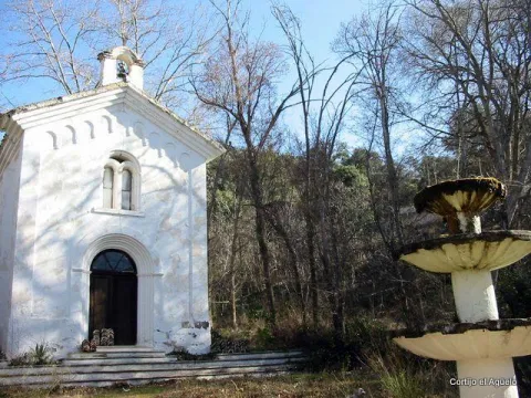
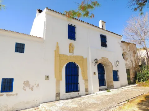
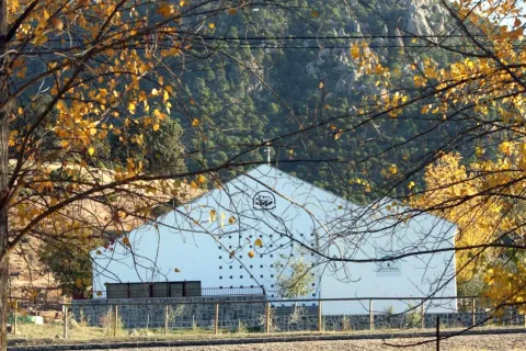
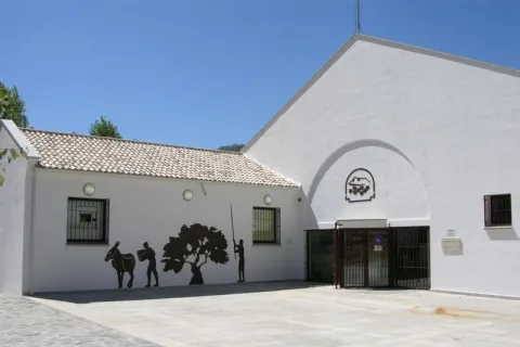
In this private estate the spirit of the belle époque with rural dyes is still revived. It is a private property with an interesting chapel, gardens, house of the gentlemen and even a regional style garage.

Ubicación
Latitud
37.676846
Longitud
-3.564921
Distrito
Municipio
Ubicación en el mapa
POINT (-3.564921 37.676846)
Tipos de punto de interés
Imágenes carrusel
imagen
Image
Ermita_Begid.jpg
Imagen principal
Desactivado
Imágenes cabecera
imagen
Image
Cortijada%20Mata%20Bejid.png
Imagen principal
Activado
Microsite al que pertenece
Loading map
Preparing points of interest and routes...

Convent of los Carmelitas Descalzos de Mancha Real

Submitted by brandcode_deweloper on
Id
5387160
Descripción
Breve descripción

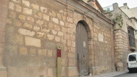
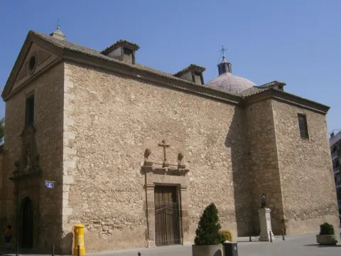
It was founded by San Juan de la Cruz when it was in Baeza on 12 October 1586, putting it under the patronage of the Immaculate Conception, as we can see in the commemorative plaque of the façade. It is accessed through a cover with a half-point arch flanked by pilasters. The set is removed by a cornice that supports four pinacles.

Telecomunicaciones
Sitio web
www.manchareal.es
Teléfono de contacto
953 350 157
Ubicación
Código Postal
23002
Latitud
37.763360
Longitud
-3.791910
Dirección
C/ Carrera de Jesús, 0
Distrito
Municipio
Ubicación en el mapa
POINT (-3.79191 37.76336)
Tipos de punto de interés
Imágenes carrusel
imagen
Image
conventodelascarmelitasdescalzas.jpg
Imagen principal
Desactivado
Imágenes cabecera
imagen
Image
convento%20%281%29.jpg
Imagen principal
Activado
Horario
Wednesday to Sunday: 10: 30 - 14: 00. Late by season (see web).
Microsite al que pertenece
Loading map
Preparing points of interest and routes...

Convent of Cazalla

Submitted by brandcode_deweloper on
Id
4406075
Descripción
Descripción larga

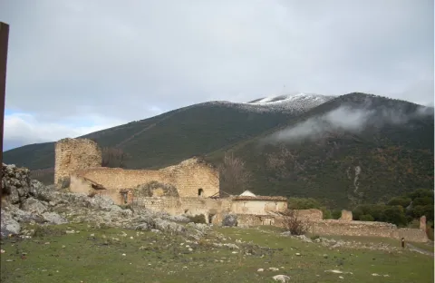
This convent is very linked to Our Lady of Hope, as we can see below. Often, when we hear about Our Lady of Hope, we automatically associate her with Seville and her Holy Week. However, one thing that many people are not aware of is that its origin is located in the province of Jaén, specifically in the region of Sierra Magina, according to some studies and the finding of a document, image of the left, of great importance on this subject. With the transcription that is presented we intend to see how in the toponymy of the convent of Cazalla a reference to the Virgin Macarena appears, in the year 1749, coinciding with the epoch of the highest splendor of the Order of the Basilios, as well as the Cadastre of the Marquis of the Ensenada. This report, which refers to a guide to the transport of cattle, is the only document found in the municipal archive, so far, where it is confirmed something that supports previous studies, such as that published by Rafael Ortega and Sagrista, "The Monastery of Our Lady of Hope, in the cazalla, belonging to the order of San Basilio Magno," where the origin of such a Marian advocation, the famous Virgin Esperanza Macarena of Seville, is determined in these places. What seems to be fully observed is that the diffuse center of the Basil monks in Andalusia comes from the region of Sierra Mágina, in particular Mata-Begid and the said Cazalla Convent, as Vicente Oya shows, to see the website www.camorl.iesata.es, or the book by Hilario Arenas González "La Macarena de Sevilla."
With this small review, we are only trying to make known an interesting line of research that we are now in the process of developing.

Breve descripción

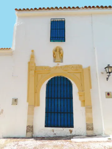
Since the 15th century there was a monastery of agustines in the place of Cazalla, which in 1578 became of the order of S. Basilio Magno. From that convent, it reached its highest splendor in the 18th century, reaching to have 13 monks, 3 leagues, 8 servants to own more than 200 flocks of cultivation (approximately 130 Hectareas) as known to the remains currently existing, only one cover remains, with a half-point bow blinded that gave access to the temple and, above it, the statue of S. Basilio Great, on a stacked hornadine up to half. It is a cast size of small proportions, which only lets see the head of the holy headline, with a luenga beard and a mitre. The size has been recently restored.

Telecomunicaciones
Sitio web
www.carcheles.es/el-municipio/patrimonio-historico.html
Correo electrónico
Webmaster@carcheles.es
Ubicación
Código Postal
23192
Latitud
37.634520
Longitud
-3.640970
Distrito
Municipio
Ubicación en el mapa
POINT (-3.64097 37.63452)
Tipos de punto de interés
Imágenes carrusel
imagen
Image
convento%20%282%29.jpg
Imagen principal
Desactivado
Imágenes cabecera
imagen
Image
Convento%20de%20Cazalla%20%281%29.jpg
Imagen principal
Activado
Microsite al que pertenece
Loading map
Preparing points of interest and routes...

Hill San Cristobal

Submitted by brandcode_deweloper on
Id
4281365
Descripción
Descripción larga

Its northwest face belongs to Jaén and is a private mountain, with a repopulation pine. Its southeast face belongs to La Guardia and corresponds to a mountain of oak and low mountain, very altered by man's hand. In spite of this, it has the attraction of the rise to the hill on the "old road," the visit to the Cabrera Cave (whose neolithic vestiges have just passed into history by burning the entire cave) and the arrival in the recreational area of the Allanadas del Santo. It has the Hermitage of San Sebastián (pattern of La Guardia), tables, barbecues, a small football field and one of the seven geodetic vertices of the municipality of Jaén. This one with the appeal of being placed at the top of a pillar about five meters high, with a ladder to be able to climb.

The proximity to Jaén (15 to 20 minutes) allows you to visit in the summer evenings with the possibility of eating there with the family, after the small route. Access is made from La Guardia, next to the Castle of the town.

Breve descripción

El Cerro San Cristóbal on a mountain that delimits the municipal terms of Jaén and La Guardia de Jaén.

Ubicación
Latitud
37.745911
Longitud
-3.712489
Distrito
Ubicación en el mapa
POINT (-3.712489 37.745911)
Tipos de punto de interés
Imágenes carrusel
imagen
Image
cerrosancristobal.jpg
Imagen principal
Desactivado
imagen
Image
cumbresancristobal-jpg
Imagen principal
Desactivado
imagen
Image
cumbresancristobal1-jpg
Imagen principal
Desactivado
Imágenes cabecera
imagen
Image
30.jpg
Imagen principal
Activado
Microsite al que pertenece
Loading map
Preparing points of interest and routes...

Visitor Centre Mata Bejid

Submitted by brandcode_deweloper on
Id
2343610
Descripción
Descripción larga

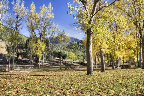
On the outside, at 1,100 meters high, we can relax in the recreational area El Peralejo, which is named after the impressive nearby ravine. And from its vicinity, there are several signposted paths, such as: El Peralejo, Gibralbca and ascend to Pico Magina and Miramundos..We will be able to discover the great diversity of landscapes surrounding this natural park.

Breve descripción

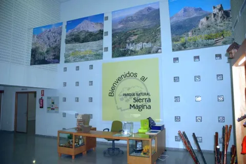
The visitor center allows you to have a first contact with the Sierra Magina Natural Park, informing us first hand about the most interesting places, and to access the practical informative material for the development of our visit. Inside there is a RENPA store where you can buy the most typical products in the area.

Telecomunicaciones
Teléfono de contacto
953 368 800 / 682 692 652
Ubicación
Código Postal
23120
Latitud
37.688570
Longitud
-3.491490
Dirección
Carretera A-324 Cambil-Huelma, km. 15
Distrito
Municipio
Ubicación en el mapa
POINT (-3.49149 37.68857)
Tipos de punto de interés
Imágenes carrusel
imagen
Image
988_cv_10-jpg
Imagen principal
Desactivado
imagen
Image
988_CV_01.jpg
Imagen principal
Desactivado
imagen
Image
image_260504.jpeg
Imagen principal
Desactivado
imagen
Image
988_cv_03-jpg
Imagen principal
Desactivado
Imágenes cabecera
imagen
Image
14455983Master.jpg
Imagen principal
Activado
Horario
Thursday and Sunday: 10: 00 - 14: 00. Friday and Saturday: 10: 00 - 14: 00 and 16: 00 - 18: 00.
Microsite al que pertenece
Loading map
Preparing points of interest and routes...

Arturo Cerdá y Rico Photography Pioneers Interpretation Center

Submitted by brandcode_deweloper on
Id
9277403
Descripción
Descripción larga

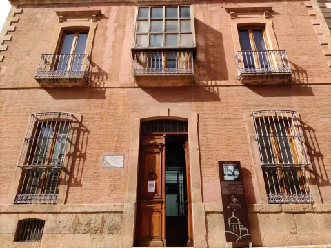
In the Casa-Museum of Cerdá and Rico we find information panels to illustrate the visitor about the dimension and artistic size of our pioneer of photography and to interpret the family building conceived by and for photography, a place where light plays a fundamental role, highlighting the glass bunk in the center of the house that illuminates all the rooms.

It is the venue of the prestigious Arturo Cerdá y Rico International Photography Competition, a competition of great trajectory and recognition in the current world of photography, approved by the Spanish Confederation of Photography and the Andalusian Federation of Photography in which the Diputación de Jaén collaborates. Place of talks and conferences of different subjects, as well as of photographic workshops. A multi-purpose building where small music concerts and book presentations are also offered. The center houses part of the original furniture of the house, as well as some of the property of Dr. Cerda.

Breve descripción

In the emblematic modernist construction that was home of Dr. Arturo Cerdá y Rico is this Casa-museum and interpretation center dedicated to photography, a building of 1900 rehabilitated and converted into a dynamic cultural and tourist center. It exhibits temporary exhibitions of various plastic, photographic, painting, fossil disciplines, with renowned and some emerging artists, as well as a permanent exhibition of photographic cameras from the beginning of the 20th century to the present, with different models and replicas.

Telecomunicaciones
Teléfono
<p><a href="mailto:info@casacerdayrico.com ">info@casacerdayrico.com&nbsp;</a></p>
Sitio web
www.casacerdayrico.com
Teléfono de contacto
953 397 002
Ubicación
Código Postal
23550
Latitud
37.704030
Longitud
-3.288289
Dirección
C/ de La Palma, 11
Distrito
Ubicación en el mapa
POINT (-3.288289 37.70403)
Tipos de punto de interés
Imágenes cabecera
imagen
Image
FACHADA.jpg
Imagen principal
Activado
Horario
Saturday, Sundays and holidays: 11: 00 - 13: 30.
Microsite al que pertenece
Loading map
Preparing points of interest and routes...

Interpretation Centre Paleomágina

Submitted by brandcode_deweloper on
Id
12592052
Descripción
Descripción larga

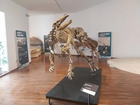
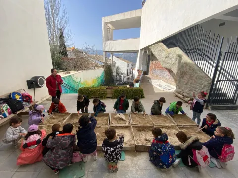
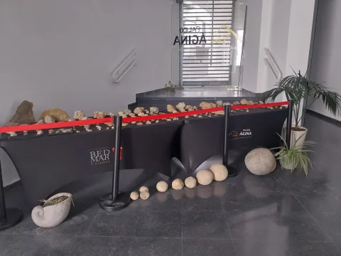
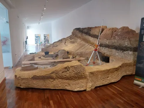
In addition, Paleomagina is a dynamic center in the dissemination of knowledge to all types of audiences. Through divulgative conferences and museum exhibitions of a temporary and permanent nature, the visitor enters an interesting journey through the origins and evolution of humanity, the daily life in Prehistory, as scientific research is done on our past and experience in the first person such as the work of the archaeologist and scientist. In 2021 it was recognized centro UNESCO Andalucía.

Breve descripción

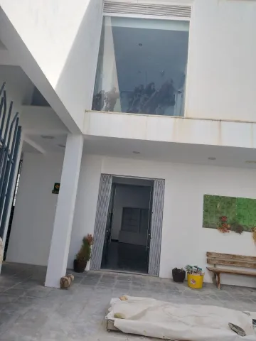
The Centre for Prehistoric Research in Sierra Mágina "PALEOMÁGINA" is a public institution, born as a bet of excellence by the City of Bedmar and Garciez, in order to promote research, education, and the dissemination of knowledge to society. It is based on three fundamental pillars: Research, Teaching and Knowledge Dissemination; with the aim of providing a holistic view of the relationship between human societies, climate and the natural environment in Sierra Magina.

Telecomunicaciones
Sitio web
https://turismoconciencia.fundaciondescubre.es/promotores/paleomagina-centro-de-investigaciones-prehistoricas-de-sierra-magina/
Teléfono de contacto
605 582 228
Correo electrónico
paleomagina@bedmargarciez.es
Ubicación
Código Postal
23537
Latitud
37.828698
Longitud
-3.411720
Dirección
C/ Linares, 1
Distrito
Municipio
Ubicación en el mapa
POINT (-3.41172 37.828698)
Tipos de punto de interés
Imágenes carrusel
imagen
Image
img-20240314-wa0366-jpg
Imagen principal
Desactivado
imagen
Image
432376890_987437586527304_1061211524213373310_n-jpg
Imagen principal
Desactivado
imagen
Image
img-20240314-wa0359-jpg
Imagen principal
Desactivado
imagen
Image
img-20240314-wa0247-jpg
Imagen principal
Desactivado
Imágenes cabecera
imagen
Image
img-20240314-wa0353-jpg
Imagen principal
Activado
Horario
Saturdays and Sundays: 10: 00 - 13: 00.
Microsite al que pertenece
Loading map
Preparing points of interest and routes...
Interés

Interpretation Centre histórica del Castillo

Submitted by brandcode_deweloper on
Id
2344186
Descripción
Descripción larga

In the Arms Room of the Jódar Castle is currently the Visitors' Centre of the Sierra Magina Natural Park. The Centre for Reception and Interpretation of the said Park located in the southern tower of the castle, describes with interactive and interpretative explanatory panels, its landscape, fauna and flora. A project to reintroduce the Primilla Cernícalo in the Natural Park is carried out in the northern tower.

Breve descripción

Of Muslim origin, after his Spanish conquest by the troops of Fernando III in 1229, he was of great strategic importance as he remained in front of the kingdom of Granada. This brought with it great modifications in his alcazaba, while building two great towers of the tribute (Old and New), used as the residence of the old lords. One of these towers is home to the "Xodar" Interpretation Center of the Castle's history.

Telecomunicaciones
Sitio web
www.jodar.es
Teléfono de contacto
953 779 718 / 670 493 465
Ubicación
Código Postal
23500
Latitud
37.844970
Longitud
-3.353770
Dirección
C/ Alhorí, 16
Distrito
Municipio
Ubicación en el mapa
POINT (-3.35377 37.84497)
Tipos de punto de interés
Imágenes carrusel
imagen
Image
14.jpg
Imagen principal
Desactivado
imagen
Image
13.jpg
Imagen principal
Desactivado
Imágenes cabecera
imagen
Image
11.jpg
Imagen principal
Activado
Horario
Saturday and holidays: 11: 00 - 13: 00 and 18: 00 - 20: 00. Sunday: 11: 00 - 13: 00.
Microsite al que pertenece
Loading map
Preparing points of interest and routes...