Saltar al contenido principal

Hermitage of la Virgen de Belén

Submitted by brandcode_deweloper on
Id
4867552
Descripción
Breve descripción

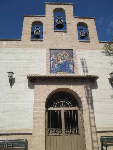
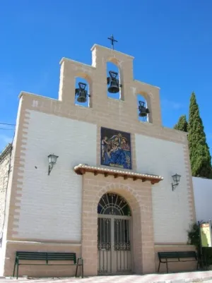
The present hermitage of the patron of Noalejo, the Virgin of Bethlehem, was raised at the beginning of the 20th century on another dating from the 17th century. It is formed by a rectangular ship with a small bell tower on its main façade that occupies three bells that were installed in its last remodeling.

The building has undergone several remodeling throughout its history. As a curiosity, Queen Elizabeth II prayed in this hermitage as she went to Granada.

Telecomunicaciones
Sitio web
www.noalejo.es/el-municipio/patrimonio-historico.html
Teléfono de contacto
953 306 134
Correo electrónico
noalejo@andaluciajunta.es
Ubicación
Código Postal
23140
Latitud
37.529020
Longitud
-3.654210
Dirección
Camino de Navalcán
Distrito
Municipio
Ubicación en el mapa
POINT (-3.65421 37.52902)
Tipos de punto de interés
Imágenes carrusel
imagen
Image
Ermita%20de%20la%20Virgen%20de%20Bel%C3%A9n%20en%20noalejo3.jpg
Imagen principal
Desactivado
Imágenes cabecera
imagen
Image
300px-Ermitanoalejo.jpg
Imagen principal
Activado
Microsite al que pertenece
Loading map
Preparing points of interest and routes...
Millenary Holm Oak

Submitted by brandcode_deweloper on
Id
4573103
Descripción
Descripción larga

We can deduce that this was the dominant landscape a few centuries ago, when after the Reconquista arrived in this village the first inhabitants attracted by the wealth of this dehesa and the possibilities it offered, not only for its cattle, but also to make it "land of bread."

Until the 19th century there were still many oak feet, but it was during this and especially during the first years of the last 20th century that they were significantly reduced, in some cases to devote the land to cereal, vineyard or olive trees and in others to obtaining charcoal. However we can still see some spots of indigenous vegetation in the vicinity of Cabeza Montosa and the hill of the Peones.

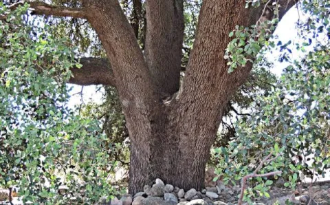
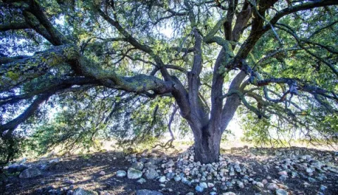
This fierce struggle of man against the dehesa has allowed some of the oak to be kept so that its shadow would cover the reapers and the flocks that took advantage of the rashes, or to collect the stones that were taken from the fallow. The fact is that in cases like this, in the face of lack of competition, it is possible that the few specimens of oak have grown more vigorously.

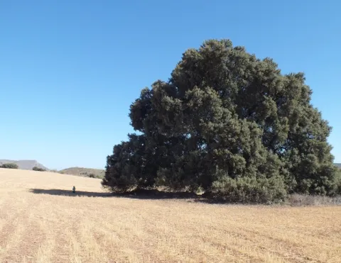
Its trunk has a considerable bearing for an oak and its cup is the widest in the entire province with about 30 meters in diameter and 300 meters in perimeter. This oak is part of the catalogue of unique trees in Spain and is waiting to be declared as Good of Natural Interest, not in vain is of the few millennia trees left on the peninsula.

It is located very close to the railway station of Cabra del Santo Cristo, next to the cortijo of "La Viña." We can access up to the millennial oak through an asphalt road, in good condition, that leaves from the passage to the level that is in the Station. We just have to follow the direction of the signage and within 2 km we will have no doubt when we see it to the left of the road, while to the right the above-mentioned cortijo of the Viña will serve as a reference.

From Cabra we can also walk along the lane that runs through the Fifth, Alamedilla and Gamelloncillo, for which we will walk through space of about 6 km (only one way). It is advisable to finish our route at the station of Cabra and stay in your canteen to take a refreshment with good viandas to recover from the effort, or, if we want to continue to know this ancient dehesa, continue track and return to Hidalgo and the Mill Barranco, but then we will extend our route to about 18 km and have walked by asphalt for a considerable part of the road.

Breve descripción

The area known as the Llanos de la Estación, or of Hidalgo, is today a very anthropolized landscape where the alternative crops of olive and cereal predominate, although it is easy to notice considerable specimens of oak, as well as numerous chaps on the linds that demarcate the agricultural farms.

Ubicación
Latitud
37.704030
Longitud
-3.286990
Distrito
Ubicación en el mapa
POINT (-3.28699 37.70403)
Tipos de punto de interés
Imágenes carrusel
imagen
Image
Encina%20Centenaria.jpg
Imagen principal
Desactivado
imagen
Image
Encina%20Centenaria%202.jpg
Imagen principal
Desactivado
Imágenes cabecera
imagen
Image
17.jpg
Imagen principal
Activado
Microsite al que pertenece
Loading map
Preparing points of interest and routes...
Interés

Doña Aldonza y Pedro Marín Reservoir

Submitted by brandcode_deweloper on
Id
6221339
Descripción
Breve descripción

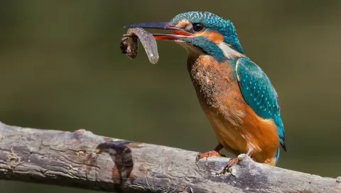
In the municipality of Jódar, next to the Natural Park of Sierra Magina, we find an important nesting population of Calamón Común. Concentrations of Black Milano in step, which rest on the saucedas during migration. Also breeding of aquatic birds, such as Common Avetorillo, Imperial Garza, Anade Friso, Anade Azulón, European Porron, Common Ciguenuela, Common Avoceta and Aguilucho Lagunero. In winter, Garcilla Bueyera, Cerceta Common, Avoceta Common, Correlimos Common, Aguja Colinegra, Archibebe Common and Duck Colorado. To highlight the high concentrations of paseriforms in sotos and carrizales, such as Common Carrier, Tordal Carrer, Moscow Bird and Buscarla Unicolor.

Ubicación
Código Postal
23500
Latitud
37.929550
Longitud
-3.311680
Distrito
Municipio
Ubicación en el mapa
POINT (-3.31168 37.92955)
Imágenes carrusel
imagen
Image
martin%20%281%29.jpg
Imagen principal
Desactivado
imagen
Image
image_content_12479651_20161109103424%20%281%29.jpg
Imagen principal
Desactivado
Imágenes cabecera
imagen
Image
Natu041%20%282%29.jpg
Imagen principal
Activado
Microsite al que pertenece
Loading map
Preparing points of interest and routes...
Tierra Bridge

Submitted by brandcode_deweloper on
Id
4571576
Descripción
Descripción larga

As we approach the Earth Bridge, the landscape becomes ruinous and lunar-looking. The immediate environment is full of hills and saws.

This natural enclave blends forest spots (especially pine trees) with white areas without just vegetation. We can observe wild vegetation and numerous repopulations of different ages. There is a wide range of shrubs and grasses adapted to the scarcity of rain, as it corresponds to its location in one of the most torrid areas of the Sierra Magina region.

In the area we can see around us and on the very floor of the road, the effects of water erosion on the geological materials around us. It is a succession of minions that extend in depth by communicating with each other. When the rain water circulates on the surface, it is soon filtered through these holes, but dragging many suspended particles that sometimes form true clay slices. It is easy to imagine that the erosive power is increasing more and more, so the mixes join each other to form the greater ones. When it affects a road, the risk to circulation is evident, whether by car, bike or even walking. In this process is the origin of the formation of the Earth Bridge.

The process is given on soft materials such as margas, margous sands or uncompact clay sands. If there was a somewhat more compact and resistant material tank above them, it may not be eroded so easily, leaving a package of materials suspended in the air. The objective of this route is to check on-site the extraordinary dimensions of this phenomenon.

Finally remember that we are on the margas of the Cretaceous, a period in which marine animals such as amonites, belemnites, and other gastropods lived, which we can find through the fossilized and pyritized soil.

Breve descripción

It is located on the northern side of the Rambla del Bizco, in a partially flat area but broken by countless rambles of very difficult orography.

Ubicación
Latitud
37.703622
Longitud
-3.286707
Distrito
Ubicación en el mapa
POINT (-3.286707 37.703622)
Tipos de punto de interés
Imágenes carrusel
imagen
Image
14.jpg
Imagen principal
Desactivado
imagen
Image
12.jpg
Imagen principal
Desactivado
Imágenes cabecera
imagen
Image
13.jpg
Imagen principal
Activado
Microsite al que pertenece
Loading map
Preparing points of interest and routes...

El Nacimiento

Submitted by brandcode_deweloper on
Id
4573220
Descripción
Descripción larga

The landscape is determined by human perception and is the result of the interaction of the elements of nature and man, then human action has conditioned the transformation of the natural landscape and the inclusion of cultural elements that give it value, so it is necessary to preserve and enhance them. We are therefore facing a natural resource that has allowed not only subsistence but also economic activity since man arrived on these lands.

It is now difficult to imagine what this spring and its immediate course would be like without that interaction by which human beings have created a laundry room, which is what we now see in the Birth, or downstream in the Matias and the Birth mills, in the Balsa, the Charcón, the Pileta and Arroyo launchers, or the numerous pools and the network of waterfalls for the irrigation of the place known as the "Site." At some point these infrastructures must have been created and we are likely to have to reassemble long before the repopulation of the Cabrilla Site. Today we will deal only with the environment closest to the Birth, so the relative to what we find downstream of this stream that so much life has spread since time immemorial will be part of the future of a new post.

To try to imagine what those places were like not long ago, when they still fulfilled the task for which they were created, we counted, of course, on the impagable photographic work of Arturo Cerda and Rico, so that we can see in some of their photos also a certain evolution, is the case of the same spring in its natural state prior to its channelling, for not so long ago, until 1910, where today we see the seven years, there was only a plateau from which the crystal waters of the Sierra Cruzada were kept.

Breve descripción

There would be no Cabra of the Holy Christ without this spring. With this very categorical statement I intend to highlight its enormous value, because those waters that have been irrigating our fields for centuries have brought the necessary energy to our mills, have gathered along their journey to long lavenders, have taken their waters to the abrevaderos, fountains and streets of the urban centre and not only to give to drink, but also to the domestic tasks, the works, or the irrigation of the gardens so characteristic of the interior of our homes.

Ubicación
Latitud
37.705870
Longitud
-3.286837
Dirección
Cabra del Santo Cristo
Distrito
Ubicación en el mapa
POINT (-3.286837 37.70587)
Imágenes carrusel
imagen
Image
nacimiento%20%281%29.jpg
Imagen principal
Desactivado
Imágenes cabecera
imagen
Image
18.jpg
Imagen principal
Activado
Microsite al que pertenece
Loading map
Preparing points of interest and routes...

El Cerro de Castellón

Submitted by brandcode_deweloper on
Id
8088833
Descripción
Descripción larga

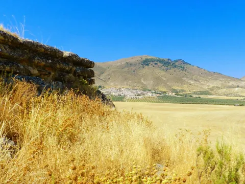
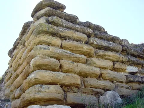
It has a rectangular plant facing from northeast to southeast and a walled enclosure. The best preserved wall is the northeast, 18.70 meters long and 4 meters high in its highest corner. It consists of several rows of large-scale stones, on which a wall of tapial, now missing, would be raised. In its interior it retains a seam of regular armchairs, smaller than those of the outer wall, of 6.30 meters in length and 2 meters in width.

Although it dates from Iberian chronology, both ceramic decorated with Iberian ceramic bands andterra sigillataRoman, so you can deduce a continued occupation of the land; as well as medieval ceramics.

Its mission was to monitor and control the communication routes, as it is closely linked to the corridor of the Guadiana Minor River, which communicates the upper valley of Guadalquivir with the highlands of Guadix and Baza.

In 1985 it was declared Good of Cultural Interest.

Breve descripción

On the hill of Castellón are preserved the remains of an Iberian cyclopian fortress between the II and I BC centuries It is a walled enclosure, with a quadrangular structure and an aljibe inside it, built with limestone armchairs that reach a meter and a half in length.

Telecomunicaciones
Sitio web
www.larva.es/el-municipio/patrimonio-historico.html
Correo electrónico
ayuntamiento@larva.es
Ubicación
Código Postal
23591
Latitud
37.770410
Longitud
-3.192560
Distrito
Municipio
Ubicación en el mapa
POINT (-3.19256 37.77041)
Tipos de punto de interés
Imágenes carrusel
imagen
Image
El%20Cerro%20de%20Castell%C3%B3n2.JPG
Imagen principal
Desactivado
imagen
Image
El%20Cerro%20de%20Castellon3%20%282%29.jpg
Imagen principal
Desactivado
Imágenes cabecera
imagen
Image
El%20Cerro%20de%20Castell%C3%B3n.jpg
Imagen principal
Activado
Microsite al que pertenece
Loading map
Preparing points of interest and routes...
Gorge of Puerta Arenas

Submitted by brandcode_deweloper on
Id
7991049
Descripción
Descripción larga

Location: On the highway of Granada, just at the limit of the municipal terms of Campillo, Cárcheles and Cambil.

Distance: 7 km.

Medium: Tourism vehicle.

Access: Directly via the Granada Highway (A-44)

Breve descripción

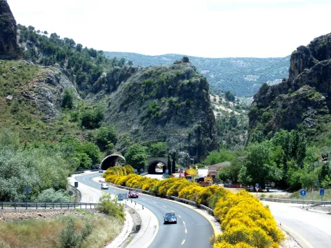
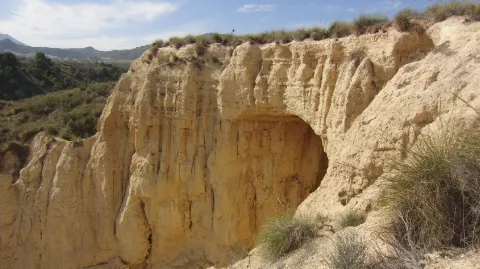
The river erosion, which has a limestone wall of about 400 meters high, is the result of the river erosion. There is a teaching path dedicated to local botany.

Telecomunicaciones
Sitio web
www.campillodearenas.es/el-municipio/patrimonio-natural.html
Teléfono de contacto
953 309 004
Correo electrónico
general@campillodearenas.es
Ubicación
Nombre
Hierro
Código Postal
28340
Latitud
37.555820
Longitud
-3.635560
Dirección
Campillo de Arenas
Distrito
Municipio
Ubicación en el mapa
POINT (-3.63556 37.55582)
Tipos de punto de interés
Imágenes carrusel
imagen
Image
Desfiladero%20de%20Puerta%20Arenas.jpg
Imagen principal
Desactivado
imagen
Image
Desfiladero%20de%20Puerta%20Arenas2.jpg
Imagen principal
Desactivado
Imágenes cabecera
imagen
Image
Desfiladero%20de%20Puerta%20Arenas3.jpeg
Imagen principal
Activado
Microsite al que pertenece
Loading map
Preparing points of interest and routes...
Chato and Baltibañas Caves

Submitted by brandcode_deweloper on
Id
7983397
Descripción
Descripción larga

Location: West of the city centre.
Distance: 7.5 km.
Medium: In vehicle tourism and on foot.
Access route: by road and mountain road.

Breve descripción

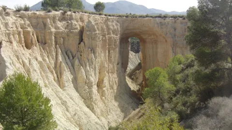
Natural environment consisting of a Mediterranean mountain area with high-value geological and geomorphological formations. It is only for experts in spelological activities.

Telecomunicaciones
Sitio web
www.belmezdelamoraleda.es/el-municipio/patrimonio-natural.html
Ubicación
Código Postal
23568
Latitud
37.724150
Longitud
-3.382370
Dirección
Av. Jaén
Distrito
Ubicación en el mapa
POINT (-3.38237 37.72415)
Tipos de punto de interés
Imágenes carrusel
imagen
Image
18431341Master.jpg
Imagen principal
Desactivado
imagen
Image
18431342Master.jpg
Imagen principal
Desactivado
imagen
Image
18431339Master.jpg
Imagen principal
Desactivado
Imágenes cabecera
imagen
Image
18431305Master.jpg
Imagen principal
Activado
Microsite al que pertenece
Loading map
Preparing points of interest and routes...
Cave of the Puerto de las Palomas

Submitted by brandcode_deweloper on
Id
8084183
Descripción
Descripción larga

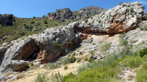
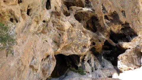
The predominant indigenous vegetation is the oaks and moans, low mountain of rosemary, lentisco and sabina. Some well-known routes are the Carchelejo-Cazall- Convent, Carchel to Carchelejo by the Barrio de la Grilla or the ascension to the Cueva del Puerto de las Palomas. On the urban periphery of the two cores there are several recreational areas, such as the Parque de la Fuente, the Haza de la Widow and the sports facilities of Carchelejo and Cárchel.

Breve descripción

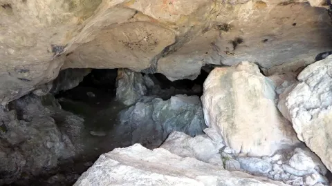
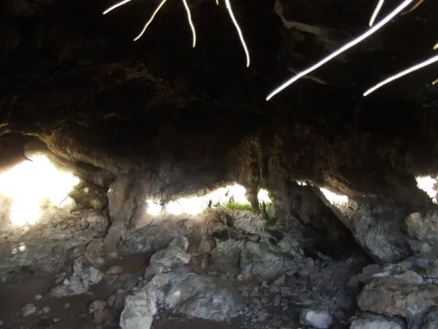
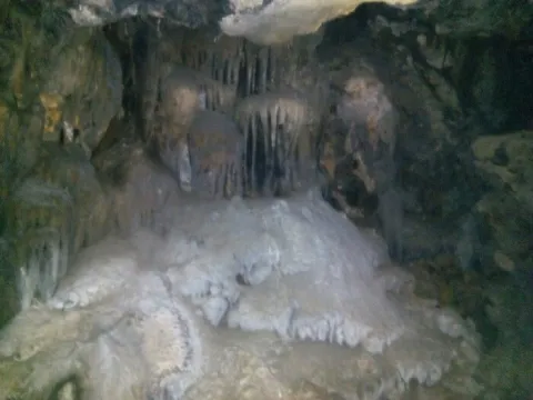
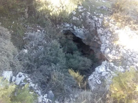
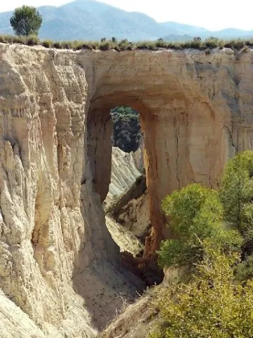
Cárcheles has a wide variety of natural sites such as the Monastery Barrio, the Cueva del Puerto de las Palomas, Cazalla and the Convent, etc., where to make excursions, using all kinds of means of transport: on foot, by cavalry, bike, bike or car, etc.

Telecomunicaciones
Teléfono de contacto
953 302 291 / 953 302 003
Correo electrónico
Webmaster@carcheles.es
Ubicación
Código Postal
23192
Latitud
37.612010
Longitud
-3.661260
Distrito
Municipio
Ubicación en el mapa
POINT (-3.66126 37.61201)
Tipos de punto de interés
Imágenes carrusel
imagen
Image
la%20Cueva%20del%20Puerto%20de%20las%20Palomas%20%281%29.jpg
Imagen principal
Desactivado
imagen
Image
la%20Cueva%20del%20Puerto%20de%20las%20Palomas3%20%281%29.jpg
Imagen principal
Desactivado
Imágenes cabecera
imagen
Image
la%20Cueva%20del%20Puerto%20de%20las%20Palomas2%20%281%29.jpg
Imagen principal
Activado
Microsite al que pertenece
Loading map
Preparing points of interest and routes...
Cave of the Morrón

Submitted by brandcode_deweloper on
Id
4872240
Descripción
Breve descripción

It is one of the greatPaleolithic-era rock sanctuariesthey are located in the Alto Guadalquivir. The paintings are in a small room in the Cave. These are two different chromatism caprics, one red and one black. It is very likely that we are facing a sanctuary in which the paintings have a magical propitiatory purpose for hunting, which was the main means of life of the surrounding populations. These rock paintings have been declaredGood for Cultural Interest.On the outskirts is"The Beast"which is as popularly known the bridge thatAndrés Vandelvira built in 1565,on behalf of Maria de Mendoza.

Ubicación
Código Postal
23540
Latitud
37.784650
Longitud
-3.508180
Distrito
Municipio
Ubicación en el mapa
POINT (-3.50818 37.78465)
Tipos de punto de interés
Imágenes carrusel
imagen
Image
cueva%20morron.jpg
Imagen principal
Desactivado
Imágenes cabecera
imagen
Image
100_7655.jpg
Imagen principal
Activado
Microsite al que pertenece
Loading map
Preparing points of interest and routes...