Saltar al contenido principal

Sierra Mágina Farm School and Summer Camp

Submitted by brandcode_deweloper on
Id
5416060
Descripción
Descripción larga

Our long history in the field of education allows us to make available to users all our years of experience; the results are manifested in the confidence that many educational centres, teachers and families that year after year support our project are placed in us. Granja Escuela Sierra Mágina has specialized in the programming of activities aimed at a student aged 3 to 16 mainly. On the other hand, every year, we face new challenges to adapt to new needs by always focusing on quality education as a pillar of our project.

Breve descripción

Since our beginning, in 2000, our mission has been the same, bringing nature, respect for the environment and animals closer to all the groups with which we work year after year. Since then, we have made progress to the most appropriate facilities for children to enjoy a unique experience in their lives.

Telecomunicaciones
Sitio web
www.granjaescuelamagina.com
Teléfono de contacto
622 383 031
Correo electrónico
info@granjaescuelamagina.com
Ubicación
Código Postal
23537
Latitud
37.816680
Longitud
-3.416830
Dirección
Carretera de Bedmar a Albanchez de Mágina, s/n
Distrito
Municipio
Ubicación en el mapa
POINT (-3.41683 37.81668)
Tipos de punto de interés
Imágenes carrusel
imagen
Image
gallinas-jpg
Imagen principal
Desactivado
imagen
Image
mg_7869-jpg
Imagen principal
Desactivado
imagen
Image
cabras-jpg
Imagen principal
Desactivado
imagen
Image
dormitorio-2-1-jpg
Imagen principal
Desactivado
Imágenes cabecera
imagen
Image
fachada-hd-jpg
Imagen principal
Activado
Horario
Monday to Friday: 09: 00 - 19: 00.
Microsite al que pertenece
Loading map
Preparing points of interest and routes...

Fountain of the Gargantón

Submitted by brandcode_deweloper on
Id
5845859
Descripción
Breve descripción

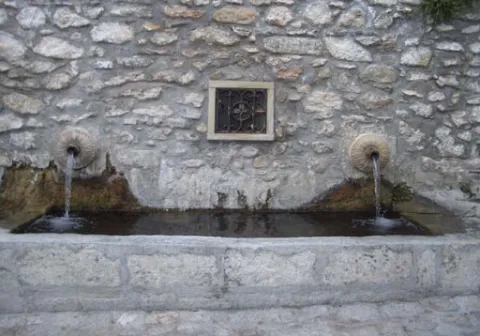
Caudalosa fountain fed by the Garganton River, one of the most important watercourses on the southern side of the Sierra Magina mountains. In summer the park and the bar next to the fountain are places to stop.

Ubicación
Latitud
37.723720
Longitud
-3.382640
Distrito
Ubicación en el mapa
POINT (-3.38264 37.72372)
Tipos de punto de interés
Imágenes carrusel
imagen
Image
1465030943_456942_1465032471_album_normal%20%281%29.jpg
Imagen principal
Desactivado
imagen
Image
fuente%20%282%29.jpg
Imagen principal
Desactivado
Imágenes cabecera
imagen
Image
13641265.jpg
Imagen principal
Activado
Microsite al que pertenece
Loading map
Preparing points of interest and routes...

Fountain of the Espino

Submitted by brandcode_deweloper on
Id
1869147
Descripción
Descripción larga

Location: To the south of the city centre, on the road to the mountains.

Distance: 4 hours.

Medium: On foot.

Access route: By mountain sidewalk.

Breve descripción

It is a water birth located in the middle of the Mediterranean mountain, with geological and vegetable formations of high natural value.

Ubicación
Latitud
37.740100
Longitud
-3.461470
Distrito
Ubicación en el mapa
POINT (-3.46147 37.7401)
Tipos de punto de interés
Imágenes carrusel
imagen
Image
Fuente%20del%20Espino%202.jpg
Imagen principal
Desactivado
Imágenes cabecera
imagen
Image
Espino1.png
Imagen principal
Activado
Microsite al que pertenece
Loading map
Preparing points of interest and routes...

Fountain of the Seda

Submitted by brandcode_deweloper on
Id
1735506
Descripción
Breve descripción

Source and public laundry that gives name to the area where the bushes were grown. The production and trade of silk, introduced by Muslims, was one of the economic bases of Albanchez until the 18th century.

Ubicación
Código Postal
23538
Latitud
37.794312
Longitud
-3.464879
Dirección
Camino de Bedmar, s/n
Distrito
Ubicación en el mapa
POINT (-3.464879 37.794312)
Tipos de punto de interés
Imágenes carrusel
imagen
Image
fuente%20de%20la%20seda.jpg
Imagen principal
Desactivado
Imágenes cabecera
imagen
Image
unnamed.jpg
Imagen principal
Activado
Horario
24 h.
Microsite al que pertenece
Loading map
Preparing points of interest and routes...
Interés

Fountain of the Reja

Submitted by brandcode_deweloper on
Id
4658611
Descripción
Descripción larga

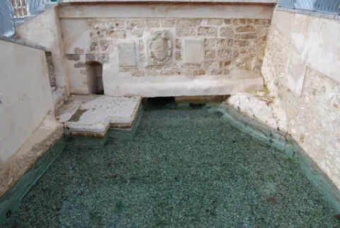
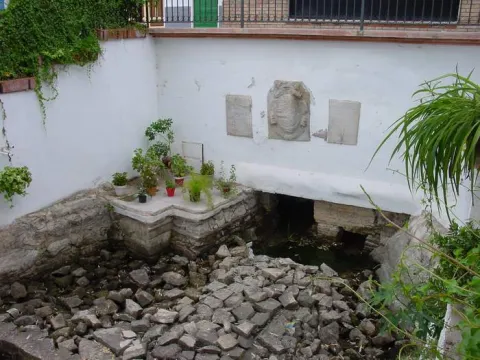
In the Fuente de la Reja we find a commemorative canvas decorated with heraldic elements, the weapons of Philip III and those of the villa itself. which reads as follows:

"King D. Philip III reigned in Spain. He ordered to do this work the village of Pegalajar year 1605.?

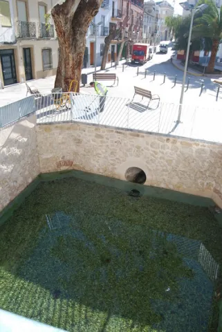
The lack of water in recent years has led to the implementation in 2007 of the aquifer extraction plan to recover the spring and to take measures to value it as a resource for local development.

The set composed of the Fuente de la Reja, la Charca and la Huerta de Pegalajar is an essential part of the historical-cultural-economic heritage of Pegalajar, as recognized by its declaration as a place of ethnic interest made by the Council of Culture of the Junta de Andalucía.

Telecomunicaciones
Sitio web
www.pegalajar.org/articulos/la_fuente_de_la_reja.htm
Teléfono de contacto
953 360 003
Correo electrónico
pegalajar@promojaen.es
Ubicación
Código Postal
23110
Latitud
37.741540
Longitud
-3.646940
Dirección
C/ Fuente la Reja
Distrito
Municipio
Ubicación en el mapa
POINT (-3.64694 37.74154)
Tipos de punto de interés
Imágenes carrusel
imagen
Image
fuente%20de%20la%20reja.jpg
Imagen principal
Desactivado
imagen
Image
fuente%20de%20la%20reja%202.jpg
Imagen principal
Desactivado
Imágenes cabecera
imagen
Image
fuentelareja2001.jpg
Imagen principal
Activado
Microsite al que pertenece
Loading map
Preparing points of interest and routes...

Fuenmayor

Submitted by brandcode_deweloper on
Id
5846796
Descripción
Breve descripción

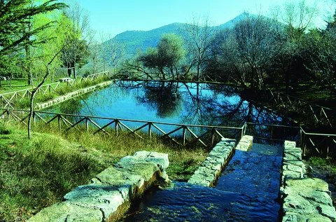
Traditional meringero area around a high-flow source that feeds a pond, around which the furniture of the picnic area is distributed. It is the starting place of several hiking routes.

Ubicación
Latitud
37.785140
Longitud
-3.509250
Distrito
Municipio
Ubicación en el mapa
POINT (-3.50925 37.78514)
Tipos de punto de interés
Imágenes carrusel
imagen
Image
Natu438.jpg
Imagen principal
Desactivado
Imágenes cabecera
imagen
Image
Fuenmayor.jpg
Imagen principal
Activado
Microsite al que pertenece
Loading map
Preparing points of interest and routes...

Hermitage of Santa Lucía

Submitted by brandcode_deweloper on
Id
4555041
Descripción
Descripción larga

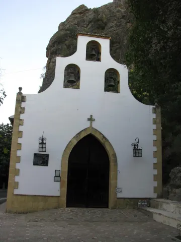
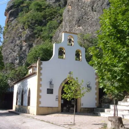
The story of the Hermitage of Saint Lucia dates back to 1858, when after several years of collection of alms of devotees passing through Puerta de Arenas and stopping to pray before the Holy one, represented, in the beginning, in a picture placed on one of the walls of the rock and then by the first image placed on a small furnace, next to the tunnel, opened in 1840. Once enough donations were gathered, the first hermitage was raised. The blessing was attended by local authorities and more than 2000 devotees from all over the region. That first hermitage of popular architecture, very tasteful of the time, was deteriorating with the passage of time, and its restoration was necessary on several occasions. The first reform was made in 1956 for finding the hermitage in a ruinous state. In 1973, it had to be restored again, leaving its architecture, both outside and inside, very modified, completely losing its original appearance. The hermitage was designed for three bells and dome over the presbytery. The roof is covered by a rich wooden handicraft, as well as the Altar Mayor, where the image of Saint Lucia is located. The soletry and socket are made of quality materials and the interior is illuminated by two beautiful wrought iron lamps. The façade is surrounded by a strong stone socket, as well as its windows and main door. In the late 1990s, the "Sand Gate Recreation Area" was built that offers different activities; bird observation, botanical garden, hiking, road and recreational area.

Telecomunicaciones
Sitio web
www.hermandadsantalucia.com
Ubicación
Código Postal
23130
Latitud
37.605480
Longitud
-3.601450
Dirección
Campillo de Arenas
Distrito
Municipio
Ubicación en el mapa
POINT (-3.60145 37.60548)
Tipos de punto de interés
Imágenes carrusel
imagen
Image
Ermita%20de%20Santa%20Lucia2.jpg
Imagen principal
Desactivado
Imágenes cabecera
imagen
Image
Ermita%20de%20Santa%20Lucia4%20ret.jpg
Imagen principal
Activado
Microsite al que pertenece
Loading map
Preparing points of interest and routes...

Hermitage of San Marcos

Submitted by brandcode_deweloper on
Id
4406206
Descripción
Breve descripción

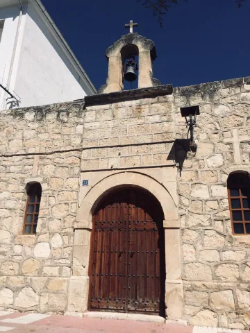
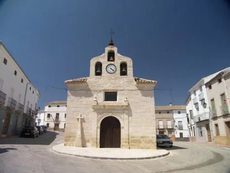
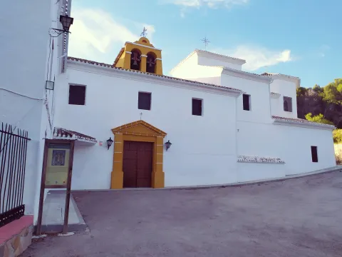
Located on S. Marcos Street, it was moved from its site in the mid-1980s and its place is currently occupied by a public square next to the present hermitage.
From its previous structure, only the entrance arc and the small stone swordsman, topped by a cross of the same material, have been maintained. Modified in the same period as the previous one, it has a small swordsman with a small bell with a half-point bow at the entrance and flanked by two windows.

Telecomunicaciones
Sitio web
www.carcheles.es/el-municipio/patrimonio-monumental.html
Teléfono de contacto
953 302 003
Ubicación
Código Postal
23192
Latitud
37.651700
Longitud
-3.636530
Dirección
C/ San Marcos
Distrito
Municipio
Ubicación en el mapa
POINT (-3.63653 37.6517)
Tipos de punto de interés
Imágenes carrusel
imagen
Image
Ermita%20de%20San%20Marcos%20en%20Carchelejo.jpg
Imagen principal
Desactivado
Imágenes cabecera
imagen
Image
e8a2af313345386e92a46e581c7deaa2.jpg
Imagen principal
Activado
Microsite al que pertenece
Loading map
Preparing points of interest and routes...

Hermitage of Our Lady of los Remedios

Submitted by brandcode_deweloper on
Id
5692026
Descripción
Breve descripción

Outside the village on the way to Albanchez, at the foot of the saw, in Cánava, between palm trees, and with a strip and a fountain of seven years, the hermitage of Our Lady of the Remedies rises. It is a temple of small dimensions and harmonious architecture, a plant in the form of a Latin cross and shrimp for the patron, built in 1910.

Telecomunicaciones
Sitio web
www.jimena.es/el-municipio/patrimonio-historico.html
Correo electrónico
ayuntamientodejimena@gmail.com
Ubicación
Código Postal
23530
Latitud
37.834850
Longitud
-3.468800
Distrito
Municipio
Ubicación en el mapa
POINT (-3.4688 37.83485)
Tipos de punto de interés
Imágenes cabecera
imagen
Image
2%20%281%29.jpg
Imagen principal
Activado
Microsite al que pertenece
Loading map
Preparing points of interest and routes...

Hermitage of Our Lady of the Fuensanta

Submitted by brandcode_deweloper on
Id
4652738
Descripción
Breve descripción

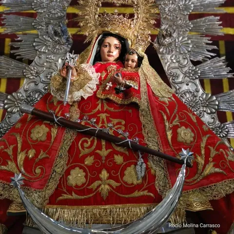
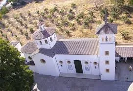
The hermitage of the Virgin of Fuensanta, located in the heart of Sierra Magina, has always been an isolated place. It was even more so in past centuries when only roads and paths could be accessed. This, together with its sacred character, made this hermitage an ideal place for the withdrawal of those who in search of God, abandoned their social environment.

Telecomunicaciones
Teléfono de contacto
953 390 210
Ubicación
Código Postal
23560
Latitud
37.672630
Longitud
-3.468580
Distrito
Municipio
Ubicación en el mapa
POINT (-3.46858 37.67263)
Tipos de punto de interés
Imágenes carrusel
imagen
Image
Ermita%20de%20Nuestra%20Se%C3%B1ora%20de%20la%20Fuensanta%20%281%29.jpg
Imagen principal
Desactivado
Imágenes cabecera
imagen
Image
Santuario_Virgen_de_la_Fuensanta_%28Huelma%29.jpg
Imagen principal
Activado
Microsite al que pertenece
Loading map
Preparing points of interest and routes...