Saltar al contenido principal

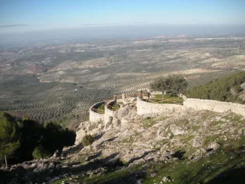
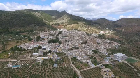
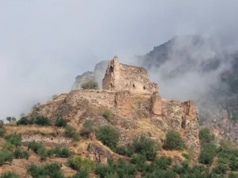
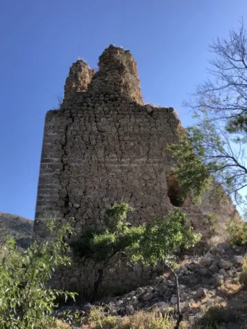
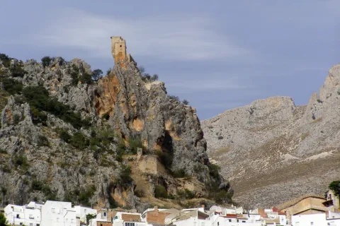
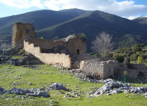
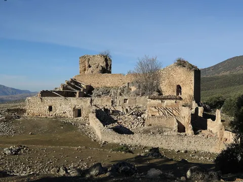
Castle of Bélmez de la Moraleda

Submitted by brandcode_deweloper on
Id
5857694
Descripción
Breve descripción

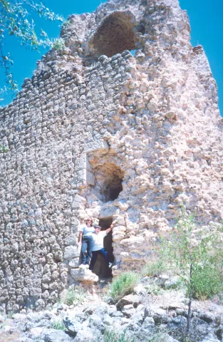
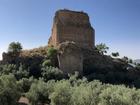
The castle of the Moraleda was built by the Muslims, and conquered by the Christians, for the first time, between 1243 and 1246, but it was not definitely until 1448, going into the Lordship of Jódar years later. It belonged to the Council of Baeza and the Order of Calatrava. From 1501 the lands of Bélmez belonged to the city of Granada in payment of certain debts that the Kings had with it, reserving the house of the castle to the lord of Jódar. The foundation as a villa dates from 1524, when land for rent was given to some local farmers. It belonged to the jurisdiction of Granada until, following the provincial organization of Javier de Burgos in 1833, it was included in the new province of Jaén.

Ubicación
Latitud
37.749540
Longitud
-3.383630
Dirección
C/ Patrocinio de Biedma, 9
Distrito
Ubicación en el mapa
POINT (-3.38363 37.74954)
Tipos de punto de interés
Imágenes carrusel
imagen
Image
castillo%20belmez.jpg
Imagen principal
Desactivado
imagen
Image
Castillo-de-Belmez-de-la-Moraleda_.jpg
Imagen principal
Desactivado
imagen
Image
Castillo-de-Belmez-de-la-Moraleda_01.jpg
Imagen principal
Desactivado
Imágenes cabecera
imagen
Image
Castillo-de-Belmez-de-la-Moraleda_02.jpg
Imagen principal
Activado
Microsite al que pertenece
Loading map
Preparing points of interest and routes...
Castle of Arenas

Submitted by brandcode_deweloper on
Id
4555180
Descripción
Descripción larga

Alfonso X won the castle through Peace signed with King Muhammad II year 1281. In 1462, after Henry IV's treguas, he granted to the great Moors the Constable Mr Lucas de Iranzo, with 600 men of horse and 2000 pawns attacked the castle of Camillo de Arenas on 20 April 1462. The fight was very intense and of five doors the castle had, two were burned by Christians. However, it was not achieved.

The Constable sent 30 gentlemen from Jaén to prepare an ambush to the Garrison of the Sand Camp. They were served as a spy by a renegade Moor who was a nephew of the Sand Camp Warden. The ambush was unsuccessful and after a slight skirmish the Christians returned to Jaén. In 1463, the Constable sent 40 pawns in command of Juan Navarrete, against the castle of Campillo. Christians make two prisoners for whom it was known that the garrison made up 33 Moors.

The Constable Iranzo sends 30 soldiers to try to take over Campillo, which was not done because... "they failed to be in good care." In 1471, the king of Granada, when he heard of a Christian project of attack on Campillo, sent his defenders "sufficient recuperation and people." In the letter of the Constable Iranzo to the then Pope Sixto IV, about the hasty situation of Jaén before the push of the Moors is cited as of great danger to Christians to the castle of Camillo de Arenas. Other news about our castle is given by the following chronists:
Argote de Molina in his "Nobleza de Andalucía" (1588), cites as Alcaide del Castillo de Campillo de Arenas to D. Francisco Fonseca.

Ximena Jury in his "ecclesiastical Anales" (1654), qualifies the castle of Campillo as "A strong castle on the Gate of Arenas." Espinalt in "Atlante española" (1787), says the following about the castle of Camillo de Arenas: "To the west of this villa half a leagues away, there remains a strong castle somewhat ruined, of immemorial time, as well as the Gate of Arenas held by two high peñascos that form it; it has twenty poles of latitude and through the river Valdearanzo and there is tradition that half chain that there is in the prison of this village one that put two Saracens in that door to prevent the entry of Christians of the kingdom of Jaén."

Campillo was conquered to the Moors by Mr Pedro Coello, Knight of the Vanda. His body was buried in the St. Louis of the Knights, the missing Royal Convent of San Francisco de Jaén. His epitaph said, "Here lies Pedro Coello, Knight of the Vanda, who won the Moors the castle of Arenas at their expense and died in an entrance with them, during the reign of the Catholic Kings in 1486.

Breve descripción

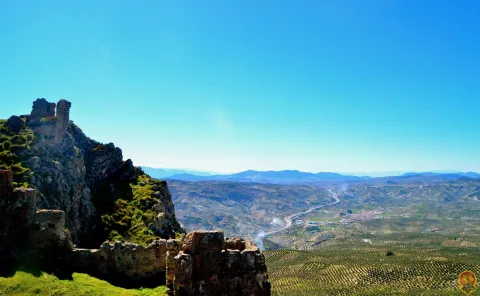
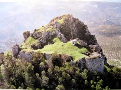
The Arenas Castle was built over the 14th century, preserving structures from the 9th to the 11th century. It sits on the Cerro del Castillo de Puerta Arenas, in the Sierra de Alta Coloma, between Granada and Jaén. The Camillo River Portillo is the only practical step to cross this saw.

Telecomunicaciones
Sitio web
www.campillodearenas.es
Correo electrónico
contacto@jaenescondido.es
Ubicación
Código Postal
23130
Latitud
37.592560
Longitud
-3.622090
Dirección
Campillo de Arenas
Distrito
Municipio
Ubicación en el mapa
POINT (-3.62209 37.59256)
Tipos de punto de interés
Imágenes carrusel
imagen
Image
Castillo-de-Puerta-Arenas-Campillo-de-Arenas-scaled%20%281%29.jpeg
Imagen principal
Desactivado
imagen
Image
Castillo%20de%20Arenas%202.jpg
Imagen principal
Desactivado
Imágenes cabecera
imagen
Image
Castillo%20de%20Arenas%20%281%29.jpg
Imagen principal
Activado
Microsite al que pertenece
Loading map
Preparing points of interest and routes...
Castle of Albanchez de Mágina

Submitted by brandcode_deweloper on
Id
1735110
Descripción
Descripción larga

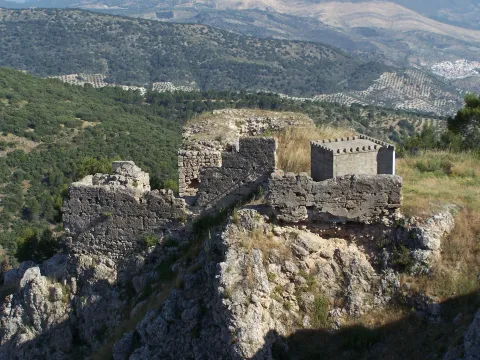
The castle was linked to the Order of Santiago, which created the command of Bedmar and Albanchez. What is preserved from it is its alcazarejo, built with masonry, which consists of two small, impressive nuclei because of its exterior appearance and the closing of the rock on which it sits, but with little internal capacity to house troops and beings. The highest core is a narrow rectangular platform that enables a small interior space. The entrance opens to the terrace of a rectangular floor turret that housed two cameras: one top, covered with a half-barrel vault, now melted, and one lower, a aljibe, with slightly pointed vault and remains of the stucco that covered it. The castle also had a small courtyard of triangular weapons with almond parapet and saetera windows, a square terrace with albarrana to defend over the cliff, protective walls, today practically destroyed, and rounded corners outside as it was a calatravo castle. It was declared Good of Cultural Interest in 1985.

Breve descripción

The castle of Albanchez de Mágina dominates and presides the village, which is located on the first ridge of the Sierra de los Castillejos. Despite its small dimensions and its inner narrows, its arriseach position makes it extremely difficult to access. Of presumably Christian origin, its construction was made with argamasa and it had to rise late, in the Middle Ages, in the early 14th century, as an alternative to another Muslim castle from which there are only remains, built with tapial in the lower and closer to the people.

Telecomunicaciones
Sitio web
www.albanchezdemagina.es
Teléfono de contacto
953 347 009
Correo electrónico
ayuntamiento@albanchezdemagina.es
Ubicación
Código Postal
23538
Latitud
37.790250
Longitud
-3.468000
Dirección
Av. de Hutar, 2
Distrito
Ubicación en el mapa
POINT (-3.468 37.79025)
Tipos de punto de interés
Imágenes carrusel
imagen
Image
Mon312.jpg
Imagen principal
Desactivado
imagen
Image
castillo%20de%20albanchez%20de%20magina.jpg
Imagen principal
Desactivado
imagen
Image
castillo%20de%20albanchez%20de%20magina%202.jpg
Imagen principal
Desactivado
Imágenes cabecera
imagen
Image
728_SS_01.jpg
Imagen principal
Activado
Horario
24 h.
Microsite al que pertenece
Loading map
Preparing points of interest and routes...

Castillejo de Mata Bejid (Torres Pass)

Submitted by brandcode_deweloper on
Id
5844957
Descripción
Breve descripción

It is a passage between mountains, some above 2,000 m., which offers a spectacular landscape: the southern side of the Natural Park of Sierra Magina, with mountains more than 2,000 meters of altitude (Almadén, 2,036 m., Ponce, 2,006 m and Cerro Cárceles, 2,061 m.), dehesas in height of complaints, flocks of sheep... The Castlejo de Mata Bejid is a beautiful place that housed a garrison that was watching this passage at the border in the Middle Ages. The first half of the 20th century saw a number of families of settlers cultivating the dehesas along the way. This castle was donated to the city of Jaén by the Catholic Kings in 1494, in reward for the services provided in the conquest of Cambil and Alhabar. Access is made from the A-324 road from Cambil to Huelma.

Ubicación
Latitud
37.704930
Longitud
-3.510540
Distrito
Municipio
Ubicación en el mapa
POINT (-3.51054 37.70493)
Tipos de punto de interés
Imágenes carrusel
imagen
Image
Castillejo%20de%20Mata%20Bejid%20%28Puerto%20de%20Torres%29.jpg
Imagen principal
Desactivado
Imágenes cabecera
imagen
Image
Castillo_Matabejid.JPG
Imagen principal
Activado
Microsite al que pertenece
Loading map
Preparing points of interest and routes...
Casas-cueva de Pegalajar

Submitted by brandcode_deweloper on
Id
5848815
Descripción
Breve descripción

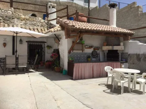
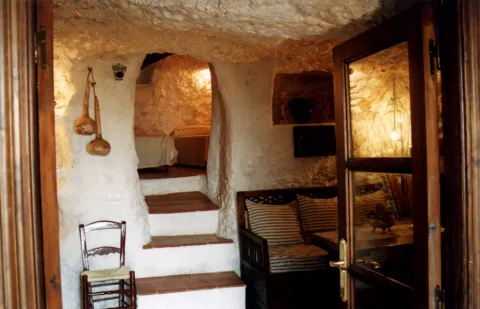
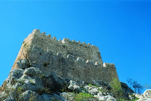
Set of troglodite houses rehabilitated as second residences and holiday tourist houses. They now make up a picturesque neighborhood, on horseback between the Serrezuela and the city centre. Very memorable.

Ubicación
Latitud
37.740061
Longitud
-3.645026
Distrito
Municipio
Ubicación en el mapa
POINT (-3.645026 37.740061)
Tipos de punto de interés
Imágenes carrusel
imagen
Image
01387888.jpg
Imagen principal
Desactivado
imagen
Image
68.jpg
Imagen principal
Desactivado
Imágenes cabecera
imagen
Image
cuevapelagar%20%281%29.jpg
Imagen principal
Activado
Microsite al que pertenece
Loading map
Preparing points of interest and routes...
Road a Cabra de Sto. Cristo

Submitted by brandcode_deweloper on
Id
5845675
Descripción
Breve descripción

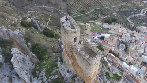
The best place to enjoy the last foothills, to the east, of Sierra Magina and also of the valley of the River Guardana Minor, characterized by its subaridity. The floral elements are numerous because they have to colonize different bioclimatic floors on different types of soils: saline, plaster, margous, limestone, etc. What is most striking are their carcabas and badlands formations.

Ubicación
Latitud
37.704030
Longitud
-3.286750
Distrito
Ubicación en el mapa
POINT (-3.28675 37.70403)
Tipos de punto de interés
Imágenes carrusel
imagen
Image
Carretera%20a%20Cabra%20de%20Sto.%20Cristo.jpg
Imagen principal
Desactivado
Imágenes cabecera
imagen
Image
106616866_3694094363937974_2481093797201150654_o.jpg
Imagen principal
Activado
Microsite al que pertenece
Loading map
Preparing points of interest and routes...
Caño del Aguadero

Submitted by brandcode_deweloper on
Id
5846600
Descripción
Breve descripción

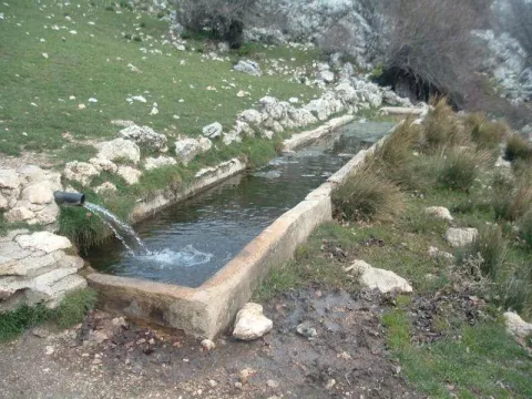
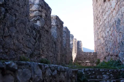
Weakening of cattle in the Sierra Mágina summit area, in the municipality of Bedmar. A place used for the perterminance, or seasonal local movement of the cattle to take advantage of the summer pastures. The whole is made up of a traditional abrevadero and a construction for herding shelter. It is a landscape of high Mediterranean mountain, with meadows and chopos bosquet. It is accessed on foot by track from Bedmar.

Ubicación
Latitud
37.743770
Longitud
-3.430490
Distrito
Municipio
Ubicación en el mapa
POINT (-3.43049 37.74377)
Tipos de punto de interés
Imágenes carrusel
imagen
Image
Ca%C3%B1o%20del%20Aguadero2.jpg
Imagen principal
Desactivado
Imágenes cabecera
imagen
Image
Caxo_del_Aguadero.jpg
Imagen principal
Activado
Microsite al que pertenece
Loading map
Preparing points of interest and routes...
Caldera del Tío Lobo and the Zurreón

Submitted by brandcode_deweloper on
Id
1869203
Descripción
Descripción larga

Location: Head of the Albanchez River.

Distance: 5 km.

Medium: On foot.

Access route: By mountain sidewalk.

Breve descripción

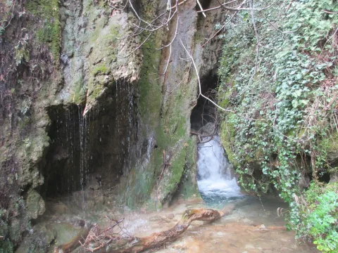
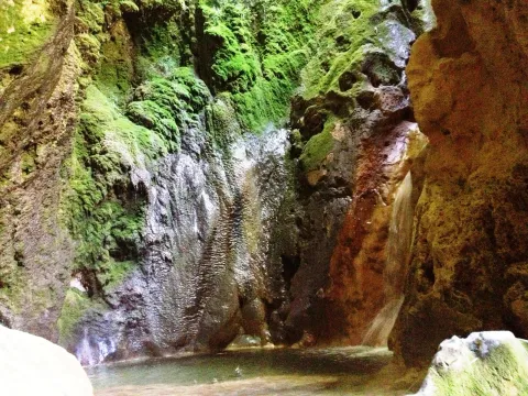
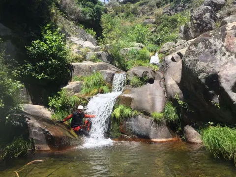
It is a set of river pods and a waterfall inside a cave, all in a very mountainous environment.

Ubicación
Latitud
37.766970
Longitud
-3.461280
Distrito
Ubicación en el mapa
POINT (-3.46128 37.76697)
Imágenes carrusel
imagen
Image
14830186Master.jpg
Imagen principal
Desactivado
Imágenes cabecera
imagen
Image
2394775Master.jpg
Imagen principal
Activado
Microsite al que pertenece
Loading map
Preparing points of interest and routes...
Ravine of the Arroyo Gargantón

Submitted by brandcode_deweloper on
Id
7983989
Descripción
Descripción larga

Location: To the west of the city centre, in the natural park of Sierra Magina.
Distance: 7 km.
Medium: By vehicle tourism and on foot.
Access route: By a lane that leaves directly from the city centre, until you reach a mountain road that access the enclave.

Breve descripción

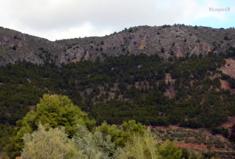
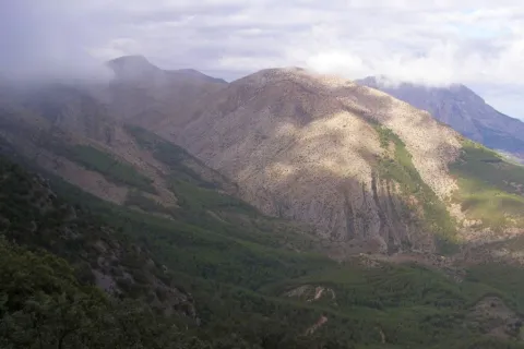
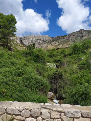
Interesting mountain side that stands out for the presence of white thorn or majolets and cornetals, among other plant formations. The rocky walls next to the Garganton serve as a refuge to a wide variety of birds, such as the royal victor, the black collar or the fences.

Telecomunicaciones
Sitio web
www.belmezdelamoraleda.es/el-municipio/patrimonio-natural.html
Teléfono de contacto
953 394 002
Ubicación
Código Postal
23568
Latitud
37.714142
Longitud
-3.399714
Distrito
Ubicación en el mapa
POINT (-3.399714 37.714142)
Tipos de punto de interés
Imágenes carrusel
imagen
Image
Barranco%20del%20Arroyo%20Gargant%C3%B3n.jpg
Imagen principal
Desactivado
Imágenes cabecera
imagen
Image
Barranco%20del%20Arroyo%20Gargant%C3%B3n2.jpg
Imagen principal
Activado
Microsite al que pertenece
Loading map
Preparing points of interest and routes...
Town Hall of Pegalajar

Submitted by brandcode_deweloper on
Id
4658310
Descripción
Breve descripción

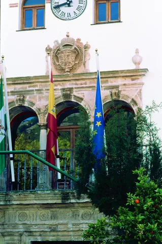
Its construction is linked to the repopulation of the southern part of Jaén in the time of Charles V. It preserves the18th century facade. It is fully rebuilt and only maintains its original track, the two-story cover of the 17th century.

Telecomunicaciones
Sitio web
www.ayto-pegalajar.org
Teléfono de contacto
953 360 003
Ubicación
Código Postal
23110
Latitud
37.737840
Longitud
-3.650930
Dirección
Plaza de la Constitución, 10
Distrito
Municipio
Ubicación en el mapa
POINT (-3.65093 37.73784)
Tipos de punto de interés
Imágenes carrusel
imagen
Image
Mon474.jpg
Imagen principal
Desactivado
imagen
Image
pegalajar-ayuntamiento-1--644x362.jpg
Imagen principal
Desactivado
Imágenes cabecera
imagen
Image
ayuntamiento.png
Imagen principal
Activado
Microsite al que pertenece
Loading map
Preparing points of interest and routes...