Saltar al contenido principal

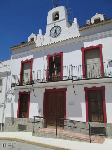
Town Hall of Noalejo

Submitted by brandcode_deweloper on
Id
4867653
Descripción
Breve descripción

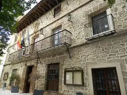
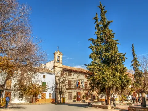
Building built at the end of16th century. At first it was a convent under the title of Our Lady of the Assumption, and this is the reason for the small image that presides over the facade. In the 18th century it became for the first time the House of the Council. The original construction corresponds to athree-storey building and swordsmanI had a bell with three crunches. It had different units anda central courtyard.A big ladderimperial two meters, immense and majestic, raised us to the second floor. On the third floor the schools were installed.

Telecomunicaciones
Sitio web
www.noalejo.es
Teléfono de contacto
953 306 134
Correo electrónico
noalejo@andaluciajunta.es
Ubicación
Código Postal
23140
Latitud
37.529460
Longitud
-3.653660
Dirección
Plaza España, 1
Distrito
Municipio
Ubicación en el mapa
POINT (-3.65366 37.52946)
Tipos de punto de interés
Imágenes carrusel
imagen
Image
noalejo.jpg
Imagen principal
Desactivado
Imágenes cabecera
imagen
Image
noalejo3.jpg
Imagen principal
Activado
Microsite al que pertenece
Loading map
Preparing points of interest and routes...

Rock Art of Jimena

Submitted by brandcode_deweloper on
Id
10897479
Descripción
Descripción larga

These more or less realistic but generally schematic manifestations reproduce human beings, animals and symbols, forming isolated scenes. The representations not only evoke and report part of daily life, but leave us witness to its complex and mysterious spirituality.

World Heritage Site

Sierra Magina houses an interesting set of rock art, especially those related to the Municipality of Jimena, being a very interesting example of schematic rock paintings. In 1998 it became part of the UNESCO catalogue as World Heritage Site.

Outdoor museums

These sites can be considered as authentic outdoor museums of incalculable value, whose preservation concerns each and every fellow citizen. When visiting them, we must remember that we contemplate figures made by the primitive man, not least human and intelligent, more than 4,000 years ago. It's all by law, Cultural Interest Property.

Visit the paintings

Visiting these places can be difficult and frustrating, not only because of their access; it can be dangerous, but because sometimes their conservation status is the least poor; and it is recommended that they be visited with a specialist. For this purpose, before scheduling the visit, it is advisable to consult with someone familiar with the place (to advise and guide) or even to be accompanied by a responsible local guide (it is advisable to contact local authorities or associations).

The Abrigo de la Graja stands out.

Breve descripción

The Rupestre Art, "art on rock," is composed of the pictorial manifestations that our remote ancestors left on the walls of numerous covacas and petreous coats of our saws, in prehistoric times (in our region, from the Neolithic, to the Bronze Age).

Telecomunicaciones
Sitio web
www.lugaresmiticosdejaen.com/es/articulos/lugares/cueva-de-la-graja
Correo electrónico
ayuntamientodejimena@gmail.com
Ubicación
Código Postal
23530
Latitud
37.833960
Longitud
-3.473090
Distrito
Municipio
Ubicación en el mapa
POINT (-3.47309 37.83396)
Tipos de punto de interés
Imágenes carrusel
imagen
Image
jimena%202.jpg
Imagen principal
Desactivado
imagen
Image
jimena%203.jpg
Imagen principal
Desactivado
Imágenes cabecera
imagen
Image
Jimena%201.jpg
Imagen principal
Activado
Microsite al que pertenece
Loading map
Preparing points of interest and routes...
Marcas de calidad

Recreational Area of Gibralberca

Submitted by brandcode_deweloper on
Id
2981114
Descripción
Breve descripción

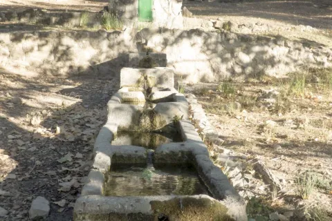
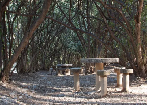
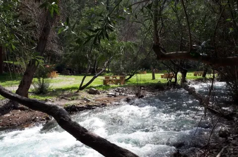
The recreational area of Gibralbca, at 1,200 metres of altitude, is a fuente- abrevadero whose waters come from the stream of the same name. Located between alamos, centenary oak and thorns, in the middle of a meadow, from this point we have impressive views of Mount Almadén (1,883 m), in the natural park of Sierra Magina. In addition, many forest birds, riverbanks and, above all, red squirrels can be observed in the moms that preside over it.

Telecomunicaciones
Sitio web
www.cambil-arbuniel.es
Teléfono de contacto
953 300 427
Ubicación
Código Postal
23560
Latitud
37.674840
Longitud
-3.498170
Dirección
Carretera A-324
Distrito
Municipio
Ubicación en el mapa
POINT (-3.49817 37.67484)
Tipos de punto de interés
Imágenes carrusel
imagen
Image
717_AR_02.jpg
Imagen principal
Desactivado
imagen
Image
717_AR_01.jpg
Imagen principal
Desactivado
imagen
Image
717_AR_04.jpg
Imagen principal
Desactivado
imagen
Image
722_SS_01.jpg
Imagen principal
Desactivado
Imágenes cabecera
imagen
Image
717_AR_03.jpg
Imagen principal
Activado
Microsite al que pertenece
Loading map
Preparing points of interest and routes...
Arch of la Encarnación

Submitted by brandcode_deweloper on
Id
4659054
Descripción
Breve descripción

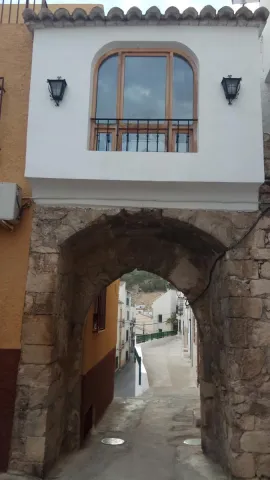
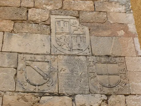
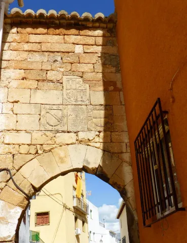
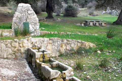
On the Arc of the Incarnation of Pegalajar, a pointed arch that was the main entrance door to the castle of Pegalajar, is a commemorative stone surrounded by heraldic shields. The stone is recorded in relief with a textual gothic letter, in some parts damaged. The writing box of the stone is distributed in relief lines where the photographs are attached. It uses some abbreviations and the concealment of some letters at the end or in the middle of the word. Words are usually separated by scores. Head the tombstone the word "Jheits ", framed in two crosses, religious invocation usual at the beginning of all public writings, followed by the date, the reference to the king reigning and then the ordinator of it and the type of work commemorative. The transcription of the stone is as follows:

Telecomunicaciones
Sitio web
www.ayto-pegalajar.org
Correo electrónico
pegalajar@promojaen.es
Ubicación
Código Postal
23110
Latitud
37.738970
Longitud
-3.649050
Distrito
Municipio
Ubicación en el mapa
POINT (-3.64905 37.73897)
Tipos de punto de interés
Imágenes carrusel
imagen
Image
arco%20de%20la%20encarnaci%C3%B3n%202.jpg
Imagen principal
Desactivado
imagen
Image
arco%20de%20la%20encarnaci%C3%B3n.jpg
Imagen principal
Desactivado
Imágenes cabecera
imagen
Image
10486986676_87a2769dfe_b.jpg
Imagen principal
Activado
Microsite al que pertenece
Loading map
Preparing points of interest and routes...
Former Convent of Santo Domingo

Submitted by brandcode_deweloper on
Id
910634
Descripción
Descripción larga

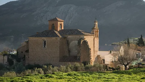
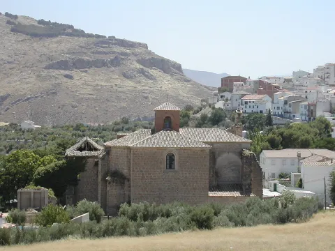
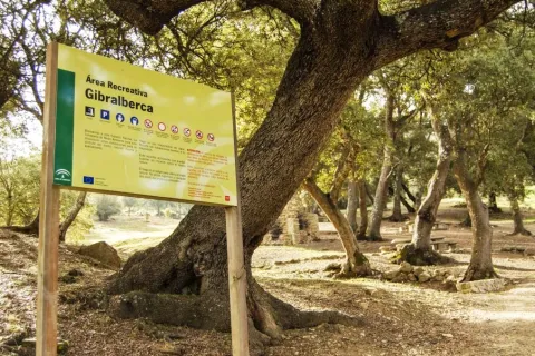
The Former Convent of Santo Domingo, in La Guardia de Jaén, is one of the most distinctive landmarks of the Renaissance of the South. Declared a Historical Monument in 1975, it preserves the former conventual church — today the Parish of the Assumption —, part of the cloister, and the remains of the conventual palace, forming an ensemble of great historical and artistic interest.

Founded in the 16th century by Don Rodrigo Messía Carrillo and Doña Mayor de Fonseca, lords of La Guardia with ties to Salamanca, the Dominican convent began construction in 1538. From 1542 onwards, the work took on a new dimension with the involvement of Andrés de Vandelvira, one of the great masters of the Andalusian Renaissance, who introduced innovative architectural solutions in the main chapel and the transept.

The main chapel, with its octagonal floor plan, follows models found in Alonso de Vandelvira's Libro de las Traças (Book of Designs) and is structured through a carefully applied Classical order. The transept is covered by a domed vault with a lantern, resting on four corner piers, creating a space of great balance and clarity. Inside, a remarkable iconographic programme is preserved, with coffered ceilings decorated with Dominican saints, prophets and apostles, as well as reliefs by Juan de Reolid depicting the Passion and Resurrection of Christ.

The ensemble reflects the dialogue between Castilian influences — stemming from the Salamanca background of its founders — and the mastery of the Jaén Renaissance, in collaboration with other stonemasons such as Domingo de Tolosa and Francisco del Castillo. Despite the transformations brought about by the disentailment (desamortización) and its later uses, the former convent still retains Renaissance coffered ceilings, remains of mural painting, a sacristy with a 1547 wooden ceiling (alfarje), and an 18th-century black jasper washbasin.

The Former Convent of Santo Domingo is today part of the Renaissance of the South Route, standing as an outstanding example of religious architecture linked to the figure of Vandelvira and to the artistic splendour of the 16th century in the province of Jaén.

Calle Escuelas, 11. 23170, La Guardia de Jaén 
Information and bookings
953 32 71 00

Breve descripción

A space where Vandelvira's architecture converses with five centuries of memory

Telecomunicaciones
Teléfono de contacto
953 327 100
Ubicación
Código Postal
23170
Latitud
37.744720
Longitud
-3.693890
Dirección
C/ Escuelas, 11
Distrito
Ubicación en el mapa
POINT (-3.69389 37.74472)
Tipos de punto de interés
Imágenes carrusel
imagen
Image
thumb%20%281%29.png
Imagen principal
Desactivado
Imágenes cabecera
imagen
Image
Convento_Santo_Domingo_La_Guardia.jpg
Imagen principal
Activado
Loading map
Preparing points of interest and routes...

Former Town Hall of Larva

Submitted by brandcode_deweloper on
Id
8088700
Descripción
Descripción larga

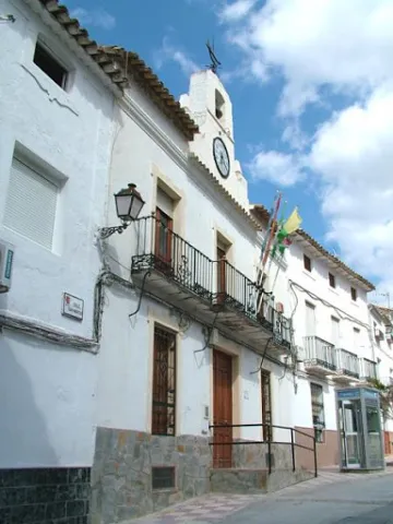
Among the Caserio de Larva is the old Town Hall, located in an altozano, with narrow walls, large symmetrical and verticalized voids, adapted to the slight level of heights of the street, and which is distinguished from the typology of the houses surrounding it by a prismatic, higher fronton, which hosts a watch and a small bell, following the model of the consistory houses of the illustrated colonization.

Breve descripción

The lands of Larva have been populated since the oldest prehistory, a town sponsored by its location near the Guadiana Menor, on the communication road that joined the Alto Guadalquivir with Levante. One kilometre from the city centre is the Iberian settlement of Cerro de Castellón, dated between the 2nd and 1st century BC. It is a fortified enclosure located at the top of a hill isolated in the middle of the plain, which remained occupied in Roman times.

Telecomunicaciones
Sitio web
www.larva.es/el-municipio/patrimonio-historico.html
Teléfono de contacto
953 781 500
Ubicación
Código Postal
23591
Latitud
37.759340
Longitud
-3.201280
Dirección
Paseo de Andalucía, s/n
Distrito
Municipio
Ubicación en el mapa
POINT (-3.20128 37.75934)
Tipos de punto de interés
Imágenes carrusel
imagen
Image
Antiguo%20Ayuntamiento%20larva2.jpg
Imagen principal
Desactivado
Imágenes cabecera
imagen
Image
Antiguo%20Ayuntamiento%20larva%20%281%29.jpg
Imagen principal
Activado
Microsite al que pertenece
Loading map
Preparing points of interest and routes...
Adelfar del Río Cuadros

Submitted by brandcode_deweloper on
Id
5845551
Descripción
Breve descripción

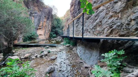
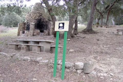
The natural adelfal of the Cuadros River is probably one of the largest and most important of the Iberian peninsula. In this case they form a curious gallery forest.

Ubicación
Latitud
37.790160
Longitud
-3.407520
Distrito
Municipio
Ubicación en el mapa
POINT (-3.40752 37.79016)
Tipos de punto de interés
Imágenes carrusel
imagen
Image
unnamed.jpg
Imagen principal
Desactivado
imagen
Image
rio-cuadros-bedmar-garciez_14676034_20200923133251.jpg
Imagen principal
Desactivado
Imágenes cabecera
imagen
Image
727_ss_01-1-jpg
Imagen principal
Activado
Microsite al que pertenece
Loading map
Preparing points of interest and routes...