Saltar al contenido principal
icon-intereses-naturaleza

Waterfall / Leap of the Cabra

Submitted by brandcode_deweloper on
Id
1909427
Descripción
Descripción larga

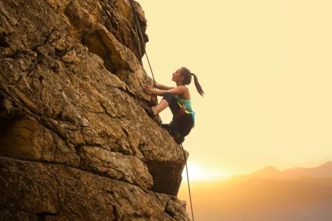
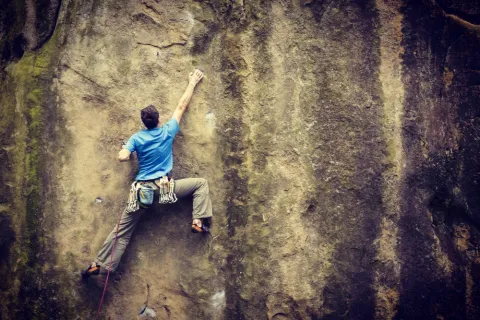
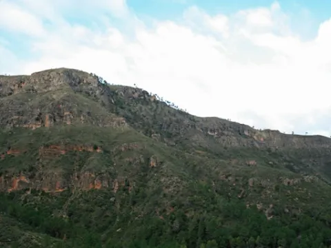
The road, very busy in holidays and weekends, is the foot of the road. The climbing is very technical in sections, with steps taken out. The tracks are equipped for sports climbing. The average height is 25 meters. The maximum height is 60 meters.

Breve descripción

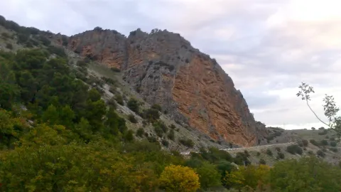
It is a limestone wall with plenty of roofs and beatings that have very comfortable access. The insurer is located on the road, so special caution will have to be taken.

Ubicación
Latitud
37.780090
Longitud
-3.814370
Distrito
Municipio
Ubicación en el mapa
POINT (-3.81437 37.78009)
Imágenes carrusel
imagen
Imagen
shutterstock_1494195701.jpg
Imagen principal
Desactivado
imagen
Imagen
shutterstock_536042689.jpg
Imagen principal
Desactivado
Imágenes cabecera
imagen
Imagen
salto1a.jpg
Imagen principal
Activado
Loading map
Preparing points of interest and routes...

San José Salt Flats

Submitted by brandcode_deweloper on
Id
4885101
Descripción
Breve descripción

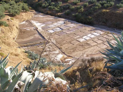
Old saline exploited from the Roman era to well in the 1990s. They are now out of activity.

Ubicación
Código Postal
23600
Latitud
37.757460
Longitud
-4.003260
Distrito
Municipio
Ubicación en el mapa
POINT (-4.00326 37.75746)
Tipos de punto de interés
Imágenes carrusel
imagen
Imagen
Salinas-de-San-Jose.jpg
Imagen principal
Desactivado
Imágenes cabecera
imagen
Imagen
3%20%284%29.jpg
Imagen principal
Activado
Microsite al que pertenece
Loading map
Preparing points of interest and routes...

Sacred Capilla de El Salvador del Mundo

Submitted by brandcode_deweloper on
Id
915681
Descripción
Descripción larga
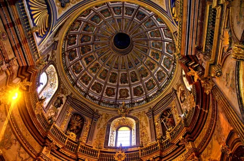
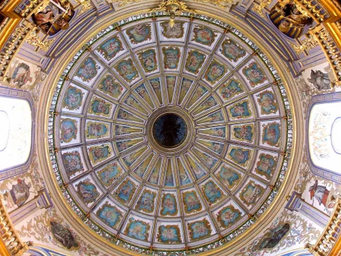
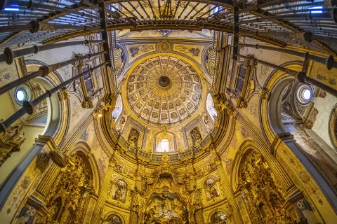
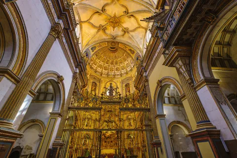
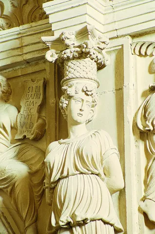
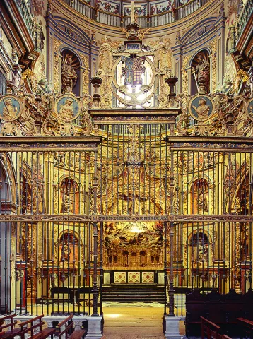
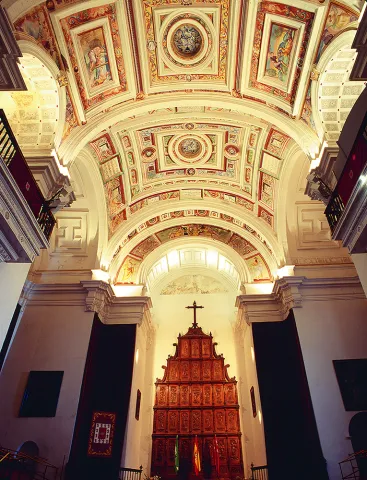
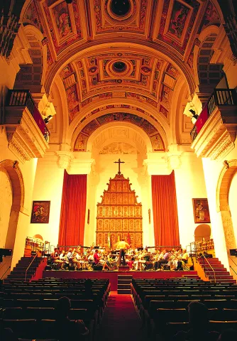
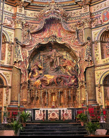
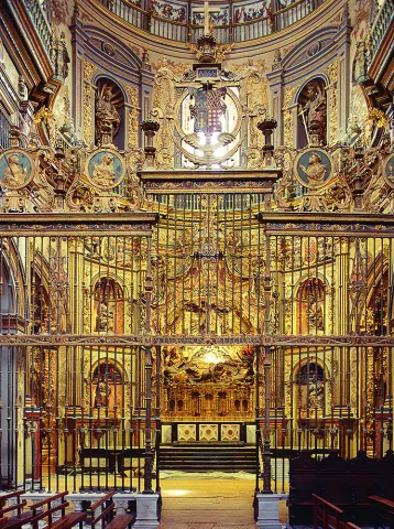
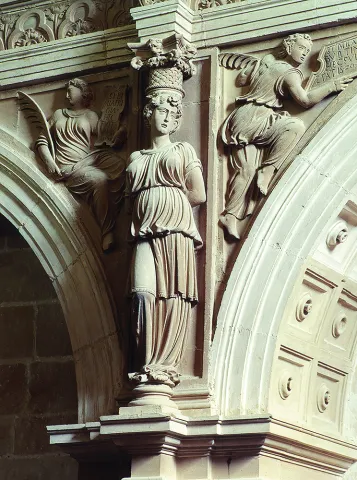
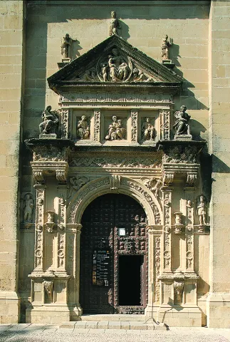
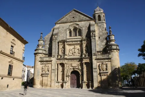
In the case of El Salvador de Úbeda, and previously in the Royal Chapel of Granada, the approach from the foundations is essentially funerary. Don Francisco de los Cobos and his wife, Doña María de Mendoza, in an absolutely novel way, conceived a free-standing building for their burial and that of their descendants, which in itself guarantees the importance and high social and economic rank achieved by Cobos, a second-rate Ubetense nobleman who came to hold, after a meteoric career, the most trusted administrative positions in the Court of Emperor Charles V. To carry out such an important project in his hometown, Cobos obtained from Pope Paul III, on February 2, 1535, a bull to erect a temple-pantheon to which the chaplaincies and privileges granted in 1525 were transferred to build a funerary chapel in the parish of Santo Tomás, located very close to the family palace-house. As in other building projects, the person in charge of carrying out the plan was Dean Ortega. The chosen place was a large plot of land near the Hospital de los Honrados Viejos del Salvador and the aforementioned family palace, sumptuously renovated and expanded. After acquiring various plots of land from individuals and the aforementioned Hospital, Cobos agreed with the famous Burgos architect, Diego de Siloé, working in Granada on the construction of the Cathedral, for his ambitious project. Siloé undertook, among other things, to provide the conditions and drawing of the plant. In 1536 the works were finished by Andrés de Vandelvira and Alonso Ruiz, who had to follow at all times the instructions drawn up by Siloé, published by Don Manuel Gómez Moreno. In 1539 Cobos ordered the suspension of the works, being advised by his relative, also royal secretary Juan Vázquez de Molina, on the convenience of transferring the construction of the sacred chapel to his manor of Sabiote. In 1540 they resumed, with Andrés de Vandelvira and Alonso Ruiz once again leading them. In this second contract, other works are required, such as the main façade, which must follow the model drawn by Siloé in the Forgiveness of the Cathedral of Granada, and the lateral ones, and Vandelvira is also in charge of the design of a new sacristy, an essential piece within the whole of the sacred chapel. The floor plan is made up of a nave with late Gothic vaults with coffered chapels and a main chapel in the shape of a rotunda with coffered ceilings flanked by two beautiful vaults, one under the tower, the other giving access to the sacristy. This articulation had already been experimented by León Battista Alberti for the funerary temple of Sigismundo Malatesta in the Italian city of Rimini. Ultimately, the circle refers us to the Pantheon of Rome and the Santo Sepulcro de Jerusalén, the nave, for its part, responds to the demands of the cult. In the sacristy, which is accessed through a beautiful angled door, Vandelvira shows his extraordinary knowledge, as in the rest of his works, of the technique of stone cutting; Its rectangular floor plan is divided into three modules covered with hollow vaults (very Vandelvirian), with large arches placed on the walls, like niches, to house the drawers, framed by Sibyls and Prophets of excellent carving, due to the French sculptor Esteban Jamete. The great façade, which presides over the east side of the monumental Plaza de Santa María, is structured like a great triumphal arch; The upper one shows us the Transfiguration of Jesus on Mount Tabor, a motif also repeated in the main altarpiece, the lower one - due to the hand of Esteban Jamete - is more complete and deeper and in it are inserted, among many other motifs, scenes from both the Old Testament (Fall of the Manna and the Veneration of the Bronze Serpent) and the pagan world (Planets, from the intrados of the large central arch), but there is also abundant Plateresque carving. Flanking this large doorway are two buttresses of Gothic tradition, featuring two of the seven labors of Hercules. (The fight against the centaurs and the bulls of Geryon). To the sides of them are two stands and below them on bases the shields of Don Francisco de los Cobos and Doña María de Mendoza supported by warriors and matrons, respectively. At the ends rise two graceful circular turrets decorated with plateresque elements. The emblems of the founders are inserted repetitively, both inside and outside The side covers are due to Andrés de Vandelvira; the southern one, like an altarpiece, with scenes from the Old and New Testament; The south, with delicate Plateresque work and the typical Vandelvirian composition of a triumphal arch, is dedicated to Santiago, patron saint of Spain. A monumental bell tower, located on the Epistle side, completes this superb complex with a high symbolic value, present both architecturally and decoratively. Ultimately everything was designed to eternalize its founders. Andrés de Vandelvira, somewhat subject at first to the instructions of Diego de Siloé, appears much more personal to us as a result of the second contract of 1540, his great creative capacity emerging in the wonderful sacristy with its entrance door, but also in many other architectural elements. In El Salvador, the desires for immortality sought by his mentor, Don Francisco de los Cobos, have been united with the architectural and sculptural quality fostered by great artists of the Renaissance: Diego de Siloé, Andrés de Vandelvira and Esteban Jamete. The church was consecrated in 1559. An inscription on one of the pillars of the nave remembers it: "This Holy Church was consecrated by the Most Reverend Don Diego Tavera, of good memory, bishop of Jaén. Sunday, October 8, 1539. Presiding in the chair of San Pedro, Pius the fourth and Philip II of this name reigning in Spain." But what really links this temple to the figure of Muñoz Molina is its façade, where the representation of the “juancaballos” is carved, mythical creatures from the Sierra de Mágina that the author rescues to echo the phenomena and legends typical of rural spaces. The author, although the real image chiseled on the façade is from Greek mythology, Hercules fighting a Centaur, to give greater emphasis to the local history, deploys a story that enhances the real possibility of its existence in the characters of the novel. “The proof that the juancaballos existed […] was, carved in stone, on the façade of the Church of the Savior, […], so that, if they had been sculpted in such a sacred place, next to the statues of the saints and under the relief of the Transfiguration of the Lord, my grandfather smilingly argued, one would have to be quite a heretic not to believe in them…” Antonio Muñoz Molina. The Polish Horseman. OTHER NON-ARCHITECTURAL ARTISTIC MANIFESTATIONS Don Francisco de los Cobos and his wife, Mrs. María de Mendoza, endowed the Sacred Chapel with a rich movable heritage, increased by her descendants the Marquises of Camarasa. Little of that valuable treasure has come from the last heirs of the Camarasa. Of the abundant goldwork still kept in the sacristy, we highlight a late-Gothic gilt silver chalice from the end of the 15th century that, according to tradition, was given by Emperor Charles V to Cobos, a Venetian-style reliquary chest (15th century) and the cluster and barrel of a processional cross (disappeared), the work of the Toledo silversmith Francisco Martínez, carved in 1542; Also there is the reliquary bust of Santa Aurelia (16th century), carved in polychrome wood, and an ivory Christ (17th century). Of the excellent pictorial collection treasured by Cobos, nothing remains in the Chapel, since even the pieces not destroyed in 1936 such as the Pieta (16th century), by Sebastián del Piombo, a Calvary (16th century) and a penitent Magdalene are currently deposited in the Casa de Pilatos. To alleviate these important losses, the Medinaceli Foundation has hung a replica of the aforementioned Pieta in one of the chapels of the nave. Only certain remains could be saved from the famous San Juanito, a sculpture sculpted in Carrara marble, which according to traditional and recent historiography is attributed to the great Michelangelo. In 1563, the image was deposited in the Sabiote castle, Cobos manor. The large altarpiece of the High Altar, partially destroyed in 1936, represents - under an 18th century duster - the Transfiguration of Jesus on Mount Tabor, traditionally attributed to Alonso de Berruguete; The complex was restored by the sculptor José Luis Vassallo. In the four niches that flank the altarpiece, the Evangelists are preserved, carved around 1634 by the Ubetense sculptor Pedro de Zayas, which are completed above with those by San Pedro y San Pablo, works from the 18th century. Part of the old upper ashlar masonry (16th century), carved by Blas Briñón according to the conditions of Andrés de Vandelvira, and the lower one (18th century) are preserved. Interesting are the collateral baroque altarpieces of the main chapel. The large grille, which separates the central space or rotunda from the rest of the nave, sits on the marble capitals of the patio of the nearby palace of Cobos and is one of the most relevant examples of Spanish ironwork, its execution being attributed to Francisco Martínez and Francisco de Villalpando; It is dated 1555, the year of consecration of this splendid funerary temple.

Breve descripción
Declared an Asset of Cultural Interest on June 3, 1931. In the Renaissance, together with the castle and the palace, the building destined for eternal rest was cared for with great attention by the monarchy, the nobility and the high ecclesiastical dignities. The funerary space could occupy an already built chapel or be manufactured in a cathedral, church or any other religious building not built expressly for this purpose.
Ubicación
Código Postal
23400
Latitud
38.007990
Longitud
-3.366760
Dirección
Plaza Vázquez de Molina
Municipio
Ubicación en el mapa
POINT (-3.36676 38.00799)
Tipos de punto de interés
Imágenes carrusel
imagen
Imagen
32003233217_cef2263647_b.jpg
Imagen principal
Desactivado
imagen
Imagen
Ubeda capilla
Imagen principal
Desactivado
imagen
Imagen
Ubeda capilla del salvador
Imagen principal
Desactivado
imagen
Imagen
Ubeda capilla del salvador
Imagen principal
Desactivado
imagen
Imagen
Capilla el Salvador
Imagen principal
Desactivado
imagen
Imagen
Capilla el Salvador
Imagen principal
Desactivado
imagen
Imagen
Capilla el Salvador
Imagen principal
Desactivado
imagen
Imagen
Capilla el Salvador
Imagen principal
Desactivado
imagen
Imagen
Capilla el Salvador
Imagen principal
Desactivado
imagen
Imagen
Capilla el Salvador
Imagen principal
Desactivado
imagen
Imagen
Capilla el Salvador
Imagen principal
Desactivado
imagen
Imagen
Capilla el Salvador
Imagen principal
Desactivado
Imágenes cabecera
imagen
Imagen
fachada-de-la-capilla-del-salvador-de-ubeda-jaen.jpg
Imagen principal
Activado
Horario
Monday to Saturday: 10:00 - 14:00 and 16:00 - 18:30. Sundays: 11:15 - 14:00 and 16:00 - 18:30. Worship: Monday to Saturday 6:30 p.m., Sundays 10:30 a.m.
Loading map
Preparing points of interest and routes...

Juniper and Savin Forests rastreros

Submitted by brandcode_deweloper on
Id
923306
Descripción
Descripción larga

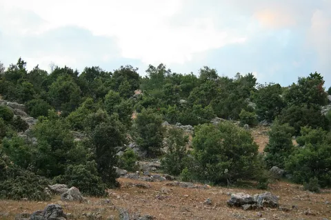
When we enter the fields of Hernán Pelea we are open to the landscape, and we will discover true vegetable monuments that charge a large extent of soil.

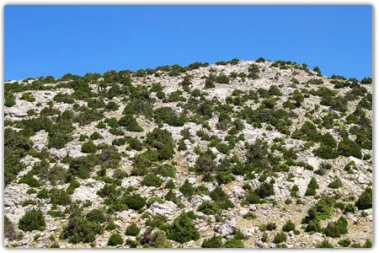
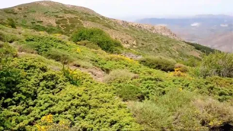
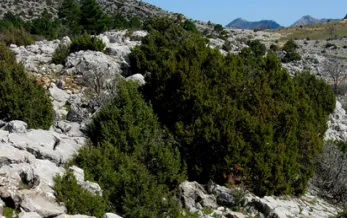
The rake savannas colonize the rocky soils, so we find them in the scarves and cresteries, as well as in the highest of the summits. On the contrary, rake juniors prefer more developed soils, although it is not difficult to see them together. They are very long-lived species, being able to reach 1000 years of age. They do not raise much from the ground, rarely more than a meter high, but a single example can extend more than 20 m ².

They are almost mono-specific plant formations, that is, of a single dominant species, to which only some salgarean pine (Pinus nigra salzmannii), thorns (Berberis vulgaris australis) and on the slopes some maple (Acer granatense) or mustard (Sobus aria) are accompanied. But in the summit areas, the rareras are the queens of the landscape, competing with piornal and lastonar.

These two species came to our saws with the glaciations of the Quaternary. Today, with a more arid climate, they only survive in the highest and coldest of the mountains. Their regeneration is difficult and scarce, and they are also used as food by herbivores, so their future is not the most flattering.

LOCATION

Following the track that goes into the fields of Hernán Perea from Don Domingo, we take the one that goes through the rample of Juan Fría, in which is the Galapan pine, we overcome it and as we pass through the cortijo of the Pinadilla, we are opened a splendid sabinar rastrero.

Breve descripción

Campos de Hernán Pelea

We cannot speak of the high mountains, their summits, their stony slopes and cresteries, without mention of one of their most emblematic inhabitants, the hillbillies or chaspines (Juniperus sabina) and the hillbillies (Juniperus comunnis hemisphaerica), true vegetable monuments of our mountains, to which can be given the qualification of The Elders of the Summits. They are plants that cover our summits in dark green and give shelter to a number of animals.

Ubicación
Latitud
37.772886
Longitud
-3.788329
Ubicación en el mapa
POINT (-3.788329 37.772886)
Imágenes carrusel
imagen
Imagen
4.png
Imagen principal
Desactivado
Imágenes cabecera
imagen
Imagen
86746483001_5836777155001_5826845296001-vs.jpg
Imagen principal
Activado
Loading map
Preparing points of interest and routes...

Juniper Forests of Sabina Mora

Submitted by brandcode_deweloper on
Id
881711
Descripción
Descripción larga

One of the most important plant formations of the park is the Sabinar of Sabina mora or simply of Sabina (Juniperus phoenicea). It is very important for its extension, for the habitat it occupies - rocks and dolomitic sandals - and for the large number of endemic species that it houses, including the most emblematic, the Cazorla violet (Viola cazorlensis) and the endemism of the Serra de Segura Jasione crispa seguridad. This training is therefore declared a Habitat of Community Interest in Natura 2000 Network.

It is presented to us in the form of clear sketches, where the black savina is the dominant plant element. We can find it in many areas of the Park, colonizing those places where other trees have not been able to develop, rocky, dry, wind-beat and with strong solar irradiation. You can say that sabina is the essence of hardness. We can also find it in isolation in almost all the forest formations of the Park, missing only in the high summits, so in many places we can see small sabinars more or less dense or scattered.

Inside Las Villas, on any side we will find sabinares. We've chosen the Wolf's boat. Once on the Sloth Hill, we will walk on the side of your left, according to the direction of the march. It is populated by savannas, juniperus oxicedrus, salgary and black pines (Pinus nigra salzmannii and Pinus pinaster), in a sparse and scattered manner, complaints and oinas (Quercus faginea and Quercus ilex ballota), thorns of dyes (Rhamnus saxatilis) and piorns (Erinacea anthyllis and Echinospartum boissierii). We are on this hill at the foot of the Blanquillo, the highest summit of the Las Villas saw.

Of the same characteristics as the one described - sabinar en rota - but with more cornicabra, are the sabinars of the Zumeta River, which extend throughout the left side in the sense of the waters. The sabinar is also seen from the other side, on the side of Albacete. We will see it from further, but in return we are compensated with the panoramic view of the Old Age reservoir.

LOCATION OF THE LOBO

We take the road that goes from the reservoir of Aguascebas to the Recreative Area of Gil Cobo. A little before we reach this area, we take a crossing that comes to our right, preferably on foot. We followed the track to a detour and took the one from the left, in gentle ascent, until we reached the Collado del Perenoso. To our left is the great lapiaz of the Lobo Boat.

ZUMETA LOCATION

In the village of Vites you have to head towards the Cortijo del Torcal.

Breve descripción

Lobo boat and Zumeta river

Ubicación
Latitud
37.912893
Longitud
-3.003887
Municipio
Ubicación en el mapa
POINT (-3.003887 37.912893)
Tipos de punto de interés
Imágenes carrusel
imagen
Imagen
622_img.png
Imagen principal
Desactivado
imagen
Imagen
unnamed.jpg
Imagen principal
Desactivado
Imágenes cabecera
imagen
Imagen
2%20%281%29.jpg
Imagen principal
Activado
Loading map
Preparing points of interest and routes...

Ruins of the Convento de San Francisco

Submitted by brandcode_deweloper on
Id
5964874
Descripción
Breve descripción

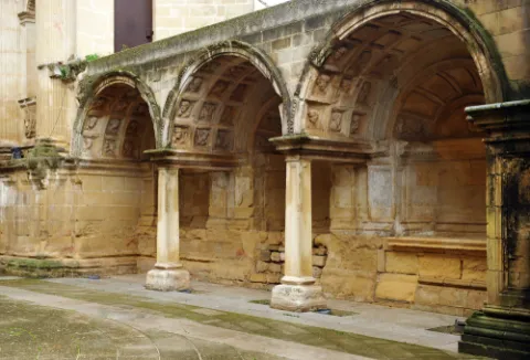
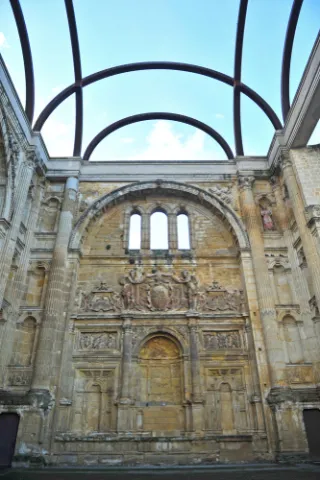
Conceived as a quadrangular space by the insignia architect Andrés de Vandelvira, it was covered by a large cross vault, of which there is only one reminder of its steel structure, reform made in the late 20th century. The chapel has the left side and the lower chapels of the bottom altar, on which the Major Altar was built. The rest of the Church is from the 17th century. It currently hosts the Municipal Auditorium.

Telecomunicaciones
Sitio web
www.baeza.es
Teléfono de contacto
953 740 150
Ubicación
Código Postal
23440
Latitud
37.994290
Longitud
-3.469080
Dirección
San Francisco, 14º
Municipio
Ubicación en el mapa
POINT (-3.46908 37.99429)
Tipos de punto de interés
Imágenes carrusel
imagen
Imagen
shutterstock_1575789340%20%281%29.jpg
Imagen principal
Desactivado
imagen
Imagen
shutterstock_1217433274%20%281%29.jpg
Imagen principal
Desactivado
imagen
Imagen
Mon542.jpg
Imagen principal
Desactivado
imagen
Imagen
Mon036.jpg
Imagen principal
Desactivado
Imágenes cabecera
imagen
Imagen
shutterstock_55718176%20%282%29.jpg
Imagen principal
Activado
Horario
External visit.
Loading map
Preparing points of interest and routes...

Ruins of the Castle of Castro Ferral

Submitted by brandcode_deweloper on
Id
5868858
Descripción
Descripción larga

In 1169 the Castle of Castro Ferral was conquered by Calatravos, commanded by Fernando de Icaza, the second Master of the Order. However, before the battle of the Navas de Tolosa, the fortress was again under Muslim control. Ferral would lead several acts of weapons during the military campaign that would end with the Christian triumph of the Navy (1212). The strategic importance of this castle, by controlling one of the traditional steps of Sierra Morena, made it an essential objective for any army that would want to cross the area.

The transfer of the border to the Betic Cordilleras marked the decline of Castro Ferral, who lost his role as a watchman for access to the Guadalquivir Valley. The foundation of St. Helena (Ermita de los Palacios), which has made it less important as a reference centre for the small population of those contours, was joined. In an undetermined time, they beat it to prevent it from becoming a jumpers' den.

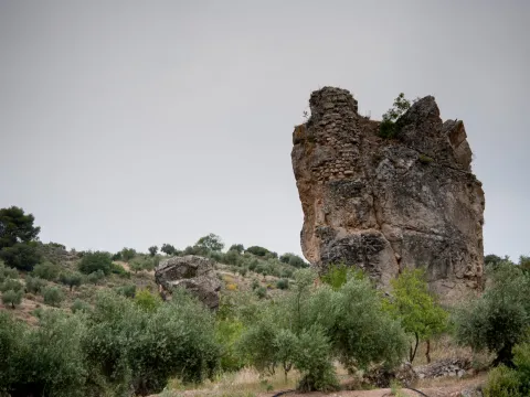
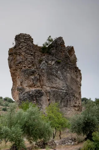
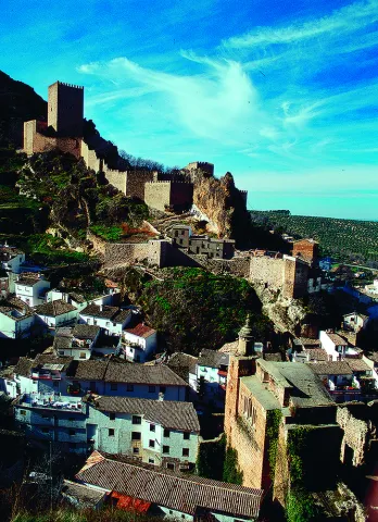
The castle of Ferral was made up of three defensive enclosures. The first, currently the worst preserved, was a broad emulated in the slope of land that closed the top of the fence describing an almost perfect circle. This defensive line is more solid and pronounced at the North and North-East ends, where the land gap is greater.
In its interior is developed a second enclosure, possibly built in ground tapial on the base of masonry, from which are preserved various remains and two bastions that could protect the entrance to the castle.
The central core of the castle is made up of a rectangular enclosure of argamase tapial, in which the underground remains, possibly aljibes, are visible.
Breve descripción

There are only remains of this castle of a bulldozer built by Muslims before the Battle of the Saves of Tolosa. It is located inside the Natural Park, on the heights of the port of Muradal, to keep the Paso de la Losa, route between Andalusia and the Plateau. It is accessed exclusively by forest track.

Telecomunicaciones
Sitio web
www.castillosybatallas.com/es/castillo-de-castro-ferral/
Teléfono de contacto
953 368 839
Ubicación
Código Postal
23213
Latitud
38.392870
Longitud
-3.545360
Distrito
Municipio
Ubicación en el mapa
POINT (-3.54536 38.39287)
Tipos de punto de interés
Imágenes carrusel
imagen
Imagen
Castillo%20de%20Castro%20Ferral%2C.jpg
Imagen principal
Desactivado
Imágenes cabecera
imagen
Imagen
Castillo%20de%20Castro%20Ferral%2C%202.jpg
Imagen principal
Activado
Horario
24 h.
Loading map
Preparing points of interest and routes...

Ruins of the Church of Santo Domingo de Silos

Submitted by brandcode_deweloper on
Id
913023
Descripción
Descripción larga

Se produce entonces el primer ensanche urbano de la población, que rompe longitudinalmente hacia el Suroeste con su antigua estructura amurallada. A lo largo de este eje se levantan el Pósito, sede del Ayuntamiento, y la iglesia de Ntra. Sra. de la Concepción, parroquia en pie hasta 1955, año en el que sobre ella se construyó la actual, perdiendo la población una de las dos parroquias históricas que tuvo en el pasado.

La otra parroquia se alza ruinosa dentro del recinto bajo de la fortaleza, configurando con ella y la espléndida naturaleza de la Sierra que la enmarca uno de los lugares más bellos de la provincia de Jaén. Este segundo templo, dedicado a Santo Domingo, es fruto del empeño de uno de los hombres más influyentes en la España de Carlos I, el famoso y prepotente secretario Francisco de los Cobos, que consiguió hacerse con el señorío del Adelantamiento en 1534, permaneciendo bajo la administración y control de sus descendientes, los Marqueses de Camarasa, hasta el año 1606, fecha en la que es recuperado por el Arzobispado de Toledo, propietario del amplio señorío desde el siglo XIII. Durante este período se construiría la que Rus Puerta califica como Iglesia Mayor.

Pero este monumental templo presentaba cierto abandono y ruina en el siglo XVIII. En el Catastro del Marqués de la Ensenada, de 1751, se relata así el estado en que se encontraba: “(...) lo que causa mayor dolor es ver la fábrica de la parroquial mayor de Santo Domingo de Silos por acabar, siendo esta bastante decente, y por los muchos hostigos y tejados con los que hoy se halla, por no estar perfeccionada padece el continuo detrimento de tan continuos gastos para poder conservarse (...)”.

La Guerra de la Independencia provocó su total ruina, pues fue incendiada, como Santa María, de Cazorla, el 4 de julio de 1810 por las tropas francesas. Posteriormente fue usado como Cementerio hasta mediados del siglo XX, quedando aún visibles los restos de esta ocupación. Paseando por las ruinas de Santo Domingo de Silos podemos acercarnos a uno de los episodios de la historia de estas sierras menos conocido. Poco sabemos sobre lo sucedido entre 1808 y 1812 en unas zonas muy alejadas de las ciudades ocupadas por los franceses. ¿Por qué incendiarían los franceses un edificio como la iglesia de Santo Domingo de Silos? Está claro que en una zona tan inaccesible, la presencia de los invasores franceses era bastante puntual.

Al mismo tiempo se ha constatado que aprovechando la geografía del terreno muchos guerrilleros se escondieron de los invasores en esta zona. Sabemos que ningún pueblo acogió de buena gana el gobierno de José I. Por el contrario, se organizaron juntas de defensas en las capitales de partido para hacer frente a los franceses.

En muchos pueblos se hicieron algunas obras de fortificación y quizá esta fue la última vez en la que se volvió a utilizar el castillo de Segura de la Sierra con fines militares. La respuesta francesa fue siempre la misma y consistió en el saqueo y destrucción de todos los elementos del poder en los pueblos. Normalmente se incendiaba el ayuntamiento con el objetivo de destruir toda la documentación del archivo y paralizar administrativamente el gobierno local. Otro objetivo eran las iglesias para destruir libros de bautismos y de defunciones, aunque la destrucción de las iglesias tenía también un componente psicológico pues se destruía un refugio para la población y al mismo tiempo el último recurso que los vecinos tenían en una situación de este tipo, el acudir a la iglesia a rezar para implorar la ayuda divina.

Por otra parte, según Vicente Salvatierra parece muy posible que la primitiva iglesia pudo estar en el mismo emplazamiento que la de Santo Domingo, al pie del castillo. En opinión de Luis Magaña, Rodrigo de Gibaja, maestro cantero ligado al Arzobispado de Toledo y responsable de las fábricas de la Colegial de Baeza y de la iglesia de Puebla de Don Fabrique, en tierras granadinas, tuvo a su cargo las obras de las iglesias de Santa María, en Quesada, y de Santo Domingo de La Iruela. También se ha documentado la participación del cantero cazorleño Gabriel de Tauste. No hay constancia documental de la intervención de Andrés de Vandelvira, pero es muy probable que diera las trazas a instancias de Francisco de los Cobos en torno al año 1534, encargándose de la ejecución Gibaja y Tauste, entre otros maestros canteros.

Chueca Goitia, comparando los restos de las iglesias de Santa María, de Cazorla, con la de La Iruela, estima que esta “Es de arte más pobre y tosco, como realizado por maestros locales siguiendo, seguramente, inspiraciones vandelvirescas”. En cualquier caso, ambas fábricas se están levantando paralelamente, dilatándose más en el tiempo la de Cazorla. De aquel monumental templo solo restan parte de los muros perimetrales, las portadas de acceso, la escalera de caracol para acceder a la torre de campanas, las capillas mayor y colaterales y una monumental portada en el lado del Evangelio con un relieve en el que se representa el milagro de la imposición de la casulla a San Ildefonso. La planta era de tres naves y la cabecera plana y destacada.

Determinados rasgos decorativos, la traza de las portadas de acceso y, sobre todo, la composición del alzado de los muros del crucero o primer gran tramo, articulado por un gran arco de medio punto en la parte alta y dos capillas en la baja separadas entre sí por una pilastra con una hornacina avenerada, son claramente vandelvirianos. En la catedral de Jaén o en San Isidoro de Úbeda, Andrés de Vandelvira incorporó monumentalmente esta composición, ejecutada con mayor sencillez en el caso de La Iruela.

Breve descripción

Monument included in the Historical-Artistic Set. Uncooked 01 / 04 / 85. The 16th century was a time of great economic development for the people of Alto Guadalquivir, which led to important urban and architectural interventions. In the villa of La Iruela, as in Cazorla, head of the advance, certain works were planned and carried out throughout that centuria that enhanced and modified its powerful medieval image, determined by its imposing strength.

Telecomunicaciones
Sitio web
www.lairuela.es/el-municipio/patrimonio-historico.html
Teléfono de contacto
953 720 712
Ubicación
Código Postal
23476
Latitud
37.920330
Longitud
-2.990450
Dirección
Cuesta Santo Domingo, s/n
Municipio
Ubicación en el mapa
POINT (-2.99045 37.92033)
Tipos de punto de interés
Imágenes carrusel
imagen
Imagen
Iglesia%20Santo%20Domingo%20de%20Silos%202%20%282%29.jpg
Imagen principal
Desactivado
imagen
Imagen
Iglesia Santo Domingo de Silos
Imagen principal
Desactivado
imagen
Imagen
Iglesia Santo Domingo de Silos
Imagen principal
Desactivado
imagen
Imagen
Iglesia Santo Domingo de Silos
Imagen principal
Desactivado
Imágenes cabecera
imagen
Imagen
Iglesia%20Santo%20Domingo%20de%20Silos-ok.jpg
Imagen principal
Activado
Modelo 3D
Loading map
Preparing points of interest and routes...

Ruins of the Church of Santa María

Submitted by brandcode_deweloper on
Id
912868
Descripción
Descripción larga

It cost him the effort, but in the end, and despite Toledo's resistance, in 1534 he obtained the title, but his descendants could not keep it, as he was reintegrated to his former owners after a sound lawsuit in 1634. Cobos would soon complete his dream of becoming a great lord with the purchase of the jiennese villas of Sabiote, Canena, Torres and Velliza (Valladolid); his wife, Maria de Mendoza, rounded this great state with the acquisition of Jimena, whose purchase process was already initiated by her husband.

In all these enclaves, more in his hometown and in that of his wife (Ubeda and Valladolid, respectively), Francisco de los Cobos planned great building programs of marked artistic and propaganda significance. This double intention is perfectly reflected in the project of the church of Santa Maria, which was in all probability carried out by his trusted man, the deán Ortega, who in turn would entrust the works and direction in Andrés de Vandelvira, the master of the house's quarry, especially from the works in El Salvador de Ubeda.

The new church would rise on the way of the River Cerezuelo, but for this it was necessary to abovednot only the space dedicated to the church, but also the rest of the same located in front of it. Thus the temple closes and presides over the square, which also had the City Hall building (now hidden) and a beautiful pilar-abrevadero, which Chueca Goitia attributes to the hand of Andrés de Vandelvira, although the date 1606 carved in its large central billboard indicates otherwise. We must not forget that the advance to Toledo was returned the traces of Cobos and his descendants, the Marquis of Camarasa, had to be erased in all those goods where they were present.

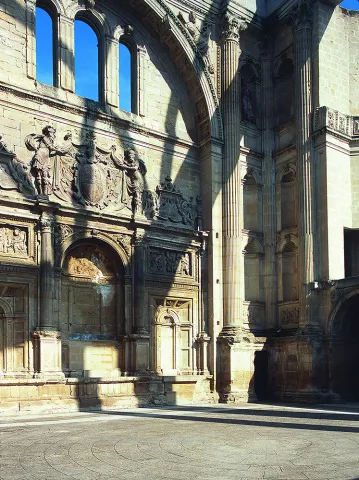
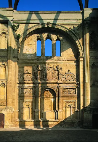
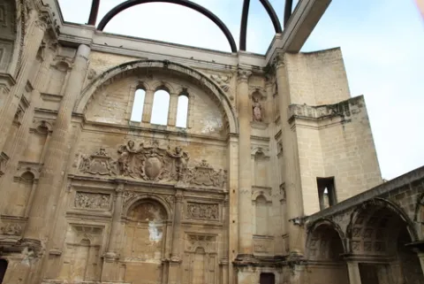
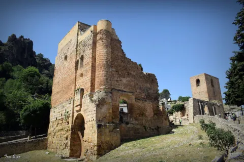
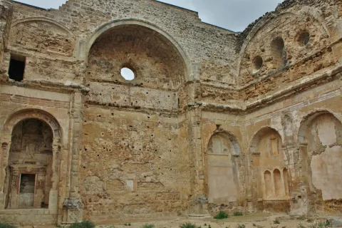
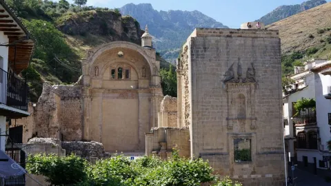
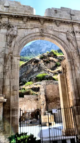
This temple, located in a unique natural setting, suffered a catastrophic raid at the end of the 17th century, taking with it almost all its movable property. The fire by the Napoleonic troops in the War of Independence left the factory ruined, remaining standing the header, part of the perimeter walls, one of the two foot towers, with various remains, and a cover on the side of the Epistle. The destruction and the limited documentation found so far about its constructive process makes it difficult to set the stages and the teachers responsible for its factory. In any case, the difference in style between the header and the rest seems clear. Andrés de Vandelvira is present in the head and chapel of San Isicio, leaving out of his language the part of the feet and the side cover, which, according to José María Crespo, was able to run to a large extent by Alonso Barba.

The canyon vault of the presbyterium, the serlian vanity of the tester, the angular pillars that would form the cruise, with half Corinthian columns and fantastic heads, and the snail staircase topped into a cylindrical body are certainly elements used by Vandelvira around the 1540's. The vault of the chapel of San Isicio, for its part, is closely related to the one located under the tower-bell tower of El Salvador de Ubeda. The plant, made up of a ship and cruise to cover (at least in the initial project) with boned vaults, would approach the type of La Guardia, a conventual church in which Vandelvira also left the best of its art in the major chapel and cruise.

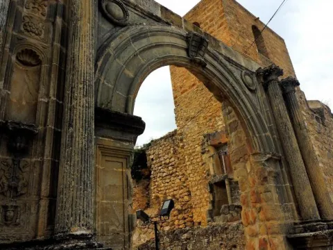
The ruins of Santa María, currently in the process of restoration in accordance with the project of the architect Mr Pedro Salmerón, still show today the proud architecture with which it was conceived by one of the most influential men of the 16th century in Spain, Don Francisco de los Cobos, who was also lucky to have at his service Andrés de Vandelvira, one of the most outstanding singers of the Spanish Renaissance.

Breve descripción

Monument of the Historical-Artistic Set. Declared 13 / 07 / 1972. The advance of Cazorla remained under the jurisdiction of the Archbishop of Toledo from the 13th to the 16th century. The large territory provided important benefits and the position of Advantado gave prestige to the one who held them. Both reasons must have weighed enough for Don Francisco de los Cobos, the prepowerful secretary of the Emperor Charles V, to come up with all the means at his disposal to obtain the rule and charge of such wide-ranging dominion for himself and his descendants.

Telecomunicaciones
Sitio web
www.cazorla.es/turismo/ruinas-de-santa-maria/
Teléfono de contacto
953 710 102
Ubicación
Código Postal
23470
Latitud
37.908550
Longitud
-2.999930
Dirección
C/ Hoz, 6
Municipio
Ubicación en el mapa
POINT (-2.99993 37.90855)
Tipos de punto de interés
Imágenes carrusel
imagen
Imagen
2%20%282%29.jpg
Imagen principal
Desactivado
imagen
Imagen
3%20%282%29.jpg
Imagen principal
Desactivado
imagen
Imagen
Mon165.jpg
Imagen principal
Desactivado
imagen
Imagen
Mon244.jpg
Imagen principal
Desactivado
Imágenes cabecera
imagen
Imagen
iglesia-santa-maria-de-cazorla-830x623.jpg
Imagen principal
Activado
Microsite al que pertenece
Loading map
Preparing points of interest and routes...

Castillejo Ruins

Submitted by brandcode_deweloper on
Id
4405889
Descripción
Breve descripción

The Castlejo de Cárchel is of Muslim origin and in the surrounding areas there have been many fragments of Spanish-Muslim ceramic glazed and unglazed, and among all the archaeological remains found in the area, stands the head of a clay figure, found in 1997 by the child José M. Ruiz. It is possibly a survival of Iberian exvotes in Muslim times.

Telecomunicaciones
Sitio web
www.carcheles.es/el-municipio/patrimonio-historico.html
Teléfono de contacto
953 302 291 / 953 302 003
Correo electrónico
Webmaster@carcheles.es
Ubicación
Código Postal
23192
Latitud
37.634510
Longitud
-3.640960
Distrito
Municipio
Ubicación en el mapa
POINT (-3.64096 37.63451)
Tipos de punto de interés
Imágenes carrusel
imagen
Imagen
270px-Castillo_de_C%C3%A1rchel_24J_14.jpg
Imagen principal
Desactivado
imagen
Imagen
castillejo.jpg
Imagen principal
Desactivado
Imágenes cabecera
imagen
Imagen
castillejlo.jpg
Imagen principal
Activado
Microsite al que pertenece
Loading map
Preparing points of interest and routes...