Saltar al contenido principal
icon-intereses-gastronomia

Trail Fundición de la Tortilla

Submitted by brandcode_deweloper on
Id
2150089
Descripción larga

After passing through an alpechenera and under an old bridge of the mining railway the path ascends along the stony coast of San Pedro to the Cañada de Incosa; from which we continue, to the right, a stretch that presents, to the west, magnificent views of the population of Baños de la Encina.

Walking this path is moving in memory to a period in the history of Linares.

After 1.4 Km we connect with the road and by a wooden step we take the Green Way until we reach a crossing (connection to the path of the Gitana Mine PR-A 264), then we pass through the solid waste treatment plant and continue on the old steep path of Siles that will lead us back to Linares.

Breve descripción

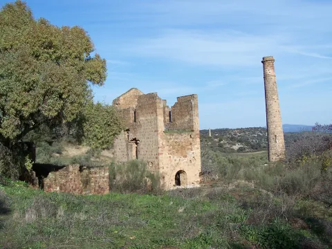
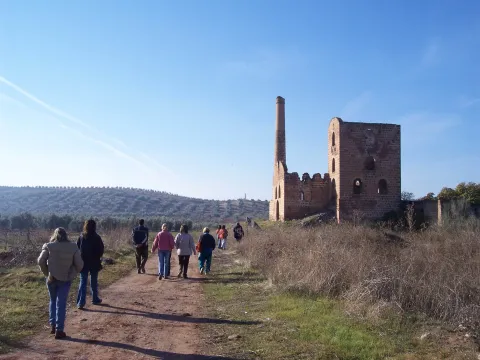
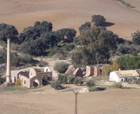
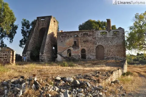
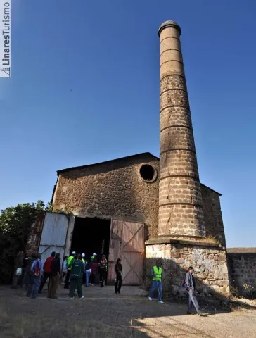
To walk this path is to move in memory to a period in the history of Linares: its mining industry which, during the 19th and mid-20th centuries, meant the way of life for many Linarians and whose heritage is scattered throughout its term. Mines, wells and smelters, today abandoned, where you can still see the melted granite constructions, the high chimneys of the smelters and the old "Cabrias" for the extraction of the material. A path that runs along the road of the Tortilla, very passed by the Linarians and that has no loss. 2 km. is found the Foundry of the Tortilla, a crossroads of roads and numerous buildings in ruins denote its importance in the mining past of Linares.
Latitud
38.0956
Longitud
-3.6369
Distrito
Municipio
Ubicación en el mapa
POINT (-3.6369 38.0956)
imagen
Image
20111022-118.jpg
Imagen principal
Activado
imagen
Image
Sendero%20Fundici%C3%B3n%20de%20la%20Tortilla.jpeg
Imagen principal
Desactivado

Friends

icon-intereses-amigos

Adventure

icon-intereses-aventura

Culture

icon-intereses-cultura

Sport

icon-intereses-deporte

Eco-friendly

icon-intereses-eco-friendly

For couples

icon-intereses-en-pareja

Family

icon-intereses-familia

Gastronomy

icon-intereses-gastronomia

Municipality

icon-intereses-municipio

Nature

icon-intereses-naturaleza

Low-cost tourism

icon-intereses-turismo-low-cost

Solo travel

icon-intereses-viajar-solo
Sendero Fundición de la Tortilla
On foot
All year round
Activado
Tramo de asfalto o cemento
 
Tramo de pista o camino forestal
 
Tramo de vía pecuaria
 
Tramo de senda
 

Trail del cerro de las Mancebas

Submitted by brandcode_deweloper on
Id
2149963
Descripción larga

The itinerary turns left and gently descends between chaps, next to air-navigation antennas, enjoying beautiful panoramic views. It concludes the fall at a crossroads between the Cerro de las Manciebas and Pico, near the Dark Porvenir well. We continue on the right to reach the hill, connecting with the path of the Garza, PR-A 262. Let us go on a path that will make us drunk by its beauty and by the history of its mining remains: the Pozo Zulueta, the Pozo de San Ignacio and the Lavadero de Mineral de Arrayanes, as well as views of the valley of the lagoons.

In the Lavadero de Arrayanes (construction on the hillside to take advantage of a gravity circuit that separated the mineral, through several phases) we moved away from the path of La Garza to continue a ramp to reach the well of San José and the Central Electric, where the route coincides again with the path of Pico to the well restoration, in which they are separated following the Green Way.

About 100 meters from this point the Via Verde is bifurca (1); on the left you reach the La Cruz Fundition road, which we follow 20 meters to take a lane to the left, next to a ruins, which leads to an aerodrome. We find two branches outside the path, both on the left, interesting if time is available, the first leads to the well Chaves and the second to the High Alamillo Mine with the possibility of enjoying an unbeatable view. Later there is the urbanization of La Cruz, where we will reach the beginning of this mining route.

(1) This bifurcation on the Green Way on the right is a shortcut to the La Cruz Fundition when little time is available to make the route marked

Breve descripción

The path begins at La Fundado La Cruz (see the path of Pico, PR-A 260). We are heading for the well-known Cadenas, which is reached after passing by an old Civil Guard headquarters and through the Vimora mineral wash. After the La Cruz fireplace, which was 100 meters high (today it is 57 m), the trails are separated.

Latitud
37.7903
Longitud
-3.5104
Distrito
Municipio
Ubicación en el mapa
POINT (-3.5104 37.7903)
imagen
Image
100_5789.jpg
Imagen principal
Activado

Nature

icon-intereses-naturaleza

Friends

icon-intereses-amigos

Adventure

icon-intereses-aventura

Culture

icon-intereses-cultura

Sport

icon-intereses-deporte

Eco-friendly

icon-intereses-eco-friendly

For couples

icon-intereses-en-pareja

Family

icon-intereses-familia

Gastronomy

icon-intereses-gastronomia

Municipality

icon-intereses-municipio

Low-cost tourism

icon-intereses-turismo-low-cost

Solo travel

icon-intereses-viajar-solo
Sendero del cerro de las Mancebas
On foot
All year round
Activado

Trail del Paño Pico

Submitted by brandcode_deweloper on
Id
2149913
Descripción larga

In the well restoration, open between 1844 and 1850, the building that housed the garage and locomotives workshop of the mining railway stands out. In the well of San José, next to the road, you can still see the place called "Bajada de la Reina," made for a visit by Elizabeth II to the first gallery.

We pass by the well Cadenas and later through the Vimora Lavadero, example of natural regeneration of the vegetation of the area...

The path continues to Paño Pico (geodetic vertex) and the Mina de La Mexicana, don enclaves from where it is possible to enjoy an unbeatable panorama of the area: far away La Carolina and Baños de la Encina, closer to the Hoyo de San Bartolomé, Cerro de las Manciebas, etc. From Mexico an ancient road between oak trees, interrupted by an olive grove, leads to the Fireplace de la Cruz, one of the highest in the area that reached a height of 100 m (today it is 57 m), and where the path reshares route with the PR-A 261. We passed by the Pozo Cadenas and later on through the Vimora Lavadero, an example of natural regeneration of the vegetation of the area, to go around the urbanization until the end of the La Cruz Foundry, where all types of lead products were made, and that will be the seat of the future Interpretation Centre.

Breve descripción

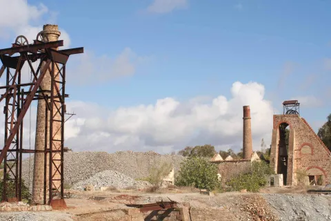
This practically flat-profile Path, born in the Barrio de Arrayanes and follows one of the most important roads that the Minas de Arrayanes communicated with Linares. The itinerary after passing the Pozo Acosta, where the house of extraction machines, fireplace and auxiliary buildings are still preserved, crosses on two occasions the tracks of the old mining tram, today dismantled: one, at its pass through the Pozo Restoration, and another, before reaching the Pozo San José and the Central Electric. The stretch between the two wells is consistent with the path PR-A 261 "Cerro de las Manciebas" which allows us to combine the route.

Latitud
37.8001
Longitud
-3.4902
Distrito
Municipio
Ubicación en el mapa
POINT (-3.4902 37.8001)
imagen
Image
MINA_DE_SAN_VICENTE_linares.jpg
Imagen principal
Activado

Nature

icon-intereses-naturaleza

Friends

icon-intereses-amigos

Adventure

icon-intereses-aventura

Culture

icon-intereses-cultura

Sport

icon-intereses-deporte

Eco-friendly

icon-intereses-eco-friendly

For couples

icon-intereses-en-pareja

Family

icon-intereses-familia

Gastronomy

icon-intereses-gastronomia

Municipality

icon-intereses-municipio

Low-cost tourism

icon-intereses-turismo-low-cost

Solo travel

icon-intereses-viajar-solo
Sendero del Paño Pico
On foot
All year round
Activado
Tramo de asfalto o cemento
 
Tramo de pista o camino forestal
 
Tramo de vía pecuaria
 
Tramo de senda
 

Trail de la Mina de Mimbre

Submitted by brandcode_deweloper on
Id
2149819
Descripción larga

This place is known as Christ of the Valley. 20 meters to the left, on the other side of the road is an old house in ruins with rocks piled to its side by tapping and hiding an old road that descends to the well El Calvary, surrounded by vegetation and where it impresses its support of cabria and fireplace. We must continue on a narrow road that leads to the Mina del Mimbre, where we will be particularly careful not to get out of the way by the various sinking of the ground that can be appreciated.

We follow the route without leaving the main track, with a south direction, until we reach a crossing near two large houses in ruins, where we leave the track.

This mine is one of the oldest in the district and had an important production already in the 17th century. Later, it is connected to the Mimbre Coast and the La Garza path, PR-A 262. We will have to overcome this common stretch to a closed curve before the slope is over, where the PR-A 262 is separated to the right and heading to the Arrayanes Mineral Laundry. We follow the route without leaving the main track, with a south direction, until we reach a crossing near two large houses in ruins, where we leave the track to follow the road leading to the well San Vicente, the deepest of the district, where the double masonry goat stands out. The Via Verde, a point very close to the San Luis Fundition, is later crossed. Without changing course we continue on a wide track across the track, which we will not leave at any time until we return to the Hermitage of Linarejos.

Breve descripción

Circular path that begins in the Hermitage of Linarejos and continues along the way of the old railway Linares- Los Salidos that, among olive trees, leads to the San Luis Foundry. After exceeding the Fundition the road is abandoned and to the right you have to take a dirty lane that has as reference, 50? m., a house in ruins with three eucalyptus. After a curve to the left the lane is occupied by an olive grove, but it does not prevent the passage; then you have to follow to the right until you reach the green track that links the La Cruz Foundry with the well 4 and Linares.

Latitud
37.8104
Longitud
-3.4803
Distrito
Municipio
Ubicación en el mapa
POINT (-3.4803 37.8104)
imagen
Image
filxn_La_Tortilla.jpg
Imagen principal
Activado

Family

icon-intereses-familia

Friends

icon-intereses-amigos

Nature

icon-intereses-naturaleza

Adventure

icon-intereses-aventura

Solo travel

icon-intereses-viajar-solo

Culture

icon-intereses-cultura

Gastronomy

icon-intereses-gastronomia

Sport

icon-intereses-deporte

Municipality

icon-intereses-municipio

Low-cost tourism

icon-intereses-turismo-low-cost

Eco-friendly

icon-intereses-eco-friendly

For couples

icon-intereses-en-pareja
Sendero de la Mina de Mimbre
On foot
All year round
Activado

Trail de La Gitana

Submitted by brandcode_deweloper on
Id
2149545
Descripción larga

The well of the Gitana, ideal place of rest where we can be surprised by a spectacular rainbow effect produced in the mouth of the well.

A lane connects right to the path. We follow on the right and about 100 meters away there are ruins, later leading a short and slight descent to the urbanization of San Roque in front of a slender fireplace on the Carretera de Guarroman. On the road and on the left you have to walk about 250 meters to a track between chalets that we take to turn left again. The path gently descends through an area of dehesa to reach the well of the Gypsy, not before opening and closing a wire that as a door prevents the free passage.

The well of the Gitana, ideal place of rest where we can be surprised by a spectacular rainbow effect produced in the mouth of the well. We arrive at the well of Las Animas, there at a table of interpretation the most interesting places in the area are recognized. The crossing is located with the mines of Adaro. Without deviating, during the descent to the left is the Pozo de San Isidro, below a vaguada the road ascends leaving at its pass and to the right the Pozo San Francisco 2nd, and culminates in the Solid Waste Plant, where it continues along the road, which is only to be left after passing the crossing with the Mina de Los Quinientos and taking a path that leaves to the left through the Via Verde next to a ruined shed linking with the Fundado de la Tortilla, PRA 265, which together use the Camino de Siles to reach Linares.

Breve descripción

This Path, in its journey, not only recovers the pecuary path of the Way of Mayecosas at its beginning, but also does so by returning to Linares on the old way of Siles, also called the Way of the Stones. This road has no loss and is marked by some other stone wall. We leave the pecuaria road turning left at the first crossing, a few meters from another crossing with the road of the well of San Adriano, which we can visit if we leave the route. Our tour continues to cross the Green Way and reach a crossing where we turn right on a road next to an electric tower that continues between olive trees.

Latitud
37.8202
Longitud
-3.4601
Distrito
Municipio
Ubicación en el mapa
POINT (-3.4601 37.8202)
imagen
Image
MINA_POZO_DE_LA_GITANA.jpg
Imagen principal
Activado
imagen
Image
20110702-0391.jpg
Imagen principal
Desactivado

Nature

icon-intereses-naturaleza

Friends

icon-intereses-amigos

Adventure

icon-intereses-aventura

Culture

icon-intereses-cultura

Sport

icon-intereses-deporte

Eco-friendly

icon-intereses-eco-friendly

For couples

icon-intereses-en-pareja

Family

icon-intereses-familia

Gastronomy

icon-intereses-gastronomia

Municipality

icon-intereses-municipio

Low-cost tourism

icon-intereses-turismo-low-cost

Solo travel

icon-intereses-viajar-solo
Sendero de La Gitana
On foot
All year round
Activado
Tramo de asfalto o cemento
 
Tramo de pista o camino forestal
 
Tramo de vía pecuaria
 
Tramo de senda
 

Route de los olivos centenarios

Submitted by brandcode_deweloper on
Id
1935699
Descripción larga

By oral tradition it is known that the olive trees located in theMotril plainhaveover 500 years. This enclave is located just over 1 km from the city centre, at the foot of the Martos road to Santiago de Calatrava. It occupies an extension of 84 ha, with 5,394 trees in total, some of them, true living sculptures. It is a fully productive olive tree, with an average production of 150 kg per tree.

Breve descripción

The olive treeMartosIt's traditional. More than 60% of plants are ageover 200 years. Among this olive forest, located in the world's first olive oil producing municipality, are the so-called Centennial Olives.

Latitud
37.722251
Longitud
-3.970322
Distrito
Municipio
Ubicación en el mapa
POINT (-3.970322 37.722251)
imagen
Image
shutterstock_113528608.jpg
Imagen principal
Activado
imagen
Image
Ruta%20de%20los%20olivos%20centenarios2.jpg
Imagen principal
Desactivado

Family

icon-intereses-familia

Friends

icon-intereses-amigos

Nature

icon-intereses-naturaleza

Adventure

icon-intereses-aventura

Solo travel

icon-intereses-viajar-solo

Culture

icon-intereses-cultura

Gastronomy

icon-intereses-gastronomia

Sport

icon-intereses-deporte

Municipality

icon-intereses-municipio

Low-cost tourism

icon-intereses-turismo-low-cost

Eco-friendly

icon-intereses-eco-friendly

For couples

icon-intereses-en-pareja
Ruta de los olivos centenarios
All year round
Desactivado
Coordenadas / Huso 30S
30S x = 414487 and = 4175442

Valdeinfierno

Submitted by brandcode_deweloper on
Id
1909543
Descripción larga

Best time:From autumn to spring

Where to drink. -In the village.

How to get there. -From Andújar take the road to the Sanctuary of the Virgin of the Head. Between kilometer 15 and 17 we will see the area of walls and blocks on our right. Parking by the road. The scalable walls and blocks are evident.

Breve descripción

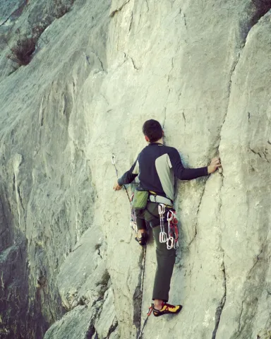
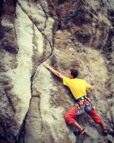
Landing school hard to locate. Explosive climb over granite. Reliable security equipment. The average height is 8 meters. The maximum height is 15 meters.

Latitud
38.368688
Longitud
-4.125104
Distrito
Municipio
Ubicación en el mapa
POINT (-4.125104 38.368688)
imagen
Image
shutterstock_532809607.jpg
Imagen principal
Activado
imagen
Image
shutterstock_1048500664.jpg
Imagen principal
Desactivado
imagen
Image
shutterstock_527300206.jpg
Imagen principal
Desactivado

Friends

icon-intereses-amigos

Nature

icon-intereses-naturaleza

Adventure

icon-intereses-aventura

Solo travel

icon-intereses-viajar-solo

Gastronomy

icon-intereses-gastronomia

Sport

icon-intereses-deporte

Municipality

icon-intereses-municipio

For couples

icon-intereses-en-pareja
Valdeinfierno
Spring and autumn
Desactivado

Number of routes:50

You're up to V:10%

Votes from V + to 6c +:55%

Vies from 7a to 7c +:35%

Eight-way:0%

Coordenadas / Huso 30S
30S x = 401714 and = 4247322
Tramo de asfalto o cemento
 
Tramo de pista o camino forestal
 
Tramo de vía pecuaria
 
Tramo de senda
 

Tajos del Canjorro

Submitted by brandcode_deweloper on
Id
1909505
Breve descripción

A very suitable place for the scale. Good rock (limestone) with a variety of styles and tracks, some very technical. You could say it's one of Jaén's best schools. Very recommended in winter. The average height is 20 meters, although maximum heights of 55 meters are reached. Verticality and sports climbing define this school. Insurance equipment is reliable.

Latitud
37.745447
Longitud
-3.791118
Distrito
Municipio
Ubicación en el mapa
POINT (-3.791118 37.745447)

Friends

icon-intereses-amigos

Nature

icon-intereses-naturaleza

Adventure

icon-intereses-aventura

Solo travel

icon-intereses-viajar-solo

Gastronomy

icon-intereses-gastronomia

Sport

icon-intereses-deporte

Municipality

icon-intereses-municipio

For couples

icon-intereses-en-pareja
Tajos del Canjorro
Desactivado
Coordenadas / Huso 30S
30S x = 430302 and = 4177867

Tajos de las Alcandoras

Submitted by brandcode_deweloper on
Id
1909469
Descripción larga

Best time:From autumn to spring

Where to drink. -On the meringers on the access road.

Information and books. -Revista Desnivel No. 93

Notes and warnings. -Do not obstruct the passage when parking.

How to get there. -From the recreational area of Otiñar, take the track and then the road that leads us to the area.

Breve descripción

It has excellent routes, both artificial and free. It's a huge cliff over the stream. Still, among the places of classics of Andalusia would occupy a place on the podium. The limestone tapes are very vertical, and given their large length they require much continuity. They're resistance pathways. The average height is 150 meters. The maximum height is 220 meters. The scale is very technical and most insurance and meetings have to be installed with emitters or similar.

Latitud
37.656911
Longitud
-3.716362
Distrito
Municipio
Ubicación en el mapa
POINT (-3.716362 37.656911)
imagen
Image
IMG_1222.JPG
Imagen principal
Activado
imagen
Image
3.JPG
Imagen principal
Desactivado
imagen
Image
1-guia-montana-escalada-deportiva-clasica-1024x768.jpg
Imagen principal
Desactivado

Friends

icon-intereses-amigos

Nature

icon-intereses-naturaleza

Adventure

icon-intereses-aventura

Solo travel

icon-intereses-viajar-solo

Gastronomy

icon-intereses-gastronomia

Sport

icon-intereses-deporte

Municipality

icon-intereses-municipio

For couples

icon-intereses-en-pareja
Tajos de las Alcandoras
Spring and autumn
Desactivado

Number of routes:45

You're up to V:30%

Votes from V + to 6c +:60%

Vies from 7a to 7c +:10%

Eight-way:0%

Coordenadas / Huso 30S
30S x = 436813 and = 4167991
Tramo de asfalto o cemento
 
Tramo de pista o camino forestal
 
Tramo de vía pecuaria
 
Tramo de senda
 

Salto de la Cabra

Submitted by brandcode_deweloper on
Id
1909427
Descripción larga

The road, very busy in holidays and weekends, is the foot of the road. The climbing is very technical in sections, with steps taken out. The tracks are equipped for sports climbing. The average height is 25 meters. The maximum height is 60 meters.

Breve descripción

It is a limestone wall with plenty of roofs and beatings that have very comfortable access. The insurer is located on the road, so special caution will have to be taken.

Latitud
37.780088
Longitud
-3.814369
Distrito
Municipio
Ubicación en el mapa
POINT (-3.814369 37.780088)

Friends

icon-intereses-amigos

Nature

icon-intereses-naturaleza

Adventure

icon-intereses-aventura

Solo travel

icon-intereses-viajar-solo

Gastronomy

icon-intereses-gastronomia

Sport

icon-intereses-deporte

Municipality

icon-intereses-municipio

For couples

icon-intereses-en-pareja
Salto de la Cabra
Desactivado
Coordenadas / Huso 30S
30S x = 428287 and = 4181728