Saltar al contenido principal
icon-intereses-gastronomia

Ascensiones a la Peña de Jaén and Tajos de la Mella

Submitted by brandcode_deweloper on
Id
2611103
Descripción larga

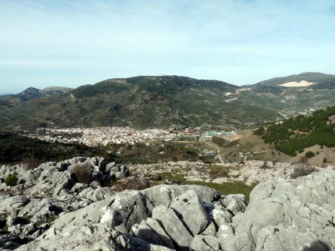
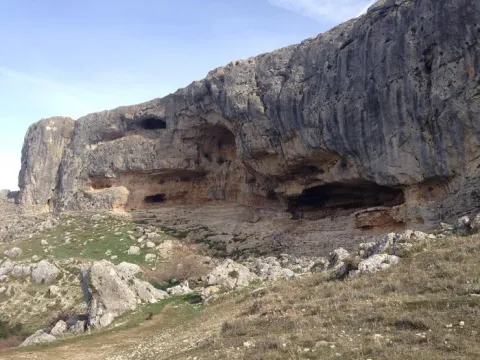
If we decide to ascend to the Peña de Jaén, to our left, we will take a path of goats that leads us to the ridge on the southern slope and that is quickly lost between the steep and sharp limestone skulls that make up the entire high area of this mountain. We will have to continue through this rocky terrain, trying to get close to the crest line and looking for the most appropriate steps, so the ascension is quite difficult. After 30 minutes we will be in one of the "peinets," as the mountaineers call these summits, on impressive cuts that fall lead to the North. Few cities count in their surroundings
immediate with a look as majestic as the one that offers us this emblematic rock.

The descent we can do on the opposite side by letting us fall down to the hill that forms the two combs and catch a sidewalk that descends at first with quite a slope between the slices, on a seemingly inaccessible terrain, and then turns left, bordering the mountain below the cliffs. It will lead us to the roof of the abrevadero.

If we decide to ascend to the Tajos de la Mella and "crest them" we will have to take from the same hill a sidewalk that goes up to the right and that, through a small climb, allows us to place ourselves in the ridge line. The path is broken down and will have to continue, as in the case of the Peña de Jaén, very carefully, above the rocks, trying not to distance us from the ridge, but paying attention to the cliff, as we walk above slices of up to 70 and 80 meters. It is worth it, however, for the views that we will enjoy all the way. We will continue to the highest part (1245 m) and once the mountain has finished to come down on the West side to find an accessible step. We will go out near a stone shelter and from there we will take the road that descends us to the city.

From the roof we can also go through the lower sides, following some of the animal paths that go up parallel to them. This option presents less difficulty and may be interesting for those who go for climbing routes. Throughout more than 1 km of rock walls we will find a lot of them. It is a true paradise for climbers just a few minutes from the city.

Breve descripción

To ascend to the Peña de Jaén, without a doubt the most spectacular peak of these saws, it is best to do so on the northern side.

Latitud
37.7796
Longitud
-3.7849
Distrito
Municipio
Ubicación en el mapa
POINT (-3.7849 37.7796)
imagen
Image
9281686.jpg
Imagen principal
Activado
imagen
Image
Ascensiones%20a%20la%20Pe%C3%B1a%20de%20Ja%C3%A9n%20y%20Tajos%20de%20la%20Mella.jpg
Imagen principal
Desactivado

Nature

icon-intereses-naturaleza

Friends

icon-intereses-amigos

Adventure

icon-intereses-aventura

Culture

icon-intereses-cultura

Sport

icon-intereses-deporte

Eco-friendly

icon-intereses-eco-friendly

For couples

icon-intereses-en-pareja

Family

icon-intereses-familia

Gastronomy

icon-intereses-gastronomia

Municipality

icon-intereses-municipio

Low-cost tourism

icon-intereses-turismo-low-cost

Solo travel

icon-intereses-viajar-solo
Ascensiones a la Peña de Jaén y Tajos de la Mella
Desactivado

Approximate distance: 5.5 Km
Difficulty: Low to the hill and medium-high along the ridge.
Estimated time: 2 hours

Tramo de asfalto o cemento
 
Tramo de pista o camino forestal
 
Tramo de vía pecuaria
 
Tramo de senda
 

Trail de La Garza

Submitted by brandcode_deweloper on
Id
2603115
Descripción larga

Back to the main path we are heading towards the hill that form El Cerro de las Manciebas and el Cerro Paño Pico for a cross-sectional tour that offers a magnificent panorama of this place surrounded by mining remains where its slender chimneys stand out. At the crossing of the hill we connect with the trail Cerro de las Manciebas, PR-A 261, which ascend to the left together, so that we can enjoy the views and the aroma of the valley and breathe the history by passing by the Pozo Zulueta, Pozo San Ignacio and the Abradero de Mineral de Arrayanes, end of the common stretch. To the Lavadero is reached by descending to the left, at a crossing, by an eroded road, from where an old line dismantled from the mining railway connects it with the Cuesta del Mimbre, turned into a wide track very crossed by the trucks of the quarry. This place in turn converges in a short section common to the PR-A 263 that links Linares, from the Hermitage of Linarejos, with the Mina del Mimbre.

Flying down the track to the same valley the path returns without difficulty to the "La Garza" Sports Complex.

Breve descripción

Starting from the "La Garza" Sports Complex located north of the municipality of Linares, following the lane in the direction of Guarroman, we are entering the fertile valley of the Lagunas, where every passing day more greenhouses appear. Before the first houses we will have the option to take a derivation to visit the Mina de San Andrés (3.2 Km away and back) towards the Embalse La Fernandina, an area with abundant vegetation.

Latitud
37.6104
Longitud
-3.8102
Distrito
Municipio
Ubicación en el mapa
POINT (-3.8102 37.6104)
imagen
Image
20110501-101%20%281%29.jpg
Imagen principal
Activado
imagen
Image
P1180095.jpg
Imagen principal
Desactivado
imagen
Image
image_173103.jpeg
Imagen principal
Desactivado

Nature

icon-intereses-naturaleza

Friends

icon-intereses-amigos

Adventure

icon-intereses-aventura

Culture

icon-intereses-cultura

Sport

icon-intereses-deporte

Eco-friendly

icon-intereses-eco-friendly

For couples

icon-intereses-en-pareja

Family

icon-intereses-familia

Gastronomy

icon-intereses-gastronomia

Municipality

icon-intereses-municipio

Low-cost tourism

icon-intereses-turismo-low-cost

Solo travel

icon-intereses-viajar-solo
Baja
Sendero de La Garza
On foot
All year round
Activado

Cerro Media Luna

Submitted by brandcode_deweloper on
Id
2599231
Descripción larga

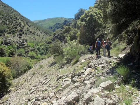
The first steps pass through the rail of Fries, but must be left immediately, at the first crossing: on the left hand side another lane goes back the lone ravine of the Arroyo del Vadillo. The rise, though long, 1 hour 25 minutes of march, does not offer difficulties for the walkers. The proud rocky scarves of the Solana del Morón will accompany during the first repulses.

A number of curves reach a farmer's cortijo. The road passes immediately to the right bank of the ravine, usually without water. The landscape changes. On the slopes, now of less sharp profile, small-sized chaperones grow and some I complain looking for the freshness of the umbria. After another tight zigzag, this longer time, the Navalayegua Collado is crowned at 1,500 meters high. At this point you have to leave the main lane, and go through an ancient era to take the road around the hill and die a little later.

A narrow path that goes up parallel to the wire is born next to the barren. This is the most uncomfortable part of the excursion, as thorny bushes sometimes make progress difficult. As you gain height, the tree vegetation disappears. On the top of the hill, the route is turning to the right, with the naked summit of the Cerro de la Media Luna, which is crowned in about 20 minutes. The return takes place on the same path as the one-way.

Breve descripción

The starting point of the excursion is in the upper part of Valdepeñas, near the football field. At the explanade next to the fountain, you can leave the car. The tour will take almost three hours

Latitud
37.6003
Longitud
-3.8301
Distrito
Ubicación en el mapa
POINT (-3.8301 37.6003)
imagen
Image
Vista_del_valle_del_Hilo_de_la_Vida.jpg
Imagen principal
Activado
imagen
Image
turismoActivo3.jpg
Imagen principal
Desactivado

Nature

icon-intereses-naturaleza

Friends

icon-intereses-amigos

Adventure

icon-intereses-aventura

Culture

icon-intereses-cultura

Sport

icon-intereses-deporte

Eco-friendly

icon-intereses-eco-friendly

For couples

icon-intereses-en-pareja

Family

icon-intereses-familia

Gastronomy

icon-intereses-gastronomia

Municipality

icon-intereses-municipio

Low-cost tourism

icon-intereses-turismo-low-cost

Solo travel

icon-intereses-viajar-solo
Cerro Media Luna
Desactivado
Tramo de asfalto o cemento
 
Tramo de pista o camino forestal
 
Tramo de vía pecuaria
 
Tramo de senda
 

Colada de Valdepeñas

Submitted by brandcode_deweloper on
Id
2599201
Descripción larga

Once an altozane is reached, the panorama opens and an era serves as an unconventional lookout. Shortly after and already practically horizontal, the lane draws a recess next to the abrevadero of a semi-noise cortijo.

After the ruins, the pecuary road is diverted by a less obvious road that goes back a small uncamped ravine. When you reach the highest area you have to turn back, now to the left and on the path that borders the olive tree. A short time later, he will be in a lane that will go to a crossing.

The road on the left is fork right away. The left branch will be where it returns and the other one goes down in the direction of the Cortijo de Nogueruelas. After passing through the buildings, it goes back up to a hill where another cortijo is located.

At this point you must cross the access gate to a cherry plantation, and leave two lanes to the left. Shortly before the olive tree starts a path that goes up to the hill, just at the foot of Cerro La Martina and the breakers where the route ends.

To return, it descends on the same path to the first cortijo, for this time to take the lane on the right that runs on half a hillside.

Breve descripción

The excursion leaves Charilla, a village of Alcalá la Real, and lasts about 2 and a half hours. In the Plaza Real you take the Calle de la Fuente that leads to the outskirts of the village, where it becomes a lane of land. After about 5 minutes of march another lane appears to the left. From this point on, the route is always close to the route of a pecuary road, the old Colada de Valdepeñas.

Latitud
37.5939
Longitud
-3.8125
Distrito
Municipio
Ubicación en el mapa
POINT (-3.8125 37.5939)
imagen
Image
4915776Master.jpg
Imagen principal
Activado
imagen
Image
Colada%20de%20Valdepe%C3%B1as.jpg
Imagen principal
Desactivado

Nature

icon-intereses-naturaleza

Friends

icon-intereses-amigos

Adventure

icon-intereses-aventura

Culture

icon-intereses-cultura

Sport

icon-intereses-deporte

Eco-friendly

icon-intereses-eco-friendly

For couples

icon-intereses-en-pareja

Family

icon-intereses-familia

Gastronomy

icon-intereses-gastronomia

Municipality

icon-intereses-municipio

Low-cost tourism

icon-intereses-turismo-low-cost

Solo travel

icon-intereses-viajar-solo
Colada de Valdepeñas
Desactivado

Cortados de La Veleta

Submitted by brandcode_deweloper on
Id
2599161
Descripción larga

Some tractor rounds arise to the right and left and are introduced into the agricultural farms, but the lane offers no doubt. The olive trees cover almost the entire slope and will accompany us along the climb. At 20 minutes' walk, right on a very closed curve, a crossing appears. In this case you will choose the way on the right that goes up with a strong slope. 10 minutes later a less obvious lane will be left.

The road then approaches the rocky pharallions and, shortly before reaching the top, it forges. The left branch reaches the edge of the calcareous wall and in a few minutes, the Cave of the Contadero is now transformed into a small serrano sanctuary.

From this point, the route follows the path that runs along the same edge of the slope. After framing a fence of wires is introduced into the rough flat calcareous area. First the naked and sharp rock makes it difficult to march and then the bushes. Despite these drawbacks, in 35 minutes the edge of the impressive cuts of La Veleta is reached. The improvised lookout is not suitable for those suffering from vertigo. At this point extreme precautions if the route is done with children or dogs. There is a risk of vacuum falls.

Breve descripción

On the road to Valdepeñas de Jaén and next to the Los Knights Restaurant, it starts a lantern of land that is basically in line with the route of an old feral road, the Royal Canyon of the Revoltilla. The first section of the tour runs along this livestock road. Just to start walking, you have to leave the road to an urbanization to the right. At the same time, the panoramic views over Los Villares are being opened.

Latitud
37.6102
Longitud
-3.8404
Distrito
Ubicación en el mapa
POINT (-3.8404 37.6102)
imagen
Image
7330823.jpg
Imagen principal
Activado
imagen
Image
turismoActivo6.jpg
Imagen principal
Desactivado

Nature

icon-intereses-naturaleza

Friends

icon-intereses-amigos

Adventure

icon-intereses-aventura

Culture

icon-intereses-cultura

Sport

icon-intereses-deporte

Eco-friendly

icon-intereses-eco-friendly

For couples

icon-intereses-en-pareja

Family

icon-intereses-familia

Gastronomy

icon-intereses-gastronomia

Municipality

icon-intereses-municipio

Low-cost tourism

icon-intereses-turismo-low-cost

Solo travel

icon-intereses-viajar-solo
Cortados de La Veleta
Desactivado
Tramo de asfalto o cemento
 
Tramo de pista o camino forestal
 
Tramo de vía pecuaria
 
Tramo de senda
 

Source of Tercero

Submitted by brandcode_deweloper on
Id
2599120
Descripción larga

Not far from the road and just in front of the cortijo, it starts on the right a signposted path parallel to the stream, which later must be watered shortly before the wire. Once on the other side, the explanade is crossed in search of a path that penetrates the beautiful throat of the Arroyo de la Fresnedilla.

The ravine gradually narrows and forces several times to change the shore. At the confluence with another stream and after walking about 25 minutes, the ravine opens. At this point you have to move to the right margin to link with a dirt lane. The road now accompanies the rising river bed, on some occasions on the right bank and on others, on the opposite. Unavoidably, you have to go through the channel several times, and if it has a lot of water, you will even have to go down on more than one occasion.

Finally, the lane disappears. The route continues to jump from one bank to another in search of the most comfortable steps to a dam and waterfall, after an hour and ten minutes.

It is taken on the right bank, the sidewalk of the acequia that used to carry the water from the chorreta to the old light factory, in the Barranco de Valdearazo. Place where the route ends.

Breve descripción

To get to the place of departure of the excursion you have to take, at the exit of Fries, the asphalt lane that leads to the cortijos of Los Rosales and Cerezo Gordo. After leaving to the right the zigzagueante lane of Noalejo, reach the Portillo Pinatero and from there descends directly to the Cortijo de La Fresnedilla where the car is left.

Latitud
37.9004
Longitud
-2.9901
Distrito
Municipio
Ubicación en el mapa
POINT (-2.9901 37.9004)
imagen
Image
tercero.jpg
Imagen principal
Activado
imagen
Image
turismoActivo10.jpg
Imagen principal
Desactivado

Nature

icon-intereses-naturaleza

Friends

icon-intereses-amigos

Adventure

icon-intereses-aventura

Culture

icon-intereses-cultura

Sport

icon-intereses-deporte

Eco-friendly

icon-intereses-eco-friendly

For couples

icon-intereses-en-pareja

Family

icon-intereses-familia

Gastronomy

icon-intereses-gastronomia

Municipality

icon-intereses-municipio

Low-cost tourism

icon-intereses-turismo-low-cost

Solo travel

icon-intereses-viajar-solo
Nacimiento del Tercero
Desactivado

Paseo por Las Lagunas

Submitted by brandcode_deweloper on
Id
2597272
Descripción larga

The first meters of the walk are already on the platform of the Via Verde del Eil until its confluence with the autonomous road. The road is passed with great caution - although there is good visibility, cars are moving at high speed - to link with the old railway route. From here, the dilated olive countryside is almost in a straight line.

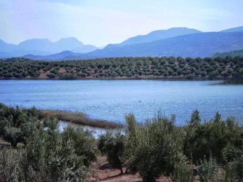
After walking about 25 minutes, you reach the first lagoon, the Nature Reserve of the Honda Lagoon. The water sheet is surrounded by an eneas and carrizos that provide shelter, during the winter, to a multitude of aquatic birds. The best way to appreciate the lagoon and the avifauna is from the same railway platform. Getting close to the water sheet means losing perspective.

The route continues a mile along the road. When he reached a raft, he moved along the lane that went up to the right. A little later it passes by the Cortijo del Chinche, from where the second lagoon, the Natural Reserve of the Laguna del Chinche, is already seen. Although smaller than the previous one, it also houses a large group of anatids. The most suitable point for contemplating it is from the left-hand lane at the next crossing. The latter section is not suitable for users with reduced mobility.

To return to the starting point, we will use the same route. If desired you can extend the walk to the end of the Green Way of Oil and the province of Jaén, near the Embalse de Vado Mojón. There it links with the Via Verde of the Subbetics, already in the province of Córdoba.

Breve descripción

To access the starting point from Alcaudete, you have to take the Cordoba road, and immediately the signposted detour, which leads to the old railway station where you can leave the car. This route connects with the Via Verde del Eil that will take us to the city of Jaén at one end, and to the province of Córdoba at the other. The walk runs through this second option. Except for areas eroded by autumn and spring waters, this route will allow people with reduced mobility to approach the natural environment.

Latitud
38.0302
Longitud
-2.7804
Distrito
Municipio
Ubicación en el mapa
POINT (-2.7804 38.0302)
imagen
Image
laguna.JPG
Imagen principal
Activado
imagen
Image
turismoActivo9%20%281%29.jpg
Imagen principal
Desactivado

Nature

icon-intereses-naturaleza

Friends

icon-intereses-amigos

Adventure

icon-intereses-aventura

Culture

icon-intereses-cultura

Sport

icon-intereses-deporte

Eco-friendly

icon-intereses-eco-friendly

For couples

icon-intereses-en-pareja

Family

icon-intereses-familia

Gastronomy

icon-intereses-gastronomia

Municipality

icon-intereses-municipio

Low-cost tourism

icon-intereses-turismo-low-cost

Solo travel

icon-intereses-viajar-solo
Paseo por Las Lagunas
Winter
Activado
Tramo de asfalto o cemento
 
Tramo de pista o camino forestal
 
Tramo de vía pecuaria
 
Tramo de senda
 

Puerto de La Hoanda

Submitted by brandcode_deweloper on
Id
2597219
Descripción larga

As soon as you have started to climb, the Pancorbo Residence lane is left to the right. The height gained by a few reels, already allows to enjoy the panoramic views above all the Barranco del Río fría, under the coat of the Sierra de La Pandera. In the autumn, when the colors become toasted, the place acquires quite spectacular tones.

At 50 minutes a crossing is reached: we must continue to climb to the right. Later on, a side lane is left, also to the right. Then the slope soften. After a cortijo, the lane ends in a depression, after an hour and a half of marching. At this point it is necessary to turn left, on a narrow signposted path that leads in 15 more minutes to the Port of the Hoya.

On the other side a lush pine covers the slopes. The path that encourages you to discover the forest, starts from the same hill and soon links with a forest track. Later on, it comes into a crossing: to the left, and in ten minutes, you reach the forest house of the Hoya del Caño.

This point presents the alternative of going up to the port of the Navy and linking with the route that descends to the Port of the Coberteras on the side of Valdepeñas de Jaén. In front of the ruins continues a path that first descends to a stream and crosses it. It is soon transformed into a sidewalk that zigzaguea way to the port.

Breve descripción

The rise to the port of the Hoya begins in the area known as Rio fría, very close to the recreation area. The road comes from the same communal road between Los Villares and Valdepeñas de Jaén. The tour connects with the route Barranco de la Hoya-La Pandera, proposed in the section of the trails in the surroundings of Jaén capital of the same website.

Latitud
38.0403
Longitud
-2.6902
Distrito
Municipio
Ubicación en el mapa
POINT (-2.6902 38.0403)
imagen
Image
1e627f6b3e140ee2c637df3580639779_720x560.jpg
Imagen principal
Activado
imagen
Image
Puerto%20de%20La%20Hoya.jpg
Imagen principal
Desactivado

Nature

icon-intereses-naturaleza

Friends

icon-intereses-amigos

Adventure

icon-intereses-aventura

Culture

icon-intereses-cultura

Sport

icon-intereses-deporte

Eco-friendly

icon-intereses-eco-friendly

For couples

icon-intereses-en-pareja

Family

icon-intereses-familia

Gastronomy

icon-intereses-gastronomia

Municipality

icon-intereses-municipio

Low-cost tourism

icon-intereses-turismo-low-cost

Solo travel

icon-intereses-viajar-solo
Puerto de La Hoya
Desactivado

Puerto de la Nava

Submitted by brandcode_deweloper on
Id
2597181
Descripción larga

On the same roof, two lanes are born, the one on the left side ends in a few meters in the New Cortijo. Right behind a waterfront begins the path of the Port of the Navy. The first section of the climb runs under the vertical flannel of the saw of La Pandera, through a rugged forest of sparrows and Mediterranean bushes.

Later on, the trees give way to a pallet and thorny vegetation. The height gained already allows you to enjoy splendid panoramic views over the Quebrajano Embalse and the surrounding mountains. Then the path is transformed into a beautiful steep sidewalk that is twisted by the abrupt and rough hillside. It straps three sticks of wires that limit pastures and municipalities. Finally, the sidewalk reaches an altozane where it ends abruptly after 50 minutes of march.

The aggressiveness of the land is lost in this herbous raid presided by a corpulent oak; it is the ideal point to delight with the panoramic views, now much more dilated.

To complete the route it is possible to approach the same Port of La Nava in about 20 minutes. First, it is necessary to descend to the bottom of a garden, where an abrevadero is located. Then it rises through a forest of pine trees intermingled with some other year old oak, until it finds the highest point of a calvero.

Breve descripción

From Valdepeñas you follow the road towards Jaén. After the gas station and a bridge, a paved lane is set off to the right, which goes up to the port of the Coberteras, the starting point of the excursion.

Latitud
38.0201
Longitud
-2.7103
Distrito
Municipio
Ubicación en el mapa
POINT (-2.7103 38.0201)
imagen
Image
DSC00553.JPG
Imagen principal
Activado
imagen
Image
Puerto%20de%20la%20Nava.jpg
Imagen principal
Desactivado

Nature

icon-intereses-naturaleza

Friends

icon-intereses-amigos

Adventure

icon-intereses-aventura

Culture

icon-intereses-cultura

Sport

icon-intereses-deporte

Eco-friendly

icon-intereses-eco-friendly

For couples

icon-intereses-en-pareja

Family

icon-intereses-familia

Gastronomy

icon-intereses-gastronomia

Municipality

icon-intereses-municipio

Low-cost tourism

icon-intereses-turismo-low-cost

Solo travel

icon-intereses-viajar-solo
Puerto de la Nava
Desactivado
Tramo de asfalto o cemento
 
Tramo de pista o camino forestal
 
Tramo de vía pecuaria
 
Tramo de senda
 

GR-48

Submitted by brandcode_deweloper on
Id
2575177
Descripción larga

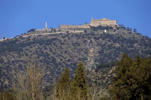
The entire route has been divided into 28 linear stages and one circular alternative route in the province of Seville. All of them can be comfortably completed during a single day of hiking. Each stage begins and ends either in one of the municipalities through which the trail passes or in places where food and overnight accommodation are available, such as the Sanctuary of the Virgen de la Cabeza in the Sierra de Andújar.

In the province of Jaén, the GR 48 is divided into five stages. Some of these are among the longest in the whole of Sierra Morena and, without detracting from the routes through the other three provinces, they are among the most highly appreciated by hikers because of their exceptional beauty.

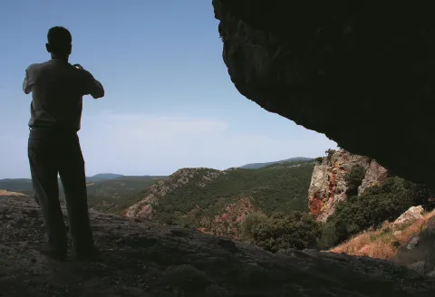
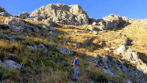
The Jaén section of the GR 48 is characterised by its varied landscapes. Along the route, the typical wooded pastureland of Sierra Morena, where livestock graze, alternates with the steep slopes of the Sierra de Andújar and the foothills of Despeñaperros. Here, gorges, ravines and medium-altitude mountains create an evocative landscape reminiscent of high-mountain regions.

The Sierra Morena trail in Jaén is divided into five stages, taking us from Marmolejo to the centre of Santa Elena. Along the way, the route passes close to important landmarks such as the Sanctuary of the Virgen de la Cabeza, the outstanding historical heritage of Baños de la Encina and the former mining pasturelands around La Carolina. The journey crosses constantly changing landscapes in which Mediterranean woodland blends with more rugged natural surroundings, creating spectacular scenery whose colours vary throughout the year and are at their finest in autumn and spring.

However, this route offers much more than scenery. The absence of major towns in the heart of the mountains has allowed the area to remain exceptionally well preserved, making it relatively easy to observe birds and mammals at almost any point along the GR 48.

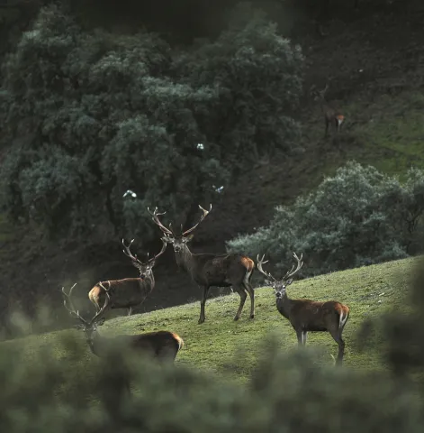
The great biodiversity of this territory provides an opportunity to observe unique species of both fauna and flora. The Sierra de Andújar is one of the last remaining strongholds of the Iberian lynx, as well as being home to other protected species such as the cinereous vulture and the golden eagle. As this area is one of the most important hunting regions in Spain, sightings of large mammals such as red deer, fallow deer and wild boar are very frequent and almost commonplace. Extensive cattle-grazing estates with herds of fighting bulls are another attraction, becoming more common as the trail continues towards the north-east of the province, particularly along the central section between the Sierra de Andújar Natural Park and the Despeñaperros Natural Park.

In addition to the species already mentioned, those interested in herpetology will find a significant amphibian population along the Jaén section of the GR 48. This includes species found exclusively on the Iberian Peninsula, such as the Iberian painted frog, the Iberian newt and the Iberian midwife toad.

The vegetation encountered along the route consists mainly of typical Mediterranean woodland and scrub, dominated by holm oak forests with rockroses, mastic trees and wild olive trees. These are complemented by examples of the conifer plantations established in the mid-20th century, particularly the pine forests around the Sierra de Andújar and near Santa Elena in Despeñaperros. Along the streams and rivers crossed by the GR 48, hikers can also appreciate riverside woodland, such as that found along Los Santos Stream during the first stage, the Jándula River during the second and the Campana River during the final stage.

When walking the GR 48, it should be remembered that the stages cover long distances and are best completed over full days. Food and supplies are available at the beginning and end of each stage. Nevertheless, particularly on the longer stages, it is advisable to carry plenty of water, as Sierra Morena is typically dry and there are few springs where hikers can quench their thirst. The time of year should also be considered carefully, as summers in Sierra Morena are extremely hot, with very high temperatures during the summer months. Anyone wishing to complete the trail during July or August should therefore plan their schedule carefully and alternate periods of walking with adequate rest.

In addition to the sensory pleasure of walking along this trail, each stage leads to fascinating places that reveal the rich heritage left in the province by different civilisations. Throughout the route, there are numerous reasons to make short detours and explore the past: archaeological sites and prehistoric cave paintings provide a connection with ancient history; the magnificent medieval heritage of Baños de la Encina and the nearby battlefield of the Battle of Las Navas de Tolosa in Santa Elena recall the Middle Ages; while the elegant urban layouts of the New Settlements of Sierra Morena and the surrounding mining remains provide evidence of the province’s more recent history.

Breve descripción

The GR 48 Path of Sierra Morena is the long-distance route that allows you to cross this mountain range from west to east. They are 590 Km of signposted itinerary and conditioning that begin their journey in the Portuguese town of Barrancos, on the border of Andalusia with Portugal, and from there it leads us to a tour of the provinces of Huelva, Sevilla, Córdoba and Jaén, ending in the municipality of Santa Elena, opening the door to the Natural Park of Despeñaparos.

Latitud
38.052907
Longitud
-4.238353
Distrito
Municipio
Ubicación en el mapa
POINT (-4.238353 38.052907)
imagen
Image
image_161430%20%281%29.jpeg
Imagen principal
Activado
imagen
Image
santuario-2-jpg
Imagen principal
Desactivado
imagen
Image
pag33-despenaperros-032-png
Imagen principal
Desactivado
imagen
Image
_mg_5140-jpg
Imagen principal
Desactivado
imagen
Image
_mg_2137-jpg
Imagen principal
Desactivado
imagen
Image
pag21-despenaperros-ciervos-png
Imagen principal
Desactivado

Friends

icon-intereses-amigos

Nature

icon-intereses-naturaleza

Solo travel

icon-intereses-viajar-solo

Gastronomy

icon-intereses-gastronomia

For couples

icon-intereses-en-pareja

Family

icon-intereses-familia

Adventure

icon-intereses-aventura

Culture

icon-intereses-cultura

Sport

icon-intereses-deporte

Municipality

icon-intereses-municipio

Low-cost tourism

icon-intereses-turismo-low-cost

Eco-friendly

icon-intereses-eco-friendly
GR-48
Spring and autumn
Activado
Coordenadas / Huso 30S
30S x = 391352 and = 4212409