Saltar al contenido principal
icon-intereses-deporte

Natural Monument Los Órganos de Despeñaperros

Submitted by brandcode_deweloper on
Id
5867289
Descripción
Descripción larga

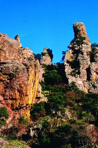
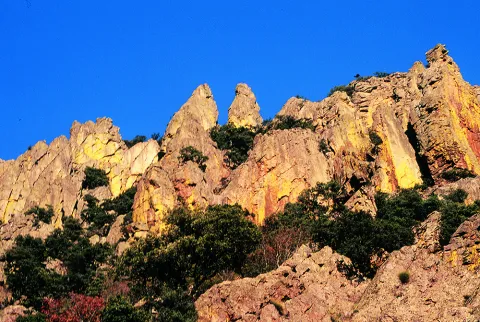
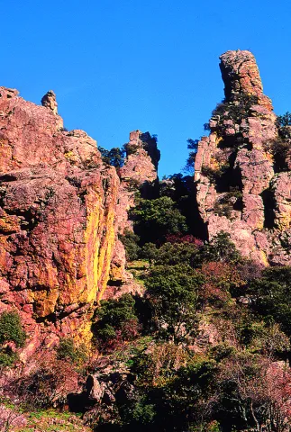
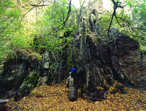
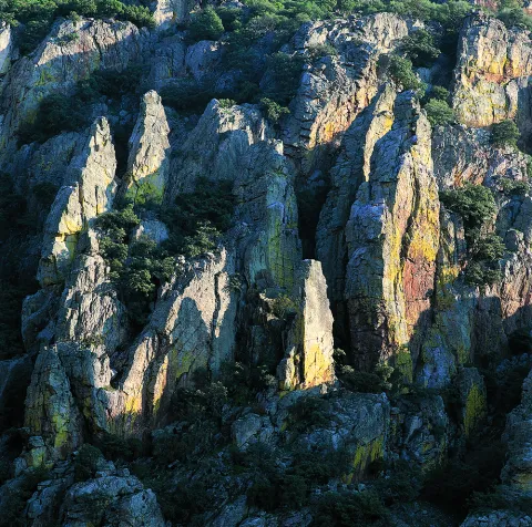
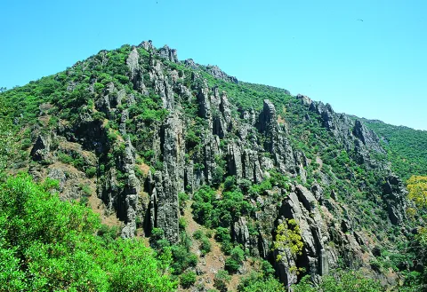
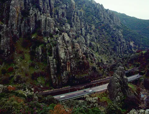
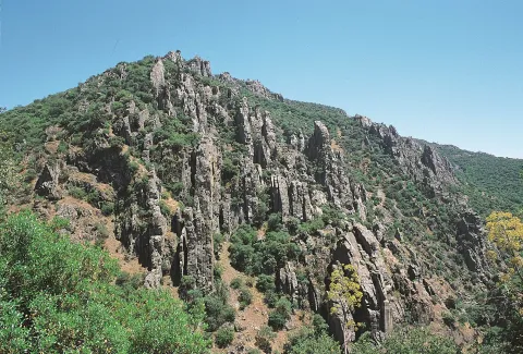
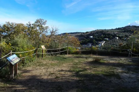
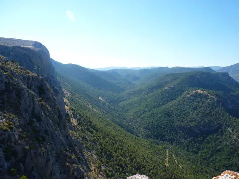
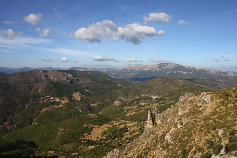
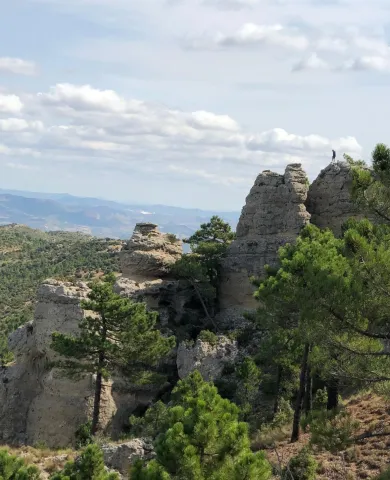
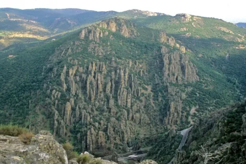
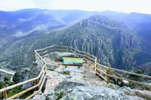
From the nearby viewpoint you can see this monument, whose origin is surprising. 500 million years ago the whole area was covered by the sea, though with little depth, so it was filled with sands and clays brought by the rivers that were flowing there from the Iberian plateau. It was 300 million years ago that the forces of the land made these lands emerge and since then, the erosion of the river, the rains and the wind have been sculpting the relief, creating beautiful forms like these organs. On these rocks, oaks, alcornoques and shrubs have found their substrate, forming a Mediterranean forest in which they inhabit ginets, chickpeas and numerous rapaces.

Breve descripción

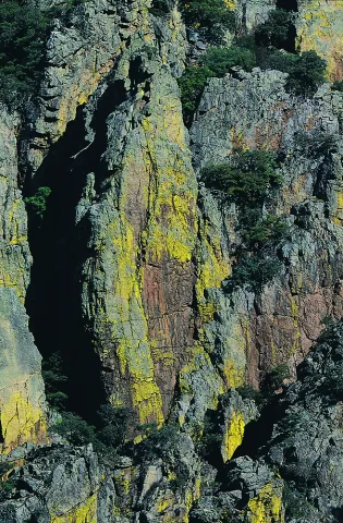
Declared Natural Monument of Andalusia. This Natural Monument is one of the most prominent places in the Despeñacolos Parade, where a set of huge rock columns are raised that resemble the tubes of an organ of a large cathedral. The beauty of this site increases the chromatic contrast of the rock grey with the intense yellow and orange of the different species of lichens that survive here.
Ubicación
Código Postal
23213
Latitud
38.411329
Longitud
-3.559652
Distrito
Municipio
Ubicación en el mapa
POINT (-3.559652 38.411329)
Tipos de punto de interés
Imágenes carrusel
imagen
Image
DESPENAPERROS%20%281%29.jpg
Imagen principal
Desactivado
imagen
Image
1615_MI_01.jpg
Imagen principal
Desactivado
imagen
Image
Natu020.jpg
Imagen principal
Desactivado
imagen
Image
Natu009.jpg
Imagen principal
Desactivado
imagen
Image
Natu066.jpg
Imagen principal
Desactivado
imagen
Image
Natu099.jpg
Imagen principal
Desactivado
imagen
Image
Natu392.jpg
Imagen principal
Desactivado
imagen
Image
Natu368.jpg
Imagen principal
Desactivado
imagen
Image
Natu331.jpg
Imagen principal
Desactivado
imagen
Image
Natu220.jpg
Imagen principal
Desactivado
imagen
Image
Natu160.jpg
Imagen principal
Desactivado
imagen
Image
Natu239.jpg
Imagen principal
Desactivado
Imágenes cabecera
imagen
Image
Parque_Natural_Despexaperros_3%20%281%29.jpg
Imagen principal
Activado
Loading map
Preparing points of interest and routes...

Natural Monument Huellas de Dinosaurio de Santisteban del Puerto

Submitted by brandcode_deweloper on
Id
2193311
Descripción
Descripción larga

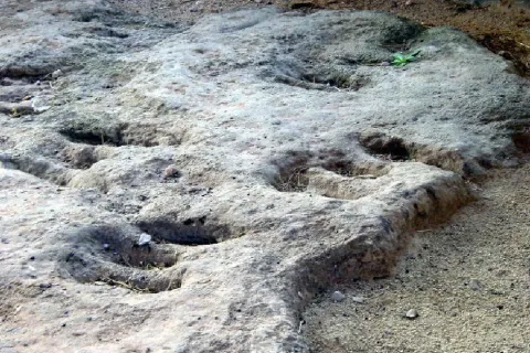
In this paleontological field there are a series of 24 tracks up to nine centimeters deep belonging to the Triassic bipedic dinosaurs. Prints on red clays, possibly belonging to the Arcosauri group, are more than 230 million years old. It is a very enigmatic field, since the almost parallel placement of the fingers and above all the central finger shorter than the two sides, make them, for now, unique in the world.

These tracks, also known as icnites, are not easy to locate, because for their formation there have to be several environmental conditions. Among them, the material on which these animals walked was different from the material on which it was later deposited. Almost certainly, these prints were printed on sediments of a river bed or lagoon to, later, be covered by some other material that allowed it to be preserved until today.

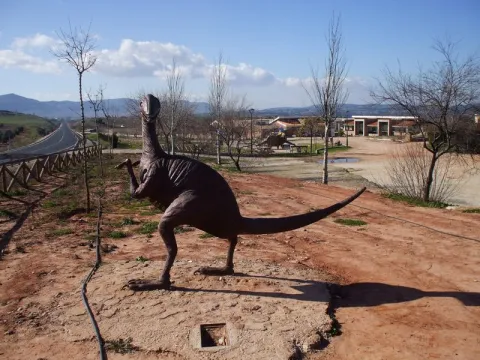
The shape of the prints reveals that these dinosaurs were walking on two legs, with movements similar to those of a kangaroo. You can even know data such as its approximate size and weight, age and social habits. The arrangement of the 24 icnites in the same direction suggests the scene of a group of animals heading to some particular place.

The remains of pollen or vegetation, also fossilized, reveal environmental conditions very different from the present ones, where the vegetation was made up of coniferous, palm and ferns, which were encouraged by a warmer and damp climate than the present.

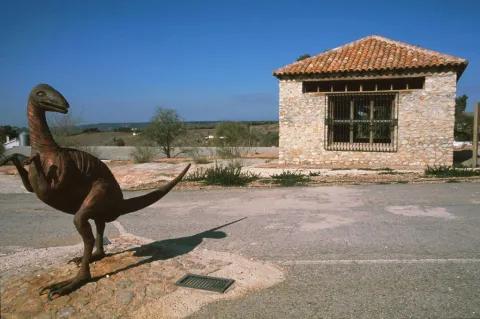
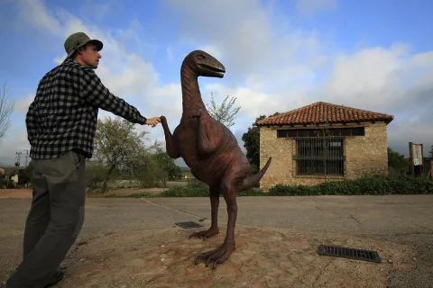
In the place a kind of cabin has been raised that protects them from unnecessary wear. A metal sculpture that reminds the "owner" of the prints has also been placed next to the prints. It should be mentioned that in the vicinity there are also interesting cave paintings, such as the Apolinary Cave dating from the Copper Age; all of them are very similar to those found in the nearby natural spaces of Despeñacolos and La Cimbarra.

More information by phone: 953 368 800

Breve descripción

This Natural Monument of the Dynosaur Footprints of Santisteban del Puerto transports to those who visit him to a very remote past, when man still did not walk on earth. Located one kilometre from the city centre of Santisteban del Puerto, the district of El Condado, it is one of the two icnite sites located in Andalusia.

Ubicación
Latitud
38.248435
Longitud
-3.206190
Dirección
Carretera A-312, km. 51,300
Distrito
Ubicación en el mapa
POINT (-3.20619 38.248435)
Tipos de punto de interés
Imágenes carrusel
imagen
Image
huellas%20de%20dinosaurios1%20%281%29.jpg
Imagen principal
Desactivado
imagen
Image
A7_05_05_D.jpg
Imagen principal
Desactivado
imagen
Image
image_248107%20%281%29.jpeg
Imagen principal
Desactivado
Imágenes cabecera
imagen
Image
Monumentos_naturales_3.jpg
Imagen principal
Activado
Microsite al que pertenece
Loading map
Preparing points of interest and routes...

Natural Monument El Piélago

Submitted by brandcode_deweloper on
Id
2193369
Descripción
Descripción larga

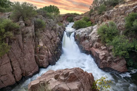
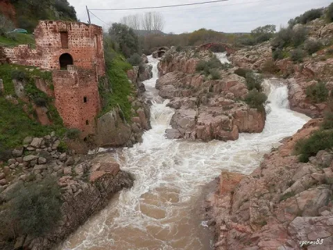
The "Natural Monument the Pat" is located to the north of the municipality of Linares. To get to it you have to follow the A-312 autonomous road towards Arquillos, after the station of Vadollano we find a detour to the left - Vilch- that leads us directly to the site.

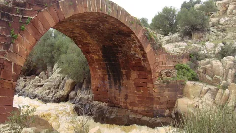
This is an area of special landscape and historical interest, since the beauty of the route of the river Guarrizas is joined by the existence of the Roman bridge of Vadollano, which is part of the route of the Via Augusta.

Just below the Roman bridge, we found the ruins of what was a chocolate factory, which used the driving force of the river water to generate energy.

Breve descripción

Area: 67,149 m ²

A place of special landscape interest whose uniqueness lies in the presence of a riverbank forest, a rich fauna and elements of enormous geological value, as well as the remains of a bridge and a Roman-era road.

Ubicación
Latitud
37.890735
Longitud
-3.565822
Distrito
Municipio
Ubicación en el mapa
POINT (-3.565822 37.890735)
Tipos de punto de interés
Imágenes carrusel
imagen
Image
el-pielago-jpg
Imagen principal
Desactivado
imagen
Image
linares3.jpg
Imagen principal
Desactivado
Imágenes cabecera
imagen
Image
1200px-El_Pi%C3%A9lago.jpg
Imagen principal
Activado
Microsite al que pertenece
Loading map
Preparing points of interest and routes...

Natural Monument El olivo de Fuentebuena

Submitted by brandcode_deweloper on
Id
6726352
Descripción
Descripción larga

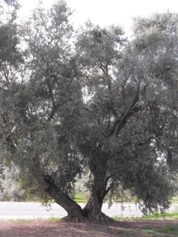
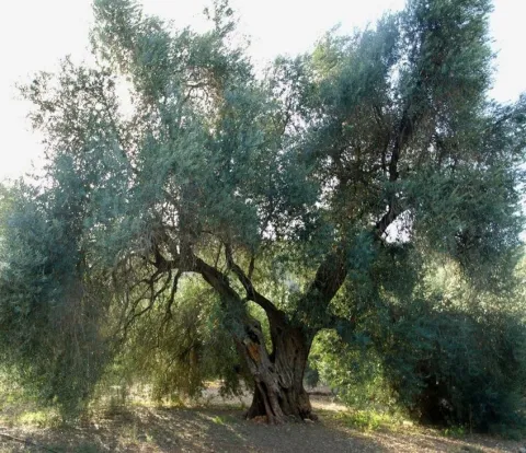
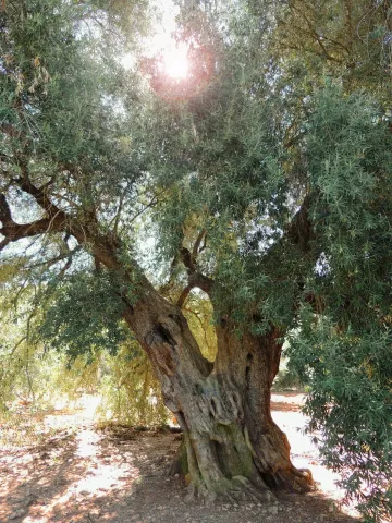
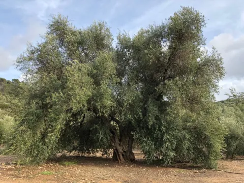
If by anything it is characterized by Jaén it is by its olive trees. There are very old people and there are also large ones (which is not about their age) spread over different municipalities in the provincial geography. The uniqueness of the Arroyo del Ojanco olive tree lies, rather than its age, in its gigantic dimensions, so it has been proposed to be declared a Natural Monument of Andalusia. It is said that it is the largest olive tree in the world, and possibly it is, because the figures that cast its measures, referred to in the tab at the beginning of the article, tell us of a single copy. This should be added to its productive capacity, which is around 600 kg. olive per campaign (an adult irrigated olive tree usually does not reach 70 kg).


The two large branches (2.10 and 2.80 m of perimeter) that are bifurcan from its thick fuse bear all the weight of the cup, which becomes of such magnitude - especially when the fruit develops - which forces its dense foliage to rest on the ground at many ends of the cup. Anyway, everything in this portentous specimen is Guinness record.


So long a centenary history has generated some legendary accounts around this olive tree, as it was planted in the Roman era (which indeed built a magnificent villa a few hundred metres from Fuentebuena) or by friars after the Christian reconquest of these lands. Another version states that its size, so different from that of the olive trees around it, is because it was born from a blessed bouquet on a Palm Sunday.

To access the Fuentebuena olive, you have to go from the urban core of Arroyo del Ojanco to the local road JV-7.005 towards Beas de Segura. As you pass the crossing of Prados de Armijo, the olive tree is about 50 metres from the road.

Breve descripción

The millennial olive tree of Fuentebuena, declared by the Junta de Andalucía Monumento Natural, is one of the symbols of Arroyo del Ojanco. This is a privileged vestige that has resisted so many generations between corns and bandages, between ice of raw winters and summers of extenuating dryness.

Ubicación
Latitud
38.320028
Longitud
-2.905589
Distrito
Municipio
Ubicación en el mapa
POINT (-2.905589 38.320028)
Imágenes carrusel
imagen
Image
olivo.jpg
Imagen principal
Desactivado
imagen
Image
Oliva-de-Fuentebuena.jpg
Imagen principal
Desactivado
imagen
Image
DSCN3042.JPG
Imagen principal
Desactivado
Imágenes cabecera
imagen
Image
Olivo-de-Fuentebuena20180317-01.jpg
Imagen principal
Activado
Microsite al que pertenece
Loading map
Preparing points of interest and routes...

Natural Monument Forest de la Bañizuela

Submitted by brandcode_deweloper on
Id
6498414
Descripción
Descripción larga

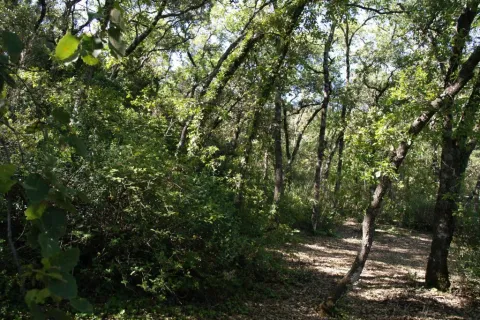
Here we can observe plant species such as the whining, coscoja, peach, yellow jasmine, clematides, madreselva and so to complete a multitude of trees and shrubs among which the Arrayan de La Bañizuela, a unique specimen, stands out. The arrayan or myrtle usually has an arbustive bearing, but the one we find in the Bañizuela Forest stands out precisely for its large size and the thickness of its trunk, more specific to a tree than to a bush. Another element that has made possible the recognition of this space as a natural monument has been the characteristic of its soil: limestones, dolomies and margocalizas belonging to the Jurassic period.

Breve descripción

The area called the Bañizuela Forest, located in Torre del Campo (Jaén) in an old garden of about two hectares of extension, now dominated by a rich Mediterranean forest mass in which we enjoy very old specimens.

Ubicación
Código Postal
23640
Latitud
37.756350
Longitud
-3.897150
Distrito
Municipio
Ubicación en el mapa
POINT (-3.89715 37.75635)
Tipos de punto de interés
Imágenes carrusel
imagen
Image
230_MN_05%20%281%29.jpg
Imagen principal
Desactivado
imagen
Image
1511_MI_02.jpg
Imagen principal
Desactivado
imagen
Image
230_MN_02.jpg
Imagen principal
Desactivado
Imágenes cabecera
imagen
Image
1511_MI_01.jpg
Imagen principal
Activado
Microsite al que pertenece
Loading map
Preparing points of interest and routes...

Monument to Félix Rodríguez de la Fuente

Submitted by brandcode_deweloper on
Id
8108303
Descripción
Descripción larga

Built in 1980

Breve descripción
Source dedicated to the memory of Félix Rodríguez de la Fuente, a lover of nature. It has a tile plate where the honorado and the year of construction are named.
Telecomunicaciones
Teléfono de contacto
953 566 001
Ubicación
Código Postal
23658
Latitud
37.746690
Longitud
-3.906610
Dirección
Camino de la Sierra, 1
Distrito
Municipio
Ubicación en el mapa
POINT (-3.90661 37.74669)
Tipos de punto de interés
Imágenes carrusel
imagen
Image
Monumento%20a%20F%C3%A9lix%20Rodr%C3%ADguez%20de%20la%20Fuente3.jpg
Imagen principal
Desactivado
Imágenes cabecera
imagen
Image
Monumento%20a%20F%C3%A9lix%20Rodr%C3%ADguez%20de%20la%20Fuente.jpg
Imagen principal
Activado
Loading map
Preparing points of interest and routes...

Mount Salfaraf

Submitted by brandcode_deweloper on
Id
5709823
Descripción
Breve descripción

The elevation of Salfaraf is a residual relief of the tectonic unit of the tabular shed of the plateau which, as a witness hill, is independent from the surrounding area, causing a landscape milestone, with a large visual basin.

The topographic contrast with the surrounding terrain and the altitude above 1000 m make it easily identifiable.
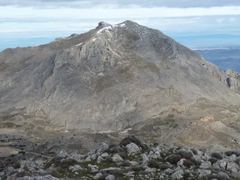
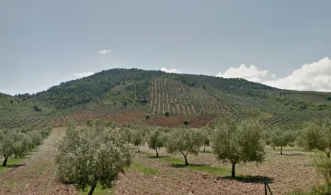
Coronado by shrubs and isolated feet of oak and cashew, it is occupied almost until its summit by olive groves that constitute the main use, also being remarkable the minor hunting. From its peak there are interesting views of other milestones such as the Guadalmena reservoir, the Yelmo or Segura de la Sierra.

Ubicación
Latitud
37.772886
Longitud
-3.788329
Ubicación en el mapa
POINT (-3.788329 37.772886)
Tipos de punto de interés
Imágenes cabecera
imagen
Image
Monte%20Salfaraf.jpg
Imagen principal
Activado
Microsite al que pertenece
Loading map
Preparing points of interest and routes...

Mount La Sierra

Submitted by brandcode_deweloper on
Id
2190681
Descripción
Descripción larga

The mountain is surrounded by two convergent valleys: that of the Quibrajano River (where the Protected Species Recovery Centre is located) and the Hazadillas Canyon, with a recreational fit equipped with grills, tables, banks, recreational furniture, fountains, kiosk, etc., as well as other facilities.

This natural space is used as a place of leisure and leisure by the people of Jaén, given its proximity to the city.

Breve descripción

The Monte la Sierra peri-urban park conforms to the mountain of the same name, of 2,720 hectares and property of the City of Jaén, consonated with the Council of Environment of the Junta de Andalucía, which is located in the municipal term of Jaén.

Ubicación
Latitud
37.653790
Longitud
-3.713720
Distrito
Municipio
Ubicación en el mapa
POINT (-3.71372 37.65379)
Tipos de punto de interés
Imágenes carrusel
imagen
Image
Natu284%20%281%29.jpg
Imagen principal
Desactivado
imagen
Image
Natu248%20%282%29.jpg
Imagen principal
Desactivado
Imágenes cabecera
imagen
Image
Ca%C3%B1ada_Hazadillas01_24J.jpg
Imagen principal
Activado
Microsite al que pertenece
Loading map
Preparing points of interest and routes...

Mount Cuarto de Ardal

Submitted by brandcode_deweloper on
Id
8095030
Descripción
Descripción larga

At 1440 m high is the MONTE ARDAL, which can be accessed by the road that reaches San Bartolomé, to the crossing that is moving to the left. It is a classroom of nature located in a forest shelter, with views of the village, the surrounding mountains,... in addition to the shelter, there is also a recreation area, adapted don barbecues, tables, and covered by a porch.

Breve descripción

Northof the term, there is a mountain, theArdal Room, in which the oaks, together with the retama, predominate, the albar thorn, wild rosals, juniper, ivy and madreselva. An ideal ground for the cicnetic species of major hunting (boar, deer, corzo...), and also of pastures, especially for the cattle of ligia.

Telecomunicaciones
Correo electrónico
ayuntamiento@genave.es
Ubicación
Código Postal
23392
Latitud
38.429970
Longitud
-2.733050
Distrito
Municipio
Ubicación en el mapa
POINT (-2.73305 38.42997)
Imágenes carrusel
imagen
Image
Cuarto%20de%20Ardal%2C2.JPG
Imagen principal
Desactivado
Imágenes cabecera
imagen
Image
Cuarto%20de%20Ardal%2C%20%281%29.jpg
Imagen principal
Activado
Loading map
Preparing points of interest and routes...

Mount Aznaitín

Submitted by brandcode_deweloper on
Id
5693260
Descripción
Descripción larga

In the Aznaitín, some plant endemisms typical of Sierra Magina are maintained. At its summit the municipal terms of Jimena, Torres and Albanchez de Mágina, whose populations are located at their feet, as do the prehistoric caves, where the former inhabitants left their mark for posterity. Not in vain the Aznaitin impregnated the pupil of Antonio Machado from the far Baeza and incorporated him into his poetry.

Breve descripción

The Az-Naitín (Nathin in local dialect) is a mountain located in Sierra Magina, Jaén, Spain. The origin of the toponymy in Arabic would be Isnatin or Asnatin, and it is noted that it can come from its ancient name in ibero as Neitin, which refers to the great iberous god Neton, the god of Thunder and fire, which according to the legend dwells in the mountain. It has a special visual appeal, especially from the East side or from the Guadalquivir valley. It has a considerable altitude, 1745 m, which allows to see much of the province of Jaén.

Ubicación
Latitud
37.841370
Longitud
-3.476880
Distrito
Municipio
Ubicación en el mapa
POINT (-3.47688 37.84137)
Tipos de punto de interés
Imágenes carrusel
imagen
Image
3.jpg
Imagen principal
Desactivado
Imágenes cabecera
imagen
Image
4.jpg
Imagen principal
Activado
Microsite al que pertenece
Loading map
Preparing points of interest and routes...