Saltar al contenido principal

Albergue Las Nogueras Hostel

Submitted by brandcode_deweloper on
Id
2155530
Redes sociales
Facebook
https://www.facebook.com/Las-Nogueras-106590816068963/
Descripción
Breve descripción

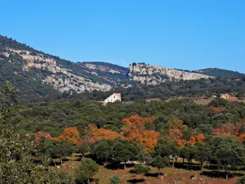
Las Nogueras, is a large-school, multi-adventure center, located on a 40-hectare farm in the natural park of Despeñacolos (Jaén) that has been developing school visits, camps and celebrations since 1992.

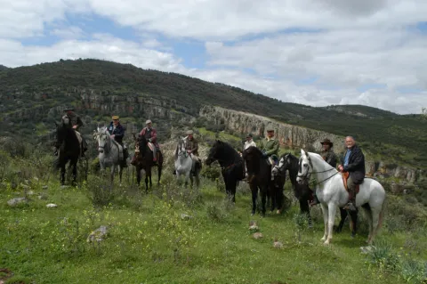
The magnificent facilities of the estate - horses, swimming pools, basketball courts, squash, football fields, rocodrome, archery, tyrolin, lake, pyroguas, canteens and dormitories -, its splendid natural and cultural environment and the wide range of activities that the monitors develop, specifically formed in our facilities, will make your stay an unforgettable sports, natural and cultural experience.

Información de contacto
Teléfono
915 730 565
Sitio web
www.lasnogueras.com
Correo electrónico
info@lasnogueras.com
Ubicación
Código Postal
23213
Latitud
38.367011
Longitud
-3.597238
Dirección
Ctra. de Miranda del Rey, s/n
Distrito
Municipio
Ubicación en el mapa
POINT (-3.597238 38.367011)
Tipo de alojamiento
Imágenes
imagen
Image
las-nogueras.png
Imagen principal
Activado
imagen
Image
albergue_10.jpg
Imagen principal
Desactivado
Aforo
150
Loading map
Preparing points of interest and routes...
El Hotel

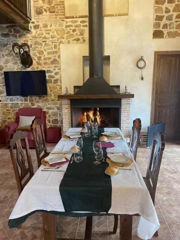
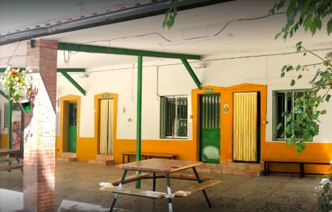
The school of Nature Las Nogueras has an area of 40 hectares and a total capacity of 150 children. It has porches for activities in the event of rain. A splendid kitchen in which our cooks take care to serve the traditional Mediterranean cuisine and dining. 10 individual bathroom apartments (8 children per apartment), 6 rooms (8 to 14 children per room) sharing 6 bathrooms, teacher residence with meeting room and exclusive bathrooms. See flat rooms.

Nursing. Swimming pool, children's kitchen workshop and art workshop, indoor basketball court, football field, archery field, rocodrome, lake with embarkation, rocodrome tirolina, horse stew, blocks, cocheries, corrals, orchard and fruit tree field.

Santa Elena

Submitted by brandcode_deweloper on
Id
750455
Perfil de redes sociales
Facebook
https://www.facebook.com/AyuntSantaElena/
Twitter
https://twitter.com/santaelenajaen
Youtube
https://www.youtube.com/user/santaelenajaen
Descripción
Breve descripción

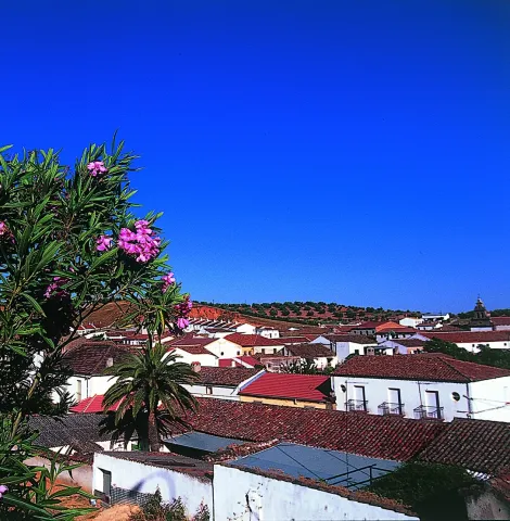
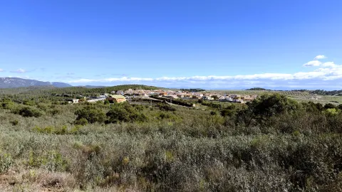
Nice town, located in the northernmost area of the Sierra Morena regionnext to the provincial border with Ciudad Real.

The northern part of its term is found within the Natural Park of Despeñapores and its geographical position makes it the greatest point of passage between Andalusia and the plateau so it receives the nickname "Puerta de Andalucía. "

It is one of the few municipalities with little agricultural interest, only 1% of its term is cultivated land.

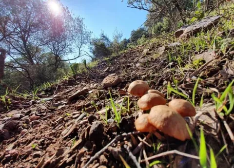
Its economy is based mainly on the exploitation of the mountain, among which the forest, cynegetic, mushroom collection and livestock, usually cattle. The passage of the motorway of Andalusia has developed a relevant hotel offer.

It has two nests: Miranda del Rey and Venta Nueva.

From its historical heritage we highlight the St. Helena Parish Church, Iberian Shrine of the Collado de los Jardines, Urban Helmets and Rupestrian Paints in St. Helena.

Telecomunicaciones
Teléfono
953 664 010
Sitio web
www.santaelena.es
Fax
953 664 253
Correo electrónico
santaelenajaen@gmail.com
Ubicación
Nombre
Santa Elena
Latitud
38.340230
Longitud
-3.539800
Distrito
Municipio
Ubicación en el mapa
POINT (-3.5398 38.34023)
Imágenes
imagen
Image
56f3a98d-b73d-3f55-8527-4d32fc56ae8f?t=1621425534983
Imagen principal
Desactivado
imagen
Image
e0fb7c79-3e7f-346a-cc16-3c8006bb9462?t=1610986998582
Imagen principal
Desactivado
imagen
Image
3429e098-1c49-2cdf-4ef5-179be64fce14?t=1621425535119
Imagen principal
Desactivado
imagen
Image
4e91cd6e-bea0-d427-df82-939c7ce7f23c?t=1621425535162
Imagen principal
Desactivado
imagen
Image
10c50cba-ee4b-ebcf-0e3e-0d11e8e97728?t=1621425535219
Imagen principal
Desactivado
imagen
Image
0c44f832-9d15-336d-b8e7-72044fea6e76?t=1610986998629
Imagen principal
Desactivado
imagen
Image
b5682c3b-4bf3-f730-fe45-52d0391f170c?t=1621425535421
Imagen principal
Desactivado
imagen
Image
78ede978-44df-d8c2-c363-f10c79bea024?t=1621425535584
Imagen principal
Desactivado
Información adicional
Curiosidades

OFICINAS DE INFORMACIÓN Centro de Visitantes LLANO DE LAS AMÉRICAS

  • Autovía A4, salida 257. Ctra. Miranda del Rey, Km. 2   
  • (Abierto de jueves a domingo)
  • Tfno.: 610 282 531
  • Email: puertanatura@hotmail.com
Imágenes cabecera
imagen
Image
Santa Elena
Imagen principal
Desactivado
Datos de interés

Tourist area: Sierra Morena / Despeñacolos

Distance to the capital (km): 78

Altitude over sea level (m): 742

Extension (Km2): 144

Number of inhabitants: 1,003

Gentilicon: Santaeleneros

Postal code: 23213

Videos
Video file
Cultura
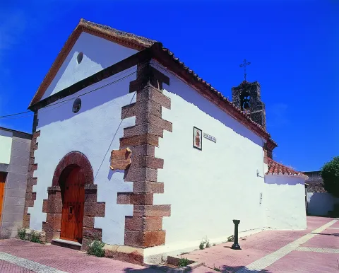
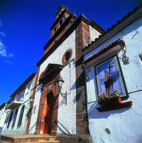
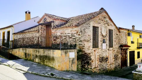
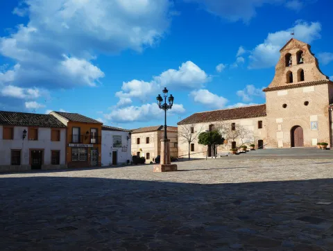
  • St. Helena Parish Church: It was erected in 1793 on an ancient medieval hermitage, which had been raised to commemorate the Christian victory in the battle of the Navas de Tolosa, which had these sites on stage and to guard the Cross to which the miracle was attributed. Built of redesigned and painted masonry, with a simple facade, of small dimensions. A staircase stands out the access door, composed of a half-point arch on imposts, flanked by Tuscan pillars that give way to an inlet finished with triangular fronton and two bones, one on each side. On the top of the first body, the pyramidal structure is raised to three levels, with pinacles at the ends and half-point holes for bells. Inside it is a single drawer ship, covered with a half-canyon vault and double lunetes on the sides. The presbyterium is opened with a spinal arch, covered with an arista vault and illuminated with two large bone-shaped windows. The header is presided over by the image of its patron saint, St. Helena, between dogrous columns that support an injunction and a curved fronton. It was remodeled in 2001.
  • Iberian Shrine of the Collado de los Jardines: It is located in the heart of Sierra Morena Oriental, on the most important traditional road of communication between Alta Andalucía and the Plateau. For the Iberian shrines they chose places, usually caves, located next to springs and forests, where it was thought that the divinity lived and where the faithful went to worship, pray and deliver offerings to their divinities. These offerings were what we know as "exvotes," small statues, between eight and twenty cm, made of bronze, stone or mud. In Iberian Shrine of the Collado de los Jardines There have been many exvotes, most of them bronze, representing men and women offering, priests, warriors and objects. It is part of the whole town that was excavated on the hill adjacent to the castle, where a wall, a sacred enclosure and a cast of metal exvotes have appeared. We meet before one of the three great Iberian shrines of the peninsula.
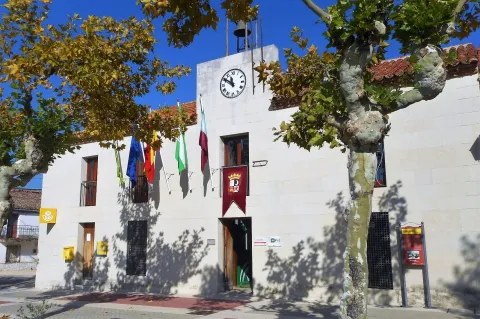
  • St. Helena's Urban Helmets:Given its geographical location, a forced passage between the plateau and Andalusia, has experienced many historical events. The Battle of the Navas de Tolosa in 1212 in which King Alfonso VIII of Castile defeated the Almohades. To commemorate this battle, a hermitage was erected in honor of the Empress St. Helena, who would later name this place and the new population, which King Charles III founded in 1767. In the colonizing urbanism of Sierra Morena, the most important element is the large rectangular square, from which they leave streets on each side and where are the important buildings, such as the Church, the City Hall and the posite of Diezmos and Labradores. The rest of the town is organized from the Plaza. The streets are dominated by axial perspectives, houses of the same height and proportions, reticular fabric and geometric structure. It only deviates from the neoclassical model on its perimeter, to adapt to the road. It has been declared Good for Cultural Interest.

  • Rupestrian Paints: The province of Jaén has more than forty points with rock paintings, declared World Heritage Sitewithin the whole Mediterranean arc. Some of them are found in St. Helena with exceptional testimonies of schematic and seminaturalist paintings, located in coats of the area, including those of the Cave of the Cows of the Retamoso in the area of the bodies, Cave of the Holy, the Cave of the Schools and some more.
  • Mining Heritage. The landscape of ancient mines and Mediterranean mountains of the former Minero District extends to eight municipalities: Linares, La Carolina, Bailén, Baños de la Encina, Vilches, Guarroman, Santa Elena and Carboneros. This mining activity has left in these municipalities an exceptional concentration of remains, unique vestiges in the world and representative of the industrial revolution in the 19th century.
Naturaleza

St. Helena is located in the northernmost sector of the northern region, next to the border with the province of Ciudad Real.

It is of the few municipalities of the province without agricultural vocation, only 1% of the total area. So its economy is based on development of the mountainincluding forest, cicnetic, mushroom collection and livestock (cattle).

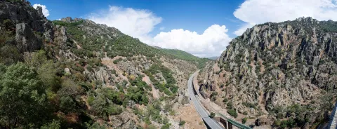
The passage of the highway of Andalusia through the municipality has developed in the town a certain hotel offer of importance.

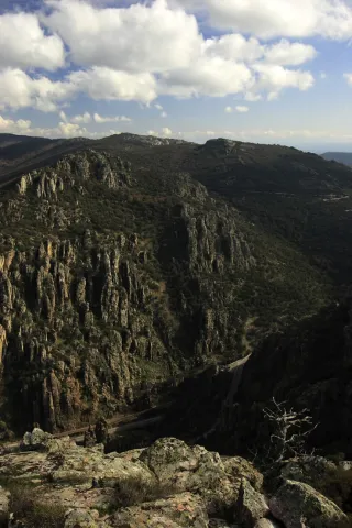
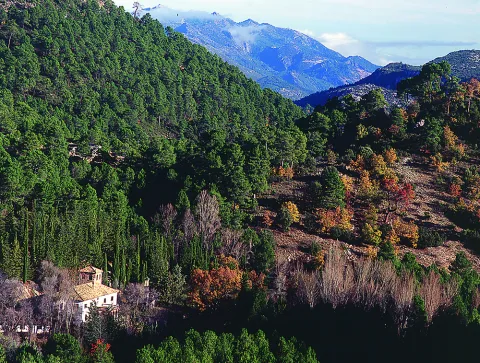
By its term the rivers run Caraway and Bell.The northern part of the municipality of St. Helena belongs to the Natural Park of Despeñacolos, of great landscape, faunistic and botanical interest.

The Park includes, among others:

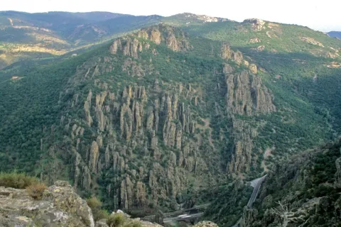
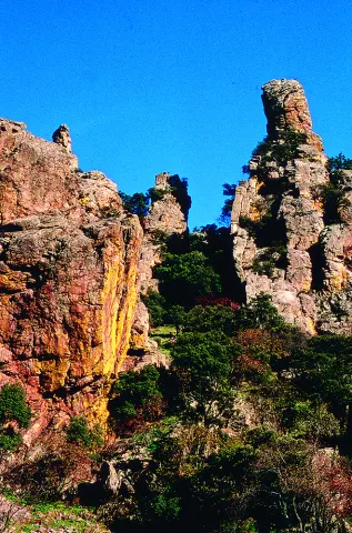
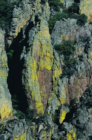
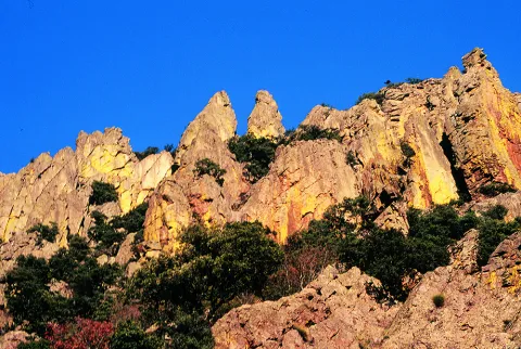
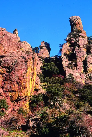
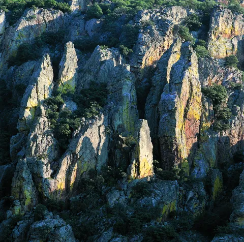
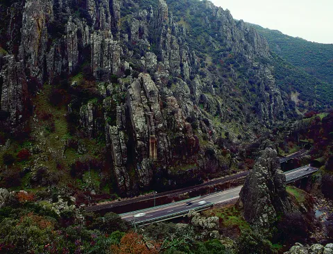
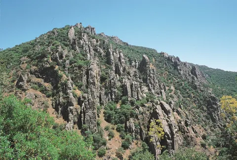
  • Place of the bodies, declared a Natural Monument of Andalusia. A place where a set of huge rock columns that resemble the tubes of the organ of a cathedral. Increases the beauty of this place the chromatic contrast of the grey of the coas with the intense yellow and orange of the different species of lichens that survive in them. On these rocks, oaks, alcornoques and shrubs form a Mediterranean forest in which they inhabit ginets, chickpeas and numerous rapacious birds.
  • Embryo de los Organos: It is an affront place that was inhabited from very old, as shown by the rock paintings found. From here we can discover the pineapples of repopulation (carrascos, black, pineapples), sodas of alcornoques, complaints, oaks and madroños.
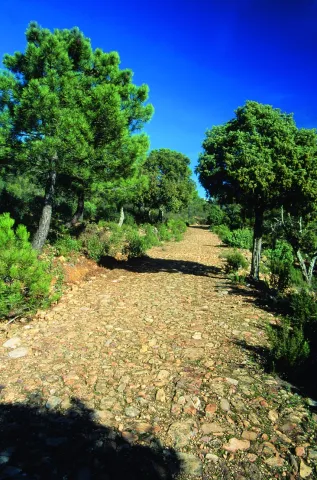
  • The Empedraillo: These are the interesting remains of a small section of the Roman road that unites Catulo (Linares) and the Galena mines of El Centenillo with Toledo.
  • Quejigal del Collado de los Jardines: Also located in the Natural Park of Despeñacolos, its biodiversity stands out. In the plant species we find complaints, alcornoques, maples and other species typical of the Mediterranean forest. With regard to the faunistic species that inhabit this place quote the wolf, lince, the otter, imperial eagle, royal eagle and azor.

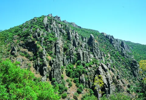
If anything characterizes Despeñacolos are their unique geological formations. The Despeñapoerno de Despeñaperes, with 4 km of extension is the product of the erosion of the stream of the same name on a natural failure of the Iberian Macizo and the main means of communication between Castilla La Mancha and the lower lands of the Guadalquivir valley.

Fiestas y Eventos
  • Sunday of Resurrection: From the Central European settlers who came in the 18th century, only the tradition of painting cooked eggs, which are eaten in the area of La Aliseda, is left. Before you have to meet the rite of making them roll by a earring of grass so they don't break. This has meant that, in St. Helena, the feast of this very well-known day is known as Rolaeggs.
  • Romeria de San Isidro: On May 15, the neighbors of St. Helena accompanied San Isidro, in gilded carrots for that party until the site of The Aliseda. In this place, of incomparable beauty, a mass is held in honor of the Holy and a whole day of field is spent.
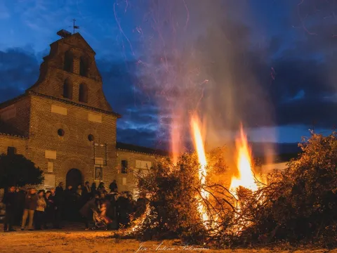
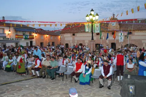
  • Patron parties: In honor of their patron saint St. Helena, parties are held between 17 and 21 August. During all these days there are many and varied leisure and sports activities. On the 17th, with the traditional repeat of bells, the beginning of the parties is announced and the three rocket warnings indicate the beginning of the cobblestones in the streets of the town. In the afternoon, taurino show. We arrived at 18 August, big day. In the morning Mass in honor of the Holy and invitation to all attendees in one of the houses. At night, the most important event of the whole fair that is the procession of the Patronthat accompanied by a music band runs through the streets of the village. On the 20th and 21st days, the morning and evening cobwebs and taurino festival return. The fair ends with a powerful haze on the 21st of the morning.
Gastronomía

St. Helena for its location in Sierra Morena is a very suitable place to take mountain meat, either from major game (deer, boar or gamo) or from small game (perdiz, rabbit or hare).

  • Andrajos: Made with a mass of flour (andrajo) that is cooked in a broth of hare meat with a saffrito of peppers and tomatoes flavoured with mint.
  • Pipirrana: Salad made from roasted peppers, olives, cooked eggs, tuna and olive oil.
  • Sage in salsa: It is made with deer meat, onion, tomato, flour, water, thyme, rosemary, peppers, olive oil and almonds.
  • Niselos al ajillo: Niscalos, olive oil, ham, garlic, parsley white wine and salt.
  • Tortilla Alfonso XIII: Made of eggs, ham, lamb kidneys, mushrooms, salt, fried tomato and olive oil.

Warehouse:

  • Sweet Gachas: With toast, hot milk or boiler honey, flour, sugar, cinnamon powder olive oil. They are preparing for the feast of All Saints.
  • Pestiños: They are made with olive oil, wine, dry spirits, sugar, cinnamon and flour.
  • Lis flower: Eggs, flour, milk, sugar and olive oil, salt and cinnamon or melted honey for irrigation.
  • Risol: A drink made with sweet anis, coffee, mejana and water.
Historia

The area has been occupied from prehistoric periodAs shown by the rock paintings located in the area's coats, with more than five thousand years old and declared a World Heritage Site in 1998.

In time of the Iberiansin the term of St. Helena was one of the most important centres of worship: Shrine of the Collado de los Jardineswhere many Iberian exvotes and the remains of what could have been a village have been located, not only in Iberian times but also in Roman and medieval times. The sanctuary also known as Cave of the Dolls has been used by the Romans for religious worship.

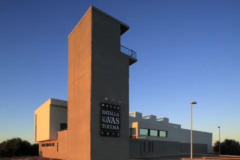
In the Age of Mediathe most important event is the Battle of the Navas de Tolosain 1212. The town is very close to it, in the vicinity is the Museum of the Battle de las Navas de Tolosa. The Almohade army was defeated and King Alfonso VIII of Castilla, ordered to build in the place a hermitage to guard the Cross to which they attributed the miracle of victory and a window-castle, to commemorate the triumph over the Almohades and that currently It is part of the Route of the Castles and the Battle.

In this same place in the 18th century, one of the New populations of Sierra Morena, project driven by the King Charles III. One of these populations is St. Helena. With the settlers, farmers from Centroeuropa (French, German and Flemish), efforts were made to establish a population and generate wealth in the depopulated areas of Sierra Morena while ensuring the passage of Despeñacolos.

In 1793, the population was in a ruinous state and it was King Charles IV who ordered it to demolish and build a new colonial type..

Otra información

It has recently been built in the municipal term, the Museum of the Battle of the Navas de Tolosa. The museum is one of the most interesting points on the route of the Castles and the Battle and is the starting point for the seventeen municipalities that make up this tourist product. Very close is the Iberian Sanctuary of La Cueva de los Muñecos and The "Llano de las Américas" Interpretation Center.

Loading map
Preparing points of interest and routes...
Imagen principal
imagen
Image
Santa Elena
Imagen principal
Activado

Aldeaquemada

Submitted by brandcode_deweloper on
Id
722825
Perfil de redes sociales
Facebook
https://www.facebook.com/turismo.aldeaquemada/
Youtube
https://www.youtube.com/channel/UCCv7KZQ0gXnY6BSzN7c34TA
Instagram
https://www.instagram.com/turismo.aldeaquemada/
Descripción
Breve descripción

Aldeaquemada located in the North countryside of the province of Jaén, in the heart of Sierra Morena Oriental, is located on horseback between the Natural Park of Despeñacolos and the Natural Park Cascada La Cimbarra, limiting to the North with the province of Ciudad Real, with which they are linked close cultural ties.

Telecomunicaciones
Teléfono
680 104 199
Sitio web
www.turismoaldeaquemada.com
Correo electrónico
turismo.aldeaquemada@gmail.com
Ubicación
Nombre
Aldeaquemada
Latitud
38.412518
Longitud
-3.371674
Distrito
Municipio
Ubicación en el mapa
POINT (-3.371674 38.412518)
Imágenes
imagen
Image
2f1425f1-090d-93eb-1d69-73bf7d20960b?t=1585569371097
Imagen principal
Desactivado
imagen
Image
bfcdd16b-15b3-bab8-9b63-95e160102ae0?t=1637861703212
Imagen principal
Desactivado
imagen
Image
e7cd5c14-8be5-f41f-735f-a9a537182566?t=1637861827564
Imagen principal
Desactivado
imagen
Image
bcf6d2a4-9d6a-ea5a-a1dd-5e3c36603288?t=1637861106999
Imagen principal
Desactivado
imagen
Image
aed0a872-19f6-89e8-cc22-fac9dde45a4e?t=1637861856573
Imagen principal
Desactivado
imagen
Image
6ed86dea-ee9b-db66-2bfa-0e4193031434?t=1637861911008
Imagen principal
Desactivado
imagen
Image
bcfaf9b9-0cba-c953-77bc-f13b2061a293?t=1637862116289
Imagen principal
Desactivado
imagen
Image
8fc4525c-a4ab-cc5b-8b89-df8a83aeb4dc?t=1637862299371
Imagen principal
Desactivado
imagen
Image
0f7062cd-64d6-2b09-c143-7f16894bde0e?t=1637862362315
Imagen principal
Desactivado
imagen
Image
c9ca2450-14a1-d882-7fef-61c720b82739?t=1637862400536
Imagen principal
Desactivado
imagen
Image
be3bab26-c91e-859f-219f-bf438277ec0c?t=1637862441706
Imagen principal
Desactivado
imagen
Image
f63290cb-e2c9-7d58-65db-da3a2768a807?t=1637862482588
Imagen principal
Desactivado
imagen
Image
4a4c1e38-772d-550a-38c4-17764d092acd?t=1637862599590
Imagen principal
Desactivado
imagen
Image
4c363c61-c24f-acc5-095c-e0929c3c79f1?t=1637862641476
Imagen principal
Desactivado
imagen
Image
aed1efda-ff1c-65cf-61b3-2c523397956f?t=1637862805470
Imagen principal
Desactivado
imagen
Image
54cc7324-2491-33f6-5174-9b4486afa1c8?t=1637863228260
Imagen principal
Desactivado
imagen
Image
76f9c16a-9e11-2cb9-ccb2-53811b4be845?t=1637863432396
Imagen principal
Desactivado
imagen
Image
3f454f83-5b61-76c1-4073-9dc10d3f7c02?t=1637863562829
Imagen principal
Desactivado
Información adicional
Curiosidades

Centro de Interpretación Pablo de Olavide:
C/ Blas Infante, 1 (Junto al colegio)

Horario: Miércoles a domingos y festivos de 10:00 h. a 14:00 h.

Reservas grupos fuera de horario. 
Teléfono: 680 104 199                                                        
turismo.aldeaquemada@gmail.com


Imágenes cabecera
imagen
Image
aldeaquemada
Imagen principal
Desactivado
Datos de interés

Tourist area: Sierra Morena and Despeñacolos
Distance to the capital (km): 107
Altitude over sea level (m): 699
Extension (Km2): 120
Number of inhabitants: 500
Gentilicon: Aldeans
Postal code: 23215

Videos
Video file
Cultura

In Aldeaquemada there are groups of rock paintings, ofschematic and eulogy style, distributed by flashlights and rocky coats of the municipal term. These deposits, calledRupestre Artunique for its theme, are the most important in Andalusia and can be considered as authentic outdoor museums of incalculable value.

These groups of rock paintings, located on most occasions on rock coats, were studied in the early 20th century by the Abate Brehuil and M. Cabré, which catalogued the vast majority of existing groups in the area.

The Rupestre Art is declared Good of Cultural Interest and, in 1998, the Unesco declared World Heritage the Rupestre Art of the Spanish Mediterranean Arc, including the 19 deposits of Aldeaquemada.

The most representative coats are:Table of Pochico, Poyos de la Cimbarra, Cimbarillo del Prado de Recheres, Cave de la Mina, Garganta de la Hoz, Prado del Azogue and Cave de los Arcos, among others.

Naturaleza

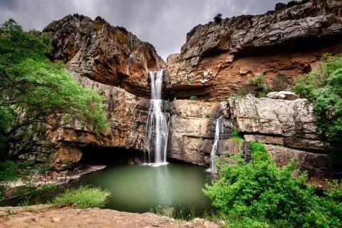
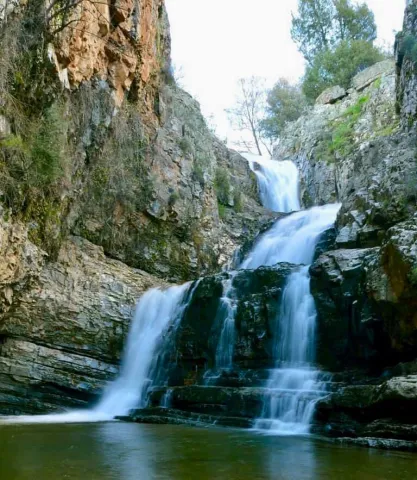
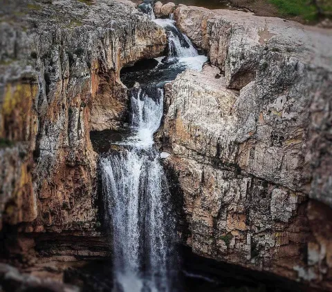
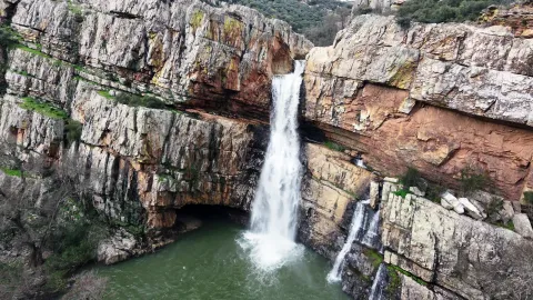
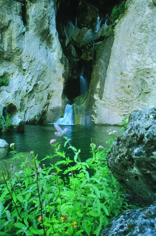
The municipal term of Aldeaquemada is mountainous, and in it we can find numerous points of interest, highlighting the Cascade of the Cimbarra, declared Natural Park in 1989 by the Junta de Andalucía.It is a spectacular waterfall about 40 meters high, and is only a few kilometers from the village, with a road in good condition to be able to access it.

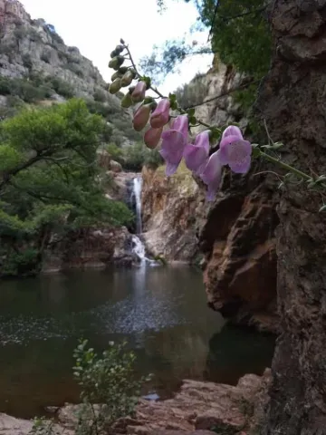
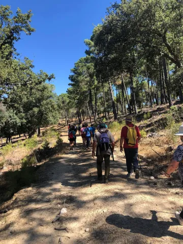
In addition to this main waterfall, there are others in the area, with signposted routes that lead to two of them: The Cimbarillo and the Negrillo.

On a walk in the area, we will find a lagoon, remains of an abandoned mill and Calderetas (water wells in the eroded rock).

The landscape is populated by mixed necketing of heterogeneous vegetation. They highlight alcornoques and encinars, also pinars of repopulation and riparian vegetation, and in it, they stand out the huge rock flashes that confer a truly majestic view.

Fiestas y Eventos

The"Cuca."is the name that receives theParty of the Painted EggsAnd it is celebrated on the Sunday of Resurrection. The day before, the Sabbath of glory, the inhabitants paint the hard eggs that will then intersect with those of their neighbors, Easter Sunday. Win the game if you get your eggs to stay intact.

It could be a tradition brought by the first Alsatian settlers (Centroeuropa).

Gastronomía

Aldeaquemada for its situation has a gastronomy produced from the isolation to which it is subjected, from the transit of pastors and hunters and also with influence of the nearby Mancha. The Gastronomical Days are well known and are held every year in May.

Among the typical dishes of this town are:

  • Calderillo:Potato stew with rabbit.
  • Potato miga:demenuted potato and onion.
  • The Galians:bread and game meat cakes (hare, perdiz, rabbit...), oil and garlic (pastorile food)
  • Wet flour:made from lunch flour.
  • La Camuña:typical food of hunters (chunks, chopped onion, guindilla and olive oil)
  • Gachamita:flour with fried garlic.
  • Jars with hare:mass of elongated bread with hare and condiments.
  • Stew of mountain meatand the typical products of the slaughter.

The sweets are not missing either:

  • Gachamita doughnuts(typical Carnival time)
  • Roscas de San Antón.
  • Fried doughnuts, flowers and blanks(in Holy Week time)
  • Pickles(San Marcos)
  • Wind doughnuts, chicharoni cakes, pastas and buns.

Starlight


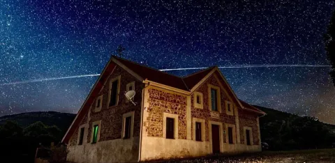
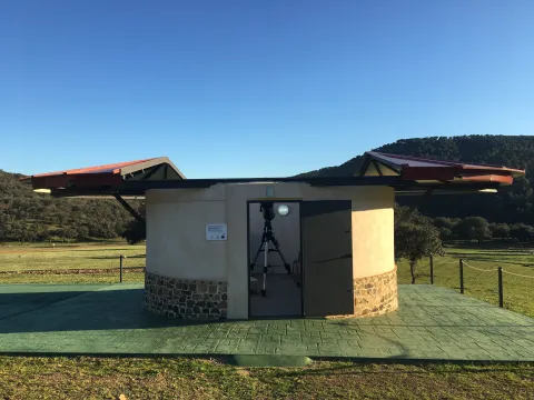
In Aldeaquemada you can enjoy your unparalleled night sky, in the light of the stars, as this municipality joined in 2014 the Starlight Declaration on the Defense of the Night Sky and the Right to Light of the Stars, and in which it is registered in the geographical area certified as the Starlight Reserve and the largest tourist destination in the world in Sierra Morena, following the contents collected in defence of the quality of the night skies and the right to observe the stars.

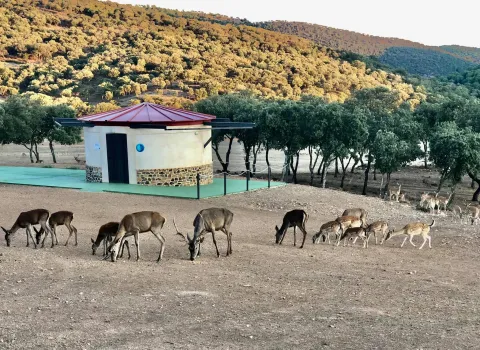
La Casa Rural Navalacedra is certified as accommodation Starlight from year 2021 performing experiences of astrotourism for the general public, wild fauna observation and G- astronomical evenings.

In order to do so, it has Starlight monitors accredited by the Starlight Foundation.

Historia

The history of Aldeaquemada is linked to the New People of Sierra Morena undertaken by Charles III in the 18th century, through the illustrious figure of Paul de Olavide, Superintendent of the New Populations. A sample of his colonial past and the mix of cultures from which Aldeaquemada was born is reflected in the presence of surnames of Central European origin as Kraff, Risotto, Téllez, Wizner, Font, Masdemont, etc., and through their traditions and customs.


As an example of their notoriety, in Aldeaquemada they highlight a preeminent historical and monumental heritage, offering one of the best preserved historical helmets of the colonies which has been worth the name of "18th century urban and colonial jewel".

Loading map
Preparing points of interest and routes...
Imagen principal
imagen
Image
aldeaquemada
Imagen principal
Activado

Town Planning of Aldeaquemada

Submitted by brandcode_deweloper on
Id
5869042
Descripción
Descripción larga

We can also find other architectural monuments in Aldeaquemada, which come from the time of the colonization of Charles III, highlighting:

• Church of the Purple Conception (18th century). A colonial-type church with a single ship. A vertical trend in relation to the rest of the buildings. Its facade is made of brick and is articulated in two bodies. In the first one, in rectangular form, the only differentiated elements are a narrow cover with a half-point arch and above, two lunetes that keep the line of horizontality. In the second body, a slight swordsman with a bell tower is triangulated, culminating in a small front. There are two houses on both sides of the church, corresponding to the old house of the priest and the post commander.

• The Comandante's House has also come to serve as a city hall for many years and even... The poultry house where bulls and bravas were locked up during the holidays of San Miguel! It is now the Retired Home, renovated and opened in April.

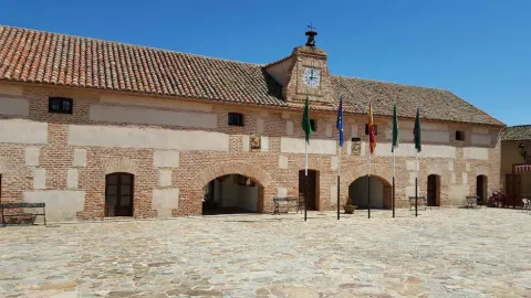
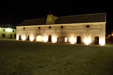
• Diezm and Labrador site (18th century). Building of the time of colonization and present in all the foundations of Charles III. It was dedicated to housing the cereals harvested by the farmers and as a warehouse in times of famine. Current town hall of the town, it is built in brick, of rectangular floor, of two floors and roof to two waters where it has a discreet structure of grabbard brick that houses the city's watch. New atypical uses: some of their rooms have performed the role of dungeon, home of the retired, butcher's shop, teleclub and, of course, municipal warehouse.

Breve descripción

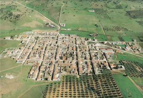
Aldeaquemada was born as a crossroads of roads, faithful to that function is the layout of its streets: rectangular urbanism, with long rectilinear axes. Aldeaquemada, is certainly the "Perla urbanística de Sierra Morena," for its urban innovations of structuring the streets on cross-sectional axes that divide it into squares and for the conservation of its original layout, hence it can be considered the entire urban town of the town as one more monument. The streets are perfectly aligned with the cardinal points, and the church with the altar
East.

Telecomunicaciones
Sitio web
www.aldeaquemada.com
Teléfono de contacto
680 104 199
Correo electrónico
turismo.aldeaquemada@gmail.com
Ubicación
Código Postal
23215
Latitud
38.412120
Longitud
-3.373310
Distrito
Municipio
Ubicación en el mapa
POINT (-3.37331 38.41212)
Tipos de punto de interés
Imágenes carrusel
imagen
Image
Aldeaquemada.png
Imagen principal
Desactivado
imagen
Image
Urbanismo_Aldeaquemada.jpg
Imagen principal
Desactivado
Imágenes cabecera
imagen
Image
Aldeaquemada%202.jpg
Imagen principal
Activado
Loading map
Preparing points of interest and routes...

Iberian Sanctuary of the Collado de los Jardines

Submitted by brandcode_deweloper on
Id
4554285
Descripción
Descripción larga

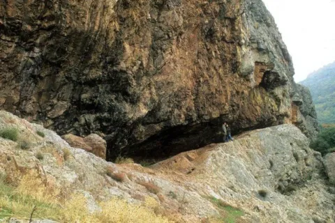
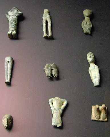
The original place of worship would be made up of a grotto in the rocky massif and a source; in front of that it is possible to emerge at different times, successive buildings of worship; for the oldest one it is kept news of its rectangular plant, and it is suspected a chronology of the centuries V- IV BC; for the most recent the dating managed would place it in the first century or perhaps before; the Shrine would already work from before the construction of the first building and would continue to do so, at least until the fourth century, after the destruction of the second building towards the third century AD. It seems that the exvotes, in the vast majority or in their entirety bronze figures, "Fury primitivement dépossées dans la caverne, et jetées de temps a autre sur la pente, mais jamais aucune fosse ne fut creusée pour les recevoir," which prevents the existence of a reliable strategy, which is aggravated by the precarious conditions of the excavation, at the beginning of the century, of the site. It is not unlikely, as one of the excavators suggested, that the religious whole should also be completed with a sacred forest, from whose branches the devotees would hang part of the offerings.

Breve descripción

Located in the area that could have been by way (although not surely of the most important before the 18th century) between Alta Andalucía and the Plateau, is this Sanctuary of which almost all that is known are its bronze exvotes (about 2,200 from the official excavations) that the Oretan peoples offered to the gods.

Telecomunicaciones
Sitio web
www.santaelena.es
Teléfono de contacto
953 664 010
Ubicación
Nombre
Cueva de los Muñecos
Código Postal
23213
Latitud
38.388204
Longitud
-3.498567
Distrito
Municipio
Ubicación en el mapa
POINT (-3.498567 38.388204)
Tipos de punto de interés
Imágenes carrusel
imagen
Image
Santuario%20Collado%20de%20los%20Jardines3.jpg
Imagen principal
Desactivado
imagen
Image
Santuario%20Collado%20de%20los%20Jardines2.jpg
Imagen principal
Desactivado
Imágenes cabecera
imagen
Image
dsc03816.jpg
Imagen principal
Activado
Loading map
Preparing points of interest and routes...

Ruins of the Castle of Castro Ferral

Submitted by brandcode_deweloper on
Id
5868858
Descripción
Descripción larga

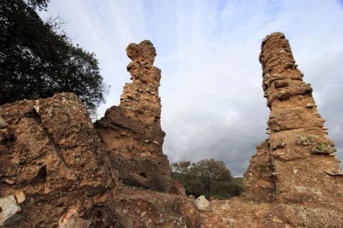
In 1169 the Castle of Castro Ferral was conquered by Calatravos, commanded by Fernando de Icaza, the second Master of the Order. However, before the battle of the Navas de Tolosa, the fortress was again under Muslim control. Ferral would lead several acts of weapons during the military campaign that would end with the Christian triumph of the Navy (1212). The strategic importance of this castle, by controlling one of the traditional steps of Sierra Morena, made it an essential objective for any army that would want to cross the area.

The transfer of the border to the Betic Cordilleras marked the decline of Castro Ferral, who lost his role as a watchman for access to the Guadalquivir Valley. The foundation of St. Helena (Ermita de los Palacios), which has made it less important as a reference centre for the small population of those contours, was joined. In an undetermined time, they beat it to prevent it from becoming a jumpers' den.

The castle of Ferral was made up of three defensive enclosures. The first, currently the worst preserved, was a broad emulated in the slope of land that closed the top of the fence describing an almost perfect circle. This defensive line is more solid and pronounced at the North and North-East ends, where the land gap is greater.

In its interior is developed a second enclosure, possibly built in ground tapial on the base of masonry, from which are preserved various remains and two bastions that could protect the entrance to the castle.

The central core of the castle is made up of a rectangular enclosure of argamase tapial, in which the underground remains, possibly aljibes, are visible.

Breve descripción

There are only remains of this castle of a bulldozer built by Muslims before the Battle of the Saves of Tolosa. It is located inside the Natural Park, on the heights of the port of Muradal, to keep the Paso de la Losa, route between Andalusia and the Plateau. It is accessed exclusively by forest track.

Telecomunicaciones
Sitio web
www.castillosybatallas.com/es/castillo-de-castro-ferral/
Teléfono de contacto
953 368 839
Ubicación
Código Postal
23213
Latitud
38.392870
Longitud
-3.545360
Distrito
Municipio
Ubicación en el mapa
POINT (-3.54536 38.39287)
Tipos de punto de interés
Imágenes carrusel
imagen
Image
Castillo%20de%20Castro%20Ferral%2C.jpg
Imagen principal
Desactivado
Imágenes cabecera
imagen
Image
Castillo%20de%20Castro%20Ferral%2C%202.jpg
Imagen principal
Activado
Horario
24 h.
Loading map
Preparing points of interest and routes...

Gall Oak Forest of the Collado de los Jardines

Submitted by brandcode_deweloper on
Id
4554494
Descripción
Descripción larga

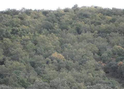
With regard to the faunistic species that inhabit the environment, mention the wolf, the lince, the otter, the imperial eagle, the royal eagle or the azor.

Location: To the north-east of the town, in the heart of the Natural Park of Despeñacolos.

Distance: 16 km.

Medium: Tourism vehicle.

Access route: Departing from the village by the highway of Andalusia in the sense of Madrid and taking, to the right and after going about 6 km, the road J-6.110 towards Aldeaquemada.

Breve descripción

This enclave, which belongs to the Natural Park of Despeñacolos, stands out for its biodiversity; thus, among the plant species present, there are complaints, alcornoques, maples and other typical of the humid Mediterranean forest.

Ubicación
Código Postal
23213
Latitud
38.390302
Longitud
-3.494124
Dirección
Carretera Aldeaquemada, km. 6,6
Distrito
Municipio
Ubicación en el mapa
POINT (-3.494124 38.390302)
Tipos de punto de interés
Imágenes carrusel
imagen
Image
quejical.png
Imagen principal
Desactivado
Loading map
Preparing points of interest and routes...

La Cimbarra Waterfall Natural Site

Submitted by brandcode_deweloper on
Id
1927564
Descripción
Descripción larga

In the central region of Sierra Morena, on a substrate of slate and sandstone, this protected space is located characterized by its accidental relief.

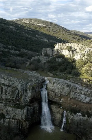
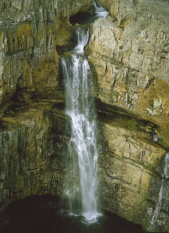
On the south-west side the river Guarrizas appears, creating strong slopes. On the contrary, the declives on the southeast side are softer. The napping of the river forms waterfalls, the most spectacular and beautiful being that of Cimbarra.

The flora is characterized by its heterogeneity. It abounds the mixed forest of oak and alcornoques, with an abundant Mediterranean bush. There is also an area of oak and repopulations of pineapple and black pine. The fauna is also rich and varied.

Among the medium-sized predators the fox and the gin abound, while numerous rapaces fly over the skies of this natural area of 534 hectares of extension, highlighting the royal eagle and the eagle.

Breve descripción

If for anything it is known Aldeaquemada is precisely for La Cimbarra. This spectacular waterfall, about 40 meters high, is located about two kilometres from the village in the south direction and has the category, as a protected natural space, of Natural Park. The access path is in good condition and efforts to improve it have been important in recent years.

Ubicación
Latitud
38.388645
Longitud
-3.414725
Distrito
Municipio
Ubicación en el mapa
POINT (-3.414725 38.388645)
Tipos de punto de interés
Imágenes carrusel
imagen
Image
xDESPE%C3%91APERROS%2C%20LA%20CIMBARRA.jpg
Imagen principal
Desactivado
imagen
Image
main_image_54214.jpeg
Imagen principal
Desactivado
Imágenes cabecera
imagen
Image
Cascada%20de%20la%20Cimbarra%20G%C3%BCido%20Monta%C3%B1%C3%A9s.jpg
Imagen principal
Activado
Loading map
Preparing points of interest and routes...

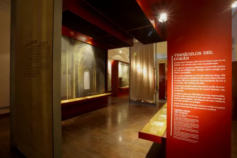
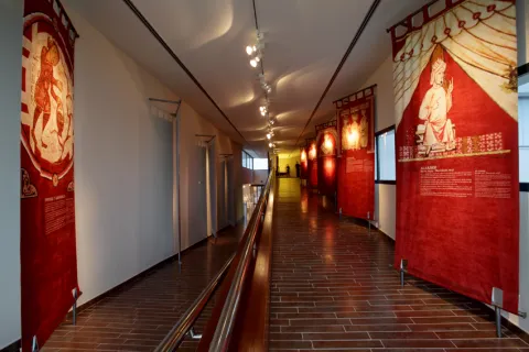
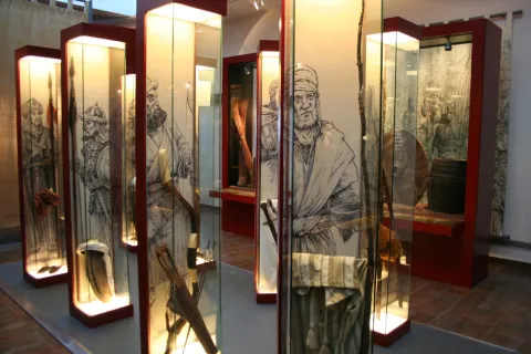
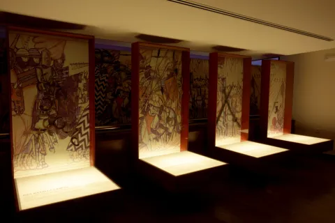
Museum of the Batalla de las Navas de Tolosa

Submitted by brandcode_deweloper on
Id
319212
Descripción
Descripción larga

The seizure of the fortress of Salvatierra, the province of Ciudad Real, by the Almohades in September 1211, prompted Alfonso VIII of Castilla to organize a campaign for the summer of 1212 with which to destroy the Almohade military capacity, inciting Innocent III to enact a bull that turned the campaign into a crusade. This is a decisive act, as it brings them together with the company across Europe and gentlemen of the different military orders.

On June 20, 1212, three troops left Toledo: Aragonese and Catalan under the command of Peter II of Aragon; Castilians with his king Alfonso VIII; and Ultramontans; Leonese and Portuguese under the orders of Don Diego López de Haro, lord of Vizcaya. The troops of López de Haro, in their advance, take the castles of Malagon (24 June) and Calatrava (1 July), the latter by capitulation. The lack of booty and the course of events began to create unrest among foreign combatants, most of whom decided to return to their places of origin.

The Almohad Caliph Muhammad al-Nasir in whose army were integrated fighters from the Maghreb, from sub-Saharan territories and from Turkish troops, set in motion his men who leave Jaén with the aim of blocking Christian troops in Sierra Morena.

Between 4 and 6 July Alfonso VIII continued his progress by taking several fortifications, including that of Alarcos. With the arrival of Sancho VII of Navarra the total of Christian armies is gathered at the foot of the castle of Salvatierra, from where they continued in search of the Almohade army.

On July 12 advanced from Don Diego López de Haro took the Puerto del Muradal, with the fortification of Castro Ferral. Two days later, after being blocked in the passage of the Slayer, they camp in the place known as the King's Table, from where they go to the battle that took place on July 16, defeating the Alphade army that will withdraw from the fortresses that defended the entrance to the Guadalquivir Valley. On July 19 they occupied Baeza and a day later they besieged Ubeda, who would eventually capitulate.

After the campaign was completed and access to the Guadalquivir Valley was assured, Christians withdrew to their kingdoms in the north.

Archaeological investigations seem to confirm some of the sites where the written sources placed the contenders' camps. The results obtained by archaeological prospecting in Mesa del Rey corroborate the presence of a camp occupied not only by the troops, but also by higher-ranking characters of the Christian army, having identified areas within the internal organization of the camp, such as that intended to change the horseshoes of the beasts. It can be proposed that the King's Bureau be the place that occupied the troops of King Alfonso VIII of Castile, but not all of the Christian armies.

Similarly, in the surroundings of the castle of Castro Ferral, the great concentration of weapons material can be interpreted as the vestiges of the assault by Alfonso VIII's troops to the fortress. Parts related to daily life have also been documented in El Ferral and its military function (horsemen, furniture elements, garrison of clothing, tools, nails and passers).

The set of recovered pieces points to the existence of a large concentration of materials related to the battle, despite the intense expolity suffered throughout the area for more than a century.

LEYENDAS

The pastor of the Navas de Tolosa. In July 1212 the Christian hosts, on their way to the heart of al- Andalus, were to cross Sierra Morena through the natural passage of La Losa, a narrow throat in the port of Muradal, defended by the fortress of Castro Ferral. Alfonso VIII sent Don Diego López de Haro to take the castle, but despite his conquest, the road remained strongly defended.

At the Christian camp came a man from the place, a connoisseur of those border lands, who showed them an alternative path between the mountains, leading Don Diego López de Haro and his troops to a high-level, ever since known as the King's Table. In it, the Christian camp was set up to launch its offensive against the Almohad army, on July 16, 1212, a confrontation that would open the door of al-Andalus to the Christian armies. The man who showed them the way was called Martin Halaja, a shepherd for some, a hunter for others and for the most pious of the same Saint Isidro.

Breve descripción

The Battle of the Saves of Tolosa of July 16, 1212 was one of the most prominent milestones in the medieval history of Peninsular, for its significance in the advance of the Christian kingdoms over al- Ándalus. Conceived as a crusade, which was preached by Pope Innocent III, he faced an army of men coming not only from the Peninsular realms, but from the other side of the Pyrenees, commanded by the Christian kings, Alfonso VIII of Castile, Peter II of Aragon and Sancho VII of Navarra, against the Almohad Caliph of Muhammad al-Nasir, in whose army were integrated fighters from the Maghreb, from sub-Saharan territories and from Turkish contingents. The Almohad defeat meant the beginning of the definitive conquest of al- Ándalus by the peninsular Christian kingdoms.
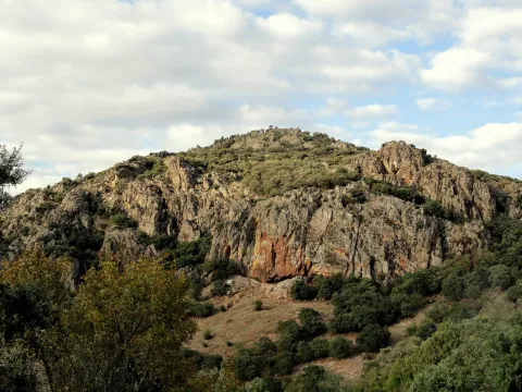
In the Park of Despeñacolos, within walking distance of the place of battle, is the Museum of the Battle of the Navas de Tolosa, in the town of Santa Elena. A centre in which visitors are guided by the history of the contest, from the prolegomens to the war, through audiovisual and scenography, teaching workshops or visits to the battlefield and the Natural Park of Despeñacolos. It is also a starting point and information of the Route of the Castles and Battle of the Kingdom of Jaén.

Telecomunicaciones
Teléfono de contacto
953 459 693
Correo electrónico
museoyturismosantaelena@gmail.com
Ubicación
Código Postal
23213
Latitud
38.342790
Longitud
-3.548910
Dirección
Carretera de Miranda del Rey, s/n
Distrito
Municipio
Ubicación en el mapa
POINT (-3.54891 38.34279)
Tipos de punto de interés
Imágenes carrusel
imagen
Image
Santa%20Elana%20-%20Museo%20Batalla%20Navas%20%281%29.jpg
Imagen principal
Desactivado
imagen
Image
PICT8132.JPG
Imagen principal
Desactivado
imagen
Image
batalla-navas-tolosa.jpg
Imagen principal
Desactivado
imagen
Image
Stoa-M%2CN%2CT020.jpg
Imagen principal
Desactivado
imagen
Image
Museo%20Navas%20039%20%282%29.jpg
Imagen principal
Desactivado
imagen
Image
Stoa-M%2CN%2CT059%20%281%29.jpg
Imagen principal
Desactivado
imagen
Image
Stoa-M%2CN%2CT024%20%281%29.jpg
Imagen principal
Desactivado
Imágenes cabecera
imagen
Image
_MG_6954%20%281%29.jpg
Imagen principal
Activado
Horario
Oct - may: Tuesday to Saturday 10: 00 - 14: 00 and 16: 00 - 19: 00, Sunday 10: 00 - 14: 00 and 15: 30 - 18: 30, Monday closed (except holidays and eve). Jun - Sept: Tuesday to Saturday 10: 00 - 14: 00 and 17: 00 - 20: 00.
Otros servicios
  • Guided tours.
  • Audio-guides.
  • Shop.
  • Coffee shop.
  • Conference and multiple-use rooms.
  • Beer area and games.
  • Parking.
  • Storage and delivery.
  • Tourist information of the province.
  • Hiking on the battlefield.
  • Routes through the Natural Park of Despeñacolos.
  • Educational workshops for schoolchildren
Loading map
Preparing points of interest and routes...
Interés

Natural Monument Los Órganos de Despeñaperros

Submitted by brandcode_deweloper on
Id
5867289
Descripción
Descripción larga

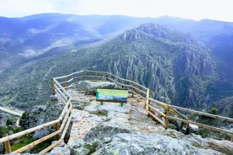
From the nearby viewpoint you can see this monument, whose origin is surprising. 500 million years ago the whole area was covered by the sea, though with little depth, so it was filled with sands and clays brought by the rivers that were flowing there from the Iberian plateau. It was 300 million years ago that the forces of the land made these lands emerge and since then, the erosion of the river, the rains and the wind have been sculpting the relief, creating beautiful forms like these organs. On these rocks, oaks, alcornoques and shrubs have found their substrate, forming a Mediterranean forest in which they inhabit ginets, chickpeas and numerous rapaces.

Breve descripción

Declared Natural Monument of Andalusia. This Natural Monument is one of the most prominent places in the Despeñacolos Parade, where a set of huge rock columns are raised that resemble the tubes of an organ of a large cathedral. The beauty of this site increases the chromatic contrast of the rock grey with the intense yellow and orange of the different species of lichens that survive here.

Ubicación
Código Postal
23213
Latitud
38.411329
Longitud
-3.559652
Distrito
Municipio
Ubicación en el mapa
POINT (-3.559652 38.411329)
Tipos de punto de interés
Imágenes carrusel
imagen
Image
DESPENAPERROS%20%281%29.jpg
Imagen principal
Desactivado
imagen
Image
1615_MI_01.jpg
Imagen principal
Desactivado
imagen
Image
Natu020.jpg
Imagen principal
Desactivado
imagen
Image
Natu009.jpg
Imagen principal
Desactivado
imagen
Image
Natu066.jpg
Imagen principal
Desactivado
imagen
Image
Natu099.jpg
Imagen principal
Desactivado
imagen
Image
Natu392.jpg
Imagen principal
Desactivado
imagen
Image
Natu368.jpg
Imagen principal
Desactivado
imagen
Image
Natu331.jpg
Imagen principal
Desactivado
imagen
Image
Natu220.jpg
Imagen principal
Desactivado
imagen
Image
Natu160.jpg
Imagen principal
Desactivado
imagen
Image
Natu239.jpg
Imagen principal
Desactivado
Imágenes cabecera
imagen
Image
Parque_Natural_Despexaperros_3%20%281%29.jpg
Imagen principal
Activado
Loading map
Preparing points of interest and routes...