The Priest's House
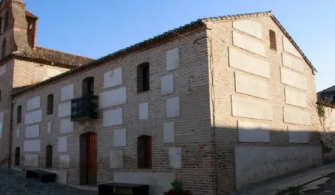
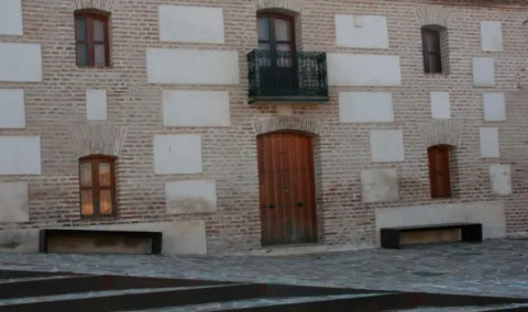
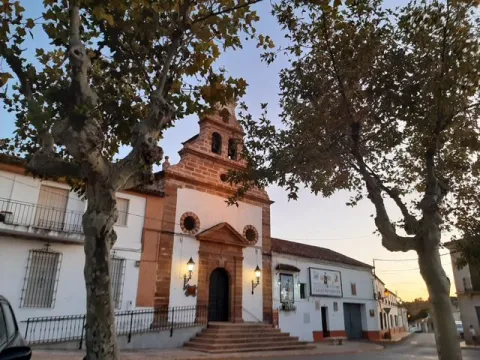
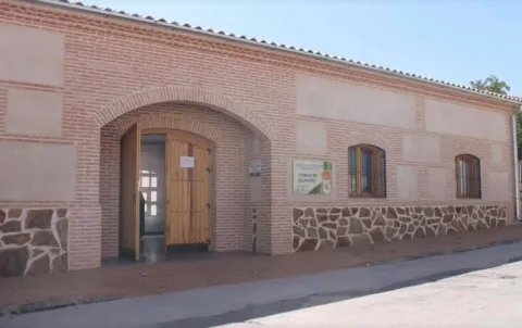
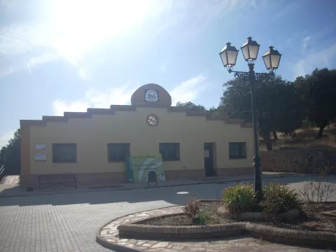
Located on the side of the church, the house of the priest is currently in the process of restoration after a time of abandonment.
In the church, this house has had several functions, some of which are the City Council and currently the home of the retired. For many years it was used as a poultry of braves during the holidays.
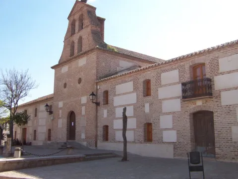
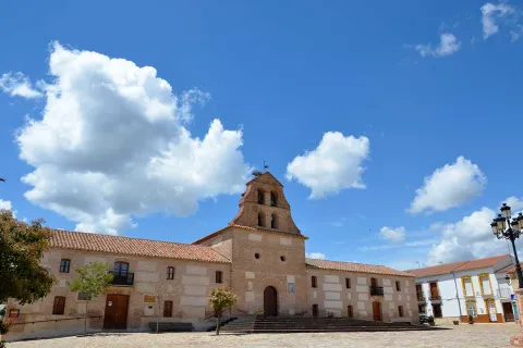
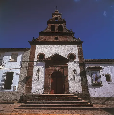
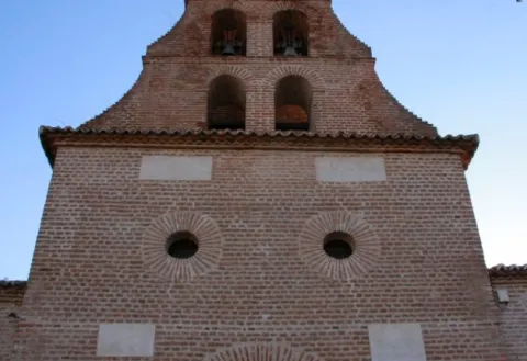
Built in overturned and painted masonry, its simple, small-sized facade speaks a classicist language: a slight step emphasizes the access door, composed of a half-point arch on imposts, flanked by Tuscan pilasters, which give way to an internment completed on a triangular front with bones on each side. On the ledge of this first body is raised an airous spadagna, with a pyramidal structure on three levels, with pinacullos at the ends and half-point holes for bells. The sword underlines its hierarchy, making it the highest building in the square.
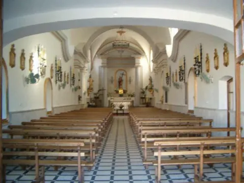
Inside it is a single drawer ship, covered with a half-barrel vault and double lunetes on the sides. The presbyterium is opened with a tural arc and also hornains made up of Tuscan columns, empleamento and triangular fronton are observed. This space is covered with a vault of edges and is illuminated by two large, bone-shaped windows. The header is presided over by the sculptural image of the patron saint, St. Helena, between dogrous columns that support an internment and a curved fronton.
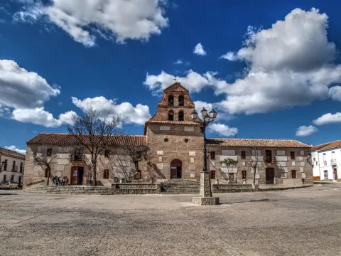
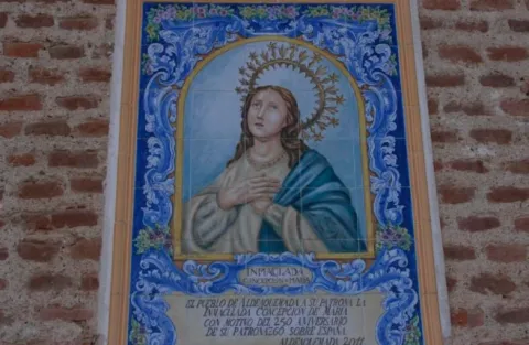
The parish Church of St. Helena was erected in 1793 on an ancient medieval hermitage, raised to commemorate the Christian victory in the battle of the Navas de Tolosa, which set these sites.
There are two houses on both sides of the church, corresponding to the old house of the priest and the post commander.
One-ship colonial-type church of the 18th century. Its facade is made of brick and is articulated in two bodies, in the first, in a rectangular way, the only differentiated elements are a narrow cover with a half-point arch and above, two lunetes that keep the line of horizonality; in the second body, a swordsman body with a bell tower that culminates in a small front.
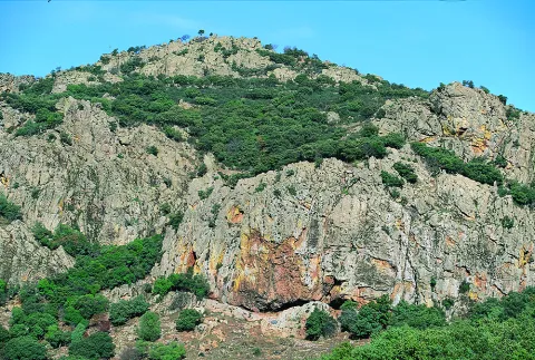
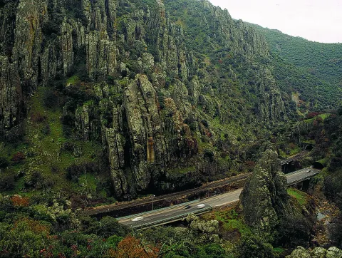
The river erosion, which has a limestone wall of about 400 meters high, is the result of the river erosion. There is a teaching path dedicated to local botany.
Location: On the highway of Granada, just at the limit of the municipal terms of Campillo, Cárcheles and Cambil.
Distance: 7 km.
Medium: Tourism vehicle.
Access: Directly via the Granada Highway (A-44).
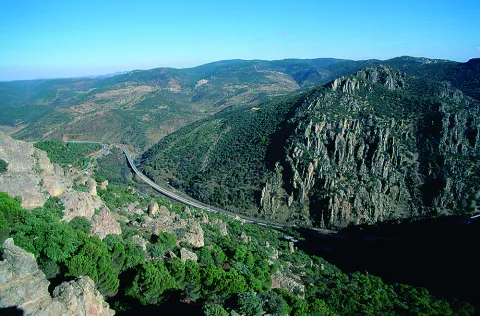
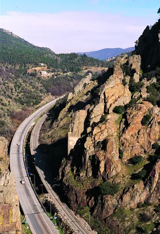
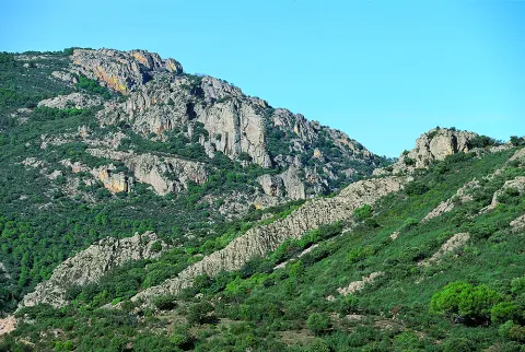
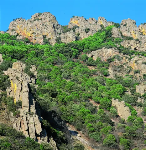
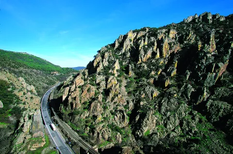
TheDespeñacolos parloris a great geological formation that makes the border between the plains of Castilla la Mancha and the Valle del Guadalquivir, declared Natural Park. Many of you will have been able to observe as you pass through the road that passes through Despeñacolos, the great mouth open in the rock caused by the erosion of the river's channel, on which the old route was built, which communicates Andalusia with the neighbouring community.
This Sanctuary of the Ibera era, along with another located also in Jaén, in the town of Castellar are very important and have provided the largest number of bronze exvotes, important pieces not only to know the work of this metal in the Iberian world, but to solve many other problems related to the faithful who approached the divinity in these places of worship, such as the type of religiosity, the forms of clothing, the jewels, weapons, the type of hair, etc.
From Collado de los Jardines more than 2,500 exvotes have come out, and from Castellar more than 2,000. The almost all of these objects are kept in the National Archaeological Museum of Madrid.
The exvotes (dolls) of this Shrine of the Collado de los Jardines are of the most varied, in them are represented faithful of all kinds: women, men, warriors, etc.
The latest research was based on the documentation of a historical population in the "Cerro del Castillo" located above the Sanctuary, with the consequent recording of materials and the documentation of 'work units' such as a Roman track, a wall and the environment of the solar that occupied the Iberian necropolis.
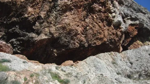
The Cueva de los Muñecos is located inside the Natural Park Despeñacolos, the municipal term of Santa Elena, within a ravine, built between colossal stone blocks, in which there are excavated several caves, the largest of which, about 50 meters deep, was probably the limit of the sacred enclosure. Within this cave today there is a water spring that probably should have existed already in ancient times. In the area there is today a Centre for the Interpretation of the Historical and Cultural Heritage of the Natural Park of Despeñacolos, as well as a path for public use that leads to the Sanctuary and a lookout in the so-called Cerro del Castillo.
There is a place in St. Helena (Jaén) for all the neighbors known as La Cueva de los Muñecos, called for the number of votes (bronze figures) found in the area. It is the Iberian Sanctuary located on the Collado de los Jardines located on the A-6200 road that leaves from the A4 motorway in Despeñacolos to the town of Aldeaquemada.
There are many corners that house Despeñacolos and La Cimbarra, however in the interpretative endowment some of the most emblematic are highlighted and presents us the human environment that surrounds these natural spaces, with special mention to the peoples of the surroundings that can not stop visiting to enjoy their gastronomy, their festivities and the heat of their good people.
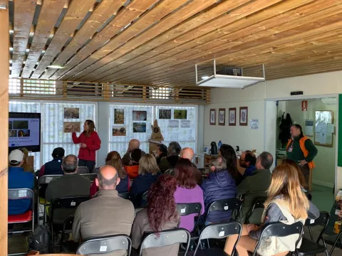
Llano de las Américas is attended by professionals who, in addition to helping with the interpretation of the center itself, give all the information that the visitor needs in order to organize his visit to the park or the natural area with the best guarantees of being an unforgettable experience.
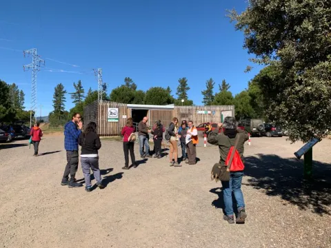
This equipment is connected to the Public-Use Path Los Straits de Miranda, through which the visitor will be able to walk into the Despeñacolos Natural Park. Next to the visitors' centre is a recreational area on forest grounds, in a tree mass of pine and cedars with the presence of oak, alcornocal and typical Mediterranean bushes.
The Llano Visitors Center of the Americas is a new equipment designed to receive and guide visitors who decide to meet the Natural Park Despeñacolos and Cascada de la Cimbarra. The main characteristics that were decisive for the Autonomous Administration to decide to declare these areas protected in 1989 are explained through an amena interpretative endowment.
In its exhibition area a review is made of the different natural and cultural values that turn these two spaces into small jewels worthy of admiration. Based on its geological evolution, it explains why its most remarkable formations: Natural Monument of the Organs and Cascade of the Cimbarra; the tour continues to review its anthropic evolution. And there have been many civilizations that have inhabited these enclaves, or simply used Despeñacolos as a natural step between what we know today as Andalusia and the rest of the Peninsula: The prehistoric man, the Iberians, the Romans, the Muslims, etc. And all of them have left their mark, today visitable in these spaces.
But perhaps the most remarkable of these areas are their different landscapes, work above all of the differences in relief and exposure to the sun that we are in short distances, and that have triggered in that there are very many species both animal and plant that have found their habitat in Despeñapores and the Cimbarra. Of all, the imperial eagle deserves special mention, so a real size reproduction will welcome us to the center.
The sustainable exploitation of these enclaves also finds its corner in the centre of visitors, explaining the reason for their realization and their importance for the proper functioning of ecosystems and their protection against pests or fires. For its ancestral connection, the use of the psychological system deserves special mention.
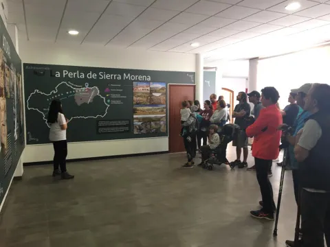
It is located in Aldeaquemada, and has the purpose of creating cultural and museum activities, also being the local Tourist Office.
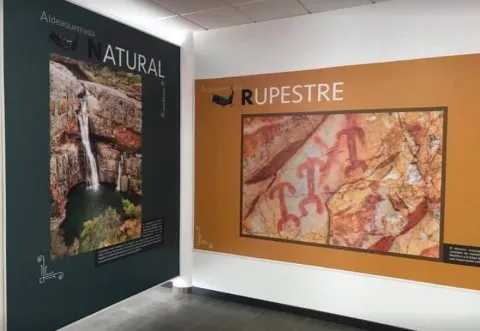
The Centre for Interpretation and Ecomuseo shows, through various panels and audiovisual technologies, the valuable cultural heritage of Rupéstre Art existing in this municipality, declared "Heritage of the" Humanity "by Unesco in 1998, the natural heritage thanks to the Natural Area of the Cascade of La Cimbarra and others, and the historical heritage associated with the colonization of Charles III in the 18th century.
The Pablo de Olvide Interpretation Centre, in Aldeaquemada, is a cultural space of this town, which was opened on October 31, 2017.
Also close to the Iberian Sanctuary "Cueva de los Muñecos" to where you can access through a signposted path that begins at the doors of the Interpretation Center.
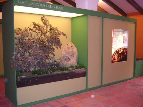
The Interpretation Centre has an exhibition area divided into 6 interpretative sets:
1. Elements of the landscape
2. Prehistory and Old Age
3. The Middle Ages. The Battle of the Navas de Tolosa
4. The Modern Age. New populations
5. The Contemporary Age
6. Audiovisual room. Dog-biting in time.
All these interpretative sets are made up of models, backlit information media, exhibition of real elements and replica in vitrines, ambiances and documentary projections.
Located in a privileged place, in the "Collado de Los Jardines" before entering the Centre you can enjoy in the surroundings of an authentic forest of Quejigos of great ecological value.
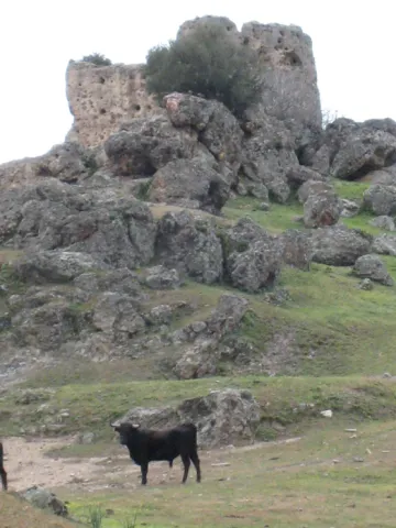
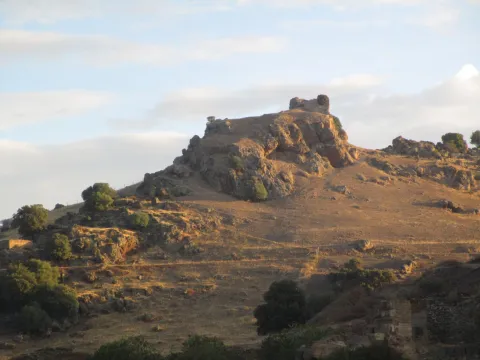
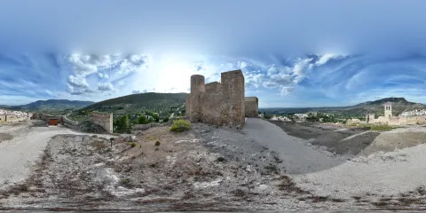
The castle of the Navas de Tolosa is made up of a trapeze-shaped walled enclosure and a hexagonal plant tower located at its northeastern angle. Possibly there was a second external enclosure to which some visible canvas would belong in the surroundings of the castle.
The site of the fortification, very destroyed, was possibly built in a tapial of argamase on a base of masonry, adapts to the rocky plateau on which it sits, using it as a foundation and as part of its defense. Inside it are distinguished some sections of walls that would belong to internal dependencies and a possible aljibe.
Two accesses are kept inside the fortress, the main door was located on its west side, protected by a narrow wall that supports a natural rock skid. On the eastern flank, next to the tower, a narrow posterna is opened partially hidden by a rock that gives it visual protection and creates a narrow corridor to reach it.
The tower, built in a very compact tapial with its high lime content, retains about 14 m from the outside and only two from the inside. In the outer plucido of the tower there are still some lines that would be part of some type of decoration or simulation of large armchairs, a technique known as false parting, especially in the area of the posterna.
Inside there is a rectangular space that occupies much of the stay, leaving a narrow corridor around it. It is possible to be an aljibe to collect and store the rain water, whose cover would hold the ground on the first floor of the tower.
To the north-east of the fortress there are traces of a rectangular building with internal divisions, perhaps the hermitage that was erected shortly after the Christian conquest. Other walls that are distinguished in their surroundings could be evidence of the existence of a small plateau.
The area of Despeñacolos has attracted inhabitants since Prehistory for its steep orography, in which caves and coats proliferate, as well as for its natural sites conducive to sacralization.
But it was its strategic value with respect to the natural steps that pass through Sierra Morena, so fortifications were erected during the Middle Ages, and even in previous periods, with the aim of controlling the communication routes between the Plateau and al- Ándalus.
Although the small plateau could be inhabited already in the Bronze Age and in Roman times, the Castle of Navas de Tolosa, it would be built between the XI- XII centuries by Muslims to control the natural steps of Despeñacolos. Years later, they would strengthen their defensive role in an attempt to stop the progress of Christian troops. This fortress became one of the "doors" of the passage of the Muradal, along with Castro Ferral, which made it a goal to beat. After the battle of the Navas de Tolosa will definitely be in the power of Castile.
The fortress was part of the stage of one of the most prominent milestones in the medieval history of the Peninsular, because of its significance in the advance of the Christian kingdoms over al- Ándalus, the battle of the Saves of Tolosa, fought on July 16, 1212. Conceived as a crusade, it was a contest in which the routes and steps to the Plateau played a fundamental role. A coalition of Christian kings, Alfonso VIII of Castile, Peter II of Aragon and Sancho VII of Navarra, supported by Pope Innocent III, faced against the Almohad Caliph of Muhammad al-Nasir, in whose army fighters from the Maghreb, from sub-Saharan territories and from Turkish contingents were integrated.
On 12 July 1212, troops under the command of Don Diego López de Haro took over the Puerto del Muradal. Two days later, after being blocked in the passage of the Slayer, Christians camp in the place known as the King's Table, from where they went to battle, defeating the Almohad army.
After the victory of the Christian armies, the fortification of the Navas would remain important on the route of the Muradal throughout the 13th century, becoming one of the strategic points for control of the passage of troops during the conquest of Alto Guadalquivir. In 1217 the archbishop of Toledo was awarded the castles of the region, with the consent of Pope Honorio III, who confirmed them as the limits of the Toledo archdiocese.
According to the written sources, this space was repopulated by Spanish contingents throughout the 13th century, and its castle was demolished in 1473 under the mandate of the City of Baeza.

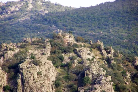
The castle of Navas de Tolosa is a small fortification in height that takes advantage of the defensive possibilities offered by the rock formation on which it is based, a hoss of a certain magnitude, capable of hosting a small military garrison. It is made up of a walled enclosure and a hexagonal tower, and may have had a second enclosure to protect them. Because of the presence in its surroundings of numerous vestiges of construction it may have been surrounded by a small population that would find refuge among its walls in case of danger.
The castle of the Navas de Tolosa or the Collados or the Eagles was one of the fortresses that were built to protect the Puerto del Muradal, one of the main mountain steps that communicated al- Andalus with the Plateau. The transcendental battle of the Navas de Tolosa marked its history, as it would be taken by the Castilians in the context of the confrontation between the Christian and Muslim sides, in July 1212. During the 13th century, it would have the role of protecting and monitoring the passage of troops and supplies for the campaigns carried out by Christian armies in the conquest of al- Andalus.