Saltar al contenido principal

Castle of Castro Ferral

Submitted by brandcode_deweloper on
Id
439190
Descripción
Descripción larga

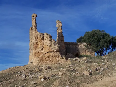
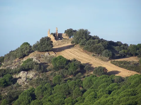
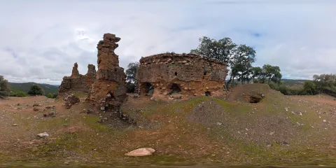
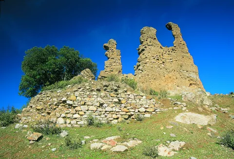
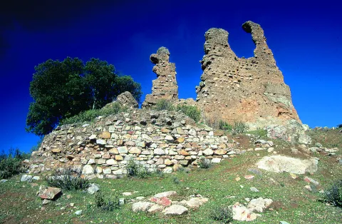
El castillo de Castro Ferral ha sido considerado tradicionalmente como un mero puesto de control en la entrada a Andalucía desde la Meseta, pero las investigaciones arqueológicas han sacado a la luz los restos de un castillo de un tamaño considerable, con una antigüedad mayor de la esperada, como demuestran las sucesivas reparaciones de las que fue objeto y las tres fases de ocupación que se han detectado en la fortificación. 

A época romana correspondería un primer asentamiento, probablemente fortificado, datado en el período bajo-imperial, al que parece corresponder un muro construido con mampostería irregular, que servirá de cimentación para el lienzo oeste del recinto del castillo. 

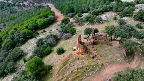
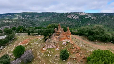
Pero serán los almohades, en la Edad Media, quienes construyan la fortificación que vemos hoy en día. Estaría formada por un recinto cuadrangular construido en tapial de tierra y cal, con un aljibe en su interior, que se rodearía con una línea de muralla también de tapial, conformando el perímetro exterior del recinto.

En el lienzo oeste, erigido sobre el zócalo de mampostería mencionado, se abre un vano en el extremo occidental del muro, que pudo corresponder al acceso a una mina para la extracción del mineral de hierro que se encuentra en el interior del castillo, actividad a la que alude su topónimo y cuya explotación continuará durante todo el período islámico. 

El sistema defensivo de Castro Ferral se refuerza probablemente antes de la batalla de las Navas de Tolosa, de 1212, con el levantamiento de un nuevo muro de tapial paralelo al lienzo este del recinto, un antemuro que crea un pasillo o liza de 2,2 m, a la vez que se amplía el recinto en dirección norte. En esos momentos la extracción de hierro se abandona y se ciega su acceso, protegiéndola.

La contienda debió originar cuantiosos daños a la fortificación, ahora en manos cristianas, lo que unido a las ofensivas posteriores de los almohades propició que se llevase a cabo la modificación de algunos de sus elementos defensivos, como el refuerzo con mampostería de muros y la construcción, en el extremo sureste, de una torre de la misma fábrica y planta circular.

La zona de Despeñaperros ha atraído pobladores desde la Prehistoria por distintas razones: 

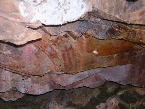
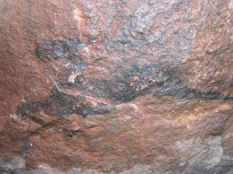
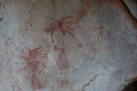
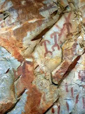
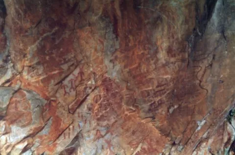
Su escarpada orografía, ha permitido la conformación y proliferación de cuevas y abrigos como los del Conjunto Rupestre Vacas del Retamoso-Los Órganos, que cuentan con pinturas rupestres, concretamente 400 figuras de estilo esquemático y levantino repartidas por 14 puntos diferentes, declaradas Patrimonio de la Humanidad por la Unesco. 

Sus parajes naturales propicios para la sacralización, como el santuario del Collado de los Jardines o Cueva de los Muñecos, un abrigo cobijado bajo un escarpe del cerro cuyo nombre alude a los más de 2.500 exvotos de bronce recuperados del expolio. 

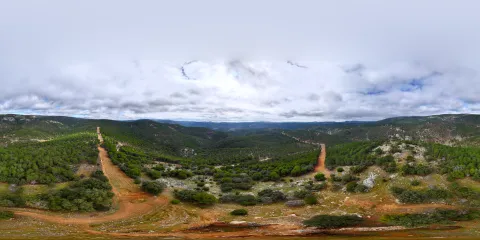
Y, por último, su valor estratégico respecto a los pasos naturales que atraviesan Sierra Morena, por lo que se erigieron fortificaciones durante la Edad Media, e incluso en períodos anteriores, con el objetivo de controlar las vías de comunicación entre la Meseta y al-Ándalus. 

Castro Ferral sería una de las fortificaciones que cubrían el paso de La Losa, lo que le convertía en un objetivo a batir. En 1169 Fernando de Icaza, segundo Maestre de la Orden de Calatrava, conquistó temporalmente la fortaleza, que volvió a manos musulmanas en fecha desconocida, hasta que tras la batalla de las Navas de Tolosa quedara definitivamente en poder de Castilla. 

La fortaleza formó parte del escenario de uno de los hitos más destacados de la historia medieval peninsular, por su trascendencia en el avance de los reinos cristianos sobre al-Ándalus, la batalla de las Navas de Tolosa, librada el 16 de julio de 1212. Concebida como cruzada, fue una contienda en la que las rutas y pasos hacia la Meseta jugaron un papel fundamental. En ella se enfrentaron una coalición de reinos cristianos, comandados por los monarcas Alfonso VIII de Castilla, Pedro II de Aragón y Sancho VII de Navarra, apoyados por el papa Inocencio III, contra el califa almohade Muhammad al-Nasir, en cuyo ejército se integraron combatientes procedentes del Magreb, de territorios subsaharianos y de contingentes turcos.

El 12 de julio de 1212, tropas al mando de Don Diego López de Haro tomaron el Puerto del Muradal, con la fortificación de Castro Ferral. Dos días más tarde, tras ser bloqueados en el paso de la Losa, los cristianos acampan en el paraje conocido como Mesa del Rey, desde donde acuden a la batalla que tuvo lugar el día 16 de julio, derrotando al ejército almohade.

En el entorno de la fortaleza, se han documentado los vestigios de su asalto por las tropas de Alfonso VIII, una gran concentración de material armamentístico, básicamente puntas de flecha. Se han registrado también piezas relacionadas con la vida cotidiana en El Ferral y con su función militar.


Tras la victoria de los ejércitos cristianos Castro Ferral mantuvo su importancia en la ruta del Muradal a lo largo del siglo XIII, como uno de los puntos estratégicos a partir de los cuales se acometería la conquista del Alto Guadalquivir. En 1217 el arzobispo de Toledo se adjudicó el castillo y su término junto con otros de la región, entre ellos el de Tolosa, con el consentimiento del papa Honorio III, quien los confirmó como límites de la archidiócesis toledana. En el año 1243, a raíz de las reclamaciones del obispado de Baeza se integró en la jurisdicción baezana.

El traslado de la frontera a las Cordilleras Béticas le restó valor estratégico, lo que marcó el inicio del declive de Castro Ferral. El abandono y la apertura de un cortafuegos que atraviesa las ruinas, supusieron la desaparición de gran parte de las estructuras que conformaban la fortaleza.

El pastor de las Navas de Tolosa. En julio de 1212 las huestes cristianas, en su camino hacia el corazón de al-Andalus debían atravesar Sierra Morena por el paso natural de La Losa, una garganta angosta en el Puerto del Muradal, defendida por la fortaleza de Castro Ferral. Alfonso VIII envió a Don Diego López de Haro a tomar el castillo, pero a pesar de su conquista, el camino seguía fuertemente defendido. 

Al campamento cristiano llegó un hombre del lugar, conocedor de aquellas tierras de frontera, que les mostró un camino alternativo entre las montañas, conduciendo a Don Diego López de Haro y sus tropas a una altiplanicie desde entonces conocida como Mesa del Rey. En ella se instaló el campamento cristiano para lanzar su ofensiva contra el ejército almohade, el día 16 de julio de 1212, un enfrentamiento que abriría la puerta de al-Ándalus a los ejércitos cruzados. El hombre que les mostró el camino se llamaba Martín Halaja, pastor para unos, cazador para otros y para los más piadosos el mismo San Isidro.

Breve descripción

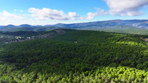
The castle of Castro Ferral is located in the Puerto del Muradal, at more than 900 m of altitude, a strategic place for the control of the Paso de la Losa, via communication between Andalusia and the Plateau, in the heart of Despeñacolos. The Almohad fortification consisted of a quadrangular enclosure and a line of outer wall that defended it, both built in tapial of lime and sand argamase, to which Christians added a circular plant tower of masonry, as well as other reforms in their wall cloth. The name "Ferral" refers to the presence of iron, mineral that was extracted from the castle itself during several historical times.
The significance of the battle of the Navas de Tolosa, in the advance of the Christian kingdoms over al- Ándalus marked the history of the castle of Castro Ferral, as demonstrated by the rapid occupation of the fortress by Christians in the days before the confrontation between the two sides, in July 1212. The importance of this fortified enclave lasted throughout the 13th century, with the function of protecting and monitoring the passage of troops and supplies.
Telecomunicaciones
Sitio web
www.santaelena.es
Teléfono de contacto
953 664 010
Correo electrónico
santaelenajaen@gmail.com
Ubicación
Código Postal
23213
Latitud
38.392870
Longitud
-3.545360
Distrito
Municipio
Ubicación en el mapa
POINT (-3.54536 38.39287)
Tipos de punto de interés
Imágenes carrusel
imagen
Image
Mon056.jpg
Imagen principal
Desactivado
imagen
Image
Mon490.jpg
Imagen principal
Desactivado
imagen
Image
castillo_castro
Imagen principal
Desactivado
imagen
Image
castillo_castro
Imagen principal
Desactivado
Imágenes cabecera
imagen
Image
CyB_Sta_Elena_01
Imagen principal
Desactivado
imagen
Image
CyB_Sta_Elena_02
Imagen principal
Desactivado
imagen
Image
CyB_Sta_Elena_03
Imagen principal
Desactivado
Horario
24 h.
Experiencia 360
Image
CyB_Sta_Elena_foto360_castillo cenital
Image
CyB_Sta_Elena_foto360_castillo cenital
Loading map
Preparing points of interest and routes...

Rock Art of Santa Elena

Submitted by brandcode_deweloper on
Id
10894576
Descripción
Descripción larga

These more or less realistic but generally schematic manifestations reproduce human beings, animals and symbols, forming isolated scenes. The representations not only evoke and report part of daily life, but leave us witness to its complex v mysterious spirituality.

World Heritage Site

The natural park of Despeñacolos has different groups of rock paintings, of a schematic and eulin style, which gives this park an interesting cultural value, for the many coats and caves where these first inhabitants left their art. In 1998 it became part of the UNESCO catalogue as World Heritage Site.

Outdoor museums

These sites can be considered as authentic outdoor museums of incalculable value, whose preservation concerns each and every fellow citizen. When visiting them, we must remember that we contemplate figures made by the primitive man, not least human and intelligent, more than 4,000 years ago. It's all by law, Cultural Interest Property.

Visit the paintings

Visiting these places can be difficult and frustrating, not only because of their access; it can be dangerous, but because sometimes their conservation status can be at least poor; and it is recommended that they be visited with a specialist. For this purpose, before scheduling the visit, it is advisable to consult with someone familiar with the place (to advise and guide) or even to be accompanied by a responsible local guide (it is advisable to contact local authorities or associations).

The Abrigo e la Cave de los Muñecos, the Abrigo de Vacas del Retamoso and the Abrigo de Los Organos are highlighted.

Breve descripción

The Rupestre Art, "art on rock," is composed of the pictorial manifestations that our remote ancestors left on the walls of numerous covacas and petreous coats of our saws, in prehistoric times (in our region, from the Neolithic, to the Bronze Age).

Ubicación
Código Postal
23213
Latitud
38.341754
Longitud
-3.539315
Distrito
Municipio
Ubicación en el mapa
POINT (-3.539315 38.341754)
Tipos de punto de interés
Imágenes carrusel
imagen
Image
cueva%20escolares.JPG
Imagen principal
Desactivado
imagen
Image
cueva%20muniecos.JPG
Imagen principal
Desactivado
imagen
Image
DSC_7089.JPG
Imagen principal
Desactivado
imagen
Image
rupestres.JPG
Imagen principal
Desactivado
Imágenes cabecera
imagen
Image
chamanes%20vacas%20retamoso.JPG
Imagen principal
Activado
Loading map
Preparing points of interest and routes...
Marcas de calidad

Arte Rupestre

Submitted by brandcode_deweloper on
Id
1927651
Descripción
Descripción larga
These more or less realistic but generally schematic manifestations reproduce human beings, animals and symbols, forming isolated scenes. The representations not only evoke and report part of daily life, but leave us witness to its complex v mysterious spirituality.

World Heritage Site

In Aldeaquemada, as a sample of its valuable cultural heritage, there are different groups of rock paintings, of a schematic and eulin style; distributed by fleshlands and rocky coats of the municipal term. So much so that UNESCO, meeting in Kyoto (Japan) in 1998, agreed to catalogue the Levine Rupestre Art of the Spanish Mediterranean Arc as a World Heritage Site. Meeting in assembly, he gave this important name and included in the list the 19 deposits of Rupéstre Levino and Eschematic Art discovered in this municipality, cataloguing that has come to recognize and highlight the great importance of the cultural manifestations of the former inhabitants of these lands.

Outdoor museums

These deposits, unique for their subject matter, are the most important in Andalusia and can be considered as authentic outdoor museums, of incalculable value and whose preservation concerns each and every one of us. When visiting them, we must remember with all due respect that we contemplate figures made by the primitive man; but not for that less human and intelligent, more than 4,000 years ago. They are all by law Cultural Interest Goods.
These groups of rock paintings, located on most occasions on rock coats, were studied at the beginning of the 20th century by the Abate Brehuil and M. Cabré, who catalogued the vast majority of existing groups in the area.
Subsequently, thanks to the new and relevant discoveries of the chronist Carlos Sanchez- Battle, it has been possible to have an extended relationship and a full awareness of the great heritage value that, for Aldeaquemada, represents the whole of its cave paintings.

Visit the paintings

Visiting these places is difficult and can be frustrating, not only because of their access; dangerous sometimes, but because of their poor conservation status; they make them difficult to see if they are not specialized. For this reason, before scheduling a visit, you should consult with a local connoisseur and let yourself be accompanied by a responsible local guide.
The most representative coats, on which signposted routes have been developed; not yet operational until the final protection of the paintings, but which has been announced (the Ayto. provide guides) can be visited, are those of the Poyos de La Cimbarra, Cimbarillo del Prado de Rechesa, Cave de la Mina, Garganta de la Hoz, Prado del Azogue and Cave de Los Arcos. Although there are another series of awakened groups.

Breve descripción

The Rupestre Art, "art on rock," is composed of the pictorial manifestations that our remote ancestors left on the walls of numerous covacas and petreous coats of our saws, in prehistoric times (in our region, from the Neolithic, to the Bronze Age).

Ubicación
Latitud
38.411070
Longitud
-3.374460
Distrito
Municipio
Ubicación en el mapa
POINT (-3.37446 38.41107)
Tipos de punto de interés
Imágenes carrusel
imagen
Image
pintlafelicita02%20%281%29.jpg
Imagen principal
Desactivado
imagen
Image
pintbarrancocueva%20%281%29.jpg
Imagen principal
Desactivado
imagen
Image
pintbarrancocueva01%20%281%29.jpg
Imagen principal
Desactivado
Imágenes cabecera
imagen
Image
pintpradoazogue%20%281%29.jpg
Imagen principal
Activado
Loading map
Preparing points of interest and routes...
Marcas de calidad

Recreational Area La Aliseda

Submitted by brandcode_deweloper on
Id
5867211
Descripción
Descripción larga

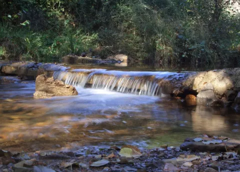
It occupies a wonderful valley in the southern foothills of Sierra Morena, next to the Natural Park of Despeñacolos. Here they grow a great variety of aromatic plants and beautiful trees of different species, such as pine trees, oak trees, alcornoques, chestnuts, willows, abounding the plateau from which this place takes the name. There is also a small river of crystalline waters on a stony bed called "La Campana."

In the geological aspect, there are iron pyrite, which is why the waters of one of its many springs are ferruginous. This area where La Aliseda is located, was in its time part of a large mining center where the gallena filons abound with a lot of silver.

Breve descripción

La Aliseda is currently a recreational area of great landscape value, located in the municipal term of Santa Elena (Jaén) and five kilometres from the population centre. We can get to it on the JA-7100 district road that we will take from the motorway of Andalusia A4 at Exit 258 or 266.

Telecomunicaciones
Sitio web
www.espaciosnaturalesdejaen.com/espacios/9-area-recreativa-la-aliseda.html
Teléfono de contacto
953 401 240
Ubicación
Código Postal
23213
Latitud
38.330910
Longitud
-3.575760
Distrito
Municipio
Ubicación en el mapa
POINT (-3.57576 38.33091)
Imágenes carrusel
imagen
Image
13.jpg
Imagen principal
Desactivado
imagen
Image
11.jpg
Imagen principal
Desactivado
imagen
Image
10.jpg
Imagen principal
Desactivado
imagen
Image
natural9.jpg
Imagen principal
Desactivado
Imágenes cabecera
imagen
Image
14.jpg
Imagen principal
Activado
Loading map
Preparing points of interest and routes...

Cold garlic soup

Submitted by brandcode_deweloper on
346816
Distrito
Municipio
imagen
Image
sopa-fria-ajo.jpg
Imagen principal
Activado
Medium

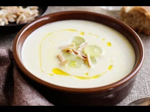
The eggs are scalated, the clear is removed and deposited at the bottom of a glass (one per person). The gelatinous cooked broth once cooled is placed on top. The ham in lasques is fried with live heat until it is crispy and the broth is added along with a few pieces of toast.

A number of garlic sheets are fried with live fire and are added to the cup along with the liquefied parsley.

Desactivado

Poultry eggs, 1? l cooked broth, 100 gr serrano ham, 50 gr bread, 2 garlic teeth, 1 parsley.

Cheese with truffles, green apple, and nuts

Submitted by brandcode_deweloper on
349522
Distrito
Municipio
imagen
Image
trufas-queso.jpg
Imagen principal
Activado
Medium

Infuse milk and manchego cheese until fused. Put it to cool in the right container.

In the center of the dish, above the cream, add a tablespoon of red tomato, the dice of cheese, apple and truffle around and a small salad of arucular leaves. Finish with a few drops of oil to macerate the black truffle.

Desactivado

250 gr of manchego cheese, 1 l of sheep's milk, 100 gr of arucula leaf, 300 gr of red tomato jam, 100 gr of minced black truffle, 300 gr of red tomato jam, 100 gr of olive oil, 1 green apple in squares, almonds and roasted rails.

Sierra Morena style partridges

Submitted by brandcode_deweloper on
1953565
Distrito
Municipio
imagen
Image
receta-perdiz.JPG
Imagen principal
Activado
Medium

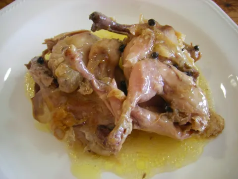
It's clean and the partridges are washed. We put on the fire a pot of oil mud and when it is hot we soften the carrots, once clean and cut into slices, the tincada onion and the chopped garlic.

We sprinkle the partridges with salt and pepper, and we incorporate them into the saffrito so that they may also be shrewd in it. The brandy is poured over them and we turn it on to flame them. Once the flame is off, we add the broth to the stew. We add the branch of aromatic herbs, we cover the casserole, and we cook 35 minutes.

If you want the cooking to be slower, we will place a dish with water on the pan. Once cooked the partridges are removed and reserved. We pass the salsa through the pasapurés, and it returns to the casserole, it adds the milk cream and moves a few minutes. We put in the partridges, we cook all six more minutes, and we serve in the same casserole.

Desactivado

6 parrots, 3 carrots, a garlic tooth, an onion, aromatic herbs (laurel, thyme and parsley), a glass of brandy, a liter of broth, half a glass of milk cream, salt pepper and extra virgin olive oil.

Confit lettuce hearts

Submitted by brandcode_deweloper on
334128
Distrito
Municipio
imagen
Image
lechuga-confitada.jpg
Imagen principal
Activado
20 minuten
Easy

We'll take advantage of the thickest nervations from the lettuce and cook them in water until they soften, take them out of the fire and put them in cold water. After we drain them, we'll dry them with a cloth and reserve them.

We take the same amount of sugar as the weight of lettuce and half or less of water. We will boil this mixture to the perfection of its stray (between syrup and syrup), let it cool and pour it into the container where the lettuce is located; so it will be two days. We will boil the sugar again and, after cooling it, we will pour it over the lettuce; it will boil the whole two or three times and, once cold, we will be able to enjoy it.

Do not be distressed by the process, as there are faster forms, according to these times, with a very similar result. We'll try it if you see it well.

Desactivado

Bean lettuce, brown sugar and water

Abades Puerta de Andalucía

Submitted by brandcode_deweloper on
1773218
Descripción larga

The root of Grupo Abades is an area of service that revolutionized the concept of on-road rest: it was not just a place to rest, it was a space to live an experience during the journey. Today, more than 25 years later, the philosophy of creating spaces in which our customers can enjoy a special moment is still present in all our business lines.

Now, in addition to rest areas, we have hotels, restaurants, catering service and events and many more services that make us one of the references of the leisure, tourism and restoration sectors and, above all, leaders in creating unique experiences for you.

To achieve this, we always seek excellence in everything we do: excellent locations, excellent gastronomic offer, excellent comfort, excellent innovation, excellent quality... All so that you feel that every time you visit us you have taken aexcellent decision.

Teléfono
953 664 358
Correo electrónico
puertaandalucia@abades.com
Latitud
38.314350
Longitud
-2.86634
Dirección
Autovía A-4, Salida 262
Distrito
Municipio
Ubicación en el mapa
POINT (-2.86634 38.31435)
imagen
Image
abades.jpg
Imagen principal
Activado
imagen
Image
Abades-Tiendas-115.jpg
Imagen principal
Desactivado
imagen
Image
Abades-Tiendas-315.jpg
Imagen principal
Desactivado
Desactivado
Loading map
Preparing points of interest and routes...

Escuela de la Naturaleza Las Nogueras

Submitted by brandcode_deweloper on
2345545
Facebook
https://www.facebook.com/Las-Nogueras-106590816068963/
Descripción larga

Las Nogueras, is a large-school, multi-adventure center, located on a 40-hectare farm in the natural park of Despeñacolos (Jaén) that has been developing school visits, camps and celebrations since 1992.

Teléfono
915 730 565
Sitio web
www.lasnogueras.com
Correo electrónico
info@lasnogueras.com
Latitud
38.365320
Longitud
-2.86867
Dirección
Carretera de Miranda del Rey, s/n
Distrito
Municipio
Ubicación en el mapa
POINT (-2.86867 38.36532)
Curiosidades

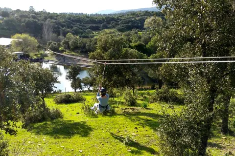
The magnificent facilities of the estate - horses, swimming pools, basketball courts, squash, football fields, rocodrome, archery, tyrolin, lake, pyroguas, canteens and dormitories -, its splendid natural and cultural environment and the wide range of activities that the monitors develop, specifically formed in our facilities, will make your stay an unforgettable sports, natural and cultural experience.

imagen
Image
las-nogueras.jpg
Imagen principal
Activado
imagen
Image
59960348_2310849338976422_1511072230350520320_n.jpg
Imagen principal
Desactivado
imagen
Image
11168025_907429079318462_2521671569421191774_n.jpg
Imagen principal
Desactivado
imagen
Image
60141255_2310849498976406_6662162341079023616_o.jpg
Imagen principal
Desactivado
Desactivado
Loading map
Preparing points of interest and routes...