Saltar al contenido principal

Recreational Area La Aliseda

Submitted by brandcode_deweloper on
Id
5867211
Descripción
Descripción larga

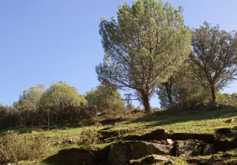
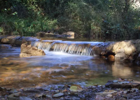
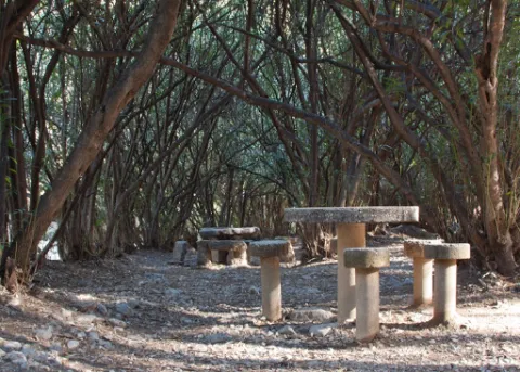
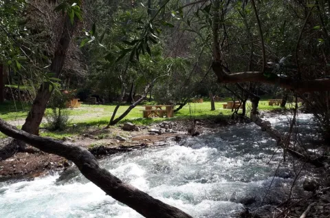
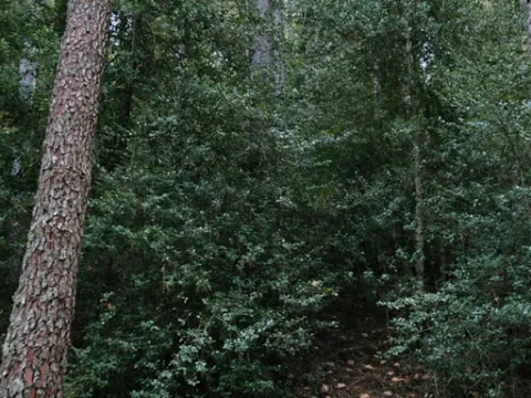
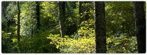
It occupies a wonderful valley in the southern foothills of Sierra Morena, next to the Natural Park of Despeñacolos. Here they grow a great variety of aromatic plants and beautiful trees of different species, such as pine trees, oak trees, alcornoques, chestnuts, willows, abounding the plateau from which this place takes the name. There is also a small river of crystalline waters on a stony bed called "La Campana."

In the geological aspect, there are iron pyrite, which is why the waters of one of its many springs are ferruginous. This area where La Aliseda is located, was in its time part of a large mining center where the gallena filons abound with a lot of silver.

Breve descripción

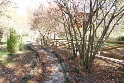
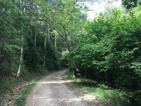
La Aliseda is currently a recreational area of great landscape value, located in the municipal term of Santa Elena (Jaén) and five kilometres from the population centre. We can get to it on the JA-7100 district road that we will take from the motorway of Andalusia A4 at Exit 258 or 266.

Telecomunicaciones
Sitio web
www.espaciosnaturalesdejaen.com/espacios/9-area-recreativa-la-aliseda.html
Teléfono de contacto
953 401 240
Ubicación
Código Postal
23213
Latitud
38.330910
Longitud
-3.575760
Distrito
Municipio
Ubicación en el mapa
POINT (-3.57576 38.33091)
Imágenes carrusel
imagen
Image
13.jpg
Imagen principal
Desactivado
imagen
Image
11.jpg
Imagen principal
Desactivado
imagen
Image
10.jpg
Imagen principal
Desactivado
imagen
Image
natural9.jpg
Imagen principal
Desactivado
Imágenes cabecera
imagen
Image
14.jpg
Imagen principal
Activado
Loading map
Preparing points of interest and routes...

Arch of la Encarnación

Submitted by brandcode_deweloper on
Id
4659054
Descripción
Breve descripción

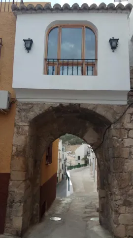
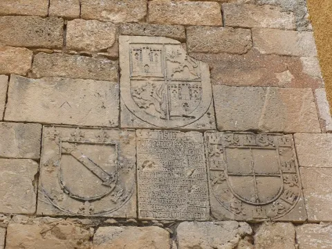
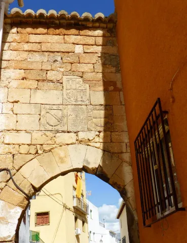
On the Arc of the Incarnation of Pegalajar, a pointed arch that was the main entrance door to the castle of Pegalajar, is a commemorative stone surrounded by heraldic shields. The stone is recorded in relief with a textual gothic letter, in some parts damaged. The writing box of the stone is distributed in relief lines where the photographs are attached. It uses some abbreviations and the concealment of some letters at the end or in the middle of the word. Words are usually separated by scores. Head the tombstone the word "Jheits ", framed in two crosses, religious invocation usual at the beginning of all public writings, followed by the date, the reference to the king reigning and then the ordinator of it and the type of work commemorative. The transcription of the stone is as follows:

Telecomunicaciones
Sitio web
www.ayto-pegalajar.org
Correo electrónico
pegalajar@promojaen.es
Ubicación
Código Postal
23110
Latitud
37.738970
Longitud
-3.649050
Distrito
Municipio
Ubicación en el mapa
POINT (-3.64905 37.73897)
Tipos de punto de interés
Imágenes carrusel
imagen
Image
arco%20de%20la%20encarnaci%C3%B3n%202.jpg
Imagen principal
Desactivado
imagen
Image
arco%20de%20la%20encarnaci%C3%B3n.jpg
Imagen principal
Desactivado
Imágenes cabecera
imagen
Image
10486986676_87a2769dfe_b.jpg
Imagen principal
Activado
Microsite al que pertenece
Loading map
Preparing points of interest and routes...

Hamlet of Fuentefría

Submitted by brandcode_deweloper on
Id
8146351
Descripción
Descripción larga

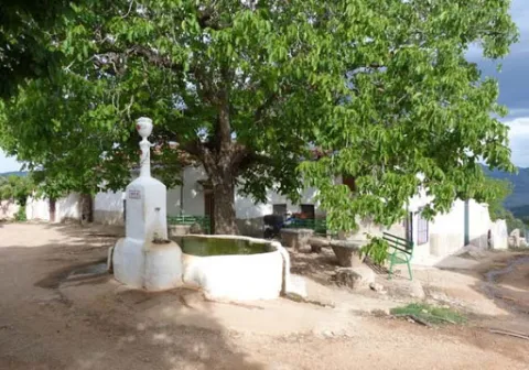
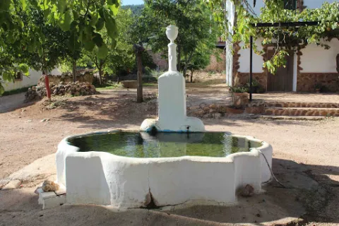
We highlight the source that is located in the centre of the village, where you can reach a track in good condition that leaves south from Collado Mahón (on the road from Torres de Albanchez to Villarrodrigo). The source of the work and with two years pours to two semicircular pillars. The water is the toima of a spring in an olive grove about 300 m south-west.

Breve descripción

In this village we will have the opportunity to contemplate beautiful views of the Natural Park. Near the settlement we can visit the Fucofría fountain, a water spring located at the foot of Mount La Cordera.

Telecomunicaciones
Teléfono de contacto
953 494 005
Ubicación
Código Postal
23391
Latitud
38.415062
Longitud
-2.676886
Dirección
Carretera de Torres de Albanchez
Distrito
Ubicación en el mapa
POINT (-2.676886 38.415062)
Tipos de punto de interés
Imágenes carrusel
imagen
Image
fuente%20de%20Fuenfr%C3%ADa3.jpg
Imagen principal
Desactivado
imagen
Image
fuente%20de%20Fuenfr%C3%ADa2%20%281%29.jpg
Imagen principal
Desactivado
Imágenes cabecera
imagen
Image
fuente%20de%20Fuenfr%C3%ADa%20%281%29.jpg
Imagen principal
Activado
Horario
is
Loading map
Preparing points of interest and routes...

Adelfar del Río Cuadros

Submitted by brandcode_deweloper on
Id
5845551
Descripción
Breve descripción

The natural adelfal of the Cuadros River is probably one of the largest and most important of the Iberian peninsula. In this case they form a curious gallery forest.

Ubicación
Latitud
37.790160
Longitud
-3.407520
Distrito
Municipio
Ubicación en el mapa
POINT (-3.40752 37.79016)
Tipos de punto de interés
Imágenes carrusel
imagen
Image
unnamed.jpg
Imagen principal
Desactivado
imagen
Image
rio-cuadros-bedmar-garciez_14676034_20200923133251.jpg
Imagen principal
Desactivado
Imágenes cabecera
imagen
Image
727_ss_01-1-jpg
Imagen principal
Activado
Microsite al que pertenece
Loading map
Preparing points of interest and routes...

Holly and Lauroid Forests de alta montaña

Submitted by brandcode_deweloper on
Id
919588
Descripción
Descripción larga

By withdrawing the ice, the Azebos undertook a migration to the contrary, reconquering to the north the lost territory, so we can say that all the Azebos of Europe are descendants of ours. So, when we enjoy this forest, let us remember that these stalks are waiting for the next glaciation... so that, after it, Europe will again have stalks.

This forest is accompanied as a vault by a canopy of salgary pines and a tapestry of ferns (Pterydium aquilinum) and herbaceas (Dactylis glomerata, Poa nemoralis, Festuca nevadensis, Brachypodium sylvaticum, Viola kitaibeliana, Bellis perennis, Sanicula europea) and others better known as the wild strawberry (Fragaria vesca), the tears of David or the seal of Solomon (Polygonatum), and the greater (Pallatago (Pallatago).

LOCATION

We take the road that leaves a mile from Siles in the direction of the Azebeas. We follow it until we reach a crossing that comes to our right, is wide and has a barrier and a sign that announces us the public use path of Navalperal. It is only necessary to walk half a mile before reaching the forest house of the Azebeas. Both to our right and to our left is a splendid forest of steels accompanied by hazelnuts.

Breve descripción

The acebedas, where the dominant tree or bush is the acebo (Ilex aquifolium), is such a closed formation that it does not allow the development of sotoscala. Finding a forest like this in the south, in Andalusia, is a luxury. These forests extend through the center and north of the Peninsula, and the ones we have here are a vegetable jewel. These balls came here thousands of years ago, pushed south by the cold and ice of the last glaciation.

Ubicación
Latitud
38.387861
Longitud
-2.582637
Distrito
Municipio
Ubicación en el mapa
POINT (-2.582637 38.387861)
Imágenes carrusel
imagen
Image
604_AR_01.jpg
Imagen principal
Desactivado
imagen
Image
Acebedas-2.jpg
Imagen principal
Desactivado
imagen
Image
Acebedas.png
Imagen principal
Desactivado
Imágenes cabecera
imagen
Image
acebeas.jpg
Imagen principal
Activado
Loading map
Preparing points of interest and routes...