Saltar al contenido principal

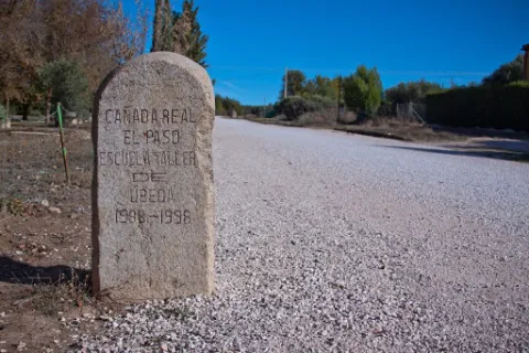
El Paso Livestock Trail

Submitted by brandcode_deweloper on
Id
8100194
Descripción
Descripción larga

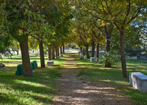
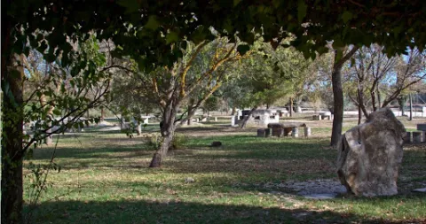
The recreational area in the initial section consists of various elements for the recreation of the users such as children's games, kiosks, fountains, barbecues, tables and benches, trees, football field, etc., making this environment a great place to spend a day in the field.

It is currently in the process of preparing and revaluing tourism under the premise of providing an intervention and rehabilitation that is environmentally friendly, with its traditional character and respecting its current physionomy.

Breve descripción

La Via Pecuaria Cañada Real de El Paso is part of the Cañada Real Conquense, one of the 10 main Cañadas Real included in the UNESCO Indicative List, which crosses the provinces of Cuenca, Ciudad Real and part of Jaén.

Telecomunicaciones
Teléfono de contacto
953 776 000
Correo electrónico
info@torreperogil.es
Ubicación
Código Postal
23320
Latitud
38.037680
Longitud
-3.311100
Municipio
Ubicación en el mapa
POINT (-3.3111 38.03768)
Tipos de punto de interés
Imágenes carrusel
imagen
Image
ca%C3%B1ada%20real%20el%20paso.jpg
Imagen principal
Desactivado
imagen
Image
ca%C3%B1ada%20real%20el%20paso2.jpg
Imagen principal
Desactivado
Imágenes cabecera
imagen
Image
ca%C3%B1ada%20real%20el%20paso3.jpg
Imagen principal
Activado
Loading map
Preparing points of interest and routes...
Path / Way El Vergao

Submitted by brandcode_deweloper on
Id
4742603
Descripción
Breve descripción

This is a route from Navas de San Juan to the "Llano de la Estrella" on the road of "El Vergao" and we turn it along the road until we reach a lane that leads us to the source of "El rosal" where it is all but dangerous to go back to the village.

In this tour you can find many cortijos and some monuments such as: The minilla, the batteries, the chiringote...

You also find a lot of people doing sport (running, walking, riding, cycling...)

In the month of May is celebrated in "The Plane of the Star" the Romeria of our Lady of the Star.

Ubicación
Latitud
38.184820
Longitud
-3.315190
Distrito
Municipio
Ubicación en el mapa
POINT (-3.31519 38.18482)
Tipos de punto de interés
Imágenes carrusel
imagen
Image
Camino%20El%20Vergao.jpg
Imagen principal
Desactivado
Imágenes cabecera
imagen
Image
8.jpg
Imagen principal
Activado
Loading map
Preparing points of interest and routes...
Interés

Roman Road on the Via Augusta or Hannibal's Route

Submitted by brandcode_deweloper on
Id
4742753
Descripción
Breve descripción

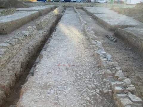
The Eritreinese called it the Hannibal Road, then it was called the Heraclea or Hercula Way. It was completed and modernized by order of the Roman Emperor César Augusto taking the name Via Augusta.

The road took from Cadiz to Rome. In modern times it was known as Vereda Real or Camino Real. Below the Cemetery and in front of the cortijo of Alfonso Medina you can see in the road a stone slab that keeps the prints of the Roman chariots engraved

Ubicación
Latitud
38.184820
Longitud
-3.315190
Distrito
Municipio
Ubicación en el mapa
POINT (-3.31519 38.18482)
Tipos de punto de interés
Imágenes carrusel
imagen
Image
Via%20Augusta%20o%20Camino%20de%20Anibal%202.jpg
Imagen principal
Desactivado
Imágenes cabecera
imagen
Image
9.jpg
Imagen principal
Activado
Loading map
Preparing points of interest and routes...
Interés

River Vault of Cerezuelo

Submitted by brandcode_deweloper on
Id
9346072
Descripción
Descripción larga

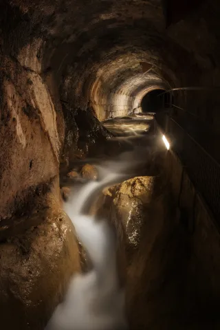
When he received the assignment, the Albacetean architect found it very difficult not to have a space of the size that Francisco de los Cobos asked for, so he solved it by building a vault on the River Cerezuelo; above the vault, the square of Santa Maria and on the square, the church, disproportionate by its enormous size, as they only lived a thousand inhabitants in the town, and yet almost cathedralicia. The project dated from 1535 and was a major engineering challenge for the media of the time.

It is said to be the only church in the world built on a river, and it is today, without a doubt, along with the vault on which it rises, the great tourist attraction in the city of Cazorla.

Breve descripción

The vault covering the Cerezuelo River was designed by Andrés de Vandelvira to be able to carry out the commission of Francisco de los Cobos, secretary of Charles V, as advance of Cazorla, of the construction of the church of Santa María. It is half-canyon, very compact, and adapts to the river's riverlevels throughout the plaza de Santa María, extending from the beginning of the plaza to the temple's header wall. The length of the tour is approximately 120 meters long.

Telecomunicaciones
Sitio web
www.turismoencazorla.com/dondeiryquever/monumentosycentros/bovedariocerezuelo.php
Teléfono de contacto
953 710 102
Correo electrónico
turismo@cazorla.es
Ubicación
Código Postal
23470
Latitud
37.909143
Longitud
-3.001215
Dirección
Plaza Sta. María
Municipio
Ubicación en el mapa
POINT (-3.001215 37.909143)
Tipos de punto de interés
Imágenes carrusel
imagen
Image
B%C3%B3veda%20r%C3%ADo%20Cerezuelo%202.jpg
Imagen principal
Desactivado
Imágenes cabecera
imagen
Image
B%C3%B3veda%20r%C3%ADo%20Cerezuelo%201.jpg
Imagen principal
Activado
Horario
Tuesday to Sunday: 10: 00 - 13: 00 and 16: 00 - 20: 00. Non-festive Monday closed. Guided tours every 30 minutes from 10: 00.
Loading map
Preparing points of interest and routes...

Ravine of the Arroyo Gargantón

Submitted by brandcode_deweloper on
Id
7983989
Descripción
Descripción larga

Location: To the west of the city centre, in the natural park of Sierra Magina.
Distance: 7 km.
Medium: By vehicle tourism and on foot.
Access route: By a lane that leaves directly from the city centre, until you reach a mountain road that access the enclave.

Breve descripción

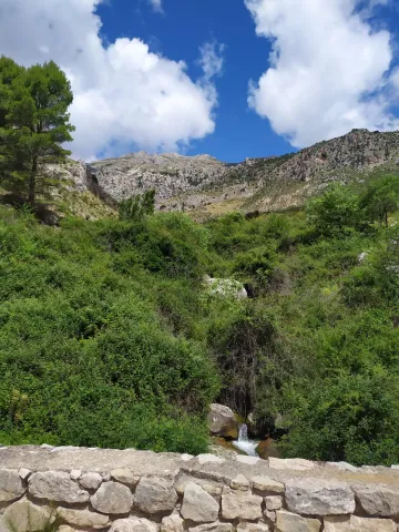
Interesting mountain side that stands out for the presence of white thorn or majolets and cornetals, among other plant formations. The rocky walls next to the Garganton serve as a refuge to a wide variety of birds, such as the royal victor, the black collar or the fences.

Telecomunicaciones
Sitio web
www.belmezdelamoraleda.es/el-municipio/patrimonio-natural.html
Teléfono de contacto
953 394 002
Ubicación
Código Postal
23568
Latitud
37.714142
Longitud
-3.399714
Distrito
Ubicación en el mapa
POINT (-3.399714 37.714142)
Tipos de punto de interés
Imágenes carrusel
imagen
Image
Barranco%20del%20Arroyo%20Gargant%C3%B3n.jpg
Imagen principal
Desactivado
Imágenes cabecera
imagen
Image
Barranco%20del%20Arroyo%20Gargant%C3%B3n2.jpg
Imagen principal
Activado
Microsite al que pertenece
Loading map
Preparing points of interest and routes...

Baños de la Salvadora

Submitted by brandcode_deweloper on
Id
8123325
Descripción
Breve descripción

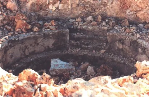
They are the archaeological remains of a few baths apparently from the Arab era, although some researchers say they can be Roman, in which we find a series of circular bathrooms with access staircase. These waters are medicinal.

Telecomunicaciones
Teléfono de contacto
953 566 001 / 953 612 600
Ubicación
Código Postal
23658
Latitud
37.740350
Longitud
-3.908120
Distrito
Municipio
Ubicación en el mapa
POINT (-3.90812 37.74035)
Tipos de punto de interés
Imágenes carrusel
imagen
Image
ba%C3%B1os%20de%20la%20salvadora3.png
Imagen principal
Desactivado
Loading map
Preparing points of interest and routes...
Town Hall of Pegalajar

Submitted by brandcode_deweloper on
Id
4658310
Descripción
Breve descripción

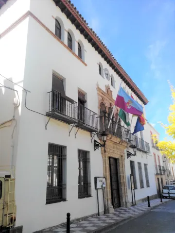
Its construction is linked to the repopulation of the southern part of Jaén in the time of Charles V. It preserves the18th century facade. It is fully rebuilt and only maintains its original track, the two-story cover of the 17th century.

Telecomunicaciones
Sitio web
www.ayto-pegalajar.org
Teléfono de contacto
953 360 003
Ubicación
Código Postal
23110
Latitud
37.737840
Longitud
-3.650930
Dirección
Plaza de la Constitución, 10
Distrito
Municipio
Ubicación en el mapa
POINT (-3.65093 37.73784)
Tipos de punto de interés
Imágenes carrusel
imagen
Image
Mon474.jpg
Imagen principal
Desactivado
imagen
Image
pegalajar-ayuntamiento-1--644x362.jpg
Imagen principal
Desactivado
Imágenes cabecera
imagen
Image
ayuntamiento.png
Imagen principal
Activado
Microsite al que pertenece
Loading map
Preparing points of interest and routes...
Rock Art of Santa Elena

Submitted by brandcode_deweloper on
Id
10894576
Descripción
Descripción larga

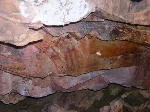
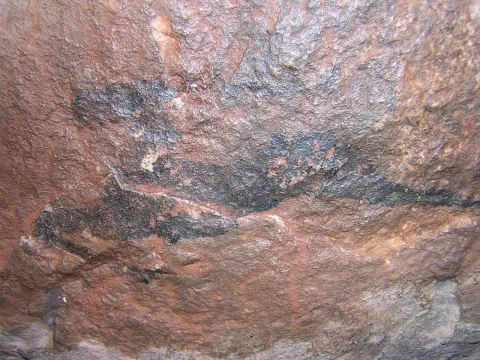
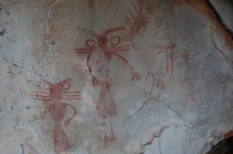
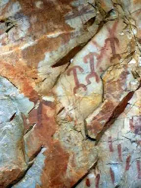
These more or less realistic but generally schematic manifestations reproduce human beings, animals and symbols, forming isolated scenes. The representations not only evoke and report part of daily life, but leave us witness to its complex v mysterious spirituality.

World Heritage Site

The natural park of Despeñacolos has different groups of rock paintings, of a schematic and eulin style, which gives this park an interesting cultural value, for the many coats and caves where these first inhabitants left their art. In 1998 it became part of the UNESCO catalogue as World Heritage Site.

Outdoor museums

These sites can be considered as authentic outdoor museums of incalculable value, whose preservation concerns each and every fellow citizen. When visiting them, we must remember that we contemplate figures made by the primitive man, not least human and intelligent, more than 4,000 years ago. It's all by law, Cultural Interest Property.

Visit the paintings

Visiting these places can be difficult and frustrating, not only because of their access; it can be dangerous, but because sometimes their conservation status can be at least poor; and it is recommended that they be visited with a specialist. For this purpose, before scheduling the visit, it is advisable to consult with someone familiar with the place (to advise and guide) or even to be accompanied by a responsible local guide (it is advisable to contact local authorities or associations).

The Abrigo e la Cave de los Muñecos, the Abrigo de Vacas del Retamoso and the Abrigo de Los Organos are highlighted.

Breve descripción

The Rupestre Art, "art on rock," is composed of the pictorial manifestations that our remote ancestors left on the walls of numerous covacas and petreous coats of our saws, in prehistoric times (in our region, from the Neolithic, to the Bronze Age).

Ubicación
Código Postal
23213
Latitud
38.341754
Longitud
-3.539315
Distrito
Municipio
Ubicación en el mapa
POINT (-3.539315 38.341754)
Tipos de punto de interés
Imágenes carrusel
imagen
Image
cueva%20escolares.JPG
Imagen principal
Desactivado
imagen
Image
cueva%20muniecos.JPG
Imagen principal
Desactivado
imagen
Image
DSC_7089.JPG
Imagen principal
Desactivado
imagen
Image
rupestres.JPG
Imagen principal
Desactivado
Imágenes cabecera
imagen
Image
chamanes%20vacas%20retamoso.JPG
Imagen principal
Activado
Loading map
Preparing points of interest and routes...
Marcas de calidad

Rock Art of Jimena

Submitted by brandcode_deweloper on
Id
10897479
Descripción
Descripción larga

These more or less realistic but generally schematic manifestations reproduce human beings, animals and symbols, forming isolated scenes. The representations not only evoke and report part of daily life, but leave us witness to its complex and mysterious spirituality.

World Heritage Site

Sierra Magina houses an interesting set of rock art, especially those related to the Municipality of Jimena, being a very interesting example of schematic rock paintings. In 1998 it became part of the UNESCO catalogue as World Heritage Site.

Outdoor museums

These sites can be considered as authentic outdoor museums of incalculable value, whose preservation concerns each and every fellow citizen. When visiting them, we must remember that we contemplate figures made by the primitive man, not least human and intelligent, more than 4,000 years ago. It's all by law, Cultural Interest Property.

Visit the paintings

Visiting these places can be difficult and frustrating, not only because of their access; it can be dangerous, but because sometimes their conservation status is the least poor; and it is recommended that they be visited with a specialist. For this purpose, before scheduling the visit, it is advisable to consult with someone familiar with the place (to advise and guide) or even to be accompanied by a responsible local guide (it is advisable to contact local authorities or associations).

The Abrigo de la Graja stands out.

Breve descripción

The Rupestre Art, "art on rock," is composed of the pictorial manifestations that our remote ancestors left on the walls of numerous covacas and petreous coats of our saws, in prehistoric times (in our region, from the Neolithic, to the Bronze Age).

Telecomunicaciones
Sitio web
www.lugaresmiticosdejaen.com/es/articulos/lugares/cueva-de-la-graja
Correo electrónico
ayuntamientodejimena@gmail.com
Ubicación
Código Postal
23530
Latitud
37.833960
Longitud
-3.473090
Distrito
Municipio
Ubicación en el mapa
POINT (-3.47309 37.83396)
Tipos de punto de interés
Imágenes carrusel
imagen
Image
jimena%202.jpg
Imagen principal
Desactivado
imagen
Image
jimena%203.jpg
Imagen principal
Desactivado
Imágenes cabecera
imagen
Image
Jimena%201.jpg
Imagen principal
Activado
Microsite al que pertenece
Loading map
Preparing points of interest and routes...
Marcas de calidad

Arte Rupestre

Submitted by brandcode_deweloper on
Id
1927651
Descripción
Descripción larga
These more or less realistic but generally schematic manifestations reproduce human beings, animals and symbols, forming isolated scenes. The representations not only evoke and report part of daily life, but leave us witness to its complex v mysterious spirituality.

World Heritage Site

In Aldeaquemada, as a sample of its valuable cultural heritage, there are different groups of rock paintings, of a schematic and eulin style; distributed by fleshlands and rocky coats of the municipal term. So much so that UNESCO, meeting in Kyoto (Japan) in 1998, agreed to catalogue the Levine Rupestre Art of the Spanish Mediterranean Arc as a World Heritage Site. Meeting in assembly, he gave this important name and included in the list the 19 deposits of Rupéstre Levino and Eschematic Art discovered in this municipality, cataloguing that has come to recognize and highlight the great importance of the cultural manifestations of the former inhabitants of these lands.

Outdoor museums

These deposits, unique for their subject matter, are the most important in Andalusia and can be considered as authentic outdoor museums, of incalculable value and whose preservation concerns each and every one of us. When visiting them, we must remember with all due respect that we contemplate figures made by the primitive man; but not for that less human and intelligent, more than 4,000 years ago. They are all by law Cultural Interest Goods.
These groups of rock paintings, located on most occasions on rock coats, were studied at the beginning of the 20th century by the Abate Brehuil and M. Cabré, who catalogued the vast majority of existing groups in the area.
Subsequently, thanks to the new and relevant discoveries of the chronist Carlos Sanchez- Battle, it has been possible to have an extended relationship and a full awareness of the great heritage value that, for Aldeaquemada, represents the whole of its cave paintings.

Visit the paintings

Visiting these places is difficult and can be frustrating, not only because of their access; dangerous sometimes, but because of their poor conservation status; they make them difficult to see if they are not specialized. For this reason, before scheduling a visit, you should consult with a local connoisseur and let yourself be accompanied by a responsible local guide.
The most representative coats, on which signposted routes have been developed; not yet operational until the final protection of the paintings, but which has been announced (the Ayto. provide guides) can be visited, are those of the Poyos de La Cimbarra, Cimbarillo del Prado de Rechesa, Cave de la Mina, Garganta de la Hoz, Prado del Azogue and Cave de Los Arcos. Although there are another series of awakened groups.

Breve descripción

The Rupestre Art, "art on rock," is composed of the pictorial manifestations that our remote ancestors left on the walls of numerous covacas and petreous coats of our saws, in prehistoric times (in our region, from the Neolithic, to the Bronze Age).

Ubicación
Latitud
38.411070
Longitud
-3.374460
Distrito
Municipio
Ubicación en el mapa
POINT (-3.37446 38.41107)
Tipos de punto de interés
Imágenes carrusel
imagen
Image
pintlafelicita02%20%281%29.jpg
Imagen principal
Desactivado
imagen
Image
pintbarrancocueva%20%281%29.jpg
Imagen principal
Desactivado
imagen
Image
pintbarrancocueva01%20%281%29.jpg
Imagen principal
Desactivado
Imágenes cabecera
imagen
Image
pintpradoazogue%20%281%29.jpg
Imagen principal
Activado
Loading map
Preparing points of interest and routes...
Marcas de calidad