Saltar al contenido principal

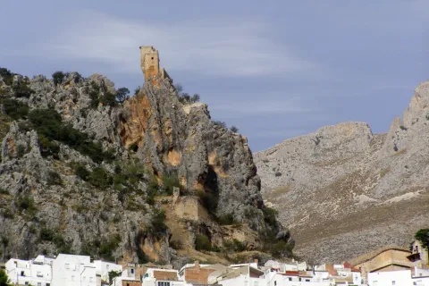
Castle of Navas de Tolosa

Submitted by brandcode_deweloper on
Id
320510
Descripción
Descripción larga

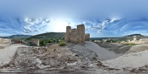
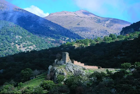
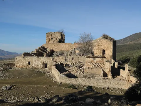
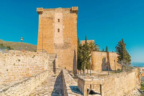
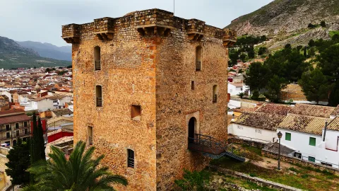
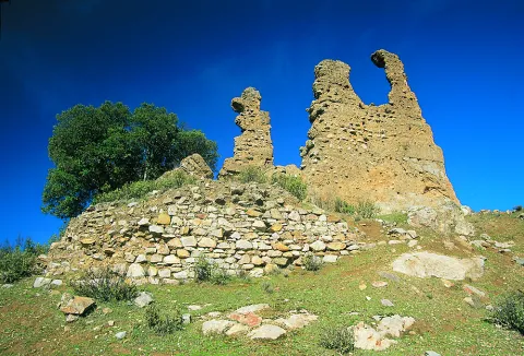
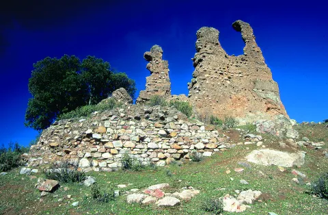
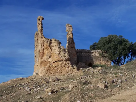
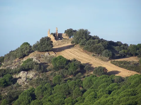
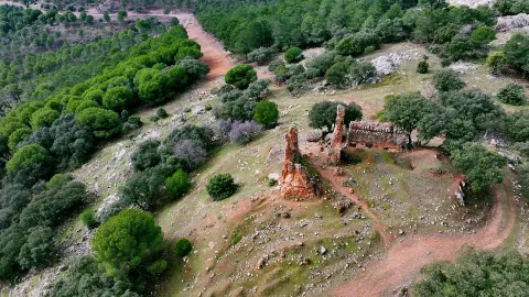
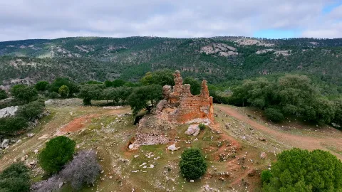
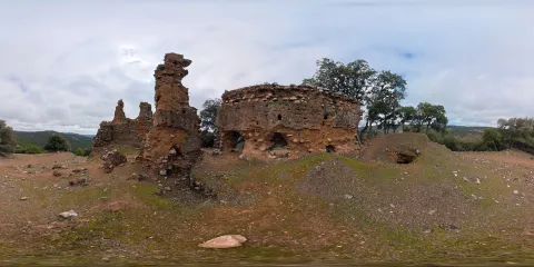
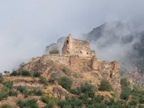
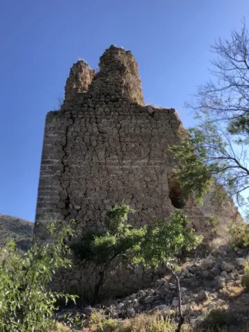
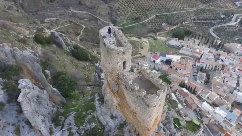
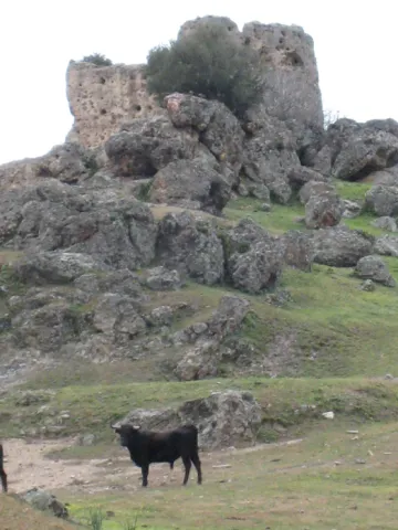
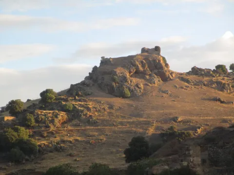
The castle of the Navas de Tolosa is made up of a trapeze-shaped walled enclosure and a hexagonal plant tower located at its northeastern angle. Possibly there was a second external enclosure to which some visible canvas would belong in the surroundings of the castle.

The site of the fortification, very destroyed, was possibly built in a tapial of argamase on a base of masonry, adapts to the rocky plateau on which it sits, using it as a foundation and as part of its defense. Inside it are distinguished some sections of walls that would belong to internal dependencies and a possible aljibe.

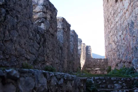
Two accesses are kept inside the fortress, the main door was located on its west side, protected by a narrow wall that supports a natural rock skid. On the eastern flank, next to the tower, a narrow posterna is opened partially hidden by a rock that gives it visual protection and creates a narrow corridor to reach it.

The tower, built in a very compact tapial with its high lime content, retains about 14 m from the outside and only two from the inside. In the outer plucido of the tower there are still some lines that would be part of some type of decoration or simulation of large armchairs, a technique known as false parting, especially in the area of the posterna.

Inside there is a rectangular space that occupies much of the stay, leaving a narrow corridor around it. It is possible to be an aljibe to collect and store the rain water, whose cover would hold the ground on the first floor of the tower.

To the north-east of the fortress there are traces of a rectangular building with internal divisions, perhaps the hermitage that was erected shortly after the Christian conquest. Other walls that are distinguished in their surroundings could be evidence of the existence of a small plateau.

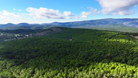
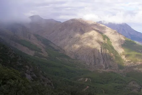
The area of Despeñacolos has attracted inhabitants since Prehistory for its steep orography, in which caves and coats proliferate, as well as for its natural sites conducive to sacralization.

But it was its strategic value with respect to the natural steps that pass through Sierra Morena, so fortifications were erected during the Middle Ages, and even in previous periods, with the aim of controlling the communication routes between the Plateau and al- Ándalus.

Although the small plateau could be inhabited already in the Bronze Age and in Roman times, the Castle of Navas de Tolosa, it would be built between the XI- XII centuries by Muslims to control the natural steps of Despeñacolos. Years later, they would strengthen their defensive role in an attempt to stop the progress of Christian troops. This fortress became one of the "doors" of the passage of the Muradal, along with Castro Ferral, which made it a goal to beat. After the battle of the Navas de Tolosa will definitely be in the power of Castile.

The fortress was part of the stage of one of the most prominent milestones in the medieval history of the Peninsular, because of its significance in the advance of the Christian kingdoms over al- Ándalus, the battle of the Saves of Tolosa, fought on July 16, 1212. Conceived as a crusade, it was a contest in which the routes and steps to the Plateau played a fundamental role. A coalition of Christian kings, Alfonso VIII of Castile, Peter II of Aragon and Sancho VII of Navarra, supported by Pope Innocent III, faced against the Almohad Caliph of Muhammad al-Nasir, in whose army fighters from the Maghreb, from sub-Saharan territories and from Turkish contingents were integrated.

On 12 July 1212, troops under the command of Don Diego López de Haro took over the Puerto del Muradal. Two days later, after being blocked in the passage of the Slayer, Christians camp in the place known as the King's Table, from where they went to battle, defeating the Almohad army.

After the victory of the Christian armies, the fortification of the Navas would remain important on the route of the Muradal throughout the 13th century, becoming one of the strategic points for control of the passage of troops during the conquest of Alto Guadalquivir. In 1217 the archbishop of Toledo was awarded the castles of the region, with the consent of Pope Honorio III, who confirmed them as the limits of the Toledo archdiocese.

According to the written sources, this space was repopulated by Spanish contingents throughout the 13th century, and its castle was demolished in 1473 under the mandate of the City of Baeza.

Breve descripción

The castle of Navas de Tolosa is a small fortification in height that takes advantage of the defensive possibilities offered by the rock formation on which it is based, a hoss of a certain magnitude, capable of hosting a small military garrison. It is made up of a walled enclosure and a hexagonal tower, and may have had a second enclosure to protect them. Because of the presence in its surroundings of numerous vestiges of construction it may have been surrounded by a small population that would find refuge among its walls in case of danger.
The castle of the Navas de Tolosa or the Collados or the Eagles was one of the fortresses that were built to protect the Puerto del Muradal, one of the main mountain steps that communicated al- Andalus with the Plateau. The transcendental battle of the Navas de Tolosa marked its history, as it would be taken by the Castilians in the context of the confrontation between the Christian and Muslim sides, in July 1212. During the 13th century, it would have the role of protecting and monitoring the passage of troops and supplies for the campaigns carried out by Christian armies in the conquest of al- Andalus.
Telecomunicaciones
Sitio web
www.lacarolina.innovasur.es
Teléfono de contacto
953 660 600 / 953 661 251
Correo electrónico
info@lacarolina.es
Ubicación
Código Postal
23212
Latitud
38.299530
Longitud
-3.597440
Dirección
En las proximidades de la A-IV, pasado el kilómetro 265, entre Santa Elena y La Carolina.
Distrito
Municipio
Ubicación en el mapa
POINT (-3.59744 38.29953)
Tipos de punto de interés
Imágenes carrusel
imagen
Image
castillo navas
Imagen principal
Desactivado
Imágenes cabecera
imagen
Image
6672445Master.jpg
Imagen principal
Activado
Horario
Visit after contact with managers. Private property.
Experiencia 360
Image
CyB_La_Guardia
Image
CyB_La_Guardia
Loading map
Preparing points of interest and routes...

Castle of Mata Bejid

Submitted by brandcode_deweloper on
Id
4349094
Descripción
Breve descripción

Fortress of Muslim origin of rectangular plant. It has two towers on both sides rather damaged, the north one consists of an inner stay covered with pointed vault (tower of tribute), and the south one has a body under massif and the upper one living. The castle is divided into two large areas, the square of arms (it became in recent times a cortijo, from which are preserved the arches of the zahurdas that gave to this great courtyard) and the Islamic alcazar (at a higher level than the rest of the castle).

Telecomunicaciones
Sitio web
www.cambil-arbuniel.es
Teléfono de contacto
953 300 011
Ubicación
Código Postal
23120
Latitud
37.704940
Longitud
-3.510560
Distrito
Municipio
Ubicación en el mapa
POINT (-3.51056 37.70494)
Tipos de punto de interés
Imágenes carrusel
imagen
Image
Mon177.jpg
Imagen principal
Desactivado
imagen
Image
1590760151_707070_1590760253_noticia_normal.jpg
Imagen principal
Desactivado
Imágenes cabecera
imagen
Image
Castillo_Matabejid.jpeg
Imagen principal
Activado
Microsite al que pertenece
Loading map
Preparing points of interest and routes...

Castle of las Peñuelas

Submitted by brandcode_deweloper on
Id
4658382
Descripción
Breve descripción

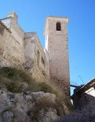
In the Christian chronicles it is cited asa Muslim fortress. Two different fortifications can be observed in the remaining remains. A previous one with a walled interior, with two entrance doors. One of them was protected by two circular turreons and the second was defended by two square turreons. He had another turret higher than the previous ones that today is the bell tower of the Church. The second outer enclosure is later, more damaged and served as an extension to the primitive fortification.

Telecomunicaciones
Sitio web
www.redjaen.es/francis/?m=c&o=13588
Teléfono de contacto
953 360 003
Correo electrónico
pegalajar@promojaen.es
Ubicación
Código Postal
23110
Latitud
37.738090
Longitud
-3.652220
Dirección
Casco urbano de Pegalajar
Distrito
Municipio
Ubicación en el mapa
POINT (-3.65222 37.73809)
Tipos de punto de interés
Imágenes carrusel
imagen
Image
Castillo%20de%20las%20Pe%C3%B1uelas%202.jpg
Imagen principal
Desactivado
Imágenes cabecera
imagen
Image
IMG_5775.jpg
Imagen principal
Activado
Microsite al que pertenece
Loading map
Preparing points of interest and routes...

Castle of Jódar

Submitted by brandcode_deweloper on
Id
5857872
Descripción
Descripción larga

El castillo de Jódar se asienta sobre un promontorio rocoso amesetado, a una cota de 665 metros sobre el nivel del mar, dominando los valles de Bedmar y del Jandulilla, junto con el del Guadalquivir.

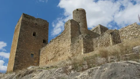
Ha sido identificada como una alcazaba musulmana, ejecutada en fábrica mixta de mampostería y sillares, transformada por en época cristiana, especialmente las dos torres del homenaje que conserva en su interior. Está conforma por una doble línea defensiva con un recinto de planta de tendencia ovalada, y un alcazarejo que, en este caso, está formado por dos grandes torres independientes situadas en los dos extremos del recinto, flanqueando el patio de armas. 

La torre norte, llamada también Torre Vieja, es de planta cuadrangular, con unas dimensiones de 15,30 x 12,60 metros, construida en el siglo XIII. Presumiblemente, la entrada a la misma se situaría por el lado sur, a la altura del primer piso, dejando la planta baja sin conexión con el resto. En la fachada norte dispone de dos series de saeteras, más largas en la planta segunda que en la primera y parcialmente cegadas.

La torre sur o Torre Nueva, que también es de planta casi cuadrada, tiene unas dimensiones de 13,50 x 12,40 metros, consta de aljibe y muro central y dista 41 metros de la torre norte, dominando la doble puerta de entrada al castillo. El acceso al interior de la torre se efectuaba por la fachada norte. Sus saeteras son similares a las de la torre norte y las cubiertas interiores son bóvedas vaídas del siglo XVI, conservándose restos de estuco mudéjar en su interior. 

Por su parte, el recinto dispone de otros elementos defensivos. En el extremo sur existía una torre albarrana, enmascarada por una vivienda de la plaza del Castillo, que se adosa al muro de la puerta del Aire, sobre el que discurre el adarve que las comunica. En el extremo opuesto, donde se encontraba la antigua entrada a la fortaleza, se observan los restos de unos lienzos de tapial que podrían corresponder a una torre que flanqueara el acceso.

El castillo, aunque integrado dentro de la trama urbana, se encontraba totalmente exento a finales del siglo XIX, sin embargo, en la actualidad está rodeado por viviendas. Sólo se puede contemplar parte de los cerramientos este y norte al estar las viviendas separadas de la muralla, permaneciendo estos lienzos en una zona de patios. En mejor estado se encuentran las dos torres, aunque han perdido parte del muro perimetral. 

El recinto externo, que englobaba el alcázar y la villa vieja, coincide en su lado oeste con el cierre actual del alcázar y en el norte con la calle Alcázar, pero se desconoce la trayectoria de la muralla por el este. Sabemos que en 1905 se autoriza derribar un torreón de la muralla en la calle Isabel la Católica y las fuentes hablan de un segundo situado a unos 150 m, en la misma calle. En el año 1511 la muralla contaba con varias puertas, de las que se ha conservado la Puerta del Aire, junto a la entrada actual a la fortificación.

Las investigaciones arqueológicas han documentado una secuencia de ocupación de este territorio desde época prehistórica, aunque será durante el periodo ibérico cuando parece producirse una mayor concentración de actividad en la zona. Es de sobra conocido el arte rupestre de Sierra Mágina, por las pinturas de La Graja de Jimena, la Cueva de Morrón, o los abrigos de La Golondrina o de la Lancha en Jódar.

Se han localizado también numerosos asentamientos iberoromanos, como el oppidum de la Loma del Perro, muchos de los cuales tuvieron continuidad hasta época romana o medieval, como ocurre en La Coscoja, El Castillejo o La Atalaya. Ya en época imperial destaca la ocupación del cerro del Castillejo, asentamiento o recinto fortificado de 5 ha, entre otros muchos. Muchos de estos yacimientos tendrán continuidad en los siglos posteriores.

La localidad de Jódar, Šawdar en las fuentes árabes, sería una pequeña aldea emiral, (qarya), que fue rodeada y dotada de elementos de fortificación para convertirla en una población amurallada (hisn). Šawdar fue creciendo hasta convertirse en el siglo X en una de las cabeceras del distrito administrativo de la cora de Yayyan (Jaén). Este desarrollo conllevó un plan constructivo que rodeó la ciudad con nuevos lienzos de muralla y erigió elementos urbanísticos tan importantes como una red de canalizaciones o una mezquita.

En el año 1090, será conquistada por los Almorávides y en 1161 pasará a integrarse en el extenso imperio Almohade, fase a la que con toda posibilidad pertenezcan las murallas de tapial del castillo.

La ciudad de Sawdar pasó a manos cristianas entre 1127 y 1229 a través de un pacto firmado por Fernando III y Abu l-`Ala, convirtiéndose en uno de los núcleos más importantes en la frontera con Granada, que a partir de ahora será citado como Xodar. El rey Fernando III concedió la villa a don Sancho Martínez, quien incluyó en su nombre el topónimo Xodar, nombrado segundo Adelantado Mayor de la Frontera (1253-1258), fundando un amplio señorío. Durante unos años fue la sede principal de la Frontera, por lo que Martínez de Xodar reforzó sus defensas y construyó la Torre Vieja.

La lucha por el control del territorio lleva al obispo de Baeza, Fray Domingo, y el arzobispo de Toledo, Rodrigo Ximénez de rada, a disputarse Jódar y Garcíez, hasta que en 1243 Jódar pasa a pertenecer a la sede baezana. La inestabilidad de la zona durará hasta mediados del siglo XIV, por lo que los reyes otorgaron el Fuero de Jódar, en un intento de mantener la población. Durante los años de señorío, la fortaleza de Jódar sufrió una importante labor constructiva. Hostigada constantemente por razzias y algaradas se reconstruyen las partes dañadas de las murallas y el alcázar, además de construirse la Torre Nueva.

Entre los siglos XIV y XV el señorío de Jódar cambió en numerosas ocasiones de titularidad. En el marco del enfrentamiento de los Benavides y Carvajales en Baeza, en el año 1521, don Alonso de la Cueva asaltó la población de Jódar, en poder de la familia Carvajal, incendiando el castillo, que quedó parcialmente dañado. En 1618 Felipe III elevó este señorío a marquesado, encabezado por Don Gonzalo de Carvajal y Messia. En 1646 el marquesado cambiara de linaje pasando a los Frías, quienes 25 años más tarde abandonaron definitivamente el castillo trasladándose al castillo-palacio de la Tobaruela, quedando en el castillo bajo la tutela del alcaide y del administrador. 

A principios del siglo XVIII el castillo se encuentra en muy mal estado, habiéndose derrumbado algunos tramos y en 1732, se traslada la cárcel de la villa a la Torre Nueva abriéndose un nuevo acceso en su cara oeste.

Durante la guerra de la Independencia el castillo parece haber estado ocupado por las tropas francesas, lo que le ocasionó nuevos daños y adaptaciones. En 1837 las guerras Carlistas ocasionaron nuevas reformas para proteger los puntos más débiles, cegando puertas y portillos. En 1885, tras años de abandono, se convirtió en hospital para sanar enfermos de cólera. Finalmente, en el siglo XX sufrió diversas restauraciones.

Actualmente se inscribe en el Catálogo General del Patrimonio Histórico Andaluz como Bien de Interés Cultural, con tipología de Conjunto Histórico. 


HORARIOS DE VISITA: 

Sábado y festivos: 11:00h. - 13:00h. / 18:00h. - 20:00h.

Domingo: 11:00h. - 13:00h.

Breve descripción

The Jódar castle, built in Muslim times and reformed by Christians, consists of a double defensive line composed of an external enclosure, and a alcazarejo made up of two large towers located at the two ends of the enclosure, flanking the courtyard of arms. Since the 17th century, he had suffered a process of abandonment that had significantly deteriorated walls and towers, and had been subject to several restorations in the 20th and 21st century. It currently hosts the reception and interpretation centre of the Sierra Magina Natural Park.
The origin of Jódar Castle is located in a small village dating from the time of emiral, which was fortified, which, according to the documentary sources, specialized in the production and export of oil, experiencing a strong development until it became in the 10th century one of the headquarters of the administrative district of the Chaén Cora. In the year 1090, it will be conquered by the Almoravids and in 1161 it will become integrated into the Almohade empire, a phase to which it is possible that the walls of tapial preserved in the castle belong. In Spanish hands since 1127 / 1229, it became one of the most important nuclei on the border with Granada and the head of the lordship, whose importance caused continued clashes and changes in ownership. At this time the two towers of the alcazar are erected. The Jódar fortress was the scene of other conflicts such as the Carlist or Independence wars, which affected their defenses.

Ubicación
Latitud
37.844960
Longitud
-3.353770
Dirección
C/ Alhorí, 16
Distrito
Municipio
Ubicación en el mapa
POINT (-3.35377 37.84496)
Tipos de punto de interés
Imágenes carrusel
imagen
Image
castillo-de-jodar2-jpg
Imagen principal
Desactivado
imagen
Image
castillo-de-jodar4-jpg
Imagen principal
Desactivado
imagen
Image
Castillo de Jodar
Imagen principal
Desactivado
imagen
Image
Castillo de Jodar
Imagen principal
Desactivado
Imágenes cabecera
imagen
Image
CyB_Jodar_01
Imagen principal
Desactivado
imagen
Image
CyB_Jodar_02
Imagen principal
Desactivado
Experiencia 360
Image
CyB_Jodar
Image
CyB_Jodar
Loading map
Preparing points of interest and routes...

Castle of Jimena

Submitted by brandcode_deweloper on
Id
5858082
Descripción
Descripción larga

Since the late 9th century, Jimena has been part of a series of scattered alqueries held by the Banu Habil, the Muladic rebels who faced the authority of the emir'Abd Allah.

Because of their proximity to Granada, Almohades and Nazaris, they conquered it and fortified it successively.

Jimena was conquered by Fernando III in 1234 and integrated into the lands of the Baeza Council. In 1284 it became the property of Don Pedro Ruy de Berrio.

The castle of Jimena replaced that of Garcíez from the 13th century, from which it is four kilometres from that of Garcíez. After the Almohades took away Garcia Gordillo, the Christians warned the need to replace the old Muslim fortress with a more modern and defensible one and built that of Jimena.

In addition, the displacement of this strategic point would be given by the need to control the route from the Jandulilla basin, bordering the northern foothills of the Aznaitín in search of the plains of Real Mancha.

In 1364, Jimena was a lordship of Herranz Rodríguez, from which she spent seven years, to Maria Gracia de Godoy, a woman of Sancho Díaz de Torres, in advance of Cazorla. At the end of the 14th (1397), he was dubbed by Ruy López Dávalos.

On an undetermined date, after 1401, it was conquered by the Muslims, in whose power it remained until 1431 when Pedro García de Herrera managed to conquer it by surprise, with night escalation. Three years later, King John II created the Order of Calatrava and Mr. Luis de Guzmán was appointed master. The Order of Calatrava reformed its defenses and especially the tower of tribute.

The Muslims won it back soon and lost it again in 1457, won by Henry IV who granted it to the Order of Calatrava, in whose power it remained a few years. In 1462 the king gave it to Don Beltran of the Cave.

In the 16th century, Jimena, together with Baeza, participated in the communal conflict in the Castile of Carlos V, even served as a hidden reduction to communeros. After these events were completed, he was sold by Emperor Charles V to his secretary, Don Francisco de los Cobos, expropriating him to the Calatravos.

From this date Jimena was the lord of Don Francisco de los Cobos and after his descendants the Marquis of Camarasa, until the extinction of the master privileges in 1812.

In 1985 the castle of Jimena was declared Good of Cultural Interest.

Description

The only remarkable rest of the castle of Jimena is its tower of tribute, of a square base and twenty meters high, was built by Christians, late 13th century or early 14th century, with regular masonry and saddle chains on the corners. The tower is preserved mocha and with the corners reinforced by armchairs ready to rope and sawn.

The tower of tribute has a dedicated internal organization on two floors covered with cross vaults. On the second floor there are three bars-moulded vanos, and a basement that could be identified with the aljibe.

Its facade, somewhat irregular, opens with a half-point arch on striated pilasters. It exhests the shields of the Marquis of Camarasa, successors of the family of the Cobos, who have possessed it since the late 18th century.

The entrance of the castle is identified with the bow of the Council, covered with a half-barrel vault and supported on the Tribute tower.

The characteristic external castrense aspect of the calvia fortifications contrasts with the palaciega aesthetics and the interior distribution of the two plants ornamented to the gothic taste - mudejar as shown by the semi-columns with vegetable capitals.

Once his military function was lost, the castle of Jimena was used for some time as an olive mill, in addition to having been used as a family home.

Some vestiges of wall canvases are kept very hidden by the house, some of them from the Islamic era.

Breve descripción

During the Middle Ages the castle of Jimena played an important defensive role, along with other castles of Sierra Magina, in front of the Nazari kingdom of Granada. In 1434 he was given to the Order of Calatrava, which reformed his defenses and especially the tower of tribute. Its tower of tribute is square floor, built in masonry and eskineer chairs, and has a careful internal organization on two floors covered with cross vaults, as well as a basement.

Ubicación
Latitud
37.842140
Longitud
-3.476500
Dirección
C/ Audiencia, 5
Distrito
Municipio
Ubicación en el mapa
POINT (-3.4765 37.84214)
Tipos de punto de interés
Imágenes carrusel
imagen
Image
imagen-095-jpg
Imagen principal
Desactivado
Imágenes cabecera
imagen
Image
imagen-025-jpg
Imagen principal
Activado
Microsite al que pertenece
Loading map
Preparing points of interest and routes...

Castle of Castro Ferral

Submitted by brandcode_deweloper on
Id
439190
Descripción
Descripción larga

El castillo de Castro Ferral ha sido considerado tradicionalmente como un mero puesto de control en la entrada a Andalucía desde la Meseta, pero las investigaciones arqueológicas han sacado a la luz los restos de un castillo de un tamaño considerable, con una antigüedad mayor de la esperada, como demuestran las sucesivas reparaciones de las que fue objeto y las tres fases de ocupación que se han detectado en la fortificación. 

A época romana correspondería un primer asentamiento, probablemente fortificado, datado en el período bajo-imperial, al que parece corresponder un muro construido con mampostería irregular, que servirá de cimentación para el lienzo oeste del recinto del castillo. 

Pero serán los almohades, en la Edad Media, quienes construyan la fortificación que vemos hoy en día. Estaría formada por un recinto cuadrangular construido en tapial de tierra y cal, con un aljibe en su interior, que se rodearía con una línea de muralla también de tapial, conformando el perímetro exterior del recinto.

En el lienzo oeste, erigido sobre el zócalo de mampostería mencionado, se abre un vano en el extremo occidental del muro, que pudo corresponder al acceso a una mina para la extracción del mineral de hierro que se encuentra en el interior del castillo, actividad a la que alude su topónimo y cuya explotación continuará durante todo el período islámico. 

El sistema defensivo de Castro Ferral se refuerza probablemente antes de la batalla de las Navas de Tolosa, de 1212, con el levantamiento de un nuevo muro de tapial paralelo al lienzo este del recinto, un antemuro que crea un pasillo o liza de 2,2 m, a la vez que se amplía el recinto en dirección norte. En esos momentos la extracción de hierro se abandona y se ciega su acceso, protegiéndola.

La contienda debió originar cuantiosos daños a la fortificación, ahora en manos cristianas, lo que unido a las ofensivas posteriores de los almohades propició que se llevase a cabo la modificación de algunos de sus elementos defensivos, como el refuerzo con mampostería de muros y la construcción, en el extremo sureste, de una torre de la misma fábrica y planta circular.

La zona de Despeñaperros ha atraído pobladores desde la Prehistoria por distintas razones: 

Su escarpada orografía, ha permitido la conformación y proliferación de cuevas y abrigos como los del Conjunto Rupestre Vacas del Retamoso-Los Órganos, que cuentan con pinturas rupestres, concretamente 400 figuras de estilo esquemático y levantino repartidas por 14 puntos diferentes, declaradas Patrimonio de la Humanidad por la Unesco. 

Sus parajes naturales propicios para la sacralización, como el santuario del Collado de los Jardines o Cueva de los Muñecos, un abrigo cobijado bajo un escarpe del cerro cuyo nombre alude a los más de 2.500 exvotos de bronce recuperados del expolio. 

Y, por último, su valor estratégico respecto a los pasos naturales que atraviesan Sierra Morena, por lo que se erigieron fortificaciones durante la Edad Media, e incluso en períodos anteriores, con el objetivo de controlar las vías de comunicación entre la Meseta y al-Ándalus. 
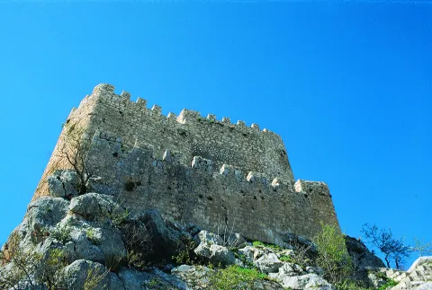
Castro Ferral sería una de las fortificaciones que cubrían el paso de La Losa, lo que le convertía en un objetivo a batir. En 1169 Fernando de Icaza, segundo Maestre de la Orden de Calatrava, conquistó temporalmente la fortaleza, que volvió a manos musulmanas en fecha desconocida, hasta que tras la batalla de las Navas de Tolosa quedara definitivamente en poder de Castilla. 

La fortaleza formó parte del escenario de uno de los hitos más destacados de la historia medieval peninsular, por su trascendencia en el avance de los reinos cristianos sobre al-Ándalus, la batalla de las Navas de Tolosa, librada el 16 de julio de 1212. Concebida como cruzada, fue una contienda en la que las rutas y pasos hacia la Meseta jugaron un papel fundamental. En ella se enfrentaron una coalición de reinos cristianos, comandados por los monarcas Alfonso VIII de Castilla, Pedro II de Aragón y Sancho VII de Navarra, apoyados por el papa Inocencio III, contra el califa almohade Muhammad al-Nasir, en cuyo ejército se integraron combatientes procedentes del Magreb, de territorios subsaharianos y de contingentes turcos.
El 12 de julio de 1212, tropas al mando de Don Diego López de Haro tomaron el Puerto del Muradal, con la fortificación de Castro Ferral. Dos días más tarde, tras ser bloqueados en el paso de la Losa, los cristianos acampan en el paraje conocido como Mesa del Rey, desde donde acuden a la batalla que tuvo lugar el día 16 de julio, derrotando al ejército almohade.
En el entorno de la fortaleza, se han documentado los vestigios de su asalto por las tropas de Alfonso VIII, una gran concentración de material armamentístico, básicamente puntas de flecha. Se han registrado también piezas relacionadas con la vida cotidiana en El Ferral y con su función militar.


Tras la victoria de los ejércitos cristianos Castro Ferral mantuvo su importancia en la ruta del Muradal a lo largo del siglo XIII, como uno de los puntos estratégicos a partir de los cuales se acometería la conquista del Alto Guadalquivir. En 1217 el arzobispo de Toledo se adjudicó el castillo y su término junto con otros de la región, entre ellos el de Tolosa, con el consentimiento del papa Honorio III, quien los confirmó como límites de la archidiócesis toledana. En el año 1243, a raíz de las reclamaciones del obispado de Baeza se integró en la jurisdicción baezana.

El traslado de la frontera a las Cordilleras Béticas le restó valor estratégico, lo que marcó el inicio del declive de Castro Ferral. El abandono y la apertura de un cortafuegos que atraviesa las ruinas, supusieron la desaparición de gran parte de las estructuras que conformaban la fortaleza.

El pastor de las Navas de Tolosa. En julio de 1212 las huestes cristianas, en su camino hacia el corazón de al-Andalus debían atravesar Sierra Morena por el paso natural de La Losa, una garganta angosta en el Puerto del Muradal, defendida por la fortaleza de Castro Ferral. Alfonso VIII envió a Don Diego López de Haro a tomar el castillo, pero a pesar de su conquista, el camino seguía fuertemente defendido. 

Al campamento cristiano llegó un hombre del lugar, conocedor de aquellas tierras de frontera, que les mostró un camino alternativo entre las montañas, conduciendo a Don Diego López de Haro y sus tropas a una altiplanicie desde entonces conocida como Mesa del Rey. En ella se instaló el campamento cristiano para lanzar su ofensiva contra el ejército almohade, el día 16 de julio de 1212, un enfrentamiento que abriría la puerta de al-Ándalus a los ejércitos cruzados. El hombre que les mostró el camino se llamaba Martín Halaja, pastor para unos, cazador para otros y para los más piadosos el mismo San Isidro.

Breve descripción

The castle of Castro Ferral is located in the Puerto del Muradal, at more than 900 m of altitude, a strategic place for the control of the Paso de la Losa, via communication between Andalusia and the Plateau, in the heart of Despeñacolos. The Almohad fortification consisted of a quadrangular enclosure and a line of outer wall that defended it, both built in tapial of lime and sand argamase, to which Christians added a circular plant tower of masonry, as well as other reforms in their wall cloth. The name "Ferral" refers to the presence of iron, mineral that was extracted from the castle itself during several historical times.
The significance of the battle of the Navas de Tolosa, in the advance of the Christian kingdoms over al- Ándalus marked the history of the castle of Castro Ferral, as demonstrated by the rapid occupation of the fortress by Christians in the days before the confrontation between the two sides, in July 1212. The importance of this fortified enclave lasted throughout the 13th century, with the function of protecting and monitoring the passage of troops and supplies.

Telecomunicaciones
Sitio web
www.santaelena.es
Teléfono de contacto
953 664 010
Correo electrónico
santaelenajaen@gmail.com
Ubicación
Código Postal
23213
Latitud
38.392870
Longitud
-3.545360
Distrito
Municipio
Ubicación en el mapa
POINT (-3.54536 38.39287)
Tipos de punto de interés
Imágenes carrusel
imagen
Image
Mon056.jpg
Imagen principal
Desactivado
imagen
Image
Mon490.jpg
Imagen principal
Desactivado
imagen
Image
castillo_castro
Imagen principal
Desactivado
imagen
Image
castillo_castro
Imagen principal
Desactivado
Imágenes cabecera
imagen
Image
CyB_Sta_Elena_01
Imagen principal
Desactivado
imagen
Image
CyB_Sta_Elena_02
Imagen principal
Desactivado
imagen
Image
CyB_Sta_Elena_03
Imagen principal
Desactivado
Horario
24 h.
Experiencia 360
Image
CyB_Sta_Elena_foto360_castillo cenital
Image
CyB_Sta_Elena_foto360_castillo cenital
Loading map
Preparing points of interest and routes...

Castle of Bélmez de la Moraleda

Submitted by brandcode_deweloper on
Id
5857694
Descripción
Breve descripción

The castle of the Moraleda was built by the Muslims, and conquered by the Christians, for the first time, between 1243 and 1246, but it was not definitely until 1448, going into the Lordship of Jódar years later. It belonged to the Council of Baeza and the Order of Calatrava. From 1501 the lands of Bélmez belonged to the city of Granada in payment of certain debts that the Kings had with it, reserving the house of the castle to the lord of Jódar. The foundation as a villa dates from 1524, when land for rent was given to some local farmers. It belonged to the jurisdiction of Granada until, following the provincial organization of Javier de Burgos in 1833, it was included in the new province of Jaén.

Ubicación
Latitud
37.749540
Longitud
-3.383630
Dirección
C/ Patrocinio de Biedma, 9
Distrito
Ubicación en el mapa
POINT (-3.38363 37.74954)
Tipos de punto de interés
Imágenes carrusel
imagen
Image
castillo%20belmez.jpg
Imagen principal
Desactivado
imagen
Image
Castillo-de-Belmez-de-la-Moraleda_.jpg
Imagen principal
Desactivado
imagen
Image
Castillo-de-Belmez-de-la-Moraleda_01.jpg
Imagen principal
Desactivado
Imágenes cabecera
imagen
Image
Castillo-de-Belmez-de-la-Moraleda_02.jpg
Imagen principal
Activado
Microsite al que pertenece
Loading map
Preparing points of interest and routes...

Castle of Albanchez de Mágina

Submitted by brandcode_deweloper on
Id
1735110
Descripción
Descripción larga

The castle was linked to the Order of Santiago, which created the command of Bedmar and Albanchez. What is preserved from it is its alcazarejo, built with masonry, which consists of two small, impressive nuclei because of its exterior appearance and the closing of the rock on which it sits, but with little internal capacity to house troops and beings. The highest core is a narrow rectangular platform that enables a small interior space. The entrance opens to the terrace of a rectangular floor turret that housed two cameras: one top, covered with a half-barrel vault, now melted, and one lower, a aljibe, with slightly pointed vault and remains of the stucco that covered it. The castle also had a small courtyard of triangular weapons with almond parapet and saetera windows, a square terrace with albarrana to defend over the cliff, protective walls, today practically destroyed, and rounded corners outside as it was a calatravo castle. It was declared Good of Cultural Interest in 1985.

Breve descripción

The castle of Albanchez de Mágina dominates and presides the village, which is located on the first ridge of the Sierra de los Castillejos. Despite its small dimensions and its inner narrows, its arriseach position makes it extremely difficult to access. Of presumably Christian origin, its construction was made with argamasa and it had to rise late, in the Middle Ages, in the early 14th century, as an alternative to another Muslim castle from which there are only remains, built with tapial in the lower and closer to the people.

Telecomunicaciones
Sitio web
www.albanchezdemagina.es
Teléfono de contacto
953 347 009
Correo electrónico
ayuntamiento@albanchezdemagina.es
Ubicación
Código Postal
23538
Latitud
37.790250
Longitud
-3.468000
Dirección
Av. de Hutar, 2
Distrito
Ubicación en el mapa
POINT (-3.468 37.79025)
Tipos de punto de interés
Imágenes carrusel
imagen
Image
Mon312.jpg
Imagen principal
Desactivado
imagen
Image
castillo%20de%20albanchez%20de%20magina.jpg
Imagen principal
Desactivado
imagen
Image
castillo%20de%20albanchez%20de%20magina%202.jpg
Imagen principal
Desactivado
Imágenes cabecera
imagen
Image
728_SS_01.jpg
Imagen principal
Activado
Horario
24 h.
Microsite al que pertenece
Loading map
Preparing points of interest and routes...

Viscount's House or Casa Grande

Submitted by brandcode_deweloper on
Id
4678481
Descripción
Descripción larga

The built volume, which rests on a basement with stone vaults, is of two floors communicated by a staircase that starts from a corner of the courtyard. The walls are of ripian and tapial of remarkable thickness; the forging of rolls and in the configuration of the main courtyard were used jácenas of large squadría. The cover system is also woody, with chandelier and limas under Arab tile.

In the center of the construction is the main courtyard, with another secondary or garden in the back. The main courtyard, with a square floor, is visually reduced from its original proportions by adding partitions that allowed to protect two of the galleries and to enable a third room, leaving today only the northern panda. As a result of these changes, the elements of wood were altered, among which the large zapatas with the decoration of volts, spirals, crosses, etc. They are also to mention some cassette doors.

From the north-east angle of the courtyard starts the staircase, of a single stretch, covered by an orange half decorated with central floron and supported by pechines decorated by small heads of cherubim in plaster. The top of the staircase offers a flat double arch of a half-point cut that separates a factory machon.

The first floor has rooms for bedrooms with plaster shells on the entrance lintel. On the second floor there are three cameras, including the one that offers the façade to the Garden Street, open with a gallery of eight half-point arches.

The cover, located under that plunder, is high and sober and is shaped by simple Tuscan pilasters that flank the inintered vain.

Breve descripción

The Vizconde de Los Villares Palace in Los Villares (Province of Jaén, Spain) is the only civil building that coetanea to the foundation of the town in the 16th century. It is called by the villariegos "Casa Grande," for its notorious largest size to the rest of the house, or "Casa del Vizconde," for having belonged to the family of Don Francisco Zeballos and Villegas, first viscount of Los Villares.

It is a solarium house that follows the Spanish rural Renaissance models and the high Andalusia, of petreous facades, articulated around an intellized courtyard shaped by a wood-bearing structure of jácenas, beautiful shoes and right feet of considerable plastic and artisan value and open on its main facade by an elegant high gallery of half-point arches.

Ubicación
Latitud
37.772886
Longitud
-3.788329
Ubicación en el mapa
POINT (-3.788329 37.772886)
Tipos de punto de interés
Imágenes carrusel
imagen
Image
whatsapp-image-2020-04-06-at-14-12-38_14443041_20200410161719.jpg
Imagen principal
Desactivado
Imágenes cabecera
imagen
Image
54.jpg
Imagen principal
Activado
Loading map
Preparing points of interest and routes...

Caño del Aguadero

Submitted by brandcode_deweloper on
Id
5846600
Descripción
Breve descripción

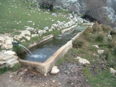
Weakening of cattle in the Sierra Mágina summit area, in the municipality of Bedmar. A place used for the perterminance, or seasonal local movement of the cattle to take advantage of the summer pastures. The whole is made up of a traditional abrevadero and a construction for herding shelter. It is a landscape of high Mediterranean mountain, with meadows and chopos bosquet. It is accessed on foot by track from Bedmar.

Ubicación
Latitud
37.743770
Longitud
-3.430490
Distrito
Municipio
Ubicación en el mapa
POINT (-3.43049 37.74377)
Tipos de punto de interés
Imágenes carrusel
imagen
Image
Ca%C3%B1o%20del%20Aguadero2.jpg
Imagen principal
Desactivado
Imágenes cabecera
imagen
Image
Caxo_del_Aguadero.jpg
Imagen principal
Activado
Microsite al que pertenece
Loading map
Preparing points of interest and routes...