Saltar al contenido principal

Hill Gordo

Submitted by brandcode_deweloper on
Id
4520165
Descripción
Descripción larga

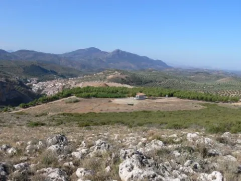
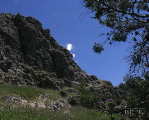
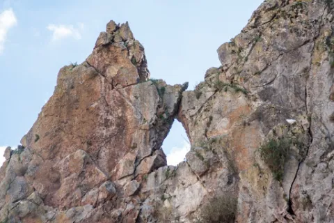
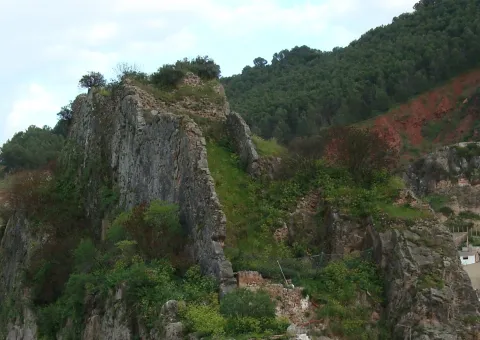
It is a high place, located at a considerable altitude (924 m.), which has impressive panoramic views of the town and its municipal term. It's 1 km away. to the east of Fuensanta de Martos, and it is accessed by the road JA-3301, towards the Sierra de la Pandera.

Ubicación
Latitud
37.646291
Longitud
-3.911022
Distrito
Ubicación en el mapa
POINT (-3.911022 37.646291)
Tipos de punto de interés
Imágenes carrusel
imagen
Image
Cerro_Gordo_Fuensanta.jpg
Imagen principal
Desactivado
Imágenes cabecera
imagen
Image
Cerro_Gordo_Fuensanta2.jpg
Imagen principal
Activado
Loading map
Preparing points of interest and routes...

Castle Hill

Submitted by brandcode_deweloper on
Id
8143181
Descripción
Descripción larga

Location: To the north of the city centre, very close to it, in the natural park of Cazorla, Segura and Las Villas.

Distance: 2 km. Medium: On foot.

Access route: Through a rural road leading to the dehesa del Castillo.

Breve descripción

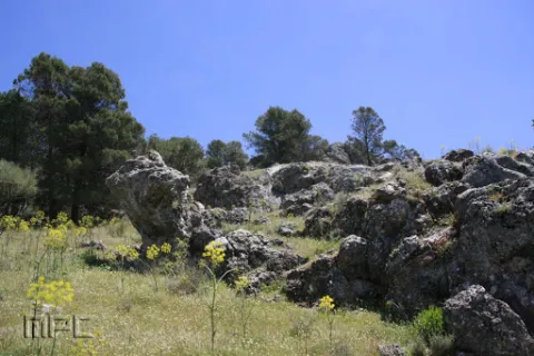
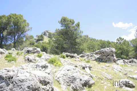
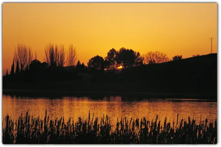
Natural enclave located at 1,145 m high, from which we can enjoy stunning views of the Natural Park and the urban core. In the dehesa of the Castle we can visit the Fountain of the Cerezo, a natural water spring located next to prehistoric caves.

Telecomunicaciones
Teléfono de contacto
953 494 005
Ubicación
Nombre
Torres de Albánchez
Código Postal
23391
Latitud
38.414570
Longitud
-2.677250
Distrito
Ubicación en el mapa
POINT (-2.67725 38.41457)
Tipos de punto de interés
Imágenes carrusel
imagen
Image
Cerro%20del%20Castillo2.jpg
Imagen principal
Desactivado
imagen
Image
Cerro%20del%20Castillo3.jpg
Imagen principal
Desactivado
Imágenes cabecera
imagen
Image
Cerro%20del%20Castillo.jpg
Imagen principal
Activado
Loading map
Preparing points of interest and routes...

La Herradura Gorge and Mesto Glen

Submitted by brandcode_deweloper on
Id
912316
Descripción
Descripción larga

This bridge was built when, in the sixty of the last century, the repressive waters buried the Molinillo Bridge, which passed through the Guadalanimin a little below, and which allowed, from time immemorial, the access of reels to a road that unites the inhabitants of the scattered cores in the upper part of the Sierra (Nava de San Pedro, Puntal de Ana María, la Loma de la Sarga, Vadillo de Castril, etc.) with El Almicarán and Pozo Alcón. Much of the wheat that was sown in that mountainous area became a flour mill that was at the confluence of the Guazalamanco River with the Guadalanimin, very close to the said bridge, and that gave name to the site.

This historic road, which progress was responsible for truncating more than forty years ago, is already collected in the medieval chronicles. It was also the way to the Mesta, where the cattle of Pozo Alcón and Castril were led to the winter of Sierra Morena, with a softer and more prone climate for sheep and cows. The journey that communicates the reservoir with the Vado de las Carretas, near the Nava de San Pedro is via pecuaria and, officially, receives the illustrative name "Cordel de Visas Pintoresca." The first stretch of this journey, which passes through the cortijo de los Tontos, forest house of the Puntal de Ana María and cortijo del Raso del Peral (the highest point of the road at about 1,320 m of altitude) is known as Cañada del Mesto, and is a pleasant walk (about 8 km away and back from where we have left the vehicle) that will surprise us by the natural viewpoints we find on the route (Cortijo de los Tontos, Puntal de Ana María and the Poyo del Raso) and the views that give us. If we continue about 5 K. further forward we find the Vado de las Carretas and the Cerradas del Guadalentín and Canaliega.

We suggest...

  • That before we take the road on foot that leads us to the Cerrada de la Herradura, in the vicinity of the Molinillo Forest House, we lie, with the maximum of precautions, to the edges of the cut that give view to the reservoir and to the final stretch of the Guazalamanco River, before we connect with the Guadalmin. If the level of the reservoir is low we can see the old Molinillo bridge and what's left of the small old flour factory. In that case, a recommended option is that, through a sidewalk that leaves east of the forest house, just in front of the large bridge, we go down to the river bank and approach the mill. There are still remains of the old systems used for the milling of wheat.

The Cerrada de la Herradura is located in the tail of the Bolera reservoir and is accessed by the Dehesa del Rincón, a large entrelano located on the right bank of that reservoir. From Pozo Alcón you have to take the A-326, up the Avenida de la Bolera, direction to Castril. By passing the campsite de la Bolera and the km 7, we take a detour that comes to our left and that borders the Forest House of la Bolera (it indicates to the Hornico). On an unasphalted road, always following the main road, you reach the Molinillo Forest House, now apricot of cattle, 7.7 Km. later. There we left the vehicle and followed the path of the route that indicates the Road Vado. About 800 meters later a narrow bridge crosses a riverbed. We meet at the Herradura Clock. If we continue the road, until it begins to descend again, 3.5 Km. later, we will make the journey known as Cañada del Mesto.

Breve descripción

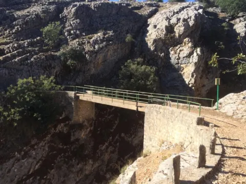
Depending on the level of the reservoir, the cannon is more or less deep. The best point to have a view of it is the same bridge that crosses it. With the safety that gives us its metal railing we can look and see polish trout and barbs in the crystal waters that the Guadalanimín River carries at its entrance to La Bolera.

Ubicación
Latitud
37.702695
Longitud
-2.935057
Municipio
Ubicación en el mapa
POINT (-2.935057 37.702695)
Tipos de punto de interés
Imágenes carrusel
imagen
Image
unnamed.png
Imagen principal
Desactivado
Imágenes cabecera
imagen
Image
herradura.jpg
Imagen principal
Activado
Loading map
Preparing points of interest and routes...

Visitor Centre Viñas de Peñallana

Submitted by brandcode_deweloper on
Id
2343298
Descripción
Descripción larga

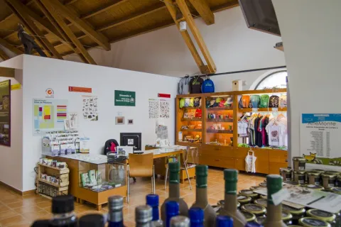
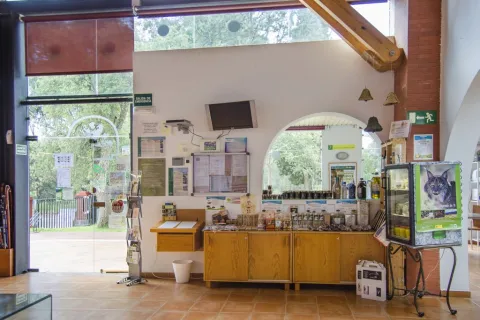
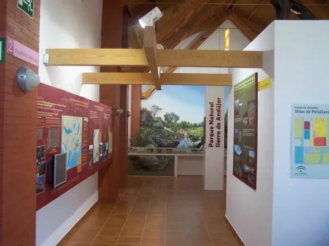
As if a portion of the natural park had been removed, in this center, the visitor can taste his morphology or walk through a recreated Mediterranean forest where to identify plant species and their aromas or discover its inhabitants in a fun way. Many emblematic species threatened find refuge in these saws; this is the case of the Iberian wolf, whose cubit is faithfully reproduced.

Among all the emblematic species of the park, the Iberian lince stands out. Its traces will lead the user to discover its habitat and behavior, as well as the problem that makes it the most threatened felline on the planet.

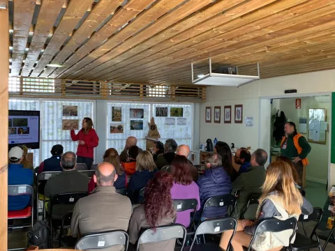
In this centre you can also know the way of life of its inhabitants, their historical development and how a harmonious exploitation of resources allows the conservation of valuable environments such as the Andújar saws.

Breve descripción

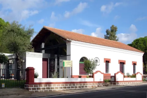
At the entrance of the Sierra de Andújar Natural Park, the Viñas de Peñallana visitors' centre is located, where you can find a first approach to the different environments of the environment and the multitude of living beings that inhabit them.

Telecomunicaciones
Teléfono de contacto
699 275 531
Correo electrónico
cvvinaspenallana@reservatuvisita.es
Ubicación
Código Postal
23740
Latitud
38.116430
Longitud
-3.964010
Dirección
Carretera del Santuario A-6177, km. 13
Distrito
Municipio
Ubicación en el mapa
POINT (-3.96401 38.11643)
Tipos de punto de interés
Imágenes carrusel
imagen
Image
709_CV_04.jpg
Imagen principal
Desactivado
imagen
Image
709_CV_03.jpg
Imagen principal
Desactivado
imagen
Image
709_CV_01.jpg
Imagen principal
Desactivado
Imágenes cabecera
imagen
Image
Imagen_006.jpg
Imagen principal
Activado
Horario
Summer: Saturdays and Sundays 08: 00 - 14: 00 (18 Jun to 31 Aug).
Microsite al que pertenece
Loading map
Preparing points of interest and routes...

Visitor Centre "Llano de las Américas"

Submitted by brandcode_deweloper on
Id
12839141
Descripción
Descripción larga

There are many corners that house Despeñacolos and La Cimbarra, however in the interpretative endowment some of the most emblematic are highlighted and presents us the human environment that surrounds these natural spaces, with special mention to the peoples of the surroundings that can not stop visiting to enjoy their gastronomy, their festivities and the heat of their good people.

Llano de las Américas is attended by professionals who, in addition to helping with the interpretation of the center itself, give all the information that the visitor needs in order to organize his visit to the park or the natural area with the best guarantees of being an unforgettable experience.

This equipment is connected to the Public-Use Path Los Straits de Miranda, through which the visitor will be able to walk into the Despeñacolos Natural Park. Next to the visitors' centre is a recreational area on forest grounds, in a tree mass of pine and cedars with the presence of oak, alcornocal and typical Mediterranean bushes.

Breve descripción

The Llano Visitors Center of the Americas is a new equipment designed to receive and guide visitors who decide to meet the Natural Park Despeñacolos and Cascada de la Cimbarra. The main characteristics that were decisive for the Autonomous Administration to decide to declare these areas protected in 1989 are explained through an amena interpretative endowment.

In its exhibition area a review is made of the different natural and cultural values that turn these two spaces into small jewels worthy of admiration. Based on its geological evolution, it explains why its most remarkable formations: Natural Monument of the Organs and Cascade of the Cimbarra; the tour continues to review its anthropic evolution. And there have been many civilizations that have inhabited these enclaves, or simply used Despeñacolos as a natural step between what we know today as Andalusia and the rest of the Peninsula: The prehistoric man, the Iberians, the Romans, the Muslims, etc. And all of them have left their mark, today visitable in these spaces.

But perhaps the most remarkable of these areas are their different landscapes, work above all of the differences in relief and exposure to the sun that we are in short distances, and that have triggered in that there are very many species both animal and plant that have found their habitat in Despeñapores and the Cimbarra. Of all, the imperial eagle deserves special mention, so a real size reproduction will welcome us to the center.

The sustainable exploitation of these enclaves also finds its corner in the centre of visitors, explaining the reason for their realization and their importance for the proper functioning of ecosystems and their protection against pests or fires. For its ancestral connection, the use of the psychological system deserves special mention.

Telecomunicaciones
Teléfono de contacto
659 936 566
Correo electrónico
cvllanodelasamericas.amaya@juntadeandalucia.es
Ubicación
Código Postal
23213
Latitud
38.351969
Longitud
-3.564221
Dirección
Carretera JA-7102 de Santa Elena a Miranda del Rey, Km. 2
Distrito
Municipio
Ubicación en el mapa
POINT (-3.564221 38.351969)
Tipos de punto de interés
Imágenes carrusel
imagen
Image
87781547_2539865129605147_1407064524921503744_n-jpg
Imagen principal
Desactivado
imagen
Image
121386724_2733913753533616_5483712097387715815_n-jpg
Imagen principal
Desactivado
Imágenes cabecera
imagen
Image
87019708_2539865532938440_5291050098334105600_n-jpg
Imagen principal
Activado
Loading map
Preparing points of interest and routes...
Interés

Interpretation Centre Paleomágina

Submitted by brandcode_deweloper on
Id
12592052
Descripción
Descripción larga

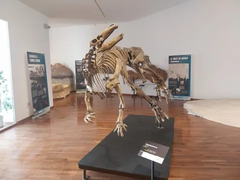
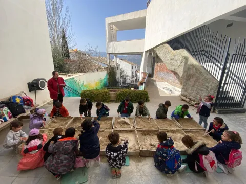
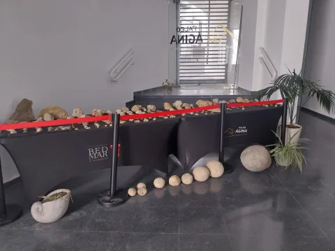
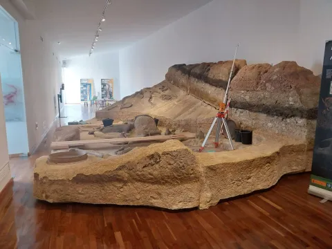
In addition, Paleomagina is a dynamic center in the dissemination of knowledge to all types of audiences. Through divulgative conferences and museum exhibitions of a temporary and permanent nature, the visitor enters an interesting journey through the origins and evolution of humanity, the daily life in Prehistory, as scientific research is done on our past and experience in the first person such as the work of the archaeologist and scientist. In 2021 it was recognized centro UNESCO Andalucía.

Breve descripción

The Centre for Prehistoric Research in Sierra Mágina "PALEOMÁGINA" is a public institution, born as a bet of excellence by the City of Bedmar and Garciez, in order to promote research, education, and the dissemination of knowledge to society. It is based on three fundamental pillars: Research, Teaching and Knowledge Dissemination; with the aim of providing a holistic view of the relationship between human societies, climate and the natural environment in Sierra Magina.

Telecomunicaciones
Sitio web
https://turismoconciencia.fundaciondescubre.es/promotores/paleomagina-centro-de-investigaciones-prehistoricas-de-sierra-magina/
Teléfono de contacto
605 582 228
Correo electrónico
paleomagina@bedmargarciez.es
Ubicación
Código Postal
23537
Latitud
37.828698
Longitud
-3.411720
Dirección
C/ Linares, 1
Distrito
Municipio
Ubicación en el mapa
POINT (-3.41172 37.828698)
Tipos de punto de interés
Imágenes carrusel
imagen
Image
img-20240314-wa0366-jpg
Imagen principal
Desactivado
imagen
Image
432376890_987437586527304_1061211524213373310_n-jpg
Imagen principal
Desactivado
imagen
Image
img-20240314-wa0359-jpg
Imagen principal
Desactivado
imagen
Image
img-20240314-wa0247-jpg
Imagen principal
Desactivado
Imágenes cabecera
imagen
Image
img-20240314-wa0353-jpg
Imagen principal
Activado
Horario
Saturdays and Sundays: 10: 00 - 13: 00.
Microsite al que pertenece
Loading map
Preparing points of interest and routes...
Interés

Interpretation Centre Pablo de Olavide

Submitted by brandcode_deweloper on
Id
9602623
Descripción
Descripción larga

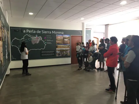
It is located in Aldeaquemada, and has the purpose of creating cultural and museum activities, also being the local Tourist Office.

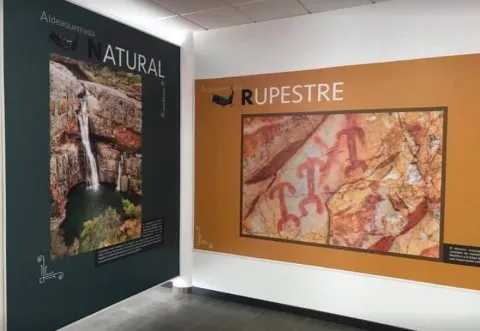
The Centre for Interpretation and Ecomuseo shows, through various panels and audiovisual technologies, the valuable cultural heritage of Rupéstre Art existing in this municipality, declared "Heritage of the" Humanity "by Unesco in 1998, the natural heritage thanks to the Natural Area of the Cascade of La Cimbarra and others, and the historical heritage associated with the colonization of Charles III in the 18th century.

Breve descripción

The Pablo de Olvide Interpretation Centre, in Aldeaquemada, is a cultural space of this town, which was opened on October 31, 2017.

Telecomunicaciones
Teléfono de contacto
680 104 199
Correo electrónico
turismo.aldeaquemada@gmail.com
Ubicación
Código Postal
23215
Latitud
38.410468
Longitud
-3.372098
Dirección
C/ Blas Infante, 1
Distrito
Municipio
Ubicación en el mapa
POINT (-3.372098 38.410468)
Tipos de punto de interés
Imágenes carrusel
imagen
Image
Centro%20de%20Interpretaci%C3%B3n%20Pablo%20de%20Olavide%201.jpg
Imagen principal
Desactivado
imagen
Image
Centro%20de%20Interpretaci%C3%B3n%20Pablo%20de%20Olavide%202.jpg
Imagen principal
Desactivado
Imágenes cabecera
imagen
Image
Centro%20de%20Interpretaci%C3%B3n%20Pablo%20de%20Olavide.jpg
Imagen principal
Activado
Horario
Saturdays, Sundays and holidays: 10: 00 - 14: 00. Free entry.
Loading map
Preparing points of interest and routes...

Centro de Int. del Patrimonio Histórico y cultural del P.N. Despeñaperros

Submitted by brandcode_deweloper on
Id
5871311
Descripción
Descripción larga

Also close to the Iberian Sanctuary "Cueva de los Muñecos" to where you can access through a signposted path that begins at the doors of the Interpretation Center.
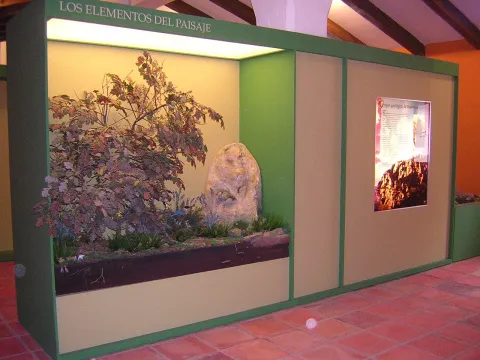
The Interpretation Centre has an exhibition area divided into 6 interpretative sets:

1. Elements of the landscape
2. Prehistory and Old Age
3. The Middle Ages. The Battle of the Navas de Tolosa
4. The Modern Age. New populations
5. The Contemporary Age
6. Audiovisual room. Dog-biting in time.

All these interpretative sets are made up of models, backlit information media, exhibition of real elements and replica in vitrines, ambiances and documentary projections.

Breve descripción

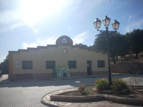
Located in a privileged place, in the "Collado de Los Jardines" before entering the Centre you can enjoy in the surroundings of an authentic forest of Quejigos of great ecological value.

Telecomunicaciones
Teléfono de contacto
953 664 307
Ubicación
Código Postal
23213
Latitud
38.410020
Longitud
-3.561010
Distrito
Municipio
Ubicación en el mapa
POINT (-3.56101 38.41002)
Tipos de punto de interés
Imágenes carrusel
imagen
Image
26010179Master.jpg
Imagen principal
Desactivado
Imágenes cabecera
imagen
Image
DSCN5729.jpg
Imagen principal
Activado
Loading map
Preparing points of interest and routes...

Castles of Cambil and Alhabar

Submitted by brandcode_deweloper on
Id
4348947
Descripción
Descripción larga

The Castle of Alhabar, occupies the entire upper plateau of the farallon of the east bank of the river. It was of small proportions but of a higher size than the castle of Cambil, of rectangular floor and adapted to the rock steep by two of its sides (north and south), against which it raised its wall, on the east and west facades, of which remains of very damaged structures.

In the inner space it is worth noting the existence of two levels that were enhanced by human work: a central one that makes the times of alcazareño and another peripheral. The visible work inside the castle is of small and abundant plaster mortar.

Access to the castle was made in the west by a narrow entrance preceded by a very long staircase, very narrow, partially carved on the rock, so it was not accessible for riding. At this point the space was closed with a wall of bulkhead.

The other wall lock, the east lock, is very restored to avoid collapse. Near this, at the top of the rib in which the hill seems to be nailed, there are signs of a rectangular construction, probably the only living space of Alhabar.

A lookout has now been enabled from the castle of Alhabar, from where you can see the field of vision that was held at that time from the castle.

The Cambil Castle, occupied the entire top plateau, approximately rectangular, of the rocky pharallion on the west bank of the river. It had natural defenses on three of its fronts, protected only by a small parapet, due to the steep nature of the rock on which it settled, only the west side has a low level of about 4 or 5 meters, so on this side it was where it had some kind of fortification and where the castle should be accessed.

The interior of the castle is rather rough, with small masonry and a lot of plaster mortar. It was structured on two levels: one central as an alcazarejo, and the other peripheral.

The alcazarejo is formed by an overheated plateau that was surrounded by parapets and perhaps leveled with land. In the eastern sector, a tight structure is detected that supports and enhances it, two walls of bulkhead at a right angle with the corner formed by a chain of very narrow and well-cut chairs.

The inner space from which we could call the courtyard of weapons, was divided into two longitudinal sectors by a divisive of dry bulkheads, today completely melted although their stones are in situ.

The remains of the pond, carved on the living rock, reveal the entrance of the castle. In some areas of the castle there are stone bowls, which, because of their dispersion, could be remnants of the bombing carried out in 1485 by the Catholic Kings.

Today, remains of the wall can still be seen.

Breve descripción

Cambil, located in a large valley south of Sierra Mágina, is surrounded by high peaks and thick mountains. Cambil has two large rocks, almost vertical murallions of Marchesian limestone separated by a cut carved by the Villanueva River, where the Muslim castles of Cambil and Alhabar were located, whose origin is related to the border of the Nazari Kingdom of Granada in 1246. The castle of Alhabar is located in the rocky farallon of the same name located to the east of the river, while the castle of Cambil occupies the entire plateau of the peñasco of the same name, to the west of the river.

Telecomunicaciones
Sitio web
www.cambil-arbuniel.es/municipio/patrimonio-historico/castillos-de-cambil-y-alhabar/
Teléfono de contacto
953 300 427
Ubicación
Código Postal
23120
Latitud
37.677430
Longitud
-3.566620
Dirección
C/ Moraleda, 2D
Distrito
Municipio
Ubicación en el mapa
POINT (-3.56662 37.67743)
Tipos de punto de interés
Imágenes carrusel
imagen
Image
Castillo_de_Alhabar%202.jpg
Imagen principal
Desactivado
imagen
Image
Castillo_de_Alhabar01.jpg
Imagen principal
Desactivado
Horario
24 h.
Microsite al que pertenece
Loading map
Preparing points of interest and routes...

Castle of Solera

Submitted by brandcode_deweloper on
Id
4652708
Descripción
Descripción larga

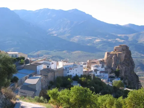
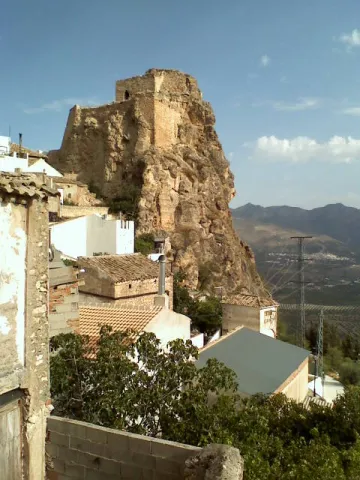
It is in a rocky spur at 1,090 meters high and is the highest castle in the province of Jaén. Two constructive phases are distinguished. At the top there are walls of irregular size masonry that delimit a small enclosure to which is associated a aljibe that still retains remains of the pointed cover vault. Below, there are remains of other larger buildings, a real castle flanked by masonry towers of armchairs at the angles and walls that close the enclosure. The communication between the two areas is carried out through a passage covered by a vault of half a barrel, also of masonry, and which preserves the remains of enlucido.

The whole construction is mounted on top of the rock that serves as a foundation. The original paraments with a strong deterioration are masked by recent remodeling.

From the Castle of Solera, of Nazari origin, you can see splendid views of the Vega in which the Jandulilla River and the Garganton River converge, as well as the village of Bélmez de la Moraleda and the Torreón del Lucero, which gives an idea of the defensive system that these lands had in the past.

Breve descripción

The Castle of Solera is located in the town of the same name, belonging since 1975 to the municipality of Huelma in the province of Jaén. Andalusia. The ruins of this Arab castle, of masonry and on a rocky needle, testified to the difficulties that Christians must have had until they managed to conquer it in 1433. The Castle was declared a Historical Monument in 1.985.

Telecomunicaciones
Sitio web
www.aytohuelma.es
Teléfono de contacto
953 390 210
Ubicación
Código Postal
23569
Latitud
37.684380
Longitud
-3.369020
Distrito
Municipio
Ubicación en el mapa
POINT (-3.36902 37.68438)
Tipos de punto de interés
Imágenes carrusel
imagen
Image
Castillo%20de%20Solera.jpg
Imagen principal
Desactivado
Imágenes cabecera
imagen
Image
132095-el-castillo-de-solera.jpg
Imagen principal
Activado
Loading map
Preparing points of interest and routes...