Saltar al contenido principal

Laricio or Salgareño Pine Forest

Submitted by brandcode_deweloper on
Id
921538
Descripción
Descripción larga

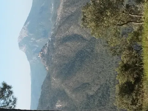
After walking through this pine tree and returning to the track we have accessed, if we look south, the clear days look perfectly Sierra Nevada and looking north the Gualay valley opens. The track opens through the rocky moles of the Cabañas peak and the lastras of the Cagasebo rope.

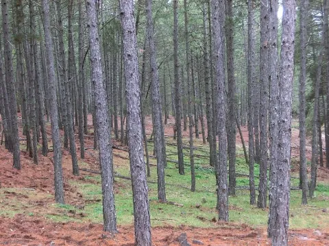
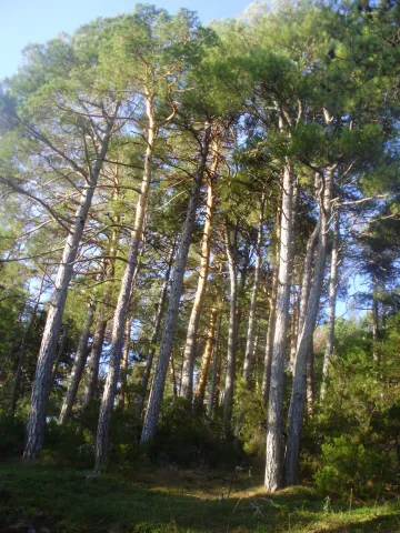
This forest is dominated by the salgarean pine (Pinus nigra salzmannii), which is sometimes accompanied by maple (Acer granatense), mustard (Sorbus aria) and whine (Quercus faginea), and in the sotoquela by rastera savines (Juniperus sabina), rake juniperus (Juniperus communis hemisphaerica), thorns (Berberis vulgaris australis), tirelles (Prunus postrata), enamubios (a), and other species (the celium (a), as well as the celium (a), and the celibelium (a), and the celium (a).

The name that has always been known in these saws to this pine is that of Salgareño. The etymology of his name is as beautiful as the pine itself; salgareño comes from sarga, a vulgar name with which several willows are known. It alludes to the fine and slender of the branches, as does the pine bear when young, slender and right. By this slender and fine figure, the ancient inhabitants of the saws baptized this pine of the high mountain of Serrana as Salgareño.

We access Puerto Llano on the track from the birth of the Guadalquivir to Pozo Alcón. Puerto Llano is the highest point of the track, where we are surrounded by a splendid pine pine pines, called salgareños in these saws.

Breve descripción

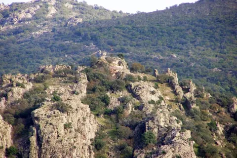
This forest is one of the botanical and landscape jewels of the Park. The plant formation we are going to describe is considered endemic to this saw, as it only exists in the high mountain of the Park. In the endemic pinar of Puerto Llano we recommend walking without haste. Most of the pine trees that form it are over 600 years old.
Ubicación
Latitud
37.702695
Longitud
-2.935057
Municipio
Ubicación en el mapa
POINT (-2.935057 37.702695)
Imágenes carrusel
imagen
Image
pinar.jpg
Imagen principal
Desactivado
imagen
Image
P9080814.JPG
Imagen principal
Desactivado
Imágenes cabecera
imagen
Image
unnamed.jpg
Imagen principal
Activado
Loading map
Preparing points of interest and routes...

Cliffside / Precipice

Submitted by brandcode_deweloper on
Id
4520188
Descripción
Descripción larga

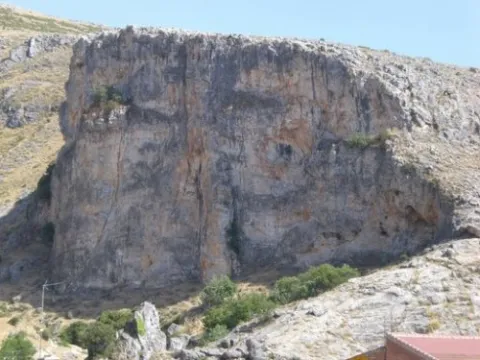
It is a unique landscape with a steep look due to the presence of karmic materials, excavated by water on the limestone.

Location: To the east of the city centre, very close to it.

Distance: 500 m.

Medium: By vehicle tourism and on foot.

Access route: Directly from the local park.

Ubicación
Latitud
37.649686
Longitud
-3.901361
Distrito
Ubicación en el mapa
POINT (-3.901361 37.649686)
Tipos de punto de interés
Imágenes carrusel
imagen
Image
El_Despe%C3%B1adero_Detalle_Fuensanta.jpg
Imagen principal
Desactivado
Imágenes cabecera
imagen
Image
NaturalDespexadero.jpg
Imagen principal
Activado
Loading map
Preparing points of interest and routes...
Interés

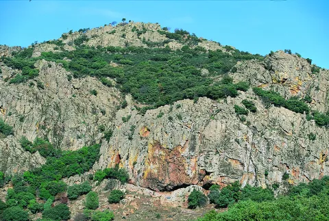
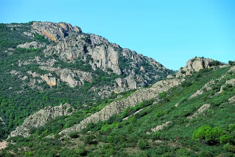
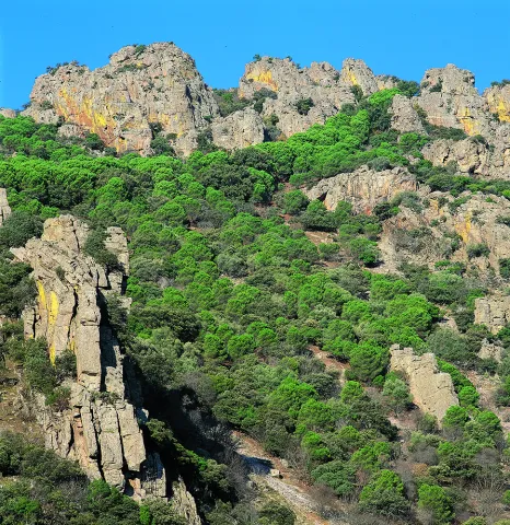
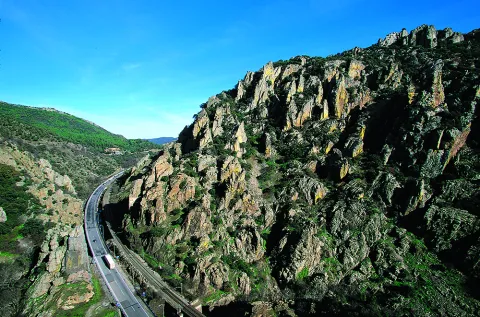
Gorge of Despeñaperros

Submitted by brandcode_deweloper on
Id
4555232
Descripción
Descripción larga

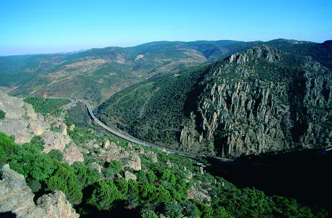
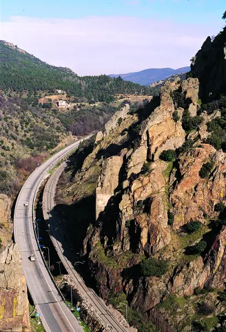
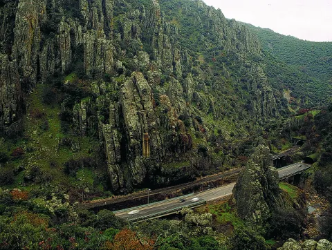
The river erosion, which has a limestone wall of about 400 meters high, is the result of the river erosion. There is a teaching path dedicated to local botany.

Location: On the highway of Granada, just at the limit of the municipal terms of Campillo, Cárcheles and Cambil.

Distance: 7 km.

Medium: Tourism vehicle.

Access: Directly via the Granada Highway (A-44).

Breve descripción

TheDespeñacolos parloris a great geological formation that makes the border between the plains of Castilla la Mancha and the Valle del Guadalquivir, declared Natural Park. Many of you will have been able to observe as you pass through the road that passes through Despeñacolos, the great mouth open in the rock caused by the erosion of the river's channel, on which the old route was built, which communicates Andalusia with the neighbouring community.

Ubicación
Código Postal
23213
Latitud
38.409930
Longitud
-3.560880
Distrito
Municipio
Ubicación en el mapa
POINT (-3.56088 38.40993)
Tipos de punto de interés
Imágenes carrusel
imagen
Image
Natu268.jpg
Imagen principal
Desactivado
imagen
Image
Natu140.jpg
Imagen principal
Desactivado
imagen
Image
Natu169.jpg
Imagen principal
Desactivado
imagen
Image
Natu176.jpg
Imagen principal
Desactivado
imagen
Image
Natu229.jpg
Imagen principal
Desactivado
imagen
Image
Natu232.jpg
Imagen principal
Desactivado
Imágenes cabecera
imagen
Image
Natu016.jpg
Imagen principal
Activado
Loading map
Preparing points of interest and routes...

Peñalta Summit

Submitted by brandcode_deweloper on
Id
8091185
Descripción
Descripción larga

Location: to the southeast of the city centre, in Cerro Peñalta.
Distance: 3.5 km.
Half: on foot.
Access route: first take the Honda Bridge road and turn right along the Peñalta road.

Breve descripción

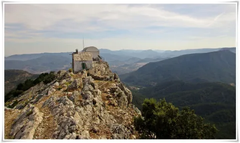
It is the highest point in the municipality of Benatae (1.412 m.), where there is a fire surveillance shed and from which you can see impressive landscapes of the Natural Park of Cazorla, Segura and Las Villas.

Telecomunicaciones
Sitio web
www.benatae.es/el-municipio/patrimonio-natural.html
Teléfono de contacto
953 480 378
Correo electrónico
benatae@promojaen.es
Ubicación
Nombre
Cerro Peñalta
Latitud
38.338650
Longitud
-2.638400
Distrito
Municipio
Ubicación en el mapa
POINT (-2.6384 38.33865)
Tipos de punto de interés
Imágenes carrusel
imagen
Image
Pe%C3%B1alta2.jpg
Imagen principal
Desactivado
imagen
Image
Pe%C3%B1alta3.jpg
Imagen principal
Desactivado
Imágenes cabecera
imagen
Image
Pe%C3%B1alta.jpg
Imagen principal
Activado
Loading map
Preparing points of interest and routes...

Caves Refugio

Submitted by brandcode_deweloper on
Id
8124859
Descripción
Descripción larga

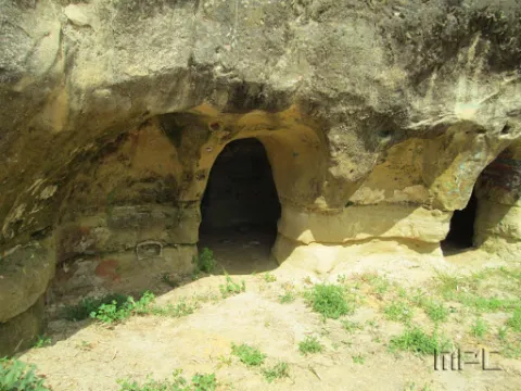
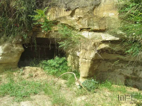
When Franco passed through Lopera in the 1950s he ordered that new houses be demolished and built for his tenants in the Pradillo Guijoso neighborhood, the front of the first body was finally only demolished. Some are currently abandoned and others have been occupied by Lopera's neighbours by keeping firewood or coal inside.

Breve descripción

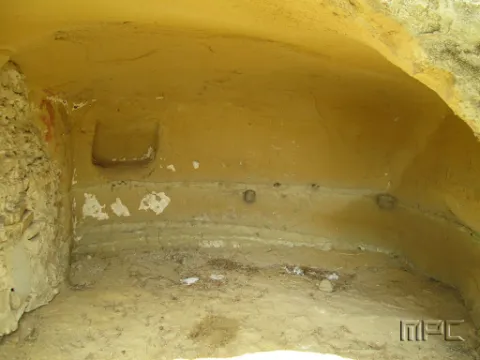
The 11 caves at the entrance were used as shelters during the Civil War. They date back to 1828 and had several bodies.

Telecomunicaciones
Teléfono de contacto
953 516 250
Ubicación
Código Postal
23780
Latitud
37.941620
Longitud
-4.209160
Dirección
Carretera de Porcuna
Distrito
Municipio
Ubicación en el mapa
POINT (-4.20916 37.94162)
Tipos de punto de interés
Imágenes carrusel
imagen
Image
Cuevas%20refugio%202.jpg
Imagen principal
Desactivado
imagen
Image
Cuevas%20refugio.jpg
Imagen principal
Desactivado
Imágenes cabecera
imagen
Image
Cuevas%20refugio%203.jpg
Imagen principal
Activado
Loading map
Preparing points of interest and routes...

Cave of the Puerto de las Palomas

Submitted by brandcode_deweloper on
Id
8084183
Descripción
Descripción larga

The predominant indigenous vegetation is the oaks and moans, low mountain of rosemary, lentisco and sabina. Some well-known routes are the Carchelejo-Cazall- Convent, Carchel to Carchelejo by the Barrio de la Grilla or the ascension to the Cueva del Puerto de las Palomas. On the urban periphery of the two cores there are several recreational areas, such as the Parque de la Fuente, the Haza de la Widow and the sports facilities of Carchelejo and Cárchel.

Breve descripción

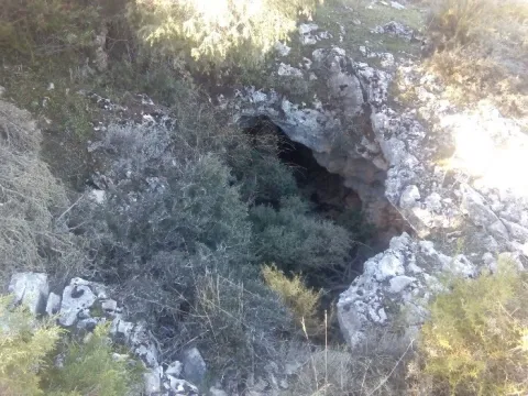
Cárcheles has a wide variety of natural sites such as the Monastery Barrio, the Cueva del Puerto de las Palomas, Cazalla and the Convent, etc., where to make excursions, using all kinds of means of transport: on foot, by cavalry, bike, bike or car, etc.

Telecomunicaciones
Teléfono de contacto
953 302 291 / 953 302 003
Correo electrónico
Webmaster@carcheles.es
Ubicación
Código Postal
23192
Latitud
37.612010
Longitud
-3.661260
Distrito
Municipio
Ubicación en el mapa
POINT (-3.66126 37.61201)
Tipos de punto de interés
Imágenes carrusel
imagen
Image
la%20Cueva%20del%20Puerto%20de%20las%20Palomas%20%281%29.jpg
Imagen principal
Desactivado
imagen
Image
la%20Cueva%20del%20Puerto%20de%20las%20Palomas3%20%281%29.jpg
Imagen principal
Desactivado
Imágenes cabecera
imagen
Image
la%20Cueva%20del%20Puerto%20de%20las%20Palomas2%20%281%29.jpg
Imagen principal
Activado
Microsite al que pertenece
Loading map
Preparing points of interest and routes...

Cave of los Muñecos

Submitted by brandcode_deweloper on
Id
5867250
Descripción
Descripción larga

This Sanctuary of the Ibera era, along with another located also in Jaén, in the town of Castellar are very important and have provided the largest number of bronze exvotes, important pieces not only to know the work of this metal in the Iberian world, but to solve many other problems related to the faithful who approached the divinity in these places of worship, such as the type of religiosity, the forms of clothing, the jewels, weapons, the type of hair, etc.

From Collado de los Jardines more than 2,500 exvotes have come out, and from Castellar more than 2,000. The almost all of these objects are kept in the National Archaeological Museum of Madrid.

The exvotes (dolls) of this Shrine of the Collado de los Jardines are of the most varied, in them are represented faithful of all kinds: women, men, warriors, etc.
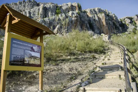
The latest research was based on the documentation of a historical population in the "Cerro del Castillo" located above the Sanctuary, with the consequent recording of materials and the documentation of 'work units' such as a Roman track, a wall and the environment of the solar that occupied the Iberian necropolis.

The Cueva de los Muñecos is located inside the Natural Park Despeñacolos, the municipal term of Santa Elena, within a ravine, built between colossal stone blocks, in which there are excavated several caves, the largest of which, about 50 meters deep, was probably the limit of the sacred enclosure. Within this cave today there is a water spring that probably should have existed already in ancient times. In the area there is today a Centre for the Interpretation of the Historical and Cultural Heritage of the Natural Park of Despeñacolos, as well as a path for public use that leads to the Sanctuary and a lookout in the so-called Cerro del Castillo.

Breve descripción

There is a place in St. Helena (Jaén) for all the neighbors known as La Cueva de los Muñecos, called for the number of votes (bronze figures) found in the area. It is the Iberian Sanctuary located on the Collado de los Jardines located on the A-6200 road that leaves from the A4 motorway in Despeñacolos to the town of Aldeaquemada.

Ubicación
Código Postal
23213
Latitud
38.388230
Longitud
-3.498410
Distrito
Municipio
Ubicación en el mapa
POINT (-3.49841 38.38823)
Tipos de punto de interés
Imágenes carrusel
imagen
Image
Cueva-de-los-Munecos-jaen-escondido-e1557137991914.jpeg
Imagen principal
Desactivado
Imágenes cabecera
imagen
Image
Cueva%20de%20los%20Mu%C3%B1ecos_SantaElena.jpg
Imagen principal
Activado
Loading map
Preparing points of interest and routes...

Graja Cave

Submitted by brandcode_deweloper on
Id
5692889
Descripción
Descripción larga

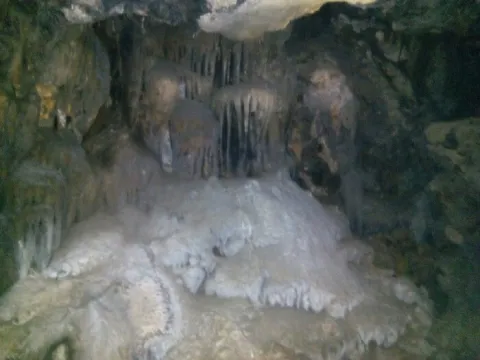
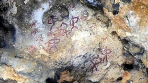
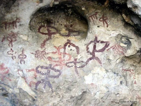
The great presence of limestone and the karmic effects make our province abundant the caves and coats that served as a home for those who lived these lands thousands of years ago. The Cueva de la Graja is an example of this; this rocky coat located at the north end of the Aznaitín at 750 meters high houses rock art manifestations with an age of 2000 to 5000 years before our age. The cave can be visited by requesting it previously in the City of Jimena.

Breve descripción

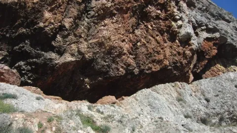
At the north end of the Aznaitin massif, in the area known as "the Cimbra," is the Cueva de la Graja. It is really a 6-meter-deep coat by 6-wide, which in its highest part reaches 5 meters. In addition to offering wonderful views from its 750 meters of altitude, this coat houses rock art manifestations that were made between 2000 and 5000 years before our era. Made with pigments obtained through the mixture of iron oxide, clays and animal fats; the paintings represent rites and grazing work. Declared an Artistic Historical Monument in 1924, the cave can be visited on request in the City of Jimena.

Telecomunicaciones
Sitio web
www.lugaresmiticosdejaen.com/es/articulos/lugares/cueva-de-la-graja
Correo electrónico
ayuntamientodejimena@gmail.com
Ubicación
Código Postal
23530
Latitud
37.833960
Longitud
-3.473090
Distrito
Municipio
Ubicación en el mapa
POINT (-3.47309 37.83396)
Tipos de punto de interés
Imágenes carrusel
imagen
Image
12.jpg
Imagen principal
Desactivado
imagen
Image
13.jpg
Imagen principal
Desactivado
Imágenes cabecera
imagen
Image
11.jpg
Imagen principal
Activado
Microsite al que pertenece
Loading map
Preparing points of interest and routes...

Mata Bejid Farmhouse

Submitted by brandcode_deweloper on
Id
5857145
Descripción
Breve descripción

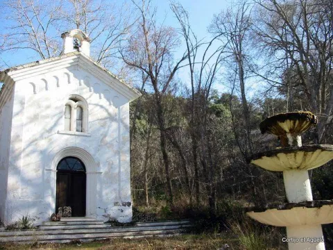
In this private estate the spirit of the belle époque with rural dyes is still revived. It is a private property with an interesting chapel, gardens, house of the gentlemen and even a regional style garage.

Ubicación
Latitud
37.676846
Longitud
-3.564921
Distrito
Municipio
Ubicación en el mapa
POINT (-3.564921 37.676846)
Tipos de punto de interés
Imágenes carrusel
imagen
Image
Ermita_Begid.jpg
Imagen principal
Desactivado
Imágenes cabecera
imagen
Image
Cortijada%20Mata%20Bejid.png
Imagen principal
Activado
Microsite al que pertenece
Loading map
Preparing points of interest and routes...

Virgen de la Cruz Pool

Submitted by brandcode_deweloper on
Id
8094481
Descripción
Descripción larga

Near the population centre is theContón de la Virgen de la Cruz, recreational area located on an old landfill recovered as a green area and crossing through a bridge the first of the previous streams. Linked to these watercourses we find a typical vegetation of riverside, in which they stand out reels, carrizos, canes, calves, and eucalyptus, alms, olmos and weeping willows.

Breve descripción

The feast that the hunters celebrate is the one that takes place on the third of May, dedicated to the Marian advocation of theVirgin of the Cross, and in which there is the custom to go in Romeria to a place located on the road of Villanueva de la Reina called the Charcón.

Telecomunicaciones
Teléfono de contacto
953 537 131
Correo electrónico
castalla@cazalilla.es
Ubicación
Código Postal
23628
Latitud
37.987020
Longitud
-3.888300
Distrito
Municipio
Ubicación en el mapa
POINT (-3.8883 37.98702)
Tipos de punto de interés
Imágenes carrusel
imagen
Image
thb_g_DSC_0124%20%28Copy%29.jpg
Imagen principal
Desactivado
Imágenes cabecera
imagen
Image
thb_g_DSC_0131%20%28Copy%29.jpg
Imagen principal
Activado
Loading map
Preparing points of interest and routes...