Saltar al contenido principal

Vadomojón Reservoir

Submitted by brandcode_deweloper on
Id
1909767
Descripción
Descripción larga

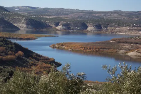
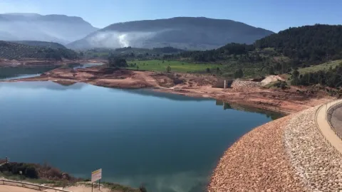
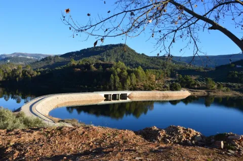
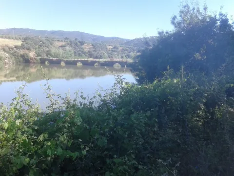
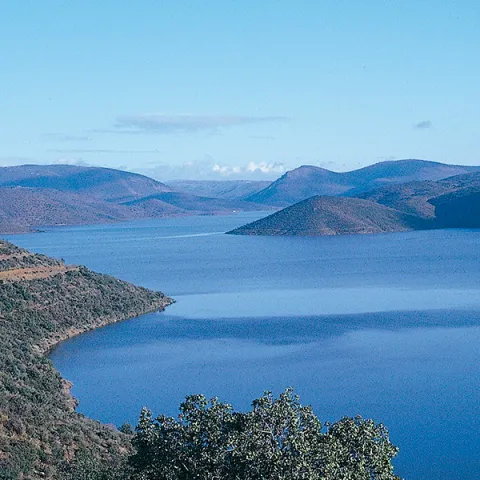
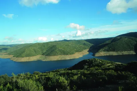
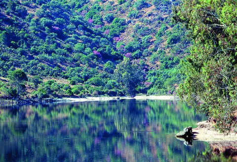
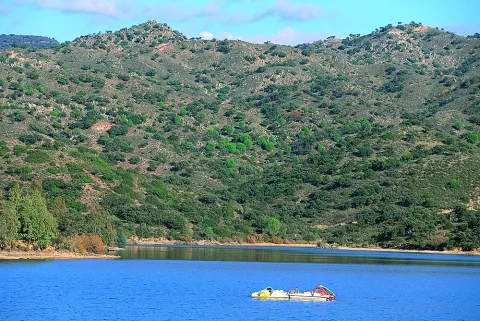
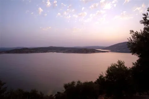
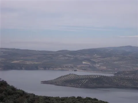
The Vadamojón Embalse was built to manage the irrigation and ecological flow of the present rivers. It is one of the most important in the Guadalquivir basin, its waters being clear, fresh and with great ecological potential. The landscape of the basin is characterized by its wavy elevations of soft slopes. Its sweet and splattering waters come, among other sources, from the Víboras and San Juan rivers.

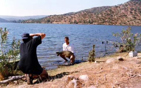
Since its implementation in 1997, Vadomojón has become one of the most important free fishing or competition scenarios in both the Sierra Sur region and the Campiña de Baena region in the province of Córdoba.

Vadomojón is a recent reservoir of transparent waters capable of hosting important populations of those fish such as the barbo that inhabited the waters of the Guadaljoz River before the construction of the dam. Other species present are the cachuelo, the boga, the fangs, the tent, the black lubine or the rainbow trout.

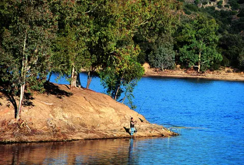
A wide variety of fishing methods and techniques can be used in Vadomojón, such as coup, bolognese, English, light or artificial fishing.

One of the most frequent fishing areas in Vadomojón is Caldera, which is accessed by the Víboras River.

Along with the fish, there are birds like flamingos and royal garzas

Breve descripción

The Embalse de Vadomojón was built in 1993, located in the channel of the Guadaljoz River. It is part of the municipalities of Alcaudete (village of Noguerones) and Baena, in the province of Jaén and Córdoba respectively. It belongs to the Guadalquivir Hydrographic Confederation (Córdoba area).
Ubicación
Latitud
37.588140
Longitud
-4.081294
Distrito
Municipio
Ubicación en el mapa
POINT (-4.081294 37.58814)
Imágenes carrusel
imagen
Image
5.jpg
Imagen principal
Desactivado
imagen
Image
1%20%283%29.jpg
Imagen principal
Desactivado
Imágenes cabecera
imagen
Image
4%20%282%29.jpg
Imagen principal
Activado
Loading map
Preparing points of interest and routes...

Siles Reservoir

Submitted by brandcode_deweloper on
Id
873003
Descripción
Descripción larga

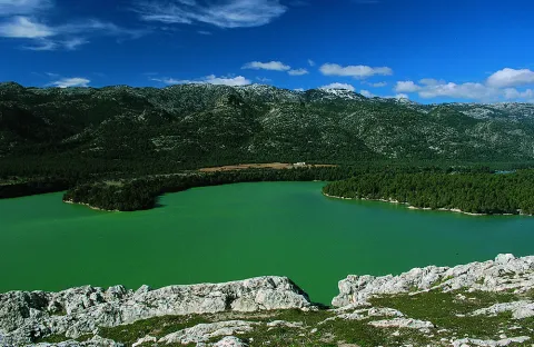
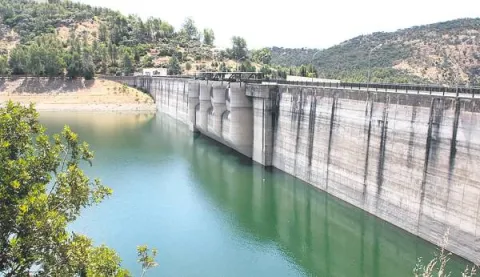
The Siles dam, which was completed in 2015, receives its water from the Gualimar River and the Carrizas River.
It is a reservoir that receives its water from the Guadalimar River and the Carrizas River, located close to its head and belonging to the Guadalquivir Hydrographic Confederation.

The reservoir is almost entirely the municipal term of Siles (Jaén), although it enters approximately 500 meters in the term of Villaverde de de Guadalimar. It is named after Dam de Siles, when the dam is found in the municipality of the same nomenclature.

The reservoir has an extension of 21.1 ha, with a capacity to store 30 hm ³ of water. The type of dam is from Arc Gravity and was completed in 2015.

Breve descripción

Siles packaging

Ubicación
Latitud
38.387861
Longitud
-2.582637
Distrito
Municipio
Ubicación en el mapa
POINT (-2.582637 38.387861)
Imágenes carrusel
imagen
Image
presasiles.jpg
Imagen principal
Desactivado
Imágenes cabecera
imagen
Image
2%20%281%29.jpg
Imagen principal
Activado
Loading map
Preparing points of interest and routes...

Ropera Reservoir

Submitted by brandcode_deweloper on
Id
6217864
Descripción
Breve descripción

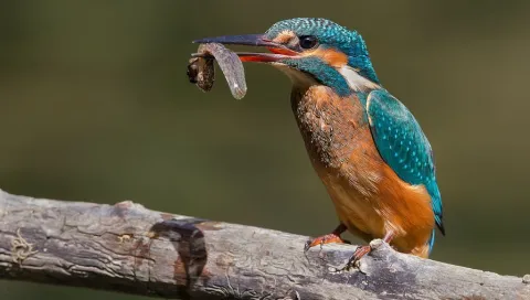
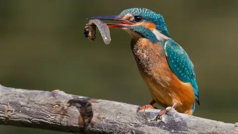
Located in the municipal term of Marmolejo this reservoir is important for the reproduction of Common Calamón, they also raise Common Avetorillo, Imperial Garza, White Cigareña, Common Ciguenuela, Chico Chorlitejo and Martín Pescador. Crab Garcilla in passage, and invert of aquatics.

Ubicación
Código Postal
23770
Latitud
38.063668
Longitud
-4.177130
Distrito
Municipio
Ubicación en el mapa
POINT (-4.17713 38.063668)
Imágenes carrusel
imagen
Image
F195_Foto_01.jpg
Imagen principal
Desactivado
imagen
Image
martin.jpg
Imagen principal
Desactivado
Imágenes cabecera
imagen
Image
11253827Master.jpg
Imagen principal
Activado
Microsite al que pertenece
Loading map
Preparing points of interest and routes...

La Fernandina Reservoir

Submitted by brandcode_deweloper on
Id
4399329
Descripción
Breve descripción

The environment of the La Fernandina reservoir presents beautiful images of the Mediterranean forest, with the presence of abundant oak, being an ideal place for the development of an interesting extensive livestock. From the geological point of view, the slate is very large.

Ubicación
Código Postal
23211
Latitud
38.207010
Longitud
-3.573720
Distrito
Municipio
Ubicación en el mapa
POINT (-3.57372 38.20701)
Imágenes carrusel
imagen
Image
Natu062.jpg
Imagen principal
Desactivado
Imágenes cabecera
imagen
Image
46643996.jpg
Imagen principal
Activado
Loading map
Preparing points of interest and routes...

La Bolera Reservoir

Submitted by brandcode_deweloper on
Id
872785
Descripción
Descripción larga

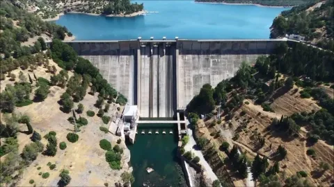
With its 53 hectares of capacity and 265 hectares of surface, it is the second largest in the park. It began to be exploited for irrigation and supply in 1972. The maximum water level is 966 m in altitude and the height of the dam on the channel is 43 m.

Breve descripción

Bread.

Ubicación
Latitud
37.789256
Longitud
-2.937727
Municipio
Ubicación en el mapa
POINT (-2.937727 37.789256)
Imágenes carrusel
imagen
Image
pantano-bolera-Sierra-Cazorla-900x603.jpg
Imagen principal
Desactivado
imagen
Image
Natu005.jpg
Imagen principal
Desactivado
Loading map
Preparing points of interest and routes...

Guadalmena Reservoir

Submitted by brandcode_deweloper on
Id
872881
Descripción
Descripción larga

Located on the outside of the Park, this large reservoir has a storage capacity of 346.5 hm ³ and occupies an area of 1250 ha. It began operating in 1969, with supply for human consumption being the main use of unpackaged water, and irrigation and electricity production being secondary uses.

Its turbines have a production capacity of 15.2 MW / hour. The maximum water level is 594.6 m in altitude and the height of the dam on the channel is 85 m.

Breve descripción

Embalse del Guadalmena

Ubicación
Latitud
38.349338
Longitud
-2.990036
Distrito
Municipio
Ubicación en el mapa
POINT (-2.990036 38.349338)
Imágenes carrusel
imagen
Image
maxresdefault%20%287%29.jpg
Imagen principal
Desactivado
imagen
Image
Natu084.jpg
Imagen principal
Desactivado
Imágenes cabecera
imagen
Image
guadalmena.png
Imagen principal
Activado
Loading map
Preparing points of interest and routes...

Encinarejo Reservoir

Submitted by brandcode_deweloper on
Id
2980354
Descripción
Descripción larga

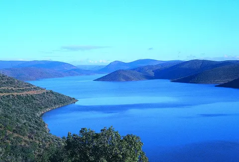
Embalse is located in the Sierra de Andújar Natural Park, in the middle of Sierra Morena, known by all Andalusian fishermen for being one of the largest swamps to practice carpfishing. With calm and clean waters, the Jandula flows into it. The most commonly seen species are tents, gypsy barbs and black bass.

Breve descripción

It is accessed by the J-5010 road from Andujar to the Sanctuary of the Virgin of the Head, diverting on a land road that leads directly to the enclave.

Ubicación
Código Postal
23740
Latitud
38.184490
Longitud
-3.985750
Dirección
Carretera A-6177
Distrito
Municipio
Ubicación en el mapa
POINT (-3.98575 38.18449)
Imágenes carrusel
imagen
Image
Natu090.jpg
Imagen principal
Desactivado
imagen
Image
BOIL-JAE-Encinarejo.jpg
Imagen principal
Desactivado
imagen
Image
Natu435.jpg
Imagen principal
Desactivado
imagen
Image
Natu410.jpg
Imagen principal
Desactivado
imagen
Image
Natu399.jpg
Imagen principal
Desactivado
imagen
Image
Natu391.jpg
Imagen principal
Desactivado
imagen
Image
Natu116.jpg
Imagen principal
Desactivado
imagen
Image
Natu346.jpg
Imagen principal
Desactivado
Imágenes cabecera
imagen
Image
Cesar%20Puente-Ortega%2016-3-05%20%281%29.jpg
Imagen principal
Activado
Microsite al que pertenece
Loading map
Preparing points of interest and routes...

Doña Aldonza y Pedro Marín Reservoir

Submitted by brandcode_deweloper on
Id
6221339
Descripción
Breve descripción

In the municipality of Jódar, next to the Natural Park of Sierra Magina, we find an important nesting population of Calamón Común. Concentrations of Black Milano in step, which rest on the saucedas during migration. Also breeding of aquatic birds, such as Common Avetorillo, Imperial Garza, Anade Friso, Anade Azulón, European Porron, Common Ciguenuela, Common Avoceta and Aguilucho Lagunero. In winter, Garcilla Bueyera, Cerceta Common, Avoceta Common, Correlimos Common, Aguja Colinegra, Archibebe Common and Duck Colorado. To highlight the high concentrations of paseriforms in sotos and carrizales, such as Common Carrier, Tordal Carrer, Moscow Bird and Buscarla Unicolor.

Ubicación
Código Postal
23500
Latitud
37.929550
Longitud
-3.311680
Distrito
Municipio
Ubicación en el mapa
POINT (-3.31168 37.92955)
Imágenes carrusel
imagen
Image
martin%20%281%29.jpg
Imagen principal
Desactivado
imagen
Image
image_content_12479651_20161109103424%20%281%29.jpg
Imagen principal
Desactivado
Imágenes cabecera
imagen
Image
Natu041%20%282%29.jpg
Imagen principal
Activado
Microsite al que pertenece
Loading map
Preparing points of interest and routes...

Dañador Reservoir

Submitted by brandcode_deweloper on
Id
4748450
Descripción
Descripción larga

It is accessed by the road that crosses the region of El Condado (A-312), there are two options: from Castellar to A-6203 after passing the cores of Aldeahermosa, Montizon and Sale of the Saints; or through the JA-9101 by Chiclana de Segura, which links with the A-6203 for Sale of the Saints.

From this last core the A-6203 is followed for 4 km. To the point of kilometer 43, where a narrow road that, after 4.5 km, leads us to the reservoir leaves to the left. From the neighbouring province of Ciudad Real it would be necessary to take the CM-3129 from Villamanrique, which at the provincial limit becomes the already mentioned A-6203.

The Environment

The Dañador reservoir, owned by the State and managed by the Ministry of the Environment, belongs to the Guadalquivir Hydrographic Confederation, and is located in the eastern end of Sierra Morena. Here the relief is low, with soft moist formations, not reaching any point in the geographical area around the 1,000 m altitude. This whole area of the Northeast of the municipality of Montizón is based on very old materials, specifically slate and quartdate of the Paleozoico de la Meseta, as this is a contact area with it.

The average rainfall exceeds 600 litres per square metre per year.
The reservoir is mainly nourished by the waters of the Dañador River, of little length (53 km.), which is born in the Province of Ciudad Real and is already in the Province of Jaén in the Guadalén River, tributary in turn to the Guadalimar and the latter of the Guadalquivir.

Since 1997, this area has been under environmental protection by the European Union called the LIC (Community Interest Place) for the characteristics of its ecosystem and the biodiversity of wild fauna and flora. Specifically this protection figure extends over an area of more than 1,700 km. squares in the north of the Province of Jaén by the basins of the Guadalén, Guadalmena and Rumblar rivers.

From a natural point of view, the importance of these spaces lies in the presence of plant formations typical of the Mediterranean mountain, some of them in good conservation, as well as the existence of phunistic species of particular interest for their scarcity. Among the first are the traditional oak oak, which is accompanied by other specimens of the genus Quercus, such as the alcornoque, the complaint and point cuts of melojo oak, species that give shelter to a sotoforest of noble Mediterranean dungeon (madroño, brezo, lentisco, cornicabra, agracejo, labiérnago, coscoja, etc.).

Also of great importance in the area are the masses of Pinus pinea and Pinus pineer from repopulation, as well as the forest formations in the gallery in the watercourses.

With regard to fauna, it is worth noting the existence of several cynetic species (deer, boar, gus, rabbits, etc.), as well as the isolated presence of some protected mammals such as the wolf, lince or meloncillo; of birds related to the aquatic environment, and of birds of special interest such as imperial eagle, royal eagle, leonate vulture or royal owl.

Breve descripción

The Dañador reservoir is located in the NE of the Province of Jaén, included in all its extension in the municipal term of Montizón.

Ubicación
Latitud
38.342195
Longitud
-3.103604
Distrito
Municipio
Ubicación en el mapa
POINT (-3.103604 38.342195)
Imágenes carrusel
imagen
Image
Embalse%20del%20Da%C3%B1ador.jpg
Imagen principal
Desactivado
Imágenes cabecera
imagen
Image
19.JPG
Imagen principal
Activado
Loading map
Preparing points of interest and routes...

Tierra Bridge

Submitted by brandcode_deweloper on
Id
4571576
Descripción
Descripción larga

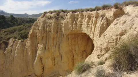
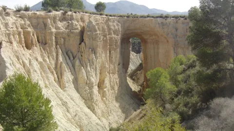
As we approach the Earth Bridge, the landscape becomes ruinous and lunar-looking. The immediate environment is full of hills and saws.

This natural enclave blends forest spots (especially pine trees) with white areas without just vegetation. We can observe wild vegetation and numerous repopulations of different ages. There is a wide range of shrubs and grasses adapted to the scarcity of rain, as it corresponds to its location in one of the most torrid areas of the Sierra Magina region.

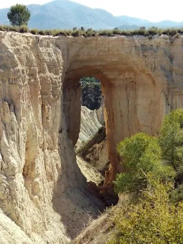
In the area we can see around us and on the very floor of the road, the effects of water erosion on the geological materials around us. It is a succession of minions that extend in depth by communicating with each other. When the rain water circulates on the surface, it is soon filtered through these holes, but dragging many suspended particles that sometimes form true clay slices. It is easy to imagine that the erosive power is increasing more and more, so the mixes join each other to form the greater ones. When it affects a road, the risk to circulation is evident, whether by car, bike or even walking. In this process is the origin of the formation of the Earth Bridge.

The process is given on soft materials such as margas, margous sands or uncompact clay sands. If there was a somewhat more compact and resistant material tank above them, it may not be eroded so easily, leaving a package of materials suspended in the air. The objective of this route is to check on-site the extraordinary dimensions of this phenomenon.

Finally remember that we are on the margas of the Cretaceous, a period in which marine animals such as amonites, belemnites, and other gastropods lived, which we can find through the fossilized and pyritized soil.

Breve descripción

It is located on the northern side of the Rambla del Bizco, in a partially flat area but broken by countless rambles of very difficult orography.

Ubicación
Latitud
37.703622
Longitud
-3.286707
Distrito
Ubicación en el mapa
POINT (-3.286707 37.703622)
Tipos de punto de interés
Imágenes carrusel
imagen
Image
14.jpg
Imagen principal
Desactivado
imagen
Image
12.jpg
Imagen principal
Desactivado
Imágenes cabecera
imagen
Image
13.jpg
Imagen principal
Activado
Microsite al que pertenece
Loading map
Preparing points of interest and routes...