Saltar al contenido principal

Mengíbar

Submitted by brandcode_deweloper on
Id
747223
Perfil de redes sociales
Facebook
https://www.facebook.com/aytomengibar
Twitter
https://twitter.com/aytomengibar
Descripción
Breve descripción

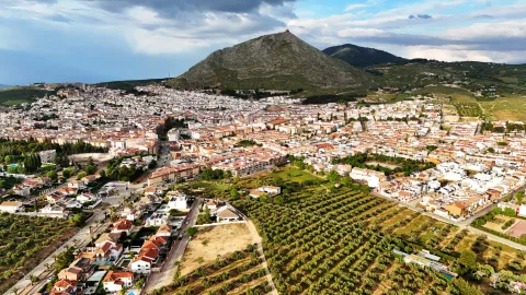
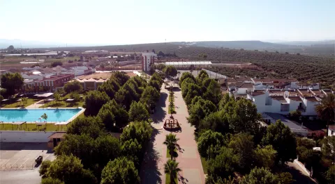
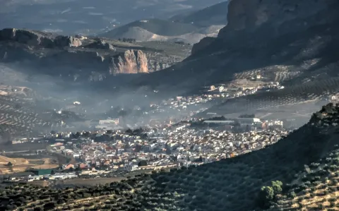
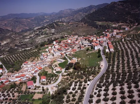
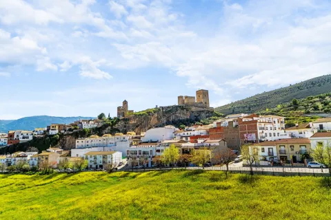
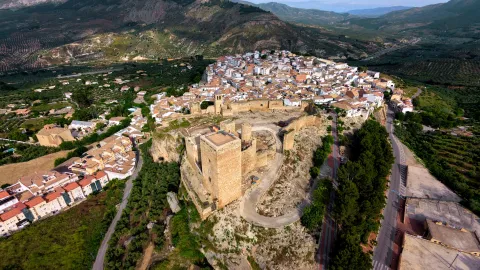
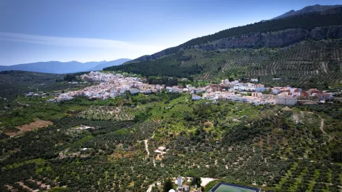
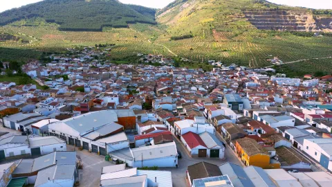
Mengibar is located to the north of the Jiennense capital, between the Guadalquivir, Guadalumillon and Guadalimar rivers, land covered with olive trees and cereal and fruit fields. Its location next to the E-902 or A-44 motorway (Bailén-Motril) has helped to maintain a balance between the dedication to agriculture, industry and services. When you reach Mengíbar el Guadalquivir, your flow rate is amused, and you start a quiet middle course, allowing for better use of the water. Mengibar was highlighted river port, on the banks of the Guadalquivir, for its good geographical location, especially for the transport of wood from the Sierra de Segura.

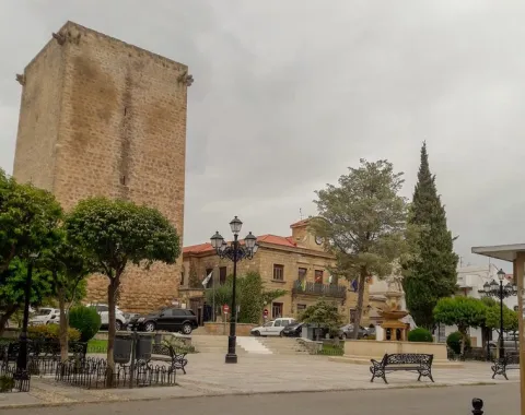
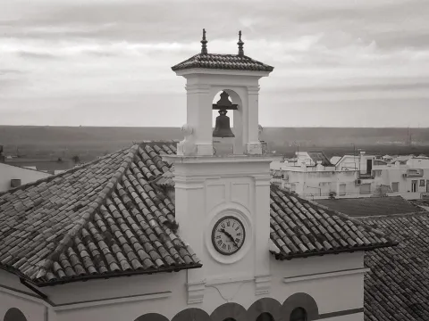
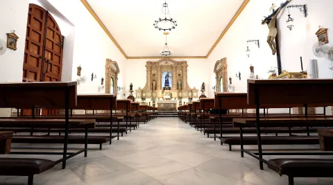
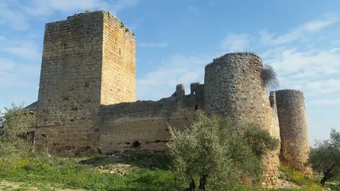
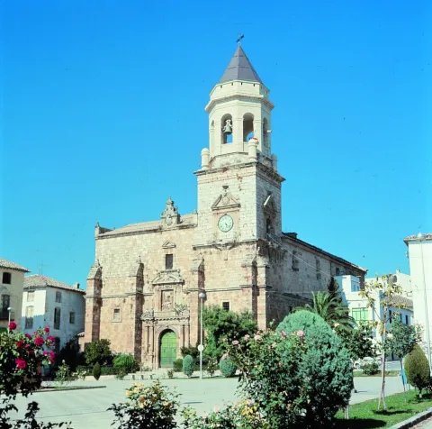
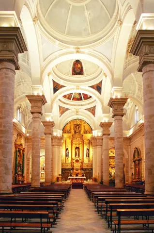
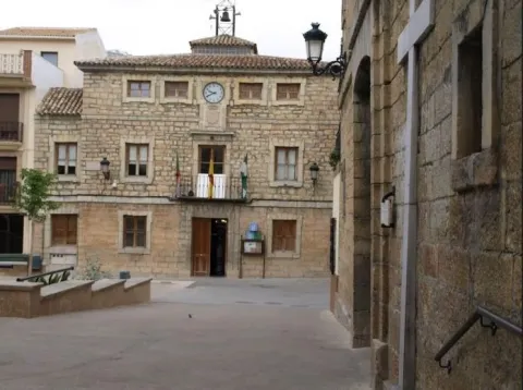
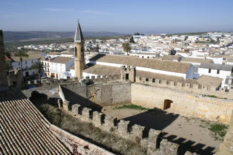
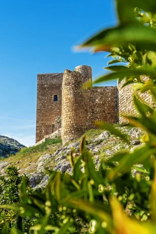
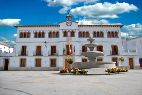
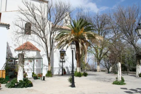
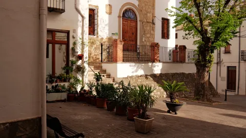
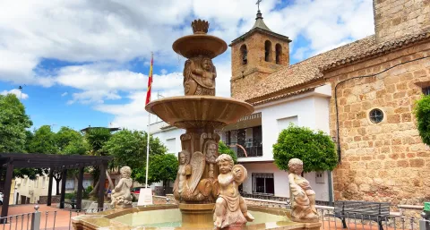
The city centre, which is located on a soft hill of fertile lands, both dry and irrigated, has in its interior buildings and monuments of interest, such as the Renaissance Church dedicated to Saint Peter the Apostle, a beautiful and slender Christian Tower, the Conistory House and the House of the Palace.

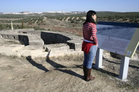
The Iberian oppidum of Iliturgi, located in Cerro La Muela, and the famous Roman city of Iliturgi, in Cerro Machiz, have been discovered nearby.

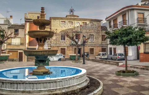
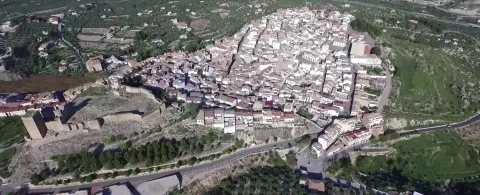
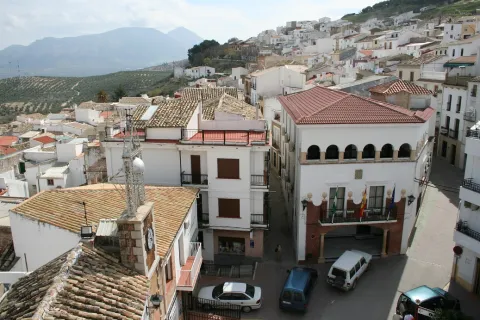
The centre of Mengibar, of irregular layout and Arab influences, has expanded in the east, west and north direction, crystallizing in a wide and rectilinean road, with apples of considerable size in the ensanches closest to the old town and with smaller apples on the periphery of the core.
Telecomunicaciones
Teléfono
953 370 025
Sitio web
www.aytomengibar.com
Fax
953 372 535
Correo electrónico
info@aytomengibar.es
Ubicación
Nombre
Mengíbar
Latitud
37.968410
Longitud
-3.809080
Distrito
Municipio
Ubicación en el mapa
POINT (-3.80908 37.96841)
Imágenes
imagen
Image
bd9dd7c4-7f1e-0dba-0fd2-8ac8158bc6af?t=1676572188698
Imagen principal
Desactivado
imagen
Image
edb57e81-d17d-24a3-406b-ca287562ea61?t=1676572793978
Imagen principal
Desactivado
imagen
Image
8040c949-bac6-38f8-6440-6aa202fca8a5?t=1676572794051
Imagen principal
Desactivado
imagen
Image
e78df582-3ef0-8b51-20e5-ca72c6a31f77?t=1585758946143
Imagen principal
Desactivado
imagen
Image
36f6f987-4a88-2b73-e598-6e017b5c9459?t=1676572794144
Imagen principal
Desactivado
imagen
Image
c584628f-6dbd-68b3-3ad6-64da50dbc967?t=1676572863592
Imagen principal
Desactivado
imagen
Image
3d0828e3-c321-a256-617e-56fbfc9c1992?t=1676899290872
Imagen principal
Desactivado
Información adicional
Curiosidades

Por teléfono: 677 222 285

Por correo electrónico:
turismo@aytomengibar.com

https://mengibarturismo.com/

Imágenes cabecera
imagen
Image
men
Imagen principal
Desactivado
Datos de interés

Tourist area: Campiña and Jaén
Distance to the capital (km): 25
Altitude over sea level (m): 315
Extension (km ²): 62,3
Number of inhabitants: 10,068
Gentillo: Mengibarians or Mengibarians
Postal code: 23620

Videos
Video file
Cultura
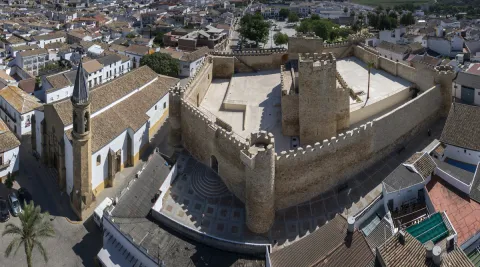
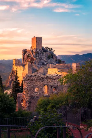
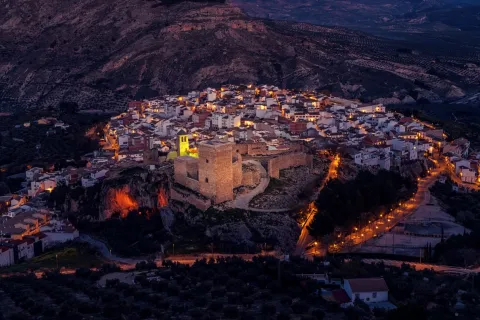
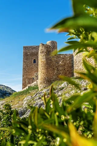
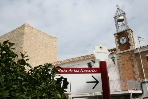
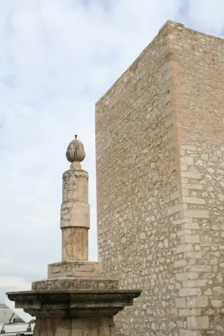
  • Mengibar Tower, is the tower of homage of the old castle of Mengibar raised in the 13th century, being the only thing that has been preserved from it. It was restored in 1982. Its height is higher than 25 meters and has vaulted rooms inside. In 1985 she was registered as BIC.
  • Arc de Jano Augusto (Ianus Augustus), a milestone in the landscape, which marked the border between the Roman provinces Betica and Tarraconense. Declared Good of Cultural Interest, the Arc de Jano Augusto (1st century BC and 1st century AD) had dimensions of 14.80 meters in length, almost 5 meters in width and a single central vain of 5.15 meters. The arc was the starting point of the Augusta Way in the Betica. It has been BIC since 2019.
  • House of Inquisition, property that is included in the General Catalogue of the Andalusian Historical Heritage. Located on Jaén Street, there is a very late classic cover dating back to the second half of the 17th century. The most important thing about the building is the main two-storey facade. It's interesting your forging grate.
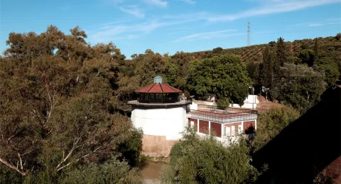
  • Hydroelectric Central and dam on the Guadalquivir River, the work of the architect Antonio Palacios, represents a remarkable exhibition of industrial architecture. The plant and dam are part of the ambitious project for the development of the Guadalquivir River of the MENGEMOR company.
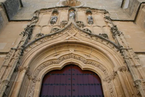
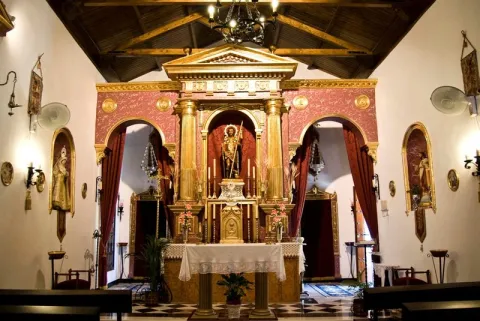
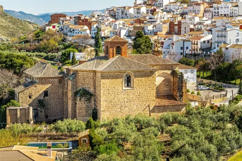
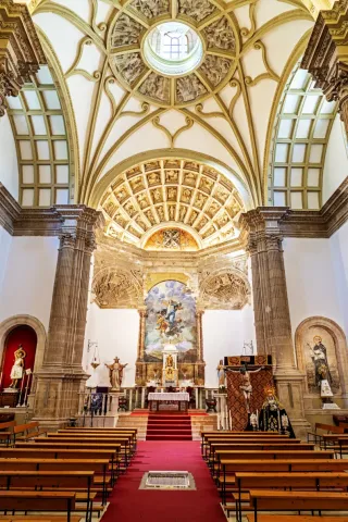
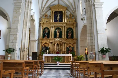
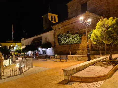
  • Parish Church of Saint Peter the Apostlenear the Tower, an architectural jewel of the Renaissance, despite the reform of 1970. Its main façade is south-facing and built in the first half of the 16th century. The other facade, facing the north, has different dependencies such as the sacristy, chapels and salons throughout the different reforms. It obeys the Vandelvirian model of three-ship temple separated by pillars and vaults. In front of its construction, Francisco del Castillo, the old man, and Alonso Barba, intervened.
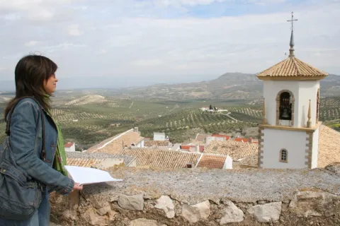
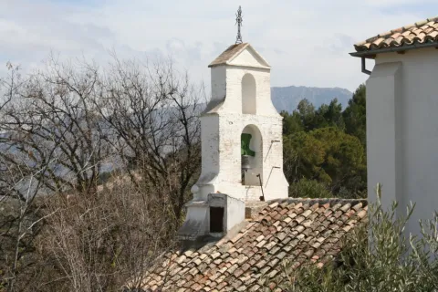
  • The Hermitage of the Lord of the Rainof small dimensions, it is made up of three narrow ships. The centre is of canyon vault, while the sides are intellized. The ships are separated thanks to two large arches of half-point brick seen. The exterior, with a stone view, has a simple front front cover, as a templet, on which a circular window is located and overlooks a revered bell swordsman. It is the only one in the municipality that is preserved from the 18th century. It is now called "Lord of the Rain," for it is venerated by a crucified Christ whom the Mengibarians have traditionally entrusted in the years and periods of drought.
  • The Hermitage of Santa María Magdalena was opened and blessed on 14 July 1990 outside the municipality of Mengibar, very close to the Roman city of Iliturgi. It is located in the Cerro de Machiz, where the ancient 16th century hermitage was erected. It has a simple half-point arch cover with two small side voids, as saetas. At the top we find a hornadine with the image of Mary Magdalena and, on a side, a small body of swordsman. Since its opening, the Romeria de Santa María Magdalena is held annually.
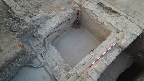
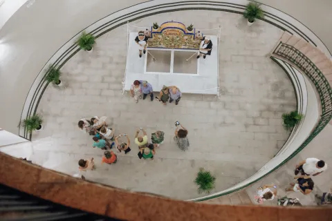
  • Oppidum ibero de Iliturgi and archaeological site of the Roman Iliturgi. Since 2016, the University of Jaén and the City of Mengibar have been working together to rescue the past of the municipality. In Cerro de la Muela, the ibero oppidum of Iliturgi (6th and 3rd centuries BC) was located, with an area of more than 14 hectares. Here, many archaeological remains have been found, which have made it possible to document the siege and destruction of the oppidum in 206 BC by the Roman army. After this event Tiberio Sememonio Graco would founded the Roman city of Iliturgi in the area of Maquiz, about 700 metres from the city destroyed. Since the mid-19th century, a large number of remains of the Roman city have been removed, most of which now form the Iliturgi Collection, which is preserved in Casa Palacio.
  • Mengibar rolls, picotas and bakers. They are part of the history of their formation as a people with their own jurisdiction. The origin of the rolls was found in 1574, when the villa managed to emancipate itself from the city of Jaén. The title, granted by Philip II, allows him to have full jurisdiction, made symbolized by the presence of rolls and picotas. While the former reflect the new administrative and legal status, picotta is the place where the prisoners were punished. The hornaces, on the other hand, are similar to holes made in walls and crowned by a reduced arc. A votive image was placed in them, thus being a sample of the popular fervor of the municipality.
  • The House Palace is a building dating from the 15th century, located in the central area of the historical artistic complex, next to the Torre del Tribute. The property has not always been a single house. From the 13th century, houses are being built very close to the castle wall. It would be a small fortification around the large tower located inside. With the coming of the centuries Casa Palacio has had distinguished owners. It has also been the scene of important historical events. It has also had functions beyond domestic. The building has now become a hotel. One of the first to build their houses on the house occupied by the palace was Mr Pedro Méndez de Sotomayor, Lord of Mengibar and Rider of Jaén, in order to keep the cattle and the cereals of their crops. This has now become the Hotel Palacio de Mengibar, which has a unique spa built in an Arab aljibe and decorated in the style of the Roman era.
  • Interactive Museum of Olive Oil and Sustainability Terra Oleum. It offers a modern exhibition space made up of unique architectural spaces, including its Caja Aurea and a natural environment presided over by the olive forest. For the dissemination of knowledge related to olive cultivation, oil production technology and Mediterranean diet. It has been selected as a reference centre by the European Union for the dissemination of the olive oil culture. The Terra Oleum Museum extends over a total area of more than 11,000 square metres. It is the largest area of knowledge planned in the Mediterranean basin for a food product.
Naturaleza


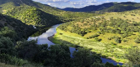
The municipal term of Mengibar is also spread between the herbaceous crops and the olive tree, with virtually all its irrigated surface, highlighting the vegas of the Guadalquivir and those of the Guadalbullion.

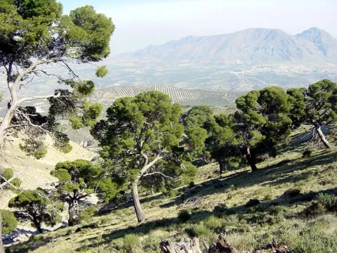
The dominant crops are: the olive tree, sunflower, cotton and cereals (wheat, barley and maize). The beautiful landscape of the Mengibareña countryside is interrupted to the north with Sierra Morena, and to the south with Sierra Mágina and Jaén, passing the rest between soft and undulations without great heights. This beautiful landscape is complete by the gallery forests on the banks of the three rivers that cross its term: the Guadalquivir and two of its tributaries, the Guadalbullón and the Guadalimar. In the autumn the trees of a caduca leaf paint a color brush in the landscape.

The lands of Mengibar offer the traveller various enclaves of natural interest. Among them is the Cerro Albariza, natural lookout from which magnificent views are obtained from the Guadalquivir valley or the Guadalbullón delta located next to the Cañada Real de Torreblasphcopedro, about three kilometres from the urban centre. Its abundant coastal vegetation gives it botanical interest.

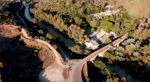
The Mengibar dam on the Guadalquivir River, opened in 1916 by King Alfonso XIII, puts a color note to the landscape. The olive tree predominates, but next to the river line we find white alms, mumberas, tarais, black alms, as well as other species of bushes. The fauna is the same as the Jienese countryside: hares, rabbits, perdices, deer, linches, boars, foxes, quails... Also, they are easy to see the storks and a wide variety of prey birds. Without forgetting the fauna that dwells next to the rivers and in the vicinity of the reservoir.

Fiestas y Eventos


In Mengibar, as in the villages of Andalusia, people look forward to popular parties because they know that they will become days of joy and fun, for both the neighbors and visitors. In addition to the Christmas, Carnival and Easter celebration, the following parties are held in Mengibar:

  • San Antónwhich is held on 17 January. The night before the streets are filled with "luminaires," where people around them sing, chorizos, chops and sardines.
  • Holy Week of Mengibarthe Holy Thursday, its preaches and the Sunday of Resurrection, stands out.
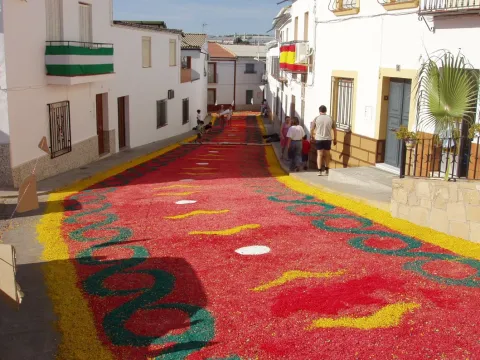
  • May Crossthe Holy Cross is celebrated on May 3. On this day Mengibar is dressed as a party, its streets and neighborhoods are covered with crosses, flowers, light and colorful. Every year more visitors come to witness them.
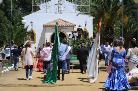
  • Romeria de "La Malena". In honor of Santa María Magdalena, patron of Mengibar, is celebrated on the second Sunday of May. The image is taken that day to his hermitage, accompanied by rosemary on foot, in carrots or on horseback.
  • Fair and Festival of the "Malena"from July 22 to 25, the heat of these days is faced with the joy of the parties in honor of the patron. There is no lack of religious acts but a comprehensive programming of activities for all the public.
  • The Rosaries of the aurora. Mengibar prays singing in the auroras on Sundays, from the last of August to the first of October. It's a custom dating back to the 17th century. The Brothers of each involved fellowship summon their people to rise up and go to the Rosary on their own Sunday. On the afternoon of that day the procession of the title image of the brotherhood takes place. On the first Sunday the Virgin of Fatima is processed, on the successive Sundays of September the Virgin of the Head, Jesus Nazarene, the Virgin of the Dolores and the Virgin of Carmen. It ends the feast, with the procession of the Virgin of the Rosary.
  • Historical recreation of the funeral court of Isabel I de Castilla, La Católica. On November 26, 1504, the queen died in Medina del Campo (Valladolid) and, following her wishes, took a way to the city of the Alhambra where she asked to be buried. On the banks of the Guadalquivir, on its way through Mengibar, a storm forced the funeral court to turn from its route to Granada to take refuge in the Church of St. Peter the Apostle. Since 2015, the third Saturday of November is commemorated with a theatrical historical recreation. More than 220 people participate in it (horse guards, royal guards, drummers, Franciscan monks, nobles, cars of beings and plain people, among others).
Gastronomía


In the culinary culture of Mengibar are present two aspects, one is olive oil, and the other is the use of the products of its gardens that become part of the ingredients of these dishes. From its varied gastronomy, we will highlight the following:

  • Pipirrana, which uses peppers, tomatoes, garlic, onions and olive oil. A refreshing dish that can't be missed in summer.
  • Migas of bread with chorizo, radishes, herring and cod.
  • Tomato fish and pepper (typical of fair days).
  • Cod meatballs, a typical Lent meal.
  • Panoil, on a slice of bread the oil that can be accompanied with tomato and cod is spread.
  • From their pastries are delights such as wine roses, honey flakes, pestins and bienmesabe.
Historia

The history of Mengibar begins to be written on the banks of the Guadalquivir River, approximately 6,000 years ago, in the Neolithic. The traces of this period correspond to the denominated settlement of the Vega Baja. The largest milestone of Iberian occupation of the municipal term of Mengibar corresponds to the oppidium of Iliturgi and the different necropolis associated with this important population core.

Until very recently it was considered that this town would have risen in the area known as Cerro Machiz or Las Torres, a place very close to the confluence of the Guadalbullion River with the Guadalquivir. Recent archaeological excavations demonstrate the exact location of the Iberian city in the site known as "Plaza de Armas del Cerro de la Muela."

This site would be besieged by Roman General Publio Cornelio Scipion, the African. Tito Livio narrated how the city was attacked, burned and massacred. In the 2nd century BC, Rome would founded a new Iliturgi in Cerró Maquiz, an enclave located on the opposite bank of the Guadalbullion River, 700 metres from the old ibero oppidum.

These remains are preserved in Mengibar from the Almohad period. In 1225, Fernando III, the Holy Conquest Mengibar, granted the land of Machiz to the Order of Santiago, leaving the Place under the jurisdiction of Jaén.

The word "MENXIBAR" first appears in the conquest of Jaén, which shows that there must have been a fortress that was occupied by Christian troops. Conquistada Jaén, the king anexiona to this city, on which it will depend until 1574, year in which Philip II, by paying 22,500 ducats, makes it Villa.

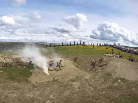
On July 16, 1808, a glorious event took place in Mengibar: the defeat of French troops, who fled to Bailén, where days later they would be defeated by General Castaños.
Loading map
Preparing points of interest and routes...
Imagen principal
imagen
Image
Mengibar
Imagen principal
Activado

Martos

Submitted by brandcode_deweloper on
Id
747103
Perfil de redes sociales
Facebook
https://es-es.facebook.com/AytoMartos/
Twitter
https://twitter.com/aytomartos?lang=es
Descripción
Breve descripción

Martos is located to the north of the Sierra Sur region, being the largest municipality and population of this region. There are other populations that are part of the municipality, such as Monte Lope Álvarez, Las Casillas, La Carrasca and Villarbajo.

Its municipal term is essentially olive tree, in its landscape of countryside the olive tree is the protagonist, extending to the horizon. Because of the great quantity and quality of olive oil produced in the city, it is called the "Olivar Cot." Around it has developed an important olive industry that together with the automotive-related factories and their auxiliary industries are the engine of employment and wealth for the municipality and its region.

It has an important historical heritage, among other monuments we quote: the Old Cárcel and Cabildo, Castles of the Peña and the Villa, Puente Romano, Urban Wall, Castle of the Endowment, Pilar of the New Source; with respect to the religious architecture: Royal Parish Church of Santa Marta, Sanctuary of Mary Most Holy of the Villa, Monastery of the Most Holy Trinity, Ermita of San Bartolomé, parish of San Amador and Santa Ana, etc.

This is the cultural wealth and beauty of its historical ensemble, which since 2003 has had the status of Good Cultural Interest.

Telecomunicaciones
Teléfono
953 210 000
Sitio web
https://turismo.martos.es/
Fax
953 553 309
Correo electrónico
turismoycomercio@martos.es
Ubicación
Nombre
Martos
Latitud
37.722260
Longitud
-3.970320
Distrito
Municipio
Ubicación en el mapa
POINT (-3.97032 37.72226)
Imágenes
imagen
Image
7470103a-fede-6cf5-54b2-edb356074e03?t=1603121821734
Imagen principal
Desactivado
Información adicional
Imágenes cabecera
imagen
Image
Martos
Imagen principal
Desactivado
Datos de interés

Tourist area: Sierra Sur and Jaén
Distance to the capital (km): 24
Altitude over sea level (m): 753
Extension (Km2): 259
Number of inhabitants: 24520
Gentillo: Marteños
Postal code: 23600

Videos
Video file
Cultura

Old Jail and Cabildo. Building built in the 16th century, considered a masterpiece of Spanish mannerism. It is currently the City Hall of the city.

In his spectacular main façade We can highlight the huge, dogrous columns with piled armchairs, the sculptures of Justice and Prudence, (both were beheaded), the great doors and their bronze aldabones and a great shield of the Austrians crowning the whole. It was declared a National Historical Monument in 1931. Below the City Hall, the Convent of the Trinitarian, work of the late 16th century, and on the same street, but in the opposite sense the Hospital of San Juan de Dios, of baroque bill of the 18th century. All this high part of the intramurous historical centre is of great quaint and from it you can enjoy beautiful panoramic.

  • Santa Marta Parish Church. It rose in the 13th century, in the years following the taking of the city by Fernando III the Holy, on an Arab mosque. It is consecrated to the patron of the city and has the title of Real since 1617. Gothic Mudejar style. The Baptisterium, the Major Chapel, was later built and embellished with the slate-cross vaults and a large cover of the isabelin Gothic. In the 16th century the interior is expanded and remodeled, raising large columns of Tuscan order and building the original Bell Tower with three bodies.
  • Pilar of the New Source. Ornamental source located in the Manuel Carrasco Municipal Park. It was built in the 16th century, reflecting the most new and outstanding aspects of the Manier architecture. The set stands out for its monumental beauty and austerity. It consists of an abrevadero pillar and a smaller one in which two lions make water pipes. In the center is the Austrian shield, and on the sides is the shield of Martos and that of Governor Aboz Enríquez.
  • The hermitage of San Bartolomé. Located in the skirts of the Peña de Martos, dates from the 14th century and houses the venerated image of Mary Most Holy of the Victory, Queen and Lady of the Peña.
  • Roman Bridge of Martos. Important engineering work, built in the Roman era on the Salado stream in the vicinity of Martos to facilitate the passage between the two shores.
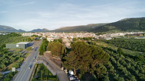
  • Sanctuary of Mary Most Holy of the Villa. Temple in which Mary Most Holy of the Villa, known as "La Labradora," is sold. It was built on dates near the delivery of Martos to the Kingdom of Castilla. In the 16th century the temple was remodeled and a bell tower was built. This sanctuary was burned and destroyed during the Spanish Civil War. The current was rebuilt in the 1940s of the last century, in a Neobaroque style. The Torre-Campanario dates from the 16th century, is separated from the main building and is the only original element of the ancient Sanctuary. It has a square floor with half-point arches.
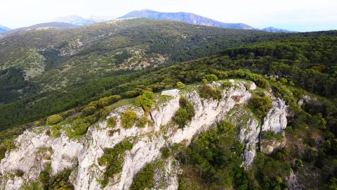
  • The ruins of Castillo de la Peña which we know today are not those built by Muslims but correspond to the strength that the Calatravos built from 1340. The floor of the castle is trapezoidal adapted to the surface of the plateau on which it sits and its entrance, for security reasons, marked a zigzag drawing. The compound was divided into alcázar and a courtyard of weapons protected by a walled enclosure. The alcázar, where the tower of tribute is raised, takes advantage of a natural podium that lifts it about three meters above the courtyard of weapons, separated by a wide, also natural.

  • Castle of the Villa. It was an alcazaba or citadel surrounded by canvases of almenada wall, as well as passageways and towers, leaving the central space for the construction of administrative and religious buildings: church of Santa Catalina, headquarters of the governorate, cavalries, tahonas, lagores, aljibes, etc. According to evidence from an inspection carried out by the Visitors of the Order of Calatrava in the 16th century in order to repair the deficiencies of the Lower Fortress.

Naturaleza

The orography of the municipal term of Martos is characterized by being quite accidental, with plenty of mountain grounds above all the southern part, instead the north-western part corresponds to soft reliefs and plain characteristic of the Guadalquivir depression, which extends in the west and north of Martos.

Among the greatest levels are the Sierra de la Caracola, with 1340 m., located in the south and to the north is located the Sierra de La Grana with 1254 m. and this is the extension of the Sierra de Jabalcuz, and we would like to mention the well-known Peña de Martos with its 1003 m. on whose slopes the city of Martos is located.

The hydrographic network is composed of a set of rivers and streams which are used for both human consumption and irrigation.

They are two rivers the main ones that pass through the municipality: Eliche Riverwhich is born by the saw of the Grana, and the river Víboras which is born in the term of Valdepeñas de Jaén. The channel of this river is used in the a reservoir of the same name, next to the pastry of Las Casillas.

The flora of the term is dominated by the olive, located in a large percentage of the land of the municipality. It also exists indigenous vegetation of the Mediterranean forest in the mountain areas, where we see species such as: the oak, coscoja, white jara, complaining and abundant number of aromatic plants such as lavender, rosemary or thyme.

In the banks of the river Víboras coexist riverside species as they can be: white, strawberry, elves, olms, zarzamoras and carrizos.

In the fauna exists a great diversity of species, from rapacious birds, both diurnal and nocturnal; aquatic birds, paseriforms, reptiles, amphibians and minor-game mammals.

For nature lovers, Martos offers an interesting natural offer to make different routes, climb to the top of the Peña, offers unparalleled views of the countryside landscape and the surrounding mountains.

Other very interesting routes are also the rise to the Sierra de la Grana, the Sierra de la Caracolera and the setting that forms the reservoir of the Víboras River and the Víboras Castle.

Fiestas y Eventos

Among the main festive celebrations of Martos are:

  • Romeria in honor of the Virgin of Victory. The last weekend of May is held. The festivities begin on Friday with the departure of the procession of the image from the hermitage of San Bartolomé to the Church of Santa Marta with the streets where it passes adorned with flags, reunions, retamas, altars and rosemary in typical suits. The next day the Virgin leaves the parish to go to the hermitage of the Virgin of Peña followed by carts, chariots and horsemen. On Sunday, the day of the rosemary, the virgin returns to her hermitage carried on a cart thrown by oxen and accompanied by gilded carrots with floral ornaments and various decorations. During the tour the atmosphere is fun and cheerful. They sing songs, they eat cheese, ham and rebujito. Once in the Peña, the solemn mass is celebrated and at the end of the rosemary they prepare to eat in the surroundings of the hermitage. This party is declared the Festival of Tourist Interest of Andalusia.
  • Fair and parties in honor of San Bartolomé. At the end of August, Martos is preparing for the largest celebration. Many and many different activities are organized during the days of pre-fair and fair, such as concerts, theatre, cultural and sports activities, horseback riding, pasacalles and taurinos (traditional the brandy torillo). The festivities begin with the official turn on of the cover and the fun is centralized in the fairgrounds, where various musical performances are offered.
  • Olive party. Typical celebration of Martos that symbolizes the official start of the olive collection campaign and pays tribute to the olives that work in the campaign. It takes place during several days of December with the celebration of many cultural activities related to the olive grove. The brooch of party end takes place on December 8, with the most outstanding events: reception of authorities at the City Hall, followed by a floral offering at the Monument to the Olives and the invitation to the attendees of a olive hole (bread, oil, cod and olives). And to put the final point to the party, the Martos' almazara teachers extract the first olive oil of the year.Declared holiday of Tourist Interest of Andalusia.
  • Holy Week. It is one of the most important popular and religious manifestations of Martos. The existence of co-fradies in the 16th century is recorded. Part of its Reciprocity in the narrow, tortuous and very considerate streets for which the hermandades run. All this linked to the incomparable frame offered by the millennial city of La Peña and the beauty of the images and thrones. It has been declared Tourist Interest Festival of Andalusia in 2002.
Gastronomía

In the gastronomy of Martos, extra virgin olive oil is a fundamental ingredient.

  • HoyoIt's bread and oil.

It retains two salads with origins of the Arabian-Andalusian cuisine: The orange chopper and the granate salad, where other vegetables are accompanied by orange or seasoned grenade grains.

  • Potage of beans and eggplants.

Meat dishes:

  • The rabbit with olives, which is prepared in the pastry of Las Casillas from which is found its replica in North Africa.

Dishes attached to the festive cycle:

  • Carnival filling, onions of Easter, the Sweet peas typical of the holiday of All Saints.

The of the Trinity mothers like the crotch or the buds, among many others.

Many traditional Martos dishes are shared with the rest of the Mexican cuisine Like, crumbs, gazpacho, pipirrana, white...

Historia

The origins of Martos they go back to Prehistory. Its strategic location, the existence of springs and the natural defense it offered were factors that caused the human settlement in the area.

There is evidence of different lytic materials belonging to the Paleolithic, however, the oldest documented statements are from the Neolithic. Remains of this period have been found in "El Molinillo," "Huertas Viejas" and "La Alberquilla." They are underground housing, funeral and defensive structures.

The city is known from very old, the Iberians named it Tucci and an important Iberian oppidum located in the upper part of the Peña is cited in the works of Ptolemy. There will be many settlements around Martos, such as Castlejo de Belda, La Atalaya, El Alamillo...

The Iberian city of Tucci, being occupied by the Romans, it became a colony that was named after Augusta Gemella Tuccitana. Many remains of this time are preserved such as mosaics, coins, ceramics, weapons, marble portraits..., the most important being the collection of Roman tombstones exposed on the façade of the Casa Consistorial de Martos.

From the visigode period, the paleocristian sarcophagus which is preserved in the Provincial Museum is the most important archaeological piece appeared in the town.

In the year 711 The Visigodic monarchy on the Iberian peninsula ends with the arrival of Muslims. Since the 9th century it was a very disputed border city. From this time are the castle of the Peña, the walls and torreons of the castle of the Villa. In 1225, Martos became part of the kingdom of Castilla, which King Fernando III will donate to the Order of Calatrava.

From the 13th century it acquired great splendor that will be increased with King Fernando the Catholic and the arrival of settlers from Castile and the Moorish of the Alpujarras.

The 16th century was a stage of economic, social expansion and of great transformation of the villa with the construction of new buildings, the remodeling of others and the expansion of the urban town.

During the 20th century, With the development of the olive grove, the arrival of the railway and the road there was a great population growth that decreased in the decades of the 50 and 60 of the last century caused by emigration.

The urban, social and demographic development of the city has now been increased by industrialization, being considered as one of the main industrial centres of Andalusia.

Loading map
Preparing points of interest and routes...
Imagen principal
imagen
Image
Martos
Imagen principal
Activado

Marmolejo

Submitted by brandcode_deweloper on
Id
745355
Perfil de redes sociales
Facebook
https://www.facebook.com/aytomarmolejo/
Twitter
https://twitter.com/aytodemarmolejo
Youtube
https://www.youtube.com/@AyuntamientodeMarmolejo
Instagram
https://www.instagram.com/aytodemarmolejo/
Descripción
Breve descripción

Marmolejo is a town in the region of the Jienese countryside that is located to the west of it, limiting to the province of Córdoba, on the banks of the Guadalquivir.

The northern half of its municipal term is mountain (Sierra Morena) and a sector of this area is integrated into the Natural Park of the Sierra de Andújar.

In the southern half the cultivated areas are concentrated, in which the olive tree is the majority, although the Vega del Guadalquivir is important irrigated crops such as corn, cotton, alfalfa and a wide variety of horticultural products.

The economy of the town is based on agriculture, livestock, forest and cicnetics and the hotel, motivated by the traffic of passengers from the nearby motorway of Andalusia (A-4).

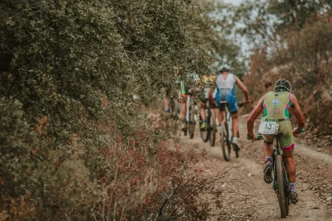
Among its parties are the celebration of Corpus Christi, the Marmoleño carnival, the Holy Week, the Romeria de la Virgen de la Cabeza and the celebration of its patrons, Our Lady of Peace and San Julián. In addition to its festivities, it is important to highlight sporting events such as the Duathlon Cross Villa de Marmolejo or other events such as the Student's Hall and Christmas lighting.

The Marmolejo Spa and the Museum of Contemporary Art Mayte Spínola are the most important.

Marmolejo is famous for its medicinal waters, which have given rise to a famous spa, immortalized, among others, by Palacio Valdés in his novel "La Sis San Sulpicio."

Telecomunicaciones
Teléfono
618 552 056
Sitio web
www.marmolejo.es/home
Fax
953 540 151
Correo electrónico
info@ayuntamientodemarmolejo.es
Ubicación
Nombre
Marmolejo
Latitud
38.045600
Longitud
-4.171100
Distrito
Municipio
Ubicación en el mapa
POINT (-4.1711 38.0456)
Imágenes
imagen
Image
12-4-jpg
Imagen principal
Desactivado
imagen
Image
ayto-2-1-jpg
Imagen principal
Desactivado
imagen
Image
la-pepa-2-1-jpg
Imagen principal
Desactivado
imagen
Image
paseo-1-1-jpg
Imagen principal
Desactivado
imagen
Image
museo-1-4-jpg
Imagen principal
Desactivado
imagen
Image
ermita-de-jesus-1-1-jpg
Imagen principal
Desactivado
imagen
Image
castillo-de-la-aragonesa-1-jpg
Imagen principal
Desactivado
imagen
Image
10-7-jpg
Imagen principal
Desactivado
imagen
Image
balenario-de-marmolejo-2-jpg
Imagen principal
Desactivado
imagen
Image
balenario-de-marmolejo-4-jpg
Imagen principal
Desactivado
imagen
Image
balenario-de-marmolejo-12-jpg
Imagen principal
Desactivado
imagen
Image
balneario-1-1-jpg
Imagen principal
Desactivado
imagen
Image
puente-san-bartolome-0-jpg
Imagen principal
Desactivado
imagen
Image
centro-de-interpretacion-balneario-1-jpeg
Imagen principal
Desactivado
imagen
Image
consulta-del-medico-2-jpg
Imagen principal
Desactivado
imagen
Image
diosa-higea-1-jpeg
Imagen principal
Desactivado
imagen
Image
diosa-higea-2-jpg
Imagen principal
Desactivado
imagen
Image
solises-1-1-jpg
Imagen principal
Desactivado
imagen
Image
jardines-balneario-2-jpg
Imagen principal
Desactivado
imagen
Image
jardines-balneario-8-jpeg
Imagen principal
Desactivado
imagen
Image
sierra-marmolejo-10-jpg
Imagen principal
Desactivado
imagen
Image
sierra-marmolejo-18-jpg
Imagen principal
Desactivado
imagen
Image
tranvia-1-jpg
Imagen principal
Desactivado
imagen
Image
sierra-marmolejo-15-jpg
Imagen principal
Desactivado
imagen
Image
sierra-marmolejo-14-jpg
Imagen principal
Desactivado
imagen
Image
sierra-marmolejo-16-jpg
Imagen principal
Desactivado
Imágenes cabecera
imagen
Image
Marmolejo
Imagen principal
Desactivado
Datos de interés

Tourist area: Sierra Morena / Parque Natural de la Sierra de Andújar
Distance to the capital (km): 63
Altitude over sea level (m): 248
Extension (km ²): 178
Number of inhabitants: 7,099
Gentillo: Marmoleños
Postal code: 23770

Videos
Video file
Cultura

Among its artistic heritage, we highlight:

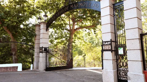
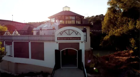
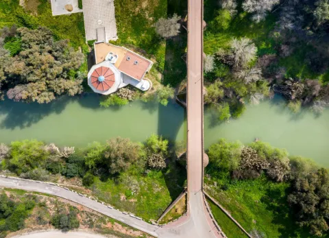
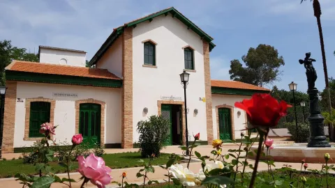
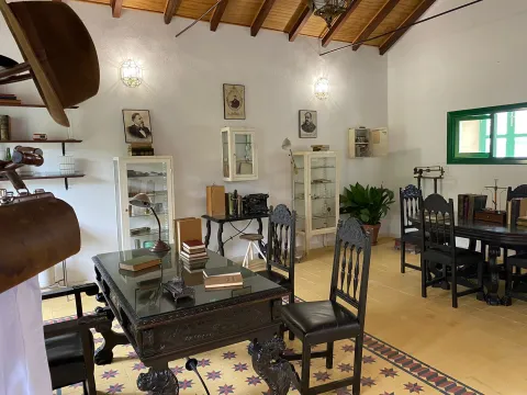
  • Marmolejo Spa. The waters of the Marmolejo Spa have been used since the Roman period in Hispania. At the end of the 19th century, the current spa was built alongside its three springs: San Luis, Buena Esperanza and Fuente Agria, declared of public utility in 1816 and recognised as medicinal mineral waters in 1869. It is the most renowned spa in the province, having received awards at the Universal Expositions in Paris, London and Chicago. Distinguished figures such as Armando Palacio Valdés, Santiago Ramón y Cajal and Charles Chaplin visited the spa. These bicarbonate-rich ferruginous waters are recommended for liver, digestive and kidney ailments. The golden age of this jewel of Marmolejo can be discovered at the famous "Doctor's House", now converted into an interpretation centre. The monument and its gardens have been declared a Historic Site and a Site of Cultural Interest.
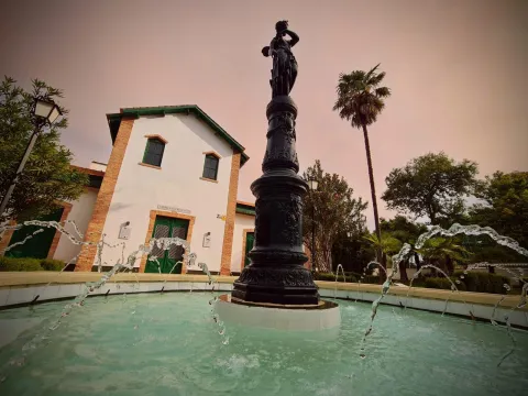
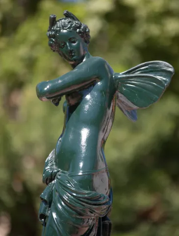
  • Hygieia Goddess – Nereid by Mathurin Moreau. This is undoubtedly the most important sculpture and the one with the greatest sentimental value in Marmolejo's artistic heritage. Cast at the French Val d'Osne foundry and sculpted by Mathurin Moreau at the end of the 19th century, this bronze sculpture is popularly known as the Goddess Hygieia. It is located in the gardens of the Marmolejo Spa.
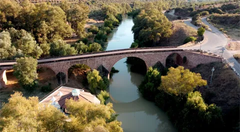
  • San Bartolomé Bridge. A magnificent Renaissance bridge spanning the Guadalquivir River. Designed by Benito del Castillo, it is one of the most spectacular bridges across the river. It was built between 1550 and 1587 and consists of seven semicircular arches supporting barrel vaults, resting on piers reinforced by semicircular cutwaters with conical tops on one side and triangular ones on the other. The bridge was remodelled in the 19th century, preserving the three largest arches from the original 16th-century structure. It has been declared a Site of Cultural Interest (BIC).
  • Parish Church of Our Lady of Peace. This is the most outstanding monument in the historic centre. The building housing the parish church was constructed in the 14th century. The transept was added during the 15th and 16th centuries, and the two entrance façades were built in the 18th century. However, the church's current appearance is the result of a renovation carried out at the end of the 19th century by the architect Justino Flores Llamas. Inside, the most remarkable feature is the central 18th-century Baroque altarpiece, brought from a Dominican convent in the town of Benavente (Zamora).
  • Church of Jesús. The Hermitage of Jesús is of Baroque origin and was one of the many hermitages that once existed in the town. It is the only one that has survived thanks to its reconstruction in 1887. It takes its name from the statue of Nuestro Padre Jesús Nazareno, which can be seen inside together with the largest collection of images carried in Marmolejo's Holy Week processions, as well as the Virgin of La Cabeza.
  • Aragonesa Castle. Located on the border between Jaén and Córdoba, in the Guadalquivir Valley, it stands near one of the branches of the Roman road that followed the river. Two distinct construction phases can be identified: the first, of Muslim origin, when the Berber fortress was built, and the second, during the Christian period, when the Keep of the rural castle that replaced the fortress was erected. This tower dates from the late 13th or early 14th century. In 1985 it was declared a Site of Cultural Interest (BIC) by the Regional Government of Andalusia.
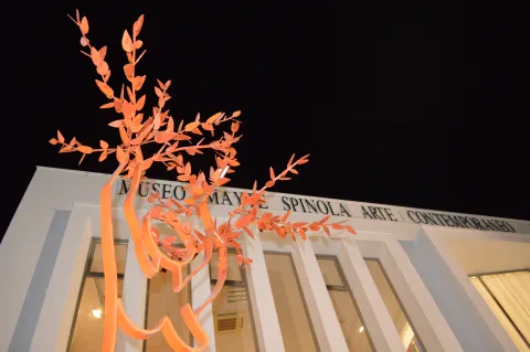
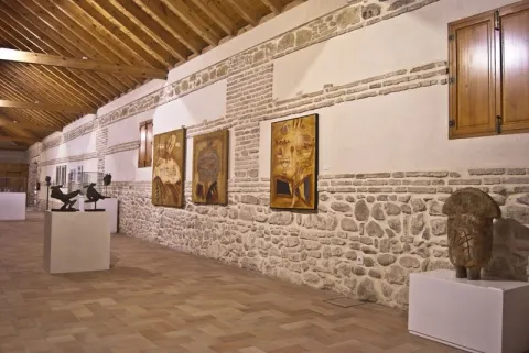
  • Mayte Spínola Museum of Contemporary Art. Founded in 2004, the museum was created from donations made by artists belonging to the "Proarte y Cultura" group, founded by artist and patron Mayte Spínola, with new works added regularly. The museum's board of trustees is chaired by the Mayor of Marmolejo, Manuel Lozano Garrido. It houses an eclectic collection reflecting the diverse trends in contemporary art from the late 20th and early 21st centuries. Today it contains more than 300 works by Spanish and international artists, making it a true oasis of art in the province of Jaén, as it is the only museum of its kind in the province.
  • Hermitage of the Holy Christ. A small single-storey building dating from 1910, located at the end of Calvario Street on the boulevard connecting the town centre of Marmolejo with its Spa.
  • San José Market Hall. Local market designed by Ramón Pajares and inaugurated in 1953 under the "Regiones Devastadas" reconstruction programme. Even today, fresh fruit and vegetables from the fertile gardens of Marmolejo remain the market's main products.
  • La Pepa. Sculpture dedicated to the 1978 Spanish Constitution, popularly known as "La Pepa", created by the artist Miguel Fuentes del Olmo. The female-shaped sculpture symbolizes the right path to follow, and the folds of her dress feature a representation of the physical map of Spain.
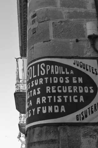
  • Esquina de los Solises. This is one of the most emblematic and oldest places in Marmolejo. The building on this corner is constructed from local azucarera stone. Its name comes from the nickname by which the owners of the shop located there, Solís Bazaar, were known, preserved just as it was during Marmolejo's golden age. There is a popular local saying referring to this place: «You're older than the Solises Corner.»
  • Paseo de la Libertad. This is the largest green and recreational area in the urban center of Marmolejo, dating from the early 20th century. It stretches from the La Pepa sculpture to the water tower, better known as La Torre. In its central area stands the most iconic ornamental fountain, featuring the word "freedom" written in more than forty languages.
  • Marmolejo Town Hall. In 1929, Luis Berges, architect of the Jaén Provincial Council, remodeled the former municipal building, which originally had only one floor, adding a second one. The building seen today preserves the 1929 structure, although it has undergone further renovations in 1989 and 2014.
  • San Lorenzo Castle Square. In order to recover the history of the former San Lorenzo Castle, part of the castle wall has been reconstructed in the former Juan XXIII Square. The castle, of Roman origin and successively adapted during the Hispano-Muslim and later Castilian periods, once stood near this location. The discovery of the old well has also enhanced the square's historical and heritage value.
  • Spa Visitors' Boulevard. Accessible promenade leading to the Spa, where visitors can read murals featuring passages from the book The Life of the Spa Visitor in the Famous Town of Marmolejo, written by Doctor Thebussem and published in 1893. This is the route followed by thousands of spa visitors over the centuries in search of relief from their ailments through Marmolejo's renowned mineral-medicinal waters.

Nature

Marmolejo is located at the foothills of the Sierra Morena mountain range, separated from it by the Guadalquivir River. It is popularly known as the "town of the three harvests", as it produces olive, fruit and vegetable, and cotton crops.

It has a large number of mineral water springs scattered throughout its lush landscape. Many of these springs are officially recognized as medicinal mineral waters with remarkable therapeutic properties.

This municipality lies between two natural parks: Sierra de Andújar Natural Park and Sierra de Cardeña y Montoro Natural Park, in the heart of the Sierra Morena mountain range.

Three major rivers flow through the municipality: the Guadalquivir, the Jándula, which forms the boundary between Marmolejo and Andújar, and the Yeguas River, which also marks the border with the province of Córdoba.

The Yeguas Reservoir, inaugurated in 1989, supplies water for local communities, irrigation, and hydroelectric power generation. Another reservoir on the Guadalquivir River is also located within the municipality of Marmolejo.

In the northern part of the municipality, in the heart of the Sierra Morena, there are natural ecosystems such as the dehesas, where scrubland has been cleared to leave isolated trees, mainly holm oaks and cork oaks, along with herbaceous species ideal for livestock grazing.

span style="font-size:11pt">Other plant formations include holm oak woodlands and cork oak forests, mixed with Portuguese oaks.

The area is also rich in aromatic plants such as Spanish lavender, rosemary, thyme, and marjoram. Along the banks of the Yeguas River, gallery forests of willows, ash trees, tamarisks, and tamujos can be found.

The wildlife is also rich and diverse. Birds of prey include the golden eagle, booted eagle, short-toed snake eagle, black kite, lesser kestrel, common kestrel, as well as numerous small bird species.

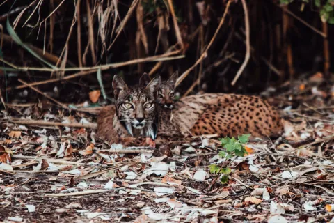
Among the mammals are the Iberian lynx, otter, and Egyptian mongoose. Other carnivores include the fox, weasel, stone marten, genet, badger, and wildcat. Reptiles include lizards and the snub-nosed viper.

The reservoirs provide habitat for water birds such as the purple heron, black-crowned night heron, and western marsh harrier.

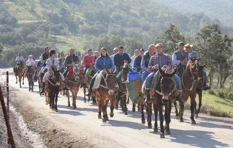
Without a doubt, this is an ideal area for hiking along the many trails that cross the region. Visitors can also take part in the traditional muladas, group excursions by mule or horseback with friends or local associations. The most popular route crosses the heart of the Sierra Morena and Sierra de Andújar Natural Park to reach the Sanctuary of the Virgin of the Head. This section forms part of the GR48 long-distance trail, which runs from Portugal to Santa Elena (Jaén), and can be explored on foot or by bicycle, passing the Cristóbal Relaño Viewpoint and the Virgin of the Head Viewpoint.

Other recommended hiking trails/routes include: The Las Flores Trails, Yeguas River Riverside Route, Guadalquivir Riverside Route, Birdwatching Route, El Pintado Route, Las Fuentes Route, and the Reservoir–El Comisario Path.

The Sierra de Marmolejo offers fantastic areas for stargazing, as it is part of the Starlight Reserve and Tourist Destination network. It has been recognized as one of the cleanest night skies in Europe for observing the stars.

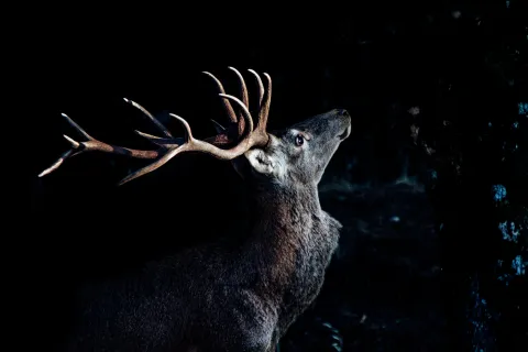
In addition to enjoying this wonderful experience, visitors can close their eyes and sharpen their hearing to witness every year one of the Sierra's most majestic natural spectacles, the Deer Rut (La Berrea), as one of Marmolejo's main sources of wealth is hunting. There is small game hunting (rabbits and partridges) in the southern part, within the northern Jaén countryside, and big game hunting (wild boar and deer) in the northern area, which lies within the Sierra de Andújar Natural Park.

Marmolejo also offers excellent opportunities for fishing, thanks to the Yeguas Reservoir, where species such as black bass, carp and Iberian nase can be found.

Festivals and Events

The local festival calendar is marked by religious celebrations. Among the most deeply rooted festivities are:

  • Three Kings Parade. It is considered one of the most creative and colorful parades in the province.
  • Feast of Our Lady of Peace. On the afternoon of January 24, the image of the Virgin is carried in procession by the town's young people.
  • Candlemas Day. Celebrated on the weekend closest to February 2, when residents of different neighborhoods light bonfires throughout Marmolejo.
  • Carnival. It is one of Marmolejo's liveliest and most popular celebrations, earning a prestigious place among the festivities held throughout the province of Jaén.
  • Holy Week. Marmolejo's Holy Week has a long-standing tradition and enjoys great popular participation. Its highlight is the early morning Maundy Thursday procession of Nuestro Padre Jesús Nazareno. It is an explosion of devotion and tradition that fills the town's streets with the scent of incense and candle wax.
  • Pilgrimage of the Virgin of the Head. It is probably the oldest pilgrimage in Spain and takes place on the last Sunday of April. On the Sunday before the main pilgrimage week, the image is transferred from the Church of Jesús to the Parish of Our Lady of Peace. On Saturday morning, the streets fill with colour, songs and joy as pilgrims, horses and decorated carts make their way to the Sanctuary of the Virgin of the Head, located in the heart of Sierra Morena.
  • San Isidro. Celebrated on the weekend closest to May 15, when the people of Marmolejo gather in the hamlet of San Julián, where Mass is celebrated and paella and cascaflote are served in the village square.
  • Corpus Christi Festival. It takes place sixty days after Easter Sunday, although in Marmolejo the celebrations are moved to the following Sunday. The streets are decorated with traditional coloured sawdust carpets, altars and balconies adorned with festive draperies to welcome the Blessed Sacrament during the procession.
  • Marmolejo Fair and Festival. Held on the third weekend of August. During these days, a wide variety of sporting, cultural, entertainment, musical and traditional activities bring the town to life.
  • Feast of Saint Julian. (San Julián is a hamlet located 7 km from Marmolejo.) It is celebrated on the weekend closest to September 5, when the image of the saint is carried in procession from the parish church to the Hermitage of San Julián on a cart pulled by a mule, accompanied by the annual chief stewards and devoted pilgrims.
  • Our Lady of the Pillar Day and All Saints' Day. On the weekends closest to October 12 and November 1, the people of Marmolejo gather in natural areas such as La Centenera, La Dehesilla, the Spa, El Baldío and the Fuente de Los Socialistas recreational area.
Naturaleza

Marmolejo is located at the foot of Sierra Morena, separating it from this the Guadalquivir River. It is popularly known as the "people of the three crops," as the olive, fruit and cotton crops are collected.

It has a large number of mineral water springs distributed along its lush landscape. Many of the springs are declared as mineromicinal and with great therapeutic properties.

This municipality is step between two natural parks: the natural park of Sierra Andújar and the natural park of Sierra de Cardis and Montoro, in the heart of Sierra Morena.

Three grand. rivers go through its municipal term: the Guadalquivir, Jandulawhich borders Marmolejo and Andújar, and the Yeguas River which also serves as a border with the province of Córdoba.

The Yeguas River reservoiropened in 1989, its water is intended for the supply of the populations, irrigation and the production of electricity. And in the term of Marmolejo is carried out another reservoir on the Guadalquivir River.

In the north of the city, located in the heart of Sierra Morena, we find natural ecosystems such as the dehesaswhere the shrubs have been removed and isolated trees are left, usually oak and / or cork and herbaceous species very suitable for livestock grass.

Other plant formations that we can observe are the Encinar and forests alcornoques, mixed with complaints.

It also highlights the presence of aromatic plants like the canopy, the rosemary, the thyme and the betteran. On the banks of the Yeguas River are the forests of galleries: saucedas, fresneas, tarais and tamujares.

The fauna It's also very diverse and abundant. The raptures are highlighted: the royal eagle, the driveway, the scum, the black millano, the primitive and the vulgar, as a large number of small birds.

Between the mammals: Iberian lince, otter, and meloncillo. Carnivores like: fox, weasel, chickpea, gineta, badger and cat montés. Reptiles like, the lizard and the snout viper.

The presence of the reservoirs allows the presence of water birds like the imperial garza, the martinete or the lizard.

Without a doubt, an ideal ground for hiking through the many trails that go through this area, where we can participate in the picturesque mules,mule or horse trips that take place in groups of friends or rock. The main route and the most demanded one is the one that passes through the heart of Sierra Morena and the Natural Park of Sierra de Andújar to reach the Sanctuary of the Virgin of the Head. This section belongs to the GR48 path from Portugal to St. Helena (Jaén). can also be done on foot or by bike and through the Mirador de las Cristóbal Relaño and the Mirador de la Virgen de la Cabeza.

Other paths / routes to be taken off are:The trails of Las Flores, Ruta Ribera del Río Yeguas, Ruta Ribera del Guadalquivir, Ruta ornithological, Ruta del Pintado, Ruta de Las Fuentes and Ruta del Pantano - Camino El Comisario.

The Sierra de Marmolejo has fantastic areas for astronomical observation as part of the reservation and tourist destinations Starlight. It has been listed as one of the cleanest night skies in Europe to observe the stars.

In addition to enjoying this wonderful experience, we can be surprised by closing our eyes and sharpening our ears to enjoy each year one of the most majestic natural courts in the Sierra, La Berrea, since one of Marmolejo's sources of wealth is the Cynegetic activity. There's minor hunting (rabbits and partridges) in the south, in the northern countryside of Jaén; and major game (boars and deer) in the northern part, which is inserted into the natural park of the Sierra de Andújar.

Marmolejo has great opportunities for the fishing, thanks to the Yeguas reservoir, and among the species we find black bass, tent or boga.

Fiestas y Eventos

The calendar of the parties is marked by religious celebrations. Among the most rooted parties in the population are:

  • Ride of the Magi kings. It is among one of the colorful creative in the province
  • Festivity of Our Lady of Peace. On January 24 in the afternoon, the image of the Virgin is processed and taken by the young people of the town.
  • Candelaria Day. It is held the weekend closest to February 2, in which the neighbors of different neighborhoods light fires throughout Marmolejo.
  • Carnival. It is one of Marmolejo's most joyful and busy parties, making itself a prestigious space with its programming in the province of Jaén.
  • Holy Week Marmoleña has a great tradition and great popular participation. It is the ultimate success of the procession of the morning on holy Thursday, of Our Father Jesus Nazarene. It is an explosion of fervor and tradition that floods the streets of the locality dl smell of incense and wax from the candles.
  • Romeria de la Virgen de la Cabeza. It is probably the oldest Romeria in Spain and takes place on the last Sunday of April. The Sunday before the Great Week the image is moved from the hermitage of Jesus to the parish of Our Lady of Peace. On Saturday morning, the streets are filled with color, songs and joy at the passage of the rosemary, horses and carts that go up to the Sanctuary of the Virgin of the Head, located in the heart of Sierra Morena.
  • San Isidrowhich is celebrated on the weekend closest to May 15 and the citizens of Marmolejo move to the pedanía of San Julián, where mass is held and they are invited to paella and cauclot in the square of this pedanía.
  • Festivity of Corpus Christi, takes place sixty days after the Sunday of Resurrection, although Marmolejo transfers the festive acts of the day indicated to the later Sunday. The streets of Marmolejo are dressed with the traditional carpets of stained sawdust, altars and balconies with the typical hangings to receive the Lord who will process that day through the streets.
  • Marmolejo fair and parties. The third weekend of August is held. During these days a variety of sports, cultural, animation, musical and traditional activities are organized that give life to the town.
  • Festivity of San Julián (San Julián is a pedany 7 km from Marmolejo). It takes place the next weekend to September 5 and the image of the saint is processed from the parish to the Hermitage of San Julián, in a carriage towed by a mule and accompanied by the older brothers of each year and the Roman devotees.
  • Our Lady of the Pilar Day and Day of All Saints. On the weekends closest to October 12 and November 1, the Marbles go to natural areas such as La Centenera, the Dehesilla, the Balneario, the Baldio or the recreational area of the Socialist Source
Loading map
Preparing points of interest and routes...
Imagen principal
imagen
Image
Marmolejo
Imagen principal
Activado

Mancha Real

Submitted by brandcode_deweloper on
Id
12460525
Perfil de redes sociales
Facebook
https://www.facebook.com/aytomanchareal/?tn-str=k*F
Descripción
Breve descripción

The population of Mancha Real is located east of the capital, in the foothills of Sierra Magina and more specifically at the foot of the Eagle Peña. It's only 19 km. from the city of Jaén.

Its municipal term, a long strip of land, is one of the most industrial municipalities of the province, extending from the foothills of Sierra Mágina, to the south, to the Guadalquivir River, to the north.

To the south of the term are the forest lands of the municipality, descending from here to the Guadalquivir River and becoming an olive countryside.

The town of Sotogordo also belongs to Mancha Real.

In addition to having a great olive tradition, it was one of the industrial cores the most powerful of the province, especially the sectors of wood, the information technology with the manufacture of computers and industry of manufacturing of tools and agricultural machinery.

To the southwest of the town, just 3 km. of the urban core, next to the Natural Park of Sierra Magina, is the Eagle Peña, an area of great environmental interest.

The church stands out from its architectural heritage Parish of San Juan Evangelista, the Old Convent of the Barefoot Carmelites, the Torre del Risquillo and the Castle of Riez, the last two in the municipal term.

Telecomunicaciones
Teléfono
953 350 157
Sitio web
www.manchareal.es
Fax
953 350 539
Correo electrónico
ayuntamiento@manchareal.es
Ubicación
Nombre
Mancha Real
Latitud
37.786400
Longitud
-3.612540
Distrito
Municipio
Ubicación en el mapa
POINT (-3.61254 37.7864)
Imágenes
imagen
Image
manchareal1-jpg
Imagen principal
Desactivado
imagen
Image
mon249-3-jpg
Imagen principal
Desactivado
imagen
Image
mon382-jpg
Imagen principal
Desactivado
imagen
Image
_mg_1185-jpg
Imagen principal
Desactivado
imagen
Image
natu171-jpg
Imagen principal
Desactivado
Imágenes cabecera
imagen
Image
Mancha Real
Imagen principal
Desactivado
Datos de interés

Tourist area: Sierra Magina

Distance to the capital (km): 19

Altitude over sea level (m): 770

Extension (km ²): 97

Number of inhabitants: 11,264

Gentillo: Manchegos or Mancharealeños

Postal code: 23100

Videos
Video file
Cultura
  • Parish Church of San Juan Evangelista, is the most important monument in the town. Declared Good of Cultural Interest in 1983, it was built in various phases between the 16th and 18th centuriesThe names of the most prestigious architects such as Andrés de Vandelvira, a master in the construction of the Jaén Cathedral, are linked to the building. The trail presents a temple of three ships with the flat header, columnary and sacristy supports, with vaulted vaults on the side and spherical ships at the central. The main coverof extraordinary bill and beautiful composition, mannerist, made of stone and structured as an altarpiece. Its most striking elements are the half point arc that opens the door, the double Ecstasy columns that flank her, ornamental grounds as diamond tips or structuressuch as pilasters and semicircular parties. The tower and with the first body without decoration to whom they point strong foothills; second body with balconies with a half-point arc on imposts, crate pilasters and triangular front with shield on the eardrum; body of bells, presents vases on the four corners on which the octagonal body is raised, which it holds, in turn, a pyramidal chapitel.
  • Convent of the Barefoot Carmelites of Real Mancha. From this convent, founded by San Juan de la Cruz in 1586, is preserved a small part of the facade, a canvas divided into three sections by pilasters, the smooth sides and the central with the door. It consists of a half-point arch on imposts with highlighted key and jambas supported in the zócalo. The axis of the pilassas is crowned with pyramidal pinacles.
  • Torre del Risquillo. They are remains of a bajomieval tower (tower of the homage of the old castle), probably from the 13th century that conserves 4 m high and is located on a small hill a few meters from Cortijo Risquillo.
  • Castle of Ríez. It is integrated into the Cortijo de Ríez, and is an ancient fortress existing in the Auringi countryside. It is erected next to the Roman road from Guadix to Catulus. This fortress was destroyed by the northern barbarians who left only the foundations. In the time of Fernando III, the Holy One was rebuilt by the Arabs and looted and burned. He protected Baeza's path with Jaén.. At the foot of the remains of the enclosure are various archaeological pieces such as a mill and a catapult bullet. It's been declared Good of Cultural Interest.
Naturaleza

The municipal term of Royal ink consists of 98.78 km2 surface, with a height of 757 m above sea level. In general terms, we can say that it is an agricultural municipality, right on the border between Sierra Mágina and the southern countryside of Jaén, where the areas covered by the crops, mainly olive trees, dominate.

The highest altitude areas are located in the south of the municipality, in the foothills of Sierra Mágina, The Morron with 1540 m. and the White Mojon with 1495 m altitude, are the ceilings of the municipality. In the term of Real Mancha, they are distinguished four ecosystems:: forest and forest land, agricultural ecosystems, rivers and humid areas and modified ecosystems.

The forest ecosystem is located in the South of the municipality, where pine, oak, oaks and complaints predominate. In agricultural ecosystem the dominant species is olive, as well as other arable or cereal crops.

The wetlandsnear the river basin, in Mancha Real, have an extension lowwhich would be located to the north, near the Guadalquivir River.

The modified ecosystems would be made up of those areas where removed indigenous vegetation to dedicate it to olive crops or recreational areas.

The fauna of the term the small game cynetic species, hares, clumsy pigeons, rabbits, partridges, badges; olive fauna: carbonaries, cobblestones, owls, cernikals, hawks...; and reptiles: lizard, hocucuda viper, salamanchees, creams...

Eagle Peñaan area of environmental interest:

Although it is outside the limits of the Natural Park, the Peña del Eagle saw, it can be considered as entrance door to the Natural Park of the Sierra Magina.

With the recently conditioned access and trails, it offers us the possibility to make a circular route that will allow us to observe the fantastic panoramic of many points in the province, while we discover the vegetation that dominates this area.

On the rise we will crown The Morron and The White Mojónfrom where we can see El Almadén and El Aznaitín as representatives of Sierra Magina. A good choice is to get close. to the recreational area from where we'll get some spectacular views of the municipality from Real Mancha.

Fiestas y Eventos

The festival of Mancha Real is wide and unique, from which we highlight the following celebrations:

  • San Joséon March 19. The importance of the wood sector is felt the celebration of the day of San José, patron of the carpenters, and in its honor a monumental failure in the style of the Levine. A party that is considered to be of Regional Tourist Interest.
  • Holy Week. During Holy Week, the four cofradies of the town process through the streets of Mancharrealeña reminiscent of the Passion of Jesus.
  • San Marcoson April 25. Real Mancha pattern.
  • The "Monkeys." The 2nd and 3er September Sunday. A party with an ancient tradition in which there is no lack of procession. The night before they gather in the square and go all over the town singing some popular coffins (16th and 17th centuries), inviting people to participate the next day at the party.
  • Romeria and Feria in honor of the Virgin of the Rosary. The Romeria, which has no specific date, is held for a weekend. The people of the village go up to the hermitage and encampa all weekend in the surroundings of the sanctuary of the Virgin to accompany her. The Saturday Mass is held in the sanctuary to which all the rosemary people attend. The Sunday The transfer from the Sanctuary to the Church of the people takes place. After the Romeria, in the following days the Fair is held in on the 7th of October, day of the Virgin of the Rosary. In those days the "target" morning or the most diverse attractions for big and small.
  • The Immaculate Conceptionon December 8. It's the Patrona de Mancha Real.
Gastronomía

In the municipality the industry of making sausages, where natural products preserved in oil have been processed, stands out. One of the most popular is the morcilla. The basic ingredients are: pork butter, onion and pig blood; and the main fences: sweet pimenton, cinnamon, nutmeg, nail, caravan, salt, oregano and optionally the thyme.

The typical dishes coincide with those of the Sierra Magina region and all of them revolve around olive oil:

  • The Calandrajos. They have as ingredients water, flour and salt for wafers. In the frying pan a saffrito of tomato, garlic, onion, green pepper, a little spicy and rabbit, hare or partridge. When cooked the meat is added the wafers and let be boiled. They're served in the same pan.
  • The Migas. It was a dish used to take advantage of hard bread. They are fried in a frying pan of garlic teeth, to which the bread is added until it is touched. The crumbs are usually served with fried peppers, torreznos, sardines, grapes and melon.
  • Pipirrana: a salad in which tomatoes, cooked eggs, green peppers, onions, tuna are chopped...
  • Gazpachos, which carry almost the same ingredients as the piirfrog, but are batted and left with the liquid presentation.

In the pastry shop:

  • The Sweet Gachas. They are made from roasted flour, bread, milk, cinnamon, sugar, olive oil and matalahúva or anis. They're typical of All Saints Day.
  • The Boring. Made with a bread made of oil and egg cooked in the center. It's consumed on Easter.
  • The Drinks. Oil, wine, flour, a little anise and sugar.
  • Other: Roscos, gusanillo...
Historia

The first signs of human presence on the lands de Mancha Real go back to Paleolithic, in the settlement of the Soguero. In Neolithic, V and IV millennium BC and the Bronze age, III millennium BC, there was a proliferation of settlements in the area, including those of Piedras Gil, Cerro Moreno, Cerro Alcalá and Peñaflor.

From the Iberian stage has been recorded in the settlements of El Toril and Las Casicas. From the Roman times is located in Cerro Alcalá la Ossigi Latonium.

During Islamic period the area was populated by small villages or houses; one of them is that of Peñaflora which had between 20 and 30 houses.

After the Christian conquest, this population was kept scattered around control towers, including Peñaflor, Requillo, the Sordo Tower, etc.

The current core population was founded by Carlos V in 1537 and the villa took the name of The Jaén Manchuelafor being dependent on this city. The reason for its foundation is in the process of repopulating these lands after the completion of the Reconquista for the defense of the roads.

The boom and consolidation of the population, determined the struggle for Jaén's independence. Philip II, 1557, granted the title of villa and thus the independence of the city of Jaén, not without having paid the amount of 58,000 reais.

The importance that La Manchuela de Jaén acquired is a testimony to the stop on the regio journey of Philip IV in 1653which led the jurists of the village, in thanks to the king for his visit, to decide that they will henceforth be called e Real-time.The population continued to develop to 11264, and today it is a people, for its industry and agriculture, with a hopeful future.

Loading map
Preparing points of interest and routes...
Imagen principal
imagen
Image
Mancha Real
Imagen principal
Activado

Los Villares

Submitted by brandcode_deweloper on
Id
743218
Perfil de redes sociales
Facebook
https://www.facebook.com/aytolosvillares/
Twitter
https://twitter.com/losvillaresjaen
Instagram
https://www.instagram.com/losvillaresjaen/?hl=es
Descripción
Breve descripción

Municipality located north-east of Sierra Sur region, very close to Jaén capital. This circumstance, coupled with the abundance of water in this area and the soft weather of the summer, makes it an ideal place for the summer season to rest.

The town is located in a vaguada near the confluence of the Eliche and Frio rivers, that along with multiple streams go through its municipal term and supply the Quebrajano swamp, an interesting place from an environmental point of view. Its geographical location makes you enjoy great beauty.

The economy of the municipality is based mainly on the cultivation of the dry olive tree, Wicker craftsmanship is the second source of income. We should also mention the production of sausages, the craft of the spartum and other vegetables and, in recent years, the packaging of mineral water at the birth of the Cold River.

Among its historical-artistic heritage is the Church of St. John the Baptist of the 15th century, the Capital houses of the City Council, opened in 1775, and the Vizcount Palace.

Telecomunicaciones
Teléfono
953 320 005
Sitio web
www.losvillares.com/
Fax
953 321 160
Correo electrónico
ayuntamiento@losvillares.com
Ubicación
Nombre
Los Villares
Latitud
37.687710
Longitud
-3.818200
Distrito
Municipio
Ubicación en el mapa
POINT (-3.8182 37.68771)
Imágenes
imagen
Image
5ba651a8-a42f-cedd-f6cd-7cd6c637dbcd?t=1610977784486
Imagen principal
Desactivado
imagen
Image
cfe5e649-28c6-27b4-f3de-e8eba17b3476?t=1610977784617
Imagen principal
Desactivado
imagen
Image
8aabea48-819a-e5c7-65bf-7c59bc3301da?t=1610977784740
Imagen principal
Desactivado
imagen
Image
2b852f60-d67d-442b-9fc9-49ad0d68a9af?t=1610977784893
Imagen principal
Desactivado
Información adicional
Curiosidades

Ayuntamiento
Plaza de Fernando Feijoo, 1

https://turismolosvillares.es/

Imágenes cabecera
imagen
Image
Los Villares
Imagen principal
Desactivado
Datos de interés

Tourist area: Jaén and Sierra Sur
Distance to the capital (km): 13
Altitude over sea level (m): 521
Extension (km2): 89
Number of inhabitants: 4860
Gentillo: Villariegos
Postal code: 23160

Videos
Video file
Cultura

From its historical-artistic heritage, we highlight:

  • Parish Church of Saint John the Baptist. In the first half of the 16th century the original temple was built, very small, and in the 18th century it was necessary to expand and reform it, but again in the 19th century some remodeling was necessary. In the Spanish Civil War, the parish was seized and dismantled, losing the small but interesting movable heritage. In general terms it retains its primitive typical provision of mannerist architecture. It consists of a single ship with small furnaces on its walls, a short cruise covered with a half-orange dome, a side chapel and chorus at the foot of the temple. The main facade is very simple. Contains a reduced but select collection of goldsmiths.
  • Casa del Vizconde or Casa Grande, As the villariegos call it. It's the most remarkable building in town. A solarium house that follows the Spanish rural Renaissance models and the high Andalusia. The facades made in excellent shillery. On the main door the traditional signor balcony and crowning the façade the usual sun open in eight half-point arches, crowned by an elegant alley. The main courtyard organized by the building, the lordory staircase covered with a vault, and some wooden-carved meds and zapatas, are also preserved.
  • City Hall House. They are built in the 18th century. The architectural lines are very simple and severe, based on the guidelines given to it by the Royal Academy of Fine Arts of San Fernando. The building was opened in 1775 and has recently been rehabilitated by preserving its early 19th-century air.
Naturaleza

The whole term of Los Villares is framed in the context of what is known geographically as Subbetic Sierra.

Geomorphologically the territory is composed of a succession of crest and valleys of different magnitude, The urban core is located in a large depression, which is flanked by the Sierra de Jabalcuz to the north, the Sierra de la Pandera to the south, the Cerro del Wind to the west, and the Cimbras to the east.

The large number of rails and temporary streams that originate in the higher areas converge into two main rivers: Eliche River and the Cold River. Both are born in the term of Los Villares.

The two converge outside the municipal term, leaving Los Villares for the known area of Los Cañones, on the border with the municipal term of Jaén.

The vegetation has undergone a profound transformation throughout history: most of the territory is currently dedicated to the cultivation of the olive tree in a dry form. The original vegetation corresponded to oak trees, riverbank forests in the surroundings of rivers, bushes and mountain pastures in the highest and most rocky areas.

At present, although there are not many places where the original vegetation, some examples can be seen:

  • Encinars and costomals in the high areas of Jabalcuz.
  • Sea forest on the Eliche River and the Cold River.
  • Encinar and complain in the area of El Espinar and in the area of Puerto Viejo.

The fauna is mostly made up of animals of medium or small size. The large vertebrate fauna associated with forests and bushes is currently very little due to the agricultural transformation and persecution of many species. The great Iberian mammals: the bear, the wolf and the lince... disappeared. Other species of great natural value such as Royal eagle or the royal owl They still have some couples.

In addition to invertebrates, small fauna is particularly interesting. Instructive birds, for the ecological role they play. Birds like Look at him, the zorzal, the red-haired, the curled... They play a very important role in the control of insects that can become plagues of the olive tree.

  • Water birth in Riofro. It is a recreational area, fully equipped, where you can enjoy the typical coastal ecosystem, characterized by the abundance of water and the presence of numerous and varied species of plants and birds. It is reached by the road in the direction of Valdepeñas de Jaén, from which we turn left, after going about 5.5 Km., on a road that leads to this enclave.
  • Port of the Hoya.Where it is still possible to find a small grotto with stalactites and stalagmites just a few kilometers from the village. This part of the Sierra is a surprise for the lush vegetation on the other side of the Air Port.
  • The Cimbras and the lock.
  • The Jabalcuz summit (1,614 m.s.n.m.): From where the three morphological units that constitute the province of Jaén are seen. At the bottom in the North Sierra Morena; at our feet the Guadalquivir valley and the countryside; and the ground on which we step is the first formation of the Betic Sierras. The summit is easily accessible in the East (Carretera de Los Villares a Jaén) or in the West from Torredelcampo. These two accesses can be done by bike through a lane.
Fiestas y Eventos

In addition to the celebration of the Christmas parties, the Carnivals and the Holy Week in Los Villares, these parties are held:

  • Celebrations in honor of Our Lady of the Rosary, patron of Los Villares since 1781.They are held between 6 and 10 October. On the 6th there is a show of carrozas, prepared by the neighbors who parade through the main streets of the village. The most important day, "Fat Day," It's day 7. This day a procession with the patron walks the streets of the town centre. During these days, cultural activities, sports competitions, dance competitions and lively night greens take place.
  • Festivals of San Juan. The parties take place between June 23 and 26. Neighbors set the streets of the appropriate neighborhood that year. On the 23rd, the eve of San Juan, the traditional fire is organized around which the neighbors gather to drink, eat and have fun. The next day, on the 24th day of San Juan, the procession that runs through the streets of the verbena is held and in the end the image will be housed in one of the houses of the neighborhood.
  • The Sunday following the verbena is held traditional Romeria with the image of San Juan that will be taken to his hermitage in Cerro Viejo. The villariegos move to the hermitage of San Juan where they will spend a country day.
Gastronomía

Of the most typical dishes in the town, we will quote:

  • Atascaburra, is a saladilla of cooked potatoes, bacalus, tomato, onion, garlic, hard eggs and tuna.
  • Pipirrana villariega, crushed garlic, green peppers, mature and peeled tomato, half a glass of olive zome and salt.
  • Choto de Los Villares.

From the confectionery we quote: Sweet Goat Pates (made with cream and biscuit), Home Alfajor (sugar and almonds), Higo bread (mass of dried figs with almonds).

Historia

Before the foundation of Los Villares, as we know it today, there are signs that make us think that in this place the Iberian, Roman, Arab and other prehistoric civilizations passed through, given the remains found in the municipal term. Some of these remains, coins, jewels, pieces, utensils... are found in the Archaeological Museum of Jaén.

The Villars, as we now know it, was founded in the framework of the policy of repopulation of the border areas with the Kingdom of Granada by the Crown of Castile, in order to protect and defend the roads.

In 1508, Jaén Council, request to Queen Doña Juana, repopulation of several places in terms and saws within the jurisdiction.

By Real Cédula, the queen has everything necessary to establish these populations and at the same time refers to the need to protect these places and their properties so that they can be inhabited. As an area with water, they had gardens and bread mills.

The foundation was not immediate. The town began its journey in 1538, after the distribution of land and the route of the city. In Los Villares, as in the rest of repopulated cores, a hipodamic colonial urbanism inherited from the Roman baskets was introduced.

Your first inhabitants were farmers of the city of Jaen and also soldiers of the Emperor's guard.

By the mid-18th century, its population had increased and, in addition to the farms, it had achieved artisanal, livestock and commercial development. In the 19th century it has an important production of cereals, fruit, vine and olive, this being the most prominent, also livestock farming. Its industries are notable, it has several flour mills and oil plus two pottery.

Loading map
Preparing points of interest and routes...
Imagen principal
imagen
Image
Los Villares
Imagen principal
Activado

Lopera

Submitted by brandcode_deweloper on
Id
741414
Perfil de redes sociales
Facebook
https://www.facebook.com/aytolopera/
Twitter
https://twitter.com/aytolopera
Descripción
Breve descripción

Municipality located to the northwest of the province of Jaén, in the region of the Jienese countryside. It's the most western urban core of the province, limiting to the west with villages of Córdoba.

Geographically it is characterized by a soft orography, typical of the olive countryside. Its economy is based on agriculture, being the cultivation of olive trees the most prominent, although there are others like cotton, sunflower, sugar beet, corn... that are sown in the vegas of the Salado stream. There are still some reductions of white grape and cereal vineyard, which were important at the time. It has a long wine tradition, but at present there are very few hectares of wine planted.

Its economy is complemented by the wood furniture industry, the service sector and construction, among other activities.

The river Guadalquivir crosses the municipal term in the north and its tributary Salado stream that runs from north to south with low flow rate.

Among its rich heritage is the Castle of Lopera, the parish church of the Immaculate Conception, the Casa de la Tercia, the City Hall and the hermites of Jesus El Nazarene, the Humilladero Christ and San Roque.

Telecomunicaciones
Teléfono
692 190 335
Sitio web
https://www.loperaturismo.es/
Fax
953 516 275
Correo electrónico
info@loperaturismo.es
Ubicación
Nombre
Lopera
Latitud
37.945550
Longitud
-4.214220
Distrito
Municipio
Ubicación en el mapa
POINT (-4.21422 37.94555)
Imágenes
imagen
Image
56866ff2-22f5-568f-f643-5fb1a0a9424c?t=1585684397066
Imagen principal
Desactivado
imagen
Image
9c5819e8-fb86-f1a5-339f-8c4ec83e12a4?t=1585684398702
Imagen principal
Desactivado
imagen
Image
ff14aacb-0c29-32e1-56d7-2726cc528538?t=1585684398444
Imagen principal
Desactivado
imagen
Image
e9030804-e601-1a3c-eae6-d402ed5ff0f3?t=1621261041691
Imagen principal
Desactivado
imagen
Image
006a5946-133d-54ac-0b05-f1859dde001b?t=1621261041810
Imagen principal
Desactivado
imagen
Image
a8f92b1e-344d-c428-c2ea-be5f59c06d6c?t=1621261041890
Imagen principal
Desactivado
imagen
Image
c2cd706e-56a0-e2f0-bd34-3480a8c8ba88?t=1621261042027
Imagen principal
Desactivado
imagen
Image
c226e437-67f2-1204-2d87-ed3744baf796?t=1585684397884
Imagen principal
Desactivado
imagen
Image
1c44ce87-14e0-d860-4414-d7194f29b26c?t=1585684397588
Imagen principal
Desactivado
imagen
Image
039ef38e-7424-2f61-46f8-a72839ddd988?t=1621261042106
Imagen principal
Desactivado
imagen
Image
a0eb714a-09d6-7447-2157-c6953e231d95?t=1621261042199
Imagen principal
Desactivado
Información adicional
Imágenes cabecera
imagen
Image
ad1e8a5c-0a8e-53d3-eb04-9a0b21da55a8?t=1659630640074
Imagen principal
Desactivado
Datos de interés

Tourist area: countryside of Jaén
Distance to the capital (km): 54
Altitude over sea level (m): 276
Extension (km ²): 67
Number of inhabitants: 4,028
Gentilicon: Loperans
Postal code: 23780

Videos
Video file
Cultura

Of the ancient artisan trades in Lopera, only two activities related to the ebanistía have been maintained to this day: the silery and the tortería. In both cases work is done following a classic Spanish line, of Renaissance air and close to the furniture that characterized Granada in the first half of the 20th century. Among the different wood used are those of beech and chestnut.

Other craft works, carried out today only by hobby, are reluctant to disappear. This is the case of the "guarines," made with olive pods, which were used to transport water pitchers or agricultural utensils to the loins of the beasts; or the anea works, especially those made for the "asses" of the traditional chairs.

In the Plaza Mayor of Lopera we find the three factual powers: the military power, represented by the castle-fortress of the Order of Calatrava; the religious power, represented by the Church of the Immaculate Conception and the civil power, represented by the City Council.

  • The Castle of Lopera. The castle is located in the centre of this town. It was built by the Order of Calatrava, to whom this population was given after its conquest in 1242. It has irregular pentagonal plant, defending its corners with cylindrical and prismatic towers or cubes. The interior of the fortress has a large courtyard of weapons, with a magnificent almost rectangular alcazar in the center formed by two towers joined by two wall canvases that form a large aspired adarve, supported by half-point arches on counterstrengths. The tower of San Miguel, which controls the main door, houses two vaulted rooms, one of which later became a curious palomar as witnessed by the dozens of ceramic cubes that cover its walls. The tower of Santa María is rectangular, with two overlapping rooms. The one on the ground floor was completely remodeled in 1535 after the works undertaken by the Comandador D. Juan Pacheco for the construction of an oratory, a small chapel that completed the significant transformation carried out in the castle to make it a nobility residence. These works also affected the skate between the two towers, transformed into the palace yard. The Lopera Castle belongs to the promotional database and has complete information sheet.
  • The tower of Santa Maria or of the Tribute, keeps in its interior remains of a Gothic chapel, made in the 16th century, when the castle became a nobility residence. We can now enjoy a centre of interpretation dedicated to the Order of Calatrava.
  • Our Lady of the Immaculate Conception. The date of its construction is not exactly known, some historians place the beginning of its construction at the beginning of the 14th century. There is a clear succession of styles ranging from the Gothic, the Order of Calatrava, to the Baroque. The basic plant is divided in three ships, highlighting the centre as being wider and higher than the sides. These ships are separated by cylindrical pillars that support the vaults of the deck, warheads and multiple nerves. The altarpiece It's neoclassical. On its outside stands the tower with a square base on which rests an octagonal body and a circular third, with four moons and half-point arches for the bells. Finishing with a pointed polygonal needle chapitel with glazed tile.
  • Casa de la Tercia. It was the old posite that is currently called "Casa de la Tercia." The building that was to be built in the 16th century is made of brick in its thick interior and thick tapial in its external walls, with quarry stones that reinforce the corners of the building. It has no decorative elements except two crosses at the top of the deck horse. It was used to store grain in the Modern Age and as a winery in the Contemporary. Don Miguel de Cervantes passed by in order to raise funds for the Invincible Navy.
  • The hermitage. It has several and very interesting hermitage, among which we highlight: The Hermitage of the Christ of the Humiliaderoof the 18th century and of Baroque style; the Hermitage of San Roqueof the 16th century, also baroque; Hermitage of Jesus Nazarene, where the 18th century cover is again baroque.
Naturaleza

Lopera, located in the area called the lower countryside and the Andújar valley, is the westernmost core of the Jienian municipalities. The Guadalquivir River crosses its municipal border on the north side, while the Salado stream, tributary to the east, serpents from south to north, forming fertile vegas.

The orography is soft, with wavy hills, the typical olive countryside, which has other irrigation crops located in the lower vegas of the Salado stream, such as cotton, sunflower, corn or sugar beet.

The vegetation, with a clear predominance of the olive tree, presents next to the channels of the rivers what we call the gallery forest: willows, strawberries, tarais, mimberas, white chopos and black alms.

The fauna is composed, among others, by Rape: a brine eagle, black millano, close it; carnivores: fox, rabbit, hare, weasel, chickpea, gineta, badger; reptiles: the lizard, snakes, and the fauna own of the riverside forests: the imperial garza, the martinete, or the aquilucho lagoon.

Lopera, due to its soft orography, is an ideal place to travel in direct contact with nature. Among the areas of the area we highlight the New Pilar site.

A short mile from the village of Lopera, along the way of the Spinillas, is the location of the New Pilar, true environmental lung of this area. The site has a pilar-abrevadero dating from 1875, and a meadow populated with trees and chaired by the hermitage of the farmers' pattern, San Isidro Labrador. No doubt an ideal place to spend a day in the field.

Fiestas y Eventos

Throughout the year, many and many different parties are held in Lopera.

  • La Candelariais celebrated since the 17th century on the night of February 1 around the typical "candelas" of olive thrones, which each group of neighbors organizes in their neighborhood. Next to these fires there will be games, songs and dances.
  • Romeria of the Virgin of the Head. On the penultimate Sunday of April, the image comes in procession through the streets of the town. The following weekend the rosemary moves to the Cerro del Cabezo (Andújar) to participate there in the Romeria de la Virgen de la Cabeza.
  • Romeria de San Isidro. On the 15th of May, in the place called "Pilar Nuevo," where the hermitage of the saint is located, this deep-rooted feast of farmers is celebrated. The image is processed, and behind it are the carts and chained cavalry, a show of color, songs and joy.
  • The Mayans. They are a kind of wooden frame, which is supported on a few sides and is covered with colored paper, ribbons, flowers... and decorated with wind thighs. In the center of the frame are two or more floors, and in them are placed biscuit cakes. It is used to honor someone, child or older, on their birthday or onomastic... The May is taken to the house of the honorado and along the way songs are sung. After the procession all together taste the rosses and sweets.
  • Tunas de Lopera competition, is one of the most expected events of Lopera's neighbours. The last weekend of July is held. There are young and not so young tunes from many parts of the world. It's all those days it's all joy, good humor, round songs... Tradition that has been transmitted from generation to generation.
  • Corpus Christi, for the celebration of this day's procession, Lopera's neighbors adorn their streets with pots, small altars, flags, flowers and junks that adorn the ground. The children who have made communion that year participate, and when it ends, they are in charge of collecting the jungle from the ground and preparing small whips.
  • Celebrations in honor of San Roque. The saint was named patron of Lopera in 1644. The parties are held between August 14 and 16, the day 16 being the big day. Start this day with a major Diana, in charge of the Band of Tambores and Corneto. In the parish the religious feast is celebrated in honor of the patron and there is the blessing of bread threads that will be distributed among the devotees. But the most striking thing is that children light up San Roque with lights made from watermelons and melons that have previously been emptied.
  • Feria de los Cristos. Fiesta Mayor, Fiesta Real or Feria Grande are appeals that mention the same celebration: the Feria de los Cristos which, after having undergone several changes of date and by popular referendum, takes place during the last Sunday of August. In Lopera, there are two crucified Christos that are venerated: that of the Vera Cross or the Great Christ and that of the Humiliadero or the Chico Christ; qualifications that refer to the size of the sizes of the Divinity. On Sunday, the image of the Great Christ is processed, first in receiving worship and whose fellowship dates back to the 16th century; the next day, there is the raging of the Chico Christ: the shooting of saved ones made at dawn by the cofrades. The religious feast is closed on Tuesday with the procession of the image of the Christ of the Humiliadero accompanied by his soldadesque that was founded in the 18th century. In the festivities of this town, known for its canned wine, they stand out: the race of the Galgos (tradition lost and recovered today), the leagues of two vaguels each day tasting their flesh on the last day of the feast on the Paseo de Colón and the animation of the Municipal Caseta with a verbena is extended until the early hours of the morning.
  • Medieval fair, which has been held over the last few years in the Castle, within the program of the route of the Castles and the Battle.
Gastronomía

The gastronomy of Lopera follows the common denominator of the villages of the region, uses virgin olive oil on all its dishes, in addition to the products obtained on its land, whether they are vegetables, fruits or game meat.

Among its most traditional dishes, we highlight:

  • "Pelao wheat", to different vegetables of the orchard like tomato, onion, garlic... are added bowels, clams and wheat grains. The wheat, you have to put it in water, peel it and let it cook for about 20 minutes, before bringing it together to the rest of the ingredients.
  • Chickpeas, to which cod and spinach are added.
  • Bread. The chopped parsley is added garlic, egg and grated bread that are milled and make balls that are then fried.
  • Trout to the mill. The trout must be put in milk for a few hours and then removed, rinsed and fried.
  • Maimons. Milk, sugar and pieces of bread will be the basic ingredients of this dish.
  • Pest in Doraillo, previously a saffrito of vegetables is made, to which must be added the chopped perdiz.

From the pastry shop a dish with much roots in Lopera:

  • CordialAlmonds, water and sugar should be added to egg whites.
Historia

The first data go back to the Bronze Age by the remains found in some cortijos. From the Iberian era there are several deposits in the municipal term, the Cerro de San Cristóbal one of the most important of Alta Andalucía.

There are remains of the Roman era in various areas of the municipality. His name was "Polesi." Many of the Roman settlements remained occupied in the Visigodic era. The most studied site is that of the Roman-Visigoda city of the "Morrones" which had a Visigoda basilica.

The current population core would probably emerge around the X and XI centuries in a small house that gradually consolidated the population. In 1240, Fernando III the Holy, conquered Lopera to the Muslims and from then until the 16th century it was under the jurisdiction of the Order of Calatrava.

Philip II decides in 1559, declare it villa that was materialized by the payment that the neighbors made to the coffers of the Royal Hacienda.

As early as the 19th century, with the decriminalization of the Church's property, the bourgeois people increased their heritage. It is worth noting the purchase of the Castle by a deputy and mayor of Lopera.

It has been a great wine center, reaching ten wineries. At present there is only one left.

The Spanish Civil War was held in the municipality from 27 to 29 December 1936. Battle of Loperabetween the Nationals and the XIV International Brigade. The result of this historic event, there are now two important nests of machine guns popularly known as "trenches".

It has a Museum dedicated to the civil war in the tower of San Miguel, and there is also a monument to the International Brigadists in the Old Pilar.

The town commemorates the confrontation on the third weekend of April, in which a "living museum" in the courtyard of the castle, a military passageway through the village and closes the day with a time dance in the town square.
 

Loading map
Preparing points of interest and routes...
Imagen principal
imagen
Image
1192d1af-0a67-bb54-0858-e023eebdf0e3?t=1603894063798
Imagen principal
Activado
Literatura

Discover Lopera through Miguel Hernández: visit the space dedicated to the poet and take the opportunity to learn more about the epic Battle of Lopera, one of the most important confrontations of the Civil War in Andalusia, knowledge of which would go on to profoundly influence the poet's work.

La Iruela

Submitted by brandcode_deweloper on
Id
739553
Perfil de redes sociales
Facebook
https://www.facebook.com/profile.php?id=100067577744297
Twitter
https://twitter.com/lairuela
Instagram
https://www.instagram.com/ayuntamientolairuela/
Descripción
Breve descripción

La Iruela, a small and beautiful town located in the north-east of the Sierra de Cazorla region. In its western part there are the cultivated lands, the rest of the municipal term is a mountain area reforested with pine trees. It belongs to the Natural Park of the Sierras de Cazorla and Las Villas, being its main entrance door.

The municipality of La Iruela, as if it were a puzzle, is composed of numerous cores, 17 pedanias are the ones that make it up. Burunchel, El Palomar, El Burrueco, Arroyo Frio, Fontanares, La Estrella, Mortalejos, Tramaya, El Pocico, San Martín, Pasada Barrero, Los Tísanas, Arroyos de Plaza, Juntas de Muriel, Nubla, Cortijo Enroque and Cañamares.

The economic activity of the municipality rests on two basic pillars: olive cultivation and nature tourism, also highlighting forest activity.
Among its historical heritage we quote the medieval castle, the ruins of the church of Saint Domingo de Silos and the conistory house.

The Iruela has been declared Artistic Historical Set in 1985.

Telecomunicaciones
Teléfono
953 720712
Sitio web
www.lairuela.es
Correo electrónico
info@ayuntamientolairuela.es
Ubicación
Nombre
La Iruela
Latitud
37.920350
Longitud
-2.994140
Municipio
Ubicación en el mapa
POINT (-2.99414 37.92035)
Imágenes
imagen
Image
00aa1637-c873-62dd-9f08-19a8dc93b82a?t=1594840447803
Imagen principal
Desactivado
imagen
Image
cascada-calavera-jpg
Imagen principal
Desactivado
imagen
Image
142fcccc-1b78-b00f-12b9-9861653aa985?t=1594840446686
Imagen principal
Desactivado
imagen
Image
984dda33-81c5-6dfc-f4c8-879496a017f7?t=1594840444901
Imagen principal
Desactivado
imagen
Image
cf00562e-66a8-42de-cafc-977dfa1c9576?t=1619544364548
Imagen principal
Desactivado
imagen
Image
0427da0e-3bb3-5495-44e8-9e5136623cc5?t=1611000362766
Imagen principal
Desactivado
imagen
Image
arroyo-de-las-truchas-la-iruela-2-jpg
Imagen principal
Desactivado
Información adicional
Imágenes cabecera
imagen
Image
La Iruela
Imagen principal
Desactivado
Datos de interés

Tourist area: Serras de Cazorla, Segura and the Villas
Distance to the capital (km): 106
Altitude over sea level (m): 954
Extension (km ²): 123
Number of inhabitants: 1,899
Gentilicon: Iruelenses or Firuqueños
Postal code: 23476

Videos
Video file
Cultura
  • La Iruela Castle. The imposing castle rises on an abrupt rock and at its feet a medieval district of unquestionable architectural value is spread. It is of mothade origin and is built on pre-Berber foundations. In the eighth century, La Iruela was occupied by Muslims, who in order to cultivate the land created alqueras, then walls to defend themselves from the enemies and, already in the twelfth century, the first fortress of the three that it currently presents. The second, also the work of the Almohades, was a courtyard of weapons surrounded by a series of defensive torreons united with each other by thick wall canvas. Inside the courtyard of arms are the remains of a large aljibe. When Fernando III conquers this area, Christians reform the castle and build the tower of tribute in the highest part of the rock. An auditorium with artistic and cultural activities has been created between the castle and the rock. It was declared a Historical Monument in 1985.
  • Ruins of the church of Saint Sunday. 16th century Renaissance Church, raised inside the walled castle enclosure. The church was composed of three ships, the largest central and where the presbytery was to be found, the sides had chapels. A building attached to the church would be the old tower-door of Muslim origin that would give entrance to the interior of the Almohad fortress and that Christians reused as a bell tower. During the French invasion, La Iruela suffered attacks and fires, in one of them (1810) the building was severely damaged. Some of its noble areas are still standing today.
  • Consistory house. It is a Mudejar-style monument that in its day was posited and grain storage. It dates back to the late 15th century. He was looted and burned in the War of Independence. In the mid-19th century it was set up as the municipality of La Iruela. A remodeling made at the end of the last century gave him the present look.

Naturaleza

The Iruela is in the skirts of the saw of Cazorla, crowning the Guadalquivir valley. It is located 932 m above sea level, which means it is the highest municipality in the entire region, and the one that has the most portion of the Natural Park of the Sierras de Cazorla, Segura and Las Villas.

If something characterizes the area is the variety in the landscapes and ecosystems, with altitudes ranging from 2,100 m in the Cabilla saw to 360 m in the vicinity of the Cerrada bridge.

The region is characterized by landscapes where the high peaks are mixed with deep ravines, soft reliefs and large valleys, forests, olive groves and high mountain pastures, orchards, humid, dry and arid areas. The altitude rises from the west to the east, but not continuously, but forming saw teeth, whose rising and incoming with progressively more pronounced, alternating river courses and summit lines.

The traditional useof these lands has been of pastures for livestock, forestry, small areas of traditional crops (olive, cereal, orchard), hunting, fishing, collection of mushrooms, wild fruits of the forest and spartum and wicker for the varied popular crafts, mainly.

These traditional uses have given way to new economic activities, mainly service companies, especially tourism, in the area of the Natural Park. Today La Iruela has a large tourist infrastructure that, together with those of the cities of Ubeda and Baeza, are the most important in the province of Jaén.

At present the olive tree has been displacing the other crops, the loins are occupied by a sea of olive trees interrupted, sometimes, by orchards, all framed in the surrounding saws. In the drier and driest areas the almonds spatter in white spring.

A space with many ecosystems in which infinity of species that make up rich and varied fauna:: from the rapacious birds, the carrionies, the cynetic species, both of major and minor hunting, the fish, amphibians, reptiles, as well as the characteristic fauna of the riverside vegetation that exists next to the stream and river.

Without a doubt, a true natural paradise to recreate. It is almost compulsory to make direct contact with one of the wonderful places that this territory hides, where in addition to observing "in situ" both vegetation and fauna, we can enjoy a fabulous panoramic view of the mountains and the jienese countryside.
Most of the land in La Iruela belongs to Mount Público Guadahornillos, with just over 6,740 hectares.

In the municipality of La Iruela, the following public equipment is highlighted:

  • Nature Hall "El Cantalar."
  • Recreative area "Tejina"
  • "Air Pass" lookout
  • Path Rio Borosa (partial)
  • Path Cold Arroyo to Cerrada de Utrero (partial)
  • Mirador "Ribera del Guadalquivir", located on the path Arroyo Frio to Cerrada de Utrero.
  • Several sections of GR-247 Southern Forests. Stage 10 "Refugio CF La Zarza - La Iruela" and derivation stage "Port of the Doves - Cold Arroyo".
  • Most of the GR-7 "Coto Rios a Vadillo Castril" and some trips of the Vadillo Castril - Quesada section.

Fiestas y Eventos

We began the festive cycle of La Iruela in January:

  • Saint Anton, January 17. It is tradition to light fires and bless animals so that Saint Anthony Abad will protect them throughout the year.
  • San Blason February 3. The traditional doughnuts are distributed and a joint raffle is made with the products that the neighbors have donated. A few days before the celebration of the party, the image is brought from its Nubla hermitage. During the procession, the saint is the reason for many offerings in thanks to the favors received.
  • Celebrations in honor of the Virgin of the Unprotected and Holy Silos Sunday. They are held in the last days of August. There are many and varied activities that are carried out: fireworks, barter championships, serrano bolus, domino tournaments, local garden and gastronomy products competition, children's theatre, pasacalles, recitals and verbenas. The Virgin is brought from her hermitage to the parish, where she will remain until the fall, when she will return to her.
  • Saint Martin and the Virgin of the Rosary. Romeria that is celebrated the first weekend of October since time immemorial. In the pedania of San Martín
  • Party in honor of the Assumption of the Virgin Mary. It is celebrated between the 13th and the 15th of August and takes place in the pedanias of Arroyo Frio and El Palmar.
  • Celebrations in honor of the Immaculate Conception and Saint Julian. From 22 to 25 August, it is held in the pedanía of Burunchel. The saint is transferred from the hermitage of Saint Julian to Burunchel, where it is processed.
Gastronomía

It shares its gastronomy with the region where it is located. In general, peas are made from land products. Among the most characteristic are the following:

  • Gachamita, which is made from olive oil, flour, water and potatoes. You can eat with chorizos, torreznos...
  • Farmed flour, which are made with hard pasta.
  • Tallarines. It consists of a stew of meat, vegetables and mushrooms in which wafers of mass are cooked that are broken.
  • Rin-Ran. It has red pepper, onion, potatoes, cod, black olives and olive oil.
  • Serrano eggs. They are usually served in saucepan with pork products, such as chorizo, scratched bacon and meat from game animals.
  • Other: In Easter the dishes made with cod and Fried artichokes.

Warehouse:

  • Lis flowers. They are made of a very liquid mass of flour and passed through the frying pan in hot iron mold.
  • Fried milk and sugar roses.

Historia

The first signs of human presence in the Iruela environment date from the Copper Age, with great occupation until the Bronze Age. Then there was a depopulation of the area for which the researchers have no explanation, since after time we attended a proliferation of settlements. One of them is that of Nubla, with remains of fortification and that was active from the Iberians to the medieval era, the same happening in the times of the Romans, the bridge of the Mill that crosses the Cañamares River is attributed to this period.

It has been said that the Carthaginians founded the city, that it was popular in Roman times, and that the Arabs destroyed it and then populated and rebuilt it.

During the Islamic period it must have been one of the villages that populated the region. Around the 11th century this population was walled and the top of the promontory served as a refuge.

In the time of King Fernando III and thanks to the troops of the Archbishop of Toledo, conquer the castle and the rest of the municipality. In thanks the king gives him the jurisdiction of these lands within the advance of Cazorla. By the end of the 13th century, in order to strengthen the Alfoz of Cazorla, they donate to him La Iruela as a village, but La Iruela did not want to accept this privilege given to Cazorla.

He sometimes got the privilege of a villa, but for very short spaces of time.
Francisco de los Cobos, Secretary of Charles I, got the monarch to give him the villa to the detriment of the archbishop of Toledo, who pleaded until in 1606 he recovered it again. In this short period of time, the Cobos, large mecenas on the lands of their lordship, ordered to build the church of Saint Sunday of Silos in the interior of the castle.

The archbishops of Toledo always maintained the possession of this villa until 1811, when the Cortes of Cadiz abolished the territorial jurisdiction of the archbishop of Toledo. The spiritual jurisdiction over these lands reaches 1958, when it passed to Jaén.

Loading map
Preparing points of interest and routes...
Imagen principal
imagen
Image
Castillo La Iruela
Imagen principal
Activado

La Guardia de Jaén

Submitted by brandcode_deweloper on
Id
739432
Perfil de redes sociales
Twitter
https://twitter.com/laguardiadejaen
Instagram
https://www.instagram.com/LaGuardiadeJaen/
Descripción
Breve descripción

Small municipality located in the west of the Sierra Mágina region, a few kilometres from the capital. The urban core, located at the eastern end of the Cerro de San Cristóbal, looking at the Guadalbullion River, conserves the tipism of its white houses and its steep and narrow streets.

Among the natural enclaves of interest of La Guardia are the Cerro de San Cristóbal, whose summit is repopulated with pine trees, and the Vega of the Guadalbullón river itself, which continues to preserve an abundant riverside vegetation.

La Guardia offers many possibilities for walking, horse or bicycle excursions, such as the Cañada del Santo or the banks of the Guadalbullion River. Of archaeological interest are the settlements of Guadaola (period of emiral), the Roman villa of the Yuca, or the different Ibero-Roman necropolis of Las Eas de San Sebastián and Barranquillo.

The castle, of Arab origin, which was remodeled as a palacio-citadel by the Messias in the 14th and 15th centuries, is the main architectural jewel of the town, along with the parish Church of the Assumption, a work of the 16th century that was originally convent of the Dominicans.

Telecomunicaciones
Teléfono
953 327 100
Sitio web
www.laguardiadejaen.com/
Fax
953 327 100
Correo electrónico
ayuntamiento@laguardiadejaen.es
Ubicación
Nombre
La Guardia de Jaén
Latitud
37.742970
Longitud
-3.695140
Distrito
Ubicación en el mapa
POINT (-3.69514 37.74297)
Imágenes
imagen
Image
9f2f7fe1-a2e3-2526-e4c0-a2eb7280a6c5?t=1619533436230
Imagen principal
Desactivado
imagen
Image
8b59eaa2-d788-aed5-41ef-2192c85235ad?t=1619533436351
Imagen principal
Desactivado
imagen
Image
14f0c086-e569-5556-8020-16841cd1ee8e?t=1619533436430
Imagen principal
Desactivado
imagen
Image
9207c7d4-f324-733d-8c04-aefef5419649?t=1619533436560
Imagen principal
Desactivado
imagen
Image
f2cc53fd-32de-a38a-bb84-c117db911ddb?t=1619533436616
Imagen principal
Desactivado
imagen
Image
2a63b17a-f270-00f3-7dee-1fc530826cce?t=1585673921591
Imagen principal
Desactivado
imagen
Image
4f197d68-aa37-4f2a-a768-56d87694e115?t=1585673920649
Imagen principal
Desactivado
Imágenes cabecera
imagen
Image
la guardia
Imagen principal
Desactivado
Datos de interés

Tourist area: Jaén and Environment
Distance to the capital (km): 10
Altitude over sea level (m): 645
Extension (Km2): 38
Number of inhabitants: 4465
Gentilicon: Guards
Postal code: 23170

Videos
Video file
Cultura

The most important monuments of La Guardia are:

  • Castle of the Jaén Guard. It is a fortress of considerable dimensions, settled on Iberian vestiges. Most of its defensive structure was built in the period of Al-Ándalus, with subsequent remodeling, mainly of the alcázar to serve as a church or palaciega residence in the 15th and 16th centuries. From the Tower of Tribute a stunning panoramic that shows us Sierra Magina, Sierra Morena and the fields of La Loma.
  • Old convent of Santo Domingo. The church is the best preserved building of the Old Convent of Santo Domingo de La Guardia, the rest being in advanced state of ruin or hidden by the reforms of the last century when it is occupied by an almazara. After the deamortization and abandonment of the church of Santa Maria on the grounds of the castle, the church of the convent was converted into Parish of Our Lady of the Assumption.Decoratively, the temple is of a pure classicist style, typical of the Vandelvira of the second half of the 16th century, hired in 1542 by the Dominicans for its project and execution. With a one-ship Latin cross plant, respecting the patterns of the Dominican order, it stands out its header, in which the date of 1556 is recorded. A Renaissance work of great beauty that has been declared Artistic Historical Monument, protected as Good of Cultural Interest in 1975.
  • Public laundry of the Second Republic. A place with a special charm, in which it still seems to be impregnated by the atmosphere that the people occupied in daily hygiene created every day. The utensils they used and which have been donated by the neighbors can still be seen in it. On the first floor is the Fountain Lavadero Museum.
  • Set Plaza Isabel II. It's another major enclave in La Guardia. The historical set was built to illustrate the greatness of the Marquise granted by King Philip II in 1556 to the first Marquis of La Guardia, Gonzalo Messia Carrillo de Fonseca.

The square concentrates several monuments concerning the 16th century and the Renaissance:

  • The Source of the five years, they are bronze and they used the water of a local spring.
  • The Source of Mary Magdalena, a central fountain topped with a sedent virgin that belonged to the ancient convent of the Dominicans.
  • Sole house of the Ochoa familywhich was built in 1813 and which seems to preside over the square.
Naturaleza

The Jaén Guard is a town on horseback between Sierra Sur and Sierra Mágina.

Since privileged area at 635 m altitude The Guadalbullan River is dominated in its search for Guadalquivir, Sierra Morena, Sierra Mágina and the fields of the region of La Loma, most of which are populated by olive trees.

Its vegetation in the high area, slopes and top of Cerro San Cristóbal, is the one of the Abrupt and steep land, highlighting the repopulation pines on the top and slopes of the hill, as well as shrubs and aromatic plants. The rest of the land is colonized by olive trees except for the area of the Vega del Guadalbullón on whose fertile land fruit trees, cereals, maize and vegetables grow.

The fauna is the characteristic of the small hunt: hares, rabbits, partridges, foxes and numerous rapacious birds nesting on the steep rocks of the hill. In the area near the river, the typical avifauna of the gallery forests.

The best way to get to know this area and discover the living nature is to walk one of the many paths that are serpentating for its municipal term. One of the most representative and best panoramic on the region is the so-called "San Cristobal Hill Path."

The path ascends by the area of Monte Prieto, and descends by the vicinity of the Peña de San Cristóbal, the point of beginning and ending being the municipality of La Guardia itself. We will find the impressive coat of Cave, with remains of human occupation from the Neolithic. At the flat summit of the Cerro de San Cristóbal you can enjoy a pleasant walk between the pines. The north and south slopes have spectacular views, being authentic natural views of the mountain reliefs of the south and the province of Jaén.

Fiestas y Eventos

The set of parties held in La Guardia, the Guardeños are grouped into two blocks: the major parties (San Sebastián and Divina Pastora), and, on the other hand, the rest of events and celebrations.

  • Celebrations in honor of San Sebastián. He is the patron of La Guardia and are the most loved by the neighbors, and especially by those who emigrated and return to their own in these days of feast. The 20 January and last from the 19th to the 22nd. It is a feast of agricultural origin, and the tradition consisted of taking the image of the saint to the ages, the place where the harvest was torn.
  • Fair and Festivals of Our Lady The Divine Pastor. The day is celebrated 10 August and its origins are related to the world of agriculture and the blessing of crops and crops.
  • Fair and Festivals of our Patron Our Lady of the Rosary. They take place around the first Sunday of Octoberand are characterized by one of the oldest traditions: the Song of the Aurora Or just La Aurora. It consists of the departure of a group of people, the "auroros"in the early morning, accompanied by musical instruments, they go through the streets of La Guarda singing to call the brothers of the brotherhood to the prayer.
  • Romeria de San Sebastián. The Third Sunday of May in honor of the patron saint, a tradition of more than four centuries. It is held in the natural area and recreational area called "Allanadas del Santo." The rosemary begins with the transfer of the image of the saint to his hermitage, located in this place. In the morning the Mass is held, and in the afternoon the saint is processed in the surroundings of the hermitage.
Gastronomía

La Guardia's gastronomy presents a wide variety of flavors, textures and ingredients, whose secret lies in the Arab reminiscent of typical recipes. A whole culinary mosaic that has been enriched throughout history to this day.
Among the most typical dishes, we highlight:

  • Wigs: is a stew made with wheat cakes, clams, bowels, meat and different vegetables.
  • Cod, a typical dish that is consumed especially at Easter.
  • CatsThe bread is added chorizo, ham, peppers... and other ingredients that change depending on the time of year.
  • Pomegranates.

They are also made sweets that are typical of this locality:

  • Pumpkin, the dessert par excellence of La Guardia. It is made with pumpkin, pepper and sugar.
  • Gusanillo, a typical gardena confectionery.
  • Sweet peas, which are consumed on the Day of All Saints, on November 1.
  • Other: fried rosses and Peach punch.
Historia

The San Marcos slope The Guard is a strategic enclave, a silent witness to the different peoples and cultures that have passed through this place. The remains that have been found thus attest to it from the Neolithic to the present. For this reason, La Guardia is known as "Cult Gate."

Apart from its important border role between Castile and Granada, what really distinguishes La Guardia from other border areas is the location of a ancient and illustrious population settled in the current location For centuries. The Guard was an important Iberian oppidium called Bastia lie About 1500 years ago.

During the Roman era it will reach its highest splendor. He was known as the Great Mentess. A strong, economic, social and political city. With a population that reached 5000 mentesans. They exploded the gold from their mines, which came to Rome, and coined coins.

With the Muslim invasion In the eighth century, the city was looted and burned. It will be during this century when the construction of the castle's defensive structures begins.

In 1244, Fernando III El Santo conquered the city and again became a defensive bastion of Castile in the Guadalbullion Valley until the conquest of Granada.

With the taking of Granada and the loss of value as a strategic and defensive position, it begins its stage of peace and immerses itself in the Modern Age.

Family Messiah is established here in the 16th century, modifying the castle to adapt it as a palaciega residence, reusing the existing tower as a church dedicated to Santa Ana. The bell tower is built on it and will be the Parish church until the mid-19th century.

Also in the 19th century, the Ochoa family sits in the municipality and decides to build a solarium house next to the fountain of the Pilar de los Messia.

Little remains of the glory of Mentesa, since since the 19th century its main sustenance was agriculture and oil and flour mills, an economy that precipitates the migrations of the people during the post-war period.

At present, its situation near the capital has encouraged the revitalization of the municipality.

Loading map
Preparing points of interest and routes...
Imagen principal
imagen
Image
Castillo La Guardia
Imagen principal
Activado

Jimena

Submitted by brandcode_deweloper on
Id
737120
Perfil de redes sociales
Facebook
https://www.facebook.com/Ayuntamiento-de-Jimena-1590966931179764/
Descripción
Breve descripción

Jimena is a town located to the south of the province, on the north side of Sierra Mágina, in a landscape that alternates the olive groves, fruit trees and orchards with saw areas.

One reason the municipality is known for its production of figs and brewers.

In the municipal term we can distinguish two well-differentiated areas: the south-east sector of mountain orography and is included in the Natural Park of Sierra Magina; the rest of the term is a land of cultivation in which the olive monoculture predominates.

The economic activity is based on the olive tree and its processing industry, and is completed with the cultivation of the fig tree for the use of the figs and the brewers.

From its cultural heritage, the cave paintings of the Cueva de la Graja, of the schematic style, are especially noteworthy. We also have to quote the Castle that was raised in the Middle Ages and delivered in 1434 to the Order of Calatrava, and the Parish Church of Santiago el Mayor, of Gothic style, although rebuilt in 1960.

Telecomunicaciones
Teléfono
953 357 001
Sitio web
www.jimena.es
Fax
953 357 002
Correo electrónico
ayuntamientodejimena@gmail.com
Ubicación
Nombre
Jimena
Latitud
37.840910
Longitud
-3.476520
Distrito
Municipio
Ubicación en el mapa
POINT (-3.47652 37.84091)
Imágenes
imagen
Image
7769e6e9-55c0-d315-7679-71fe181cca7d?t=1608755317328
Imagen principal
Desactivado
imagen
Image
5c2eb610-b641-8a1d-6895-de1efe1d985d?t=1619531351344
Imagen principal
Desactivado
imagen
Image
03078ad5-f191-e3a6-8477-b2ea021fd15b?t=1619531351459
Imagen principal
Desactivado
imagen
Image
13991925-c898-ec97-83b0-783503efe7c0?t=1619531351648
Imagen principal
Desactivado
imagen
Image
5935cba4-862d-fda6-5b60-f877712feec0?t=1595274395356
Imagen principal
Desactivado
imagen
Image
4828a5c3-4035-11db-07e4-ef99210ff376?t=1619531351757
Imagen principal
Desactivado
imagen
Image
73ea9299-fd52-0d29-24af-0121f12f741e?t=1619531351855
Imagen principal
Desactivado
imagen
Image
55a86bdd-af3a-db24-0572-d127b5577f93?t=1619531352024
Imagen principal
Desactivado
imagen
Image
610f258f-cc6d-141e-1760-c350531b3b6c?t=1619531352079
Imagen principal
Desactivado
imagen
Image
3dac1769-bbde-f9e9-0a8b-485721f25d17?t=1619531352134
Imagen principal
Desactivado
Información adicional
Curiosidades

Punto de información del Parque Natural de Sierra Mágina:   

Castillo de Jimena. C/ Audiencia, 5
De lunes a viernes, de 9 a 14 horas.
Sábados y domingos, de 10 a 14 horas.

El Ayuntamiento de Jimena ha creado un moderno portal turístico para visibilizar los atractivos turísticos del municipio.

https://jimenaturismo.grupofortalezas.com/

Actividad subvencionada por la Diputación Provincial de Jaén. Herramientas digitales de promoción turística (ejercicio 2022) 


Imágenes cabecera
imagen
Image
jimena
Imagen principal
Desactivado
Datos de interés

Tourist area: Sierra Magina
Distance to the capital (km): 38
Altitude over sea level (m): 606
Extension (km ²): 48
Number of inhabitants: 1,675
Gentilice: Jimenates or Jimenians
Postal code: 23530

Videos
Video file
Cultura
  • Church of Santiago the Major. It is of three ships highlighting the central ship, and it owes its name to the day in Fernando III won Jimena to the Arabs in 1234. The initial factory of the church is gothic, with elements as significant as vegetable capitals, the pointed backbone that opens the perspective to the major chapel or the starry vault that covers it.His first roof was to move, and the first cover with a half-point bow, you were humming ruthless and wide davelas with ménsula in the key, like the strippers and the aldero piled, show Renaissance prints, which contrasts with the gothic cornice from the outside of the header. The current roofing, the three altarpieces of the header, the size of the Virgin of the Rosary and the square-floor tower, date from the reconstruction of 1960.
  • Hermitage of Our Lady of Remedies. It is a temple of small dimensions and harmonious architecture, plant in the form of a Latin cross and camerín for the patron, was built in 1910.
  • Castle. Su tower of tribute, the only thing preserved in its integrity, recalls the medieval importance of this castle to strengthen with that of Bedmar, the border line. It appears with the shields that evoke the power of the Marquis de Camarasa, successors of the family of the Cobos, to whom Charles I gave the castle expropriating it to the Order of Calatrava. It has been declared Good of Cultural Interest in 1985.
  • Cave of the Graja. It's a shallow coat with rock paintings in which up to seven groups of figures belonging to the schematic style have been located, with red tones. It is attributed to Neolithic period, III millennium BC

Naturaleza

Jimena is located in the centre of the province of Jaén, with an area of 48.04 km ² and an average altitude of 774 m above sea level. It is located at north-west of the region of Sierra Mágina, whose southeast portion is of mountain orography and included in the Natural Park of Sierra Magina. The rest of the territory is the land in which it predominates the olive tree.

The economy is based on olive cultivation and in the processing industry, being completed with the cultivation of the fig tree to use the Breva and the fig.

So that we can get an idea of the scale of brewery production that is harvested, we will say that in 2013 they were collected About 60,000 kg of brews. Of all production, approximately 10% is distributed in the province of Jaén, 25% reach the markets of Andalusia and the challenge is exported to Barcelona, Madrid and Valencia.

In its near environment has the following heights and peaks: Aznaitin (1794 m.), Air Caves (1364 m) and Atalaya (760 m)

As regards its vegetation It is common for the oak trees, whimsical, carrasco pine and salgareño, apart from the olive tree as the emblematic tree of the municipality.

In the municipality of Jimena la fauna is very diverse, among many, species as emblematic as the grubb, brown chotocabra, perdicera eagle, seedling eagle, cappuccino herryillo, pelegrin hawk, roquer plane, pale aguilucho or rastro gavilan, royal eagle or flow eagle, royal owl, common badger, fox, boar, gineet or musk cat, goo, deer, staircase, creek, viperine...

One of the best alternatives to get good views of the municipality is to approach one of the various areas in the environment, among the most visited are:

  • Mount Aznaitín. It's a real landscape milestone. It is one of the most significant landscape units in the Natural Park of Sierra Magina. The panoramic views that are seen are really spectacular. It is only 6 km away. of the town.
  • Pinar del Lancar. It is an indigenous pine of great value due to its testimonial character as a typical species of the Mediterranean forest. 5 km. of the urban core of Jimena.

Fiestas y Eventos

In addition to the traditional Christmas and Easter holidays, in the municipality of Jimena these other days are commemorated:

  • "Lumbres" of Saint Lucia, on December 13. On the eve of the day, there are fires on which rosets of corn and wine are eaten, accompanied by songs and dances.
  • San Marcos, March 25. The saint is honored, as is done in many other municipalities of Sierra Mágina, thanking him for having delivered the people from a plague of locusts that threatened their crops to rise.
  • Corpus Christi. Since the 16th century, there has been a record that the "Maroon bull.", better known as "Thin bull.", forerunner of the current "bull of fire" of the patron parties.
  • Day of the Cross, May 3. A party with a religious part which consists of the procession to the fields of Our Father Jesus on the Cross. And another pagan part the "Guys of Rice", which are dolls made of old clothes filled with paper, which have a pot or a mud pot as their head, and which in jetty positions are placed on the streets of the village with signs in which some event in the village is referred to in a tone of lance. They'll end up being the target of a claw or a burn.
  • Party in honor of Our Lady of Remedies. They are held from 7 to 10 September. On September 7, the image is brought from his hermitage to Jimena, where he will remain until the 10th, and on this day he will be taken back to his the sanctuary of CanavaAt the foot of the saw.
  • As a colophone of the parties they will run to several "fire bulls", metal artifacts that are placed on the back of the carriers and are releasing sparks, flares and "raceous rockets" causing the consequent jolgorium among the spectators.
Gastronomía

The Jimena brewers have been famous since then, which in addition to being an important complement to the local economy, are also reflected in some dishes of gastronomy.

Among the most traditional dishes, we highlight:

  • "Wheat.", is the most sharp dish of the jimenata gastronomy, and consists of a very elaborate stew where the wheat grains are previously crushed and peeled in a stone mortar and once clean the shell are soaked, for the next day to cook it with a chopped onion, a red tomato, green beans and some cod or bowls.
  • "Borullos.", is a farinacea vianda of wide presence in the traditional cuisine of some places of Magina, they are named "talarines"It is a broth in which vegetables and hare meat are cooked next to a mass of peeled flour.
  • "Morococcus"it is a dish that is not only present in the kitchens of Mágin, but also in those of La Loma. It is made with very crushed cooked chickpeasadded the broth and a generous chorreton of olive oil, some fried peppers. All this will be cooked until you get a mashed, which will sometimes be added a chopped onion.
  • Other dishes: the pipirrana and The papajotes.

In the pastry shop: rosses fried in the frying pan, alfajores, fig bread, brewing cheese...

Historia

Jimena has a rich legacy of prehistoric times, a group of rock paintings in the Cave of La Graja, which shows the existence of groups of pastors who lived between the IV and the III millennium BC in the Southern Serras.

Another settlement of this time is that of Cerro Alcalá, fundamental reference for the prehistory and ancient history of this town.

In the Iberian stage Cerro Alcalá will be one of the oppid which will remain occupied in the following centuries until Roman times.

In the Arab period there was an intense occupation of the municipal term of Jimena by small rural or rural populations.

This population had several fortifications for shelter how Source of Moro, Cerro Alcalá or San Estabin. Jimena (Xemena) could have been another of these castles or a fortified house after the conquest of Granada.

The municipality of Jimena will be conquered by Fernando III the day of Santiago of the year 1234, and integrated into the lands of the Council of Baeza. After several changes in membership, in 1434, King John II gave the municipality to the Order of Calatrava which was the commission of Torres, Canena, Jimena and the heiress of Recena.

In the 16th century, Jimena, aligned next to Baeza participated in the communal conflict in the Castile of Carlos V, and even served as a hidden reduction to communeros. And years later it was sold by Carlos V to his secretary, Francisco de los Cobos. From then on, Jimena will become the Lord of Francis of the Cobos and after his descendants. the Marquis of Camarasauntil the extinction of the lordship privileges in 1812.

Loading map
Preparing points of interest and routes...
Imagen principal
imagen
Image
jimena
Imagen principal
Activado

Jamilena

Submitted by brandcode_deweloper on
Id
735636
Perfil de redes sociales
Facebook
https://www.facebook.com/Ayuntamiento-de-Jamilena-628964344275251/
Descripción
Breve descripción

Jamilena is a small town Jienense located to the west of the capitalat the foot of the South Sierra, Sierra de la Grana, in the foothills of the calcareous massif of Jabalcuzin an area of olive groves which are the main element of its landscape.

The main access road with the population is the JV-2211 road that links the A-316 on the Jaén-Martos motorway.

Su reduced term municipal, with 8.99 km2, the smallest in the provinceand is divided into two halves: a serrana, dedicated to pastures and other occupied by the olive tree.

The olive is the main economic activity, the other great product of Jamilena is garlic, which is not grown in its term but in other parts of the province or the rest of the country, although the conservation, handling, packaging and marketing are carried out in the locality itself and is one of the main occupations, in addition to work in the metal and construction sector. There are also several mining farms, including the cement quarry.

At the back of the saw on which the town is located, known as Peña or Pecho de la Fuente, the Cerro Miguelico and natural space the forest of The Bañizuela.

The Parish Church of Our Lady of Nativity built in the 16th century.

It was declared a Historical Monument in 1994.

Telecomunicaciones
Teléfono
953 566 001
Sitio web
www.jamilena.es
Correo electrónico
jamilena@dipujaen.es
Ubicación
Nombre
Jamilena
Latitud
37.746704
Longitud
-3.912450
Distrito
Municipio
Ubicación en el mapa
POINT (-3.91245 37.746704)
Imágenes
imagen
Image
e80d318b-f5aa-6f3a-fb41-dbb43dc74e28?t=1608755067659
Imagen principal
Desactivado
imagen
Image
8187abbc-1f9c-dfef-d8c5-0e32255a698c?t=1608755067692
Imagen principal
Desactivado
imagen
Image
40041a55-4cae-6bf5-c03b-f8d94cce37ac?t=1608755067718
Imagen principal
Desactivado
Información adicional
Imágenes cabecera
imagen
Image
jamilena
Imagen principal
Desactivado
Datos de interés

Tourist area: Sierra Sur and Campiña de Jaén

Distance to the capital (km): 16

Altitude over sea level (m): 765

Extension (km ²): 8.99 km

Number of inhabitants: 3,293

Gentilice: Jamilenuses or Jamilenuds

Postal code: 23658

Videos
Video file
Cultura
  • Parish Church of Our Lady of Nativity. It was built on the second half of the 16th century, by the express desire of Emperor Charles V. The initial traces and first works were carried out by the prestigious Italian training architect, Francisco del Castillo "El Mozo." He stood on a place occupied by the ancient hermitage of Our Lady of the Star. Of a single shipwith rectangular floor and drawer structure, which is covered with false barrel vaults and wood. Presents on its sides, hornant chapels to host several altars. On its outside it exhibits a commendable dignity and uniqueness despite the constructive simplicity.The main cover it rises on a small staircase and is emphasized by the bell tower located in its first body. Its layout is the traditional: a half-point arch with fillets on the imposts and framed by Corinthian columns. He is removed by a triangular fronton with leaps held by mends. The most characteristic is the Mannerist of the second body of the tower, a kind of ornamental mask with garlands, inspired by the drawings of the Italian architect Serlio. The third body welcomes the bells and ends up in the form of a chapitel.
  • Hermitage of San Francisco, located in the direction of the saw. This is a contemporary hermitage raised by 1920, a stylistically historic temple that draws attention to the contrast of the red brick of the cover with the white of the facade.
Naturaleza

Jamilena with only 8.99 km2 of surface, becomes the village of the province from Jaén. In the Sierra de la Grana with a maximum altitude of 1240 m and that can be traveled by one of the many paths that walk it. It's located at 16 km. of the capital, Jaén, and a 765 m of altitude over sea level. Its municipal term is divided into two well-differentiated halves: the serrana area, dedicated to pastures, and the other half populated with olive trees.

The vegetation has undergone a profound transformation throughout history: most of the territory is currently dedicated to the cultivation of the olive tree in a dry form. The original vegetation corresponded to oak, bushes and mountain pastures in the higher areas. So we can say that the indigenous vegetation practically. It's non-existent. This town has no river and the wetlands we can say do not exist.

The flora of the term is dominated by the olive, located in a large percentage of the land of the municipality. It also exists indigenous vegetation of the Mediterranean forest in the mountain areas, where we see species such as: the oak, coscoja, white jara, cornicabra, complaining and abundant number of aromatic plants such as lavender, rosemary or thyme.

The fauna is mostly made up of animals of medium or small size. The large vertebrate fauna associated with forests and bushes is currently very little due to the agricultural transformation and persecution of many species. The great Iberian mammals: the bear, the wolf and the lince... disappeared. Other species of great natural value such as the royal eagle or the royal owl They still have some couples. The area provides shelter to some species of mammals such as badger, field mouse and boar.

In addition to invertebrates, small fauna is particularly interesting. Instructive birds, by the ecological role they play. Birds like the myrtle, the zorzal, the red petrored, the curuca, the vegetables and the jilgueros They play a very important role in the control of insects that can become plagues of the olive tree.

For nature lovers, Jamilena offers an interesting natural offer to perform different hiking routes such as the "La Cueva Palomera y Pecho de la Fuente" in which you can climb to the top of the Peña de la Fuente and visit the Cueva de la Palomera of special tourist interest. It is a recently rehabilitated path with a journey of approximately 2 km of one-way with a degree of average difficulty and has an estimate of time of 1 h 30 minutes. Along the path a carrasco pinar is extended and a beautiful panoramic view can be seen on the highest altitude of the path.

Another natural offer option would be to approach natural space of the Bañizuela, offers unparalleled views of the countryside landscape and the surrounding mountains.

Fiestas y Eventos

Jamilena's festive cycle is immersed in the popular agricultural culture, with a multitude of references to the countryside and its work at the roots of traditional festivals and legends. From the festive cycle, they highlight:

  • San Antónon January 17. The party begins with the burning of fires in his honor. Some say that the custom of "marrano de San Antón," a pig who was raised by all the neighbors of the village to rifle him on the day of his holiday and the benefits were for the Brotherhood or the parish, had its origin in Jamilena.
  • San Isidro, is celebrated on May 15 and is the pattern of those who work in the agricultural work. The festivities start on May 13, when the saint is descended from his hermitage to the church of Our Lady of Nativity. The next day it will be carried to its hermitage on a cart, not missing the festive atmosphere throughout the night until the 15th, when it is processed through the fields to bless them.
  • Patrons of Our Father Jesus Nazarene. On September 14, the Jamaicans celebrate the feast of their patron, Our Father Jesus Nazarene, whose devotion starts from the 17th century, a time in which a surprising event is located that gave rise to the devotion that is processed to the patron. It is said that a local labriego acquires a canvas with the image of Jesus Nazarene and took him home. By the miracles he did, he even came to sweat blood, he was transferred to the Parish Church. Even today, when on September 14 the procession to which the neighbors attend carrying candles, passes through the house where the canvas was housed, the procession stops in front of the window. During the 5 days of the celebrations, the City Council organizes sports competitions, musical performances and typical night verbenas.
  • August Fair and Festivals in honor of the Virgin of Nativity. They take place during the days 14-15 August, the parties in honor of their Patron and are held in the so-called New Quarter of the town. Musical performances, verbena and sports competitions take place these days. The religious feast is the 15th of August festive of the Assumption of the Virgin, with a procession of the image of the patron in the streets of the Villa.
  • Course and International Music Festival "City of Jamilena": More than 200 students participate in 22 courses of which 16 correspond to different musical instruments and 6 to various complementary techniques such as initiation to "Jazz" or "Internet" for musicians. During the Festival, the traditional "International Trompa Prize" "Miguel Ángel Colmenero is held. It is held in August.

  • Corpus Christi: the neighbors of Jamilena set the streets where the Sacramental Body of Christ is processed.

Gastronomía

As with the festive cycle, it also happens with the gastronomy that goes very close to the festive and religious cycle. Among the most traditional dishes are:

  • Caldy rice with rabbit. A festive dish with which the celebrations dedicated to the patrons, Our Lady of Nativity and Our Father Jesus Nazarene are held in September.
  • "Fill," is done with the stomach of a pig which was salted by the ham, and that once clean it is filled with ham and chorizo chopped. A succulent dish that becomes the third dish of the menu that day, the previous posts have been occupied by broth and chickpeas. It's a dish that is traditionally eaten on Carnival.
  • Albondidon, it is the same dish of the filling but not inculcated in the pig's stomach, but it is allowed to cook as a simple but larger meatball.
  • "Cod stew with potatoes"; is to be consumed in Lent, and is the same meat stew, to which the meat has been replaced by cod.

It is taken on Good Friday and the rest of the days of vigil.

  • "Olive-Vinegar." or "machacao". It is a peculiar piirfrog of crushed tomato, pepper, pieces of orange, bread miga, garlic, salt, olive oil, vinegar, tuna, hard eggs, and can sometimes carry green beans. The presence on this dish of oranges recalls the "soak " from far-off Moorish origins.
  • "Bread punishes." These are the traditional garlic soups with which it was hot in the winter days. Maybe it's called because it was used. the hard bread that ends up giving consistency to the very spicy garlic of the earth.

In pastry shops:

  • Rosses: A dough is made with flour, egg, milk, cinnamon and passed through the pan.
  • Bake: characteristic sweet with a egg cooked in the center.
Historia

For the archaeological remains found in the area known as the Dehesaas well as Calvary (necropolis, tombs, arrow tips...), here was settled a village before the Iron Age, or later but not iber.

History tells that in the mountains of Jamilena the Lusian warlord ViriateHe fought against the Servilian consul, suffering a great defeat.

The settlements that existed when the Muslims remained occupied and became alqueras, which took advantage of the many springs in the area.

The most characteristic of the Muslim occupation in Jamilena is now considered to be the castle, built in the 13th century And now he's gone.

The purpose of the castle was double: on the one hand, served as a shelter and protection for the population in the event of an attack; and on the other hand, it had the function of controlling and monitoring the road between Martos and Jaén. The castle passed to the Order of Calatrava, after the cession of Martos and his territory to the Order by King Fernando III the Holy.

In the year 1525 the Emperor Charles V, intended to build a convent for the nuns using the stones of the castle already melted. It would later become the Parish Church of Our Lady of Nativity.

Throughout the Modern Age life in the town was characterized, apart from the belonging to the Order of Calatrava, and the slow and tortuous construction of the church, for a subsistence economy and a crisis of lack of care.

At the end of the 19th and early 20th century, a flourishing the economy with a recovery of the cultivated land and the progressive introduction of the olive tree. This economic recovery was accompanied by an increase and consolidation of the population, with a total of 4,030 inhabitants.

The post-wars, the bad crops and the hard life in the work of the countryside, were motivating factors for many people to leave the countryside and go to industrial cities in Spain, and also to foreign nations. It was emigration. that would cause harm in the population of the region. The population figure for 2019 in the town of Jamilena was 3,300 inhabitants.

Loading map
Preparing points of interest and routes...
Imagen principal
imagen
Image
jamilena
Imagen principal
Activado