Saltar al contenido principal

Jaén

Submitted by brandcode_deweloper on
Id
735516
Perfil de redes sociales
Facebook
https://www.facebook.com/Turjaen-880368115409952
Twitter
https://twitter.com/turismodejaen
Instagram
https://www.instagram.com/turismodejaen/?hl=es
Descripción
Breve descripción

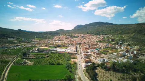
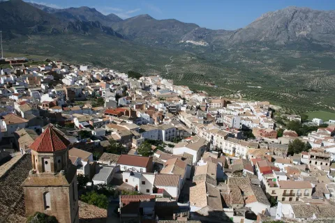
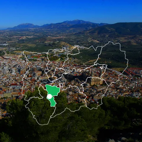
Jaén is an extensive municipality located in the south-west centre of the province, and in which the capital is located.

In its term two areas are distinguished: the countrysidewhich is located to the north and another, smaller, located to the south, which is the mountain.

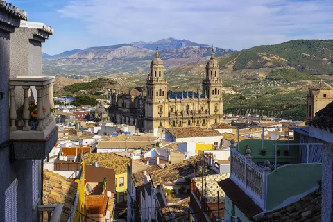
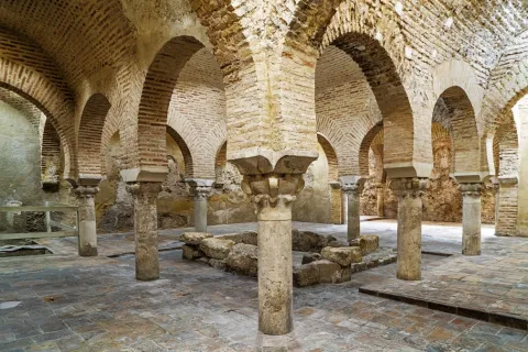
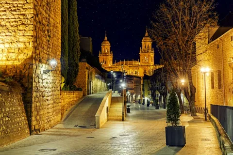
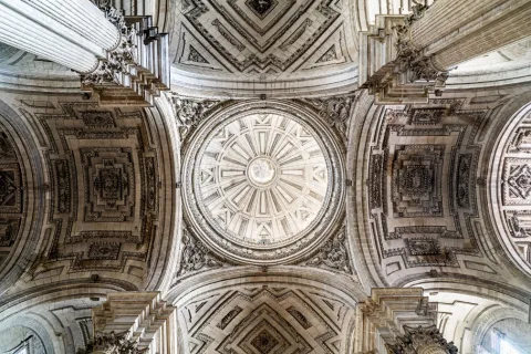
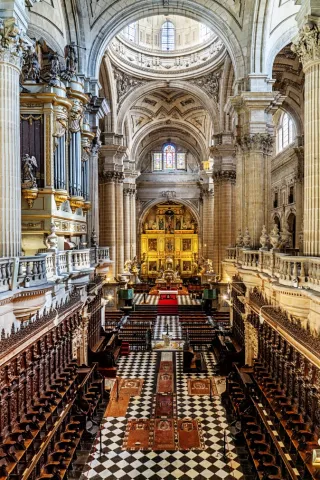
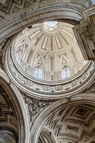
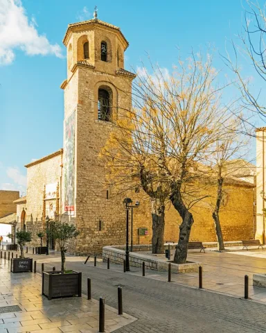
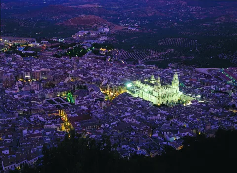
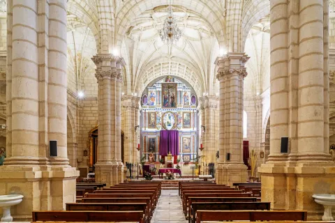
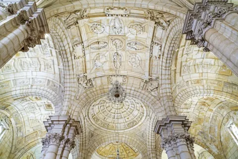
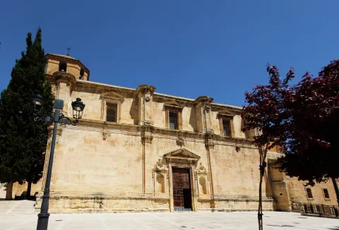
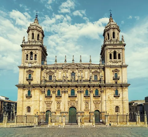
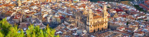
As we go through its historical centre, in streets, corners and monuments we discover the richness of the coexistence of three cultures: Christian, Jewish and Muslim. We will walk through the narrow streets of the Jewish Quarter, we can visit the Arab baths of the 11th century in the basements of the palace of Villardompardo and admire the rosary of churches, some of them raised over ancient mosques and numerous convents. And visible from all points of the historical center is the Cathedrala true jewel of the Spanish Renaissance.

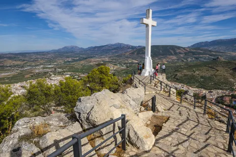
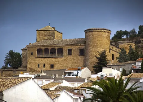
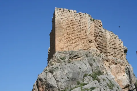
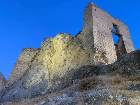
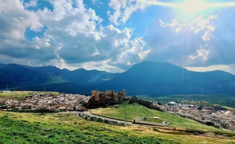
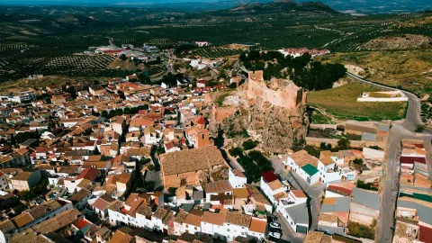
On the hill of Saint Catherine the imposing castle of the same name, from where you can admire extraordinary panoramic views over the Guadalquivir valley, the countryside and the Sierra Sur behind your back.

Jaén, the world's capital of olive oil, is today a modern city as its squares, gardens and large avenues testify.
Telecomunicaciones
Teléfono
953 313 281
Sitio web
https://www.jaencityofgastronomy.com/ www.culturayturismojaen.es
Correo electrónico
otjaen@andalucia.org
Ubicación
Nombre
Jaén
Latitud
37.772770
Longitud
-3.787970
Distrito
Municipio
Ubicación en el mapa
POINT (-3.78797 37.77277)
Imágenes
imagen
Image
565c6eb4-5942-2554-4006-8ceab143b8db?t=1619526386769
Imagen principal
Desactivado
imagen
Image
b424e57e-dc79-a428-daca-35eeb083bea1?t=1619526386986
Imagen principal
Desactivado
imagen
Image
55d454b0-8c1d-d414-0b1e-e823a8ec112e?t=1603985313163
Imagen principal
Desactivado
imagen
Image
7715a631-5b75-15b6-5980-62fd2f46d2e7?t=1603985472695
Imagen principal
Desactivado
imagen
Image
01dc3f35-ff78-28a9-7c8e-35e481da450c?t=1619526387099
Imagen principal
Desactivado
imagen
Image
0fa84b0a-05ed-c54d-7d4b-22183bb3e3a6?t=1619526387156
Imagen principal
Desactivado
imagen
Image
14937a6a-998e-3821-a140-fd3fd1ca419f?t=1603985313279
Imagen principal
Desactivado
imagen
Image
d06ab30b-57dd-c08d-06c5-3ede89eecc14?t=1585768371068
Imagen principal
Desactivado
imagen
Image
e6950987-2c4d-dd30-5a67-62a547b05db3?t=1619526387274
Imagen principal
Desactivado
imagen
Image
3540dc4f-fdd4-e549-c395-e4da63d47419?t=1619526387340
Imagen principal
Desactivado
imagen
Image
bfd586f4-48bc-d3aa-18ee-68705b3b0e19?t=1619526387391
Imagen principal
Desactivado
imagen
Image
144298d6-85db-03e9-e4c2-49526aac5889?t=1619526387572
Imagen principal
Desactivado
imagen
Image
0c7d68e7-f21d-8966-856c-2e62cd746a9f?t=1619526387623
Imagen principal
Desactivado
imagen
Image
48b3d107-5960-f7f2-e080-3c725a30800c?t=1619526387677
Imagen principal
Desactivado
imagen
Image
e1522135-9be2-ee72-37d1-29d49c34f935?t=1603115329866
Imagen principal
Desactivado
imagen
Image
7cae4916-09df-b35e-2986-f704ed193a4f?t=1619526387748
Imagen principal
Desactivado
imagen
Image
30754f84-6bf0-8bce-d131-7832dd6a306b?t=1619526387799
Imagen principal
Desactivado
imagen
Image
d5a8b2be-e7d6-1b7a-01b8-f4412b3d1e07?t=1603117566668
Imagen principal
Desactivado
imagen
Image
32ae96fb-7f94-4623-2b3d-b7fac51e241a?t=1619526387876
Imagen principal
Desactivado
imagen
Image
fcb67e8f-ebc1-467f-7b33-183b53cf1e8f?t=1619526387922
Imagen principal
Desactivado
imagen
Image
fedd54a5-2237-fd6e-425e-7237a8d0f26b?t=1619526388085
Imagen principal
Desactivado
imagen
Image
ec4ce20b-7984-d4fe-3bdf-d035228f9528?t=1619526388368
Imagen principal
Desactivado
imagen
Image
a3a10c78-37e3-21bd-b9d8-813f1849eefc?t=1619526388625
Imagen principal
Desactivado
Información adicional
Curiosidades

Horarios de visita


Oficina de información turística de Jaén.
C/ Carrera de Jesús, 2.
23002 Jaén
Tel. 953 190 455
Imágenes cabecera
imagen
Image
b963ff18-ff49-21ea-0900-3e68f5e313be?t=1606405214909
Imagen principal
Desactivado
Datos de interés

Tourist area: Jaén and surroundings
Altitude over sea level (m): 573
Extension (km ²): 424
Number of inhabitants: 120,021
Gentilicon: Jiennenses
Postal code: 2300x

Videos
Video file
Cultura

Jaén's architecture bears witness to the many civilisations that have inhabited the city and its surroundings throughout the centuries, resulting in an outstanding monumental heritage that includes both religious and civil buildings. Its historical and artistic legacy showcases a variety of architectural styles, including Gothic, Mudéjar, Renaissance, Baroque, and Neoclassical.

Among its most important monuments are the following:

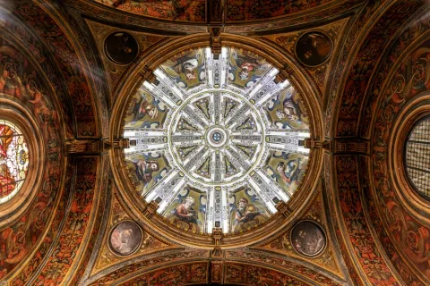
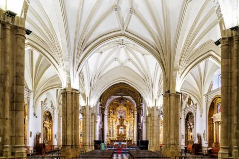
  • Cathedral of the Assumption of the Virgin, a masterpiece by one of the greatest Renaissance architects, Andrés de Vandelvira, and the inspiration for the construction of many cathedrals throughout Latin America. It is regarded as one of the finest examples of Renaissance architecture in Andalusia, which is why the process to obtain UNESCO World Heritage status for the cathedral began several years ago. The city's first cathedral was built on the foundations of the former Great Mosque following the conquest of Jaén by King Ferdinand III of Castile, known as Saint Ferdinand, in 1246. Later, during the 14th century, Bishop Nicolás de Biedma brought to the city the relic of the Holy Face (Santa Faz or Santo Rostro), believed to be one of the three cloths that, according to Christian tradition, Saint Veronica used to wipe the sweat and blood from Jesus' face on his way to Calvary. The presence of this relic in the first Christian cathedral transformed it into an important pilgrimage destination, making its expansion necessary in the Gothic style. Elements of this Gothic phase can still be seen in the apse of the present cathedral. Due to structural problems that arose during the 14th century, a new Renaissance cathedral was commissioned from the architect Andrés de Vandelvira. Although construction continued for nearly three centuries, Vandelvira's original design remained largely faithful throughout the project, resulting in what is considered the most architecturally balanced, harmonious, and proportionate cathedral in Andalusia, with one of the most solemn and majestic interiors in the region.
  • Basilica of Saint Ildefonsus. After the Cathedral, it is the largest church in the city. The earliest records of the original building date back to 1248, when it was established as a chapel serving the Cathedral. Two centuries later, in 1430, it became the setting for the famous miracle of the descent of the Virgin Mary to the city of Jaén. Following this event, it became a sanctuary dedicated to the image of the Virgin housed inside, under the title of Our Lady of the Chapel. In the 16th century, the Virgin of the Chapel was proclaimed the patron saint of Jaén. Finally, in 2010, Pope Benedict XVI granted the church the status of Minor Basilica. The building features three entrances: the oldest, in Gothic style, is located at the rear of the church. The side entrance, in Renaissance style, displays a relief depicting the Chasuble Bestowal upon Saint Ildefonsus. The last to be built was the Neoclassical main façade, crowned by a statue of the saint to whom the basilica is dedicated.
  • Santa Catalina Castle. An ancient Caliphal fortress stood on the summit of Santa Catalina Hill as early as the 9th century. Centuries later, following the conquest of the city by King Ferdinand III in 1246, the Christian castle that survives today was built. During the 19th century, the castle underwent several modifications to strengthen its defensive structures in response to the Napoleonic invasion. Close to the castle, the building that now houses the National Parador was constructed in the 1960s. From the summit there are spectacular panoramic views of the city and its surroundings, especially from the Cross Viewpoint. The fortress also houses an Interpretation Centre that explores the history of the castle.
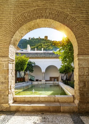
  • The Arab Baths. They are the largest and best-preserved Arab baths in Spain. Built in the 11th century during the reign of Abd al-Rahman II, they are located beneath the Villardompardo Palace in the heart of the city's historic centre. Covering an area of 450 square metres, they still preserve Almohad decorative elements, suggesting that they were restored towards the end of the 12th century. Between the 14th and 15th centuries, after they ceased functioning as public baths, the rooms were converted into tanneries. Later, at the end of the 16th century, Fernando de Torres y Portugal, Count of Villardompardo and Viceroy of Peru, built his palace above them. At the beginning of the 20th century, together with several adjoining buildings, they became part of a women's hospice. A section of the baths was rediscovered in 1913 and, a few years later, they were declared a National Monument. Today, following a restoration project that received the Europa Nostra Award, they form part of the "Arab Baths" Cultural Centre, which also houses the Museum of Popular Arts and Customs and the International Museum of Naïve Art.
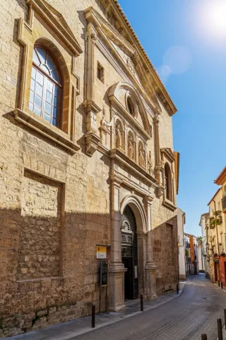
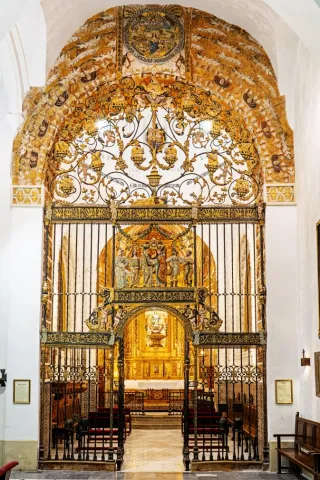
  • Chapel of Jesús (Camarín de Jesús). The chapel and the convent church of Saint Joseph are the only surviving remains of the former Convent of Saint Joseph of the Discalced Carmelites, founded in the 16th century. The recently restored church, with its characteristic Carmelite façade featuring a niche, houses both the chapel and the Camarín de Jesús, created in the 17th century to enshrine the celebrated Renaissance sculpture of Nuestro Padre Jesús Nazareno ("El Abuelo"). The image belongs to the brotherhood founded in this very convent in 1588 and is carried in procession during the early hours of Good Friday before thousands of worshippers and pilgrims. The façade is adorned with a beautiful terracotta sculpture of Saint Joseph by the renowned ceramic artist Paco Tito.
  • Church of La Magdalena. Originally the city's Great Mosque during the Islamic period, it was converted into a parish church following the Christian conquest. Its main façade and interior are Gothic in style, while one of its towers still preserves the former Arab minaret. The church contains several important works of art, including Calvary by Jacobo Florentino "El Indaco", a panel of Our Lady of the Pillar attributed to Pedro Machuca, the 16th-century Christ of Clemency by Salvador de Cuéllar, and the 18th-century image of Saint Mary Magdalene by Mateo de Medina. The courtyard of the former mosque, with its rectangular ablution pool, served various public purposes during the Christian era and was landscaped with gardens and ornamental fish during the 20th century.
  • Church of Saint Bartholomew. It is one of the oldest churches still standing in the province of Jaén. Dating back to the medieval period, this religious monument features a Baroque exterior and a Mudéjar interior. Among its highlights is a green glazed ceramic baptismal font decorated with 15th-century Gothic inscriptions.
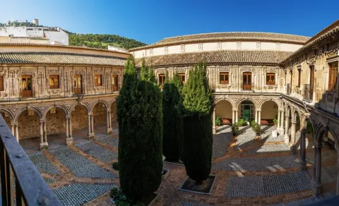
  • Provincial Council Palace. This palace was built in the mid-19th century by architect Jorge Porrua. Originally, the site was occupied by the Convent of Saint Francis, commissioned by King Ferdinand III in the 13th century. A century later, King Peter I of Castile ("Peter the Cruel") granted it to the Franciscan friars. Following the ecclesiastical confiscations, the building became public property and was eventually converted into the headquarters of the Provincial Council. Today, visitors can explore its central courtyard and the lower galleries.
  • Oppidum of Puente Tablas. The fortified Iberian settlement of Puente Tablas is located just 4 kilometres from Jaén. Over more than thirty years of archaeological research, the site has revealed its outstanding historical importance through evidence of continuous human occupation from the Bronze Age to the Islamic period. However, its most significant phase dates from the Iberian period, particularly the 4th century BC. Visitors can discover how the Iberians of the Upper Guadalquivir lived while exploring one of the most impressive defensive systems of the period, with more than 300 metres of preserved walls standing over 5 metres high. Visitors can enter the settlement by following the same route once used by its ancient inhabitants, passing through the famous Sun Gate.
Naturaleza

Half of the municipality of Jaén lies within the Baetic Mountain Range. This impressive landscape can best be appreciated from Santa Catalina Castle, an exceptional viewpoint overlooking both the city and the surrounding countryside.

To the south stretch rugged mountains and rocky peaks, forming the peri-urban parks of Santa Catalina and Monte La Sierra, where visitors can enjoy a wide variety of hiking trails and mountain routes just a short distance from the city centre.

To the north lies the fertile countryside, with gently rolling hills covered by centuries-old olive groves. Further afield, the landscape gradually gives way to pine forests, terebinths and holm oaks, announcing the arrival of the mountains.
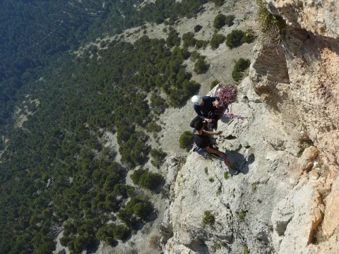
Activities such as hiking, cycling, rock climbing and via ferrata are all within easy reach for both residents and visitors, only minutes from the city centre.

Fiestas y Eventos

The Bonfires and the San Antón International Urban Night Race, declared a Festival of National Tourist Interest, is held on the weekend closest to 17 January. More than 12,000 runners enjoy a unique atmosphere along the route, with music, flaming torches and enthusiastic crowds cheering them on. Afterwards, bonfires are lit in neighbourhoods and squares throughout the city. Around these fires, people gather to sing, dance and enjoy the traditional "melenchones", while sharing local cured meats, regional wines and rosetas (popcorn), creating a warm and festive atmosphere where unforgettable moments are shared.

Carnival. Carnival celebrations in Jaén have a history spanning more than 700 years. For over a month, comparsas, chirigotas and other carnival groups parade through the streets to the Darymelia Theatre, where they perform humorous, satirical and socially critical songs as part of the competition organised by the City Council. Local groups and individuals also take part in the fancy-dress competition, delighting spectators during the colourful parade through the city centre.

Holy Week in Jaén is a religious, cultural and tourist event of outstanding importance. Its brotherhoods and confraternities preserve a legacy dating back to the 16th century, renowned for the beauty and artistic quality of their religious sculptures. Holy Week has been declared both a Festival of National Tourist Interest and of Andalusian Tourist Interest. Twenty-one brotherhoods take part in the processions from Palm Sunday to Easter Sunday, with one of the most moving moments taking place during the early hours of Good Friday, when El Abuelo is carried through the streets.

The International Olive Oil and Related Industries Fair (Expoliva), held every two years at Jaén's Exhibition and Conference Centre, is recognised as one of the world's leading events in the olive oil sector. Over four days, it brings together farmers, machinery manufacturers, transport companies, olive oil producers from around the world, scientific symposiums and conferences, making Jaén the international capital of the olive-growing and olive oil industry.

San Lucas Fair. This fair originated in the 14th century through a privilege granted to the city by King Henry IV of Castile. Originally held in August to coincide with the harvest season, it was moved to October during the 19th century to coincide with a livestock fair. From 12 to 18 October, the city hosts numerous events including bullfights, concerts and theatre performances. At the Alfonso Sánchez Fairground, visitors can enjoy open festival tents serving traditional cuisine, live music, dancing and fairground attractions, as well as the traditional tents at the "La Vestida" fairground.
Music plays an important role in the city's cultural life. Jaén hosts the Autumn Festival, the prestigious Jaén International Piano Competition, Oleosónica, Jaén Sounds Like Opera, the Bolero and Latin American Music Festival, many other music festivals throughout the year, and the internationally recognised Jaén International Jazz Festival: "Jazz Among the Olive Trees".

Other Festivals and Events:

The Bonfires of Saint Anthony, held on 17 January. Amid singing and dancing, the traditional "melenchones" are performed while people share laughter, conversations and "rosetas" (popcorn). This festival has been declared a Festival of National Tourist Interest.

May Crosses Festival. A tradition in which local residents decorate crosses beside churches, in squares and other iconic places throughout the city. Both locals and visitors tour the crosses, enjoying the festive atmosphere, gastronomy and community spirit that surrounds them. Children also take centre stage on Friday afternoon, parading through the city centre with small floats decorated with crosses, Christs and Virgins of their devotion. They are dressed in traditional mantillas and accompanied by civil, religious and military representatives, delighting everyone who watches the procession.

Corpus Christi.

Festival in Honour of the Virgin of the Chapel, co-patron saint of the city. These festivities take place in the popular San Ildefonso district, combining religious devotion to the patron saint with celebrations in Jaén's best-known gastronomic quarter, where bars and restaurants extend their terraces into the streets to offer their finest dishes. The City Council also organises a wide programme of cultural and tourist activities throughout the festival. Every 11 June, the Lola Torres Choirs and Folk Dance Association holds a floral offering to the Virgin. Participants parade dressed in the traditional pastira costume (for women) and chirri costume (for men), joined by many other residents of Jaén. The celebration concludes with the performance of the traditional Bolero de Jaén before the Virgin's image. In the afternoon, the Virgin is carried in procession through the city centre to the cathedral.

25 November – Saint Catherine's Day. The feast day of Jaén's co-patron saint is celebrated on Santa Catalina Hill. After the procession climbs to the castle, a religious service is held inside. Afterwards, visitors enjoy food from the stalls and bars set up around the castle, where grilled sardines, barbecued meats, patatas a lo pobre and paella are among the traditional dishes served in a wonderful atmosphere of celebration and togetherness.

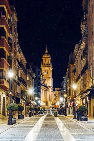
From the beginning of December, the city enjoys a wonderful Christmas atmosphere with the switching on of the festive lights and the start of an extensive programme of activities, including concerts, street music and theatre for all ages. The popular central street, Calle Carrera, is beautifully decorated and welcomes everyone who wishes to share moments of joy and celebration with the people of Jaén.

Gastronomía

Jaén's gastronomy is varied and is based on the Mediterranean diet, in which extra virgin olive oil gives dishes their distinctive aroma and flavour.

Among the city's most traditional dishes are:

  • Pipirrana, made with finely chopped ripe tomatoes and dressed with a mixture of extra virgin olive oil, green pepper, garlic, egg and salt. It is often topped with grated boiled egg and, optionally, tuna.
  • Homemade partridge pâté.
  • Migas with traditional accompaniments.
  • Scrambled eggs with broad beans and Iberian ham.
  • Broad beans, campion greens or spinach with pine nuts, showcasing the quality of Jaén's vegetable gardens.
  • Roast kid goat, chicken, young goat or lamb.
  • Trout from the rivers of Jaén.

Among the desserts, we should mention gachas dulces (sweet porridge), fried milk, and, of course, the traditional pastries made in the local convents (the Bernardas, Santa Clara and the Carmelite nuns).

If you would like to enjoy a unique culinary experience, the San Ildefonso district is home to two Michelin-starred restaurants: "Bagá" and "Dama Juana".

Historia

The human presence in the present city is seen from the calcolitic stage, also called the Copper Age, when there were several villages scattered around the area. In the surroundings of the city, rock paintings and remains of megalithic architecture have been found.

Otra información

Jaén is a city that houses a large number of legends very imbricated in the soul of its people. Maybe the most famous of them is the "Maline lizard"or"Jaén lizard. "The influence is such that it has become one of the symbols of the city, being present in its architecture, rides and concerts. It is based on the existence of a dragon (lizard) that had the population afraid and that with ingenious tactics its inhabitants managed to get rid of it.
Loading map
Preparing points of interest and routes...
Imagen principal
imagen
Image
a4c3eb80-f7b7-801d-a6f0-4d01416611b6?t=1603979481525
Imagen principal
Activado

Huelma

Submitted by brandcode_deweloper on
Id
731976
Perfil de redes sociales
Facebook
https://www.facebook.com/aytohuelma/timeline
Twitter
https://twitter.com/AytoHuelma
Instagram
https://www.instagram.com/aytohuelma/
Descripción
Breve descripción

Huelma is a important location located to the south of the region of Sierra Magina, right on the provincial border with Granada.The third north of the municipality is included in the Natural Park of Sierra Magina, where you reach heights that exceed 2,000 m to go down to the Jandulilla Rivereast of the municipal term. Solera is a population that was annexed to Huelma in 1975.It is an important municipality in the region from an economic point of view. The main industry is the Manufacture of furniture of wood, with national and international markets, and which has been able to be renewed despite times of crisis.The ceramic and textile industry. It has important assets for cultural, nature and sport tourism.

The United Nations agriculture is the most employed, followed by the Services sector,the olive tree is the largest crop, followed by cereal, while fruit and vegetable crops are almost testimonial. Within the industrial fabric there is a oil packaging which belongs to the Designation of Origin of Sierra de Magina.

The livestock It also takes on special relevance, it is raised livestock, sheep, and sows. The exploitation of the montesine sheep, originating in the mountain areas of the province of Granada and the south of the province of Jaén, is noteworthy.Huelma is a compulsory stop in the tourist product "Travel to the time of the Iberians," as it offers a Iberian field dated in the 4th century BC in the place the "Cortijo Pajarillo. "

With regard to his historical-artistic heritage, his castle which stands on a promontory of strong earrings. It is of interest to the parish Church of the Immaculate of the 16th century.

Telecomunicaciones
Teléfono
953 390 210
Sitio web
http://www.aytohuelma.es/
Fax
953 390 000
Correo electrónico
registro@aytohuelma.es
Ubicación
Nombre
Huelma
Latitud
37.647300
Longitud
-3.455180
Distrito
Municipio
Ubicación en el mapa
POINT (-3.45518 37.6473)
Imágenes
imagen
Image
43fe4e80-11d9-0d8b-2169-ad2a0fc6dbe3?t=1617881108892
Imagen principal
Desactivado
imagen
Image
3428f7da-4c13-cfba-84bd-1d2ca1b25d18?t=1611061743692
Imagen principal
Desactivado
imagen
Image
477327e7-5dce-e2cb-4f69-56be2c8b5463?t=1617881108966
Imagen principal
Desactivado
imagen
Image
de13f7fc-a3b5-7cfd-d9ab-7637e127225a?t=1617881109014
Imagen principal
Desactivado
imagen
Image
a6ec54c2-ddf0-721c-d68f-eb0bd60073e1?t=1617881109060
Imagen principal
Desactivado
imagen
Image
c666021c-530c-b870-352b-24ff47f28b2f?t=1617881109115
Imagen principal
Desactivado
imagen
Image
c430746c-b7ba-3f50-1ae0-46fc045a1113?t=1617881109294
Imagen principal
Desactivado
Imágenes cabecera
imagen
Image
huelma
Imagen principal
Desactivado
Datos de interés

Distance to the capital (km): 50
Altitude over sea level (m): 1100
Extension (km ²): 250
Number of inhabitants: 6051
Gentilice; Flakes
Postal code: 23560

Videos
Video file
Cultura

The beautiful urban town of Huelma, made up of a set of white streets and houses, located under the remains of its castle, make up a harmonious and attractive set that has valued their cataloguing as Historical-Artistic Set in 1971.

From its rich heritage we highlight:

  • Huelma or Alburquerque Castle. It is located on the outskirts of the city centre of Huelma, on a hill that dominates the entire population. The strength we contemplate today was probably built by the Lord of the villa, the Duke of Albuquerque, in the first half of the 16th century. On that same place there was a Muslim castle from which only some of the canvases of the wall and the Great peel inside the castle. A quadrangular plant with 4 cylindrical towers, one in each corner, united with each other by a wall cloth and an open door in a half-point arch at ground level. On the west side it stands directly on a large peñasco, cut to peak, which is already a great fortress.
  • Church of the Immaculate Conception. It is considered as a jewel of Renaissance architecture in the province of Jaén. The most great artists of the time: Diego de Siloé, Francisco del Castillo el Viejo, Andrés de Vandelvira and Francisco del Castillo el Joven. The building presents basic plant divided into 3 ships. The header of the flat tester church is covered with canyon vault with cassettes. The southern façade is of great elegance and balance, based on Italian models. He's got the body of peeled bells.
  • Ibero Sanctuary of Pajarillo. It's a oppidum ibero found in the pastry of Cabritas de Huelma, dates from 4th century BC, and the sculptures found are found in the Provincial Museum of Jaén. The figures found are: a wolf, a warrior, two taps, a young boy and a carnivore. This sanctuary is located in the Jandulilla River Valley, the commercial pass between Murcia and the Guadalquivir Valley.
  • Castle of Solera. Here, on a hill, are the remains of a Nazari castle built in the 13th century. From it you can see splendid views of the Vega in which the Jandulilla and Garganton rivers converge.
  • Hermitage of Our Lady of the Fuensana. Located about 7 km. of the population, in the heart of Sierra Magina, the sanctuary of Fuensanta is the epicenter of the devotion of the strikers to be the house of their excellent patron.
Naturaleza

A very important part of the municipality of Huelma is crossed from south to north by the river Jandulilla, dividing it into two similar extension areas. On the left bank of the river is the Mágina saw massif and the town de Huelma. On the right margin, the Cabra saw and the historical core of Solera.Approximately 10% of the area of the municipal term is included in the Sierra Magina Natural Park. There are several signposted itineraries such as the healthy route of the Cordel del Salado, the road of the Borregueras or the path of ascending to the Magina peak that will offer us amazing panoramic views of the region.

The routes by the karst of Sierra Magina will allow us to observe meadows, bushes, sabinars and the vegetation of the summits (blue lead, fine piorno, mountain ruse, thyme and alfacarensis herring), as well as karst formations, snow wells, perdicular eagles, grey colalba, and capillants.

The low areas are covered with olive and almond plantations, mainly, although there are also frequent coals, complaints and pineapples of carrasco and salgareño pine.

Fiestas y Eventos
  • Holy Weekwhich has a unique character within the region, it has the collaboration of numerous cofradies and its processional parades are attended by many neighbors either by devotion or by tradition.
  • May parties and September romance. These are the parties in honor of the Virgin of Fuensanta, patron of Huelma. The first Sunday of May is produced the transfer of the Virgin of the Fuensana and of Saint Lucia from the sanctuary to the parish church, each year participating a greater number of carrozas and rosemary.The first Sunday of September the Romeria in the Sanctuary of the Virgin of Fuensanta.Since the 16th century, the fellowship of Our Lady of Fuensanta and Saint Lucia has organized this pilgrimage that is held every year on the first Sunday of September. The events begin with the reception of the subsidiary cofradies of Cambil, Solera and Torres and the road to the sanctuary. After the Eucharist, the size of the Virgin is processed, which is accompanied on her throne by the image of Saint Lucia. In a typical rosemary environment, a campera day is spent in which you have to drink the water from the well of the sanctuary, to which many miracles have been attributed.
  • Carnival. He's very popular. Since 1989, there has been a competition for groups of Chirigotas and Comparsas, as well as dances. To close the festivities, the "Carnival Filler" is celebrated.
  • August Fair. Also called by Saint Augustine. During the parties the Expooluma Show Fair and the "La Serranilla de Magina" competition is held.
  • Popular holidays in the municipalities, each of the villages belonging to Huelma also celebrate the day of their feast: in May are the Feasts of San Isidro in Solera; in June are the Feasts in Cabritas de Huelma; in July the Feasts in La Calesera and La Unión Plaza Nueva; and in August are the Feasts of the Emigrant in Solera, the Villa and Campo del Moral.

Gastronomía

Huelma's gastronomy is succulent and varied. They highlight strong dishes like the "scallops", bean peas with cod, chotto al ajillo, andrajos with cod, andrajos with hare. It is typical of the "cucumbers" on Holy Week.

In the field of pastry there is a large variety of sweets: "roscos," "flowers," "drunks," "buds," "polvorons," "stained," "moles eggs," "papajotes," "membillo meat," "gachas" and the typical "Hornazo" for Resurrection Sunday.

Historia

One of the most important milestones in the history of Huelma is the presence in these lands of a Heroic shrine of the Iberian era, specifically on the so-called hill "The Pajarillo"which can be given in the 4th century BC This sanctuary would be the entrance door to a territory controlled by an Iberian aristocrat on the Jandulilla River, and whose headquarters would be located in Ubeda. In Roman timesin the third century AD repopulate these lands the high valley of Jandulilla with small farms.

During the Muslim era we are living moments of great splendor in Huelma. From the conquest of the Iberian Peninsula by this civilization, it is when the present core arises around the hill where the castle is located. This Muslim fortification will become a key piece in the Middle Ages border struggles between the kingdoms of Castile and Granada.

The Nazaris They will possess it. to the late date of 1438, year in which it is conquered by Mr Íñigo López de Mendoza, I Marqués de Santillana. King John II will be granted it in a lordship, and years later, in 1474, Henry IV elevates the Lordship to the category of Vizcounty and then County in the person of D. Beltrán de la Cueva, I Duke of Albuquerque. Hence the castle was built at this time on the remains of the ancient Muslim fortress, also known as the "Castle of the Dukes of Albuquerque."

After the end of the Granada war, 1492, Huelma entered a period of political and economic stability during the first half of the 16th century, thanks to the repopulation and the cultivation of new lands. These years of economic bonus will be reflected in the undertaking major religious and civil worksas is the parish church.

It will be in the late 16th and early 17th century when there is a decline in the population due to crises and epidemics. The War of Independence will be the entry of French troops into Huelma who will destroy the fortress.

Loading map
Preparing points of interest and routes...
Imagen principal
imagen
Image
Huelma
Imagen principal
Activado

Hornos de Segura

Submitted by brandcode_deweloper on
Id
731780
Perfil de redes sociales
Facebook
https://www.facebook.com/profile.php?id=100093559135446
Descripción
Breve descripción

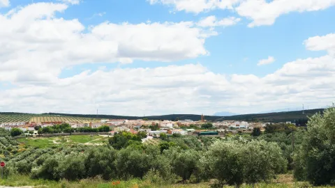
Nice town located in the Sierra de Segura, fully included within the Parque Natural de las Sierras de Cazorla, Segura and Las Villas. Next to the reservoir of the Tranco de Beas and the valley of the Guadalquivir River at its beginning.

The municipality of Hornos belongs to several villages spread throughout the municipality: Cañada Morales, La Capellanía, El Carrascal, Fuente de la Higuera, Guadabraz, Hornos El Viejo, El Majal, La Plantera, El Tovar, El Tranco and La Venta. Some of them are located in places of great beauty, such as La Plantera or La Capellanía, and others are more active thanks to their situation, such as Cañada Morales or El Tranco. The rest with a marked agricultural character, where peace and tranquility are assured, are currently developing interesting quality tourist infrastructure such as rural houses.

Furnaces are essentially forest, the pinars occupy about 80% of their municipal term.

The urban core is surprised to be located on a large peñasco. Its medieval character gives it a special charm. It has been declared an Artistic Historical Set in 1985.
Its economy is based on tourism, forest use and olive cultivation. Without forgetting the very important activities and fishing.

It has a rich heritage: the Castle, the Church of Our Lady of the Assumption, the Castle of Bujaraiza, the Puerta de la Villa, the Mirador del Aguilón and the Tower of Bujarcaiz.

Telecomunicaciones
Teléfono
953 495 002
Sitio web
www.hornos.es
Fax
953 495 031
Correo electrónico
secretaria@hornos.es
Ubicación
Nombre
Hornos de Segura
Latitud
38.216730
Longitud
-2.719170
Distrito
Municipio
Ubicación en el mapa
POINT (-2.71917 38.21673)
Imágenes
imagen
Image
d562cab0-e866-6fc2-5039-73ea3dbf7a78?t=1617879834093
Imagen principal
Desactivado
imagen
Image
4684996b-b0d2-b0c9-6c52-78a920a820ba?t=1617879834360
Imagen principal
Desactivado
imagen
Image
3cec6640-bac7-3c8e-ffdb-f6c872b5e0cb?t=1617879834408
Imagen principal
Desactivado
imagen
Image
d4899350-18e9-f1b0-db9d-0b24730b8c30?t=1595609312667
Imagen principal
Desactivado
imagen
Image
barco-solar-jpg
Imagen principal
Desactivado
imagen
Image
f206640e-6f53-e174-aeb5-00637460fe64?t=1617879834950
Imagen principal
Desactivado
imagen
Image
1466792f-a098-2464-a39e-1dcc797b36fa?t=1595609312725
Imagen principal
Desactivado
imagen
Image
e4ae55d5-e1fc-f627-48a6-8b65c462cff8?t=1602772415163
Imagen principal
Desactivado
imagen
Image
830bbe2f-9ca3-3494-3786-ada91c4ef032?t=1617879835016
Imagen principal
Desactivado
Información adicional
Imágenes cabecera
imagen
Image
Hornos de Segura
Imagen principal
Desactivado
Datos de interés

Tourist area: Serras de Cazorla, Segura and the Villas
Distance to the capital (km): 103
Altitude over sea level (m): 865
Extension (km ²): 117
Number of inhabitants: 679
Gentillo: Horneros or Hornenses
Postal code: 23292

Videos
Video file
Cultura

Castle. Hornos was granted by Fernando III the Holy, after his conquest in 1239 to the Order of Santiago. The time at which the castle would be built, probably on an earlier Muslim fortress from which the aljibe is preserved.

Of a purely defensive nature, the trapezoidal shape set is built with small masonry. It is made up of a magnificent Tribute Tower, three slender torreons square floor and the outer wall of a room that closed the courtyard of arms.

The Tower of Tribute in square shape and rounded corners, something common in the constructions of the Order of Santiago, has only one entrance at half height.

In its interior two overlapping rooms supported by vaults and communicated by a staircase carved in thick wall.

By the end of the 20th century, the rehabilitation of the castle that was very damaged began. After many attempts, in 2011 the works of their total restoration were completed. It has been declared Good of Cultural Interest in 1985.

Located inside the castle you can visit one of the most important tourist resources of the area as is the Cosmolarium.It is a centre for the dissemination of astronomy that consists of a digital planetarium, with a dome of 8 meters in diameter that shows enveloping audiovisual productions, complete exhibition rooms on the Universe, spaces for workshops and educational games, as well as a terrace for astronomical observations.

Parish Church of the Assumption. Data from the first half of the 16th century. Its construction follows the style of the Order of Santiago. Of a square floor, with one ship and side chapels, it is divided into three square sections separated by fajon arches.

The decks are gothic, the 16-century renaissance-style altarpiece as it is recorded. The cover is one of the first plateresque in the province of Jaén, although it is currently damaged by time.

The tower stands out for the gargobles of the cornice and the Gothic crest of the mast. We can say it's a magnificent example between Gothic and Renaissance.

In it was found the ornamental vessel in the form of a Nazi-style amphora, with motifs glazed in blue and gold on white enamelled background that is preserved in the National Archaeological Museum.

The Villa Gate. It's a door on the wall dating back to the 11th century. It is built in elbow to make access to the enemy difficult, which makes you think of a mothade origin. Made of masonry and red brick in the vaults, as well as a small window of the facade. Declared Good of Cultural Interest in 1985.

Bujaraiza Castle. It rises on a the island in the waters of the Tranco reservoir. It is a small fortress formed by a walled polygonal enclosure and a tower of tribute. It is built with small-size masonry yarn, with lime mortar. Declared Good of Cultural Interest in 1985.

Tower of Bujarcaiz. It is currently submerged under the waters of the Tranco reservoir. It was part of the surveillance system of the Hornos castle. It is a square floor construction and a troncoconic form.

Aguilon Viewer. Located next to the City Hall shows one of the best views of the Natural Park and an impressive view of the waters of the Tranco reservoir.

Naturaleza

The municipal term of Hornos is located in the heart of the Sierra de Segura, and by it they run the waters of the high courses of the Segura and Guadalquivir rivers, it takes its waters to the Tranco reservoir.

The water is present in much of its term and makes that nature is overflowingboth in the arid High summits villages of larive pine trees and high-rise tiles, as in the lower areas where the black pines grow, whose wood is very resistant to rot, oaks, oaks, moans and chopos.

Here we find more than thirty endemic species that cover the steep surfaces of the rocks, such as aromatic plants or the curious trapping.

The variety of ecosystems also makes the number of animal species living in these areas very diverse. In the higher and more steep areas live the large-game, muflon, deer, go and boar species; Rapes and scavengers like, eagles, broken bones and lethargy vultures. And in the less high areas, the cynetic species of minor hunting: badgers, foxes, hares, rabbits or gines. Without forgetting the fauna that lives in the crystalline waters of these rivers: trout, barbs, otters, salamanders. No the birds who either live in olive trees, or feed on their fruits in their migratory movements: carboneros, abbullas, jilgueros, petriroreds, ratoneros...

The municipal term of Hornos will present us with thousands of routes to discover and that it will surely leave a deep footprint on us when you go through them.

We point out three places that we should not miss:

  • The Tranco Pantano. It is an inner sea between pine trees, given the abundant vegetation surrounding it and the olive sea that goes down to the banks of the reservoir. The main and regulator of the Guadalquivir River. The village of Tranco had chapel, schools, event hall, sound cinema, post office and civil guard headquarters. Dolorosa was the disappearance under the waters of the Lordship of San Miguel de Bujaraiza, loaded with history and whose castle still stands out challenging above the waters, when the swamp is at its highest level. From time to time, in El Tranco water sports have proliferated. This activity is designed to be enhanced by public institutions as an alternative to tourism in one of the essential visiting places for all nature lovers.
  • Cynegetic park. An interesting nature reserve where animals live together in semi-freedom, highlighting especially deer and go. It is visited following a perfectly marked itinerary that has sources and viewpoints. It is near the Tranco swamp.
  • The Celadillas. A promenade area with a view towards the village and the Tranco swamp. The views are unbeatable.
Fiestas y Eventos

These are the parties that are held in Hornos:

  • Patron parties. In honor of Our Lady of the Assumption and Saint Roque and are held in mid-August. For a week there are dances, Turkish bowling championships, summer cinema and the most important things: "The Vickles". On the new door, you can release the poplars that are run through the streets of the village. This taurina tradition has a deeply popular character.
  • Saint Anton. The 17 January And it's the pattern of the animals. The day before, fires are lit, around which they dance, sing and eat and drink. As long as the light lasts, chorizos, morcillas and other viandas of the pig are prepared, such as the carette accompanied by traditional drinks such as the crow and the mistelle.
  • Romeria under the title of the Virgin of Fatima, is held since the mid-last century. A teacher from the school of La Capellanía donated an image of the Virgin of Fatima to the parish of Hornos and asked the parish priest to perform a mass so that the children of the village and the surrounding cortijos could make the first communion. Today is celebrated in the beautiful The Control site.
  • Holy Week. Emotional procession that takes place on the Sunday of Resurrection in which the encounter of Mary and her Risen son. The hornilleros celebrate this day by shooting their shotguns in the air, for the time the process course lasts.

They are also held Other parties as: San José, in Cañada Morales and the Virgin of Carmen in the Tranco.

Gastronomía

Among the most typical dishes of Furnaces are:

  • Pig derivatives. The products derived from the pig have an important place. Chorizos, loins, ribs, solomiles, stored in the oil of the traditional orza. The morcillas, longanizas and faces that are left to be consumed on the day of Saint Anton around the bonfires.
  • Garlic. It is made with the liver of the fried pig that is added to a saffrito of green peppers, tomato, garlic and pepper, to end up adding mist of bread, water and spices. It is also known as Killing garlic.
  • Garlic of flour. With potatoes and vegetables, but with the unmistakable taste of nisthem from the saws.
  • Bread crumbs. They have the particularity that they are cooked in a meat broth with crushed peeled tomato.

To highlight the drinks which are usually taken on festive occasions. This is about "the crow," a mixture of wine and water with a lot of sugar and pieces of fruit; "Mistel." made up of spirits, coffee and spices.

To accompany these drinks you will take some traditional sweets, including the panets and Fried roses.

Historia

The site currently occupied by Hornos He was busy. for the period Copper age and remained busy during the Bronze age. This place was subsequently abandoned.

From the Roman times There are many remains of tombstones, coins and ceramic pieces in the La Laguna field.

It's in the Middle age when this population reaches its greatest splendor, mainly due to its strategic and defensive situation. The Arabs know her as Fornus and was a small village inaccessible for its situation.

The Islamic Age in the area of Hornos, and in the mountains in general, she was convulsed by the struggles between the leaders who wanted to impose her authority. The population for the most part was Muladi. During the X and XI centuries, is a zone of great splendor, Since along with the surrounding populations are the border between Christians and Muslims, they will be the starting point of war expeditions against Christians.

The Christian conquest was carried out by the knights of the Order of Santiago in 1239, in particular by Pedro Pelayo Correa, master of the Order and was attached to the commission of Segura de la Sierra, dependent on the spiritual of the diocese of Cartagena. Fernando III will grant you the Villa title.

Hornos was one of the places, along with Segura de la Sierra, from which members of the Manrique family actively participated in the Spanish politics of the 15th century. This family was generally confronted with the kings of Castilla Juan II and Henry IV, as they always controlled a large part of the forces and resources of the Order of Santiago, of which Don Rodrigo Manrique, the commander of Segura, came to proclaim himself Grand Master, resisting and defeating in Hornos the troops sent against him by John II and his valid Don Álvaro de Luna.

In 1833 the demarcation of the municipality within the province of Jaén, after a stage of secondment and belonging to the province of Murcia.

The period of the largest expansion of this population was between the mid-19th and mid-20th centuries. From this date its population has declined to reach the just over 700 inhabitants at present.

Otra información

A characteristic sport in Furnaces are the serrano bowling, which consists of throwing a ball without passing a line and giving the "mingo" of wood to send it as far away as possible. They are made championships and come neighbors of the rest of the villages that make up the municipality.

Loading map
Preparing points of interest and routes...
Imagen principal
imagen
Image
Hornos de Segura
Imagen principal
Activado

Frailes

Submitted by brandcode_deweloper on
Id
4844517
Perfil de redes sociales
Facebook
https://es-es.facebook.com/ayuntamiento.frailes/
Twitter
https://twitter.com/ayto_frailes
Descripción
Breve descripción

Fries is a small municipality in the province of Jaén, located to the south and limited to the province of Granada. It was a place of recreation for its wealth in waters and its nostalgic spa.

Located half the hill and left by the rivers Chorrillo and Soto Redondo, its streets are steep and zigzagueante with small slopes that are used as family gardens. When you walk through your streets, you have the feeling of walking on agricultural land as well as urbanized.

The water is born in its own heart and seems to circulate everywhere in sources, venerations and springs, through streams and streams. So much so, that we can say that water is the essence of Friars.

Its population is 1775 "friars" which are distributed by a large urban town, due to the inseparable binomial of the house-garden. The silence of the people is only broken by the sound of the bells of their parish or of one of their hermitage. No doubt a place with a special charm.

Telecomunicaciones
Teléfono
953 593 002
Sitio web
www.frailes.es/
Fax
953 593 002
Correo electrónico
ayuntamientofrailes@frailes.es
Ubicación
Nombre
Frailes
Latitud
37.486220
Longitud
-3.837320
Distrito
Municipio
Ubicación en el mapa
POINT (-3.83732 37.48622)
Imágenes
imagen
Image
057c1bbc-54d5-3672-c4ea-b18d61284f63?t=1585834430583
Imagen principal
Desactivado
imagen
Image
53638264-2737-a071-a4a0-8c3ad0bdb81f?t=1585834430793
Imagen principal
Desactivado
imagen
Image
d760df32-868c-99b7-8fca-57f04516c13a?t=1585834431444
Imagen principal
Desactivado
imagen
Image
dd0be176-1e6a-4962-66cf-de1905959029?t=1585834431170
Imagen principal
Desactivado
imagen
Image
8cf70f12-0d4d-792a-dad9-e47e107e2560?t=1585834432000
Imagen principal
Desactivado
imagen
Image
1f13571e-06bf-426d-b9b7-c029c70e617d?t=1585834432159
Imagen principal
Desactivado
imagen
Image
10687b7e-9f74-2907-db30-244c6024100b?t=1585834431808
Imagen principal
Desactivado
imagen
Image
460e7454-c52e-094b-3340-198c78116f62?t=1585834429945
Imagen principal
Desactivado
Imágenes cabecera
imagen
Image
frailes
Imagen principal
Desactivado
Datos de interés

Tourist area: Sierra Sur and Campiña de Jaén
Distance to the capital (km): 80
Altitude over sea level (m): 780
Extension (km ²): Number 40
Population: 1,575
Name: Friars
Postal code: 23690

Videos
Video file
Cultura

From its artistic heritage we highlight:

  • The parish church of Saint Lucia. Built in the 16th century on the remains of an ancient hermitage, with the passage of time will be suffering expansion of the ship to accommodate the growing number of friars. In the last reform carried out at the end of the last century, a magnificent craftsman was incorporated in Granada.
  • The House of the Dean of Mudarra. Built in the late 20th century of the last century, it has a sober three-storey façade, highlighting the beautiful grating of the first floor balconies.
  • Casa de José Escribano. It is located a few meters from the Dean de Mudarra, and it is from the same time. The glare with a balustrade and pilastras with floral motifs stands out.
  • Calvary hermitage. Located in the highest part of the city centre, it is reached by a winding road excavated on the hill side, between oaks and almonds.
  • Hermitage of San Antonio. It is the largest hermitage in which the cult is most active. Its outer building is topped by a swordsman with a bell that sounds every time a devotee enters or leaves the hermitage. The image of St. Anthony with the Child Jesus on his hand is the hermitage.
  • Hermitage of San Pedro. Located in the Era de Mecedero, it is the last building in the village, following the road to Valdepeñas de Jaén. It is a very small hermitage, as it is a room that a neighbor gave to the worship of the Holy. Press the inside the image of the hermitage holder.
Naturaleza

The privileged climate of Fries, with very fresh summers, and water running everywhere, invites you to enjoy nature in that unique space.

The peak ofLa Martinawith its 1552 meters, it is the highest point of the saw to which it gives its name. Many hiking and cycling routes run along their slopes for those who want to enjoy these areas.

As we go up, the olive trees in the lower part are giving way to shrubs, complaints and oaks. The slopes of this saw are an ideal hunting place just 5 km away. of the city centre.

The Fountain of the Satin, At 1100 meters high, it is the ideal place to view the orography of the area and have contact with Mediterranean vegetation. Here the water goes to buckles, to refresh visitors or to follow the way to the Genil.

It's interesting to visit what the natives callThe Tagus, a number of orchards formed on limestone rocks by the effect of erosion, which in the past the inhabitants used as housing.

Surround the houses there is a set ofvegas, humid and fertile lowlands where the best fruits and vegetables are given.

Fiestas y Eventos

The stage of the Friars' festivities is marked by the seasons of the year and by the Christian liturgy. These would be the main festivities of the town:

  • Holy Week: The representation of the "Easter Steps" by the neighbors is a very rooted custom in the town since the 17th century. Attached in costumes of the time of Jesus Christ are the different scenes of the Passion.
  • Corpus Christi: Since 1779, Fries has had a fellowship of the Holy Sacrament, and in recent years the feast is having a special splendor. That day, the streets through which custody passes are carefully adorned by the neighbors of the village.
  • San Antonio: On June 13, after celebrating Mass in his hermitage, the image is processed through the streets of his own neighborhood.
  • San Pedro: It is the local patron party. On June 29, after the Mass, the image is processed and a verbena is held, where boys and big men dance in crowded movements.
  • August party: The first week of August, the town was dressed as a gala to celebrate its fair with activities for all ages: pasacalles, popular marathon, horse-ribbon racing, vegetable competition, and dances until the morning.
  • Wine and gastronomic day: At the end of the winter, when the wine of the harvest is already in a position to be tasted, this expected day is celebrated. Since 1997, the City Council has promoted this day the typical products of the massacre, as well as the traditional sweets that are still being produced in the bakeries of the town.
Historia

The name Fries comes from Alphthalyaswhose origin is thought to be not Arabic.

When King Alfonso XI in 1341 conquered Alcalá la Real, to which the vessel and the tower of Alfralyas belonged, these territories are incorporated into the crown of Castilla.

In the mid-16th century, the Saint Lucia hermitage was built near the first settlements. As early as 1621, the surrounding area of the hermitage was renamed "Huerta de Saint Lucia," and the population settlements were increasing.

From this date on, there are several attempts to independence of these new settlements of Alcalá la Real, although they will only come to a successful conclusion in 1836, thus starting their solo walk with the title of Villa.

During the Civil War of 1936, the town will remain faithful to the command of the Republic, which cost him the bombing of the national army, with the logical consequences of destruction, pain and death.

Today, Fries, is a town close to the 2000 inhabitants, with a wonderful climate and extraordinary beauty.

Loading map
Preparing points of interest and routes...
Imagen principal
imagen
Image
frailes
Imagen principal
Activado

Cazalilla

Submitted by brandcode_deweloper on
Id
727407
Perfil de redes sociales
Facebook
https://es-la.facebook.com/Ayuntamiento-De-Cazalilla-456504624871178/
Descripción
Breve descripción

It is a municipality of the region of the countryside of Jaén, located on the left bank of Guadalquivir, to the north of the municipality of Jaén, and only 31 km. of the capital and 24km from Andújar.

It is an eminently agricultural town, the main crop being olive trees, cereal lands and orchards.

The main architectural work with which it counts is the parish church of Santa María Magdalena.

This small municipality in the eastern part of the region of La Campiña is essentially agricultural, as the cultivated land accounts for the entire area. It is of the few municipalities in which the olive tree is in a minority, along with the arable crops, although the olive tree, which is clearly increasing, is the largest source of income. The north of the term reaches the Guadalquivir River and in this small area cotton and corn are grown. Minor hunting, especially hare and partridge, is abundant because these species find in the countryside the ideal place for feeding and breeding.

Telecomunicaciones
Teléfono
953 537 131
Sitio web
www.cazalilla.es
Fax
953 537 780
Correo electrónico
castalla@cazalilla.es
Ubicación
Nombre
Cazalilla
Latitud
37.984340
Longitud
-3.881640
Distrito
Municipio
Ubicación en el mapa
POINT (-3.88164 37.98434)
Imágenes
imagen
Image
3bbc16c7-b50e-e0da-fa7b-40f45d9666e5?t=1649252906503
Imagen principal
Desactivado
imagen
Image
cbe997de-725a-33f2-6115-1839e763a33d?t=1649252906571
Imagen principal
Desactivado
imagen
Image
0d2944e6-b86e-c42e-5278-cf5f692fcdb5?t=1649277372898
Imagen principal
Desactivado
Imágenes cabecera
imagen
Image
cazalilla
Imagen principal
Desactivado
Datos de interés

Distance to the capital (km): 31
Altitude over sea level (m): 300
Extension (Km2): 47
Number of inhabitants: 821
Gentilicon: Cazalilleros
Postal code: 23628

Videos
Video file
Cultura

In the center of the city centre is its most significant building, the parish church of Santa María Magdalena. It is overtaken by its volume and height, as well as by the quality of the building materials and their artistic beauty. The service of his tower is striking. Its construction must have been carried out in the 17th century.

Taken to the parish church is the so-called Caligula Tower, a semicircular turret from the old castle. Torreón that was declared Good of Cultural Interest by the Junta de Andalucía in 1985.

We must also highlight the Casa Carrileraof the 12th century and the House of the Posite, today rebuilt by its current owner.

Naturaleza

Cazalilla is located in the high Jienese countryside and fully participates in the characteristics of this region: areas flattened with very soft slopes in which the main cultivation is the olive grove, even in the area of the vegas and irrigation.

Near the population centre is the Contón de la Virgen de la Cruz, recreational area located on an old landfill recovered as a green area and crossing through a bridge the first of the previous streams. Linked to these watercourses we find a typical vegetation of riverside, in which they stand out reels, carrizos, canes, calves, and eucalyptus, alms, olmos and weeping willows.

Other leisure areas for the population and visitors to Cazalilla are the Pilar de la Dehesa Parka place of leisure and rest that has areas of shade with barbecues, water fountains and tables, in one of the livestock caches that cross the countryside, and the Old Pilar, recreational area equipped with meringers and good views of the countryside.

The Cerro de la Coronillalocated in the cortijo of the Atalaya, where the first major settlement of Cazalilla has been identified, configured thanks to its height as an integral element of a strategic defensive system of the area in the Copper Age.

Fiestas y Eventos

On 3 February the Festivity of San Blas, much loved by the neighbors not only of Cazalilla, but also of the neighbouring villages, such as Escaluy, Villanueva de la Reina and Mengibar. The traidional blessing of the Saint's donuts culminates with the long-term preservation by mothers of these "blessed by the saint" bread donuts, which are meals to bits by children as an effective remedy when they are affected by a coughing. The colour tapes that the saint has held in his hand are also used, so that once placed in the neck they will serve to cure and prevent throat conditions.

Another holiday that the hunters celebrate is the one that takes place on the third of May, dedicated to the Marian advocation of the Virgin of the Cross, and in which there is the custom to go in Romeria to a place located on the road of Villanueva de la Reina called the Charcón.

There are also two other significant festivities in Cazalilla: Candelariathe traditional prelude of San Blas, where there was the tradition of taking children under the age of one to present them in the church, in clear accordance with the religious feast of the presentation of Jesus Child in the Temple, and the Corpus Christiwhere balconies and windows are covered and the streets are carpeted with junction.

Gastronomía

In the summer of 1965, within Plan Jaén, the population of the nearby town of Espelúy with settlers from the Sierra de Segura was expanded. This has meant that the "kitchen of the countryside"is mixed with the"serrana cuisine. "Among the most traditional dishes, we highlight:

  • "The Pipirrana, "this typical dish of the Jienese countryside, but which here has a thicker consistency, we would say that more related to the Cordobese salmoire.
  • "Asparagus"a typical spring dish that is presented as a sauce, hence the name of the dish.
  • "Migas of bread with melon"using the last melons of the summer.
  • Potting with muffinsThe well-known potage of chickpeas with Holy Week cod is added to the heart or spinach.

From the serrana kitchen, these other dishes would come:

  • "Gazpacho of reapers"and thejopringue"food from the massacres.
  • "Rings with hare"and theGalians. "

In the time of the olive collection, the "bread singing with oil"accompanied by bacon or cod.

In the pastry shop the "milk rosses, "thePestives"and theflaminquins. "

Historia

In its term the human presence from the Copper Age is documented, both by the ceramics collected in its urban centre and by the settlement of Cerro de la Coronilla, in the Cortijo de la Atalaya. Around the second millennium this centre was abandoned and reoccupied in the late 6th century a. C. in the oldest stage of Iberian culture. In Roman times there was a dispersed population, probably villae, one of them located on the current site of Cazalilla.

In the Arab era it was one of the iqlims in which the Cora de Jaén was divided, from which a tombstone with the epitaph of a certain man was found in the town. Ahmad b. Mauro or Mawruwhich died in 885, although the researchers are of the opinion that the town would already exist in the Visigode era, because that name is of Latin root, which could indicate that it was a muladi (Christian converted to Islam).

In the reconquest the name of Caztalliella appears in the delimitation of terms between Jaén and Martos. In the Synod of 1311, it appears as one of the parishes of the Jaen artebrittle.

In the second half of the S.XV, during the war between the nobility and King Henry IV, Cazalilla is named on several occasions in relation to his castle. One of the most significant facts was that of December 23, 1471, when Fernando de Acuña, the son of the Count of Buendía, was shot by the castle's mayor, Diego de Frías, and handed him over to the Constable Iranzo. The castle only remains the drawing made by Ximena Jurado in the 17th century. This was not the only defensive bastion that existed in Cazalilla, as in the municipality is also located Torre de María Martínwhich was part of the set of surveillance and control fortifications of the territory.

In the Modern Age the town follows the guidelines of the rest of the province, with socio-economic recovery in the XVI and depression in the XVII and XVIII. In the 17th century, he changes to the village, and the town of Jaén is segregated.

Loading map
Preparing points of interest and routes...
Imagen principal
imagen
Image
cazalilla
Imagen principal
Activado

Castillo de Locubín

Submitted by brandcode_deweloper on
Id
727290
Perfil de redes sociales
Facebook
https://www.facebook.com/ayuntamientocastillodelocubin
Twitter
https://twitter.com/aytoclocubin
Youtube
https://www.youtube.com/channel/UCwDa42I-Buh3vodwwfVgG-A
Descripción
Breve descripción

The people ofCastillo de Locubínis located in theSouth Sierraof Jaén, at the gates of the subbetic mountain range and its municipal term is populated with olive trees and cherry trees. At the edge of the Achillos saw, and located in a valley on the banks of the San Juan river, they alternate areas of saw with valleys of garden tiles.

Its municipal term includes theSales of Carrizal and Los Chopos.The birth of the San Juan River is a place of great beauty enjoyed for its recess by both the castilleros and visitors.

In this town the cherry is the emblematic fruit, the object of a fair and a party around its collection. During the flowering time of this tree, towards the end of March, it offers a picture worthy of being admired.

In its artistic heritage we highlight thethe parish glesia of Saint Peter the Apostle, built in the late 16th century. Its main cover is classic and the side mannerist.

In the surroundings of the city centre there are surveillance towers of the Muslim era, such as theLa Villeta, that still retains the bottom and part of the wall that surrounded it.

Telecomunicaciones
Teléfono
953 591 364
Sitio web
www.aytocastillolocubin.org
Fax
953 591 311
Correo electrónico
info@aytocastillodelocubin.org
Ubicación
Nombre
Castillo de Locubín
Latitud
37.527950
Longitud
-3.942240
Distrito
Ubicación en el mapa
POINT (-3.94224 37.52795)
Imágenes
imagen
Image
c072e489-a7bd-6ea2-ee40-6da8f81ae06c?t=1608754191263
Imagen principal
Desactivado
imagen
Image
eacbb044-91b9-b44c-d698-8d0fd2f2a0bf?t=1617626152992
Imagen principal
Desactivado
imagen
Image
0f6df4ec-51c5-7e6a-dc5d-1a4867f56640?t=1617626153064
Imagen principal
Desactivado
imagen
Image
9838817d-e08b-738b-a044-f2006e34ee8b?t=1610988809820
Imagen principal
Desactivado
imagen
Image
215554f0-7393-a5a4-8b3a-ae69aedc443b?t=1610988878829
Imagen principal
Desactivado
imagen
Image
50981034-f68c-0985-6cc5-3b14f1a341c6?t=1617626153156
Imagen principal
Desactivado
imagen
Image
2277ec7f-6bf1-a043-39a7-311d73938a7f?t=1617626153243
Imagen principal
Desactivado
imagen
Image
ad8aa008-a4da-489a-2fde-88a89eea54f7?t=1617626153454
Imagen principal
Desactivado
imagen
Image
bdef093b-f0da-042c-4702-11f61ae50075?t=1617626153593
Imagen principal
Desactivado
Imágenes cabecera
imagen
Image
castillo de locubin
Imagen principal
Desactivado
Datos de interés

Tourist area: Sierra Sur and Campiña de Jaén
Distance to the capital (km): 68
Altitude over sea level (m): 550
Extension (km ²): 103
Number of inhabitants: 5366
Gentillo: Castilleros
Postal code: 23670

Videos
Video file
Cultura

Its artistic heritage is spread between the city centre and the surrounding area. Inside the city centre we have:

  • The church of San Pedro, built around 1580. On the cover there are two dogrous columns that culminate in a hornaine with a Saint Peter Apostle.
  • Hermitage of Our Father Jesus, of 1700 and that preserves the paintings and the original wood size of the Patron, Our Father Jesus Nazarene.
  • Hermitage of San Antón, dates from 1800, and was demolished and rebuilt in 2001.

In the urban area:

  • Tower of the Batan, of Roman origin to which an Arab body was added. It was used as a flour mill and later oil mill.
  • La Villeta, remains of an Arab fortress from which its bottom and part of the wall are preserved.
  • Low Head of Beautiful Encina, a fortified population centre, founded at a late moment of Iberian culture and that reached its development in the Roman stage.
  • Torre del Marroquín, a medieval atalaya in good condition of 9 m high and that has been declared Good of Cultural Interest.

Naturaleza

The birth of the river San Juan is the green lung of Castillo de Locubín, it is a place of great beauty, surrounded by vegetation, has an abundant flow of water that sprouts from the interior of the mountain. Around this source, numerous pools of crystalline water have been formed, from which water sprouts into columns of bubbles. A space that has become a recreational area for casters and visitors.

And on both sides of the San Juan River is the vega castilleraa fertile land that welcomes a care and valuable agricultural landscape, in which all kinds of fruit are given, with special predominance of the cherry trees.

To discover in more detail both the fauna and the flora of the municipal term, nothing better than to travel some of the the paths and ways they go through these places. Sendas that, without a high level of difficulty, we can pass them to discover the contrasts that enclose this earth.

One way to know the characteristics of the rocks in these saws is to visit some of the caves that form these rock masses. One of the best known is the Cueva Jabonerowho was inhabited at the age of the Copper.

The visit to Low Head of Beautiful Encina, it is an elongated plateau with abrupt slopes in all directions, which was an archaeological settlement known since ancient times.

The data obtained in the excavations indicate that the oppidium de Cabeza Baja de Encina Hermosa is founded in the late 3rd century a. C., and develops a population that follows the typical Iberian urbanism of Alto Guadalquivir.

Fiestas y Eventos
  • Fair and Feast in honor of Our Father Jesus Nazarene, from 7 to 11 September.
  • Cherry Party, It has been held since 1983 and has been a great boost to tourism and local gastronomy. Among the many activities that are organized, is the free tasting of different products that have the main basis of cherry. Its date is usually in June, when the collection ends.
  • San Antonio party, is celebrated in the Pedanía de Ventes de Carrizal on 13 and 14 June.

Gastronomía

The wide variety of fruits and vegetables that are produced in the gardens of Castillo de Locubín gives us an idea of the diversity of dishes in the town.

Between the strong dishes are: Oreganillo de orza, Migas with melon, the bowling soup, the Holy Week potage, Cod casserole, Chotto al ajillo, rabbit to the oreganillo, gazpacho and Ajowhite with cherries.

The desserts include the multiple fruit compots and jams of the orchard, mainly cherries. We must mention the Cherry Liquor, which is only made in this town.

Among the pastries: the Castling Mantawhich is a biscuit filled with natural products; castles, wrapped in sugar and egg whites; almond trins, papuecas and cherry chocolates.

All these products are served for free at the cherry fair.

Historia

The first testimonies of the human presence in this municipality date back to the 4th millennium BC in the caves of the and the scrap, inhabited by pastors who made ceramic with incisions.

In the municipal term of Castillo de Locubín the Iberian village of Cabeza Baja de Encina Hermosawhich reached its development in the Roman era. And to this Roman imperial era corresponds the Roman villa of the Cortijo del Baño, in the pedanía de Ventes de Carrizal.

During the Islamic stage it was known as Hisn al- Uqbin that some translate by "Castle of the Eagles." The history of this town was very linked to that of Alcalá la Real on which it depended.

In the time of Fernando III, he formed part of the territories of the Order of Calatrava and constituted one of the advanced limits of the commission of Martos. And it will be King Alfonso XI who gives the castle and the village of Castillo de Locubín to the people of Alcalá la Real, which will last until the first decades of the 19th century.

It will be in 1835 when after several attempts he can become independent. In 1915, King Alfonso XIII gave him the title of city.

Otra información

We want to quote one of the many legends that exist around the image of the Nazarene Jesus. It is said that when the image was taken on a wagon to Alcalá La Real, they stayed in Castillo de Locubín, and when the next morning they prepared to continue the road, the weight of the image was such that the oxen of the wagon could not with the weight. What was understood as a sign that the image should remain in this place. So it was done and now it is the image that they venerate as a pattern.

Loading map
Preparing points of interest and routes...
Imagen principal
imagen
Image
castillo de locubin
Imagen principal
Activado

Castellar

Submitted by brandcode_deweloper on
Id
727183
Perfil de redes sociales
Facebook
https://www.facebook.com/excmo.ayto.castellar
Twitter
https://twitter.com/aytocastellar
Instagram
https://www.instagram.com/ayto.castellar/
Descripción
Breve descripción

Castellar is a municipality in the north-eastern part of the province of Jaén. It is located in the central part of the district of El Condado, between the mountain ranges of La Loma and Sierra Morena.

The crops occupy more than half of their municipal term and are located to the south, where the olive grove predominates, although the Vega del Guadalquivir gives rise to horticultural, industrial and forage crops. The main activity is in agriculture and in particular in olive farming.

This municipality has witnessed the passage of millennial cultures that have left its mark. The rupestre sanctuary of the Cave of the Lobera where remains of the Iberian era have been found, and the 17th-century ex-collegiate Church of Santiago, which has been declared a Historical-artistic Monument in 1983, is noteworthy.

Telecomunicaciones
Teléfono
953 460 005
Sitio web
www.castellar.es
Fax
953 460 006
Correo electrónico
info@castellar.es
Ubicación
Nombre
Castellar
Latitud
38.251690
Longitud
-3.131480
Distrito
Municipio
Ubicación en el mapa
POINT (-3.13148 38.25169)
Imágenes
imagen
Image
62138201-faa9-3c39-b466-c842034c7b2d?t=1617623743189
Imagen principal
Desactivado
imagen
Image
45effd2a-8662-3921-c160-ec621270acc1?t=1594657620241
Imagen principal
Desactivado
imagen
Image
d7ca5134-6c43-1033-5bd4-fd66d29903f1?t=1617623743257
Imagen principal
Desactivado
imagen
Image
e4b3a80e-476d-092c-d0ec-2005f348ffa8?t=1617623743320
Imagen principal
Desactivado
imagen
Image
1303f3fd-29bd-5937-e9a9-722618a26dee?t=1617623743388
Imagen principal
Desactivado
imagen
Image
30b4529e-0e6c-ebd1-44f5-0c366ace828b?t=1617623743463
Imagen principal
Desactivado
imagen
Image
294387e5-91e3-def1-a9b4-48c35ec956b6?t=1617623743578
Imagen principal
Desactivado
imagen
Image
8fedaf5c-26e2-acbd-fc31-3fe132b1125f?t=1617623743638
Imagen principal
Desactivado
Imágenes cabecera
imagen
Image
castellar
Imagen principal
Desactivado
Datos de interés

Tourist area: Sierra Morena / Sierras de Andújar and Despeñacolos
Distance to the capital (km): 110
Altitude over sea level (m): 757
Extension (km ²): 157
Number of inhabitants: 3,654
Gentillo: Castellariegos, Castellarenses or Alcucillas
Postal code: 23260

Videos
Video file
Cultura
  • Former Collegiata de Santiago, declared an Artistic Historical Monument, is a sober construction of elegant proportions dating from the 17th century. In 1692 he was raised to the rank of a collegiate by Pope Inocencio XII.
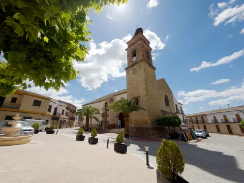
  • The parish Church of Our Lady of the Incarnationsettled on an old Visigode castle rebuilt in the 10th century by the Arabs and whose torreon served as the base of the tower of the present temple. Its interior is protogotic (14th century), but its cover is neoclassical from the 17th century.
  • Palace of the House of Medinaceli, 16th century Renaissance palace, current city hall.
  • The Iberian Sanctuary of the Cave of the Loberalocated 1.5 km. de Castellar, on a rocky ledge that houses caves that were used as houses in past civilizations, is an emblematic settlement of Iberian archaeology. Place known as Altos de Sotillo, numerous bronze exvotes from Iberian times have been found, which can be visited at the Iberian Sanctuary Museum.
  • The Museum of Iberian Art, popularly known as the Museum of the Exvote, it is located within the 14th century tower of tribute, known as the Pallarés Castle. It presents one of the largest collections of exvotes exposed to the public.
  • The House of the Diez Family, is a living-16th century palace of which stands out its plateresque cover carved in stone and topped with an imposing shield.

Naturaleza

The municipal term of Castellar has a very irregular form, in the north-south direction it reaches 39 km, while in the east-west it does not reach 10 km. of a maximum width of less than 0,5 km near the Montizon River.

The northern part of the term, known as Sierra del Oro, is mountainous and belongs to Sierra Morena. It presents the typical Mediterranean forest, steep and pedestal areas.

The characteristic fauna is the same as that of Sierra Morena, in which the cynetic species abound: deer, boars, goos, foxes, rabbits, partridges...

The flora is made up of low mountain and native Mediterranean forest: oaks, juniors, madroños, acuches, complaints...

South of the municipal term, being part of the Guadalquivir basin, extends the valley area, more suitable for the cultivation of olive trees, pastures, forage plants and garden areas.

Fiestas y Eventos

Among the main festivities, we will mention the following:

  • Great Fair, is held in August, from 10 to 15, are its patron parties, in which the bull, with different taurino shows, is the protagonist of these parties.
  • San BenitoOn March 21, the Spanish people celebrate the feast of their patron. This day, the saint, is moved to his hermitage as a form of romance in the midst of different religious and playful activities.
  • Our Lady of Consolation, patron of the town and is held from 1 to 3 May. There is a rosemary with the later transfer of the patron to the town.

Gastronomía

The gastronomy of Castellar is rich and varied, its base being the olive oil.

Its inhabitants presuppose to produce the best triguero or campero asparagus in the province, and prepare them in many ways.

The most traditional dishes are not missing:

  • Calandrajoswith either hare or cod. In other places they are called rags, rags or wink.
  • The Galians, which makes us think this has been a land of transhuman shepherds.
  • "Ajoharina", it's a stew of vegetables, potatoes and flour with pepper.
  • "Ajopringue"and consists of the liver of pig seasoned with spices and "print"either pork butter or olive oil.
  • "Gachasmigas"It's a great breakfast for the men who were going to do a hard job in the field.
  • Other variants, where "garlic" means "crushed": "Burn." and "Hairdresser".

Within the traditional sweetness, stand out the entangled, stained olives, roses of spirit and olive oil, flowers, drunks, papajotes...

The work on olive wood is worth noting.

Historia

The archaeological vestiges located in its municipal term go back to the Neolithic, and one of the most interesting findings is that of the Cave of the Sima, with a collective burial set.

Castellar was an important place in the time of the Iberians, as it was in the territory of the Oretania, and here is located one of the great centres of worship of the Iberians, the Rock Shrine of the Cave of the Lobera, located in the Altos del Sotillo.

From the period of Roman domination there have also been found a multitude of vestiges and settlements characterized as the sites of Campillo and El Dorado.

It was one of the first localities conquered by King Fernando III by the Nazari Muslims in 1226. During the Middle and Modern Ages, Castellar was linked to the Casa de los Benavides. Under his patronage, the collegiate of Santiago Apostolo is built.

This dynasty of the Benavids, would become condes in 1473, and its county comprised three villages: Navas, Castellar and Santisteban. Conflicts between the three localities over disputes over common land membership were very frequent and would continue for a long time. They would be ended in 1978 with the "Scripture of Concord".

Otra información

It should be noted that in Castellar there is an important shellfish factory, even if it seems to be a contradiction for being this town of the earth inside. From this factory, high quality seafood are produced and distributed from the most distant coasts.

Loading map
Preparing points of interest and routes...
Imagen principal
imagen
Image
castellar
Imagen principal
Activado

Canena

Submitted by brandcode_deweloper on
Id
726500
Perfil de redes sociales
Facebook
https://www.facebook.com/Canena-Ayuntamiento-797777960269910/
Twitter
https://twitter.com/aytodecanena
Descripción
Breve descripción

Canine is a small municipality in the province of Jaén, located in theNorth slope of the region called The Loma.

It is an olive town, as the almost whole of its municipal term is dedicated to the cultivation of the olive tree. Canine is a municipality with a 14 km ², very small compared to the villages around him: Ibros, Rus, Baeza or Ubeda.

It has an impressive castle - palace of the Renaissance period, ordered to build by Mr Francisco de los Cobos, secretary of King Charles I.

The parish church dedicated to Our Lady of Conception is Renaissance in style and is raised in the first half of the 16th century.

Special mention deserves the interesting spa of thermal waters dating from the Roman era and was officially declared as a spa in 1853. Its mineromimicinal waters were declared public utility in 1948, currently being the only spa in operation within the province of Jaén.

Telecomunicaciones
Teléfono
953 770 161
Sitio web
www.canena.es
Fax
953 770 157
Correo electrónico
canena@canena.es
Ubicación
Nombre
Canena
Latitud
38.048160
Longitud
-3.481680
Municipio
Ubicación en el mapa
POINT (-3.48168 38.04816)
Imágenes
imagen
Image
bcadd46f-d550-47db-93e9-04bf1a97ab12?t=1617622860093
Imagen principal
Desactivado
imagen
Image
7287a0e8-f3ef-ba63-26c4-01565406f663?t=1586302332591
Imagen principal
Desactivado
imagen
Image
52ff6eaf-5b0e-9aaa-cdee-031ee1621868?t=1610987722402
Imagen principal
Desactivado
imagen
Image
8e65ff68-4368-5691-a789-da9cbf865678?t=1610987769453
Imagen principal
Desactivado
imagen
Image
deb4b4cb-b7fa-bb24-46a6-6b78ffc33f0e?t=1610987805783
Imagen principal
Desactivado
imagen
Image
f9119661-9354-8645-7628-9c3c22feab2e?t=1593796058632
Imagen principal
Desactivado
imagen
Image
88783720-57b3-bc14-567e-66e1738fbf73?t=1610987851073
Imagen principal
Desactivado
Información adicional
Curiosidades

ADR La Loma y las Villas: www.adlas.es

Imágenes cabecera
imagen
Image
canena
Imagen principal
Desactivado
Datos de interés

Tourist area: Ubeda / Baeza
Distance to the capital (km): 47
Altitude over sea level (m): 525
Extension (Km2): 14
Number of inhabitants: 2096
Gentilicon: Caneneros
Postal code: 23420

Videos
Video file
Cultura

From its artistic heritage we highlight:

  • The Castle-palace, which belonged to Francisco de los Cobos, and was built in the second half of the 16th century, after the purchase of the town by Francisco de los Cobos. Of almost square floor, with four circular towers on the corners, two larger on the main facade. The tower of tribute, square floor. Antaño was surrounded by a moat, now blinded, the slots are preserved to lift the old lift bridge. The cover, with a half-point arc, it is flanked by Corinthian pilasters, with an architrabed, cold setting decorated with grotesques and a cornice on which the half-point arch is raised, which welcomes, in its eardrum, the shields of the founders, and on its fantastic sides, tenants figures with the lower half of their bodies transfigurated in wing and vegetation. On the facade are scattered windows with conventional-style bars. The castle has a inner courtyard It has double gallery of half-point arches with Ionic columns and claustral staircase. The upper gallery, also Ionian, repeats the intellized structure, with the peculiarity of large zapatas on the columns, which support in plintos decorated with military motifs and, it borders a railing of balaustres. The set offers a constructive sobriety and a balance and harmony that demonstrates the authorship of an artist builder like Andrés de Vandelvira. It was declared a National Monument in 1931. It is currently in private hands.
  • Our Lady of Conception parish church, It is built in the first half of the 16th century and is of Renaissance style. It is made up of three ships, the largest central than the sides, separated by half-point arches that are based on columns. It also has a crypto of great robustness, dated around 1000.
  • Hermitage of Our Lady of RemediesIt was built in the 15th century and finished in the first half of the 18th century thanks to alms, as indicated on the facade. The entrance is protected with a small cancel with three more lower-than-usual carpanel arches and supported by dogrous columns on plintuses.
  • Molinillo. It is a hydraulic construction of the Roman era, intended for the grinding of the cereal, and is located on the left bank of the Yedra stream, about 700 m from the urban centre. It was improved at the time of Carlos V, when the villa was bought by Francisco de los Cobos.
  • Sources, dedicated to the solace of its inhabitants and the irrigation of gardens. There are several of us: New Source, Caño Source, Ark Source and Pilarejo.

Naturaleza

A Canine is considered as the entrance door to the region of La Lomaa plateau above the basins of the two rivers, to the north the river Guadalimar and to the south the Guadalquivir.

The landscape that is presented to us when we are located in the lands of Canena is really spectacular, a true sea of olive trees, the most representative image of La Loma jiennense. The promontories are low and the earrings are soft. Some small areas are reserved for the cultivation of cereals. In the areas near the Guadalimar the vegetation changes by what we know as the riverbank forest: willows, alms and low bushes.

The small extension of the municipal term, Only 14 km ², compared to the extent of the villages around you. Although in recent years it has been increasing as farmers have to buy other land in the nearby municipalities: Baeza, Ubeda, Ibros, Torreperogil... among others. The agriculture in these places is very mechanized.

The fauna of this municipality is made up of the minor game animals: rabbits, hares, foxes, parrots, codornices... And it is very common to see the silhouette of the rapacious birds fly.

There are many roads and paths that go through the term Canena, with ideal points from which to obtain extraordinary panoramic views of the region of La Loma.

Fiestas y Eventos

The festive celebrations in Canena have as their main reference the celebration of the celebrations of the employers: Saint Mark and the Virgin of Remedies popularly known as the August Virgin.

At the parties of the Virgin of the Remediestogether with the religious spirit, migrants from the town are also received and welcomed who, on these summer dates (August), return to their people on holiday.

In late April, on the 25th, the canaries celebrate the holiday of his pattern, San Marcos. It tells the tradition that in the 17th century,It had to be processed through the streets to free the people from a plague of locusts that devastated their fields, and at the passage of the procession, the locusts were disappearing.

Since then, the grateful people have held the feast in the surroundings of their hermitage, to which they have to come, men, women and children... Barefoot! And it was also stipulated that they would not eat meat that day.

On that day, the superior of the Holy Brotherhood gives the "roscas of charity" to all the neighbors and visitors that there is that day in the town.

The San Isidro holidayin which farmers participate, processing the Holy Labrador to one end of the village to bless the fields.

The owner of the Castle lends its dependencies for the celebration of the Music Festival "Villa de Canena" held every year, on the weekends of July.

Gastronomía

The inhabitants of the town retain the custom of distributing "roscos of Charity" to all those present at the feast of their patron, San Marcos, in the times when Canena had vineyards, the neighbors accompanied the roscos with wine from their harvest, and in years of bonanza and prosperity also for stewed meat.

From the Moorish cuisine There's still a relic in the gastronomy, it's the call "sweet omelet."which consists of a light mass of yeast flour, which once made pieces is fried in olive oil, then bathed in honey.

Of the most traditional dishes of the local gastronomy, we list the following:

  • "Migas de breads con torreznos", to which is added chorizo, sardines, herring and other ingredients that we want to add.
  • "Mower soup" that reminds us quite a lot of garlic soups and they were taken in the morning. At lunch time, the refreshing gazpacho was taken, which is prepared with oil, vinegar, bread and grilled garlic, to which pieces of tomato and cucumber were added.
  • "Wink with hare" name known in the region of La Loma to the alrajos.

At the parties, both at the San Marcos and the Virgin of August, the "meatball stew." and take the traditional ones "pigeons" consisting of dry anis mixed with water, accompanied by sugar and lemon juice.

On the Sunday of Resurrection the bakeand for the Saints the "Cucumbers candy."

At Christmas they are unique to this villa the "Home-packed syrup" who are filled with angel hair, and the "Wine doughnuts."

Canena Castle is a family company that offers an exclusive, unique and 360º experience about the exciting world of Extra Virgin Olive Oil, with olive tradition since 1780.

Historia

The origin of the municipality can be traced back to the Prehistory, since in the vicinity have been found stone axes polish.

Although it is in the Roman era that the first stable populations appear in the area of the spa, as shown by the location of mosaics and a hydraulic work of the same time.

The current enclave has its origin in the Arab era. The settlement of the Banu Kinana tribe was produced in this territory around 750. Everything seems to indicate that the name of Canena comes from the name of this tribe.

1226 will definitely be conquered by King Fernando III the Holy as it advances to the lands of the Jaen countryside. After the conquest, he was handed over to the district of Baeza; shortly after, King Alfonso X would hand over these conquered lands to the military orders of Santiago and Calatrava; finally, in 1302, Fernando IV took it to the Order of Calatrava and gave it to the city of Ubeda.

At the end of the 15th century Sancho de Benavides took over from Canena in the context of his dispute over the Calatrava de Canena and began the construction of a castle, without real permission, and with the subsequent complaints of Baeza to the Catholic Kings, who had prohibited new fortresses in the territory to put an end to the struggles between the nobility sides.

In 1538 Don Francisco de los Cobos, secretary of the Emperor Charles V and great patron of the Renaissance in Ubeda and its region, buys the village of Canena. And it will be he who transformed the ruins of a castle into a sumptuous palace, whose path and direction of works were in Andrés de Vandelvira.

From then on, the town became part of an extensive Lordship of the Marquesado de Camarasa until well into the 20th century.

The image of the municipality in the 19th century was marked by the imprint of one for the care in the labour of the crops and by the presence of a property distributed from the Military Orders that exploited them in the form of a colonate, and thus would remain well into the 20th century.

The main crops were olive trees, cereal, vineyards and also orchard.

Otra información

Other points of interest in his artistic heritage:

  • San Andrés Spa, of Roman origin and with waters indicated for therapeutic treatment.
  • Canena Telecommunications Museum. It provides visitors with an overview of the evolution of communications and technologies that have made it possible.
  • House of Culture, located in an ancient house of the 16th century, also restored, with a treadmill arch and framed by the mould and cross of Calatrava.
  • San Marcos Cross, order to rise by the farmers.
Loading map
Preparing points of interest and routes...
Imagen principal
imagen
Image
can
Imagen principal
Activado

Cambil

Submitted by brandcode_deweloper on
Id
726294
Perfil de redes sociales
Facebook
https://www.facebook.com/ayuntamientodecambil/
Twitter
https://twitter.com/aytocambil?lang=es
Descripción
Breve descripción

Cambil is a municipality located in the south of the province of Jaén and integrated into the Sierra Mágina region. Its municipal term ascends from the Guadalullon River to the south, to the summit of Mount Almadén, the second highest peak of the province. Regored by the rivers Villanueva, Oviedo and Cambil, between fields of cereals, olive trees and fruit.

It is of great interest that the population centres in its term, such as the village of Arbuniel, with a great wealth of water and good weather in summer, make it an ideal place to spend the summer months; or the corrijada of Matabejid, highlighted by the peculiar historical architecture of its constructions.

From the artistic heritage of Cambil, the church of Our Lady of the Incarnation, from the end of the XVI, built in the Renaissance style, stands out. He keeps an extraordinary Renaissance altarpiece from Sebastián Solís.

And also, the Old Hospital, raised in the second half of the 18th century and which is one of the most baroque examples of the province of Jaén.

    Telecomunicaciones
    Teléfono
    953 961 599
    Sitio web
    www.cambil-arbuniel.es
    Fax
    953 961 696
    Correo electrónico
    ayuntamientocambil@gmail.com
    Ubicación
    Nombre
    Cambil
    Latitud
    37.676840
    Longitud
    -3.564920
    Distrito
    Municipio
    Ubicación en el mapa
    POINT (-3.56492 37.67684)
    Imágenes
    imagen
    Image
    d33bc3a9-f232-f251-6b78-a6f430dc6292?t=1585576072643
    Imagen principal
    Desactivado
    imagen
    Image
    5b0fa44f-ec9b-0367-18d9-37822510cdda?t=1616174025504
    Imagen principal
    Desactivado
    imagen
    Image
    2a8a3d78-9893-da68-8d6f-fdfc326f8dfb?t=1585576072117
    Imagen principal
    Desactivado
    imagen
    Image
    2805d7be-df5e-d332-82d2-1f61e4807f94?t=1585576070079
    Imagen principal
    Desactivado
    imagen
    Image
    e29a7b00-d085-f745-8318-b2651f873861?t=1585152488274
    Imagen principal
    Desactivado
    imagen
    Image
    f5a943c2-8333-043c-1c86-89f0aee44ea5?t=1585576068494
    Imagen principal
    Desactivado
    imagen
    Image
    fab3b723-93e3-911c-2441-ae7a68e69096?t=1585576068162
    Imagen principal
    Desactivado
    imagen
    Image
    b02e8f76-d7f5-a19c-4ddb-d3c9b146d21c?t=1603136354445
    Imagen principal
    Desactivado
    imagen
    Image
    b5660670-8dbf-fba1-e515-08dcc324b28d?t=1603138798603
    Imagen principal
    Desactivado
    imagen
    Image
    68856994-720e-0150-e135-2619d62d9167?t=1603139571321
    Imagen principal
    Desactivado
    Imágenes cabecera
    imagen
    Image
    cambil
    Imagen principal
    Desactivado
    Datos de interés

    Tourist area: Sierra Magina
    Distance to the capital (km): 32
    Altitude over sea level (m): 822
    Extension (Km2): 140
    No. of inhabitants 2,703
    Genuine:
    Postal code: 23120

    Videos
    Video file
    Cultura

    From the artistic heritage of Cambil we highlight the following points of interest:

    • Castles of Cambil and Alhabar. The castle of Cambil It is located on the left bank of the Camil River and above a high rock flask, with a wall that falls vertical on the channel. The castle of Alhabar is located on the right bank of the same river, on another rocky flask and in front of the castle of Cambil. Both castles were declared "Good of Cultural Interest" in 1985.
    • Historical helmet, declared Good of Cultural Interest in 2012: located at the foot of two hills crowned by the castles of Cambil and Alhabar, crossed by the River Cambil, and around a historic road: that of Arbuniel. The image that characterizes its historical ensemble is generated by a set of crouched buildings with steep roofs of Arab tile, solarium houses in the lower area, and narrow and winding streets with straps and adarves in the upper parts.
    • Castle of Mata Bejidit is located between the mountains of Magina and Almadén, it seems to be of Christian construction from the early 14th century. Its function is essentially strategic and, by its size, it had the capacity to accommodate a small garrison. Also declared Good of Cultural Interest in 1985.
    • Our Lady of the Incarnation Parish Churchbuilt in the late 16th century, the exterior is sober and compact. Already inside, the main altar has an extraordinary Baroque altarpiece attributed to Sebastian de Solís.
    • Old Hospital of Poor Passengers, raised in the second half of the XVIII and on whose facade the exuberance of the baroque is noticed, being considered one of the most baroque monuments of the province.
    • Single houses: House of the Salazares and House of the Palace in Calle Real, both of them also show baroque facades of the 18th century.
    • Prehistoric reptile tracks, just a mile from Cambil, we found a trace of eight traces of the arcosaur reptile. Several of them are currently in a ballot box inside the conistory building.

    Naturaleza

    Change is the municipality that brings the most area to the Natural Park of Sierra Mágina, 25% of its territory is within it.

    The municipal term extends all the west side from the Guadabullón River until Almadén peak, with an altitude of 2,036 m, in Sierra Magina. For this reason we will find a great variety of both fauna and flora.

    At the same time, this variety at the altitude of the land will allow us to have places from which we can observe extraordinary panoramic views, both of the Jiennense countryside and of the fertile valleys that form the basins of the numerous river courses that travel these slopes.

    The paths and recreational areas that spatter the territory show the diversity and natural wealth of these lands; among the most interesting are: water route and olive groves, Torrecilla route, the Salt Arroyo or the birth of the Arbuniel River, without forgetting the environment of the gradual birth of the Mata in Mata Bejid. In fact, in its term is one of the two Visitors' Centres of the Natural Park of Sierra Magina, the C. Visitors of Mata Bejidfrom which several signposted paths are based: Up to the Pico Magina and Miramundos, El Peralejo, Puerto de la Mata and Sendero Gibralberca.

    To go through these places is to feel nature in its greatest splendor: thus we will find numerous sources, acequias, charcas, river births that go down the slopes to meet the Oviedo and Villanueva rivers. Also with remains of construction related to agricultural uses and old livestock.

    In addition, climbing routes are availablein the same centre of Cambil; thus, in the rock Castillo there are 7 perfectly equipped ways.

    The vegetation is very varied and we will find oaks, complaints, olive trees, cornicabra, alamos, etc. with examples of considerable bearing the Chopos of Mata Bejid,which exceed 30 m in height and 7.5 m in diameter.

    Something similar can be said of the fauna of the area, because here we can find ourselves: the Hispanic goat, the badger, the boar, the gin, the grubby... while it will be very easy to observe the majestic flight of the royal eagle or other rapes.

    But if there's an identifier of your territory, it's water. Ríos, springs, acequias, fountains, etc., model the area of the valley, both in the same town of Cambil, vertebrated by the river, and in Arbuniel, where the sound of the water as a background soundtrack accompanies the visitor from Birth to the very streets of its urban town, on a spicy tour of acequias, light factories, mills, laundry, etc.

    These heritage elements linked to water, and those that have remained the fruit of past agricultural and livestock activities, give the natural environment of Cambio a predominant ethnographic and landscape character.

    Fiestas y Eventos

    Among the parties with the most roots and tradition are:

    • San Antón, San Sebastián, Candelaria and San Blas. On January 17, the feast of San Antón, is blessed to the animals and become "lumbres," which is extended until the 20th of the same month, the day of San Sebastián, with the procession of the saint and the lumbres are repeated. In the Candelaria, on February 2, the fire returned to the village square made with the branches that carry the bakers. And on February 3, in San Blas, doughnuts are blessed and "lumbres" return.
    • Patrons of the Holy Christ of the Marble. It is celebrated the last weekend of February, when the canvas containing the image of Christ is taken to its hermitage, where it will be veiled all night, as it happened in the legend around the image. The next day, Sunday, the image returns to the parish.
    • Patrons of the Blessed Virgin of the Rosarywhich took place on 15 August, since its original celebration was moved in October. This very day a cattle fair is held.
    • St. Anne's Day. "Cultural Week":The holiday of Santa Ana is celebrated on July 23, and a cultural week begins in which the City Council has a large number of sports and play activities.
    • Tambora, a feast that has been held since time immemorial on the day of the Immaculate Conception. On the night of the 7th, a drum is used to carry out the prayer, hence the name of the holiday. The image of the Virgin is processed at 24, 4 and 6 hours in the morning, accompanying the songs with a sound drum.
    • Holy Week.With the arrival of Easter, a period of religious and customary acts that make the people full of incense begin in Cambil.
    • "Historical Recreation" Day in Arbuniel: In August, the neighbors starred in a tour of the different historical stages of the town.
    • Top Trail Magina, a mountain race born in Cambil and ascends to the highest peaks of Jaén. It's quite a reference for the most demanding athletes.
    • Magina Bike, in March, andSan Blas Urban Challenge.

    Gastronomía

    In the gastronomy of Cambil, three elements are common: olive oil, present in all its dishes, which most of the ingredients are from its own harvest or from the rivers and mountains of its surroundings, and which are usually dishes with quite a caloric contribution, as the works in the field consume a lot of energy.

    • Carnerete, is a dish with a lot of energy, as it has a pancake, chorizo, morcilla, fried tomato and meat broth.
    • Almorony, a potation of beans to which various vegetables are added.
    • Brown beans with chorizo.
    • Cod.
    • Crab from the Arbuniel River in salsa.
    • CigaretteThis vegetable is added to the chorizo.
    • Migas.
    • Migas of flour.
    • Cake cakes.

    In the pastry shop they highlight:

    • Sweet peas, are made with milk, flour and chickenpox above.
    • Aguacebámade of water, barley, hazelnut, cinnamon, vanilla and sugar.
    • Guides in spirits.

    Historia

    The oldest testimonies of the territory of Cambil are located in the tunnel of Saint Lucia, where they were found Bronze Age burial (II millennium BC)

    From the year 182 to. C. The romanization of this region begins. They've been found. sarcophages, remains of columns and capitals in Arbuniel.

    The core of Cambil takes on importance from Islamic domination and is already cited in the 12th century (Qanbil). It was divided into two small villages separated by the river and protected by two small castles to ensure its defence.

    The town will be definitely taken from the Nazarian Kingdom in the year 1485 by the Catholic Kings, with the help of six thousand men who arrived from Jaén and the first use of artillery. In thanks to this help, the Catholic Kings determined that Camil would become part of the Jaén Council.

    He will be King Philip II, in 1558who emancipates Cambil from the tutelage of Jaen and orders that the lands of Arbuniel be added.

    In 1676 the segregation of Cambil of the population of Carchelejo including Carchel and Cazalla (today, Cárcheles).

    And it will be in 1862 when it is incorporated to Change the territory of Mata Bejid, which until then had been under Jaén's jurisdiction.

    Already in the 20th century, with the proclamation of the 2nd Republic and the beginning of the Civil War, Cambil is occupied by the Republican side, being bombed by Jaén and its surroundings by the "Legion Condor."

    In the 1960s, Cambil, like the other populations of Sierra Mágina, suffered from emigration from many of its people to the industrial centres and large cities of Spain and Central Europe.

    Loading map
    Preparing points of interest and routes...
    Imagen principal
    imagen
    Image
    cambil
    Imagen principal
    Activado

    Bedmar y Garcíez

    Submitted by brandcode_deweloper on
    Id
    725662
    Perfil de redes sociales
    Facebook
    https://www.facebook.com/Ayuntamiento-de-Bedmar-y-Garciez-1055296757848162/
    Descripción
    Breve descripción

    A municipality that extends to the feet of Sierra Magina, with a landscape of abrupt land, dedicated to the cultivation of cereal and olive trees.

    It belongs to the Natural Park of Sierra Magina, which is part of the Subbetica and offers beautiful and spectacular landscapes. In terms of vegetation, there are frequent cobblestones, complaints, carrasco pine and salgareño. Its rich and varied fauna is also important.

    It is made up of the towns of Bedmar and Garcíez, the first being the most important. Bedmar has a magnificent church and Garciez an interesting palace, both Renaissance.

    Its territory extends from the Guadalquivir River to the north to the high summits of Sierra Mágina to the south, so the municipal term is included in the limits of the Sierra Mágina Natural Park, being varied and rich in both natural and transformed spaces. The area of the Adelfal de Cuadros, a riverbank forest on the river Cuadros, is a small area.

    From the heritage point of view, the architecture of interest of Bedmar and Garcíez is represented by the parish Church of Our Lady of the Assumption, built between the 15th and 18th centuries, without forgetting the Castle of Bedmar, declared Historical Monument, or the Palace of the Marquis of Viana.

    Telecomunicaciones
    Teléfono
    953 760 043
    Sitio web
    www.bedmargarciez.es/index.html
    Fax
    953 760 043
    Correo electrónico
    alcaldía@bedmargarciez.es
    Ubicación
    Nombre
    Bedmar y Garcíez
    Latitud
    37.822000
    Longitud
    -3.411800
    Distrito
    Municipio
    Ubicación en el mapa
    POINT (-3.4118 37.822)
    Imágenes
    imagen
    Image
    95ef46a6-350d-f327-89dd-192089a59ceb?t=1585575500688
    Imagen principal
    Desactivado
    imagen
    Image
    122c882d-61f0-81a7-5c1f-0dc475ad3a62?t=1585574688529
    Imagen principal
    Desactivado
    imagen
    Image
    46db3a60-36f3-5941-abd0-237bce9f38ad?t=1616677473625
    Imagen principal
    Desactivado
    imagen
    Image
    496ed207-8cff-84dc-949f-f87a28e00bc7?t=1616677473690
    Imagen principal
    Desactivado
    imagen
    Image
    bebbd022-8d3f-54b5-e617-cde614f3d0be?t=1585575500881
    Imagen principal
    Desactivado
    imagen
    Image
    7b753b03-1e4f-247a-a0ab-981f9a568e1f?t=1585575500444
    Imagen principal
    Desactivado
    imagen
    Image
    2453d98b-6d9c-cd80-45a2-5807a15eb38d?t=1603118867360
    Imagen principal
    Desactivado
    imagen
    Image
    7c758a75-8ebd-d7f9-e738-4d3b592bf661?t=1616677473955
    Imagen principal
    Desactivado
    imagen
    Image
    d5436218-7826-96fd-4c1f-2bbc921b681c?t=1616677474165
    Imagen principal
    Desactivado
    imagen
    Image
    6eff8490-6421-9bcc-08f9-eac91f8832af?t=1616677474399
    Imagen principal
    Desactivado
    Información adicional
    Imágenes cabecera
    imagen
    Image
    bedmar
    Imagen principal
    Desactivado
    Datos de interés

    Tourist area: Sierra Magina
    Distance to the capital (km): 48
    Altitude over sea level (m): 643
    Extension (Km2): 119
    Number of inhabitants: 2682
    Gentillo: Bedmareño and Garcileño
    Postal code: 23537

    Videos
    Video file
    Cultura
    • Church of Our Lady of the Assumption of Bedmar.The most artistic religious building in Bedmar is the parish church of Nuestra Señora de la Asunción, near the castle, built on a rift of the land, with magnificent silery and remarkable covers. The oldest, Gothic part, are the header and the cruise, with starvaults of tercelets. The three ships have docile columns and half-point arches Renaissance. Its quadrangular tower, with four half-point arches to locate the bells, is made octagonal in the second body. It has two magnificent 18th-century pulpits and a baptismal 16th-century pile.

      Its covers are of simple structure but of great ornamental interest. The main one, of the XVII, opens with a half-point arch, between Ionian columns, geometrically decorated with mannerist-style breaks. In the center a hornadine houses a sculpture of the Immaculate. It has two other covers, both with a half-point bow; the north of 1570, with flamboyant care at the ends of the cornice, which is attributed to Francisco del Castillo "el Mozo" and his brother Benito; and the south, dated 1620, with an oval shield, aletons and pinnacle.
    • Palace of the Marquis de Viana.Among the civil architecture is the Marquis de Viana Palace, in the old Garcíez Lordship, built in 1548 by Sánchez de Quesada and Leonor de Acuña Day, with a structure and initially gothic elements that were expanded in the following two centuries. It is organized around a rectangular courtyard with galleries with Renaissance works in marble; but the major reforms occurred in the XVIII, to which the upper gallery belongs. The cover opens in the archboard on imposts with acanto key, is framed in marble stone by two pilasters with Ionic capitals, and it is topped by a frieze opening decorated with bucumbers. Recently, in 2006, it was declared Good of Cultural Interest.

    • Square Sanctuary.In the relations of Philip II, 1575, the great devotion felt in the region by the Virgin of Cuadros, whose sanctuary, five kilometres from Bedmar, was raised in 1615, forming together with a medieval turret and mill.

      Its outer appearance is little stylized but viscous by its volumetric contrasts. Made of masonry, the cover framed by molded cornice opens with a half-point arch on imposts with smooth transdotes. On its axis is raised a high swordsman of two bodies, the lower one with two arches also of half point and the upper one with one, triangular front and vases. It keeps a cover in a carved stone that belonged to the Marquis de la Cueva palace.

    • Old and New Castles.Throughout the Middle Ages, Bedmar and Garcíez was an important bastion for the defense of Guadalquivir and the protection of Baeza from Muslim attacks. His well-known castles bear witness to his strategic importance. The Old Castle was raised in the place known as the Serrezuela, well adapted to the rocky terrain, with work of calicanto and masonry reinforcements. But the need for a better stronghold of containment on border territory in front of the powerful Granada caused, from 1411, the order of Santiago to raise the New Castle, in the present population, more in line with the new artillery techniques, better equipped to repel attacks and with more polyorthopetic and aesthetic refinements. Both castles were declared Cultural Interest Property in 1985.
    • Square Tower.Four kilometres from Bedmar to the south the torre-atalaya de Cuadros rises. Of cylindrical structure, narrow saetries and regular masonry, it strengthened the defense of the kingdom of Jaén in this border line. In 1985 it was declared Good of Cultural Interest.
    • Parish Church of the Assumption of Garciez. The cover presents a half-point arch on imposts with highlighted key in which the date of its construction, in 1574, appears. It consists of a single ship with flat tester, covered by a half-barrel vault with lunetes, while the presbytery is covered with a half-orange vault.
    Naturaleza
    • Birth of the Cuadros River.Also known as "Senda de los Adelfares, "it is a forest in gallery, made up of adelfas, which develops along the birth of the Cuadros River. It is the most extensive formation in southern Spain, with a high degree of conservation.
    • Serrezuela from Bedmar.This natural enclave is characterized by the presence of extensive spartum formations, raw material for one of the most important crafts in the region.

    • Bedmar Valley.From a landscape point of view, the plant formations that develop on their slopes, such as the cornicabral, the tiles, the high mountain pine, etc. This valley also stands out for the presence of ferocious gardens that are irrigated by the waters of the river.

    Fiestas y Eventos

    Bedmar retains its festive cycle based on the agricultural works with some customs that still endure and others that have been diluted over time.

    So it's traditional to light fires the the eve of San Antón - 16 January - around which chops and popcorn are usually taken, and on whose flames the young men jump, helping themselves with sticks and rods as if they were pertigas.

    The same custom of lighting lumbers existed to San Sebastián and for the Candelaria, where the eve of this feast the Bedmareans used to go to the countryside to take the "rosque" of that day, accompanied by beans, which have become their tradition next to the oil and the bacalate for the day of Andalusia.

    For the Easter of Resurrection traditional hornazos continue to be made. Until not many years ago the day of St. John was celebrated by placing branches of fig trees on the bedmarean doors, not without those who placed horns on them, rather than with an offensive sense of hidden infidelities, with the sense of abundance and prosperity that symbolizes the mythical "horn of abundance."

    The 15 August the Virgin of the Rosarywhere the aurora is sung with guitars, banduries and violins. In the early years of the 1990s of the 20th century, the August Fairs, of a playful and cultural character, were established as a tribute to the Bedmaran migrants who, during this month, return to their people on holiday, today, are known as the traditional CULVE, with sports, lucicas and culturate them during the months of June, July and August. During these parties, a monumental piirrana is usually shared, which is tasted by all the neighbors, concluding with a popular verbena held in the park of Pilarejo.

    It is the ritual with which the parties of his patron San Marcoswhich last between the 23-26 Apriland in which the saint is processed to the outskirts of the village to bless the fields and bring water for the crops. During those days, a stew of dry beans is prepared and so-called San Marcos rosches are made, which will be distributed among the neighbors after the procession.

    But without a doubt the funniest party in Bedmar is the Romeria de la Virgen de Cuadroswhich takes place on the last Sunday of October. It was traditionally done on the 25th of that month, moving on the 25th of September from its hermitage in the area of Cuadros to Bedmar, where it is venerated by all the neighbors. The Virgin of Cuadros is devotly held as the Lady and Mother of Sierra Magina, celebrating this rosemary since the 16th century.

    Gastronomía

    They enjoy Bedmar and Garciez from the cuisine of Sierra Mágina, from which the products of their gardens and the slaughter of the pig are no other. From the first, their "peas"rehogados in the oil of having fried some garlic, a picataste and a dry red pepper, letting them cook, and grabbing some eggs when they start to boil.


    No less tasty are the "asparagus in salsa"or scaffolding, or the tender beans that it was tradition to eat in the field accompanying the"rosca de la Candelaria"or the mashed with the crushed dry beans once they have been cooked with a tomato saffrito. It is not foreign to these Bedmarian lands that are widely extended by our provincial cuisine."rye"whether they are of game meat, rabbits or hares, but above all with cod, clams and squid.


    Exquisite porridge of the pig that is made on these lands are both the "onion bite" and that of rice, where it is cooked with the bowl and the butter and is served with various herbs and spices such as the oregano, the pimenton, the nutmeg, the caravan, or the anise grains with nail and cinnamon. Highlights the call here "butyfarra"made with the liver of the pig and with the parts of the head previously cooked, crushed and embossed, not forgetting the loin of orza that with so much mastery is prepared on these lands. Very traditional is the call"filling"so typical of the time of Carnival, and today food of the whole year, where minced meat, bacon, pieces of ham and chorizo, eggs beaten with parsley and grated bread, are soaked in a chest, or in the stomach of a pig, and is cooked in the same pot as the cooked one, then opened in the dish to be distributed and served as an accompaniment of the pot.


    For the Easter of Resurrection the traditional ones are still made "bake"and during the patron parties of Garcíez those called for it"roscos de San Marcos. "

    Historia

    The lands that now occupy the core of Bedmar have been inhabited since Prehistory, which is no wonder, if we take into account the large number of natural caves and coats that exist on these slopes of Sierra Magina. The Iberian period corresponds to the archaeological sites of the Cornetales and the Cerrillo de los Ayozos, and the vestiges found at other points allow to document the Roman and visigoda presence in the area. It is precisely in this last period, the Visigode, when the village of Bedmar begins to take shape.

    The original core was in Peña Marta, with a wall belt to shelter the inhabitants of the valley. The strategic situation of Bedmar, dominating the valley of the Guadalquivir River, encouraged the construction of new defenses from the early moments of the Muslim conquest. Thus, in the eighth century, a second defensive belt was raised and the castle was built. At this time it was called Bedmar "al-Matmar," which means silo and, by extension, cave. The term is likely to refer to the cave that opens on the rocky wall that dominates the city. A cave that was integrated into the primitive fortified set of which, still today, remains: two canvases, part of the towers and an aljibe attached to the rocks.
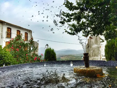
    As a border land, the history of Bedmar is sour in those centuries. Several times conquered by the Castilians and many others recovered by the Muslims, they resisted losing this bulwark on the northern limit of the Nazarite kingdom. The castle of the city, the torreon de Cuadros, the small castle of Fuensucia or the torreon of Fique, between Bedmar and Baeza, are some constructions of its defensive system. It was not the struggle, but a peace treaty (the one in Seville in 1310 between Fernando IV and King Nasr) that determined the passage to the Christian domain of the city. Yet a century later, in 1417, the Nazarites of the Kingdom of Granada would try to take the castles of Bedmar and Albanchez by surprise, but they did not.

    At that point, the villa already belonged to the Order of Santiago and, with the end of the Granada War, these lands, so far very insecure, are repopulated. Thus in the 15th century new houses are built, at first close to the castle, but then overflowing the limits of the fortress. The Catholic Kings granted the privilege of the villa to Bedmar, which was later endorsed by Charles V. King Philip II authorized his sale to Don Alonso de la Cave in 1512. Already separated from the Order of Santiago, Bedmar was the head of a marquee. As a lordory villa, it experienced a significant growth and urban renewal. From the 17th century are the main buildings: the chapel of Cuadros, the church of the Assumption, the church of the Conception... In 1882 Alfonso XII granted the city council the treatment of most illustrative and reaffirmed his shield of arms.
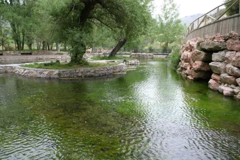
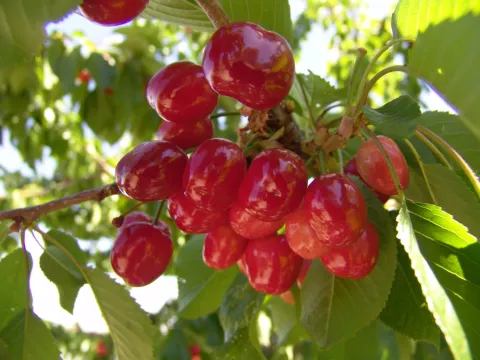
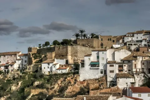
    Dominating the opposite bank of the Cuadros River, over a Altozano, is Garcíez. This core, originating in one of the villages of the term, has a signory origin. In 1973 a Voluntary Fusion Record was launched with

    Loading map
    Preparing points of interest and routes...
    Imagen principal
    imagen
    Image
    bedmar
    Imagen principal
    Activado