Saltar al contenido principal

Segura de la Sierra

Submitted by brandcode_deweloper on
Id
751057
Perfil de redes sociales
Facebook
https://www.facebook.com/ayuntamiento.segura/
Youtube
https://www.youtube.com/channel/UC0tAxfUQ5z6fv74Z3R6BrGg
Instagram
https://www.instagram.com/seguradelasierra_/
Descripción
Breve descripción

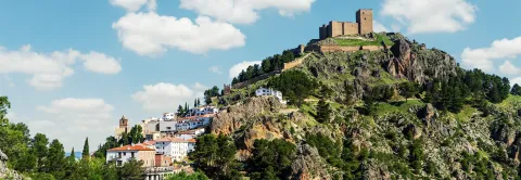
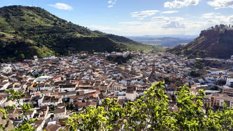
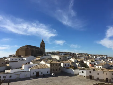
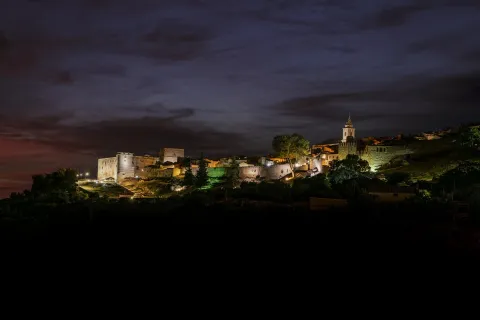
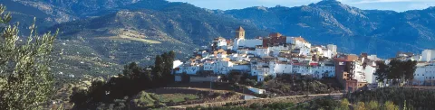
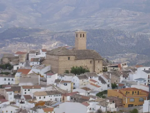
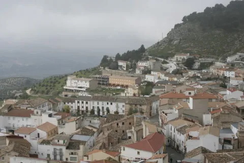
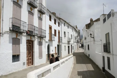
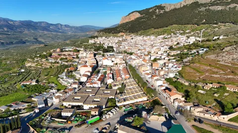
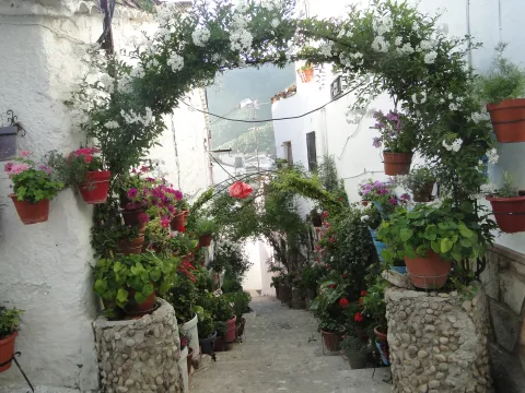
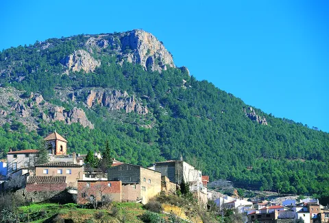
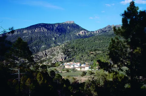
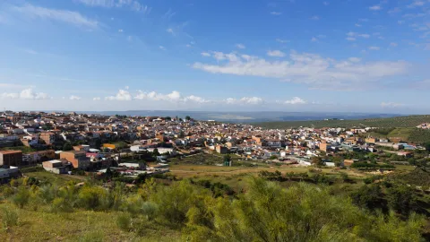
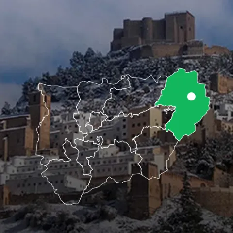
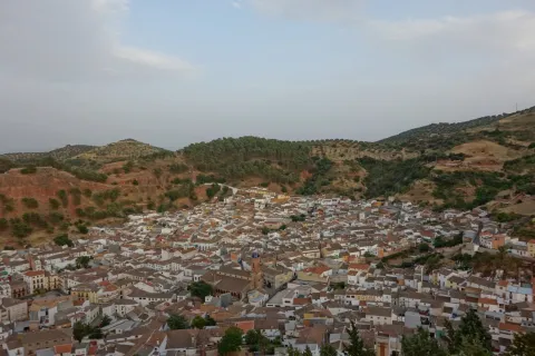
Segura de la Sierra is a beautiful villa located in the heart of the Sierra de Segura, located in the northeast of Andalusia. It is certainly one of the most beautiful peoples in Andalusia and, as such, is part of the most beautiful Peoples Network in Spain.

Segura gives name to a river, to a region and is synonymous with history. Visiting this town we can pack history and heritage in its urban centre or taste nature in its maximum expression in the many villages of its large municipal territory.

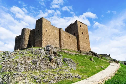
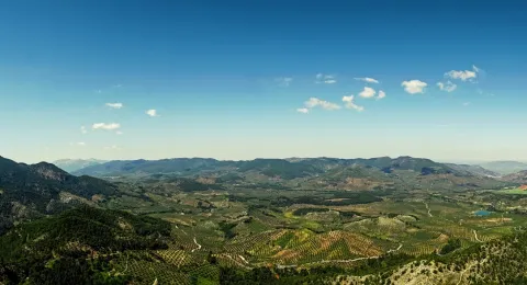
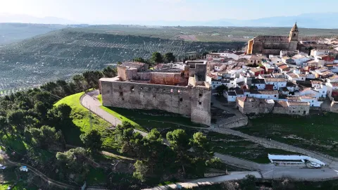
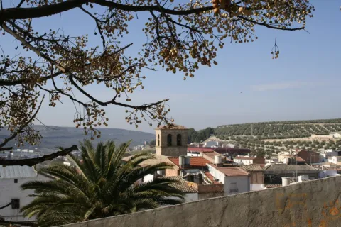
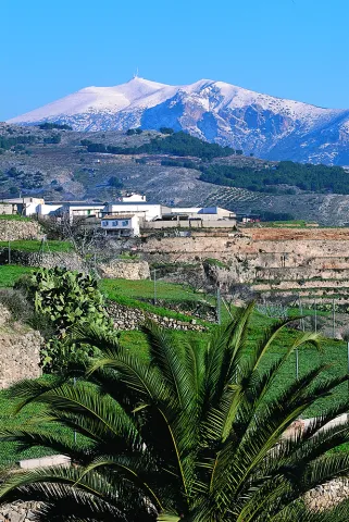
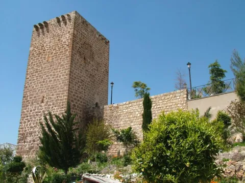
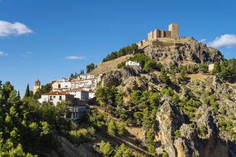
From its castle, of Muslim origin, you can see impressive panoramic views of the whole area, which is distinguished by its wide serrania, with an enormous natural and forest wealth. It is part of the Natural Park of the Sierras de Cazorla, Segura and Las Villas, the largest protected area in Spain.
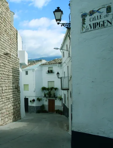
This wonderful environment, its streets and historical corners make Segura de la Sierra has been declared a Historical-Artistic Set and Pintoresque Park.

Segura de la Sierra and its high peaks served to illuminate the best literature of the Renaissance, by the hand of Jorge Manrique, author of the "Cops to the death of my father."
Telecomunicaciones
Teléfono
953 480 280
Sitio web
www.seguradelasierra.es
Fax
953 481 012
Correo electrónico
administracion@seguradelasierra.es
Ubicación
Nombre
Segura de la Sierra
Latitud
38.298850
Longitud
-2.651870
Distrito
Ubicación en el mapa
POINT (-2.65187 38.29885)
Imágenes
imagen
Image
18670190-05e7-df1b-a17a-e92e0d671cef?t=1603979935869
Imagen principal
Desactivado
imagen
Image
despegue-el-yelmo-jpg
Imagen principal
Desactivado
imagen
Image
84676aeb-bfa8-a851-5550-3b4d15c74706?t=1621445408264
Imagen principal
Desactivado
imagen
Image
6fde7b00-3201-46c4-e6c3-528a9d11093d?t=1595353573804
Imagen principal
Desactivado
imagen
Image
a66e4f4c-435d-565a-2c1d-47799e04c4ce?t=1595353573833
Imagen principal
Desactivado
imagen
Image
4e21d820-8e51-89a4-0274-af8aeb2894f0?t=1621445408309
Imagen principal
Desactivado
imagen
Image
8668c55e-f4f0-0979-0f1b-fbd53f037c7e?t=1621445408354
Imagen principal
Desactivado
imagen
Image
78496ace-41be-4e6a-cd26-a6097356a63d?t=1621445408397
Imagen principal
Desactivado
imagen
Image
d1c73291-0577-d6d3-7c68-b4cea6f8ac35?t=1595353574079
Imagen principal
Desactivado
imagen
Image
5a350abd-951a-6543-e791-3a83e2a39938?t=1621445408446
Imagen principal
Desactivado
imagen
Image
307ca2fa-ccf4-8ce0-302a-896577682bb1?t=1595353574160
Imagen principal
Desactivado
imagen
Image
4d621b1f-d10e-8b22-6bc0-9c2c2c218615?t=1621445408494
Imagen principal
Desactivado
imagen
Image
b5bce32c-dbd5-c32b-b191-af98ea79ea34?t=1621445408543
Imagen principal
Desactivado
imagen
Image
aeb6f7e7-dfc2-de87-6f7f-daaaadba363b?t=1621445408593
Imagen principal
Desactivado
imagen
Image
49a44de3-3e7c-ef37-cfb0-56a999ea436d?t=1602789076574
Imagen principal
Desactivado
Información adicional
Imágenes cabecera
imagen
Image
segura-de-la-sierra1-jpg
Imagen principal
Desactivado
Datos de interés

Tourist area: Serras de Cazorla, Segura and the Villas
Distance to the capital (km): 160
Altitude over sea level (m): 1145
Extension (Km2): 224
Number of inhabitants: 1986
Gentillo: Segureños
Postal code: 23379

Videos
Video file
Cultura

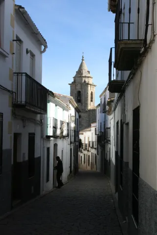
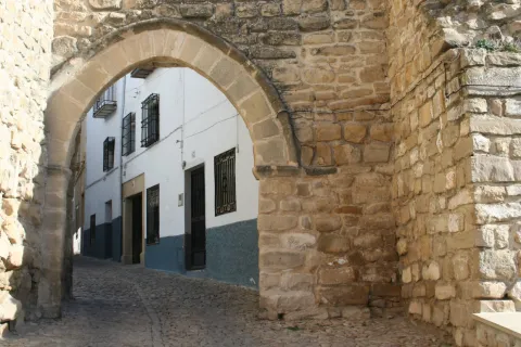
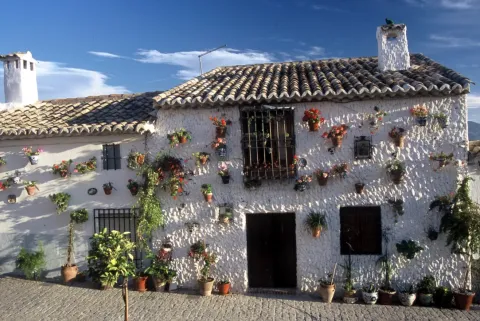
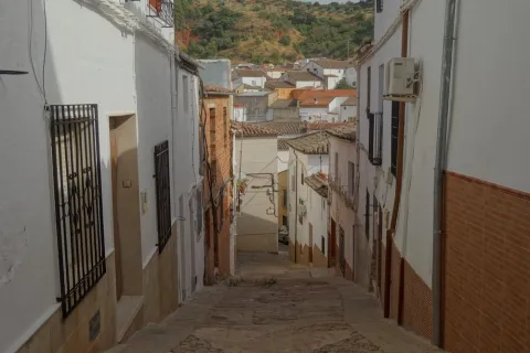
The villa offers the physiognomy of past times, preserving its steep and silent streets. From its rich and varied heritage, we highlight:

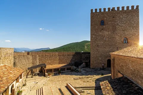
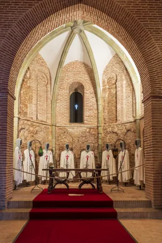
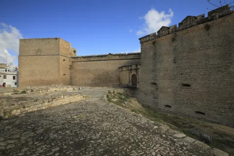
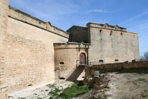
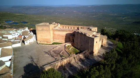
  • Castle.Of Mudejar origin, eternal vigil located in the highest of the village and surrounded by an old wall that still retains some turreons. The tower of tribute, which reaches 18.50 m in height and from which you can see impressive panoramic views of the Segura saw. Inside the castle we find: chapel, adarves, covered with wood and roofed in two waters, aljibe and Arab baths.
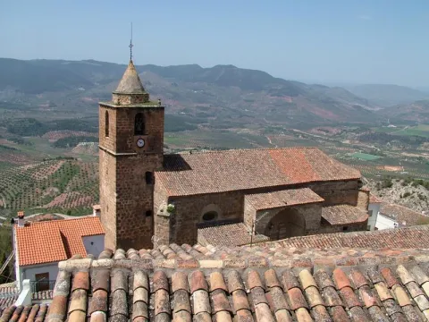
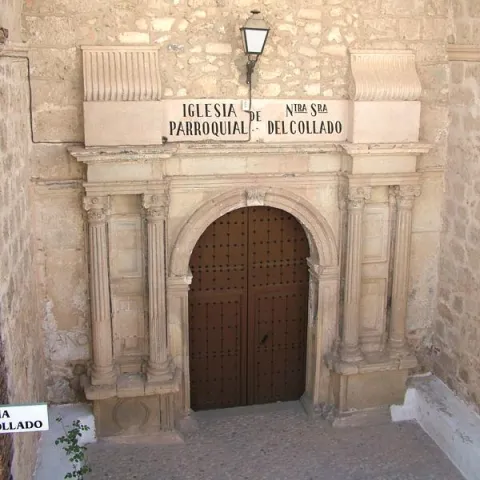
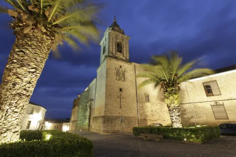
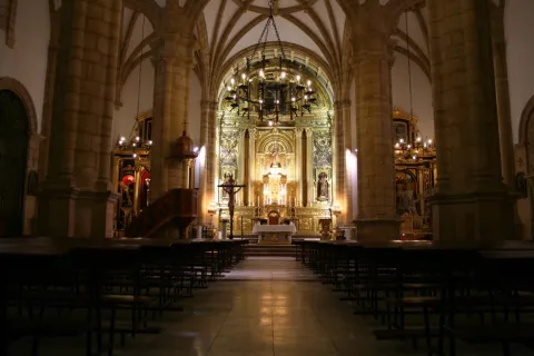
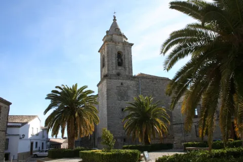
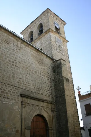
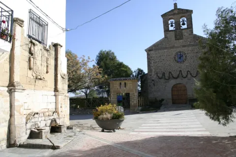
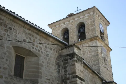
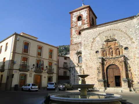
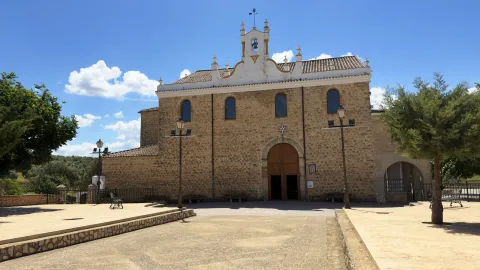
  • Parish Church of Saint Mary of the Collado. It was built in the 16th century on the site of the old Romanesque temple. The Napoleonic troops set it on fire and would be restored between 1814 and 1817. Its only ship is rectangular and of vaulted roof. On the outside, his tower built with masonry. With a quadrangular plant, it has its first body with a flask and a second body covered with an octagonal pyramid on which a forged iron cross goes. He has accumulated a rich religious iconography during his history.
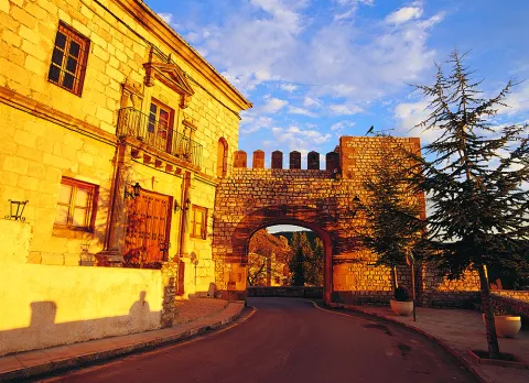
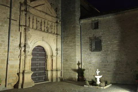
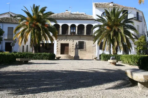
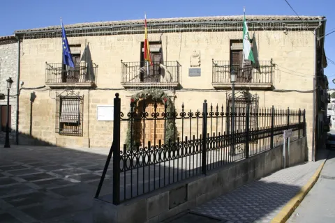
  • City Hall. Other Renaissance paradigm, old house of the Society of Jesus. It opens with an arched arch of highlighted keys, to which they flank crate pilastras and dotal column. The second body is embellished by a curved balcony, a triangular fronton decorated with tacos and noble oval shields with plucked helmets.
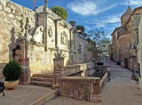
  • Imperial source. A monument that reflects the transition between the Gothic and the Renaissance. It is built in front of the church and dates from the year 1517. Presents a large fronton divided into three streets separated by Ionian columns. A large shield with the weapons of Carlos V. is displayed on the central street
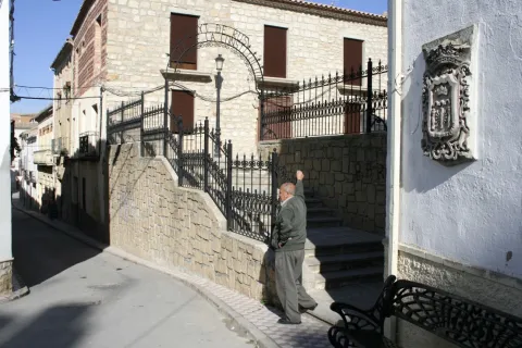
  • Casa de Jorge Manrique. The façade has a half-point arch decorated with vegetable motifs, flanked by crate pilasters and complemented by small Ionian columns. The nobility shield of arms of the Figueroa, the mother family of Jorge Manrique, was carved in stone.
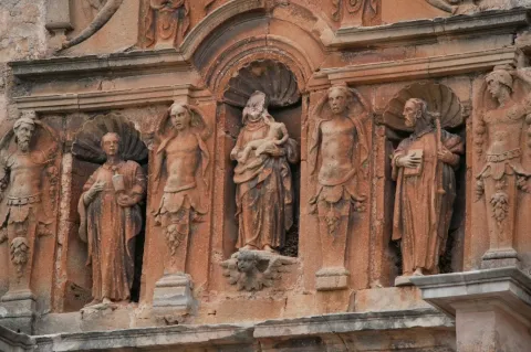
  • Church of the Jesuit. It is built in the last quarter of the 16th century. It has Renaissance decoration, with a half-point arch with reliefs of the apostles. This building has now been remodeled and turned into an event and exhibition room.
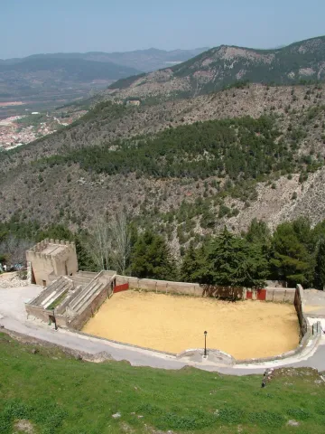
  • Bull's Square. It is located on the outskirts of the village in the old courtyard of weapons and chivalry. It's one of the oldest and most curious, being quadrangular.
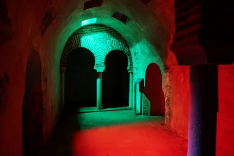
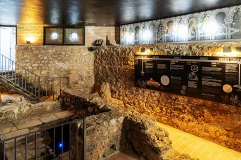
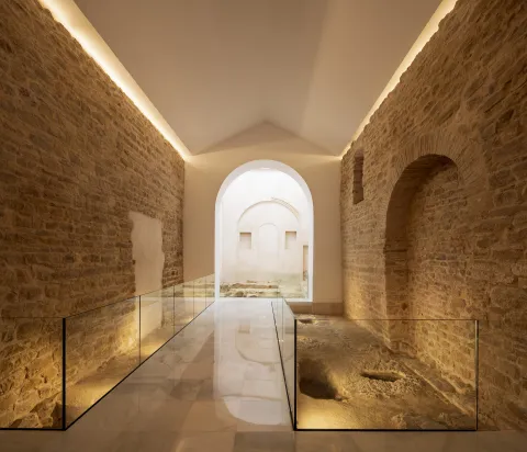
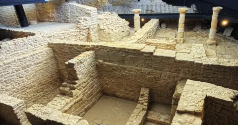
  • Arab baths (hammam). Used not only for hygiene and toilet, but also as social assembly centres. They were used by both men and women, but at different times. They consist of three longitudinal ships, corresponding to thecold room, the most external,tempered and hot, the innermost. They were tied with double horseshoe arch and canyon vault with skylights. It is estimated to be built between the 11th and 12th centuries.
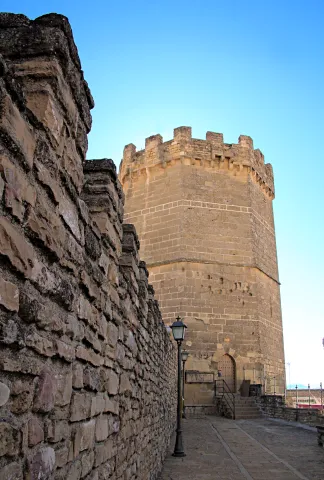
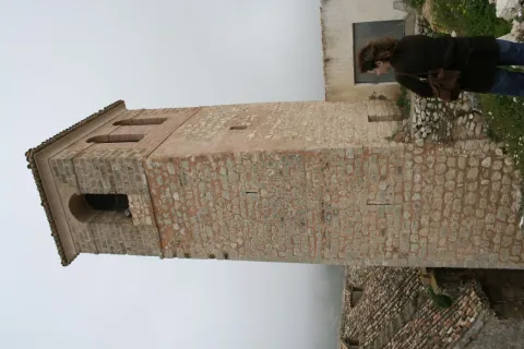
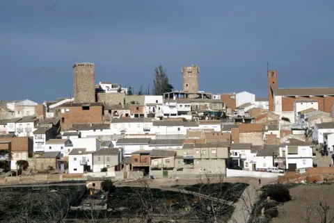
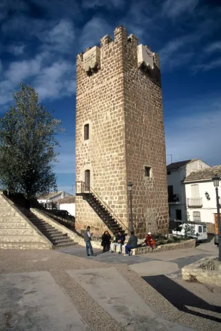
  • Wraith and defense. Many sections of the local walls can still be observed. One of the best preserved is the water tower, It is called that because its mission was to protect a water spring that supplied the plateau. Other still preserved are: The Era tower, the School tower and the Snow well. The latter space was used to store water and snow during the winter period and then to use them through drains that existed at the bottom.
  • Access doors. The way to access the Segura de la Sierra fortification was 4 doors: The New, the Gontar, the Catena and the Orcera.


Naturaleza

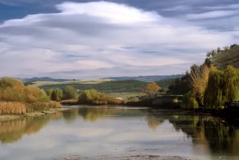
Segura de la Sierra is located in the center of the mountains to which it gives name, the entire municipal term is part of the PN Sierras de Cazorla, Segura and the Villas.

The flora, when there is such a great difference in height in the municipal term, it is different: high mountainLet's find the pino laricio, flexible and resin-rich wood, and lacquer; half mountain live the black pine, whose wood is very resistant to rot and can reach 45 m in height and tejoof slow growth, but of a longevity that can reach the age of 5,000; low mountainthe Pine carrasco, complaining, melojo oak, the oak, the oak, the coscoja, olive and other endemic and aromatic plants.

The fauna is also, like the flora, very diverse. So, we'll meet. Rapist birds and scavengers(eagles, lethand vultures, alimoche vultures...), animals of major game(deer, muflon, gamo, boar...) and minor hunting (perdiz, rabbit, hares, crow, crows, tortoises, doves and foxes).

They also live in various species of fish, like trout, barbo, boga, etc., andmammals,Like bat, mountain cat, chickenpox, badger, otter, fox and gin.

An area with enormous natural and forest wealth, place to feel that nature is alive.
 

Fiestas y Eventos

The Segureños celebrate the following parties:

  • Patrons of the Virgin of the Rosary. They have a place of 4-8 Octoberand are celebrated in honor of the patron. On the 8th the most emotional act takes place: the procession of the Virgin on the shoulders of the women of Segura. During these days there are taurine celebrations, which are held in the peculiar square of quadrangular bulls, and serrano bolus competitions.
  • Saint Vincent. It is the patron saint of the town and is celebrated the January 22. In his honor fire is on in the extramides of the villa. It is a custom that is very rooted in the saw that the winter festivities turn on "Luminaires"(bonfires). This is the day of" La Pura "(8 December), in Saint Lucia (13 December), Christmas Eve, New Year's Eve, San Antón (17 January), in San Vicente (22 January) and ending at the Candelaria (2 February).
  • Romeria de San Isidro. It is the pattern of the New cuts, the most important pedany of the many that Segura has. It is held in the area of the Lomilla, by the village The Ojuelo.
Gastronomía

The gastronomy of Segura de la Sierra is rich and full of tradition, has been able to combine the agricultural customs with those of the pastors or those dedicated to the works of the wood, carried out by the cut of pine trees in this saw.

The diversity of the dishes that we find in the town is characterized by the use of the products we find in the area: olive oil, mountain meat in hunting season (boar, perdiz, rabbit, soybean sheep) and, in concrete seasons, mushrooms and niscalos (guízcanos) or asparagus that are so well given in the saw.

  • Galians, bread cakes, rabbit and spices.
  • Andrajoswith flour, meat and spices.
  • The Migasof bread, to which is added chorizo, torrezos...
  • The Gachamita, flour and potato that is accompanied by all kinds of dressing, both sweet and salty.
  • Lamb to the young shepherd, pastoralist chard, lamb in cabañil garlicIn all these dishes, the base is the same: the following sheep's meat.
  • Pisto gandul, made of goat, lamb or rabbit and is to then consume in fairs or evenings. Hence the name of the gangul.
  • Cecinaof sheep's or goat's meat that has been cured.
  • Ajopringueis consumed in the massacres and is made with the pig liver It's a bit.

In pastry, the bake, a dessert of oil cake that carries a hard egg in the middle.

Historia

The history of the term Segura de la Sierra dates back to the 4th millennium BC, according to the many archaeological sites that testify to the human presence in those times.

Very close to the city centre is the settlement called The Old Onea few kilometres from the village of Moralejos and that it has always been attributed to peoples as Iberians and Phoenicians, being later the scene of wars between Romans and Carthaginians.

But it is, no doubt, with the Islamic people (781) when the population they call Saqura lived the golden era as a strong square in the area. In the 9th and 10th centuriesAfter the collapse of the Cordoba caliphate, Segura de la Sierra has several periods of independence that make it important.

It will be conquered by the Christian troops, becoming dependent on the Order of Santiago by the donation of Alfonso VIII. In 1243, with King Fernando III, he passed to the crown of Castile and within the kingdom of Murcia until 1833, the year in which the current province of Jaén was created.

In 1517, after the visit by Carlos I to the square, the fountain is built in his honor. A Renaissance source, though clearly of transition. In 16th century had a a time of great splendor, provided by the large amount of wood produced in its territory and which, transported by the Guadalquivir River, supplied all of Andalusia.

In 18th century, the State has converted the saw, under the name of saw of Segura, Maritime Province, No doubt you need wood for the construction of your ships. The Napoleonic invasion (1810) turned the population into a huge stake, destroying the files and taking part of its history.

illustrious characters:

  • Jorge Manrique (1440-1479), a Spanish poet and author of "Cops for my father's death," considered one of the capital works of Spanish literature. The origin of his birth is discussed with Paredes de Nava (Palencia)
Otra información

We want to place on record two traditions that are very deep-rooted in Segura de la Sierra:

  • The serrana jack. Of the popular dances of Segura de la Sierra, no doubt, the serrana jota is the one with the greatest personality. It is interpreted alone or with whole or half-ways, usually, in popular parties.
  • Via living crucis. It is interpreted by the neighbors of the village and is developed in different places of the town, with excellent views of the Segura saw.
     
Loading map
Preparing points of interest and routes...
Imagen principal
imagen
Image
53a920a5-6491-8831-30ac-3d989e48192e?t=1603979644641
Imagen principal
Activado
Literatura

This town may have been the birthplace of the warrior-poet, since his father was Commander of Segura de la Sierra, the most important commandery of the Order of Santiago. In fact, the Manrique family home is still preserved today.

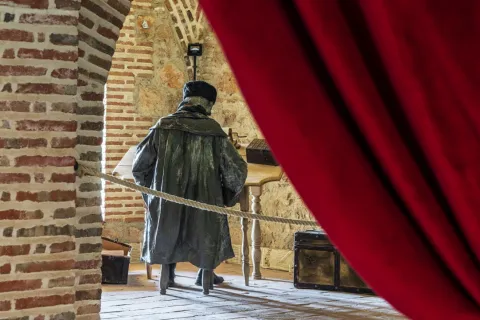
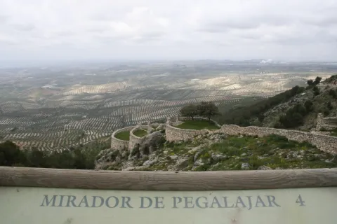
Segura de la Sierra pays tribute to the poet not only by marking the Manrique family home, but also by building part of its tourism offer around Jorge Manrique, dedicating several rooms of the castle to interpretation spaces devoted both to the poet and to the Order of Santiago.Segura de la Sierra also pays tribute to the illustrious writer with a statue-monument and with a magnificent viewpoint offering sweeping views of the Natural Park from the village itself.

The tribute to Jorge Manrique culminates with the biennial Jornadas Manriqueñas, an event combining academic and leisure activities as a way of honouring this illustrious figure.
Santisteban del Puerto

Submitted by brandcode_deweloper on
Id
750817
Perfil de redes sociales
Facebook
https://www.facebook.com/Santisteban-del-Puerto-356879824344518/
Descripción
Breve descripción

Santisteban del Puerto is a municipality in the district of El Condado, of which it occupies the central strip and is erected in the main center of the region.

It is located in the foothills of Sierra Morena, to the north of the province, in the Loma de Chiclana, between the Guadalimar and Montizón rivers.

The mountain spaces are abundant, especially in the northern half. Most of the surface is not cultivated, with wood and natural meadows predominant.
The cultivated lands are basically devoted to olive trees.

The economy revolves around the olive grove, the almazara industry, the sheep cattle and the larger and smaller cynegetic activity, without forgetting the hotel.

In relation to its architectural heritage, the church of Santa María del Collado stands out, in it the Renaissance, baroque and silver styles are mixed. The 15th century church of San Esteban, Gothic and the Museum of Jacinto Higueras.

Telecomunicaciones
Teléfono
953 402 112
Sitio web
www.santistebandelpuerto.es
Fax
953 402 424
Correo electrónico
santisteban@promojaen.es
Ubicación
Nombre
Santisteban del Puerto
Latitud
38.248430
Longitud
-3.206180
Distrito
Ubicación en el mapa
POINT (-3.20618 38.24843)
Imágenes
imagen
Image
976b7b1b-160c-39cb-9ad2-e688c8639eb0?t=1595425513394
Imagen principal
Desactivado
imagen
Image
aee6a063-30ab-69cd-08a1-0d8f72af4931?t=1595425560348
Imagen principal
Desactivado
imagen
Image
02e4b92a-313f-225e-fc99-01573197eff9?t=1621444513085
Imagen principal
Desactivado
imagen
Image
98a1b640-1935-3050-973e-f7da7a31a259?t=1621444513137
Imagen principal
Desactivado
Información adicional
Imágenes cabecera
imagen
Image
Santisteban del Puerto
Imagen principal
Desactivado
Datos de interés

Tourist area: Sierra Morena
Distance to the capital (km): 104
Altitude over sea level (m): 681
Extension (km ²): 373
Number of inhabitants: 4,472
Gentillo: Santistebeños
Postal code: 23250

Videos
Video file
Cultura
  • Church of Santa María del Collado. It is the main of its churches, built between the 13th and 18th centuries on another Visigode of the 7th century. It consists of three ships, separated by columns with unique visigoths capitals of the early church. The deck is made of wood. The central apse to which it is accessed by an arch pointed from the silery includes a silverware that communicates with the baroque shrimp. In its interior the plastic art: the wooden gate of the chapel, the carved wooden altarpiece and the choir's silery. In exteriumr, the two covers, one Gothic with pointed bow and the other Renaissance; the Renaissance portico with five sillery arches, supported by brick pillars on the basements of a quarry. Declared Good of Cultural Interest in 1978.
  • Church of St. Stephen. It is started in the 15th century and is prolonged in the following. The medieval factory shows basic plant. The central ship is separated from the sides by half-point arches based on pillars. In his outside the masonry, the red brick with neogotic elements of the cover and the neomudéjars of the tower, to which it covers a conical polygonal dome of blue ceramic.
  • Egido hermitage. The Hermitage of the Egido or the Collado, to which the legend relates to the parition of the Virgin, was built in 1624. There's almost nothing left of his primitive Romanesque trail. It is the result of reconstructions of different times. In the interior it stands out its magnificent wooden cover with armor of tradition mudejar to two waters in pair and row.
  • San Esteban Castle. A fantastic look at the historic centre of Santisteban del Puerto, declared Good of Cultural Interest in 1985. Few remains remain of it or of other fortifications such as the Castle of Torre Alver or the Tower of Ero, all declared Good of Cultural Interest. Although the configuration of an altomedieval organic urbanism in its historical center has been preserved, it has been worth it that it has also been declared Good of Cultural Interest.
  • Poyato Tower. It is a tower of tribute, belonging in its time to a rural castle of the 13th century.
  • Archaeological heritage. The Iberian period pieces found in the estate of Perotito and are currently in the National Archaeological Museum (Madrid). In the municipality of Santisteban there are also the coats of the Cerro de la Caldera, the Alamedilla and the Morciguilla de la Cepera, and the Cave of Apolinario, all declared Good of Cultural Interest.
Naturaleza

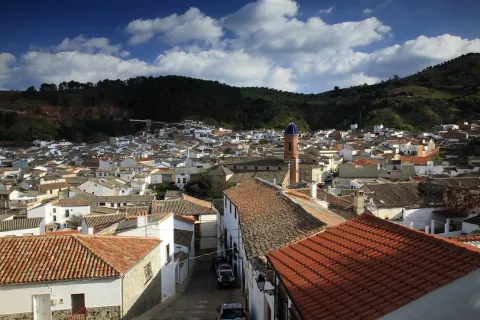
Santisteban del Puerto is located in the Sierra Morena foothills, its urban core in which white houses predominate is loaded with history. The location of its old castle offers excellent panoramic views from where we can see the beautiful layout of its urban centre.

Within the Natural Heritage of Santisteban del Puerto there is a wide variety of endangered species of Mediterranean mountain like, for example, the black vulture, the Iberian lince, the royal eagle and the leonate vulture. Animals who find their last shelters in these spaces.
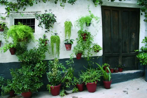
In this town, olive groves, livestock and forest resources draw a diverse and high environmental quality landscape.

Among the many natural enclaves that the municipality has, we mention:

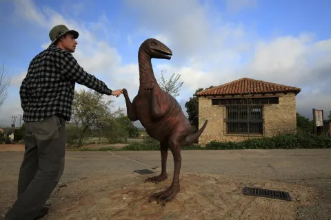
  • Footprints of Dinosaurs: This is a set of 24 dinosaur tracks which extend over an area of about 20 m ². Scientists attribute the prints to a arcosaur, a 230 million-year-old bipedo. The place is perfectly conditioned to visit, with information panels and recreational area for the little ones. It is located only 1 km away. of the city centre. It has been declared by the Junta de Andalucía Monumento Natural.
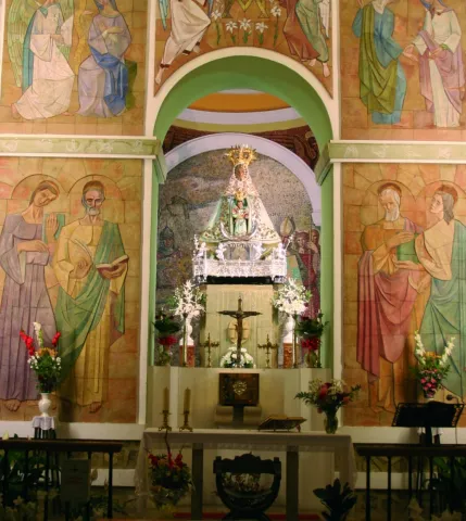
  • The Whale: It's located 30 km away. to the west of the town, by the river Gloves. It is a magnificent place to discover the flora and fauna typical of the Sierra Morena massif, especially the Mediterranean forest.
  • The Butcher. It is a municipal estate and an ideal place for the practice of major hunting, deer, boar, muflons, let's go... We can enjoy looking at the typical plant species of the Mediterranean forest and an interesting alcornocal. It is located to the north of the town, in the heart of Sierra Morena.
  • The Vultures. Another extraordinary place to discover the fauna and flora of Sierra Morena, especially the Mediterranean forest. It is located to the north of the town, just to the limit with the province of Ciudad Real, near the river Guadalén. To get to him, we'll have to go up with him. "Sierra lane" for 30 km.

Several rivers go through the municipal term: El Guadalquivir by the south, delimiting the term for several kilometres with the neighbouring town of Villacarillo; the river Montizon which crosses the municipal term in the north of the city centre; and the Guadalén and Gloves, further north.

That is why the riverside forests next to the rivers, chopos, willows, strawberries, mimberas, tarays... they draw a color brush with the passage of the seasons, especially striking during the fall. Reptiles, amphibians, trout and barbos complete the rich and varied fauna of Santisteban del Puerto.

Fiestas y Eventos

Among the parties held in Santisteban del Puerto, we mention:

  • St. Stephen, on December 26. It's the party of Pattern. In his honor that day will rise a monumental stake.
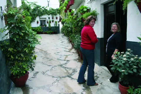
  • Saint Anton, January 17. It continues with the tradition of burning fires. It is the feast that closes the festive cycle of Christmas, as announced by the saying: "As far as San Antón, Pascuas are, and if there is a dungeon as far as San Fabian" (20 January).
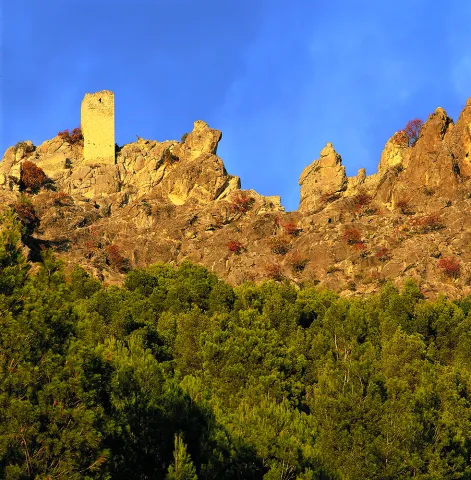
  • La Candelariaon February 2. The night before will be on Lamps to celebrate. To light the lamps will be used "ramon" of the olive pruning. This day, the Municipal Corporation, accompanied by the "mayordomy," will go to light lumbres in front of the house of the Big Brother and the Mayordomo, inviting the present to sweets and liquors.
  • Pentecost parties. They are the patron parties in honor of the patron, The Most Holy Virgin of the Coronado Necklace, popularly called "Pascumayo Party." The events begin on Palm Sunday, continue on Resurrection Sunday, on Monday and Tuesday Easter, until the Monday of Pentecost, when the call takes place "Taking the picture"in which, through a particular rite, it is designated who will take over the "mayordomy," and which among other missions, has the one to organize the holidays of the Virgin of the following year.
  • Another event that cannot be missed at the parties are the uprooted Broad cattle coils.
  • San Marcos, April 25. Date of departure "Get the devil away." and to take a bake, which by its form is called "San Marcos rosco."
  • Mayo night. It is a popular party at which at 12: 00 p.m. on the night of April 30, the sanctistebeños and visitors go up to the church of Santa María del Collado to sing the "Mayors.", one Jota who welcomes a month, accompanied by the Band of Music and the Tuna.
Gastronomía

As in many other places, the sanctistebeans use in the kitchen the ingredients that the environment provides them: mountain meat (rabbit, hare), mushrooms, slaughter products, fruits and vegetables from their gardens.

The slaughter of the pig is a tradition very rooted in Santisteban del Puerto, not only for the products that are obtained from it and that will use in the kitchen the rest of the year, but also because the killing has always been synonym of party, of neighbouring harmony and family reunion. By preparing special dishes to pay tribute to the guests on that day, it is the case that "Ajopuerco."

Among the most traditional dishes are:

  • "Ajopuerco," that is made with the pig liver, grated bread, almonds, onion and parsley, leaving it to cook later in the pan.
  • "Paid potatoes."That in other places you call the poor potatoes. They consist of potatoes cut into thin slices, with onions, peppers, parsley, passed through the frying pan. A tasty dish that can be eaten alone or as a companion of meat or fish.
  • "Covered with rice," It is a typically sanctisterean, forceful dish that served as a reconstituent of the forces after a hard working day.
  • "Andrajos with hare". It has as ingredients water, flour and salt for wafers. In the frying pan a saffrito of tomato, garlic, onion, green pepper, a little spicy and rabbit, hare or partridge. When cooked the meat is added the wafers and let be boiled. They're served in the same pan.
  • "Ajoharina": A saffrito is made with tomato, onion, potato and eggplant. In the frying pan, dry red peppers are tasted, once toast is crushed in the mortar with cumins and salt. When everything is ready, water is added and at the end flour is to be weighed.
  • "Acholamalo.". They eat potatoes, dry peppers, tomato and salt. Once cooked they are crushed in the mortar and water is poured from the cooking of the potatoes, and oil, onion and cod are added.

Piping: Most sweets are associated with the festive cycle:

  • "Roscos de San Marcos", have their origin in the traditional bakes that were prepared with painted eggs.
  • "Charity.", which are held at the parties of Pentecost in honor of the Patron, the Virgin of the Collado. Three pieces of collation are distributed, some "bakers of charity" and a piece of bull meat.
Historia

The first settlers have bequeathed us a great set of Rupestrian Paints, including the the cave of Apolinario mid-fourth millennium BC

During Bronze age, II millennium BC, and linked to the consolidation of the metallurgy of Sierra Morena, there was an intense occupation of these lands with several villages.

The origins of current location date Iberian stage, a oppidum (fortified village), identified as Ilurgeia. This town would leave us the treasures of "Experts"(currently at the Archaeological Museum of Madrid) and the"Alameda"(at the Provincial Archaeological Museum).

During the Roman era the Via Augusta and fortification of peoples.
It is the Visigoths who change the Roman name of Ilugo for San Estebanfrom which the present name derives.

During Islamic period is mentioned as Sant Astiban or Sant Istiban.

From the al- Andalus period we have remained strong like that of San Esteban, Torrealber or Poyato.

The Christian conquest was carried out by Fernando III in the year 1,226. Your son, Alfonso X Santisteban as a village to Ubedawhich would be for a short time, since in 1285 Sancho IV granted the Villa Real's privilege.

From the 14th to the 19th century, Santisteban's history was linked to the House of the Benavids. In this situation it will remain until 1,812, the year when the Cortes de Cadiz decreed the abolition of the Lordships.

For many years there have been disputes over the demarcation of municipal terms between the three towns that made up the county, Santisteban, Castellar and Navas de San Juan.

Loading map
Preparing points of interest and routes...
Imagen principal
imagen
Image
Santisteban del Puerto
Imagen principal
Activado

Sabiote

Submitted by brandcode_deweloper on
Id
750335
Perfil de redes sociales
Facebook
https://www.facebook.com/AyuntamientoSabiote/
Twitter
https://twitter.com/SabioteAyunt
Descripción
Breve descripción

Sabiote is a municipality in the centre of the province of Jaén, located in the region of La Loma and Las Villas, on the top of the inter-river plateau, bordered by the north by the Guadalimar River and the south by the Guadalquivir River.It is the third vertex of the call "La Loma Renaissance triangle," Chair of the best Renaissance along with Ubeda and Baeza.

It is also part of the widest "South Renaissance Route"along with Ubeda, Baeza, Canena and Villacarillo, a whole range of monuments, corners and places of the region with which it is intended to attract the interest of tourists.Walking through Sabiote is nice, as the entire villa has an excellent state of conservation. Their homes and their preserved and cobbled streets are splashed with blasphemed houses.

The economic base of the municipality agriculture of the olive tree, in the form of a monoculture as in the rest of the region. The crafts It also has implementation in the locality: articles made with sparto and palm, gardening made with leather and wool carpets.

The exploitation of its historical attractions is being enhanced to boost the attraction of tourism.

The best sample of the local architectural heritage is, no doubt, the Castle, which has its origin in an ancient Spanish-speaking alcazaba, which later, Mr Francisco de los Cobos, transformed into a Renaissance palace.

The parish church of San Pedro, a mixture of Gothic, plastic and Renaissance style; Hermitage of San Ginés de la Jaraof the 18th century and the Monastery of Carmelitas Descalzas of Renaissance ethyl.

Telecomunicaciones
Teléfono
953 773 002
Sitio web
www.sabiote.com
Fax
953 773 503
Ubicación
Nombre
Sabiote
Latitud
38.070120
Longitud
-3.309740
Municipio
Ubicación en el mapa
POINT (-3.30974 38.07012)
Imágenes
imagen
Image
75d4600b-20b5-6914-cb11-863b8e9bfb6c?t=1621358282523
Imagen principal
Desactivado
imagen
Image
898d58ff-f025-34e2-21e5-3806a8805773?t=1621358721532
Imagen principal
Desactivado
imagen
Image
071b9b26-8ccb-9642-ec42-2832066b9210?t=1621358721697
Imagen principal
Desactivado
imagen
Image
dacdacbe-d81f-539a-e826-17dea56944f3?t=1621358282578
Imagen principal
Desactivado
imagen
Image
ffa72b86-f7d5-9dd1-f0fa-034389cb7f22?t=1621358721746
Imagen principal
Desactivado
imagen
Image
6573dcf7-4b5e-9f6e-45a3-4919d96eaf83?t=1585842724448
Imagen principal
Desactivado
imagen
Image
3eeff34b-f2d1-a061-0424-a93bf0e083cc?t=1627996237182
Imagen principal
Desactivado
imagen
Image
ae0f9b59-9086-4bb0-7307-05de12e62bd4?t=1621358282756
Imagen principal
Desactivado
imagen
Image
d2a39c8f-945d-8fe9-3b46-a7786229e5d8?t=1621358282806
Imagen principal
Desactivado
imagen
Image
c9db30f7-6ee4-738d-b3e6-2193bea160df?t=1621358282866
Imagen principal
Desactivado
imagen
Image
73b43b3e-6187-c512-d2fe-7636bb7c4286?t=1621358282919
Imagen principal
Desactivado
Información adicional
Imágenes cabecera
imagen
Image
Sabiote
Imagen principal
Desactivado
Datos de interés

Tourist area: Ubeda / Baeza
Distance to the capital (km): 64
Altitude over sea level (m): 840
Extension (km ²): 112
Number of inhabitants: 4,302
Gentillo: Sabioteños
Postal code: 23410

Videos
Video file
Cultura

In general the villa has an excellent state of conservation, so when walking through its streets it easily transports us to preterito times.

The views from the walls or from the viewpoints are truly spectacular. Among the most prominent monuments are:

  • Sabiote Castle. It was built on 13th century, Although this hill must have been a fortified place in all previous civilizations. The ancient Muslim alcazar is placed on a small mound, where it rises its signage door preceded by a pits. The current appearance of strong walls and elegant and imposing bastion is due to the reconstruction in the 16th century, Mr Francisco de los Cobos, Secretary of Carlos V., The reform was carried out by Andrés de Vandelvira and is inspired by the Italian Renaissance fortifications. Unfortunately it was Flying by the Napoleonic troops, so internally there is only one outline of what was an outstanding work of art. It has an accused military character. Its great Renaissance facade of silery and quarry, as well as the large pentagonal towers, stands out. declared Good of Cultural Interest since 1931 and its walled enclosure Historical-Artistic Set in 1972..
  • Parish Church of San Pedro. The perspective it offers is oversized for a parish temple. Reconstructed in the 16th century, with a drawing of Alonso Barba, disciple of Vandelvira. The North cover It's style. isabelin Gothicbut in the south, or Puerta del Sol, the protoplatereco. A large corner arch holds all the weight of the monument in that southern part. Your magnificent tower is striking.
  • The wall. That until just over a century ago surrounded the villa in its entirety. They stand its two-thirds share, as well as two of the six doors, that of the Saints and that of Granada, plus the arch opened in the 19th century.
  • Convent of Barefoot Carmelites. This convent recalls the presence in La Loma de San Juan de la Cruz. It was founded on 1584 by Francisco de los Cobos and his wife, Maria de Mendoza. With a Renaissance style, it has a beautiful cloister with half-point arches and dórica columns. This cloister was designed by Alonso de Vandelvira and Luna, "Architect Mayor de Sabiote," in 1586. The church, under the title of St. Mary, was built on an earlier Romanesque. Inside it is preserved the high chorus grille, the large wooden beam that holds it and at its extremes it is viscated with angels and the shield of the Order of Carmelites. It is believed that the cover of the temple is due to the great Alonso of Vandelvira. The City Council has now rehabilitated it as a House of Culture.
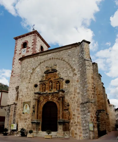
  • Hermitage of San Ginés. Apart from the historical core, it is dedicated to the pattern of the villa. It was built in the 18th century. It has a half-point and triangular front cover.
  • Barrio del Albaicín. Of the different neighborhoods that make up the urban town, this is the one that best preserves the taste of the past, that of the old neighborhood where the streets are of pebbles worn out by hundreds of years of traffic, of gone and coming, where each house has its own history.
Naturaleza

Sabiote with an extension of 112 km2 and at an average altitude of 840 m. on the sea level, it is on the top of the plateau of La Loma, framed by the Guadalimar River to the north, and by the Guadalquivir River to the south.

The view that offers us its term is typical "olive seas " that in a soft way, both on the north and south slopes, they go down until they find the valleys of the Guadalimar and Guadalquivir rivers, to the north and to the south, respectively.

From the urban centre panoramic that are visible are spectacular: to the north the foothills of Sierra Morena, to the south Magina saw and the depression of Guadalquivir, and to the east the Serras of Cazorla, Segura and Las Villas.

But in addition to this great framework in which it is located, Sabiote has places of special interest, including:

  • Cañada Real del Paso, recreational area just 3 km. of the town of the town.
  • The Source of the Corridor. It is a natural mushroom of great beauty with a natural waterfall and a cave in the vicinity.
  • The Source of HealthIt's his stalactites and the birth of a stream.
  • Olvera's jump, a water jump over the Guadalimar River, where we can practice the fishing of the barb.

The Sabioteños the plant resources which offers them the ground to maintain some traditional activities. We can still find samples of the craft made with spartum and palmand the most traditional gardening made of leather and wool carpets.

Sabiote, in the shadow of Ubeda can go unnoticed, but we have already seen that it is a town with a historical-artistic heritage and a natural heritage that makes it a worthy representative of the most characteristic of the region of La Loma Fuck you.

Fiestas y Eventos
  • Holy Week. When Holy Week comes, Sabiote, he takes his works of religious art to the streets to commemorate the Passion of Christ. Its origins start in the 16th century when the first cofradies were created, Our Father Jesus Nazarene, Our Lady of Soledad and that of the Most Holy Christ of the Exhibition. An assistance that is increasing over the years, both for the quality and value of the sizes and for the bands of music, which are dressed in nazarene perform process marches.
  • San Ginés, whose celebration dates back to the times of Fernando III. They take place between 22 to 26 August. The day 25, day of the Patron, the image of the Saint Gines is processed from the church of St. Peter the Apostle to the hermitage that bears his name. At the end of the procession, the traditional auction of the threads takes place. As a farewell to the parties, a pyromuscular show is held.
  • Horse racing. On the occasion of the Festivals of the Virgin of the Star (May 1) The Middle Ages-style horse races are developed. The races take place on the football field and are held at 12 in the morning and 6 in the afternoon.
  • The bulls. The Taurin tradition of this town dates back to the 16th century, celebrated in portable squares until 1914, Sunday of Resurrection, the day on which the fixed bullring was opened. The day 24 August, local copattern party, is the Main Taurin Day. The first swords of the tauromaquia have passed through this square.
  • The fire of Saint Anton, January 17. The day begins with a religious feast attended by farmers, farmers, craftsmen and the Big Brother. At the end of the Mass the procession of the saint through the streets of the town. At the end of the procession, the Big Brother offers a refreshment to the attendees. In the afternoon the traditional fires where smoke cigarettes of matalahuga and eat chickpeas.
  • Virgin of the StarMay 1. She's the patron of Sabiote. In the early morning of this day she is processed on the streets. In the Rosary of the Aurora it is moved to the hermitage of San Ginés, where the Eucharist is celebrated, the Maya are sung and the traditional one is offered to the faithful charity of bread and oil, green beans and wine. In the afternoon, after the prayer of the Rosary, Our Patron is processed until the parish done will remain during the month of May for the offering of flowers, being returned to his sanctuary on the last Sunday of May.
  • The Virgin of the Head. The Sabiote Brotherhood is one of the oldest to attend the Romany.
  • La Candelariaon February 2.
  • San Isidro Labrador, patron of farmers who exhibit their machinery.
  • Santa Rita, on May 22, although the hermitage of this saint is in the jurisdiction of Villacarillo.
  • Corpus Christi.
  • Carnival.
Gastronomía

This town has a wide variety of traditional dishes and some with clear reminiscent of the civilizations that have been on these lands. Among the dishes with the most roots in the population, we highlight:

  • "Andrajos": cooked in the broth of boiling minor game pieces with peppermint and a saffrito of vegetables and strips of flour made of jirones that take the name of "talarines."
  • "Ajoharina": A saffrito is made with tomato, onion, potato and eggplant. In the frying pan, dry red peppers are tasted, once toast is crushed in the mortar with cumins and salt. When everything is ready, water is added and at the end flour is to be weighed.
  • "Bread migas." They are accompanied by chorizo, torreznos, rabanillos, olives, and fruits like grapes or melon.
  • "Hare hair soup." That's what the tomato soup is called.
  • "Sabioteña Salad." It has cucumber, melon, orange, tomato seasoned with olive oil, chopped garlic, oregano, salt and vinegar.
  • "gazpachos salad." The aquasal, oil and vinegar are added with chopped onion and toast.
  • "Stand up." It is a modest spicy dish of La Loma that is made with saffrito of vegetables, trimmed with flour, toast and colored with pimenton.

Among the daily dishes are:

  • "Muchero," The one who in Sabiote is called "widower" when he has no meat.
  • Cortiser riceIn addition to the dressing, it only has a few chopped potatoes.
  • Eggplant tortilla.
  • Panets: are meatballs made with bread miga and unscratched cod pieces.

From the sweetness stand out:

  • Roscos de San Ginés. They are deposited in the ways of the saint when he moves to his hermitage, auctioning himself at the end of the procession.
  • "Whites."Of Morisca tradition, it is a mass of oil, flour, egg, and covered with a fragile layer of sugar, egg clear and a lemon chorreon, then taking a solid consistency the white or white bath.
  • Other: drunks, buds, cinnamon and powder.
Historia

It is likely that first settlements daten of the Copper Age, and they would be located in the fertile lands by the Guadalimar River. These settlements are characterized by being watertight settlements, establishing platforms on which the houses would be located, with stone sockets. Remains of these settlements have been found in the area called "The Coward" and "Cerro de la Mula."

We will no longer have any information until the end of the Iberian stage, between the 2nd and 1st centuries. C., where we find a town on the flat on the site "Avenazar's Cortijo," on a terrace of the Guadalimar with 20 or 30 houses.

In the Roman era, the first century, the population is occupied by the small peasants, known as villas.

With the Muslim era, centuries VIII - X, the strategic situation of being on the hill would lead to a "hisn," a shelter, to which the occupants of the houses would come in case of danger. This core would be fortified in the ninth century.

This settlement would be conquered by Fernando IIIbetween 1227 and 1229, and that years later, his son, Alfonso X, to the Order of Calatravawhich would strengthen medieval fortification, to which it would belong until the early 16th century. The Military Order would sell the villa with its land to Francisco de los Cobos, Secretary of Charles V, and after his son Philip II. At this time the castle would be reformed to make it a palace.

The Napoleonic troops when Sabiote left, 1808They would fly the interior of the palace.

As of this date, stability is reflected in the population increase from Sabiote, which at the beginning of the 20th century already had with 7,000 inhabitants. A population that lives from agriculture, mainly from cereal and vineyard cultivation. It will be from the last century when we begin to replace the cultivation of the cereal with that of the olive tree.

The social convulsions of the first half of the 20th century, as well as the Civil War and the emigration to the provincial capitals or industrial areas, will be the causes of population loss to reach 4,302 inhabitants at present.

Loading map
Preparing points of interest and routes...
Imagen principal
imagen
Image
Sabiote
Imagen principal
Activado

Rus

Submitted by brandcode_deweloper on
Id
750215
Perfil de redes sociales
Facebook
https://www.facebook.com/ExcmoAyuntamientodeRus/
Twitter
https://twitter.com/AytoRus
Youtube
https://www.youtube.com/user/ayuntamientorus
Instagram
https://www.instagram.com/ayuntamientoderus/
Descripción
Breve descripción

Municipality located to the north of the region of La Loma, between extensive and fertile olive fields. Its term is essentially agricultural, the olive tree being the main crop. It should be noted that, in recent years, 85% of land of the farm have irrigation.

The Rus economy is based on olive cultivation, Almazara industry and textile industry, very rooted in the town. The proximity and good road communication with Ubeda and Linares means that trade and care activities are derived to these municipalities.

In its municipal term is the Local Autonomous entity of El Marmol.

From its historical heritage we highlight: The Parish Church of Our Lady of the Assumption, the Arab Torreon of Rus and the Palecanal Oratory of Valdecanas.

Telecomunicaciones
Teléfono
953 770 002
Sitio web
www.rus.es
Fax
953 770 002
Correo electrónico
alcaldia@rus.es
Ubicación
Nombre
Rus
Latitud
38.047670
Longitud
-3.461800
Municipio
Ubicación en el mapa
POINT (-3.4618 38.04767)
Imágenes
imagen
Image
1a5416ab-6d59-0fbc-44c3-933fbf9ec2c2?t=1621357362818
Imagen principal
Desactivado
imagen
Image
51d9759e-6be1-2abc-7b1a-f5cc03fbff78?t=1621357362858
Imagen principal
Desactivado
imagen
Image
4a052845-5f01-d6f9-2e56-4803901afaaa?t=1621357362896
Imagen principal
Desactivado
imagen
Image
7b433461-58fd-f78a-45a0-253207e4f916?t=1621357362935
Imagen principal
Desactivado
imagen
Image
5adb7914-e5a5-8cf8-b78c-ace4a7b1b39b?t=1621357362981
Imagen principal
Desactivado
imagen
Image
0c89f7d9-858a-275a-fd9e-a8b8ffc47243?t=1621357363025
Imagen principal
Desactivado
imagen
Image
9e9ddfd9-dfbb-ea8f-c346-23159a1dfd52?t=1621357363067
Imagen principal
Desactivado
imagen
Image
461e3cd6-d9c6-93bd-a1bc-0ced1e4c72ed?t=1621357363212
Imagen principal
Desactivado
imagen
Image
b9555580-bab7-bfeb-4968-a9eef3ed04e3?t=1621357363333
Imagen principal
Desactivado
imagen
Image
96ba0e6c-a504-c486-5fa8-ba109127ae07?t=1621510678815
Imagen principal
Desactivado
imagen
Image
8146b867-6383-b9f0-0f90-1cdd13977673?t=1621510679163
Imagen principal
Desactivado
imagen
Image
f683c147-33e8-a9b4-2e74-001b4563057a?t=1621510679481
Imagen principal
Desactivado
imagen
Image
653c2635-a04b-6982-ba2c-8206d771f21e?t=1621510679806
Imagen principal
Desactivado
Información adicional
Imágenes cabecera
imagen
Image
Rus
Imagen principal
Desactivado
Datos de interés

Tourist area: Ubeda / Baeza

Distance to the capital (km): 52

Altitude over sea level (m): 590

Extension (km ²): 47

Number of inhabitants: 3801

Gentilicon: Rusignos

Postal code: 23430

Videos
Cultura
  • The Parish of Our Lady of the Assumption: Built between 1565 and 1576. The building responds to the premises of the school of Vandelvira: centralized plant, predominance of vaulted vaults and flat tester to which you can access through a dental arc. The author introduced Mannerist compositional elements, especially on the covers, with initial Renaissance design. The inner space is divided into three ships, divided in turn into two sections, by cylindrical pillars of a dórico-Tuscan order raised on a square base and flat presbytery integrated into the central ship. The various sections of the ships are covered with vaults vaulted on half-point arches with an attractive decorated of plaster. He was doing three facades outside. The main one made in the quarry and framed by great contrasts, consists of a half-point arch, Tuscan columns and smooth fronton. The other cover keeps the same scheme, but easier. On the third facade is the tower of the bell tower, it is square and exhibits the shield of Bishop Sancho Dávila. It has been restored in the mid-20th century. The monument has been declared Good of Cultural Interest in 2009.

  • Rus Arab Torreon: From the castle - the Arab fortress of the 13th century Rus, which probably had a triangular plant, with a turret in each vertex, only one of them is preserved. It is of masonry, with 12m of perimeter and its holes are made up of saetries and drains. Until a few years ago, remains of which it would be the third of the torreons on which the entrance door should be. It was declared Historical Monument in 1985.
  • Palrestre oratorium of Valdecanas: The rock oratorio of Valdecanas, located a few km from the population, dates from the Visigoda period. It is built between the 6th and 7th centuries, and is the only visiotic hipigee in the southern peninsular. The set consists of three caves excavated in the rock. The main facade, carved in a talud, has a long blind arcade with horseshoe arches and eardrums decorated with pallets of classical tradition, all carved in the talud of the terrain. Inside we find a three-ship chapel with barrel vaults on square pilasters. The other two caves were to serve one as the residence of the monks who inhabited the oratory and the other possibly as Baptistery. It was declared Good of Cultural Interest in 1970.It has recently been located another place of worship or visible cenobium in the municipal term Rus called "Cave of the Veguilla."
  • City Council: Located in the Plaza de la Constitución, the City Hall, a building of the 20th century silery, with a classic air, is built with a door flanked by pilassas, intellized and recercated holes. In the upper part of the building, you can observe the shield of the municipality.
Naturaleza

Rus, located in the region of La Loma and south of the Guadalimar River, with an average altitude of 590 m and an extension of 47 km2 He is a clear representative of this Jienese region.

The landscape that is presented to us when we are located in the lands of Rus is really spectacular, a real olive sea, the most representative image of La Loma jienense. The promontories are low and the earrings are soft. Some small areas are reserved for the cultivation of cereals. In the areas near the Guadalimar the vegetation changes by what we know as the riverbank forest: willows, alms and low bushes.

Because of its privileged location, Rus has interesting natural environments that are worth discovering. The framework around it is truly striking: to the north Sierra MorenaSouth Sierra Magina and to the east the Serra de Cazorla, Segura and Las Villas.

Among the areas of most natural interest in its term are:

  • The Lambra. It is a place to the north of the municipal term, near the Giribola swamp, an ideal place to enjoy a day of countryside. From this place you can see the swamp of Giridance, The caves, Giribola Castle and the municipality of Vilches. There are some corijos such as: La Lambra, Mirabuenos, La Colonia and la Casería. The soil is limestone and reddish, and the vegetation that covers it is typically Mediterranean with species such as the oak, lentils, retama, olive thyme and sparraguera.
  • Pantano de Giribola. This swamp collects the waters of the Guadalimar River and belongs to the Guadalquivir basin. A swamp that affects the municipal terms of Ibros, Vilches, Rus, Canena, Ubeda, Navas de San Juan, Sabiote in the skirts of the natural area La Lambra.

To the many species that live in the olive tree, some as emblematic as the abubilla, brown chotocabra, coal, pale aguilucho, ash aguilucho, we have to add mammals such as the fox, the rabbit, the gin or the deer. Without forgetting the birds that feed on the olive tree in their long migratory movements through the peninsula, a nutritious food that will help them to restore strength.

Fiestas y Eventos

Many parties are held, but there are two traditions that stand out above the others.: San Blas and the Fiesta de Mozos.

  • Saint Anton on January 16 and 17. It's one of the tradition parties in Rus. The celebration of the "San Antón Holes," on the night of January 16, the tortillas of San Antón and chocolate, the churros and the traditional "morning cigarettes." On the 17th day of St. Anton, a Eucharist is celebrated in his honor and then the animals who come with their owners are blessed.
  • San Blas: 2, 3 and 4 February. The party begins on day two with the fire of the Candelaria in the City Hall square. In this bonfire, you will be burned, you will cut off and bring to the people the brothers of Saint Blas. On the third day, the big day begins at 8: 00 in the morning with the Diana Floreada. The municipal music band accompanied by the brothers of San Blas throwing rockets, they go around the village. Later the Mass is held in honor of the Holy and the distribution of the doughnuts. Once finished, San Blas is processed through the streets accompanied by the Rusigns. At night fireworks. The party will end on the fourth day with the "Races"(reels)) And the Great Trach.
  • Fiesta de Mozos: On the third Sunday of September, the Feast of the Mozos is celebrated, which has its origin in an epidemic of bubonic plague that ravaged the village and decimated the local children. It tells the tradition that in order to fight it the neighbors took out the Most Holy Sacrament in procession and the sick began to recover. To commemorate the prodigy each year the Most Holy is processed. Then, the village is full of masks and the neighbors are ready to enjoy a kind of carnival as a summer epilogo. These are three days of authentic popular party in which the rudenians go out to express their ingenuity, their mockery or criticism. Just have fun.Declared Feast of Tourist Interest of Andalusia.This is certainly an atypical and extraordinary party.
Gastronomía
  • Rus filling:Great meatball that results from burying in the pig's stomach, a pickle of products made with his meat, sanded with spices, bread grated, hard egg chopped and parsley. Once sewn the albondidon is left to boil in the broth of the cooked.
  • Bread crumbs: made of bread, garlic, green peppers, olive oil, salt, water, Rus chorizo, bacon and toasted. They can be accompanied by olives, grapes, melon, sardines...
  • Mower soup: with tomato, onion, garlic, water, salt, vinegar, olive oil and bread.
  • Wink with hare: red pepper saffrito, green pepper, onion, garlic, laurel, olive oil, pepper, white wine, vegetables and hare. All flavoured with peppermint. For the dough, flour and water.
  • Rabbit to the garlic, cod peas, oil hole, piirrana....

Other:

  • Papajotes: Mass made of eggs, milk, sugar. It's cold in olive oil.
  • Rus-style sweet stickers: needed, milk, flour, cinnamon sugar powder, matalahúva, water, some bread and olive oil.
  • Tortillas de San Antón, Roscos Fritos, Empanadillas de hasta de angel, Rosquillo de vino....

Historia

According to some sources, Rus is the former Ruradensis Republic of 202, the time of the Roman Emperor Marco Aurelio, although there may have been an Iberian core before.

In addition to the two oratorios or cenobia, the Valdecanals and the Cave of the Veguilla, ceramic remains have been found extended by the term, which makes us imagine that there was a core population.

Although it does not appear in the chronicles, it is assumed that the town passed to the hands of Fernando III, at the same time as the rest of the region, around 1226. At that time he became a member of the Order of Calatrava and the jurisdiction of Baeza until 1628, when by the privilege of Philip IV he was separated and converted into a village of realingo.

Rus is known to have participated in the Battle of the Salty in 1340.

Property with bars, balconies and shields from the 18th and 19th centuries are preserved.

In 1886 he incorporated into his municipality the anejo of El Mármol, former lordship of the secretary of Philip II, Juan Vázquez de Salazar.

    Otra información

    El Mármol is an entity of a territorial area below the municipality of Rus.

    He was a lordship from 1577, until the Cortes of Cadiz suppressed them. It is set up as an independent city council in the 19th century, but the accumulation of debt causes its inhabitants to ask the Provincial Council for its annexation to Rus, which happened in 1886.

    It has a rich historical heritage made up of:

    • Castle of the Canalejas: Christian work of the 13th century. Only one cylindrical tower is preserved. It was declared Good of Cultural Interest in 1985.
    • The Church of Our Lady of Peace of the late 16th century.
    • The Portada: cover of an 18th century house with a shield of the Order of Calatrava.
    • The town hall 1798 Marble.
    Loading map
    Preparing points of interest and routes...
    Imagen principal
    imagen
    Image
    Rus
    Imagen principal
    Activado

    Quesada

    Submitted by brandcode_deweloper on
    Id
    750095
    Perfil de redes sociales
    Facebook
    https://www.facebook.com/ayuntamientoquesada
    Youtube
    https://www.youtube.com/user/AyuntamientoQuesada
    Instagram
    https://www.instagram.com/ayuntamiento_de_quesada/
    Descripción
    Breve descripción

    Quesada is a municipality in the Sierra de Cazorla region, south-east of the province of Jaén. The east and south of its territory are part of the Natural Park of the Sierra de Cazorla, Segura and Las Villas.

    This municipality is made up of Quesada and the villages of Belerda, Don Pedro, Collejares, Los Rosales and Tícar, as well as El Cortijuelo.

    This is one of the most beautiful and historic villages in the park. Built around a hill, the streets and squares present the curved and heterogeneous physionomy of the medieval route.

    In its municipal term is the birth of the Guadalquivir River, in La Cañada de las Fuentes.

    In agriculture the olive grove dominates. It has an olive cooperative that is part of the designation of origin "Sierra de Cazorla." It is also very important to have sheep. The cultivation of the cereal is residual and has been replaced by the olive tree.

    Its surroundings are splashed with places of environmental and heritage interest, such as the Roman villa of Bruñuel and the venerated shrine of the Virgin of Tícar.

    Among its heritage is the Parish Church of San Pedro and San Pablo, the Atalaya del Infante Don Enrique, the Arc of the Saints and the rock paintings of the style of the Levine, declared World Heritage and located in the Cave of the Encashier; and finally the Museum of Rafael Zabaleta, a native painter of Quesada, and that of Miguel Hernández, whose wife was born in this town.

    Telecomunicaciones
    Teléfono
    953 733 025
    Sitio web
    www.quesada.es
    Fax
    953 733 707
    Ubicación
    Nombre
    Quesada
    Latitud
    37.842980
    Longitud
    -3.066920
    Municipio
    Ubicación en el mapa
    POINT (-3.06692 37.84298)
    Imágenes
    imagen
    Image
    8bd2037d-3371-a447-c462-f23bb08238ba?t=1621356088703
    Imagen principal
    Desactivado
    imagen
    Image
    b19dc278-a564-d320-1b28-83f48077c0be?t=1621356088757
    Imagen principal
    Desactivado
    imagen
    Image
    915ef1cf-917d-c03a-a168-b51a2e548138?t=1621356088805
    Imagen principal
    Desactivado
    imagen
    Image
    3bfc6c96-084a-ed27-97c6-8687538dd6dc?t=1621356088943
    Imagen principal
    Desactivado
    imagen
    Image
    9ee5d02b-d843-108d-1f27-14997322ea39?t=1603724928275
    Imagen principal
    Desactivado
    imagen
    Image
    1556b6e2-6b04-b9cc-c61b-9487ac687d36?t=1603747428216
    Imagen principal
    Desactivado
    imagen
    Image
    ec921ab0-540a-0430-4cb0-0cf4c14bdd15?t=1621356089164
    Imagen principal
    Desactivado
    imagen
    Image
    9b35f320-001f-6702-e3e2-b9000cbeea31?t=1621356089364
    Imagen principal
    Desactivado
    imagen
    Image
    7f7a9beb-08e0-9187-90f8-061c87d37ef0?t=1621356089555
    Imagen principal
    Desactivado
    imagen
    Image
    cazorla-pinar-jpg
    Imagen principal
    Desactivado
    imagen
    Image
    nacimiento-del-gadalquivir-jpg
    Imagen principal
    Desactivado
    Información adicional
    Curiosidades

    Oficina de Turismo de Quesada
    Plaza de la coronación, 5
    https://admin.dipujaen.es/municipios/Quesada/turismo.html

    Imágenes cabecera
    imagen
    Image
    431db42c-0322-5342-0307-bd339c5a9014?t=1606405219719
    Imagen principal
    Desactivado
    Datos de interés

    Tourist area: Serras de Cazorla, Segura and the Villas
    Distance to the capital (km): 99
    Altitude over sea level (m): 676
    Extension (Km2): 328
    Number of inhabitants: 5,944
    Gentillo: Quesadeños
    Postal code: 23480

    Videos
    Video file
    Cultura

    From the abundant and rich historical-artistic heritage, we highlight:

    • Tiscar Castle. It was raised in the Arab era and located in a rocky area of easy defense. The first news of the castle dates back to 876. It is a small complex with a small tower of tribute. Built in apial cane, with parts of bulkhead and the wall cloth attached to the rock. In the center there is a great rosehold called "Black Peña." In 1949 it was declared Good of Cultural Interest.
    • Sanctuary of the Virgin of Tícar. It is certainly the center of Marian devotion of the region, both for its tradition and for its location, under the "Black Peña Castle."The present construction of the Sanctuary of the Virgin of Tiscar dates back to the mid-20th century, although it retains architectural remains of previous times, such as the great entrance door with pointed bow and decorated jambas, remains of the plywood of the Granadine in the sacristy of the 14th century and others that can place us at the end of the Gothic of the 16th century. The exterior of the Sanctuary maintains the original trail and on the facade the two-high swordsman. Above the main door is an image of the Virgin between two trees sculpted in relief. During the Civil War he suffered great damage, which is why the Sanctuary has been reformed.
    • Parish Church of St. Peter and Paul. It dates from the 18th century, in a neoclassical style and built on the site that had previously occupied another Gothic church of which a chapel is preserved. It has a cross floor with three ships covered with half-canyon vaults with lunetes. The entrance door with 18th-century bronze carnation and the bell tower built on an ancient medieval tower are outside.
    • Atalaya del Infante Don Enrique. The spectacular cylindrical tower of More than 10 m. of height is in the Tiscar port. Its role was to monitoring the movement of troops of the Nazari kingdom of Granada. It was built in the late 13th century by order of the Infante Don Enrique, son of Fernando III. After its restoration, a metal staircase allows us to access its interior by the original door, located about three meters in height. From its privileged situation, we can see a very important extension of the territory.
    • The Arc of Saints. Gothic door that gave entrance to the walled enclosure, built in the 14th century. The exterior shows an arch pointed with a quarry, with two novels whose right hamba is a Roman funeral stele of the third century. At the bottom is a half point brick arch with a half-barrel vault. The double arcade that it presents today could be due to the fact that the arch of half-point interior was the original of the Andalusian enclosure, remade in Christian times.
    • Roman Villa of Bruñel. This villa is a magnificent testimony of Roman domestic architecture linked to agricultural exploitation. The exceptional wealth and magnitude of Bruñel makes it a scarce model among the rural houses of this time. Originally there must have been a rather modest construction that was reformed during the second century after Christ to build an extensive complex of great decorative wealth. An urban building was designed around a large central courtyard around which the rooms are distributed, mostly with splendid mosaics and covered walls. In the fourth century, part of the house was destroyed to overcome it another with a porticated central courtyard, with a large double room to the north and another wing with a central courtyard to the east. In this last phase, although a great decorative wealth is still maintained, there is already a great ruralization of life in the villa. Their abandonment and ruin had to take place gradually during the VI and VII centuries. This villa was declared Good of Cultural Interest in 2005.

    Other monuments are: The Church of Purification, known as the Chica Church, built in the 17th century with Baroque-style features and the Hermitage of San Sebastián.

    Naturaleza

    It is surrounded by mountains of considerable height, such as the Gilillo peak (1899 m.), Rayal (1884 m.), or Magdalena (1219 m.), which is located in the surroundings of the Guadiana Menor River, with streams that serate along its slopes, it is an invitation to travel one of the many paths to let us be surprised by the botanical and faunistic wealth of its territory.

    Part of its municipal term is included in the Natural Park of the Serras de Cazorla, Segura and Las Villas, the largest protected space in Spain. An orographic labyrinth of valleys, calares, slices, mountains, high-rise hydrological importancebecause of the large number of rivers and streams that run by their end; botany (larix pine, carrasco pine, tejos and a wide variety of endemic species; pheasant-cynetic and landscape.

    In the mountains of Quesada there are numerous coats with rock paintings including the Cave of the Encarejo, the coat of the Cerro Vitar, the cave of the ivy and the Cave Cabrera, in which in addition to the rock paintings were found ceramics and lytics that have allowed to give the first human occupation of these lands in the third millennium BC

    The variety of ecosystems also makes the number of animal species living in these areas very diverse. In the higher and more steep areas the major hunting speciesand muflons, and deer, and we, and boars, Rapes and scavengers like, eagles, broken bones and lethargy vultures. And in the areas of lower height, the cynetic species of minor hunting: badges, foxes, hares, rabbits or gines. Without forgetting fauna living in crystalline waters of these rivers: Trout, barbos, otters, salamanders. No the birds who either live in olive trees, or feed on their fruits in their migratory movements: carboneros, abbullas, jilgueros, petriroreds, ratoneros...

    One of the places we can't stop visiting is the Water Cave. It is one of the first natural clusters of limestone formations discovered in Spain, in which the water of the Tícar River and the Roca del Monte de Caballo are combined.

    He is also known by the names of the Cave of Wonders, for the spectacular waterfalls in the melting season and their stalactic formations, and Cave of the Virgin of Tícar, because according to the tradition there the Virgin appeared in 1391 to the king of Tiscar, Mohamad Abdon. Near the cave is the Sanctuary of the Virgin of Tícar.

    Access to the cave is made through a tunnel about 10 meters long and 1 meter high. Inside, concerts are organized for the fantastic acoustics it has. This cave is 13 kilometres from Quesada.

    In addition, Quesada has the following areas of environmental interest:

    The Chorro.They highlight their impressive rocky cuts, places where it is very easy to observe how large carrion birds like the leonate vultures or the aloches fly over us.

    • Location: To the west of the town, in the natural park of Cazorla, Segura and Las Villas.
    • Distance: 11 km.
    • Medium: Tourism vehicle.
    • Access route: By the A-315 in the direction of Peal de Becerro; after a few km, we will turn right by the A-322 in the direction of Cazorla; after 1.5 km, we will take the JV-7.107 in the direction of the birth.

    The birth of Guadalquivir.Impressive landscape, belonging to the Natural Park of Cazorla, Segura and Las Villas, characterized by the abundance of large formations of larice pine trees associated with rake juniper.

    • Location: To the west of the town, next to the Cañada de Las Fuentes, in the natural park of Cazorla, Segura and Las Villas.
    • Distance: 27 km.
    • Medium: Tourism vehicle.
    • Access route: By the A-315 in the direction of Peal de Becerro; after a few km, we will turn right by the A-322 in the direction of Cazorla; after 1.5 km, we will take the JV-7.107 in the direction of the birth.

    Valley of the Tejos.It is a unique forest of tejos, among which one millenarian, with over 3,000 years of age, stands out.

    • Location: To the west of the town, in the natural park of Cazorla, Segura and Las Villas.
    • Distance: 27 km.
    • Medium: Tourism vehicle.
    • Access route: On the A-315 towards Peal de Becerro; a few km, we will turn right through the A-322 in the direction of Cazorla; after 1.5 km, we will take the JV-7.107 towards the birth of the Guadalquivir.
    Fiestas y Eventos

    The following parties are held in Quesada:

    • San Sebastián. Between 19 and 21 January, the parties are held in honor of San Sebastián, patron of Quesada. On the 19th, the saint is brought from his hermitage to the people, so that the next day the three banners and the drummer, bound in ancient suits, will make five feuds of flag during the procession of the image that takes place in the afternoon. The day ends with the luminaire raised in front of the City Hall door, where the products of slaughter and wine are tasted. The parties end on the 21st, which only differs from the previous one because the flags are danced three times.
    • Saint Anton. The 17 January, pattern and protector of animals. On the eve the lounges are lit in some streets and squares are made crumbs, morcilla, chorizos, bacon... Always accompanied by dances and singers of the participants and by the "crow."
    • Celebrations in honor of Patrona La Virgen de Tícar. The summer are held between the 23 and 29 August. During these days activities of all kinds are alternating until the moment when the Patron leaves the church of St. Peter and St. Paul to return to the Tiscar Sanctuarywhere you will stay until the first Saturday of May of the following year in which you will recelebrate the rosemary to take you back to Quesada.
    • Fiesta de los Cargos or Fiesta del Dios Chico. They are celebrated in the pedany of Belerda and is a tradition that dates back to the 16th century. The party begins on December 25. The five "Charges," First and second captain, the flag, guinche and the small charge, accompanied by the drummer and a very fervent comitiva leave on the 26th until the Sanctuary of Tiscar where they prosecute the Virgin. The return is made from corriada to corrijada, testing the products of the slaughter and the good wine with which they are made. The party ends with the renewal of the, "Charges."
    Gastronomía

    Quesada's kitchen is serrana, and therefore it is strong. Among the dishes we highlight:

    • Talarines. It is the most unique, similar to the manchego gazpacho and the andrajos. It consists of a stew of meat (rabbit, hare, pig) with vegetables and mushrooms in which wafers of mass are cooked that are made of strips, that look like rags of fabric. Hence his name.
    • Pipirrana. It is salad whose basic ingredients are onion, tomato, green pepper and cucumber.
    • Migas with chorizo, peppers, pancake and grapes.
    • Garlic flour. It consists of red peppers, niscalos, natural pancette, potatoes, garlic, pepper and flour. Cod is also sometimes used.
    • Gachurrene. Potatoes, oil, flour, salt and water for the mass, which is added to the fries

    The pastry shop is also important and prepare: Sweet fig bread, papajotes, florites, drunks, bathrobes.

    Historia

    In the quesada saw there are caves with rock paintings, ceramic and lytic remains that allow us to give the first human occupation of the area in the third millennium BC

    During Bronze age, With the arrival of the first argaric populations these same caves and others, such as the village and necropolis of the "Corral de Quiñones," were again occupied.

    Of his Roman past, Villa de Bruñel It's a clear example. It is made up of a Roman necropolis from the 1st to the 4th century, a third century villa, with patios, peristilos, impluvium and an interesting collection of mosaics. From the 4th century the remains of a Paleocrist basilica. In addition to this villa, others have been located, such as Voladero, Aguas Calientes, Allozar and the Rosales.

    The current location of the city centre is attributed to the Visigoths, according to the many remains that appear in the town, such as the capitals that pull access to the garden.

    It was in the cunado Arab era it acquired entity as a population core becoming within the ten most important populations of Jaén. In its texts it appears as Madinat, a fortress at the foot of a mountain with markets, bathrooms, inns and arrabal village. At this time, its industry of dishes and wooden vessels were sold throughout Al-Andalus and the Maghreb.

    Since the first Christian conquest in 1157, by King Alfonso VI, he has changed several times from Christian to Arab and vice versa. In 1310 it was finally recovered by Fernando IV, and in 1331 it became part of the advance of Cazorla, and was later given to Ubeda by King Alfonso XI.

    In the 19th century, Queen Elizabeth II granted him the title of city.

    In the early years of the 20th century they visited the city, Antonio Machado and Manuel Cigues Aparicio, which based some of their works in Quesada. The painter Rafael Zabaleta was born in 1916 and Josefina Manresa, wife of Miguel Hernández, was born.


    Otra información

    The Zabaleta Museum

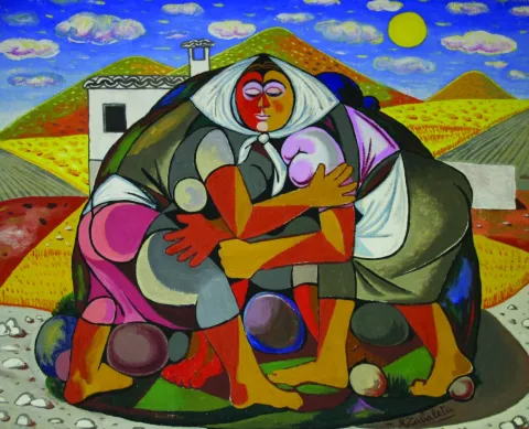
    Rafael Zabaleta was born in Quesada in 1907. After studying at the Madrid School of Fine Arts he travels to Paris, where he studies the teachers of contemporary painting, such as Picasso. In 1942 he made his first individual exhibition and since then there will be many successes. He won the UNESCO Prize for the Third Latin American Biennial in 1956. In their painting, light, color, family objects, the fields of Quesada will be immortalized and hang in many museums around the world. He died in Quesada in 1960.
    The Zabaleta Museum was created in 1963 with the important legacy donated by the heirs of the painter. All the works exposed are of great interest and constitute their most complete exhibition.

    Museum of Miguel Hernández and Josefina Manresa

    Located on the ground floor of the Zabaleta Museum, it contains much of Miguel Hernández's legacy. It offers a tour of the work and life of the poet and his wife, the quesadeña Josefina Manresa, a story of love full of passions and emotions.

    Quesada Archaeological Heritage Interpretation Center, CIPAQ

    The Center for the Interpretation of the Archaeological Heritage of Quesada, CIPAQ, opens its doors in September 2015 to join the extensive cultural offer of this picturesque jiennense villa, cradle of the Guadalquivir. The aim is to show the extraordinary legacy, prehistoric and Roman, which treasures Quesada. Thus, the first floor is dedicated to one of the most important sets of rock, eulin and schematic art in the province of Jaén, declared World Heritage by UNESCO in 1998. On the ground floor the theme revolves around the Roman villa of Bruñel, with an amazing group of mosaics in excellent conservation. The tour is set with the exhibition of interesting objects, recreations, audiovisual, interactive and a teaching classroom for small visitors to learn by playing. "

    Loading map
    Preparing points of interest and routes...
    Imagen principal
    imagen
    Image
    08dafa1a-7a1f-a656-cb9f-1064faa23eca?t=1603979598255
    Imagen principal
    Activado
    Literatura

    An excellent way to get to know one of the most beautiful and historic villages in this Natural Park is to follow in the footsteps of two illustrious poets: Antonio Machado and Miguel Hernández.

    Quesada's connection with Antonio Machado stems from the fact that it is one of the places the poet visited during some of his frequent excursions to the source of the Guadalquivir river. You can follow in Machado's footsteps in a park where you'll find ceramic tiles bearing a fragment of one of his poems, and the same is true at the Sanctuary of the Virgen de Tíscar. Once there, be sure to visit the incomparable Cueva del Agua.

    Quesada's link with Miguel Hernández, on the other hand, comes from the fact that his wife was born in the town. You can see how the people of Quesada cherish the poet's legacy through the Miguel Hernández-Josefina Manresa Museum and pay tribute to him through various corners linked to his memory.

    Porcuna

    Submitted by brandcode_deweloper on
    Id
    749735
    Perfil de redes sociales
    Facebook
    https://www.facebook.com/AyuntamientoDePorcuna/
    Twitter
    https://twitter.com/aytoporcuna
    Instagram
    https://www.instagram.com/ayuntamientoporcuna/
    Descripción
    Breve descripción

    Among large plains of green olive trees is a noble atalaya in which is found Porcra, a universe in stone carved through its six thousand years of history.

    Canteros of all times recorded in their walls the mark of an illustrious past, leaving for eternity the echo of their master's. In it the sculptural set of Cerrillo Blanco was modeled; the solid foundations of the Roman Obulco were raised; it served as the custody of an Andalusian bulwark and was the site of matres and calatraves.

    Its golden stone carved by hand looks majestic in monuments and squares that open to the astonishment of those who contemplate it.

    Our earth, changing in appearance, but unchanging spirit, has traveled through time wrapped in names that narrate the same essence: Ipolca, Obulco, Bulkuna... Porcella.

    Today, Porcilla invites you to enter into its charms, to lose you through its serene streets, to feel the closeness of its people and to taste, without haste, the truth of its gastronomy. Because here, every stone tells a story and every story awaits you.

    Telecomunicaciones
    Teléfono
    953 544 004
    Sitio web
    www.porcuna.es
    Fax
    953 544 606
    Correo electrónico
    ayuntamiento@porcuna.es
    Ubicación
    Nombre
    Porcuna
    Latitud
    37.871140
    Longitud
    -4.183990
    Distrito
    Municipio
    Ubicación en el mapa
    POINT (-4.18399 37.87114)
    Imágenes
    imagen
    Image
    img_5364-jpg
    Imagen principal
    Desactivado
    imagen
    Image
    2531-0120-1-jpg
    Imagen principal
    Desactivado
    imagen
    Image
    2438-1439-jpg
    Imagen principal
    Desactivado
    imagen
    Image
    _mg_3740-jpg
    Imagen principal
    Desactivado
    imagen
    Image
    img_9531b-jpg
    Imagen principal
    Desactivado
    imagen
    Image
    2241-0082-jpg
    Imagen principal
    Desactivado
    imagen
    Image
    04-1-jpg
    Imagen principal
    Desactivado
    imagen
    Image
    img_7925-jpg
    Imagen principal
    Desactivado
    imagen
    Image
    02-1-jpg
    Imagen principal
    Desactivado
    imagen
    Image
    img_6720-2-jpg
    Imagen principal
    Desactivado
    imagen
    Image
    foto-parroquia-jpg
    Imagen principal
    Desactivado
    imagen
    Image
    img_9364-jpg
    Imagen principal
    Desactivado
    imagen
    Image
    1657-0934-jpg
    Imagen principal
    Desactivado
    Información adicional
    Curiosidades

    Oficina de Información Turística

    Plaza de Andalucía, 3

    Tlf.: 953 545 130

    oficinaturismo@porcuna.es


    Imágenes cabecera
    imagen
    Image
    Porcuna
    Imagen principal
    Desactivado
    Datos de interés

    Tourist area: Sierra Sur and Campiña de Jaén

    Distance to the capital (km): 42

    Altitude over sea level (m): 427

    Extension (km ²): 174.5

    Number of inhabitants: 7,055

    Gentilicon: Porcunenses

    Postal code: 23790

    Videos
    Video file
    Cultura

    Ibero site of White Crow

    The pale tone of its rocks gives meaning to the name of this small hill located two and a half kilometres from the urban core of Porcra: White Crow.

    Archeologically involved during the 1970s of the last century, the process of human use of the field is delimited in three moments.

    First, during the tartesic period, there is a distinction between an inhumation necropolis dated around the 7th century BC. There are twenty-four individual graves and a double-chamber grave.

    From a second epoch, around the 5th century BC, is the largest Iberian sculptural ensemble of the national territory. A thousand three hundred fragments among which are more than thirty sculptures. The warrior of double armor, symbol by anthonomasia of the Iberian world in general, stands out.

    Finally, necropolis continued to be used for such purposes from the 5th century BC to the 1st century BC, changing the first rite of imhumation to the rite of incineration.

    Roman Amphitheatre of Obulco

    The Roman Amphitheatre of Obulco was one of the largest show buildings of the Roman Hispania, an example of the enormous magnitude of the ancient Ibolca-Obulco police. It was the largest of the cities of the Protohistoric and Roman Iberia in the time of Julius Caesar.

    This amphitheater shows the imposing archaeological reality of Municipality Pontificensis Obulconensis in the 1st century BC, when it was raised about five hundred meters from the walls.

    After the last great intervention of this colossal amphitheatre, its monumental remains, of more than one hectare of surface, have been managed to size and integrate in harmony with the existing neighborhood, allowing its visitors to walk through a large section of the southern façade with its imposing counterstrong of piled chairs in the Hellenistic style, see the doors and volitories, the outer access routes and the large falls of cyclopeia blocks, then be able to enter the cavies or steps, and come down from the wall of the podium to the space of the sand and carcerwhere to appreciate the dimensions and panorama that the old gladiators who fought in the seaweed or games.

    Cisterna Romana de La Calderona

    The Roman Cistera de La Calderona is a colossal underground hydraulic complex of the Pontifical Municipality of Obulco, intended to store water, which has been in use for more than two millennia and has arrived to this day in exceptional state of conservation.

    It was accidentally rediscovered by one of the neighbors of the three contemporary houses that are available over it and intended for air-raid in the Spanish War of 1936. It was originally a large public water tank with several years of rainwater collection and three catchment wells.

    The project has been completed by building a contemporary building of access through ramps to the complex and with the excavation of approximately 500 m ² of the large Roman neighborhood of the poniente, where part of a cross-sectional enlisted street have been exhumed, three houses organized around patios, a shop and a butcher-carnage, which allow to qualify this block of the neighborhood as a handicraft and commercial sector of the city.

    Boabdil Tower

    In an era of invasions and conquests, during the Middle Ages, two names express the same reality. The Muslim Bulkūna and the Christian Porcella live together and share the same territory.

    On the remains of an Andalusian bulwark, which in turn was erected on Roman vestiges, the Castle of Porcra is fortified with new defenses to become a Christian alcazar.

    Ten are the towers that make up the castle's walled enclosure and one of them, the last to be built, which is maintained until today. The New Tower was raised during the first half of the 15th century by the precept of the Calatravo gentleman Don Luis de Guzmán.

    It is also called the Tower of Boabdil for what happened in 1483 when the last sultanate of the Nazarí Kingdom of Granada, Boabdil, was taken as a prisoner to that tower after being arrested in the Battle of Lucena.

    The tower is octagonal base, is 28 meters high and has an ochavada shape. Its interior, of two floors and a terrace, will house the medieval rooms of the Archaeological Museum Municipal Obulco.

    Church of Santa Ana

    The first data that are held from the hermitage of Santa Ana are from the late 15th century although its exact origin is unknown, being able to be reassembled at the end of the 13th century.

    Santa Ana is drawn like a hermitage of a ship, with several adjacent dependencies such as the house of the santera and some corrals. During the later centuries the whole is spread and consolidated until in the 19th century it is closed to worship. In the 20th century, the property is sold to the Juárez family for use as a bread oven.

    The recent intervention carried out by the City of Porcra has involved the restoration and recovery of the original building. These works have brought to light important findings: unique pavements, numerous burial or wall paintings in the altar area.

    Today, the ancient church of Santa Ana has become the Visitors' Reception Centre.

    Royal meat stores

    This is one of the most modest buildings, which was mentioned in the 15th century, next to the organization of the square: the carnage of the villa, the Church Mayor and the Cabildo.

    The Royal Carniceries, called for the Crown's control over meat, supplied the population with beef and sheep for more than five hundred years, from the Middle Ages to the Second Republic.

    From this moment on, the city's library is located in the building and, in addition, the work-bag functions are performed there, to be, before its restoration, the Comarcal Court.

    In 2015 this space was opened after the rehabilitation and value that the City Council of Porcilla carried out, hosting, there, the municipal services of Historical Archives and Tourist Information Office.

    There are some of the vestiges that can be seen inside the building. It is also worth the attention to stop and observe its inclinated facade witness to the Lisbon earthquake of 1755.

    The Royal Posite of Charles IV. City Council

    In the square of Andalusia was built in the Enlightenment of the King Charles IV in 1798 the Royal Po'sito, that is, a public warehouse of grain for consumption and sowing. It is a functional building offacade of silleri ́ a with beautiful classic cover, which consistsof three ships, one main and two lateral, separated by stone arches on which the deck rests. The building is accessed after climbing a step, an element that allows to generate a lower level or ventilation gallery.

    After the Civil War contest, the building was ruined and a major reform had to be made.Although the works were directed by Ramón Pajares Pardo, the project is due to the architect and National Architecture Prize José Luis Fernández del amo, the first project he signed.

    The building currently houses the headquarters of the City of Porcra. The large "glass yard" is a bright space that acts as a distributor of the entire ground floor and also functions as a main public service room.

    Galleries of the Royal Posite of Carlos IV. Municipal Archaeological Museum of Porcilla

    This is abouta space located under the building of the Royal Posite, current City Hall.In its day were the ventilation galleries and prevented the moisture from reaching the grain store. In origin they had no direct access from the outside, only one registration trap. Over time, several entry doors were opened, allowing this place to take different uses, from construction materials storage to dungeon or hardware shop.

    Following the major reform in 2017, the space was restored and opened to the public. During the intervention, archaeological remains of Roman and medieval times, now integrated into the journey, came to light. The vaults system used in its construction is particularly noteworthy.

    In 2023, two museum rooms were incorporated into the whole, which greatly enrich the understanding of the past of Porcra: one dedicated to the world of the Turdulum and the other to the Roman period. Both offer a clear and accessible journey through the cultures that left a deep mark on the ancient Obulco.

    Ntra Parish. Sra. de la Asunción

    The Parish Church of Our Lady of the Assumption of Porcilla, concluded in the early 20th century thanks to a popular subscription, rises on the site of the ancient Church of Santa Maria la Mayor. The building, wide and bright, has a Neo-Byzantine style and is articulated in three ships covered with cross vaults. The sacristy, attached to the head, belongs to the temple of the 17th century and is connected to the rectoral house, which houses the residence of the parish priest, the archive, the office and the parish hall.

    After the construction of the new temple, Julio Romero de Torres was commissioned to paint the vault of the apse, where the artist represented the Assumption of the Virgin, surrounded by a chorus of angels. The work was so impressed that he was asked for two new murals for the capels of the cruise. In one of them he made the Holy Supper, showing the apostles attentive to the moment when Jesus instituted the Eucharist. On the other, he represented The Holy Family in a serene sunset, with the Child Jesus in Mary's arms and the silent presence of St. Joseph. In addition, the temple retains five more works of the painter: an oil of St. John the Baptist in prayer and four canvases of the evangelists located in the pechines of the cruise.

    House of the Stone

    Summary of the millennial craftsmanship of the stone in Porcra. The bartender and marmolist Antonio Aguilera Ruedas (1896-1980) built it in the middle of the 20th century for 30 years with considerable personal effort and firm mastery.

    Its extravagant and eclectic combination of solutions, techniques and decorations exalt the work of the stone. Their personal and unusual explanations that portray in an unusual way the complex parallel trajectory between building and author draw attention.

    In August 2018 it was reopened following the reforms that the City Council of Porcilla made. After an important work of cleaning and restoring the stone a sophisticated lighting system is chosen to bring all the beauty to the craftsmanship of the stone. At the same time, an extensive set of ramps, built in marble concrete, gives access to a glass elevator, a unique dissonant element but that will allow access to the entire building.

    Naturaleza

    The natural environment of Porcilla forms a unique environmental heritage, modelled by thousands of years of history, a marked Mediterranean climate and the constant presence of the olive tree as an identity element of the landscape.

    Geological description

    The municipality is based on extensive margous formations of the Mioceno Medio-Superior, shaping a homogeneous and gently undulating relief, characterized by rounded hills and looms. In a timely way, the spurs and rocky outflows of sand-calcareous litology, more resistant to erosion.

    Edaphology

    The soils of the municipal term are mostly limestone and little or medium-evolved. Clear margas, with shallow but fertile profiles, and a slightly basic pH that promotes the development of crops characteristic of the countryside, predominate.

    Climate

    The climate of Porcilla is continental-temperate Mediterranean. The average annual temperature is around 17 ° C and precipitation is 563 mm, with marked annual irregularities and long periods of drought. Winters are temperate, with diurnal peaks close to 13 ° C, while in summer they are easily reached 40 ° C, with few rains.

    Hydrogeology and hydrology

    The municipality is located on two aquifers: the Porcra aquifer, which occupies almost the entire municipal area, and the Aluvial aquifer of Guadalquivir, located to the north. The term is integrated into the Guadalquivir watershed, and its main channels are the Salado stream, which crosses the municipality from southwest to northwest to the Guadalquivir, and the Saladillo stream, its main tributary.

    Flora and vegetation

    Porcula is integrated into the Mediterranean region, and has a dry climate with mild temperatures in winter and hot summers.

    The olive tree is today the dominant agrosystem and a true monoculture that occupies almost the entire territory, although there are also areas with natural herbaceous species. Porcilla also houses four endemic species of great biological value: Hispanic, Betic, Ibero-Atlantic Mediterranean-Maghreb and Bético-Maghreb.

    Fauna

    Agricultural activity conditions the availability of habitats, but the olive tree offers a plant cover that allows the presence of a diverse fauna. Birds, small mammals, reptiles and invertebrates find in this ecosystem an enabling space for their food and shelter.

    In it we can observe species such as: the green and the green; and in winter the capirate curved, the red petrored and the common zorzal.

    The biodiversity of the olive tree is very much increased when, together with it, streams with riverbank forests or Mediterranean bushes, made up of carrizos, adelfas and tarajes. And so we find: sparrows, pinches, jilgueros, nightingale, cogs, cordnices and cornejas. Amphibians: common toad, green frog, salamander; reptiles: rib, lizard and lizards; mammals: hares, rabbits, foxes, badges, jinetas...

    Some areas are highly recommended where we can look at the nature we have described in that paragraph:

    • Jesus' walk. We're in front of the big garden of Porcra. It is an extensive public park with a large grove built in the late 19th century. It is the center of the city's playful and social life as it brings together the important parties of Porcra, from the Real Fair to the Oil Fair. This important green space with countless botanical species is populated by monuments or unique elements of the city's heritage, such as the church of Jesus, the house of the Stone or the important viewpoint of the round, a place from which you can see the beautiful landscape of the olive tree, as well as various villages neighbouring the countryside to the Subbetic Sierra of Córdoba and Jaén.
    • Llano de Alharilla. The village of the Alharilla located just 4 km from Porcilla is characterized by a large plain surrounded by ancient olive houses, many of them today become cozy recreational houses. A lush tree offers shade and freshness, creating an ideal environment for rest and coexistence. In addition, the space has a road, making it an ideal place for family recreation or to enjoy a field day in full nature.
    • Pillars and aljibes.The current pillars have their origin in the fountains or springs whose waters were channeled in time and date, perhaps protohistoric, to collect it in receptacles, the pillars, in order to have it available so that the cattle could easily be watered, for use in laundry or in pools for the irrigation of the many gardens that were established in their way. Taking as a driving thread the pillars and sources, you can make a hiking and visiting route: the pillar of La Galga, María Cotilla, the Great Source, the Girl Fountain, Uncle Pago and the Fuenhot, among others.

    Fiestas y Eventos

    Ride de Reyes (5 January).On the night of January 5, the streets of Porcra are filled with magic and illusion for the coming of His Majesties the Kings of the East. A variety of carrots, parades and musics make it shine, au ́ n ma's if it fits, tonight so special.

    Day of Andalusia (28 February). The City Hall of Andaluci ́ a, an autonomous festival, is held in Porcra an institutional event in which the City Council holds the Concession of Honours and Distinctions to different personalities related to this city.

    Carnival (February).Its tradition in this town dates back to the dawn of the 20th century, although it has been more recently when it has become particularly relevant. On the one hand, in the Cine- Teatro "Mari ́ a Bellido" a Carnival Gala takes place in which the letters and chords of different carnival groups intermingle with the rhythms of three by four of the local murgas. On the other hand, during the afternoon of the carnival season, there is a spectacular passage in which hundreds of people gather to show the elaborate work carried out for months. The color, music and dance flood everything, and the diversity takes hold of all those who encourage themselves to contemplate it.

    San Benito, Patron de Porcilla (21 March).The devotional to San Benito in Porcra dates back to the 13th century and we have been aware that such religious functions have been carried out since the 16th century. It is therefore not to be removed that the veneration of the Holy Patro is so rooted among its neighbours. On March 21 of each year, a solemn celebration of the Eucharist takes place in its honor and subsequent process of the image, which is accompanied by the local music bands.

    Holy Week.During Lent, Porcella is filled with tradition and solemnity. The streets of Porcra make up an exceptional framework for the processing of their cofradi'as that, with their knowledge of being, they move us to an environment or a nico of sobriety, devotion and beauty. Ten are the cofradi ́ as and hermandades that process in Porcra from Palm Sunday to Resurreccio Sunday.

    San Marcos (25 April).In honor of this evangelist, a religious and later process is held to end with a popular verbena from the same neighborhood to which it gives name. It is worth noting the curious tradition of the "Spark of San Marcos." This is the realization of fires that traditionally light up in squares and high places, with wood and old things that were discarded and that the young people stacked for their subsequent burning. This tradition was carried out in order to invoke San Marcos Evangelista to bring rain beneficial to agriculture. At present, one of these fires continues to be made next to the hermitage.

    May Crosses (first weekend of May).In various squares, streets and neighborhoods of the village, gilded with care for the occasion, the traditional Cruces de Mayo, a holiday that inundate each rinco with a festive air full of color, are raised. The streets are dressed in floral motifs and personal details, self-reflective of the life and traditions of the place, while the neighbors, with dedication and pride, compete to create the most beautiful and striking cross.

    Romeria de Alharilla. Tourist interest party of Andalusia.The second Sunday of May takes place in Porcra one of the most important romeri's of Andaluci, which is celebrated in honor of the Santi-sima Virgen de Alharilla, Patrona and Alcaldessa Perpetua of the town. The previous week, the municipality is set up and its streets are filled with people to celebrate the holiday in honor of its patron. Among others, they highlight the spectacular ride of horses, in the afternoon of the evening, with riders and carriages that spread through the main streets. On Sunday, say great, thousands of devotees and rosemary gather to live a day of deep faith, culminating in the longed process of the Virgin, carried in paths between the two and the prayers.

    Bervena de San Benito (11 July).San Benito de Nursia, patro ́ n de Porcra and de Europa, has a second holiday in July in which, following the religious feast, a popular verbena takes place in the neighborhood with its same name.

    MiaqueFest (first weekend of August).This is one of the largest music festivals in the province of Jae'n. With an open and diverse spirit, the festival does not focus on a specific musical style, but rather accommodates a wide range of ideas in which consolidated figures from the national musical landscape are combined with others that begin to unpoint.

    San Lorenzo (10 August).Following the celebration of the Holy Mass, the San Lorenzo process takes place on the main streets of the town. Subsequently, one of the popular verbenas is held with the most raigambre of Porcilla.

    Real Fair (September).The so-called "Real Fair" unio ́ la devocio ́ n by San Benito and the Virgin of Soledad, miraculous intercesors in the face of a great storm, with the tradition of holding an annual cattle fair granted by Queen Elizabeth II to the City of Porcra. At present, these parties are held in the first days of September and it is worth noting its Flamenco Besana, Porcra Electronic Night, the young night with musical performances or the parade of giants and heads.

    Oil Fair (last weekend of October). This is a holiday celebrated around olive oil, the main economic engine of the town, which had its orien in 2007. At the Porcilla Oil Fair there is a wide exhibition of agricultural machinery, numerous places where to taste the gastronomy, to you, crafts, conferences, oil tasting... All this closed on Sunday with the taste of the traditional hole of bread with extra virgin olive oil and olive harvested in our land.

    Gastronomía

    On horseback between Jaén and Córdoba, Porcella brings together in its kitchen the best of each of these provinces, always with its star ingredient: extra virgin olive oil. This liquid gold, the fruit of the extensive olive trees surrounding the municipality, not only permeates its recipes of an unmistakable taste, but also becomes the symbol of a tradition that defines its culinary essence.

    At the table of Porcilla, the piirranas and the jiennese sparragados with the flaminquins and the Cordobese salmorejo live together in a perfect balance that enriches its gastronomic heritage. However, it is in his native recipes that the true essence of this land is found.

    Among its most peculiar dishes are the rape, a small square cake that is formed by folding a wafer over a spicy minced meat filling. This craftsmanship dish becomes an essential for those who seek to taste something unique and authentic.

    On the other hand, chicken in milk It surprises both his name and his history. This typical sweet, similar to the mazapan and the alfajor, evokes with its almond aroma an Andalusian past that has been recorded in the gastronomic memory of Porcella.

    For lovers of the good table, the visit to Porcra would not be complete without testing these specialties, which represent a bridge between the past and the present, between tradition and innovation. In addition, local restaurants and bars offer the opportunity to enjoy these delights in a welcoming atmosphere, surrounded by the hospitality that characterizes the porcunenses.

    Historia

    The origins of Porcra go back to a group of villages of the Final Neolithic located in its surroundings. In the Copper Age (3rd millennium BC) the area becomes a nuclear centre of the countryside. Archaeological research has discovered on the hill of the Alcores one of the oldest fortifications documented in the Alto Guadalquivir, with double walled fence surrounded by circular cabins. Another similar village is located on the hill of Albalate and both remained during the Bronze Age (II millennium BC).

    In the 7th and 6th centuries BC the Iberian culture was formed on these lands and so, on the hill of the Alcores, there appears a new urban planning, of geometric layout, with rectangular houses of adobe walls that are raised on stone zócalos, sometimes covered with mud. The area maintained its status as a great center of the countryside and in this Iberian era an aristocracy emerged with heroic political models, as did other Mediterranean regions. This elite, to perpetuate its stretch, represented its exploits and its origins, by passing on to us the wonderful sculptural ensemble of the warriors of Cerillo Blanco, who are already emblem of this culture. These sculptures were in a sacred enclosure on the hill of the Alcores, but shortly after their erection they were buried in the necropolis of Cerillo Blanco.

    The Roman Obulco was the origin of the current Porcula, confirmed by the epigraphic findings and texts of Plinio, Ptolomeo and Estrabón. During the republic and the first Empire the city was of great importance and enjoyed some autonomy, as it coined its currency.

    When the second civil war between Caesar and Pompey was about to end, a uprising led by the children of Pompey broke out on the Peninsula. In the face of this situation, Caesar was forced to quickly mobilize his legions towards the rebel areas. The chronicles report that it took only 27 days to travel the distance between Rome and Obulco, an example of the impressive logistics capacity of the general.

    Once in Obulco, Caesar reorganized and concentrated his troops there before marching towards Córdoba, where the famous battle of Monda would take place. The triumph in this confrontation definitely consolidated its power.

    Otra información

    Water Footprint

    The Water Hole is a road through Porcra and its surroundings, whose main thread is the water, that is, the water system in Porcra from early times to the present. It is proposed, therefore, a tour of the missing water tank of San Cristóbal and the current one of the street of the Cross; the so-called El Albercón street; Maria Bellido and his role in the Battle of Bailén (1808); the Roman Cisterna de la Calderona, as well as the different pillars and aljibes located, these already, outside the urban town of the Pilar, the Pilar, the Pilar and the Pilar, the Pilar, the Pilar, the Pilar, the Pilar and the Pilar.

    Route of the Stone

    The Route of the Stone proposes a tour of one of the most unique and defining elements of Porcilla: its golden sandstone. This rock, which has been taken from the local quarries for over 6,000 years, has been the leading thread in the history of the municipality, since with it the most emblematic monuments have been raised from the Iberian era to the present.

    The quarry in Porcra is a millennial trade that has never been interrupted. Already the Iberians of the ancient Ipolca-Obulco used this stone for their sculptures, such as the well-known pieces of the set of White Cerrillo, which show an extraordinary technical domain. In Roman times, the local sandstone was again a protagonist in public buildings, foundations, decorative elements and hydraulic conductions. Later, during the Middle Ages and Modernity, it continued to be used in walls, churches, noble houses, civil spaces and hydraulic works, becoming the material identity of the city.

    The route invites you to know the historical quarries, where still today the stone is extracted in a artisanal way, maintaining techniques that have passed from generation to generation. There you can see how you cut, size and prepare this material that has shaped Porcra for millennia.

    Loading map
    Preparing points of interest and routes...
    Imagen principal
    imagen
    Image
    Porcuna
    Imagen principal
    Activado

    Pegalajar

    Submitted by brandcode_deweloper on
    Id
    749615
    Perfil de redes sociales
    Facebook
    https://www.facebook.com/ayuntamientopegalajar/
    Descripción
    Breve descripción

    Municipality of west of the Sierra Magina regionwhose municipal term is entered by the north-east end in the Natural Park of Sierra Magina, which is part of the Subbetica and which offers beautiful and spectacular landscapes. The town is located at the feet of the Serrezuela, at 798 m above sea level, where the spring of the Fuente de la Reja that supplies the Charca and the Huerta, elements exclusive the local landscape of Pegalajar.

    The municipal term of Paste occupies a extension of 80 km2and is located in the valley of the Guadalbullion River, about 18.8 km. from the city of Jaén. Pedany The lock is part of the municipality.

    The olive tree, become practically monoculture, occupies the descending slopes of the numerous peaks that coronate the geomorphology of Pegalajar, focusing on the south and east and occupying approximately half of the municipal term.The economy is based on olive trees and the oil industry.

    In the municipality of Pegalajar there are 26 Property declared Heritage Real estate of Andalusia, six of them too Good for Cultural Interest. Let us quote: The Church of Santa Cruz, Tower of the Head, Arc of the Incarnation, Castle of the Peñuelas, Medieval Arrabal, Conistory House, hermitage of the Virgin of the Snow, The Fountain of the Reja, the Charca and the Huerta, the Molinos, the Plaza de Toros, the Caves of the Serrezuela...

    Telecomunicaciones
    Teléfono
    953 360 003
    Sitio web
    www.ayto-pegalajar.org
    Fax
    953 360 002
    Correo electrónico
    ayuntamientopubli@pegalajar.es
    Ubicación
    Nombre
    Pegalajar
    Latitud
    37.740060
    Longitud
    -3.645020
    Distrito
    Municipio
    Ubicación en el mapa
    POINT (-3.64502 37.74006)
    Imágenes
    imagen
    Image
    7700b9b4-1f86-8d03-5d6c-80f8cbf28cb8?t=1621353747106
    Imagen principal
    Desactivado
    imagen
    Image
    d420b1bd-20f1-a85f-8d06-d75f7020b357?t=1621353747368
    Imagen principal
    Desactivado
    imagen
    Image
    img_9478-jpg
    Imagen principal
    Desactivado
    imagen
    Image
    d6dabf3f-5dc2-5b96-0a15-c982914310b1?t=1621353747420
    Imagen principal
    Desactivado
    imagen
    Image
    img_9482-jpg
    Imagen principal
    Desactivado
    imagen
    Image
    73500c6e-b45f-bcfd-99e9-48782dbadc55?t=1595962404361
    Imagen principal
    Desactivado
    imagen
    Image
    22bf0ed0-e023-731f-78ea-3bead20486f4?t=1621353747486
    Imagen principal
    Desactivado
    imagen
    Image
    cf7993c4-d47a-1c6f-3caf-fbf1d28d3828?t=1621353747535
    Imagen principal
    Desactivado
    imagen
    Image
    484a263b-7ebf-80db-d5eb-c5a55dd2ccd2?t=1621353747639
    Imagen principal
    Desactivado
    imagen
    Image
    1250ab62-0360-ce68-bfa8-dcbe37eadd53?t=1603128932399
    Imagen principal
    Desactivado
    imagen
    Image
    526cc8e9-ccf1-f5ff-976b-8089825ae4d1?t=1621353747714
    Imagen principal
    Desactivado
    imagen
    Image
    e8da0954-ae46-57a9-9ba7-b631ac7bf71f?t=1603725645301
    Imagen principal
    Desactivado
    Imágenes cabecera
    imagen
    Image
    Pegalajar
    Imagen principal
    Desactivado
    Datos de interés

    Tourist area: Sierra Magina

    Distance to the capital (km): 21

    Altitude over sea level (m): 818

    Extension (Km2): 79

    Number of inhabitants: 3145

    Gentilicon: Pegalajeños

    Postal code: 23110

    Videos
    Video file
    Cultura
    • Pegalajar City Council: Its construction is linked to the repopulation of the southern part of Jaén in the time of Charles V. It preserves the 18th century facade. It is fully rebuilt and only maintains its original track, the two-story cover of the 17th century.
    • Church of the Holy Cross: Built in the castle's enclosure in the 16th century Renaissance style. Its two covers with a very sober decoration are of mannerist style and in its interior, stands out the baroque altarpiece, from which only the top is preserved. The bell tower is the ancient tower of homage. It's declared Good of Cultural Interest in 1985.
    • Castle of the Peñuelas: In Christian chronicles it is cited as a Muslim fortress. Two different fortifications can be observed in the remaining remains. A previous one with a walled interior, with two entrance doors. One of them was protected by two circular turreons and the second was defended by two square turreons. He had another turret higher than the previous ones that today is the bell tower of the Church. The second outer enclosure is later, more damaged and served as an extension to the primitive fortification. One of its doors that is in good state of conservation is known as Arc of the Incarnation. Declared Good of Cultural Interest.
    • Tower of the Head: It was built between 1462 and 1470, Although it is likely to rise on the ruins of a previous one. It is part of a set of towers that crossed the province, such as the atalaya de la Pedregosa located in Serrezuela de Pegalajar. Declared Good of Cultural Interest
    • Arc of the Incarnation: It is about the main access door to the enclosure and the old castle of Pegalajar. It forms a pointed arch on which there is a commemorative stone in Gothic letter and two shields. The arms shield on the left belongs to a family linked to the Order of Calatrava and the shield on the right is from the city of Jaén. On top of all the above is the shield of Fernando III the Holy. It's kept in good condition. In the 19th century the chapel of La Incarnación was built in the adarve. It was declared Historical Monument in 1985.
    Naturaleza

    The Sticking Garden along with the Charca, is a Good Cultural Interest, for being an emblematic model of man-nature interaction.

    The Serrezuela de Pegalajar is a Mediterranean mountain, with a large mass of pino carrasco repopulation, natural regeneration cells and other shrubs (majelo, juniper, torvisco...). Very abundant are also the aromatic plants (rosemary, alhucema and thyme). Between her fauna There's big. Rape (perishable eagle, common fencing), Night rapes (royal owl, mocha and autillo) and mountain goats in the rocky areas.

    Currently takes advantage of this saw to do sport in nature: hiking, mountain bike, climbing, bulder, free flight... It has two views with splendid panoramic views of the mountain environment, and a recreational area known as "Seven Pillas."

    Paste has numerous natural sites of high interest both environmental and cultural. Between them We stand out the following:

    • The Charca. It's a reservoir that collects the waters of the birth of the Fuente de la Reja since medieval times. In the beginning it was a simple dam with a containment stone wall and gates that regulated the water output through a network of kilometres of waterfalls, which allowed to water the orchard and olive lands located south of the urban core, distributed in banks. A spring that has never been enough to fertilize all the lands that extend at a decreasing level towards the Guadalbullion River. On the other hand, the years of drought the flow of the source is significantly reduced.
    • Source of the Reja. It is the natural spill of the underground aquifer and origin of the hydraulic system of the garden pegalajareña. A legend tells, that a lavender discovered the image of the Virgin of Grace in this place, building in his honor a hermitage over the source itself.
    • Recreative area "Seven Pills." This area is 2 km away. from Pegalajar, it is given this name due to the source in the vicinity and it is called in the same way. A space with merenderos and viewpoints from which an extraordinary panorama of the countryside, Sierra de Cazorla, Jaén capital and the municipal term of the municipality are obtained. Here is the flight center Seven Pills dedicated to the practice of the Paragliding.

    Other areas of interest They deserve to be visited: Valle del Guadalbullón (The Lock) and Bercho Valley.

    Fiestas y Eventos
    • Carnival: The arraigo among the pegalajareños is so important that after the Spanish Civil War, the festival of the masks continued to be celebrated.
    • Party in honor of the Virgin of Grace:Commemorated on the first Sunday of May. The participants go to the hermitage of the Virgin, located in the area where the spring of the Fuente de la Reja is located. A Mass is held in his honor and later the procession through the streets of the people.
    • San Gregorio Nacianceno: Devotion to this saint goes back to 1670, When the people decide to hold a feast and process the saint every year to rid the field of plagues.
    • Virgin of the Snow:: Between 4 and 8 AugustThe patron parties are held in honor of the Virgin of the Snow, with many activities dedicated to all the groups. The Flamenco Festival, to which there are notable figures at national level. Also the bulls and bullfights, which are held in the Plaza de Toros opened in 1919 and have many followers.
    • Flamenco Festival: A special mention is required of the Festival of Flamenco Art of Pegalajar, which has been held since 1969 and where each year it is honoured to different prominent figures of Flamenco Art.
    Gastronomía

    In Pegalajar we find a very varied gastronomy whose fundamental base are the products of the garden. Among the most traditional dishes we have:

    • Pipirrana: with tomato, garlic mallet, cooked egg, salt, olive oil.
    • Peanuts: soup garlic, chorizo red pepper.
    • Cazolilla: made from a traditional conserved called "tomato cake" consisting of dry tomato forming a large cake, which makes a sauce to which a saffrito of onion and cod is added.
    • Bercho rice: with potatoes and vegetables from the garden or with "peppers."

    Warehouse:

    • Papajotes: fried mass of flour, milk, sugar and egg.
    • Fried skillet peas and nuts, sugar "tostah," roscs and almond stained...
    • Home licenses of endrin, purple or the mistel and wine of the country.
    Historia

    The first documented references date back to the Bronze Age. It has been found in the Cueva de los Majuelosdiscovered in the 1970s of the last century, a collective burial with human remains and instruments carved in bone and silex, polished stone, ceramic remains...

    Another of the prehistoric references is the hill of Tower of the Head in which the remains of the Copper, Bronze, Iberian, Roman and medieval epoch are mixed.

    From the Roman era, deposits have been located scattered by the municipal term, corresponding to small necropolis and villas that indicate the existence of a scattered habitat, with an agro-livestock economy. One of these. necropolis is the Port Altowhere there is also a pottery of the seedling land, pieces of Roman teagula and a stone-carved altar. There are other locations, such as the Canteruelathe Charcons, even in the vicinity of the Torre de la Cabeza has been located Roman ceramics made around.The four militaries found in 1975 in The lock They make known to us the existence of an important Roman road passing through this town. The insecurity of the area in the Middle Ages is reflected in the disappearance of the Roman houses scattered by the term and occupation of the natural strength of the Peña de los Vultreswhere it was built a pebble that is still preserved.

    The origin of the villa is from the time of Al-Ándalus. Their existence revolves around the Source of the Tea, aquatic origin of La Charca. With peace and the rise of the caliphate between the X and XI centuries should have to expand the network of accesses and banks that form the Paste orchard.

    The Christian conquest took place next to that of Jaén by Fernando IIIwhich also took over the castle of Pegalajar. The primitive Muslim compound was expanded after the conquest, with the construction of a second compound and strengthening of the first one with circular towers more resistant to the gunpowder attack.

    From the conquest in 1246, was a village of Jaén, was part of its alfoz and its proximity to the Muslim kingdom of Granada made it a fundamental defense of this city, until the end of the Reconquest in 1492. On this date he loses the strategic value of his castle, but not its economic importancebecause at the feet of the fortress a fertile vega of orchards and olive trees, inherited from the Arabs.

    The origin of the population of Pegalajar after the Reconquista was linked to the city of Jaén, on whom it depended administratively. This population was formed by men in the 13th century from several Spanish areas.

    In 1559 King Philip II granted Pegalajar a real privilege for which he recognized him. Jaén's exemption and the title of the villa in exchange for a service to the Crown of a significant amount of maravedis. The municipality begins a period of economic and demographic improvement.

    After XVII crisis, increased by the tabs and famine in the 18th century, there is a slow population growth leading to the expansion of the agricultural land and the various production, which was maintained until mid-term 20th century where, as in the rest of the province, a important emigration to cities in search of a better life.

    Loading map
    Preparing points of interest and routes...
    Imagen principal
    imagen
    Image
    Pegalajar
    Imagen principal
    Activado

    Peal de Becerro

    Submitted by brandcode_deweloper on
    Id
    749482
    Perfil de redes sociales
    Facebook
    https://www.facebook.com/ayuntamiento.pealdebecerro/
    Twitter
    https://twitter.com/pealdebecerro
    Youtube
    https://www.youtube.com/channel/UCRo597Z-lgcrLF1Xzvee0Mg/videos
    Instagram
    https://www.instagram.com/ayto_pealdebecerro/
    Descripción
    Breve descripción

    Municipality located to the east of the provincein the Sierra de Cazorla region.

    It has an enclave in the middle of the mountain area. The main territory of the municipal term is to the west of the region on land of olive countryside. The original administrative division thus allowed this municipality to have forest resources, pastures in communal mountain areas.

    It is part of the Guadalquivir watershed, a river that crosses the municipal territory, as well as its tributary Guadiana Minor, Guadaltiín and Toya.

    In its landscape, the large olive groves and cereal fields. In addition of the main population centre, Peal de Becerro, the villages of Toya, Peal Furnaces and the enclave of The Almicaran, integrated within the mountain area of the Sierra de Cazorla.

    In Toya exists a burial chamber of Iberian origin, declared a National Historical Monument in 1918. Inside it was found "La Bicha de Toya" which is a sculpture and is currently in the National Archaeological Museum of Madrid.

    The local economy is based on olive cultivation, processed metal, construction, olive industry and meat products.

    Within Historical Heritage We highlight: Toya Chamber, the Clock Tower, the Mocha Tower, the Toya Castle and the Peal Furnace Aqueduct.

    Telecomunicaciones
    Teléfono
    953 730 075
    Sitio web
    www.pealdebecerro.es
    Fax
    953 730 901
    Correo electrónico
    ayuntamiento@pealdebecerro.es
    Ubicación
    Nombre
    Peal de Becerro
    Latitud
    37.912130
    Longitud
    -3.124050
    Municipio
    Ubicación en el mapa
    POINT (-3.12405 37.91213)
    Imágenes
    imagen
    Image
    36ed687c-6781-2c15-a6ca-96c10df24791?t=1621272389278
    Imagen principal
    Desactivado
    imagen
    Image
    a1255b7a-25c1-49d8-c70f-54d9311fb045?t=1621272389327
    Imagen principal
    Desactivado
    imagen
    Image
    0c495f3f-a175-bd80-6af1-b5a640307452?t=1595435156186
    Imagen principal
    Desactivado
    imagen
    Image
    f46b1747-cb7f-6d40-a908-654d4eeffccd?t=1621272389373
    Imagen principal
    Desactivado
    imagen
    Image
    687d48bc-006b-017f-12ea-4600ed60245b?t=1621272389419
    Imagen principal
    Desactivado
    imagen
    Image
    a4e805f6-b189-49a7-3cfd-d274f4eef1ca?t=1621272389595
    Imagen principal
    Desactivado
    imagen
    Image
    e876c399-4357-b1e3-3d9d-421dba5e1d2d?t=1595435254911
    Imagen principal
    Desactivado
    Imágenes cabecera
    imagen
    Image
    peal de becerro
    Imagen principal
    Desactivado
    Datos de interés

    Tourist area: Serras de Cazorla, Segura and the Villas
    Distance to the capital (km): 87
    Altitude over sea level (m): 550
    Extension (km ²): 147
    Number of inhabitants: 5,277
    Gentillo: Pealeños
    Postal code: 23460

    Videos
    Video file
    Cultura
    • The Toya House. Discovered in the early 20th century, it is one of the most important funeral monuments of Iberian culture on the Peninsula, not only because of its conservation status, but also because of the monument itself. Some consider it the first great architectural work of the Iberian Peninsula. This is a underground burial chamber built with large "in situ" carved stones, placed one on the other without any type of argamase. The interior impacts, because it is a three-ship enclosure, the sides in turn, divided into two, made of carved chairs to fit perfectly on each other. Banks, bakers and a table appear. The roof is also closed with stone slabs. The construction work of the camera is very interesting for its high level of execution. The "Toya's jousting." It is characteristic of an Iberian prince and his family, of it we highlight: the wheels of a warrior car, dishes, vessels, remains of a sword, an iron helmet, beads of silver necklace, glass of marine blue and yellow....Declared Historical Artistic Monument in 1918.
    • The Clock Tower:In the heart of the urban core are two towers that formed part of an ancient medieval fortress, One of them, The Clock Tower raised at the end of the 14th century, sits on a stone socket, is quadrangular, of silery not always regular. It is internally distributed on four levels, maintains the almenate and also on two sides of its matacan-function balconies, in the third, matacan menulas, and in the latter a watch that gives it name has been placed.Declared Good of Cultural Interest in 1985.
    • The Mocha Tower: It is about the second tower of the fortress Medieval, it is of masonry concerted in some of its parts has corners reinforced to rope and sawn and topped with skimmed canes. It must have been built between the 13th and 14th centuries, it was restored at the end of the last century.It has been declared Good. of Cultural Interest in 1985. Among the towers is a wide space, in which an Auditorium has been established, for the celebration of cultural and playful activities in the open air.
    • The Castle of Toya: In Toya, near the Iberian tomb, an impressive tower of the Toya castle is maintained. It has a square floor, it is demochada and in its interior are preserved half-barrel vaults that covered the rooms and on its outside the arrangement of the masonry goes to soga and tizon, also showing structure of calicanto. It has been declared Good of Cultural Interest since 1949.
    • Aqueduct of Peal Furnaces: In this pedany, there is an old and damaged aqueduct, considered as of Roman construction. It defies the passage of time and erosion caused by the river that crosses it below.

    Naturaleza

    Peal de Becerro with a surface of 147 km2, belongs to the region of Sierra de Cazorla. Posee two pedanities, Toya and Peal Furnacesand an enclave, The Almicaran, integrated in the Sierra de Cazorla, 55 km. of the municipality.

    It is part of the Guadalquivir watershed, river that crosses the municipality, as well as its tributary the Guadiana Menor, the Guadaltiín and other minor water streams.

    The land of olive countryside and in a more secondary way, east of the region, a mountain areaincluded in the Natural Park of the Sierras de Cazorla, Segura and Las Villas.

    The agricultural land are divided between arable crops (wheat, barley) and olive in similar extensions.

    The enclave of The Almicaran, part limit with the province of Granada. In these saws there is a large variety of tree species. Up to 900 m of altitude are the pine forests carrasco, accompanied by Madroños and lentils. Up in altitude, we found oats, complaints and Pine rodenum.

    In more humid areas we can find millennia tejos and copies of steels, both very few in Andalusia. On the margins of the rivers appear strawberries, willows, choposas well as and eneas where water birds and small mammals are covered.

    The Natural Park has one of the richest flowers in the entire Mediterranean basin.

    With the declaration of the National Cazorla and Segura Coto in 1960, some new species were introduced, such as: the muflon, boar or gamo. There are currently 51 species of mammals in the Park. The remaining include: Monkey goat, deer, gamo, fox, garduña and badger. In the fish fauna, the common trout, rainbow trout and barb. Several types of reptiles and amphibians.

    Among the most interesting areas of the municipality we will mention:

    • Loma de los Castellones. From this abrupt enclave we can see the impressive rocky cliffs and stone blocks that rise in their surroundings. It is located south of the town in the natural park of the Sierras de Cazorla, Segura and Las Villas, 19 km. of the municipality.
    • Pico Crico. Impressive peak of 1,847 m., from which we can enjoy spectacular views of the Natural Park.
    • Gualay screws. It is a beautiful place where you can see the coastal vegetation surrounding the Arroyo Tornillos de Gualay.

    Fiestas y Eventos
    • Saint Anton, 17 January: in honor of the holy protector of the animals. The tradition of burning fires is preserved, the night before.
    • La Candelaria February 2: The current custom is to bring the children who were born and baptized the year before the Church for presentation. The Pealeans carry offerings that are the typical roses and the popcorn of bread that are blessed and accompanied by the Virgin of the Incarnation. In the procession the image and the throne instead of being adorned with flowers and cirios are adorned with the rosches of the candlestick.
    • Celebrations of Our Lady of the Incarnation: the parties in honor of their patron are celebrated twice in the year. In the days close to March 25 and between August 17 and 21, dates on which the Peal de Becerro fair is held with a multitude of both playful and festive events, among which the loft of loops stands out.
    • Romeria dedicated to San Marcos in Toya: the last Sunday of April is celebrated in honor of San Marcos. In its course the image is moved to the river Toya, where it is wet as a symbol of purification of the fields and livestock, so that the year is fruitful.

    Gastronomía
    • Gachamas: Cook flour and potatoes together, then turn a lot in the pan to get a golden cake, eat with chorizo, pancake, fried peppers and even some pieces of melon.
    • Talarines. Tomato, garlic, onion, a dry red pepper and minor game meat, rabbit or hare.
    • Beet: Made with olive oil, flour, potatoes, green pepper, tomato, crushed garlic and sweet pepper.
    • Rin-Ran:Mashed potatoes with choriceros peppers, sanded with olive oil, vinegar, salt, garlic and cumin. This dish is decorated with hard egg, cod strips and onion or onions.

    In the pastry shop:

    • Cattle cake: The size of a cookie and made with a flour and water paste that is amassed with oil and canals that once fermented is cooked in the oven.
    • The "twists," punched for Christmas, white bath rosches for important parties, oil rosches for the Candelaria....

    Historia

    From Bronze Age settlements have been documented in the municipality of Peal de Becerro, with an intense population in the Toya and Guadiana Minor Rivers courses.

    The connection of the province of Jaén with Iberian archaeology is important, but the municipality of Peal de Becerro is certainly an exceptional place. Since the 5th century of C., Tugia was a important centre in route control that through the Guadiana Menor put the Alta Andalucía in contact with the coast of the Levina. Between the 5th and 2nd century of C.the city was linked to development of the Iberian aristocracy as shown by many other remains found in the area, the location of an incineration necropolis presided by an extraordinary burial chamber, the most monumental and best preserved that has provided the Iberian Archaeology, the House of Toya.

    From the Roman and Visigoda stage have been found various elementslike a funerary stele with a touch relief, a gravel stele, a quail, a visigode column and in the Cerro de la Horca a visigode necropolis with eight tombs.

    In medieval times Peal is not mentioned so in that period it must have been a small population dependent on the fortified centre of Toya. Your castle, according to the chronicles by Fernando III. A few years later the king bestows on the archbishop of Toledo, Quesada and Toya, who incorporated the advance of Cazorla, passing by in 1,310 the jurisdiction of the Ubeda.

    After the Spanish conquest Peal de Becerro became an independent population. The Spanish strengthened their defenses and They raised the towers. which we now know as the Clock and Mocha. It has belonged to the advance of Cazorla until its dissolution by the Cortes de Cadiz in 1812.

    Then by Royal Order of King Fernando VII was declared villa in 1822.

    Loading map
    Preparing points of interest and routes...
    Imagen principal
    imagen
    Image
    peal de becerro
    Imagen principal
    Activado

    Orcera

    Submitted by brandcode_deweloper on
    Id
    749362
    Perfil de redes sociales
    Facebook
    https://www.facebook.com/ayuntamiento.orcera/
    Descripción
    Breve descripción

    Municipality belonging to the region Sierra de Segura, within the Natural Park of the Serras de Cazorla, Segura and Las Villas. Eminently forest and full of landscape attractions.

    This municipality has the particularity of to be divided into two enclaves: one south-eastern, in which is the town of Orcera, and one in the north-western area of the region, bordering the province of Ciudad Real.

    The cultivated land are in the west of the municipal term. The town is hidden in the skirts of Mount Peñalta, with an urban interiors and an excellent medieval town.

    Economic activity It depends on the olive grove, the oil industry, the hunting, the forest and the tourism, as it is the gateway to the Natural Park of the Sierras de Cazorla, Segura and Las Villas.

    Among its historical heritage we highlight: the Parroquial Church of the Assumption, the Towers of Santa Catalina, The fountain of the Chorros and its Old Town, among others.

    Telecomunicaciones
    Teléfono
    953 480 154
    Sitio web
    www.orcera.es
    Fax
    953 480 155
    Correo electrónico
    ayuntamiento@orcera.es
    Ubicación
    Nombre
    Orcera
    Latitud
    38.318020
    Longitud
    -2.661050
    Distrito
    Municipio
    Ubicación en el mapa
    POINT (-2.66105 38.31802)
    Imágenes
    imagen
    Image
    4d801f2d-0fbe-80cd-e9b3-da943df1b529?t=1621271852271
    Imagen principal
    Desactivado
    imagen
    Image
    7564df32-691f-5fe6-5772-200271f90ab8?t=1596037186672
    Imagen principal
    Desactivado
    imagen
    Image
    a3ef91bb-6788-aeb3-3ce1-52c63c6a049b?t=1596037276689
    Imagen principal
    Desactivado
    imagen
    Image
    93ea953b-b7fb-00f7-6751-442e27f9d852?t=1621271784259
    Imagen principal
    Desactivado
    imagen
    Image
    4b2b369e-2226-4eec-d0a4-6c1aa7068997?t=1596037329344
    Imagen principal
    Desactivado
    imagen
    Image
    adf5b266-0623-263e-e83e-858b83feb20b?t=1603729407461
    Imagen principal
    Desactivado
    imagen
    Image
    67588f5f-1456-f1f3-2a99-9ff944435ff8?t=1603729570170
    Imagen principal
    Desactivado
    imagen
    Image
    6b96b240-e7be-da17-68df-cbe38bd19e5b?t=1621271852323
    Imagen principal
    Desactivado
    imagen
    Image
    49fdaa46-c7f3-a242-9a12-4c6be0414434?t=1621271852458
    Imagen principal
    Desactivado
    Información adicional
    Curiosidades

    C/ Joaquín Payá, s/n

    Imágenes cabecera
    imagen
    Image
    Orcera
    Imagen principal
    Desactivado
    Datos de interés

    Tourist area: Serras de Cazorla, Segura and the Villas

    Distance to the capital (km): 151

    Altitude over sea level (m): 797

    Extension (Km2): 126

    Number of inhabitants: 1,894

    Gentillo: Orcerners

    Postal code: 23370

    Videos
    Video file
    Cultura
    • Church of Our Lady of the Assumption. It began to be built in 1530, finishing the works in 1570. The building is of a single ship divided into three sections that separate semi-columns with half-point arches covered with Gothic-style starvaults.
    • The major chapel also covered with a starry cross vault is accessed to it through a half-point backbone. It has side chapels.. The most important thing who owns is his magnificent mannerist coverfrom the ancient monastery of Santa María de la Peña. Data from last third of the 16th century and it is divided into two bodies: in the first one the arch door of half point is opened framed by Corinthian columns, with allegorical figures in the shrouds; in the upper body, a triple hornaine and the whole is removed by a triangular fronton divided with pinnacle. The tower is settled on a torreon of the primitive castle Medieval, it is quadrangular and consists of two bodies and bell tower, with soga and tendon reinforcements at the highest corners. On one side it has a magnificent window with a half-point arch on jambas caried between menillas, crowned by a triangular fronton. The other window displays in its half-point arch a whole decorative program: highlighted plates, cherubim in the key or semidesnude figures. This element is completed by lateral clumps. It was declared Good of Cultural Interest in 1985.
    • Fuente de los Chorros. Monumental source made of stone and brick, perhaps at the end of the 18th century. It is made up of a somewhat irregular silical frontis, in the central part of which two half-point arches and a triangular fronton that in its center carries a shield. They remove the fronton three pineapples, one at the vertex and the other at the ends.
    • Torres de Santa Catalina. Situations across the river OrceraWe see three Muslim towers dating back to the 12th century, when the advance of Christian troops required a strengthening of defensive structures. These atalayas and the one that rises in the church square, and that makes as the bell tower of the temple, will constitute the defensive line of the house. They have been declared Good of Cultural Interest.
    • Old helmet. Posee Orcera a medieval neighborhood who resist the vicissitudes of times. The old town of the population is perfectly adapted to the medium, with narrow alleys, intricate and unmistakable Islamic regent. The houses are built with slimmed masonry walls, and complicated asymmetric volumes, low height, original chimneys and Arab roofs.
    Naturaleza

    The municipal term of Orcera has 126 km2 and has the particularity that it is found divided into two enclaves:

    • The South-East enclavewhere the main population of the Orcera and is located within the Natural Park of the Sierras de Cazorla, Segura and Las Villas.
    • The second sector is in the North-West of the region, bordering the province of Ciudad Real in the foothills of Sierra Morena.

    Orceradue to its location in the largest Natural Park in Spain has many picturesque areas and interesting placesincluding Armujus, with a huge river pool, The Straits, Cascade of the Hueta, Orcera Lagoon and Wood River.

    The population centre is 795 m above sea level, on the hill of the Villares.

    • Key area:Its eastern part is very accidental from the orographic point of view, concentrating here the highest heights of the municipality: Peña Blonde (1625 m.), Engarbo (1595 m.), Navalhora (1419 m.), Los Villares (1209 m.) With a surface of 70 km2 is made up of forest mass (pineapples) and crossed by a warlike Wood River. The western part is the area of the valley, vertebrated by Orcera and Trujala rivers. Being the first tributary of the second, and this in turn, of the Guadalimar River. It is the most populated area of the municipality where the town's town centre and its villages are located. Here they concentrate. agricultural land, highlighting the olive tree, followed by cereal and orchards.
    • Northwest enclave:It is located to the northwest of the region, in the left bank of the Guadalmena River, which makes the border during a good stretch of the province of Jaén and Ciudad Real. It has a extension of 50 km2.The landscape is different from that of the other enclave, formed by shrubs, pastures, burning and scattered pine. It's a lower one on the mountain. The Marañosa (846 m.) maximum height.

    Population is concentrated in the main core or municipal capital, the rest does in small villages or villages: La Hueta, La Marañosa, Linarejos, Los Arroyos and Valdemarin. Some of them, like Linarejos, are completely abandoned.

    A space with many ecosystems in which infinity of species that make up rich and varied fauna:: from the rapacious birds, the carrionies, the cynetic species, both of major and minor hunting, the fish, amphibians, reptiles, as well as the characteristic fauna of the riverside vegetation that exists next to the stream and river.

    No doubt, a true paradise where nature seems to be recreating. It is almost compulsory to make direct contact with one of the wonderful places that this territory hides, where in addition to observing "in situ" both vegetation and fauna, we can enjoy a fabulous panoramic view of the mountains and the jienese countryside.

    Fiestas y Eventos
    • La Candelaria, February 2. This holiday has always been commemorated in Orcera. The celebration consists of a day of coexistence in the area known as The Convent. The typical snack of that day is "the Candelaria or Hornazo Rosca," that carries a hard egg in the center painted in colors. They also sing and dance a series of popular songs.
    • Holy Week. It's curious the custom that takes place on Good Friday in the procession of the Meeting, with the steps of Jesus of Nazareth. The Roman squadron that escorts Jesus of Nazareth prevents the procession of the Virgin of Soledad from approaching. At that time, an angel-dressed child will recite verses requiring soldiers to depose their attitude.
    • San Isidroon May 15. It has been held since the middle of the last century. A Mass is held in honor of the Holy and once finished, the gilded carrots for the occasion begin the way to the place known as Armujoaccompanied by all the orchards who wish to. It is tradition to distribute and consume a "crow."
    • Patrons in honor of Our Lady of the Assumption. These parties take place in honor of your patron from 10 to 15 August. They have a wide range of activities, including religious acts, pregon, verbenas, concerts, championships and traditional "cobblestones." One of the championships is of the Turkish bowling, the indigenous game of the Sierra de Segura that was almost lost and Orcera has been the pioneer of the resurgir of it, organizing in 1969 the "First Comarcal Championship."
    Gastronomía

    Orcera participates in the culinary wisdom of the serrana region to which it belongs. The wheat culture is manifested in many of its dishes.

    • Garlic of flour with walnuts: potato, flour, nests, garlic, green pepper, tomatoes, pepper, olive oil, salt and pepper.
    • Ajo-atao: potatoes, salt, garlic, olive oil, egg and vinegar.
    • Andrajos: saffrito of tomato, garlic, hare or mountain rabbit, mint and "the rags," homemade pasta made with water and flour.
    • Ajopringue: a dish of medieval origin, the main ingredient of which is the liver of the cooked, ground and seasoned pig with olive oil, red pepper, garlic, chopped parsley, tomato and miga of bread and all this seasoned with pimenton and saffron.

    We must also mention the "roulette crumbs," made from corn flour. Among the products of the pig, in addition to the sausages, we must name the "fried," which is a long and slow frying of swine meat, tomato sauce, roasted peppers and other vegetables such as beans.

    In his pastry shop, "The Traps," frying flour and eggs are then cooked in a roasted sugar syrup with orange, matalahuva and saffron peel.

    The crow. is a drink made of wine, water, sugar and fruit. It is distributed in most acts as a symbol of brotherhood and hospitality.

    Historia

    It has been found that during the Neolithic valleys of the rivers as the Guadalimar were very populated, with centers of height like the Cerro de la Atalaya and Peñón Utrero, with abundant fortified remains and lower position sites, such as Cerro de la Coja. The first news we have about Orcera goes back to previous dates the Bronze age. In the Iberian period there is again news of a small occupation, which will increase during the stay of the Romans. Iberian and Roman remains have been found.

    In the Islamic period, Orcera It was a small house located by the Orcera River. From the 11th century, and in the face of the danger of the Spanish armies of the 12th and 13th centuries, Orcera and the rest of the houses They raised defensive enclosures.. The three towers of Santa Catalina are preserved in the municipality. It was conquered in 1230 by the alfoz de Alcaraz of the current province of Albacete and belonged until 1258 to this jurisdiction of Alcaraz, going on this date to be part of the Segura Common and their land for a privilege of the king Sancho IV, which is preserved in the National Historical Archive. It will be donated as an Arrabal of Segura to the Order of Cavalry of Santiago, then owner of Segura.

    In the area known as the "Convent" there was the Franciscan monastery of Our Lady of the Peña, in which in 1580 the procurators of the villas of the common to draw up "Orders of the Common of the village of Segura and its land," which was intended to save, preserve and manage the mountains of Segura.

    These ordinances were confirmed by Philip II and were in force until 1744date on which the Segura Maritime Provincewhose seat and minister were located in Orcera, which was still in the area of Segura de la Sierra. In 1836 this maritime province was abolished, and the following year, 1837, Orcera became independent de Segura de la Sierra becoming an independent villa.

    Loading map
    Preparing points of interest and routes...
    Imagen principal
    imagen
    Image
    Orcera
    Imagen principal
    Activado

    Navas de San Juan

    Submitted by brandcode_deweloper on
    Id
    749122
    Perfil de redes sociales
    Facebook
    https://www.facebook.com/Ayuntamiento-Navas-de-San-Juan-448985438457871/
    Descripción
    Breve descripción

    Population located in the north of the province, in the district of El Condado. The whole of its term is located in Sierra Morena on its southern side and in the Guadalquivir watershed. The rivers of Guadalimar, Guadalén and Guarrizas run through this municipality.

    The landscape of Navas de San Juan, as the rest of the region has the olive tree as its protagonist, although there are also areas of cereal. The uncultivated land is pasture in which a mainly bovine livestock is fed. Pigs and stabulated birds are also important at the provincial level.

    The economy is based first on olive cultivation, followed at a distance by livestock and hunting. The pistachio is recently being introduced as an alternative crop and economic source.
    From its cultural heritage we highlight: the hermitage of the Virgin of the Star and the church of St. John the Baptist.

    Telecomunicaciones
    Teléfono
    953 689 100
    Sitio web
    www.navasdesanjuan.es
    Fax
    953 688 012
    Correo electrónico
    navas@dipujaen.es
    Ubicación
    Nombre
    Navas de San Juan
    Latitud
    38.183640
    Longitud
    -3.313750
    Distrito
    Municipio
    Ubicación en el mapa
    POINT (-3.31375 38.18364)
    Imágenes
    imagen
    Image
    056fe538-4d82-8621-2ced-07fcf5561cd9?t=1595352501222
    Imagen principal
    Desactivado
    imagen
    Image
    7459d44a-841b-509b-4d76-d3490e4baaca?t=1595352516320
    Imagen principal
    Desactivado
    imagen
    Image
    f98e1bf3-2beb-106a-2277-02c01fa10a2a?t=1595436293652
    Imagen principal
    Desactivado
    imagen
    Image
    10f8a3e8-0495-4644-e363-79174b2f4513?t=1595436293770
    Imagen principal
    Desactivado
    imagen
    Image
    4a17f527-2aef-e582-8906-7848b2ee6075?t=1595436333456
    Imagen principal
    Desactivado
    imagen
    Image
    2ec55283-1a70-8d06-6f99-c37b6ec049d4?t=1621270123467
    Imagen principal
    Desactivado
    imagen
    Image
    98701ad5-582b-2261-af27-a20fa0f8b448?t=1621270123633
    Imagen principal
    Desactivado
    Información adicional
    Imágenes cabecera
    imagen
    Image
    Navas de San Juan
    Imagen principal
    Desactivado
    Datos de interés

    Tourist area: Sierra Morena
    Distance to the capital (km): 86
    Altitude over sea level (m): 732
    Extension (Km2): 176
    Number of inhabitants: 5285
    Gentilicon: Naveros
    Postal code: 23240

    Videos
    Video file
    Cultura
    • Hermitage of the Virgin of the Star. Up on an Arab fortress of the 13th century, of which the tower of homage is preserved. In the 15th century he began his dedication to Christian worship and has since been reformed several times. Built in gilded masonry and silery, the set presents basic plant with arches of half point on quadrangular pillars with achaflanated corners. The shrimp of the Virgin is located in the tower of homage, covered by a half-orange vault on breast. From the outside it is observed that in order to adapt it, vain and saetera were blinded. In 1781 the bell tower and the last century the swordsman.
    • Church of St. John the Baptist. Built between the 16th and 18th centuries. It presents Renaissance, mannerist and baroque elements. Its plant is long and of a single ship, arranged in three unequal sections: the presbyterium, covered with a barrel vault with lunetes; the previous space, which is a little wider, covered with a vault of edges and with hornacino chapels on the sides and the third section is centralized and covered with a half-orange vault on the pechines.The cover style Mannerist It has a simple half-point arch with trapezoidal dovens, and in the upper body a hornaine with dogrous columns, dogric setting and triangular fronton. The bell tower It's been raised in the 18th century, with a first body of square floor and the second of polygonal floor topped by a conical volume covered with Arab tile. A very valuable and important piece is preserved in this church. a silver cross adorned with low-reliefs which represent the Old and New Testament.
    • The Vergao Fountain. We found the first references of its existence in the Marquis de la Ensenada Census in 1752. It is a sample of public-use civil architecture from which not many remain. It has supplied water to Navas until 1966, when the drinking water network was installed in the municipality.

    Naturaleza

    The town of Navas de San Juan located to the north of the province, on the southern slope of Sierra Morena, it extends between the Montizon River and the Guadalimar.

    Its landscape, like the rest of the municipalities of this region, has protagonist to the olive tree, but also cereal lands and mountain areas.

    In North third is found the most abrupt area, the areas of Torrealver, Villamalo, Cerro de San Pablo and the Ballestera.

    We found several valleys throughout the term: The one from the Guadalimar River, by its southern limit; the Guadalén in the north half, and the valley of River Guarrizas delimiting the north of the municipal term.

    The the whole of the municipal term is found in the river Guadalquivir watershed and from its main tributary the Guadalimar River.

    The South Third of the term pour directly to the Guadalimar River, while the remaining two thirds pour to the Guadalén River, either directly to it, or to its tributary the Montizon River.

    In the term of Navas de San Juan we distinguish four ecosystems well-differentiated: mountain and high mountain areas, of the olive tree, the cereal crops and banks of rivers and wetlands.

    It will be this last ecosystem, with its gallery forests in the vicinity of the rivers, that they put a color note in the landscape with the passage of the stations, especially at the station fall.

    The flora is made up of: oaks, corks, complaints, oaks, Mediterranean nobleman forest, and repopulation pines, gallery forests in the water courses.

    The fauna The site is also very diverse: major and minor hunting species, presence of protected mammals such as the wolf, lince or meloncillo. Birds related to the aquatic environment and rapacious birds of special interest such as the imperial eagle, leonate vultures or the royal owl.

    An ideal space from which we can contemplate extraordinary panoramic views of the countryside and jienese saws.

    Fiestas y Eventos

    The following festivities are held in the town of Navas de San Juan:

    • Virgin of the Star Romeria. During the first three days of May, Navas de San Juan celebrates the Romeria of Our Lady of the Star. The events begin on April 30 with the floral offering to the banner of the Virgin, mass and preaching. The day 1 May, rosemary in typical suits, carrots garnetted, horsemen and horses Start towards the hermitage of its employer, located in the Star Plane. In the sanctuary there is a solemn mass, performances in the auditorium and "mayos" in the hermitage at night. The day two, the authorities leave again from the City Council to accompany the Virgin of the Star from the sanctuary to the monolith that commemorates its appearance in the 12th century. The Third dayafter the Mass in the sanctuary, the Virgin return to his parish in the Navas de San Juan, being received with great joy by the naveros that cover the image with rose petals and where it will remain until the first Saturday of September. In addition to "Maya.", traditional songs in honor of the Virgin, also offer to her patron the, wide silk ribbons with embroidery beautiful that are placed to the image of the patron. It has been declared National Tourist Interest Party in 1985.
    • Festivals of San Juan. These parties have been held since 1808 in honor of San Juan Bautista, the master of the municipality. The day 24 June, in the afternoon, the Patron walks through the streets of the village to the bullring, to the double bar to turn the course and grant the blessing and approval of the acts prepared in his honor. Within all the programmed, the "bulls", a custom celebrated since time immemorial, in which Braves run through the streets of the village.
    • August parties. Also called migrant parties. They were born in order to pay tribute to all who one day for work reasons had to emigrate and are unable to attend the holidays of San Juan. They are a replica of the traditional ones held in June. It has been established for the first weekend of August.

    Gastronomía

    It has a certain influence of the manchega cuisine due to its proximity, but it has many typical recipes of the village. These are some of those with the greatest roots in the population:

    • Cauliflower knife. For its production it is necessary: cauliflower, onion, tomato, pepper, garlic, parsley, olive oil, it can also carry boquerones, but it is optional.
    • Gachamas, made with olive oil, flour, water and potatoes. You can eat with chorizos, torreznos...
    • Ajo- flour: potatoes, flour, cod, pepper, tomato, onion, garlic, cumin and pepper.
    • Cranberries: olive oil, rabbit or field hare, potatoes, onions, garlic, dry pepper, tomato, sweet pepper, mint and laurel. For cakes, flour, water and salt.
    • Galians. Galianeras (bread cakes without yeast), rabbit, tomato, green pepper, olive oil, water and salt are needed.

    In pastry shops:

    • Drunk: eggs, roasted oil, white wine, flour, sugar and spirits.
    • Other: Holy Week flowers, sweet gazhas...
    • Risol: It is the typical Christmas liquor and its ingredients are: sweet anis, coffee in grain, cinnamon, orange shell and sugar.

    Historia

    A mid-second millennium BC the territory of Navas de San Juan already showed an important human occupation, as the settlements of Castellón and the Atalaya testify.

    The people must have emerged, the Iberian period, of a colonization promoted by the great Iberian center of Cattulo.

    Later, as the rest of the province of Jaén was under Carthaginese power, and already in Roman times it was an important point on the road between Catulus and Ilugo as shown by the appearance of two "militaries" within the municipal term. In the territory, there was an abundance of the farm-type villa, of which seven have been invented, including the Cortijada de El Steel or Roman Villa of Cerro Prior.

    In the times of Al Andalus, Navas de San Juan It had to be a pitcher, where Muslims built a castle and other fortifications such as the castle of Ero and tower of tribute around which the Sanctuary of Santa Maria de la Estrella has been built.

    Fernando III conquered these lands in the year 1226, when they were under the jurisdiction of Santisteban del Puerto, coming this link with Santisteban until 1802, when Charles IV grants him the privilege of villain.

    The second half of the 19th century was characterized by population growth, people looking for work in the countryside.

    From 60 years of the last century, as in other Jienian localities, Navas de San Juan suffers from strong emigration due to the massive rural exodus to the large cities, losing up to 25% of its population.

    Loading map
    Preparing points of interest and routes...
    Imagen principal
    imagen
    Image
    Navas de San Juan
    Imagen principal
    Activado