Saltar al contenido principal
icon-intereses-turismo-low-cost

El Yelmo Summit

Submitted by brandcode_deweloper on
Id
912527
Descripción
Descripción larga

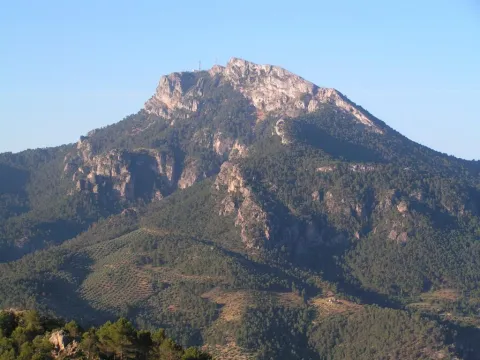
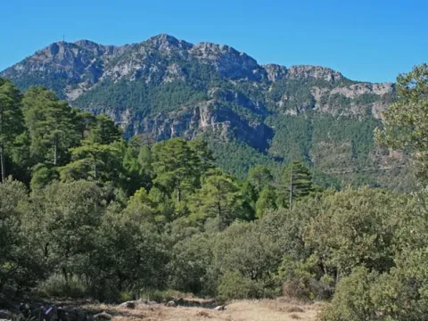
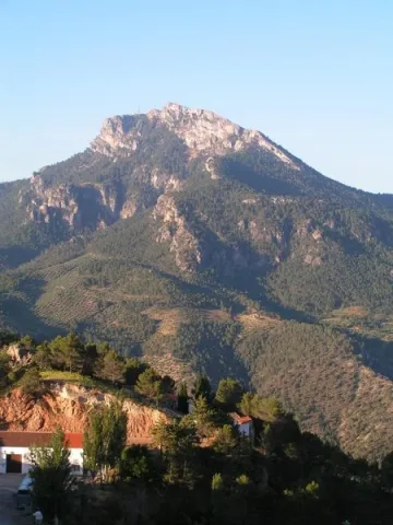
The slopes of the Yelmo are covered by dense pine trees, as well as some oak trees and mixed forests of both species. The complaint is abundant and at some points you will also be surprised by beautiful maples. In the summit area, often visited by the mountain goats, only the piornos and some small, twisted larix pine survive.

The Yelmo is the epicenter of the International Air Festival, an original event that brings together thousands of people, from the neighbors of the villages closest to pilots from different countries, attracted by many different activities.

The summit is accessible by car by a narrow asphalt forest track that is accessed from the village of Robledo, near Cortijos Nuevos. We strongly recommend you to walk up at least the last miles, because you can appreciate the beauty and purity of the environment much more intensively.

You can also access from the area of the Campillo, on the opposite side, next to the road JF-7016. This access is based on an altitude above the first and also has an asphalt track, although we recommend walking along the signposted route PR-A 194, whose 3 km of one way we will travel in about an hour and twenty minutes.

Breve descripción

The Yelmo is the most popular and emblematic summit in the northern part of the Natural Park due to the amazing views enjoyed from its summit, at 1.809 m of altitude. From it we see the vast forests of the entire Natural Park, the distant Albaceteña and granadine summits and the manchegos plains. In the harmonious set of forests and olive groves in the low areas, the beautiful villages of Hornos de Segura and Segura de la Sierra, as well as the waters of the Tranco reservoir, stand out in view of a bird. It is also an international reference for the world of free flight, since it has a take-off that meets a great condition for the practice of this sport.
Ubicación
Latitud
38.298857
Longitud
-2.651877
Distrito
Ubicación en el mapa
POINT (-2.651877 38.298857)
Tipos de punto de interés
Imágenes carrusel
imagen
Imagen
image_174764.jpeg
Imagen principal
Desactivado
imagen
Imagen
image_174810.jpeg
Imagen principal
Desactivado
Imágenes cabecera
imagen
Imagen
main_image_64735.jpeg
Imagen principal
Activado
Loading map
Preparing points of interest and routes...

Caves Refugio

Submitted by brandcode_deweloper on
Id
8124859
Descripción
Descripción larga

When Franco passed through Lopera in the 1950s he ordered that new houses be demolished and built for his tenants in the Pradillo Guijoso neighborhood, the front of the first body was finally only demolished. Some are currently abandoned and others have been occupied by Lopera's neighbours by keeping firewood or coal inside.

Breve descripción

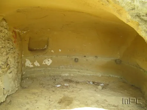
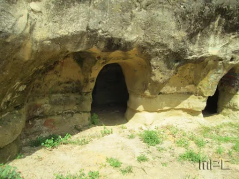
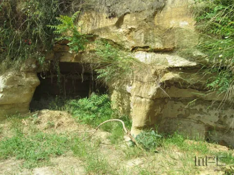
The 11 caves at the entrance were used as shelters during the Civil War. They date back to 1828 and had several bodies.

Telecomunicaciones
Teléfono de contacto
953 516 250
Ubicación
Código Postal
23780
Latitud
37.941620
Longitud
-4.209160
Dirección
Carretera de Porcuna
Distrito
Municipio
Ubicación en el mapa
POINT (-4.20916 37.94162)
Tipos de punto de interés
Imágenes carrusel
imagen
Imagen
Cuevas%20refugio%202.jpg
Imagen principal
Desactivado
imagen
Imagen
Cuevas%20refugio.jpg
Imagen principal
Desactivado
Imágenes cabecera
imagen
Imagen
Cuevas%20refugio%203.jpg
Imagen principal
Activado
Loading map
Preparing points of interest and routes...

Chato and Baltibañas Caves

Submitted by brandcode_deweloper on
Id
7983397
Descripción
Descripción larga

Location: West of the city centre.
Distance: 7.5 km.
Medium: In vehicle tourism and on foot.
Access route: by road and mountain road.

Breve descripción

Natural environment consisting of a Mediterranean mountain area with high-value geological and geomorphological formations. It is only for experts in spelological activities.

Telecomunicaciones
Sitio web
www.belmezdelamoraleda.es/el-municipio/patrimonio-natural.html
Ubicación
Código Postal
23568
Latitud
37.724150
Longitud
-3.382370
Dirección
Av. Jaén
Distrito
Ubicación en el mapa
POINT (-3.38237 37.72415)
Tipos de punto de interés
Imágenes carrusel
imagen
Imagen
18431341Master.jpg
Imagen principal
Desactivado
imagen
Imagen
18431342Master.jpg
Imagen principal
Desactivado
imagen
Imagen
18431339Master.jpg
Imagen principal
Desactivado
Imágenes cabecera
imagen
Imagen
18431305Master.jpg
Imagen principal
Activado
Microsite al que pertenece
Loading map
Preparing points of interest and routes...

Cave of the Puerto de las Palomas

Submitted by brandcode_deweloper on
Id
8084183
Descripción
Descripción larga

The predominant indigenous vegetation is the oaks and moans, low mountain of rosemary, lentisco and sabina. Some well-known routes are the Carchelejo-Cazall- Convent, Carchel to Carchelejo by the Barrio de la Grilla or the ascension to the Cueva del Puerto de las Palomas. On the urban periphery of the two cores there are several recreational areas, such as the Parque de la Fuente, the Haza de la Widow and the sports facilities of Carchelejo and Cárchel.

Breve descripción

Cárcheles has a wide variety of natural sites such as the Monastery Barrio, the Cueva del Puerto de las Palomas, Cazalla and the Convent, etc., where to make excursions, using all kinds of means of transport: on foot, by cavalry, bike, bike or car, etc.

Telecomunicaciones
Teléfono de contacto
953 302 291 / 953 302 003
Correo electrónico
Webmaster@carcheles.es
Ubicación
Código Postal
23192
Latitud
37.612010
Longitud
-3.661260
Distrito
Municipio
Ubicación en el mapa
POINT (-3.66126 37.61201)
Tipos de punto de interés
Imágenes carrusel
imagen
Imagen
la%20Cueva%20del%20Puerto%20de%20las%20Palomas%20%281%29.jpg
Imagen principal
Desactivado
imagen
Imagen
la%20Cueva%20del%20Puerto%20de%20las%20Palomas3%20%281%29.jpg
Imagen principal
Desactivado
Imágenes cabecera
imagen
Imagen
la%20Cueva%20del%20Puerto%20de%20las%20Palomas2%20%281%29.jpg
Imagen principal
Activado
Microsite al que pertenece
Loading map
Preparing points of interest and routes...

Cave of the Agua de Tíscar

Submitted by brandcode_deweloper on
Id
7009656
Descripción
Descripción larga

If you already know Covadonga and then discover this place, you will be amazed at the aesthetic, mystical and historical parallels between this and a place in the Cangas Valley, where it is said that Don Pelayo began the war against Muslims, and that, at that time, he was known as Cave Dominica. There are those who consider this overwhelming space as the Covadonga Andaluza and, according to tradition, here appeared the Virgin of Tiscar, an image exalted after the fall of the Arab fortress in the 14th century. The building is less majestic than the Asturian, but the sacred cave...

The enclave must have been sacred already from remote times. Tradition speaks of an appearance in the Water Cave, which is actually a closed cannon and sculpted by the Tícar Arroyo. This tradition also tells that it was already venerated at a time when the Arabs kept a square they considered unexpugnable, just above the grotto. On the main floor of the fortress, the present abode of Our Lady, dating back to the 15th or 16th centuries, was erected with subsequent remodeling.

In front of the entrance to the hermitage there is a fountain with a poem by Antonio Machado, dedicated to the patron of Quesada. From the old fortin is the majestic tower of tribute, with the shield of arms of Peter I (11th century) embedded in the armchair and the walled enclosure of the courtyard of arms, riding on a neckline hardly accessible to Peña Negra, a spectacular vertical wall, frequented by the mountain goats, vultures and eagles. You can climb up to him, from the sanctuary, by a metal step.

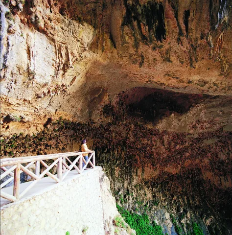
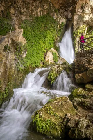
The Cueva del Agua is set down by an asphalt lane that leaves from the same A-6206, about 300 m from the sanctuary, where you can access a few small parking spaces, from where you will leave stairs that go down to a narrow and under tunnel (you have to bend down to cross it) through which a waterfall takes the water to the traditional gardens nearby. Through artificial oquity, the road offers us several alternatives to visit this magical place. Here, on a small obscene on the wall of the cave, there is a small replica of the Virgin, where the devotees, considering that this is their first and true abode, place their offerings. It is recommended to wear shoes with non-slip soles and to take precautions, as the floor and stairs are sometimes slippery.

We suggest...

  • Visit the birth of the Arroyo de Tíscar and the road of the Vadillo de Tíscar, very close to the sanctuary.

Tiscar is located at a crossroads of roads, right over the villages of Don Pedro and Belerda. The A-6206, also known as Tícar, which links Quesada with Hinojares and Pozo Alcón passes through a tunnel that crosses the rocky wall on which the Sanctuary and the Castle of Peña Negra are based and under which is the Cueva del Agua. This way Hinojares is 12 km, Quesada 15 km and Pozo Alcón 17 km. However, the nearest town is Huesa (10 km). From the same village a narrow local road is set up which, passing through Belerda, links with the previous one very close to the area.

Breve descripción

Tiscar is located at a crossroads of roads, right over the villages of Don Pedro and Belerda. The A-6206, also known as Tícar, which links Quesada with Hinojares and Pozo Alcón, passes through a tunnel that crosses the rocky wall on which the Sanctuary and the Castle of Peña Negra are based and under which is the Cueva del Agua. To the cave is down an asphalt lane that leaves from the same A-6206, about 300 m from the Sanctuary.

Ubicación
Código Postal
23489
Latitud
37.767970
Longitud
-3.024270
Dirección
C/ Diseminado de Don Pedro, 11-17
Municipio
Ubicación en el mapa
POINT (-3.02427 37.76797)
Tipos de punto de interés
Imágenes carrusel
imagen
Imagen
25csv-jpg
Imagen principal
Desactivado
imagen
Imagen
natu113-1-jpg
Imagen principal
Desactivado
Imágenes cabecera
imagen
Imagen
cueva-del-agua-1-jpg
Imagen principal
Activado
Loading map
Preparing points of interest and routes...

Cave of los Muñecos

Submitted by brandcode_deweloper on
Id
5867250
Descripción
Descripción larga

This Sanctuary of the Ibera era, along with another located also in Jaén, in the town of Castellar are very important and have provided the largest number of bronze exvotes, important pieces not only to know the work of this metal in the Iberian world, but to solve many other problems related to the faithful who approached the divinity in these places of worship, such as the type of religiosity, the forms of clothing, the jewels, weapons, the type of hair, etc.

From Collado de los Jardines more than 2,500 exvotes have come out, and from Castellar more than 2,000. The almost all of these objects are kept in the National Archaeological Museum of Madrid.

The exvotes (dolls) of this Shrine of the Collado de los Jardines are of the most varied, in them are represented faithful of all kinds: women, men, warriors, etc.
The latest research was based on the documentation of a historical population in the "Cerro del Castillo" located above the Sanctuary, with the consequent recording of materials and the documentation of 'work units' such as a Roman track, a wall and the environment of the solar that occupied the Iberian necropolis.

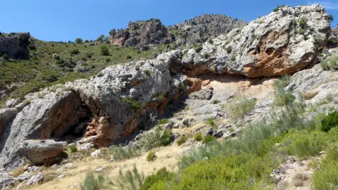
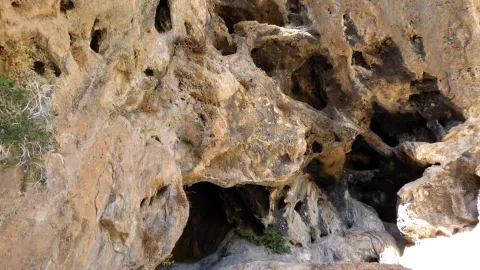
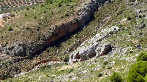
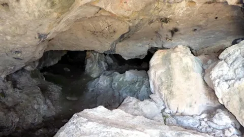
The Cueva de los Muñecos is located inside the Natural Park Despeñacolos, the municipal term of Santa Elena, within a ravine, built between colossal stone blocks, in which there are excavated several caves, the largest of which, about 50 meters deep, was probably the limit of the sacred enclosure. Within this cave today there is a water spring that probably should have existed already in ancient times. In the area there is today a Centre for the Interpretation of the Historical and Cultural Heritage of the Natural Park of Despeñacolos, as well as a path for public use that leads to the Sanctuary and a lookout in the so-called Cerro del Castillo.

Breve descripción

There is a place in St. Helena (Jaén) for all the neighbors known as La Cueva de los Muñecos, called for the number of votes (bronze figures) found in the area. It is the Iberian Sanctuary located on the Collado de los Jardines located on the A-6200 road that leaves from the A4 motorway in Despeñacolos to the town of Aldeaquemada.

Ubicación
Código Postal
23213
Latitud
38.388230
Longitud
-3.498410
Distrito
Municipio
Ubicación en el mapa
POINT (-3.49841 38.38823)
Tipos de punto de interés
Imágenes carrusel
imagen
Imagen
Cueva-de-los-Munecos-jaen-escondido-e1557137991914.jpeg
Imagen principal
Desactivado
Imágenes cabecera
imagen
Imagen
Cueva%20de%20los%20Mu%C3%B1ecos_SantaElena.jpg
Imagen principal
Activado
Loading map
Preparing points of interest and routes...

Cabrera Cave

Submitted by brandcode_deweloper on
Id
4281397
Descripción
Descripción larga

The site of the first archaeological remains dated from the Neolithic (4000 BC) in the town of La Guardia de Jaén. It was later used by the local inhabitants as a guard and poultry for the cattle from which it comes its current name: Cueva Cabrera.

On a blackened wall there is a red stain that can be a rock painting (cave paintings of the Cabrera Cave).

Breve descripción

It is located on the current road to the Allanada del Santo Recreative Zone.

Ubicación
Latitud
37.742568
Longitud
-3.693708
Distrito
Ubicación en el mapa
POINT (-3.693708 37.742568)
Tipos de punto de interés
Imágenes carrusel
imagen
Imagen
cuevacabrera.jpg
Imagen principal
Desactivado
Imágenes cabecera
imagen
Imagen
35.jpg
Imagen principal
Activado
Microsite al que pertenece
Loading map
Preparing points of interest and routes...

Peñolite Stream Basin

Submitted by brandcode_deweloper on
Id
4707471
Descripción
Breve descripción

The Peñolite stream has a basin limited by peaks from which the beautiful panoramic surroundings of the Cazorla Natural Park, Segura and Las Villas and the nearby Calar Alto Park in Albacete stand out, as well as magnificent sunsets to the west, with the Jiennese countryside in the background. In its center is the village of Peñolite. La Corda de Lucas is located to the east of the village of Peñolite and separates the municipalities of Puente de Génave and La Puerta de Segura. It is accessed by the forest track that links Peñolite with Cañada Catena. At its highest peak this rope reaches 1,143 m. This water division continues to be limited to the municipalities of Beas de Segura and Arroyo del Ojanco. Among its summits are the Cerro de Las Banderillas, of 1,160 m, the peak Catena, with 1,233 m and the Cerro Estero, of 1,103 m, the Cerro de La Lagunilla and the Cerro del Espartal, of 1,050 m.

Ubicación
Código Postal
23350
Latitud
38.355595
Longitud
-2.802850
Distrito
Municipio
Ubicación en el mapa
POINT (-2.80285 38.355595)
Imágenes carrusel
imagen
Imagen
poV6a-xw%20%281%29.jpeg
Imagen principal
Desactivado
Imágenes cabecera
imagen
Imagen
que-ver-y-hacer-en-puente-de-genave-jaen-2339-2.jpeg
Imagen principal
Activado
Loading map
Preparing points of interest and routes...

El Moralejo Farmhouse

Submitted by brandcode_deweloper on
Id
2853367
Descripción
Descripción larga

To arrive there is only to follow the signs to the Natural Monument of the Quejigo del Master from Valdepeñas de Jaén, just 1 '5 km from a lane that descends to the right, continuing just over 2 km we arrive to an old ruined cortijo in the middle of a wide explanade.

The horizon is wide, although it is true that the mountains cut the celestial vault a little. We are facing a top-class place for those most demanding fans.
This observation point is located more than 1,100 meters in height and in the bottom of the valley with outstanding conditions of seeing and darkness.

Breve descripción

We are at one of the best points in the entire Starlight Reserve in the South Sierra de Jaén. Note: the use of 4x4 vehicle is necessary to access this point, however it is worth it because it is reached at the bottom of a large valley surrounded by lomas and mountains that hide the few remains of light pollution. From this point on the darkness and purity of heaven is exquisite.

Telecomunicaciones
Sitio web
www.andalucia.org/es/valdepenas-de-jaen-turismo-cultural-cortijo-del-moralejo
Ubicación
Latitud
37.591089
Longitud
-3.808862
Distrito
Ubicación en el mapa
POINT (-3.808862 37.591089)
Tipos de punto de interés
Imágenes carrusel
imagen
Imagen
shutterstock_313430609.jpg
Imagen principal
Desactivado
Imágenes cabecera
imagen
Imagen
image_197209.jpeg
Imagen principal
Activado
Loading map
Preparing points of interest and routes...

María Luisa Farmhouse

Submitted by brandcode_deweloper on
Id
2853502
Descripción
Descripción larga

The point we propose in the old rear explanade of the old cortijo of Maria Luisa, right on the border between the provinces of Córdoba and Jaén, in the municipal term of Martos. It is easily accessed from the marteña pedanía of Monte Lopez-Alvarez in the direction of Albendín, a few meters from the province limit a detour to the left in the direction of Alcaudete. At this point is already visible the large line of cereal with the old cortijo preceded by a row of trees that is just the way of access.

In the back we find a large place to leave the vehicles and set up to enjoy the night show.

Breve descripción

A nearby place for the inhabitants of the surrounding populations, easily accessible and wide to go on summer nights to enjoy the rain of stars. It is a place of wide horizon, very dark in the cenit and free of light pollution in much of the horizon. Only the light of Martos pollutes the horizons E and NE.

Telecomunicaciones
Sitio web
www.martos.es
Teléfono de contacto
953 210 000
Ubicación
Código Postal
23600
Latitud
37.723220
Longitud
-3.970320
Distrito
Municipio
Ubicación en el mapa
POINT (-3.97032 37.72322)
Tipos de punto de interés
Imágenes carrusel
imagen
Imagen
JJG_4951.jpg
Imagen principal
Desactivado
Imágenes cabecera
imagen
Imagen
Imagen principal
Activado
Loading map
Preparing points of interest and routes...