Saltar al contenido principal
icon-intereses-turismo-low-cost

El Chorro Cliffs

Submitted by brandcode_deweloper on
Id
912498
Descripción
Descripción larga

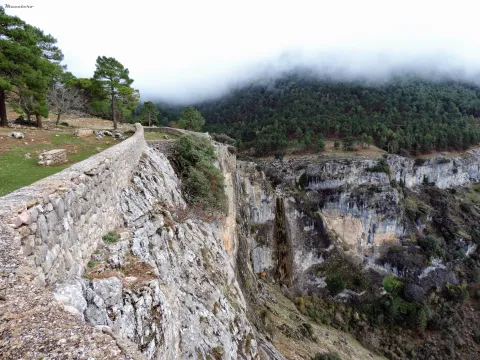
Two are the points from which you get a good view of the Chorro:

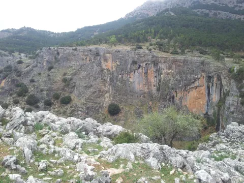
  • In front of the forest house comes a path that takes you to a lookout with a stone wall from which to serene observe the show that opens before your eyes. The white spots that are seen on the walls of this mole accuse the presence of vultures' nests, for they are only the stained of their excrements by being dragged through the waters.
  • Following the track that has brought us to the Chorro and a few meters away you have to go down a path that comes to the right to the very abyss through a cast of sharp stones. You're on top of an impressive rosejo of vertical walls. With great caution you can look and get over the heights, views and flight of the many birds that live or go by in their constant search for food.

We suggest...

  • Take binoculars to see the caves where the birds nest.
  • Make use of the wooden observatory from where you will pass unnoticed for the birds that will fly and pose around you without complexes. At the entrance there is an information panel with the most common birds in the area. A good time to learn to identify them.

In the Iruela, from the City Hall square, the road rises towards the Riogazas hotel. It is known as the Chorro road. 12 km from the Iruela is the Chorro forest house on the left bank of the forest track.

Breve descripción

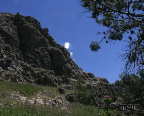
This abrupt glow, located just a few meters from the road, is an ideal place to observe carrion birds such as the leonate vulture or the aloche. The impressive cut of limestone forms deep cracks used by numerous birds to nesting. The royal vicar, the common cernicalo and even the pilgrim hawk are constantly flying over the ravine of the Chorro stream, which is strolling in a 70-meter waterfall and which welcomes the melting waters of the Giillo.

Ubicación
Latitud
37.920351
Longitud
-2.994140
Municipio
Ubicación en el mapa
POINT (-2.99414 37.920351)
Tipos de punto de interés
Imágenes carrusel
imagen
Imagen
cortados.jpg
Imagen principal
Desactivado
imagen
Imagen
576_img.png
Imagen principal
Desactivado
Imágenes cabecera
imagen
Imagen
El%20Chorro%20078.JPG
Imagen principal
Activado
Loading map
Preparing points of interest and routes...

Cornicabrales

Submitted by brandcode_deweloper on
Id
920498
Descripción
Descripción larga

Once we get to Central, we're already in the middle of the cornicabral. A mile earlier, from the Nidillo Strike, we will be accompanied by the cornicabra to our right on a very stony and pending slope. At the end of the route, in front of the bridge that crosses the Borosa River to access the central one, on the hillside that extends to our left after crossing the bridge, we will observe large trees, which look like oak trees, but if you look at us it will surprise us that they are large cornicabra. In the fall we are presented with a multitude of warm colors ranging from orange to dark red.

The cornicabral that we see is associated with little vegetation in its lowland, this is because the presence of cattle (wild or domestic ungulates) benefits the cornicabra, its outbreaks and spills of seed are very toxic and not appetizing to the cattle, so it is not easy to see other species accompanying the cornicabral, and more in areas frequented by the cattle. However, they are usually seen in oak (Quercus ilex ballota), arces de Montpelier (Acer mosnpessulanum), agracejos (Phillyrea latifolia), sabinas (Juniperus phoenicea), lentisco (Pistacia lenticus), rosemos (Rosmarinus officinalis), torvizcos (Daphne gnidium), esamujos (Rosa ssp.) and among herbaceas we highlight the peony or rose of mountain (Paeonia broteroi), as well as in the gradivos (Rachos), as in the gradivázos, as in the gradivánas in the gracos (Rachos, as in the gradius, as in the gradivás, as in the gradivázos, as in the gracos (Rachos), as in the gradius, as in the gradivávás, as in the gradius in the gracas in the gracos, as in the (Poa bulbosa, Agrostis ssp., Cynosurus echinatus, Aegilops geniculata, Arrhenatherum elatinus, etc.).

The name of the cornicabra is due to the protuberances in the form of goat horn so characteristic in leaves and stems, which are gills produced by the bite of an insect, which uses them as food for its larvae.

We suggest:

  • The cornicabral are present in others in many mountains and more or less stony slopes of the Park, as in this type of environment it is where the cornicabra (Pistacia terebinthus) finds its habitat. Extensive cornicabral can be seen on the slopes of the Zumeta River, near the Ticiano Sale, in the gutters of Peña Corba (Las Villas), on the slopes of the Yelmo Chico, in the Cerrada del Utrero, etc.

Route of the Borosa, from the place known as La Central. To reach the cornicabral we must remount the Borosa River along the track that passes to its vera, and that ends up in a hydroelectric power plant. We take it on the farm of Borosa, a well-known place. We have 8 km ahead of us, but they don't have much slope and can be done easily, and we go all the way through the Borosa River, which is one of the most spectacular and popular routes of the Park.

Breve descripción

Pilate boat, Borosa River

This cornicabral is extended by the Pilate Boat, at the head of the Borosa River, where there are the largest copies of those in the Park.

When enjoying plant formations, preference is often given to those that are starring in trees, but in these saws many are dominated by shrubs. This is the case with the cornicabral, of great ecological and landscape importance, especially in the autumn, when they become almost red.

Ubicación
Latitud
38.252679
Longitud
-2.890872
Distrito
Municipio
Ubicación en el mapa
POINT (-2.890872 38.252679)
Imágenes carrusel
imagen
Imagen
Natu154.jpg
Imagen principal
Desactivado
Loading map
Preparing points of interest and routes...

Control Checkpoint of La Cabrera

Submitted by brandcode_deweloper on
Id
2854602
Descripción
Descripción larga

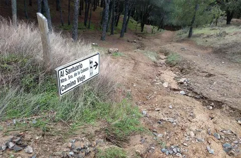
The access road runs through a relatively easy forest track; this track is taken from the same town of Marmolejo, after crossing the bridge over the Guadalquivir River at the height of the spa.

Right on the north bank of the river a right turn is taken towards the Aliseda, follow those signs and this way for 12.5 km until you reach the closed control door. There you can leave the vehicle and put things on the other side by entering the pedestrian door.

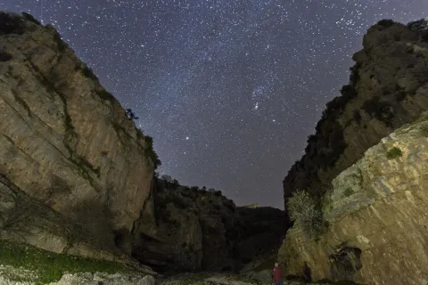
This point is especially suitable for those fans with telescopes and their own means in search of an outstanding sky and with light-taking to connect their equipment.

Breve descripción

Another privileged place is La Cabrera Control, in Marmolejo. The great advantage of this enclave is that it currently has an electric current that can be taken directly from an external plug that is located on the wall of the guard's surveillance shed.

Telecomunicaciones
Sitio web
www.andalucia.org/es/marmolejo-turismo-cultural-control-de-la-cabrera
Ubicación
Latitud
38.044893
Longitud
-4.170983
Distrito
Municipio
Ubicación en el mapa
POINT (-4.170983 38.044893)
Tipos de punto de interés
Imágenes carrusel
imagen
Imagen
Sendero%20Control%20de%20la%20Cabrera-Santuario%20Virgen%20de%20la%20Cabeza2.jpg
Imagen principal
Desactivado
Imágenes cabecera
imagen
Imagen
JJG_1117%20%281%29.jpg
Imagen principal
Activado
Microsite al que pertenece
Loading map
Preparing points of interest and routes...

Complex Arroyo de la Rambla (PB-4)

Submitted by brandcode_deweloper on
Id
875717
Descripción
Descripción larga

Discovered in 1992. It currently reaches a total of 5.117 m of development with important prospects for exploring new galleries. This very important complex is located in the vicinity of the Pantano de la Bolera, in the Barrio known by Arroyo de la Rambla, the two mouths of access are opened in the municipal term Peal de Becerro (Jaén) and much of the cavity is developed under the term Cazorla (Jaén). Along with this large complex, several more cavities have been located that have not been able to communicate to date (PB-1, PB-2, PB-5, PB-7), which were certainly part of it at the time, and these cavities are currently being explored.

The main entrance, of small dimensions, provides access to a floor room that is damaged by the blocks that cover it, ceilings between two and four meters high and spacious, allowing to accommodate several dozen people. At the bottom, between blocks, the sinuous continuation is opened. Close steps and several descending highlights lead almost to the level of the ravine, and it is often found flooded. The water input is done through the PB-6 sink. A narrow corridor with clay-covered floor, followed by several climates, leads again to the level of the entrance room, out of reach of the waters. The transit through them is balized, to try to mitigate as much as possible the alteration of the floor, after the steps to be followed you have to climb to a top floor with the help of a small staircase of about 10 m.

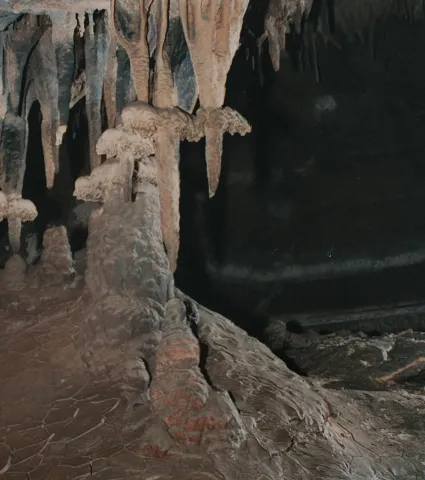
This apartment is characterized by a succession of steps between blocks that once stranded back down to the level of the gallery. From this point the continuation is more problematic, as the succession of ramps, steps between blocks, des climes, etc. make their description very monotonous. The second staircase opens a large room and an almost horizontal corridor of about 100 meters with the floor covered with gours and ceilings with large stalactic blankets, flags, etc. We meet about 700 meters from the mouth. A new drop to a siphon (usually dry) allows the passage, also between blocks, rips, and narrow steps of about 300 meters of very accidental gallery that leads to the final room or the siphon. Large room with different possibilities of continuation.

The 60-meter-long siphon with a penetrable gap to 6 meters under water leads to a descending gallery that connects with a large cavity, circulated by an active river that spills its waters in the Valentine's Source (PB-1 and PB-5). Currently in exploration of spelologists. This succession of rooms is beautifully decorated by spelotems in various ways, among which are predominantly ceilings covered with stalactite stylized.

About a hundred meters from the mouth, a new succession of weeds return us to the theoretical level of water, changing the morphology of the cavity strongly. After several stretches and decreases the dimensions of the gallery increase. In this area the two possible entries to the Network of the Talegas are located (flooded sectors, Red Gallery, Sala Alicia, etc.). Continuing through the main gallery you can reach the Paso Javi, a small laminator that cuts a rock barrier (this step is very common to find it flooded), if it is under the waters, the pass is carried out by a strong ramp to the right of the pass, followed by a vertical - easy to overdo - descent that goes down to the level of the main gallery, after the Paso Javi. The continuation is obvious, just follow the gallery, yes, with some other narrowing and passage between blocks, until you reach the gallery of the Levels, easy to recognize by the calcite sidewalks that go through all the walls, blocks and other speleotems.

From here a new rebound between blocks and slices lead to the header of some scarves. A few meters before reaching them and on the left wall, several narrow steps are opened, between blocks, which reach the base of these scarves. It is entering the Cebra Gallery, thus called by the successive levels of floating calcite that have been fixed on the clay walls; corresponding to different flood stadiums.

Source: Inventory of Georresources of Andalusia. Environmental Council. Junta de Andalusia.

Breve descripción

Arroyo de la Rambla complex

Ubicación
Latitud
37.912140
Longitud
-3.124060
Municipio
Ubicación en el mapa
POINT (-3.12406 37.91214)
Tipos de punto de interés
Imágenes carrusel
imagen
Imagen
7-0.png
Imagen principal
Desactivado
imagen
Imagen
201712-01%20Columna%20%281%29.jpg
Imagen principal
Desactivado
Imágenes cabecera
imagen
Imagen
espeleologia_cazorla-2.jpeg
Imagen principal
Activado
Loading map
Preparing points of interest and routes...

Virgen de la Cruz Pool

Submitted by brandcode_deweloper on
Id
8094481
Descripción
Descripción larga

Near the population centre is theContón de la Virgen de la Cruz, recreational area located on an old landfill recovered as a green area and crossing through a bridge the first of the previous streams. Linked to these watercourses we find a typical vegetation of riverside, in which they stand out reels, carrizos, canes, calves, and eucalyptus, alms, olmos and weeping willows.

Breve descripción

The feast that the hunters celebrate is the one that takes place on the third of May, dedicated to the Marian advocation of theVirgin of the Cross, and in which there is the custom to go in Romeria to a place located on the road of Villanueva de la Reina called the Charcón.

Telecomunicaciones
Teléfono de contacto
953 537 131
Correo electrónico
castalla@cazalilla.es
Ubicación
Código Postal
23628
Latitud
37.987020
Longitud
-3.888300
Distrito
Municipio
Ubicación en el mapa
POINT (-3.8883 37.98702)
Tipos de punto de interés
Imágenes carrusel
imagen
Imagen
thb_g_DSC_0124%20%28Copy%29.jpg
Imagen principal
Desactivado
Imágenes cabecera
imagen
Imagen
thb_g_DSC_0131%20%28Copy%29.jpg
Imagen principal
Activado
Loading map
Preparing points of interest and routes...

Hill San Cristobal

Submitted by brandcode_deweloper on
Id
4281365
Descripción
Descripción larga

Its northwest face belongs to Jaén and is a private mountain, with a repopulation pine. Its southeast face belongs to La Guardia and corresponds to a mountain of oak and low mountain, very altered by man's hand. In spite of this, it has the attraction of the rise to the hill on the "old road," the visit to the Cabrera Cave (whose neolithic vestiges have just passed into history by burning the entire cave) and the arrival in the recreational area of the Allanadas del Santo. It has the Hermitage of San Sebastián (pattern of La Guardia), tables, barbecues, a small football field and one of the seven geodetic vertices of the municipality of Jaén. This one with the appeal of being placed at the top of a pillar about five meters high, with a ladder to be able to climb.

The proximity to Jaén (15 to 20 minutes) allows you to visit in the summer evenings with the possibility of eating there with the family, after the small route. Access is made from La Guardia, next to the Castle of the town.

Breve descripción

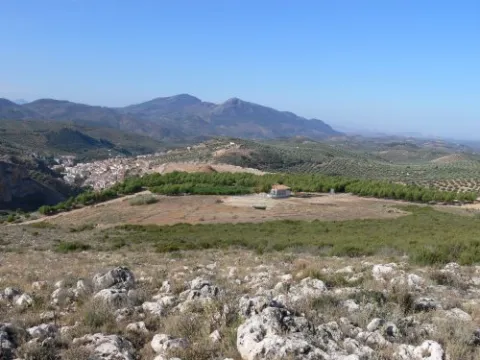
El Cerro San Cristóbal on a mountain that delimits the municipal terms of Jaén and La Guardia de Jaén.

Ubicación
Latitud
37.745911
Longitud
-3.712489
Distrito
Ubicación en el mapa
POINT (-3.712489 37.745911)
Tipos de punto de interés
Imágenes carrusel
imagen
Imagen
cerrosancristobal.jpg
Imagen principal
Desactivado
imagen
Imagen
cumbresancristobal-jpg
Imagen principal
Desactivado
imagen
Imagen
cumbresancristobal1-jpg
Imagen principal
Desactivado
Imágenes cabecera
imagen
Imagen
30.jpg
Imagen principal
Activado
Microsite al que pertenece
Loading map
Preparing points of interest and routes...
Hill Miguelico

Submitted by brandcode_deweloper on
Id
4873420
Descripción
Breve descripción

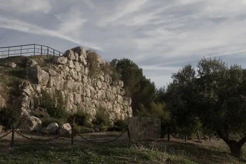
On the surface of an old oppídum and taking advantage of a cyclopeia wall (9th and X century), a plateau that would be the germ of the present town of Torredelcampo is consolidated.On its west side, acyclopoeia walland in the south-east is still preserved aVisigoda necropolis. On the east side is the hermitage of Santa Ana.

Ubicación
Código Postal
23640
Latitud
37.753720
Longitud
-3.904730
Distrito
Municipio
Ubicación en el mapa
POINT (-3.90473 37.75372)
Tipos de punto de interés
Imágenes carrusel
imagen
Imagen
miguelico.png
Imagen principal
Desactivado
Imágenes cabecera
imagen
Imagen
Muralla_Ciclopea_Cerro_Miguelico.jpg
Imagen principal
Activado
Loading map
Preparing points of interest and routes...
Hill Gordo

Submitted by brandcode_deweloper on
Id
4520165
Descripción
Descripción larga

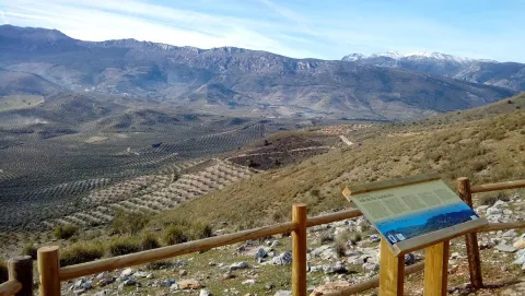
It is a high place, located at a considerable altitude (924 m.), which has impressive panoramic views of the town and its municipal term. It's 1 km away. to the east of Fuensanta de Martos, and it is accessed by the road JA-3301, towards the Sierra de la Pandera.

Ubicación
Latitud
37.646291
Longitud
-3.911022
Distrito
Ubicación en el mapa
POINT (-3.911022 37.646291)
Tipos de punto de interés
Imágenes carrusel
imagen
Imagen
Cerro_Gordo_Fuensanta.jpg
Imagen principal
Desactivado
Imágenes cabecera
imagen
Imagen
Cerro_Gordo_Fuensanta2.jpg
Imagen principal
Activado
Loading map
Preparing points of interest and routes...
Castle Hill

Submitted by brandcode_deweloper on
Id
8143181
Descripción
Descripción larga

Location: To the north of the city centre, very close to it, in the natural park of Cazorla, Segura and Las Villas.

Distance: 2 km. Medium: On foot.

Access route: Through a rural road leading to the dehesa del Castillo.

Breve descripción

Natural enclave located at 1,145 m high, from which we can enjoy stunning views of the Natural Park and the urban core. In the dehesa of the Castle we can visit the Fountain of the Cerezo, a natural water spring located next to prehistoric caves.

Telecomunicaciones
Teléfono de contacto
953 494 005
Ubicación
Nombre
Torres de Albánchez
Código Postal
23391
Latitud
38.414570
Longitud
-2.677250
Distrito
Ubicación en el mapa
POINT (-2.67725 38.41457)
Tipos de punto de interés
Imágenes carrusel
imagen
Imagen
Cerro%20del%20Castillo2.jpg
Imagen principal
Desactivado
imagen
Imagen
Cerro%20del%20Castillo3.jpg
Imagen principal
Desactivado
Imágenes cabecera
imagen
Imagen
Cerro%20del%20Castillo.jpg
Imagen principal
Activado
Loading map
Preparing points of interest and routes...
Hill of San Miguel

Submitted by brandcode_deweloper on
Id
5631210
Descripción
Descripción larga

Benatae is the smallest municipality in the Sierra de Segura and is fully included in the Natural Park of the Sierras de Cazorla, Segura and Las Villas, so it is a perfect place for lovers of tranquility and nature.

The Cerro de San Miguel is located 1.5 kilometres east of the city centre of Benatae, in the direction of Puente Honda.

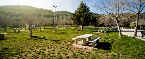
The Cerro de San Miguel is a recreational area with excellent views of the park. On one of its slopes, a source that gives origin to its name, one of the many water sources that spatter the municipality, stands out.

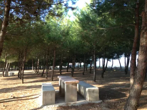
The recreational area has several tables and its corresponding banks, barbecues, the pillar and a large explanade.

In the recreational area you can see the vegetation and fauna typical of the Natural Park and from where you can observe excellent landscapes.

On the hill dominates the black pine pine pineapple, under which grows a stinking little forest with juniper, lentif, jars and crocodile. The fox, boar and squirrel are very abundant, and it is possible to contemplate mountain goats at the summit. Among the raptures are the pilgrim hawk, the seedling eagle and the leonate vulture.

From the Cerro de San Miguel you can take hiking routes, not so, in the recreational area we find the panel of beginning of the path (PR-A 179) to the summit of Peñalta (1,412 m.).

Breve descripción

It's a recreational area at 1.5 km. from the city centre, and from which we will get magnificent views of the Natural Park of the Sierra de Cazorla, Segura and Las Villas.

Telecomunicaciones
Sitio web
www.benatae.es
Teléfono de contacto
953 482 080
Ubicación
Código Postal
23390
Latitud
38.345040
Longitud
-2.643430
Distrito
Municipio
Ubicación en el mapa
POINT (-2.64343 38.34504)
Tipos de punto de interés
Imágenes carrusel
imagen
Imagen
Cerro%20de%20San%20Miguel.jpg
Imagen principal
Desactivado
Imágenes cabecera
imagen
Imagen
p1100918.jpg
Imagen principal
Activado
Loading map
Preparing points of interest and routes...